Team-BHP > Travelogues > Route / Travel Queries
Register New Topics New Posts Top Thanked Team-BHP FAQ


Reply
  Search this Thread
12,609 views
Old 21st April 2010, 16:44   #1
BHPian
 
Join Date: Nov 2007
Location: Marlborough, MA/Bangalore
Posts: 345
Thanked: 59 Times
Bangalore-Kuruva Island Roa Condition Required

Hi,

We're planning a weekend trip to Kuruva Island.

Following information will be greatly helpful.

1. Which is the best route to take to reach Kuruva?
Bangalore-Hunsur-Kutta-Kattikulam or Bangalore-Mysore-Sulthan Bathery-Mananthavady-Kattikulam?

2. Latest update on the condition of both these routes?

3. Is it a good time to visit Wayanad now? Will it be very hot?

4. We're looking at the lodging options. Any recommendations? I'm sure there a lot of people on this forum who've visited this place.

5. We're planning to reach on a Saturday afternoon and leave Monday early morning. Would that be sufficient to see around Kuruva?

Regards
Rex
rex_varghese is offline  
Old 21st April 2010, 17:06   #2
Senior - BHPian
 
clevermax's Avatar
 
Join Date: Jun 2006
Location: Tvm/Amsterdam
Posts: 2,086
Thanked: 2,640 Times

Quote:
Originally Posted by rex_varghese View Post
4. We're looking at the lodging options. Any recommendations? I'm sure there
I had stayed in Hotel Green Gates in Kalpetta, it was good.

You may get info about the road condition from this thread:

http://www.team-bhp.com/forum/route-...ad-kerala.html
clevermax is online now  
Old 21st April 2010, 20:08   #3
Team-BHP Support
 
ampere's Avatar
 
Join Date: Sep 2009
Location: Bangalore
Posts: 17,948
Thanked: 12,935 Times

The Mysore route is a belter. Very nice roads all the way till Sultan Bathery.
Not sure how the roads are from Hunsur side. But road till Hunsur is very good.
ampere is offline  
Old 22nd April 2010, 00:32   #4
BHPian
 
bornin70s's Avatar
 
Join Date: Feb 2010
Location: Bangalore
Posts: 70
Thanked: 2 Times

I drove to Kuruva on saturday and this is the route i took.
Bangalore-Mysore-H.D.Kote

then continued on Mananthvady road towards Kabini Resort. After you pass H.D Kote there is a small village called Antharasanthe and after that is a forest check post. I don't know if the check post is closed all the times but on saturday the road was closed. I had to take a left towards Kabini and pass through small villages for about 20 kms (Approx) on average to bad roads. The road joined back on to the main road again which led me to Bavali from where Kuruva Dweep is a 5 minutes drive.

If you can brave the village roads; then take this. My total distance travelled was 240 odd Kms.

You can visit Kuruva Dweep and Banasura Sagar Dam, both of which are close by from Mananthavady and Lakkidi.

Wayanad will be much more pleasant than Bangalore for sure. Try Rain Country Resorts - Lakkidi - Wayanad at Lakkidi.

The closest city near Kuruva Dweep is Mananthavady where you can stay at Hotel Bramhagiri (Three Star) which is the only decent place i found. Then other lodge in Mananthavady town is at the "Indian Coffee House". They have nice clean affordable rooms.
bornin70s is offline  
Old 22nd April 2010, 09:29   #5
BHPian
 
Join Date: Jan 2008
Location: 515134
Posts: 321
Thanked: 336 Times

1/2) Had been to Wayanad and passed thru Kaatikulam last month. We took Mysore>Sultan Bathery Route and return route was Mananthavady>Kaatikulam>Kutta>Nagarhole>Hunsur>Ban galore

I would suggest you to take Bathery route. This has good roads throughout

In the other route, the Kerala, Karnataka border area, Kutta is in terrible condition. But this is the shortest route to Kuruva from Bangalore

3)Kerala is still having summer but it is raining these days. Also when we went last month, climate was good.

4) Since you are planning Kuruva, Pepper Green would be a good option. There is another resort nearby, forgot the name. There are good reviews on Pepper Green in TBHP. you can search. I personally wasnt much impressed when i went there last year.

Another place i have tried in Wayanad is Aranyakam which I found to be really good. But it is in Meppadi and will be far from Kuruva (probably around 30-40 kms)

5) This should be sufficient if it is only Kuruva
rajesh1868 is offline  
Old 22nd April 2010, 12:30   #6
BHPian
 
Join Date: Aug 2008
Location: Bangalore
Posts: 218
Thanked: 7 Times

Quote:
Originally Posted by bornin70s View Post
I After you pass H.D Kote there is a small village called Antharasanthe and after that is a forest check post. I don't know if the check post is closed all the times but on saturday the road was closed.
Yes this check post is always closed and has been for more than a year now. Apparently they are fixing the road! IIRC the road through the National park was beyond horrible. Good news if they have mended it.

I would recommend Mysore - Najanagudu - Gundlupet - Sulthan Bathery route. It has always been great and a pleasure to drive.
bullinb is offline  
Old 22nd April 2010, 12:43   #7
BHPian
 
bornin70s's Avatar
 
Join Date: Feb 2010
Location: Bangalore
Posts: 70
Thanked: 2 Times

Quote:
Originally Posted by bullinb View Post
Yes this check post is always closed and has been for more than a year now. Apparently they are fixing the road! IIRC the road through the National park was beyond horrible. Good news if they have mended it.

I would recommend Mysore - Najanagudu - Gundlupet - Sulthan Bathery route. It has always been great and a pleasure to drive.
Oh i guess then i took the road less traveled.

The road from where it joins back into the forest area is a breeze. Right now the finished roads have good signboards for elephant crossing and speed breakers. Hope its completed soon. Then that would be the shortest route.

But i guess for now, Sultan Bathery route is the best.
bornin70s is offline  
Old 22nd April 2010, 14:39   #8
Senior - BHPian
 
rjstyles69's Avatar
 
Join Date: Sep 2006
Location: Bengalooru..
Posts: 4,343
Thanked: 842 Times

Quote:
Originally Posted by bornin70s View Post
If you can brave the village roads; then take this. My total distance travelled was 240 odd Kms.
Here's what you gotto brave thru and am sure its doable in a sedan too.

Bangalore-Kuruva Island Roa Condition Required-14-large.jpg

Bangalore-Kuruva Island Roa Condition Required-17-large.jpg

Bangalore-Kuruva Island Roa Condition Required-18-large.jpg

I would still say do this route just for the fact that its devoid of too much traffic.

Quote:
Originally Posted by bornin70s View Post
You can visit Kuruva Dweep and Banasura Sagar Dam, both of which are close by from Mananthavady and Lakkidi.
They aint pretty near and are in different directions.


Quote:
Originally Posted by bullinb View Post
Yes this check post is always closed and has been for more than a year now. Apparently they are fixing the road! IIRC the road through the National park was beyond horrible. Good news if they have mended it.
Its been close to 2 years now since this checkpost has been shut. The road was in horrible shape after the detour.

Quote:
Originally Posted by bullinb View Post
I would recommend Mysore - Najanagudu - Gundlupet - Sulthan Bathery route. It has always been great and a pleasure to drive.
Good roads but not devoid of traffic and the usual imbeciles with less concern for safety.
rjstyles69 is offline  
Old 22nd April 2010, 21:06   #9
BHPian
 
Join Date: Nov 2007
Location: Marlborough, MA/Bangalore
Posts: 345
Thanked: 59 Times

Thanks for all the replies and for all the information. It's great!

Slight change in plan. Now, we're planning to start at around 2pm on Friday.

1. Will I be able to hit Nagarhole entrance before 6pm?

2. Also, is it safe to drive in the night through Kutta-Tholpetty-Kaattikulam-Kuruva stretch with respect to road conditions and wild life?

3. Are there proper sign boards and directions in this stretch since this stretch may not have many people in the night to check on directions?

Regards
Rex
rex_varghese is offline  
Old 22nd April 2010, 21:45   #10
Team-BHP Support
 
ampere's Avatar
 
Join Date: Sep 2009
Location: Bangalore
Posts: 17,948
Thanked: 12,935 Times

Bandipur closes from 9PM to 6AM. Not sure of Nagarhole.
I think its not a good idea to drive in the night. More importantly because of wlid life.

In general you want to enjoy the views on the drive.
What is the point if you dont enjoy that? These places are amazingly green and a treat to watch.
ampere is offline  
Old 22nd April 2010, 22:48   #11
BHPian
 
vinay.pillai's Avatar
 
Join Date: Dec 2007
Location: Little Rock, US
Posts: 229
Thanked: 15 Times
My Expereience (Based on Jan 2010 Trip)

Quote:
Originally Posted by rex_varghese View Post
Thanks for all the replies and for all the information. It's great!

Slight change in plan. Now, we're planning to start at around 2pm on Friday.

1. Will I be able to hit Nagarhole entrance before 6pm?

2. Also, is it safe to drive in the night through Kutta-Tholpetty-Kaattikulam-Kuruva stretch with respect to road conditions and wild life?

3. Are there proper sign boards and directions in this stretch since this stretch may not have many people in the night to check on directions?

Regards
Rex
1. Nagarhole entrance closes at 6PM. But generally they stop entry before 5:30 PM as it takes more than 1 hr to cross the forest.

2. Kutta Kaattikulam road was hell for my Linea. It literally hit the road at every 50m. No road exist in Jan 2010. Also, Tholpetty you might have elephant crossing also.

3. You can find few signboards


Best way to reach (used while returning) is to come through Kabini. Road is good except 20-25Km patch near Kabini. The first entrance to forest when you reach Kabini is closed for Public vehicle and all vehicle has to go through Kharapur village and reach the second check post and make an entry and go ahead. But this also closes at 6 PM.

Hope it helps
vinay.pillai is offline  
Old 23rd April 2010, 00:32   #12
BHPian
 
Join Date: Nov 2007
Location: Marlborough, MA/Bangalore
Posts: 345
Thanked: 59 Times

Quote:
Originally Posted by vinay.pillai View Post
Best way to reach (used while returning) is to come through Kabini. Road is good except 20-25Km patch near Kabini. The first entrance to forest when you reach Kabini is closed for Public vehicle and all vehicle has to go through Kharapur village and reach the second check post and make an entry and go ahead. But this also closes at 6 PM.

Hope it helps
Does that mean this road is motorable now?

How long it took for you to reach the first check post from Mysore?

Also, how much time it took for you to reach Bavali from the first checkpost?

I just want to get a rough idea.

Regards
Rex
rex_varghese is offline  
Old 23rd April 2010, 13:50   #13
BHPian
 
gypsyFreak's Avatar
 
Join Date: Dec 2007
Location: Bengaluru
Posts: 418
Thanked: 553 Times

@bornin70s... Can you please post a route map of the Antharasanthe route from Google maps or Mapmyindia. I know the route till the first forest checkpost, but need the route after that.

i am planning to travel to Thirunelly temple sometime in the next two weeks. i have done the Nagarhole route couple of times and want to try the Antharasanthe route.

Also will the antharasanthe route pass through any forest area?
gypsyFreak is offline  
Old 23rd April 2010, 14:03   #14
Senior - BHPian
 
rjstyles69's Avatar
 
Join Date: Sep 2006
Location: Bengalooru..
Posts: 4,343
Thanked: 842 Times

Quote:
Originally Posted by gypsyFreak View Post
@bornin70s... Can you please post a route map of the Antharasanthe route from Google maps or Mapmyindia. I know the route till the first forest checkpost, but need the route after that.

i am planning to travel to Thirunelly temple sometime in the next two weeks. i have done the Nagarhole route couple of times and want to try the Antharasanthe route.

Also will the antharasanthe route pass through any forest area?
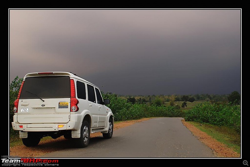
gyspyfreak your location says Mysore , so it shouldn't be difficult to find your way through. Drive towards HDKote and the route is something like Jayapura--Saalundi-- Kolgala-- HDkote--Handpost -- then find the deviation to Beechanahalli Dam(Nagarahole) simply follow the signboard for Bavali. Antharasanthe is the 1st village enroute JLR methinks. Check my previous post, the image of the scorp' is around the same place.

The Kharapur forest road looks something like this

Bangalore-Kuruva Island Roa Condition Required-3593123854_f65ed27580_b.jpg
rjstyles69 is offline  
Old 23rd April 2010, 14:59   #15
BHPian
 
bornin70s's Avatar
 
Join Date: Feb 2010
Location: Bangalore
Posts: 70
Thanked: 2 Times

Quote:
Originally Posted by gypsyFreak View Post
@bornin70s... Can you please post a route map of the Antharasanthe route from Google maps or Mapmyindia. I know the route till the first forest checkpost, but need the route after that.
Gypsyfreak, google maps don't seem to locate Antharasanthe or Kurapur Jungles. Like rjstyles69 said the deviation from the checkpost is good. The deviation will get you back on to the main Karapur Jungle road.

@rjstyles69, are the pictures of the road, recent? Look exactly like the area i passed through but the roads were a little bumpier than what it looks like. Il try to upload a video to let you know what i mean.

Still definitely do-able though because its just a few kms.
bornin70s is offline  
Reply

Most Viewed


Copyright ©2000 - 2024, Team-BHP.com
Proudly powered by E2E Networks