Team-BHP > 4x4 & Off-Roading > 4x4 Excursions
Register New Topics New Posts Top Thanked Team-BHP FAQ


Reply
  Search this Thread
124,010 views
Old 20th June 2010, 19:27   #121
Team-BHP Support
 
tsk1979's Avatar
 
Join Date: Feb 2005
Location: San Jose, CA
Posts: 23,717
Thanked: 22,825 Times

On the rocks.
I normally do not like rocks, but sometimes you do not have the choice.
The swift was unable to make it, so it was parked to the side.
Original plan was to use the white elephant to pull the swift, but that, is a totally another story
tsk1979 is offline  
Old 21st June 2010, 11:45   #122
Senior - BHPian
 
tanwaramit's Avatar
 
Join Date: Aug 2005
Location: Dilwalon ki Dilli
Posts: 1,930
Thanked: 497 Times

the videos are amazing, what happened to the swift ?

Just missed getting stuck yourself while pulling the qualis from the front.
tanwaramit is offline  
Old 21st June 2010, 11:50   #123
Team-BHP Support
 
tsk1979's Avatar
 
Join Date: Feb 2005
Location: San Jose, CA
Posts: 23,717
Thanked: 22,825 Times

The swift had to go back. We tried and tried, but all it would do is spin wheels, and undercarriage would hit rocks.
I also got a foot guard hit. At first the plan was to pull the swift, but then something happened, and we had to run. Details in travelogue.
tsk1979 is offline  
Old 25th June 2010, 18:36   #124
Team-BHP Support
 
tsk1979's Avatar
 
Join Date: Feb 2005
Location: San Jose, CA
Posts: 23,717
Thanked: 22,825 Times

Another video. I try to climb a hill near magnetic hill. Decide to do it in reverse as the slop was very steep and did not want to come down in reverse
tsk1979 is offline  
Old 7th July 2010, 12:00   #125
Team-BHP Support
 
tsk1979's Avatar
 
Join Date: Feb 2005
Location: San Jose, CA
Posts: 23,717
Thanked: 22,825 Times
Changthang - Off the road version - I

Changthang is a cold desert in the Ladakh region, with average altitude above 4000m, and many sections above 5000m. At the north lies Pangong Tso, and its south end is marked by the Hanle Chumur axis.
Parts of Changthang desert are 4x2 motorable with some sections motorable by cars too.
These are the road to Pangong, and on the south the Leh-Chumathang-Nyoma-Loma-Hanle road.
While this route is very nice and scenic, to really explore Changthang, you need to get off the road.

For such a trip there is one popular option.
The road from Pangong to Loma via Chushul. Its been a favorite with bikers and some taxis also attempt it, though most who attempt it have 4x4 scorpios or gypsies.

For Travelogue - This post and couple of subsequent ones detail it
http://www.team-bhp.com/forum/travel...ml#post1948538

Now coming to the off road part.
Beyong Lukung, the point where starts, there is no proper road, just a track. Its motorable by any high GC vehicle, even SX4 if one is careful. This will take you till spangmik, after which the track vanishes, and you get dirt trails.
There are sections which are hard packed sand, and therefore easier

And then there are sections which are like multiple choice questions, chose any track, and its your luck whether you get a 4x4 track or a 4x2 track


More than the tracks, its the dried up water crossings which are troublesome. The reason being round stones, and some sharp stones. They have serious tire damage potential.
With a 4x2 you have to use momentum to get through, which makes it risky. But with 4x4, you can shift to low ratio and gently navigate them, which is the correct way.
Also watch out for stones hidden


As you near the end of Pangong, after crossing the villages of man and merak, the track gets harder. No 4x4 required here, but its bumpy, and sharp stones like hidden here and there.


From here, you head towards chushul, and cross a minor pass


Here it gets tricky. There are water crossings which tend to get slushy, and getting stuck is a real possiblity, even in a 4x4. So you have to follow the most recent tire marks, made by a small vehicle. Army 4x4 stallions do not care about such stuff, and basically go anywhere, creating deep ruts.
A highlight of this section is the Kiang. The Wild A.s.s. Most probably, here you will get your first sightings


Then comes the village of chushul, which is actually a small town by ladakhi standards, and like many other small villages it boasts of a satellite STD PCO.

After this you cross the war memorials(detail in log) and head towards Tsaga La

As you can see, its mild offroading here, with sand here and there.


Depending upon which track you take, the level of difficulty varies


A safe bet is to look for Gypsy tracks. Stay clear of truck tracks, because they sometimes lead to tricky trails.

After some time the mountain pass of Chagga La or Tsaga la comes

After that its decent road(by leh standards) motorable by car


This will take you to Loma, and you will get mostly tarred sections at many places, with dirt tracks being smooth and high speed.

A metalled road leads you from loma to hanle, and only 20kms before hanle the road ends.

Here you have a choice. you can use the "road" which is actually stones thrown and risk the tires, or you can take the alternative sand tracks


The road is so bad, that even cars try the sand tracks


After this comes Hanle, and your day trip ends here.
tsk1979 is offline  
Old 7th July 2010, 16:00   #126
Team-BHP Support
 
tsk1979's Avatar
 
Join Date: Feb 2005
Location: San Jose, CA
Posts: 23,717
Thanked: 22,825 Times
Changthang - Off the road version - II Kyun Tso

In the previous post, the route covered is a proper track and recognized route. However, Changthang offers a few routes which rarely see any traffic. Once a week or so, a ITBP truck passes through, and that too is not guaranteed. Some sections are totally off the map or normal routes.

The start point of this route is hanle, from where you take the chumur track. A GPS is a must, and even with GPS if you do not have the trail marked, you can head of somewhere else.

Its sandy and rocky, with some water crossings which are mostly dry, except during the rare times when it rains(remember, its a desert)

Now what is the problem here.
Well first the altitude. It starts from around 4200m above sea level, goes upto 5100, and then comes down to around little less than 4000. Much of the riding is above 4500

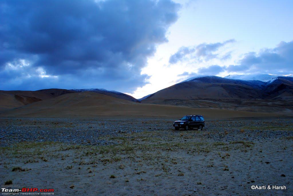
After you cross the village of Punguk, a few kms after hanle, take a good look back.
Though we did not know at that time, we were beginning our 90km ride, and for these 90kms we will not see a single human. Only living things.... Some Kiangs


As for the track, its different. Frequently used tracks get beaten down, and after a few years, you get a well defined track, but not here
There are some truck marks, thats all

And your marks...


Thankfully initial section is still soft, and you can make out the existing tracks


But many times tracks go here and there. We also ended up here and there, in a totally wrong direction. But then this is called exploring. And over here, you can discover some really amazing spots. Like this one


Tempting, right. Race to the horizon? Well not really, there are deep gulleys, and one such gully is not passable. Which is actually a blessing in disguise, because we had to turn back and take the correct track


Such hidden places have another advantage - Kiangs everywhere!


and then finally after hours on the tracks, you actually see what you wanted to see


The lake of Kyun Tso, Numerous such Tso's some motorable, some not motorable, and some make your own road motorable. Kyun Tso is make your own road kind of motorable. And guess what its one with one free!


But to get closer its wiser to walk, esp if you are alone. Nobody to winch you out here. Even if you have a winch, remember, there are no trees. with two vehicles, of course, you can be braver


Its tough to reach such places, and there is no habitation, but sights like these make up for it


As I said, one with one free, here is the second lake

This one has a soft swampy sand around it, its difficult to walk. Feet keep sinking in. So be careful while attempting to drive towards this one

Can you spot the white elephant?


After the lakes you have Thit Zarbo La and from there you descend to saner altitudes. Lakes are at 5010m, and the La is around 5100m

Road towards the La- Here the track is well defined

Near the Pass you can see both the lakes


The Pass

After the pass, the track worsens, with rocks and all

Its a bumpy ride, but downhill. And as you know, gravity is a friend.


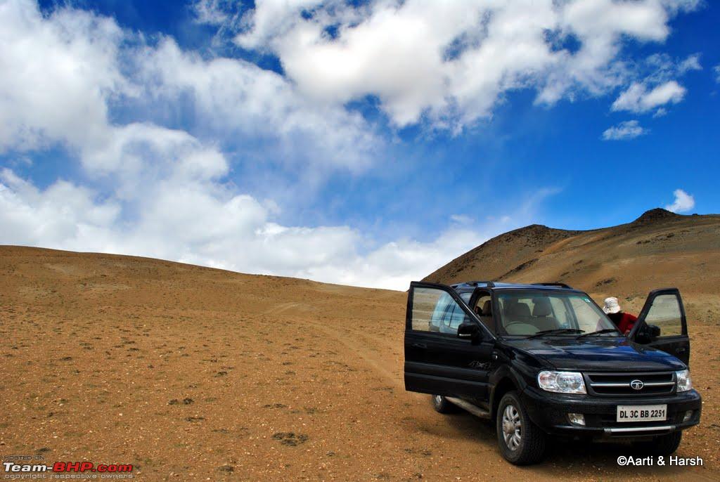
Now if you are going to attempt this ride, make sure of a few things
1. Vehicle reliability. I know you must be laughing here, because of the stories of my white elephant, but guess what, periodic care and maintenance can tame the wildest of horses
2. Food - Bread and cheese-spread work best. So do chocolates
3. Fuel - Changthang loop can require anything from 1000kms(which we did) to 1400kms of fuel
4. Environment - That high mountain may seem very tempting to do 4L stuff, but refrain if it has grass. If you drive on a grassy section it will take a full season to grow back. In this hostile environment, its the only food the wild animals get. Do not kill their food. Of course, there are a lot of sandy and dry mountains to attempt heroics.

Apart from this, make sure your glow plugs work. Even in summers some sections can see -5 in the early morning. Try to park your vehicle where it will get sunlight in the morning. Helps a lot during cold starts.

Last but not the least, the biggest risk here is overheating. Yes overheating. There is so less air, that if you are on a low gear and medium high rpm, the radiator fan will not be able to cool the engine sufficiently. In modern engines, the ECU puts the engine in limp mode much before any damage can happen. But in older engines, keep an eye on that guage, and service your radiator before the trip!

Thats all and ride safe.
I rarely see 4x4s going exploring the unknown in India, but I hope, with the coming of Thar like vehicles, more people will dare to see ladakh a little differently.

If you really want to do this loop, and want directions, feel free to drop a note, or ask your questions. There are many more Tso's like Kyun Tso, accessible by 4x4 only, and there are many hidden plains, waiting for exploration.
whatever I have done, is just a small section, and I have mapped it on openstreetmap.

Meanwhile, enjoy a compiled video from my Changthang Loop
tsk1979 is offline   (2) Thanks
Old 7th July 2010, 16:35   #127
Senior - BHPian
 
gsferrari's Avatar
 
Join Date: May 2009
Location: Chennai
Posts: 1,014
Thanked: 1,808 Times

Awe inspiring stuff...absolutely amazing pictures. Can you share more details on the camera and settings used?
gsferrari is offline  
Old 8th July 2010, 11:06   #128
Team-BHP Support
 
tsk1979's Avatar
 
Join Date: Feb 2005
Location: San Jose, CA
Posts: 23,717
Thanked: 22,825 Times

Quote:
Originally Posted by gsferrari View Post
Awe inspiring stuff...absolutely amazing pictures. Can you share more details on the camera and settings used?
Thanks.
Two cameras were used in this trip.
Panasonic FZ-35 for telephoto and videos, and tight landscape shots
Canon 350D with a Tamron 10-24 for landscape shots

I used Aperture priority for stills.
Some videos were taken in Aperture priority, and some in Auto mode.
tsk1979 is offline   (1) Thanks
Old 8th July 2010, 14:28   #129
BHPian
 
Join Date: May 2008
Location: Mumbai
Posts: 219
Thanked: 29 Times

Very pleasing thread, I normally visit this thread 2-3 times in a day to see these amazing pictures.

Since you were using the GPS to track your way, you must be having the gpx file of your track. Kindly share it on the forum so it will be helpful to locate these beautiful place during our visit to Leh.

cheers!

Alok
Crazy4Power is offline  
Old 8th July 2010, 16:21   #130
Team-BHP Support
 
tsk1979's Avatar
 
Join Date: Feb 2005
Location: San Jose, CA
Posts: 23,717
Thanked: 22,825 Times

My gpx tracks are shared with the entire world on openstreetmap.org. Just search for tsk1979 and download them from there!
tsk1979 is offline  
Old 8th July 2010, 19:46   #131
BHPian
 
Join Date: May 2008
Location: Mumbai
Posts: 219
Thanked: 29 Times

Thx!

I tried to locate the tracks on openstreet, but with no sucess. the search option on the left pane in not showing any results for tsk1979, Do they have any other search option?
Crazy4Power is offline  
Old 8th July 2010, 20:30   #132
Team-BHP Support
 
tsk1979's Avatar
 
Join Date: Feb 2005
Location: San Jose, CA
Posts: 23,717
Thanked: 22,825 Times

All you need to do is google for tsk1979 openstreetmap

OpenStreetMap
tsk1979 is offline  
Old 2nd August 2010, 18:20   #133
BHPian
 
Join Date: Jul 2010
Location: New Delhi
Posts: 297
Thanked: 844 Times
Offroading in Changthang (Ladakh)

My two cents:

We recently did a road trip to Ladakh and it had some off-roading part in it as well. Thankfully the softroader/pretender did it quite well.

Here's the safari at our campsite on the easter bank of Tso Moriri. The road can be seen on the hill behind the vehicle.
Tata Safari 4x4 The Off Road, and No road journeys-247_at-tso-moriri.jpg

The dreadful climb before Ungti La, just when one is about to leave Tso Moriri for Chumur valley.
Tata Safari 4x4 The Off Road, and No road journeys-256_climb-ungti-la-copy.jpg

The descent from Ungti La.
Tata Safari 4x4 The Off Road, and No road journeys-260_descent-ungti-la.jpg
vardhan.harsh is offline   (1) Thanks
Old 16th August 2010, 08:30   #134
Newbie
 
patrack1in's Avatar
 
Join Date: Sep 2008
Location: Chennai
Posts: 9
Thanked: 2 Times

Awesome sceneries. Brave enough to do it with just one vehicle. How about communication, like cell phones or radios?
patrack1in is offline  
Old 16th August 2010, 10:58   #135
Team-BHP Support
 
tsk1979's Avatar
 
Join Date: Feb 2005
Location: San Jose, CA
Posts: 23,717
Thanked: 22,825 Times

Actually in those areas there are no cell phone networks. Some remote villages do have BSNL satellite public phone, thats about it.
tsk1979 is offline  
Reply

Most Viewed


Copyright ©2000 - 2024, Team-BHP.com
Proudly powered by E2E Networks