Team-BHP > Shifting gears > Gadgets, Computers & Software
Register New Topics New Posts Top Thanked Team-BHP FAQ


Reply
  Search this Thread
860,643 views
Old 11th January 2009, 02:22   #91
BHPian
 
rshiv's Avatar
 
Join Date: Feb 2008
Location: Bangalore
Posts: 39
Thanked: 3 Times

MMI owners

For Inav loaded, will MapmyIndia give free version upgrades (maps) in the future?
rshiv is offline  
Old 11th January 2009, 03:32   #92
BHPian
 
Join Date: Dec 2008
Location: Delhi
Posts: 271
Thanked: 11 Times

Hey Bigman, thanx for the PM. Downloaded and started using. In fact had made my friend buy the update from MMI so that the same can be cracked. The same was uploaded on Ipmart by Blackjasmine.

Quote:
Originally Posted by bigman View Post
Even mapmyindia doe snot have these villages in its DB
The DB in the new version is of MMI only.
WanderNomad is offline  
Old 11th January 2009, 09:18   #93
BHPian
 
Wind's Avatar
 
Join Date: Jun 2005
Location: Bangalore
Posts: 277
Thanked: 75 Times

Quote:
Originally Posted by rshiv View Post
MMI owners

For Inav loaded, will MapmyIndia give free version upgrades (maps) in the future?
I had asked them this question but they were not very forthcoming. I was asked to register at their support site with the promise that they would get in touch with me whenever new versions of the product was released. But so far, I have not received any communication in that regard.

For a customer who has bought their product paying Rs 6900 in early 2008, I feel cheated when an updated version with more cities is available for half that price today especially since they do not have an upgrade policy for existing customers.

Overall I am quite unsatisfied with their product and service.

-- Wind
Wind is offline  
Old 11th January 2009, 10:39   #94
BHPian
 
ask77's Avatar
 
Join Date: Nov 2008
Location: Agra
Posts: 147
Thanked: 23 Times

Quote:
Originally Posted by rshiv View Post
MMI owners

For Inav loaded, will MapmyIndia give free version upgrades (maps) in the future?
I bought their Inav loaded in september and at that time they promised unlimited updates but till now I have not received any. maybe its too early since their latest updates were put out in aug. Overall they have provided with most detailed map data I have seen. But I feel regular updates are most necessary because of the rapidly evolving metro cities where poi's get changed and added quickly and old map data can become obsolete fast.
ask77 is offline  
Old 11th January 2009, 14:27   #95
Senior - BHPian
 
Join Date: Oct 2005
Location: NA
Posts: 1,224
Thanked: 93 Times

Quote:
Originally Posted by WanderNomad View Post
Hey Bigman, thanx for the PM. Downloaded and started using. In fact had made my friend buy the update from MMI so that the same can be cracked. The same was uploaded on Ipmart by Blackjasmine.


The DB in the new version is of MMI only.
Let us know how it performs in reality and accuracy of the maps. Visually it looks excellent when running via miomaps software.
bigman is offline  
Old 11th January 2009, 23:30   #96
Senior - BHPian
 
Join Date: Oct 2005
Location: NA
Posts: 1,224
Thanked: 93 Times

The latest mapmyindia (miomap) offering works fine on the Voxtel units. Whether they are accurate is another matter. 2 minute job to get miomaps working on these generic units.
bigman is offline  
Old 12th January 2009, 15:10   #97
BHPian
 
Join Date: Dec 2008
Location: Delhi
Posts: 271
Thanked: 11 Times

Quote:
Originally Posted by bigman View Post
Let us know how it performs in reality and accuracy of the maps. Visually it looks excellent when running via miomaps software.
Works very fine, quite detailed.
WanderNomad is offline  
Old 12th January 2009, 21:48   #98
Senior - BHPian
 
Join Date: Oct 2005
Location: NA
Posts: 1,224
Thanked: 93 Times

Some screen shots of the all india map on miomap (run on Kaiser). It looks better in landscape mode on a bigger display.

The GPS/Maps Discussion Thread (Dedicated Satnav, Smartphones, Tablets, etc)-2009-01-12_16-03-58_0004_111g.jpg

The GPS/Maps Discussion Thread (Dedicated Satnav, Smartphones, Tablets, etc)-2009-01-12_16-04-05_0005_111g.jpg

Name:  2009 01 12_16 04 12_0006_111g.jpg
Views: 2813
Size:  14.0 KB

The GPS/Maps Discussion Thread (Dedicated Satnav, Smartphones, Tablets, etc)-2009-01-12_16-04-18_0007_111g.jpg

The GPS/Maps Discussion Thread (Dedicated Satnav, Smartphones, Tablets, etc)-2009-01-12_16-04-31_0009_111g.jpg

The GPS/Maps Discussion Thread (Dedicated Satnav, Smartphones, Tablets, etc)-2009-01-12_16-04-38_0010_111g.jpg

The GPS/Maps Discussion Thread (Dedicated Satnav, Smartphones, Tablets, etc)-2009-01-12_16-04-58_0013_111g.jpg

The GPS/Maps Discussion Thread (Dedicated Satnav, Smartphones, Tablets, etc)-2009-01-12_16-05-19_0016_111g.jpg

The GPS/Maps Discussion Thread (Dedicated Satnav, Smartphones, Tablets, etc)-2009-01-12_16-05-25_0017_111g.jpg
bigman is offline  
Old 22nd January 2009, 03:20   #99
Senior - BHPian
 
Join Date: Jun 2006
Location: bangalore
Posts: 1,266
Thanked: 309 Times
mapmyindia iNav Feedback

Ok, so here's my much delayed update on mapmyindia iNav WF on my N95. Actually, I had sent this email out on the very first day I installed it last month - but I wished to try out more to get over initial bias/disappointment, and also to let mapmyindia have a chance to respond to some of the feedback/query. Since then, I had a chance to do more tests, and my overall view remains one of disappointment interms of things missing/not possible/not easy to use, and especially in comparison to free options like mgmaps, Nokia sportstracker, gpsed etc that I have been using for a while.
I'll use my colleague's Asus P527 with Satnav for a couple of days, and post comparison to mapmyindia in some days (he is out of station till end of month).

Disclaimer: These are my own opinions and they do go into deep usage issues as I perceive. For simple navigation, map browsing etc, one may find iNav WF to be adequate and indeed it is a somewhat simple app (rather over simplified/reduced functionality in some cases). So, you may find it of more useful, easy to use or less. Most importantly, the below is more a relative assessment (in terms of my experience) against other commercial GPS software like Garmin, Nokia maps and free GPS/map software including trackers and so on. A few points are related to usability improvement potential on a mobile (w/o touchscreen capability).
I do believe mapmyindia maps are still the most detailed over wide regions of India, and their PoI database is also probably more comprehensive.

---------Mail to mapmyindia 6th Dec 2008 --------------------
Hi mapmyindia team,

Today, I finally installed the iNav WF on my N95. Here's feedback from trying it out for 1 day (still have to take it out in the car for the navigation). I have used navigation devices like Garmin Street Pilot, Nokia Maps (Germany and US), Satguide, free programs like mgmaps and j2memaps, so you may want to take my feedback quite seriously. I have in the past given feedback to mapmyindia (as also kudos) on some occassions, urged to make a navigation device for India, and then urged to release the software solution for navigation on mobile phones. I have benefited immensely from using online maps since the beta.mapmyindia.com days and even before. I preferred to buy iNav WF from mapmyindia than Satguide for mobile which is 2/3 the price currently. I would really wish to see a much improved iNav product, and this is my intent with the rambling below.

First impressions : Have to admit, i am very disappointed with the navigation software and also the way maps are rendered and detail that is shown :-( Naturally, I'll use it for a while with actual driving for more detailed report. One nice feature is the roadblocks option though I have to still use this - but I can see this is a must have for India, so that I can guide the routing logic)

Some key feedback (I am only giving the negative ones here hoping for improvement. I'll provide both + and - in a more detailed review after i have used the software for a week or two) :-

* WF seems to be a pretty basic and limited capability software. I know mapmyindia did not make WF software, but you guys need to push for improvements in it if its to become useful and you guys want to get adv over Nokia Maps (beats the heck out of WF to my disappointment, though WF does have a few things for it like narrowing down places to search etc. but its way too limited and clumsy in most aspects), Satguide, Garmin, Route 65, TomTom and others. I believe WF is worse in this customization for India maps, than it maybe for Europe etc - otherwise, it wouldn't sell at all in Europe, trust me. And I am wondering why mapmyindia didn't use Tomtom or Route65 which are atleast from this experience way superior navigation solutions!

1. No font size adjustment in the menu settings. I mean even mgmaps freeware allows you to do this. One size does not fit all!

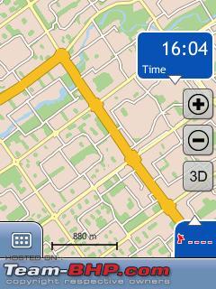
2. What's with all these apartment names written in ugly big font regardless of the zoom level of the maps. Totally destroys the map and ability to use it meaningfully.
- in every other navigation device I used, the names were scaled depending on zoom level. Also, instead of showing landmarks, putting out names of apartments using BLOCK capitals is wasteful to say the least. Here is an example
"RIFCO SANTOSH APARTMENTS" - can't even read the full name at a certain zoom level and beyond. Why is it important ? And all the road names are hidden till a few pop up at the highest zoom levels :-( Is this a map & navigation device or an apt locater ? Why isn't there a mode to toggle of apt names and other's on the screen to choose what info comes there. Why are names not scaled down in size when printing it in ugly caps is an eyesore ?

3. No map browsing mode of any value in the product! I understand navigation has certain goals - keep info legible, use zoom levels as per speed etc, but I also want to be able to browse the India maps on my phone when I am trying to locate routes manually. The level of detail in the zoom levels (spoilt again by those horrid apt names) is absymal. I can use Yahoo India maps (from mapmyindia) from an application like mgmaps over the GPRS net, and use the maps meaningfully. But in WF, its next to useless to browse a city like BLR or Delhi.

4. No tracking mode whatsover. I found no option (maybe I haven't seen it yet, so in that case you can ignore this) to track my route, save it to KML or other formats, to import tracks from saved track files. There is no way to record new paths/roads and report back to mapmyindia for improvements in an electronic format :-(

5. The road names as well don't scale and only pop-up in an odd manner at the highest zoom levels. This maybe ok in navigation when the software is guiding you, but absolutely crap in map browsing, and also when you're trying to locate those small roads etc that the software does not even have in its database. Now, both you guys and I know, that street address searching is highly limited for India even in metros in such software. Heck, I can't search for some of those apartments which block most of the screen space. So, how am I going to take those final turns, when I can't see any names and so on ? Just use Nokia maps on your Nseries phone (there maps are crappy - why else would I buy mapmyindia for mobile), and you'll understand how limited iNav WF is in terms of use.

6. The settings and options are way too limited. And even the route planning options are horribly bad. If I plan A -> B, I can't do a single option routing from B -> A. There are via points through the waypoint add option, but its quite unintuitive to a first time user ? The WF user manual is also crap. For an expert user like me, I don't care that much for manuals, but for your average customer, its incomplete, does not show any examples and what not!
Back to options in the menus - it does not automatically use my GPS location to search within the same state, or city. So, I can have 10 Airport Roads all over India and even more M.G. Roads and what not. It also does not have an option to manually enter the state. This becomes important because you cover 200+ cities, and hundreds of thousands of roads. Alternately, there could have been options to only enable "North India", "South India', 'East', 'West', 'Central' maps, so one could enable all, or one or more of them. That way, sitting in BLR, I don't hit all the roads in Delhi.
Unlike Nokia maps, there isn't an easy "Use this place" option on the menu for a search result, manually positioned cursor on the map or whatever, where this becomes "source" or "destination" for routing purpose. Atleast, options are limited and not intuitive.

7. No use of T9 to match city, street names auto from the database. So, one has to go tap-tap-tap using the number keypad. This also means that WF gives a pause of 3-4 seconds before it brings out the list of matches (since it cannot be sure if the user is pressing A or B or C and taking a bit of time with it - 1,2 or 3 key presses of the same key). This makes it quite slow to reach final addresses compared to say Garmin navigation devices.

8. The whole route is shown blinking for a couple of seconds before going to navigation level map zoom level. Don't know how to get back to it except for manually zooming out 'n' number of levels.

9. Does not keep a history of last planned/calculated routes. So, if I have to do it again, I must do the whole jing-bang process again...

10. There seems to be only street and city and number. Don't know what number is - pincode or house number ? Also, no way to use important landmarks, regions, colony names or apt names while doing the search. This is rather limiting. I did see though that if I use Airport Road, some options are suggested from the map database - so there is some capability to get around it.

11. The drive time provided for the route is completely off for Indian road conditions in cities. This is, ofcourse, difficult to tackle for India.

12. No simulation of the route path, or move from one turn to another by pressing a key unlike Nokia maps. So, I need to keep pressing up arrow key to move forward in the route (and zoom out for faster coverage of the route). Also, the waypoints/turns in the route path are not numbered, and the numbers aren't displayed on the map - which makes it confusing at times...

13. For such a limited capability application, it uses a whopping 8-10MB of RAM. What does it do ? Even java based map applications take only the same amount of memory while this is native Symbian. For comparison, Nokia maps uses 3-4 MB only. I am wondering how this will run on most N-series phones w/o running into memory issues.

I don't mean to sound so harsh, but I have been using mobile navigation in India and outside for close to 2 years now. I have also used dedicated GPS navigation devices. I have spent a lot of time and effort with certain freeware apps to overcome the lack of maps for India as a temporary hack. so, i am disappointed to see this application fall way beneath my expectations. Even the strongest point of mapmyindia - the quality and depth of map data relative to competition, has been severely compromised in terms of viewing and using it as I explained in some of the points above.
I really hope we get a much improve iNav for Symbiam - WF or otherwise! If that does not happen in next 3-6 months, I probably need to go back to Nokia maps, freeware or Garmin for mobile/ Satguide (hoping the maps improve) and they have more useful solutions - and that would be sad indeed!

Regards,
----------------------------------------

Last edited by lancer_rit : 22nd January 2009 at 03:30.
lancer_rit is offline  
Old 22nd January 2009, 03:27   #100
Senior - BHPian
 
Join Date: Jun 2006
Location: bangalore
Posts: 1,266
Thanked: 309 Times
mapmyindia iNav Feedback update

After using the iNav WF for about a month (a dozen times or so, including a long drive from BLR to Ooty and back), I sent the following additional feedback to mapmyindia today. Hope its useful to some of the bhpians here (a bhpian had also asked for my user experience on PM).
-----------------------------------------------
Hi Mapmyindia team,
I didn't get any replies to my previous detailed feedback on iNav WF for Symbian. In the meanwhile, I had the chance to use it more widely, though its limitations as perceived on the first day itself have dampened my enthusiasm for using it more often than I have. Here is some more feedback (both + and -) on the application and maps - in the hope you are interested in the same from a customer and it, somehow, helps your app improve for everyone's benefit.

+ The routing and rerouting is very quick once the process is initiated. On my N95, I definitely felt it more responsive than a Garmin Streetpilot device I used last year
+ Once you find a road in a city, it does show reasonable routes most of the time, though sometimes its not the best route or fastest route or even the right route.
+ Allows to narrow down search if a 2-3 pause is given between key presses. Would have liked this 'pause' timeperiod to be configurable since the default delay is too slow for me.
+ Voice prompts were generally quite clear and helpful wrt when and where they are announced. Liked the navigation in that sense.

- No T9 support in the app for allowing only valid combinations from the database to be used. This would be the most logical method on a mobile phone and ease entry of streets, cities etc.
- Several times while navigating, the mobile screen will go to power saving mode (blank off) : I found this ridiculous in a paid app which is supposed to provide on-screen navigation. I had to use a utility like S60Spoton to keep the phone from switching to power saver mode.
- A few times I found voice prompt was not played while the screen showed requirement to turn etc. Not sure if this is some oversight on my part or some kind of error
- On a drive from Bangalore to Ooty, several times, I was way off the road (SH17, NH212) - in navigation default zoom level, some times, I could not even see any road on the screen unless I zoomed out. Would be good to have a 'stick to road' option - also can the software have some 'smart' sense and reduce zoom level if there is not road on the screen but one in the vicinity (it could atleast attempt to reduce zoom levels by upto 2 or 3 levels). It also showed the alignment of the roads on mapmyindia with the the now existing highways is not accurate in many places
- Some main road forks were missing like the right after Gundlupet towards Wayanad - only the straight onto Bandipur/Mudumalai is shown! I was quite shocked since this road exists on your mapmyindia web maps, and i found many smaller roads on the mobile map while making the trip.
- Did not find an option to record trackpoints or waypoints while navigating. If its there, please drop me an hint.
- One way roads inside BLR arenot marked out properly - infact, no such indication is visible on any such road that its a one way - Google maps is better!
- No option to select a default street/any street if I don't select one when searching for small towns like Ooty (w/o forcing me to select some specific road, i know nothing about). I am happy if it selects any road in the database in Ooty and plots the route.
- Didn't find an option to use the map cursor to move around, and ask to route to that map cursor location (or as close to it as possible). Not sure if this is possible and overlooked somehow.

All the above are in addition to everything I wrote below. To be honest, I had to also run Nokia Sportstracker to record my whole route for later (no option in WF as noted in my previous email), and also run mgmaps just to make sure that in places where there is confusion, I can see maps in more details, with street and locality names in readable, small fonts and with the right zoom levels. So, atleast for me, iNav WF hasn't removed the need for others apps I was already using esp. mgmaps for the maps and tracking reason, and I have to say I remain disappointed as a result!

Regards,
-----------------------------------
lancer_rit is offline  
Old 22nd January 2009, 04:02   #101
Team-BHP Support
 
tsk1979's Avatar
 
Join Date: Feb 2005
Location: San Jose, CA
Posts: 23,717
Thanked: 22,825 Times

Does satguide sell mio maps without the device? Whats the cost?
tsk1979 is offline  
Old 22nd January 2009, 04:11   #102
Senior - BHPian
 
Join Date: Jun 2006
Location: bangalore
Posts: 1,266
Thanked: 309 Times

Quote:
Originally Posted by tsk1979 View Post
Does satguide sell mio maps without the device? Whats the cost?
It does sell maps for Symbian mobiles. I didn't get the 'mio' part ?

Quote:
I bought their Inav loaded in september and at that time they promised unlimited updates but till now I have not received any. maybe its too early since their latest updates were put out in aug. Overall they have provided with most detailed map data I have seen. But I feel regular updates are most necessary because of the rapidly evolving metro cities where poi's get changed and added quickly and old map data can become obsolete fast.
@ask77, that's not correct. I have a email from mapmyindia explicitly stating that their management has not firmed up the policy for map updates (till Nov '08 atleast). They expect map updates will be charged a nominal amount in all probability.
lancer_rit is offline  
Old 22nd January 2009, 10:39   #103
BHPian
 
Join Date: Dec 2008
Location: Delhi
Posts: 271
Thanked: 11 Times

Tanveer Satguides sell maps for windows, Symbian, PNDs etc. The retail for about Rs. 2200. PM me for details etc.
WanderNomad is offline  
Old 22nd January 2009, 12:08   #104
rkg
Senior - BHPian
 
Join Date: Apr 2005
Location: bangalore
Posts: 1,044
Thanked: 594 Times
My Experiance with SATGUIDE

I have Satguide's Voxtel 430.
here are some initial impressions

It is reasonable accurate ( upto 90 % or more) within city( Bangalore)

Highway use --------- One word USELESS

Coverage is too poor.

On NH5 which is part of GQ especially in AP, it does not show any of the bypasses at Gudur, nellore, ongole, Vijayawada etc. when you are on byapss, it shows nothing.

Most of the intersections on NH5 are not shown at all.

There is no option to show POI like highway petrol stations/restaraunts etc. this option is available if one selects a city. one can choose the POI. but for a route like Bangalore to Vizag no such option

Coverage of state highways is very poor. it does not show roads which are existing since 50 years. ( example for most part of SH61 in AP i.e; Putalapattu to naidupet via tirupati) the navigator is way of the mark. till the turn in to SH61 the navigator is firm on the road. but once you enter SH61 road is no where to be seen

In guntur town i wanted to reach GQ, i.e; NH5. it asked me to turn left. i have turned left. when i inquired with a person, i was told that i should not have taken the left turn at all in the first place and should have gone straight to reach GQ. this much for its navigation capabilities.

In tirupati i was on Kapilatheertham road, Satguide is showing it only up to 2/3 length afterwards no road

as usual no option to record the route.
rkg is offline  
Old 22nd January 2009, 12:39   #105
BHPian
 
nisarg86's Avatar
 
Join Date: Mar 2005
Location: Ahmedabad
Posts: 392
Thanked: 13 Times

I am getting Sirf star III USB GPS Receiver. Amazon.com: GlobalSat BU-353 WaterProof USB GPS Receiver (SiRF Star III): Electronics
How can I run this thing with MMI or satnav on Windows XP ?
nisarg86 is offline  
Reply

Most Viewed


Copyright ©2000 - 2024, Team-BHP.com
Proudly powered by E2E Networks