Team-BHP
(
https://www.team-bhp.com/forum/)
Good morning :)
A newbie here and this is my second post in the forum and first one in this thread. Shouting a "Hi" to paragsachania, ampere and everyone else.
Let me clear the air on the underconstruction roads in Belgaum, the concern which I just now noticed has been raised in the last page. The following updates are only for those who are unaware, while I presume most of them have good knowledge about Belgaum and Goa
Refer to the below Google map snapshot of Belgaum with standard "North" direction i. e upwards.
1.The destination symbol of Google represents the functional traffic signal at Gogte circle, Belgaum.
2. Whether from Bangalore, Pune or Mumbai or Hyderabad , you come from Northwards to reach that signal.
3.As you can see, the road forks into two (southwards) at Gogte circle. The thick yellow colour* labelled road running on right (actual right in reality) indicates "Congress road" which is a divided 4 lane road, has been so since many years. Other road you can see in the snapshot is "Khanapur road" as mentioned, which is 30% 6 laned and rest 70% is under 6 laning at present.
4. Both these roads meet up at Third Railway gate junction as indicated by a red box.
5.The blue box indicates Peeranwadi cross, Belgaum where there's another fork as you all know, where left (left in reality) takes you on NH4A and right through the Chorla.
Now, the roads that are under construction are-
A. Khanapur road between Gogte circle and Third railway gate. As I said earlier, it's 30% 6 laned and rest is in under construction for 6 lanes and at present is prone to insane traffic snarls at unexpected* times of the day. Work is expected to complete here in another 1.5 to 2 months. First timers or occasional travellers unknowingly commit the mistake of taking this Khanapur road. Even when it was a good old 2 lane there was never a reason to take this congested road.
Reason being, you always had the Congress road which is a well divided 4 lane and a standard route to take to exit Belgaum onto Khanapur/ Goa side. Traffic moves continuously here except for some situations. Interceptors are placed* once in a while towards the end of this Congress road* and all vehicles doing even 40 kmph are challaned (40 is the limit everywhere in Belgaum). Hence, locals used to stick to 35kmph.
"Congress road" is THE road to be taken if you are heading to Goa/Karwar/Dandeli/Ulavi from Belgaum. Keep on extreme right at Gogte traffic signal to get easy access to Congress road.* It's because first timers keep left, they end up taking "Khanapur road" and experience lot of traffic and underconstruction roads.
B. The road between red box and blue box is a common final road as you can notice in the snapshot and passes through industrial hub of Belgaum (udyambagh).* Let me call this as a "final common road".* It's 3.3kms long and until a month back was an insanely traffic prone stretch due to 6 laning. 80% work is completed as of now with last 100 meters being untouched. Additional works like construction of median divider and lights are underway. Else, it's a broad 6 lane providing a huge relief for the smooth flow of traffic. Take care though, especially at nights, as there are unmarked pending construction activities and a final layer of tarmac is yet to be laid down, so you have undulations.* Full work with final touches is expected to be completed here in 1 month.
So, with the Congress road and the final common road thereafter , you get only broad 4/6 lane roads till Peeranwadi cross, it's been comparatively fast to cover this 5.8kms stretch (5.8 from Gogte circle) . Infact right from your exit from NH4 into Belgaum, today you have only 4/6 lane roads within the city, to exit onto Chorla or NH4A.** If you take Khanapur road in between though by mistake,* you might end up getting stuck for 15 mins in traffic and if unlucky another 10 mins for railway crossing at third railway gate.
Secondly, talking about the roads to be taken after Sanquelim in Goa to respective destinations (in case you took Chorla route from Belgaum). I presume everyone by now knows the famous T-Junction at Sanquelim. Now, right from day 1,the dictum was turn right at T-junction for Panjim/Old Goa/South Goa and turn left for Mapusa/North Goa.
The reason why people took a detour via Mapusa even when they wanted to head to Panjim was, one is Google map recommendation and the perceived wrong notion of passing through narrow lanes of Old Goa. Let me clarify, Ribander bypass for Old Goa which is 10 kms long, existed since last 8 years atleast. It was a good wide 2 lane then with fast moving traffic and today has been converted into 4 lanes making things even better. So,* one had to never pass through the traffic prone narrow lanes of Old Goa when you had the all free and fast Ribander bypass in place. I have always taken Sanquelim- right turn at T-Junction- Marcel- Banastarim junction-Ribander bypass - Panjim route past 3.5 years ever since Chorla took birth. Mapusa was a detour by 10-12 kms for Panjim as destination* and add to it traffic prone Bicholim-Tivim stretches. It's good only if you are heading directly towards Mapusa or North Goa beaches.
Having said all this, I know there is absolutely no reason to touch Belgaum today for Bangalore--Goa travellers unless for other reasons.
Hope it helps.
What is the fog condition in anmod ghat very early morning? I heard it will be heavily foggy in rains during early morning hours and not safe. I need to travel to goa in early july but my return journey will be early in the morning and will be hitting the ghat at around 6am. Kindly guide. Else will take devimane ghat since it will be nice 8-9 am for me to reach the ghat via kumta if started at 5.30am.
Regards
Quote:
Originally Posted by rajivtelang
(Post 4001936)
What is the fog condition in anmod ghat very early morning? I heard it will be heavily foggy in rains during early morning hours and not safe. I need to travel to goa in early july but my return journey will be early in the morning and will be hitting the ghat at around 6am. Kindly guide. Else will take devimane ghat since it will be nice 8-9 am for me to reach the ghat via kumta if started at 5.30am.
Regards
|
In my experience with Western ghats all these years,every region gets equally fogged out at any time frame in a given day. Yes, it will be really thick during monsoons, so safety can be a concern. About 7 years ago, once when we were riding via Anmod ghat around 9-10 a.m during monsoons, it was heavily fogged out, we were riding at 10kmph with extreme caution with headlights on and intermittent honking, even then a rashly driven Goakadamba Stu bus barged upon us head on in his bid of overtaking a truck in ghats. We swerved to the left and got off the road in the nick of time, else it would have been a severe accident if not fatal. I don't know with what confidence he was driving rashly even though the fog had blinded every other vehicle on that road. Needless to say, take extreme care whichever ghat you would drive on during these monsoons. I believe during monsoons, one can't assure that at so and so time of the day, it will be less foggy or more foggy, it purely depends on the prevalent weather conditions at that point of time. I have experienced thick fog at 3pm too. Anmod ghat will offer you splendid views of multiple waterfalls dotting the mountains in these monsoons, but you will enjoy it if there is no fog.
Quote:
Originally Posted by paragsachania
(Post 3984176)
Drove to Goa on Wednesday through Friday and my destination was Benaulim Beach near Colva.
|
Parag, on your return journey you took the following route viz., MADGAON.>KARWAR>ANKOLA>YELLAPUR>MUNDGOD>BANKAPUR>D AVANAGERE I would like to know the distance between Mundgod and Davanagere and the
road condition
Quote:
Originally Posted by KALSANKRPAI
(Post 4003252)
I would like to know the distance between Mundgod and Davanagere and the road condition
|
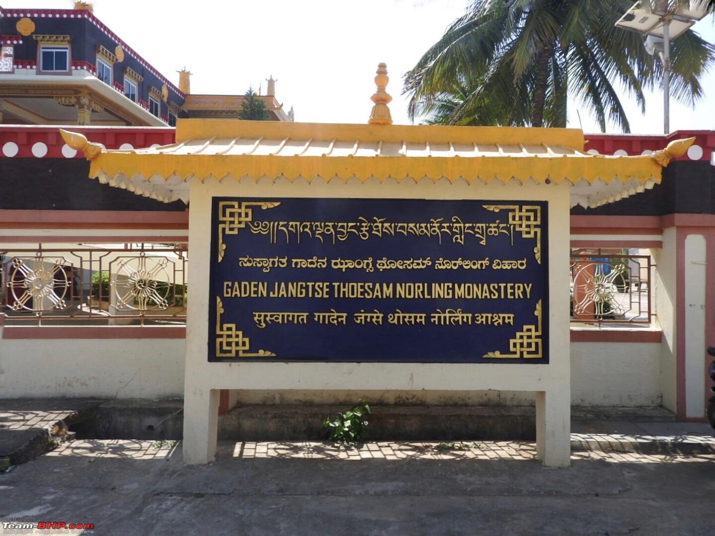
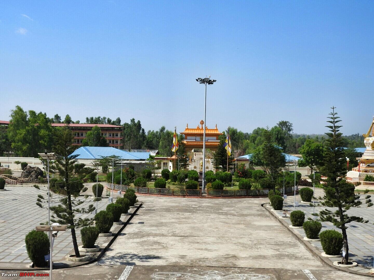
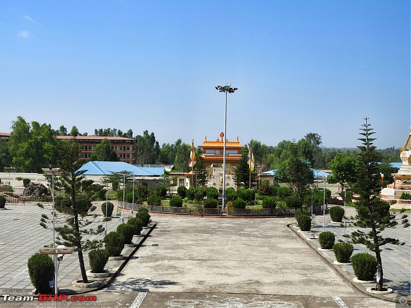
Davangere - Mundgod is roughly 125 km. If you've time to spare, visit the Mundgod Tibetan Settlement. You'll get momos and thukpas in Camp No 3 :thumbs up
Road conditions based on my drive in May first week :
- Davangere - Bankapur : NH4 :D
- Bankapur - Mundgod : Two lane roads with less traffic
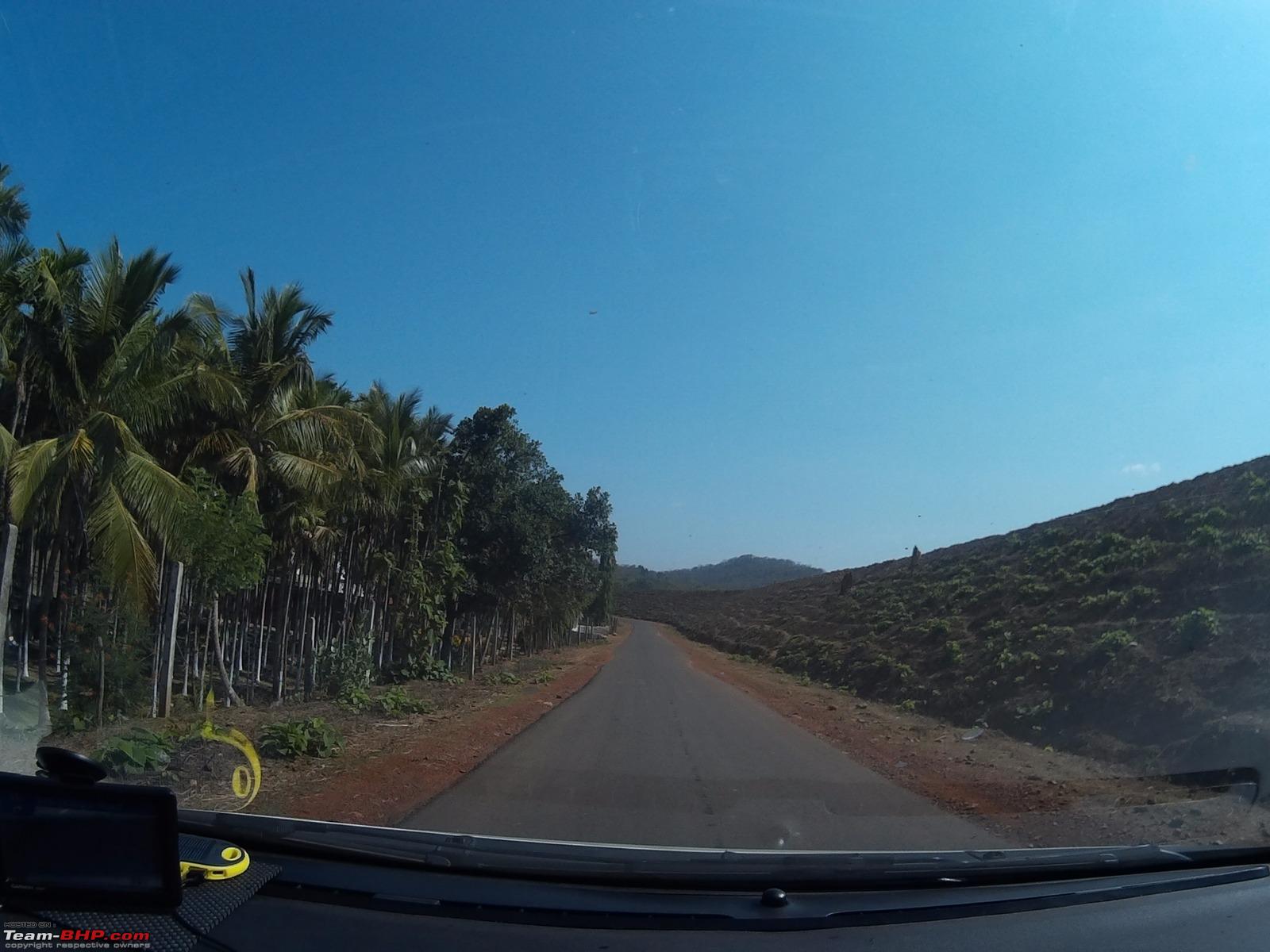
Sharing few pictures of Bankapur - Mundgod section and Tibetan Settlement :


I heard that there was heavy rainfall in the Hubli region a few weeks back. Any idea if the Bangalore-Hubli-Mollem-Goa route is ok now?
Quote:
Originally Posted by PearlJam
(Post 4008880)
I heard that there was heavy rainfall in the Hubli region a few weeks back. Any idea if the Bangalore-Hubli-Mollem-Goa route is ok now?
|
If in doubt, it is best to take Hubli-Ankola-Karwar-Goa route. I feel it is much wider route but time consuming as well. During rains I feel that is the best route.
Regards
travelled to goa via mangalore and back via hubli- attached maps
Chennai mangalore - - my son missed the nice road and went sight seeing into Bangalore - so lost time .
- lunch at breeze hotel
- drove thro sharavanabelagola
- continuous rain from hassan to mangalore - two lane - heavy traffic - night time . road condition was not bad.
mangalore - goa - stopped at murudeshwar
- lunch at ankola - kamat plus
- road from mangalore to karwar - lot of work happening with lot of diversions - making time not possible
- karward to goa -great road and landscape - a pleasure to drive - continuous rains
goa - hubli - fog in jamboti ghat
- took a scenic route (bad road conditions for about 10 kms)
- went into hubli for lunch - scrambled back because of traffic and ate in kamat upahar
hubli - hosur
got caught for speeding - lost about 30 min and 2000 rs for 2 cars - (doing 140 in a 60 kms limit ) - no pollution certificate for 1 car - no original DRL for for my son.
hosur - Chennai
- dinner at the biriyani shop near mc donalds -
- reached Chennai at 12.20 am.
Quote:
Originally Posted by vijay shekar
(Post 4011568)
goa - hubli
took a scenic route (bad road conditions for about 10 kms)
|
I believe this is the Jamboti--Khanapur ( 17 kms) forest road that might have gone bad in these rains. May be some part of Bidi--Kittur too.
Quote:
Originally Posted by vivek95
(Post 4011642)
I believe this is the Jamboti--Khanapur ( 17 kms) forest road that might have gone bad in these rains. May be some part of Bidi--Kittur too.
|
You are spot on. But the route was scenic
Quote:
Originally Posted by PearlJam
(Post 4008880)
I heard that there was heavy rainfall in the Hubli region a few weeks back. Any idea if the Bangalore-Hubli-Mollem-Goa route is ok now?
|
NH4A Belgaum-Ramnagar-Anmod ghat-Mollem,Goa remains all good and supersmooth. This is today's update from my friend. ( route from Hubli meets NH4A at Ramnagar, not sure about Dharwad--Ramnagar but I believe it should not have gone bad at all )
Quote:
Originally Posted by vijay shekar
(Post 4011568)
travelled to goa via mangalore and back via hubli- attached maps mangalore - goa- road from mangalore to karwar - lot of work happening with lot of diversions - making time not possible
- karward to goa -great road and landscape - a pleasure to drive - continuous rains
|
Is the Mangalore-karwar route that bad? I am planning on a Calicut-Goa drive. If NH17 is bad then it makes sense to go via Bangalore-Hubli.
Quote:
Originally Posted by tomraven99
(Post 4012018)
Is the Mangalore-karwar route that bad? I am planning on a Calicut-Goa drive. If NH17 is bad then it makes sense to go via Bangalore-Hubli.
|
road is bad . in the sense that 4 lane work is going on and the lanes keep shifting . as and when this happens the junctions are bad and you slow down. . but it is scenic drive and from karwar to goa you should not miss the drive. drive during day time. great roads ( two lane) great landscape. but since you are from kerala , probably the landscape may not impress you as much as it did to us.
Bangalore hubli is like any other 4 lane highway till hubli . then it is 2 lane and then 6 lane . when you leave the highway to goa it becomes 2 lane . and a ghat section .
Hi,
Need to visit south Goa on next weekend i.e. 23rd July. I have three options in mind. Kindly let me know which one could possibly be the best since I will travel in a Santro with my parents, wife and 6 years old daughter.
1. Bangalore-Dharwad-Anmod-Mollem
2. Bangalore-Hubli-Ankola-Goa
3. Bangalore-Haveri-Sirsi-Kumta-Goa
Specifically due to the heavy rains I am concerned about all the three routes. I am expecting a travel for 12-13 hours due to rains. As far as distance is concerned option 1 is shortest and option 2 is the longest. Anmod ghat in option 1 is not that wide and could be very foggy.
Any suggestions would be of great help.
Regards
Quote:
Originally Posted by rajivtelang
(Post 4014988)
travel in a Santro with my parents, wife and 6 years old daughter.
|
For the above, below option holds best.
Quote:
1. Bangalore-Dharwad-Anmod-Mollem
|
Quote:
Specifically due to the heavy rains I am concerned about all the three routes.
|
With rains and current conditions, I would recommend Dharwad Bypass - Anmod - Mollem route mainly for the sparse traffic and less "Dangerous" spots in rains.
Quote:
Anmod ghat in option 1 is not that wide and could be very foggy.
|
There might really be no escape from fogs with all 3 routes but except may be Option 2 since you would need to cross the Western Ghats to reach the coastline. However, Anmod Ghats after repairs is in "Excellent" shape. It is not at all narrow if you compare that to Chorla and not too curvy too.
| All times are GMT +5.5. The time now is 09:07. | |