| |||||||

| Search Forums |
| Advanced Search |
| Go to Page... |
 |
| Search this Thread |  57,080 views |
 11th August 2012, 15:28
| #1 |
| BHPian | Northeast Himalayan Escape - Bhutan and Tawang There is no road; No problem. The road is narrow and slippery; No problem. There is a huge land slide and rocks are falling from the cliff; No problem. We have to go back; well that is not an option. So what to do? Just drive ahead. This travelogue is about our 16 days, 7500KM self drive expedition to Bhutan and Arunachal Pradesh that has taken us through some of the most treacherous terrains, highest passes and majestic North eastern Himalayan ranges. All these adventures were done in wrong season when Rain Gods decided to unleash their fury in this part of the world. About us: Freedom to explore our own trail is the main reason we prefer road journeys. Our strong belief that bad road leads to great destinations motivates us to choose the un-trodden path. This belief has taken us to some of the remote and beautiful places across south India. After gaining 5 years’ experience, it was now high time to up the ante and do something that very few people have done, a drive from Hyderabad to the Northeast during Monsoons. We also had the perfect car to take the challenge head on, my faithful Tata Safari 4x4. We have crossed rivers, drove on beaches, climbed hills, and went into forest trails. There is nothing stopping us. Planning: None of our trips are planned and the trips that we plan, nothing goes according to plan. However, we ensure that the vehicle is in top condition and do meticulous research on the routes, their condition and the places around that are worth seeing. In addition to this, we also plan for the worst. To give you an example, we were expecting landslides and to take us through such eventualities, we carried fire wood, lighter fluid and utensils to cook en-route. Members of team-bhp have been very helpful while planning for this trip. A special thanks to hvkumar and Sutripa for their patient answers to my questions, that were often bordering on stupidity. Before I start my travelogue, I want to mention about my heart-felt appreciation for the Indian Army. The fighting qualities of the Indian jawan and the young officers are second to none. They were very helpful even though they work in harsh conditions. They dedicate their lives to protect our homeland. We were lucky to interact with some of the jawans and listen to their fascinating stories. We are truly honored to be in their company for the small amount of time that we spent with them. The Team(Left to Right): Ananya, Myself, Kalyan and Karthik  The most important member of the team, Tata Safari 4x4  And the motto we try to live by  The roads we encountered  And the views we witnessed  Last edited by himavanth_m : 15th August 2012 at 19:44. |

|  (14)
Thanks (14)
Thanks
 |
| The following 14 BHPians Thank himavanth_m for this useful post: | aalokg, anandpadhye, AvonA7, Blue Thunder, GTO, hvkumar, jnanesh, JoseVijay, moralfibre, Ponbaarathi, rahul_sinha, scopriobharath, SmartCat, swiftnfurious |
| |
|
11th August 2012, 23:00
| #2 |
| BHPian | Re: Northeast Himalayan Escape - Bhutan and Tawang No matter how much we plan, anything can go wrong in the trip and the risk increases exponentially as the distance increases. So keeping our fingers crossed, we started our journey. The first leg of the journey is supposed to test our endurance. Our plan was to reach Siliguri non-stop. We started on Friday, June 29th 2012 at 2:00 PM and the odometer on my Safari read 71,380 KMs at the start of the journey. Day 0 and Day 1: The route taken upto Kolkata: Hyderabad - Suryapet - Khammam - Rajahmundry - Vizag - Bhubaneshwar - Kolkata. Hyderabad Suryapet stretch: The road surface is smooth throughout. The 4 laning works is almost finished. The number of diversions are reduced drastically. We reached Suryapet in 4 hours. Suryapet - Khammam - Rajahmundry : This is completely 2 laned road. Most of the road is littered with potholes. It is difficult to drive in excess of 80kmph in this route. The last 100kms of this 2 laned road is very smooth and it is easy to do speeds at 100kmph. I would not recommend doing taking this road during the nights after 8 PM. The first pic of the trip somewhere on the Suryapet - Khammam route  We decided to stop for the first time for having a late lunch which we got from home. By late lunch we mean lunch+dinner at 5:30 PM.The view while having the lunch was amazing  NH5 - Rajahmundry - Vizag - Bhubaneshwar - Kolkata: The 4 lane road is in excellent condition for most part. Some distance near Chilka Lake and some distance on the Odisha - West Bengal border is filled with pot holes. We reached Vizag at 1 AM and Bhubaneshwar at 10 AM. We got refreshed at a coffee day in Bhubaneshwar that is there in the Ginger Court hotels. This is located after a small deviation from the main highway. After breakfast, we were fresh and ready to target Kolkata by Night A pic of the Chilika Lake taken from the road side  Chilka lake is the largest Brackish water lake in the world. Chilika supports some of the largest congregation of migratory birds in the country, particularly during the winter. The birds migrate from as far as Caspian sea, Russia and Mongolia. Chilika lake is also home to Irrawaddy Dolphins. If one goes to Chilika Lake near Puri, there are multiple boat rides that take you into the lake for Dolphin sightings. When I went there in 2004, the sightings of the dolphins were abundant. Not sure about it now. We did not want to explore Chilika as our main target was to reach Kolkata We crossed Kolkata by 6 PM which is a full 28 hours later. The odometer read 72,916 KMs. We have covered 1,536 KMs and we were happy with the progress. At this time, we decided to proceed with the journey and reach Siliguri. We were still very very fresh. Day 1 and Day 2: The route taken: Kolkata - Bardhaman (on NH2) - Rampurhut - Farakka - Malda - Islampur - Siliguri We did not take the NH34 as we wanted to be on the completed 4 lane road for some distance. The 4 laning was done upto Bardhaman but after that, the roads just turned horrible. On the stretch between Bardhaman and Rampurhut, the pot holes were the size of the craters. It was raining throughout for us and the drive was during the night. The bad roads just made us very very tired. We touched the NH34 after crossing Rampurhut, and we hoped the tarmac would atleast be better. However the craters disappeared but the potholes were still there. In addition to this, the traffic made things worse. We crossed Ganges at Farakka in the night. The police there asked us to switch off lights and drive on the bridge in a convoy. The bridge is very close to Bangladesh border, but we did not understand the reason to switch off lights. The locals also did not help in telling us the reason behind this. Could anyone specify the reason for asking us to switch off lights while on the bridge during the night? By 3 AM, we were tired and sleep crept in. We decided that driving any further would be dangerous. So checked for a safe spot where there was a checkpost, stopped the vehicle there and slept for a couple of hours in the car. We got up by 5 30 AM and continued our journey. Finally at 9 AM, the 4 lane road started again. The Odo read 73452 KM (2,072 KMs from Hyderabad) A pic of the 4 lane road. There was another 100 KMs to Siliguri from here  We were used to seeing Tea Plantations on hills like Munnar and Ooty, but this is the first time we saw tea Plantations on Plains.  Just as we reach Siliguri, the 4 lane roads end and the 2 lane road begins. But the surface is good  If the road conditions had not improved in the last leg, we might have gone crazy after driving the whole night in pot hole filled roads. We reached Siliguri on Day 2 at 11 AM. Upto this time, we were in the car for 46 hours. After checking some hotels, we finally found a hotel by the name Hotel Conclave to stay for the night. The weather was humid, but we decided to take a Non A/C room to save money. We wanted to see Darjeeling which is very close. Somehow were were fresh after reaching Siliguri. 2 hours rest later, we were off to a dash to Darjeeling. Last edited by himavanth_m : 15th August 2012 at 19:49. |
|
| (7)
Thanks
|
| The following 7 BHPians Thank himavanth_m for this useful post: | aalokg, GTO, JoseVijay, krish3, scopriobharath, SmartCat, swiftnfurious |
|
12th August 2012, 03:14
| #3 |
| BHPian | Re: Northeast Himalayan Escape - Bhutan and Tawang Day 2: Darjeeling Drive in a Hurry. By the time we took rest and got ready, it was 2 PM. We either had the option of taking more rest in the room or to go for a quick dash to Darjeeling. Darjeeling was about 77 KMs from Siliguri and it would take close to 3 hours. So we would not have much time to see anything there, but just for the pleasure of driving, we went ahead anyways. It was a rush of adrenaline and pure madness. The initial part of the drive to Darjeeling was through smooth Single laned roads on the plain. We encountered some wonderful views enroute. First view of the Himalayas from a distance : On the way to Darjeeling  Inviting roads to Darjeeling. These roads hide what is about to come  After going certain distance, we reached the foothills of the Himalayas. From here on, the drive was through steep Ghats at inclinations exceeding 40 degrees and wide enough to fit a safari with no place for oncoming vehicles. It was one the most challenging drives for me. I had not encountered such narrow roads on steep inclines in south India. But this challenge was only upto Kurseong. Once we reached Kurseong, the road becomes much wider, but the road surface worsened. The railway track follows the road path from this point onwards. The famous Darjeeling railway track that goes right beside the road  One of the best pics of the Safari, somewhere on the way to Darjeeling  Finally we reached Darjeeling  Darjeeling: This hillstation is also called 'the Queen of Hills' and is at an altitude of 6,700ft. As we gained altitude to reach Darjeeling, we could feel the difference in temperatures. The high humidity in Siliguri gave way to chilly breeze in Darjeeling. Darjeeling tea is renowned all over the world. The following two places are worth visiting in Darjeeling, based on my previous trip to Darjeeling 10 years ago. 1. Himalayan Mountaineering Institute(HMI) and the Darjeeling zoo. Both these places are right beside each other. HMI was established by Tenzing Norgay who climbed Everest with Sir Edmand Hillary. These two were the first climbers to reach Mt. Everest. 2. Tiger Hill: This is the view point of the Kanchenjunga, which is the third highest peak in the world after Mount Everest and K2. This mountains contains 5 peaks and the tallest peak is in excess of 28,000 feet. The best time to reach Tiger hill is early morning. Sunrise over Kanchenjunga from Tiger hill is an experience in itself. It was a Stunning view that was captured in my memory from earlier travel. I cannot forget that sight. 3. Mirik Lake: This lake is on the Indo-Nepal Border. There is an entry point to Nepal close by if one wants to go there. The lake is really beautiful and the boat ride is splendid. By the time we reached Batashiya Loop, it was 5 30 PM and it was getting darker. Batashiya Loop is basically a place where the legendary toy train makes a loop. there is a Gorkha martyar memmorial here surrounded by a beautiful park. Since it was late, we could not attempt to go to the Tiger Hill view point of Kanchenjunga. However, we had some time for shopping and snacks. We spent about 2 to 3 hours here and we headed back to Siliguri. Full Moon at Darjeeling. We were surprised to see clear skies during monsoons in Darjeeling  Since it was a quick drive, we have no further pics of Darjeeling. We finally reached the hotel in Siliguri at 10 PM, had dinner, and quickly dozed off to sleep. For the first time in 2 and half days, we got a bed to sleep in. Next day we would be off to the Bhutan border. Last edited by himavanth_m : 12th August 2012 at 12:59. |
|
| (3)
Thanks
|
| The following 3 BHPians Thank himavanth_m for this useful post: | aalokg, JoseVijay, saket77 |
|
12th August 2012, 12:05
| #4 | |
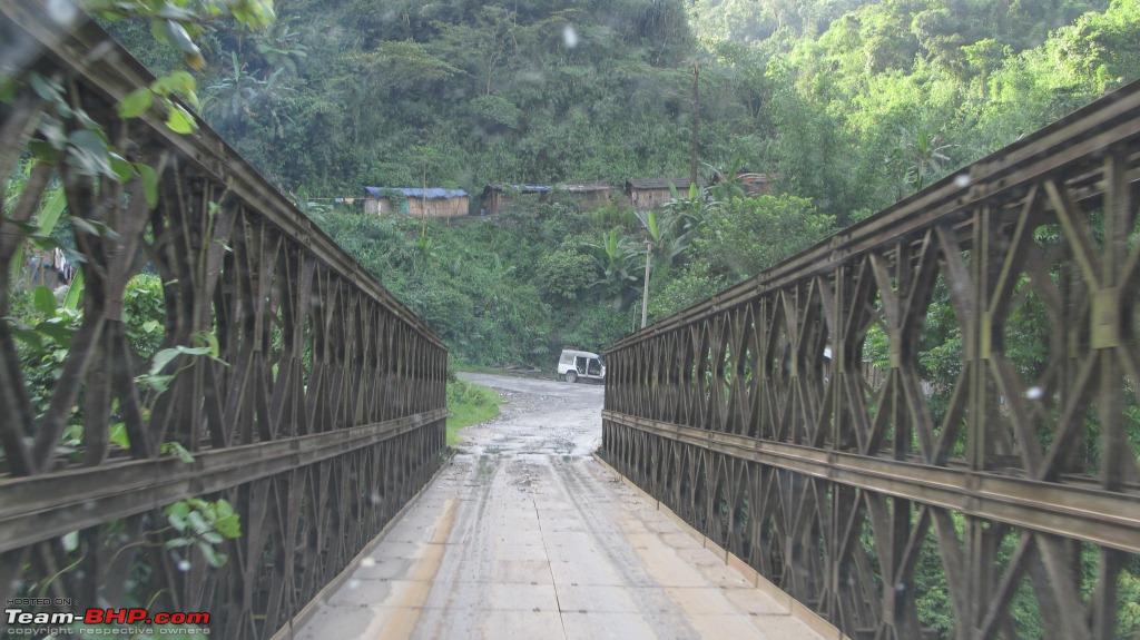
| BHPian | Re: Northeast Himalayan Escape - Bhutan and Tawang Day 3: Entry into Bhutan The route taken: Siliguri - Sevoke - Mong pong checkpost - Oodlabari - Chalsa - Banarhat - Birpara - Hashimara - Jaigaon/Phuentsholing The Odo read 73,695KMs. We started at 5 30 AM We reached Indian Bhutan Border at 73,870 Kms at 12 Noon Dooars: The Dooars is the foothills of eastern Himalayas and this region forms the gateway to Bhutan from India. The Darjeeling is also part of this region. The drive through this region has taken us through Ghats of Sevoke across the Teesta River. Teesta River is the lifeline of Sikkim which flows through the length of Sikkim and forms border between Sikkim and West Bengal. This river joins the mighty Brahmaputra in Bangladesh as a tributary. The roads upto Hashimara were in Excellent condition. Fantastic 2 laned highway.  Another example of the road.  A view of the Teesta River  Crossing a canal or a tributary of the beautiful Teesta river.  We reached Chalsa at around 8 AM. We had our breakfast here at a beautiful resort called Sinclairs hotels. Link to the website of the resort Dooars, Chalsa, Best Hospitality Hotels This hotel is very expensive, but after 3 days of food at no proper timings, we decided to go ahead anyways. A nice view from the lobby of the resort  Another pic of the team  After crossing Hashimara, the road just becomes non existant. These are the worst roads I have even seen so far. The average speed one can attain in this 20 km stretch is 10 km/hr. It is very difficult for normal sedans and hatchbacks to make through this road without hitting the bottom atleast once. There were also a lot of Bhutan registered Toyota SUVs and Transportation lorries after Hashimara. We realized that we were not far off, but the road condition made it look really distant. After crossing this horrible road, we could again see the tea plantations at a distance. We were now able to spot the hill ranges at a distance again. We reached Bhutan Border at 1 PM after frustrating stretch of 20 kms First view of Bhutan from the Indian Side  Upon arrival at the border, we found a stark difference on the two sides. The Indian side is shabby while the Bhutan side is extremely clean. There is no concern for traffic rules on our side, while every drives in a straight line with no honking on the Bhutan side. Next we had to take permits for entry. For this, I found hvkumar's information very helpful. The procedures are still the same. So I will directly copy and paste the information from his website: https://sites.google.com/site/hvkumar/kumar'snortheastdrivingholiday Quote:
Now about our experience: First thing, after reaching the entry point, we realized that we had left our passport photos back at home. Not only that, the downloaded internet forms for the entry was also at home. Thankfully we got our passports. So we got our passport photos clicked which is cause of one delay. One of our team's passport has expired. So he had to get the xerox attested from the Indian consulate. By the time we reached Indian consulate, they went for their lunch which is 1 - 2 PM. The Indian Consulate for attestation is on the Bhutan side itself. By the time we got an attested copy, it was 2 30 PM indian time. We had to run all the way from Indian Consulate to the Visa application center. By the time we filled our forms and received the permit, it was 3:30 PM. Which means it is 4 PM Bhutan time. The Permit for vehicles are given only upto 4 PM. So dejected we could not enter Bhutan the same day, we took a hotel at Phuentsholing. We had some more time to kill. So we went back to the road for a photo session. It is only because of our mistakes that we got delayed. We did not face any problems while obtaining the permits as such. A few pics of the photo session in the tea gardens with Himalayas at a distance   A couple of snaps of my Safari   We would need to get up in the morning and obtain the permit for the car the following day Last edited by himavanth_m : 15th August 2012 at 19:56. | |
|
| (2)
Thanks
|
| The following 2 BHPians Thank himavanth_m for this useful post: | aalokg, Renjith_Mani |
|
14th August 2012, 02:04
| #5 | |
| BHPian | Re: Northeast Himalayan Escape - Bhutan and Tawang Day 4: Entering the land of the Dragons The next day we all got ready by 8 AM. This day was the day we would be driving to Bhutan. Just as we entered the gates, a group of 10 Police officials whistled and stop the car and were very angry with us. Upon inquiring, we found that on Tuesdays, vehicles would not be allowed to move in Phuentsholing. We were shocked. We thought that we would be delayed as we thought they would not allow our vehicle into Bhutan that day. We were very dejected. But upon further inquiring, we found that vehicles would not be allowed to move only in Phuentsholing every tuesday. But if our plan was to head directly to Thimphu, they would allow us. This rule was put in place from June 2012 onwards. So anyone trying to enter Bhutan on Tuesday would involve a lot of exercise. With a sigh of relief, we mentioned that we were going to take permits and not to drive within the city. They still refused. They asked us to park the vehicle on Indian side and walk within Phuentsholing for the permits. Obliging to their rules, we walked all the way to the Bus stop where the RSTA (Road safety and transport Authority) office was there. This is a good 20 minute walk. We had all the vehicle documents necessary for the permits and we got our permits by 10 AM. We walked back to our vehicle very tired as the RSTA office is some distance away from the border. But we were very enthusiastic. All our permits were finally in place and we would be taking our Andhra Pradesh Registered vehicle into a foreign land. We showed all the paperwork at the Bhutan entry. The police officers warned not to go into Phuentsholing and only use the direct route to reach the Thimphu Highway. We obliged as we did not have any work within Phuentsholing. The Odo read 73,881 KMs at 10:40 when we reached the first checkpost.  After showing necessary paperwork, we were given green signal. I assumed there would be more checking of luggage. But there was none. We were surprised. The following pic shows the hills of Bhutan on the right and the Plains in India on the left  Bhutan: Bhutan is also called Druk Yu, meaning the land of the Thunder Dragon. This kingdom is tucked away on the southern part of the Eastern Himalayas. Bhutan is known for its natural beauty. This is one of the most sparsely populated countries in the world and its ecology is still untouched as the people in Bhutan strongly believe in the power of nature and they want a symbiotic relationship with nature. Bhutan is still in touch with its roots of ancient traditions. It is home to Vajrayana Buddhism and it is the only country where this form of buddhism is followed. Due to its pristine environment and harmonious society, the tiny Kingdom of Bhutan has been called 'The Last Shangrila'. Bhutan is supposed to be one of the most happiest countries in the world. They also have their official dress code and it is known as Driglam Namzha. Their national game is Archery and there are archery ranges all over the country. Prior to 17th Centuary, Bhutan was a group of kingdoms. This was unified in the 17th century, by Shabdrung Ngawang Namgyal. I will reference him later in the travelogue. Bhutan is still a monarchy. The Wangchuck hereditary monarchy has wielded power since 1907. However, Jigme Khesar Namgyel Wangchuk, the current young King of Bhutan introduced Democracy in this country. Bhutan became a two-party parliamentary democracy after elections in March 2008. Even though there are political parties now, all the parties are very pro-monarchy. This king also wrote the constitution of Bhutan which was not there upto now. Bhutan's ancient Buddhist culture and breathtaking scenery make it a natural tourist attraction. And our first view of the beautiful roads as we traveled through the Chukha district of Bhutan. This gave us a great impression of Bhutan.  In the hurry and mix up and anxiety that happened at the border, we did not have breakfast. We were very hungry and we stopped at this hotel on the highway in Bhutan. Breakfast stop. And after having Maggi at this hotel, we realized that we would need to survive for the next 5 days on Maggi and Lays. We could have written to 'Main Aur Meri Maggi ki Story'   And our first view of the Fog!  We reached Gedu at 12:20 and odo read 73,919 ( 38 Kms from Phuentsholing). The Royal University of Bhutan (at Gedu, Chukha District, Bhutan) is very famous and is shown in the pic below.  After crossing Gedu, we hit more fog as we reached WangKha at 1:15 PM (Odo - 73,951 Kms - 70KMs in Bhutan )  And then we found this Hydro Power project near WangKha.  The roads continued to be beautiful. Wish we could drive every day on these fantastic Ghat roads.  And then Thimphu was just 54KMs ahead.  The road now widens and the river flows right beside the road. The towering mountains on either side of the road are intimidating to say the least.  A couple more pics of the valley and the river with mountains on either side. One can see the long twisty road upto a long distance along the side of the mountains. What a sight!   And then we reached Paro. First view of the Paro Dzong. Also known as Rinpung Dzong. .  Dzongs of Bhutan: Fortresses of the Kingdom of Bhutan Source: Bhutan Times Book. Quote:
The construction of Paro Dzong began in 1644 under the order of Zhabdrung Ngawang Namgyal, the unifier of modern day Bhutan. Unlike other Dzongs in Bhutan, it survived the Earthquake of 1897 and was damaged in fire of 1906. Its full name is Rinpung Dzong meaning 'the fortress of the heap of jewels' Since it was just 4 PM by the time we reached Paro, we decided to drive further and see Drukgyel Dzong. Drukgyel Dzong: The Dzong is located in the Phondey village near Paro. It was built as one of the four principle Dra Dzongs (Defense Fortresses). The other 3 are Gasa Trashi Thongmong Dzong, Haa Damthang Dzong and Lingzhi Dzong. This Dzong was built to commemorate the victory of Bhutanese over the allied Tibet - Mongol forces. Hence it derived the name Drukgyal, fortress of the victorious Drukpas. Some pics of the Dzong below. It is believed that this Dzong can be entered only through one side.    Apparently it is just a 24 hour walk to reach the China border from this place as per the locals. There are a lot of wild horses running around the Dzongs. After spending some time at the Dzong, we now headed back to Paro in search for a place to stay. We found a lot of Toyota LandCruisers in Bhutan. One such pic. I was surprised to see my Safari matching the mighty Cruiser in size.  On the way, we found the Tiger Nest monastery Or Paro Taktsang as the locals call it. We did not visit this place but a pic from one of the magazines was very impressive.  To reach this monastery it is a 3 hour trek one way. We neither had the time nor the energy to climb to this place and there was no point reaching to the base of this monastery. This monastery was built in 1692 in the upper valley of Paro. Wonder how the people carried all the materials to build this during those times After multiple failed attempts to find a place, we finally found this. The name of the hotel is Tashi Phuntshok. This 5 star room we got it very very cheaply. The time we went was off-season and the discounts were in excess of 50%. Look at the room. Very inviting room and we deserved this luxury after an exhaustive day of running around and driving and a bit of trekking at the Dzong.  About Paro: Paro city is located in the Paro valley of Bhutan to the West of Bhutan. It is the largest city in Bhutan although it did not look like there was large population. It is also the only place in Bhutan where there is an international airport. Next to the city Paro Chu (Paro river) flows at a rapid pace cutting through the valley. Paro is at an altitude of 7000ft. At the hotel, we had dinner and we ordered some Bhutan dishes. For people in Bhutan, red Chillies are considered vegetables. They have red chilly curries. Their Red Rice is also very famous. We ordered red rice and Chilly Datshi. Datshi means cheese and it tasted very well. The Garlic noodles at this restaurant was simply superb. The following day, we would need to leave early for Thimphu for the permits to complete our West-East Drive. Since we were already delayed by one day, we did not plan to see the rest of Paro. The only place we would have missed would be the Tiger's nest monastery and none of us were ready to take on the challenge of a trek the next day. However talking to locals, we got a bad piece of information that there were a couple of landslides near Mongar (Eastern Bhutan) and they warned us not to take the risk of the West east Drive. However, we decided that we will target our plan to finish our West East drive inspite of all the news. So we slept for the night. Next: Thimphu and Beyond. Last edited by himavanth_m : 15th August 2012 at 20:16. | |
|
| (4)
Thanks
|
| The following 4 BHPians Thank himavanth_m for this useful post: | aalokg, parassoni, Renjith_Mani, Surprise |
|
14th August 2012, 03:52
| #6 | |
| BHPian | Re: Northeast Himalayan Escape - Bhutan and Tawang Day 5: Thimphu and Beyond Key information for those interested:  We clicked some pics of the hotel we stayed in early morning.  The name of the hotel, Tashi Phuntshok. This hotel is right near the Paro Airport.  And then we left to Thimphu. Just as we were leaving Paro, the ODO read 74,070KMs and The ODO as we reached Thimphu read 74,134KMs. Overall we have driven 253Kms in Bhutan, by the time we reached Thimphu. Paro Thimphu distance can be done in an hour. Even though the drive is through ghats, the road is wide and in excellent shape. And then Thimphu city welcomes us  We reached the immigration office by 9 AM (Bhutan time) and waited there for the people to come in.  A view of the well planned Thimphu city, the capital of Bhutan  We were the first in line for permits to further enter into Bhutan. We finished submitting our documents by 9:20 AM. We were asked to come back in an hour for the permits. We mentioned the exit through Samdrup Jonkar. We got permits to enter Punakha, Wandue Phodrang, Phobjhika valley, Mongar, Trashigang. The exit was mentioned Samdrup Jonkar. After taking the permits at 10:00 AM, we decided to take a taxi to the RSTA office since we wanted to finish our formalities as soon as possible and avoid wasting time by asking for directions. We reached the office by 10:30 AM and we were out with permits for the vehicle by 11:30 AM. Now the trip was on and we were entering into some of most sparsely populated areas of Bhutan. These areas were also restricted areas for tourists until a few years back. Our excitement had no bounds. In the excitement we forgot to eat and realized it only later once we were on the highway. The only thing we got was a small cup of noodles that we finished in no time. This time we were more efficient in our permit acquiring process. There are not many highways in Bhutan. So it is very difficult to get lost. However, we still managed to get lost. We took the incorrect left and what followed was 30 minutes into the streets of Thimphu with no one around. We finally reached the highway to Wandue (Pronounced as Wongdi) and the checkpost is the first stop enroute. Now all our hopes of getting some food vanished as the roads looked deserted with no town in sight. The roads upto Thimphu were being maintained by the BRO (Border Roads Organization) of the Indian Army. However from here on, we would be going on the roads maintained by Bhutan Government. After crossing the checkpost, we found some beautiful vistas and the drive was through rain and fog. The road was in good shape although there were some potholes which pose no real threat to any vehicle. Smooth roads with occasional potholes  Misty!  We have gained altitude and the fog became thicker. And then we entered DochuLa Pass. The Bhutan military or Bhutan police were there in 3 or 4 trucks and we did not get too much time to spend at this place. Even the coffee shop at Dochula pass was closed at noon. So we were going along on the highway hungry. Dochula Pass which is the most known pass in the Bhutan is just 30 odd Km drive from the Capital City Thimphu on the way towards central Bhutan. Dochula pass is around 3150 meters (10,000 Feet) from sea level. Quote:
The entrance to a famous temple at the pass  The 108 Chortens at the Dochula pass  A view of one of the structures built at the pass  After crossing the pass, we had our first scary moment. The ropes tied to secure the logs being carried snapped and the logs from the truck fell on the road. Reminded me of Final destination movie. And then immediately a JCB came and picked up the logs, put them back in the truck. We were stranded for 30 minutes due to this incident. A pic of the Truck carrying logs and the JCB at work  A pic of a majestic building perched high up in the mountains. Looks like a Dzong to me.  Next: Confusion at Wandue Last edited by himavanth_m : 15th August 2012 at 20:22. | |
|
| (3)
Thanks
|
| The following 3 BHPians Thank himavanth_m for this useful post: | aalokg, MDED, Renjith_Mani |
|
15th August 2012, 15:42
| #7 |
| BHPian | Re: Northeast Himalayan Escape - Bhutan and Tawang Day 5(Contd.) : Confusion at Wandue (Drive through Wandue Phodrang, Phobjhika and Khuruthang) Once we crossed Dochula pass, the roads intermittently became muddy. But nothing to be afraid of. We drove along slowly but steadily.  I think our brain froze because of hunger. Ideally the route should have been Thimphu - Wangdue - Punakha for the day. The next day should have been Punakha - Wangdue - Phobjhika - Bumthang. We knew that Punakha would be close to Wandue, but what we did not know was that Phobjhika valley would be on the way to Bumthang (Our next destination). We thought that Phobjhika would be a separate 80km drive which is not enroute to Bumthang. We wanted to visit Phobjhika at any cost and so without second thoughts and without finding about the optimal route and using our own assumptions in an unknown land, we headed straight to Phobjhika valley missing out Punakha. After going some distance towards Phobjhika, we saw the distance stones mentioning about Trashigang(Our destination towards end of Bhutan Drive). A sane person should have got a doubt as we knew Trashigang would be after Bumthang and there is only one main highway in Bhutan. But we thought that the stones were giving route through some villages and we continued. Only after reaching Phobjhika and after eating some food, we realized that we had made a blunder. We also did not want to miss Punakha. So we decided that we will drive back the same way towards Punakha at night, see Punakha the next day and again drive towards Phobjhika for third time to reach Bumthang.  But before that, some pics near Wandue Phodrang when we were still ignorant!  We needed fuel and Wandue has a fuel station  And then the first view of the town of Wandue in the valley  The bridge across the river that takes you towards Phobjhika  And then there is another Dzong. The WanduePhodrang Dzong. This Dzong is built in 1638 by Zhabdrung Ngawang Namgyel and it overlooks the convergence of the two rivers Dangchu and Punatshangchu The walls protecting the Dzong.  This Dzong caught fire on June 24th, 2012. So we could not enter this Dzong. However, pics from Bhutan times showed that this is a great architectural marvel. The actual Dzong from outside  This pic from Bhutan Times shows the Dzong and the confluence of the two rivers  Another pic from Bhutan Times showing the areal close up view of the Dzong  Once we crossed the Dzong and Wandue, we headed straight towards Phobjhika valley. As usual, a rapidly flowing stream accompanied us through some part of the drive.  The roads upto this point posed no challenge to us and we became a bit complacent. This is when Bhutan decided to show its true colors. The Good roads turned to muddy and slippery roads. While driving slowly through one such high altitude road, our car lost the grip and we were literally inches away from death. By the time we recovered from this mishap, a stone from the top of the hill decided to pay us a visit. This rock fell ridiculously close to our vehicle. From here on, it was just game on. There is no turning back. To make matters worse, we had to drive back in the same road (Or let’s say trail) in the night with rains pouring down due to our stupidity mentioned above in this post. Work going on at some of the land slides.   This pic gives an Idea of the land slides that happend and the inclination of the road on the mountain at opposite side  Some beautiful views of the valleys enroute. These views made us forget all the mishaps that happened. We were in bliss.  Closer to Phobjhika, the views become unforgettable  Clouds hiding the majestic mountains  Due to these views, we also forgot about our hunger. And then we entered Phobjhika valley. The valley of the black-necked crane, where the graceful Black-necked Cranes from the Tibetan Plateau visit the valley during the winter season to roost. Finally just about 15 kms before the valley, we found this place to eat. Again there was no choice but to eat Maggi 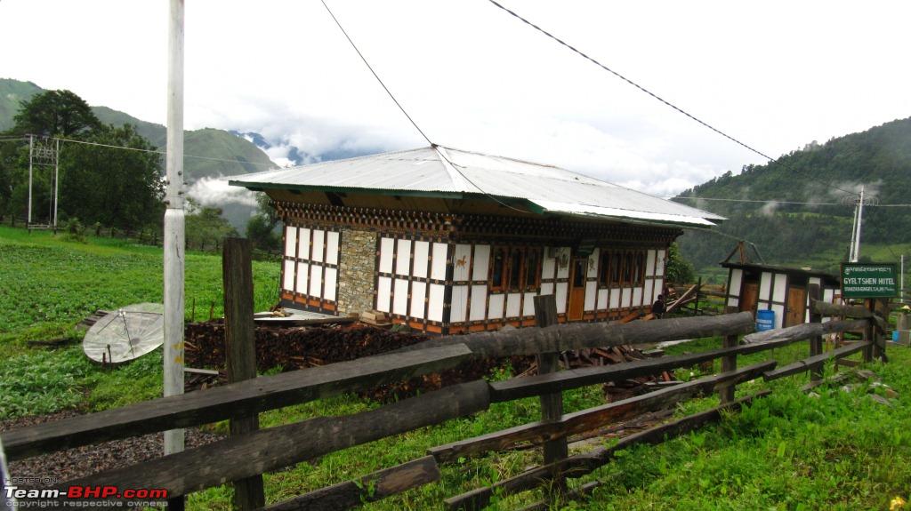 While eating Maggi, we got this view. So the watery Maggi taste did not bother us.  Phobjhika valley welcomes us.  A pic of the famous Gangteng Monastery  Phobjhika valley is also called Gangteng Valley due to the Gangteng monastery in this location. The Phobjhika valley is at a height of 9800 feet and is surrounded by the Black Mountain ranges. These ranges separate the Western Bhutan with Central Bhutan. We reached Phobjhika valley at 6:30 PM and it was pretty late. We could not click too many pictures but whatever I remember, it was just green grass fields and farms in the valley with towering mountains on either side. The season we went was not the season for Cranes. So we did not spot any. After spending some time in the valley, it was time for our return journey through the same road where we encountered our wake up call. To make matters worse, we had to drive down the same way back the next day. At this time, we had thought to leave Punakha, and find a stay in the valley itself. But we convinced ourselves to take the risk of the journey back as Punakha Dzong is something that none of us wanted to miss. The return journey was through a lot of rain. It was raining non stop. This was good in a way, because all the slush at the land slide area was washed away (Although the danger of new landslides increased). In all the slushy areas, we made sure to engage 4H, even if it was little slippery. Safety always comes first. We finally reached Wandue at 9 PM. Punakha was another 30 kms ahead. Through these 30kms, we tried to find a place to stay , but in vain as most of the hotels were either closed, non functional or too expensive. Just as we were about to loose hope of dinner and Stay, we found a place at Khuruthang which is 2km before Punakha. The name of the resort is Damchen resort which is right beside the river. Since it was off season, we got this at a cheap rate well within our budget. But there was no food. So we had to do with one meal for the day and sleep hungry. Summary for the day: Odo Started - 74,070 KMs, at Thimphu - 74,134 KMs, at Wandue Phodrang - 74,193 (60kms from Thimphu) at Phobjhika Valley - 74,260 KMs ( 67 Kms from Wandue - 3.5 hour drive) Back to Kuruthang - Odo - 74,340 KMs Overall Distance for the day - 270 KMs in 16 Hours. Next up: Punakha, Trongsa and Bumthang Last edited by himavanth_m : 16th August 2012 at 03:25. |
|
| (1)
Thanks
|
| The following BHPian Thanks himavanth_m for this useful post: | aalokg |
|
15th August 2012, 22:55
| #8 | |
| BHPian | Re: Northeast Himalayan Escape - Bhutan and Tawang Day 6: Beautiful Dzong at Punakha and Highway to Trongsa There was no point starting early as Punakha Dzong would open ata 9 AM (8:30 AM Indian Time). But we got up early anyways because of hunger. We had breakfast at Damchen resorts and took some pics of the River as it was not 9 AM still. A group pic at the Breakfast table in Damchen resort, Khuruthang, Bhutan.  This resort is right beside a river and this is the view we woke up to   The water current in the river looks really fast and with great power. A bridge across this river  After the photoshoot, we headed to Punakha Dzong. Punakha Dzong: (Source: Bhutan Times) Quote:
First view of the Dzong. One can distinctly see the two rivers Pochu and Mochu merging here. The color of Mochu is red while the color of Mochu is white. At the confluence, the two distinct colors make for a remarkable sight.  Another pic of the confluence showing the two distinct colors of the two rivers.  One must cross the Mochu river through this bridge to enter the Dzong  A pic of the Majestic Dzong from the bridge  We had a hard time walking up these wodden steps. These steps were strategically designed so that in times of war, these can be removed making the Dzong in effect impenetrable.  The watchtower on one side of the Dzong  Once we were inside the premises of the Dzong, we were awestruck by beauty and size of the place. Some pics from inside the Dzong.    Inside the temple was a huge statue of Lord Buddha and on the walls were adorned by beautiful paintings. The wood structures were carved to perfection that form the windows and doors. The Bhutan have their own distinct style in these Dzongs. A pic of just the Mochu river from the bridge  A pic of the river after the confluence.  From this Dzong, if one goes upstream along the river Mochu, one will reach Gasa Dzong, which lies right in the middle of their Jigme Dorji National Park. This is a circular Dzong. A pic of the Dzong from Bhutan Times for those interested.  However, I am not aware of the permissions required to reach this place. I think we would need to specify the request at Thimphu itself. But I think this would be a good place to visit. One can view the snow capped Himalayan Mountain ranges from this Dzong. We spent about 1 hour around in Punakha Dzong and we headed back. We had head down to Wandue and then towards Phobjhika. This is the 3rd time we are traveling on this road and by this time, we remember each and every probable land slide location. We knew what to expect and so this time, we could cover this part of the journey much faster. However, the rain gods lashed more rains and it was more foggy. We could see none of the sights that we saw the day before that were in my previous post. Then we believed that in all this confusion yesterday, something good came out. We would have missed the fog free views from yesterday in case we had done the trip directly today. After crossing Phobjhika somehow, the fog cleared up completely and the road became somewhat better albeit for a short period of time. So it was time to take a pic of my beloved beast on a well surfaced road after a long time.  After crossing Phobjhika and upto Chazam ( 100 KMs from Kuruthang), the roads were in a much better shape as can be seen in the following pic and the pic above  However closer to Trongsa, the road conditions deteriorated again. First we encounter these huge stone walls on one side and deep valley on the other side sandwiching the narrow road in between.  And then the roads turn to no roads. Add fog to it, and you are in for a dangerous time.  The state of roads became even worse as we reach Trongsa. There was no traction on the tyres and we had to run in 4H. At one point, the road becomes just wide enough to fit my safari and even with 4H, the tyres were skidding. We could feel the horizontal movement of the vehicle. But this time we were more careful (unlike first time). We ensured that we do not give any sudden accelerator inputs and go at a steady pace to minimize the sideways sliding of the vehicle. We were in more control now, and we were slowly getting used to tackling such terrains. Link to my youtube video taken from my vehicle trying to cross one such slush filled road. In the video you can see the beautiful sight in the background. That made us forget all our fears and we only wanted to enjoy the natural beauty of Bhutan. A couple of pics of my safari in this mountain ranges near Trongsa to end this post   Next up: From Trongsa Dzong to Bumthang Plains Last edited by himavanth_m : 16th August 2012 at 00:06. | |
|
| (1)
Thanks
|
| The following BHPian Thanks himavanth_m for this useful post: | parassoni |
|
16th August 2012, 00:47
| #9 |
| BHPian | Re: Northeast Himalayan Escape - Bhutan and Tawang Day 6(Contd): From Trongsa Dzong to Bumthang Plains! After negotiating the horrible roads, we immediately reached Trongsa. The time was 4:30 PM and the odo read 74,490. However, we still had about 80kms to reach Bumthang. So even though there was Dzong in Trongsa, we decided to skip this place as it was getting late. So a quick view of the Dzong from a distance and we were off. Trongsa means 'the new village' and this lies at an altitude of 3200 m or 10,500 feet. Trongsa Dzong: (Source Bhutan Times) Overlooking the Mangdechhu river, the Trongsa Dzong testifies to Bhutan's architectural heritage, political history, rich traditions and culture. This Dzong stands for the Dzong on the tip of a Dungkhar (conch), of the never-changing country of Druk and the everlasting Dharma. This Dzong was bult in 1647 and this was expanded several times in the 18th century. The little time we had to see the Dzong from a distance, it truly amazed us with the sheer size and location. The first look of the Trongsa Dzong  Zooming in  My Safari Parked at the view point  The altitude at the view point  The Dzong viewed from another angle  After crossing Tronsa, the road conditions improved a lot. I think half the reason for the improvement was because of the decrease in altitude. The rains were intermittent now and not as harsh when were high up in the hills. A video of the beautiful roads. Driving on these roads was an unforgettable experience. It was quickly getting darker and the clouds cleared. Again we were treated to some beautiful valleys enroute.   This pic has to be one of my favorite pics of the entire trip. The Tata Safari stopped at a perfect location and the pic clicked from a perfect angle  Again we did not have any lunch. So finally at 6:30 PM, we reached the hotel named KTM hotel (1 hour away from Bumthang)  To our surprise, we found Puri on the Menu. In order to be on the safe side, we first ordered one plate of Puri, and believe it or not, these were one of the tastiest Puri's we had. It may be due the lack of Indian food for the past 3 days, but we ordered more and pounced on the food. We finally reached Bumthang in the night at 9 PM. Unlike the rest of the places, the hotels in Bumthang were full. After searching for 30 minutes we finally found a lady enroute who offered to take us to her homestay about 10 minutes away. We do not remember the name of this homestay, but it was very clean and really beautiful. Sorry for the pic in dark, but this is the only pic of room we have.  Bumthang is a district in Bhutan. The capital town of Bumthang is Jakar and one can ask for directions for Bumthang or Jakar. They both mean the same for the locals. The plains / valley of Bumthang is supposed to be the most beautiful place in all of Bhutan as per the locals. They are very helpful and I found a distinct difference between the people here and in Thimphu. The people in Bumthang were much more helpful and much more proactive in providing directions. We just enjoyed talking to them. Summary: 74,340 at Khuruthang, 74,438 at Chazam ( 2:30 PM), 74,490 at Trongsa and 74,570 at Bumthang. Distance traveled: 230KMs Fuel after cossing 50kms from Trongsa. The fuel station at Trongsa had no fuel. Next up: Gaining altitude again Last edited by himavanth_m : 16th August 2012 at 00:56. |
|
| ()
Thanks
|
|
16th August 2012, 02:40
| #10 | ||||
| BHPian | Re: Northeast Himalayan Escape - Bhutan and Tawang Day 7: Gaining altitude again We got up at 6 AM and we were dumbstruck by the sheer beauty of this place. There is also an airport in Bumthang and our stay was right next to the runway. A pic of the valley with the runway. The river also flows right next to the runway. Beautiful sight, aint it?  Again we started the day with no breakfast hoping to get some breakfast on the way. At this time, none of the restaurants are open. So even if we wanted to eat and leave, we could not. Day 7 was supposed to a hectic day as we had to cover about 300kms. This drive also involved driving through the second highest mountain pass in Bhutan, Thirumsingla pass. Our plan was to reach Trashigang by 4:30 PM and visit Trashigang Dzong there. Needless to mention that our plan did not work out. After settling the bill, we first headed to an 8th century temple at Bumthang Quote:
A pic of the 8th century temple.  A pic of a smaller temple with mountains in the background.  The next place of visit was Jakar Dzong. After reaching the sight, we saw too many steps to reach the top of the Dzong. As 'Po' from Kung Fu Panda would say, My oldest enemy is back. We did not attempt the steps. Jakar Dzong: (Source: Bhutan Times) Quote:
 The Dzong tower standing tall  However, for those interested, a pic of the Jakar Dzong from Bhutan times  The roads after crossing the town of Jakar were in great shape. We were in good mood and were really pushing hard to reach our destination with minimal stops. The safari enroute.  And the beautiful road.  We saw this enroute. Looks like another Dzong or Monastery  And then there was a land slide ahead. The land slide was coupled with road widening work as well. A video of the drive through another landslide/road widening work. Look at the narrow slippery road. The landslide we just crossed.  Look at the trees on the Cliff. Some more rainfall and they are ready to slide down.  And then, just as we touched the 40 Kms mark from Bumthang, we met with sheer bad luck. We were at the location exactly at 9:05 AM. But the road was closed from 9 AM to 12 Noon. With no food, we were stuck here for two and half hours. All our hopes of reaching Trashigang by 4 30 PM vanished. A pic showing the opening and Closing timings. We were also the second car to be stop after closing. Notice the time in the watch above the board.  *All times are in Bhutan Local Time. Bridgestone Duelers had very little grip on muddy roads  The JCBs starting to go for Work 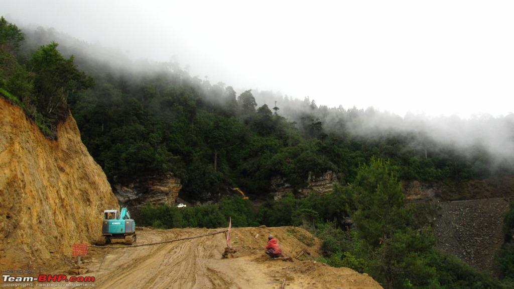 While we stopped for the road to open again, we decided to take a peek at the road ahead. And it was not looking good.  They finally let us go at 10:45 AM. Lucky for us, the workers were in good mood and let us early. By that time, there were atleast 20 to 30 vehicles in line to cross this section. A video of us crossing this section when they opened the road After successfully crossing the first hurdle, we were still 30 KMs away from Thirumsingla pass. We were constantly gaining altitude. On this road we entered the Thirumsingla National Park and saw beautiful Pine tree Forests. By 11:50 AM, we were at Thirumsingla pass. At these altitudes, the temperatures decreased drastically and the surroundings became foggy. We had to travel on these roads at painfully slow pace due to poor visibility. As if this is not enough, being monsoon season, the incessant rains caused more havoc. And we were stuck for hours with no food. But as the famous saying goes, No Pain, No Gain, all the troubles we faced were worth it as soon as we saw the pass. This pass is also called Donga pass and is at an impressive altitude of 12,400 feet. It connets the central and eastern regions across the otherwise impregnable Donga range that has separated populations for centuries. The pass is often closed during winter due to heavy snowfall, shutting off land communication. Our drive along the pass has taken us through many sheer drops of thousands of feet at the roadside. At the highest point, travelers leave prayer flags in thanks for safe arrival to the pass. Our Safari has taken us safely to these heights.   Quote from Wiki: Quote:
After crossing the pass, we immediately realized that the downhill inclination is very steep and we were loosing altitude at an fast pace. The following quote from wiki confirms this Quote:
 As the altitude decreased, the rain started to become heavy. At many places the stones of the mountains were cut to make the highway. The walls were vertical and also the source of many waterfalls enroute. There were many rushing streams of water from mountains falling on the road, sometimes even falling on the entire width of the road. This scared us a lot. What if at one such streams carries a stone and it falls right when we were driving under the stream? Holding onto this thought, we just prayed for good luck and continued further. And then in all this rain, there was a stop due to the most unexpected reason. We were stopped because a JCB was trying to get onto a truck. This is the first time we saw the front wheels of the truck lifted almost 6 feet in the air, when the complete load of JCB was on the rear wheels. We were skeptical if the rear 4 wheels of the truck would hold the weight of JCB, while it tries to get on the truck. A pic of JCB trying to load itself on the Truck  We were lucky enough to capture the full video. How a JCB gets onto a truck? We were enlightened that day. After about 20 minutes stop at this unusual place, we proceeded further with caution looking for any stones on road to estimate if the water falling from above is carrying any stones. At this point we reached a small town called Namling. Due to the amount of rain this region receives, there are a lot of waterfalls. Namling is about 45KMs after Thirumsingla and we were there at 2:30PM.We could not take out our cameras because of the heavy rain. However we managed to capture a couple of pics Breathtaking falls near Namling  The height from which the water falls causes the water droplets hit the skin like needle pricks.  After crossing Namling, the rain Gods decided to give us a break. There was no longer lashing of the rains on our Safari. The roads also cooperated with us and rest of the drive was through better roads and at lower altitudes. Some pics of the route. 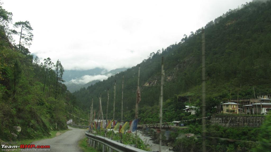 Crossing another rapid stream  Twisty roads. A BMW would just blast off here.  Finally we reached Mongar at 4:30 PM. We made new friends at a hotel in Mongar.  At 4:30 PM, this was our first meal of the day. We expected that this would be the only meal for the day and stuffed ourselves. As expected, it was the only meal of the day. The rest of the drive to Trashigang from Mongar was uneventful. The light also faded and we did not get opportunity to take any further pics. We reached Trashigang at 9 PM, checked into a hotel and slept. The next day we would be back in India and we were looking forward to eating Roti and Rice the next day  Summary: 74,570 - Bumthang - 6:45 AM 74,653 - Thirumsingla Pass - 11:50 AM ( 83 KMs ) 74,697 - Namling Bridge - 2:25 PM ( 127 KMs ) 74,759 - Mongar - 4:30 PM ( 189 KMs ) - Only meal of the day at this place 74,809 - Dundari Bridge 74,817 - Sherichu 74,863 - Trashigang - 9 PM Total Distance: 293 KMs in 14 Hours. Next up: Back to India Last edited by himavanth_m : 16th August 2012 at 03:20. | ||||
|
| ()
Thanks
|
|
16th August 2012, 04:19
| #11 | |
| BHPian | Re: Northeast Himalayan Escape - Bhutan and Tawang Day 8: Back to the Plains in India After a hectic previous day, we started our journey on day 8 aiming to reach India. The news was that on June 29th, there was big landslide on the Trashigang - Samdrup highway. This would slow us down considerably as BRO was working in full strength to restore the highway into normal condition. The good news was that the land slide happened a week ago, and though the journey would be slow, we would be able to make it to the other side of the border by evening. So we set off from Trashigang at 8:30 AM without going to the Trashigang Dzong The entrance to Trashigang tucked away in the hills  Trashigang Dzong: Quote:
  Just as we crossed 15 to 20 Kms from Trashigang, we saw the BRO signboards. The Indian Army maintains the last 170 Kms from Trashigang to Samdrup Jonkar. We were first on the lookout for food as it was another day where we did not have breakfast. We had been living on one meal a day or on Maggi while in Bhutan, and this day was no different. We were unable to find any food and we had to do fill our stomach by the supplies that we bought from Hyderabad. The BRO Sign boards mentioning 160KMs to India  The first place we attempted to find some food. Kanglung. To our utter badluck, all the restaurants are closed here. There is a Sherubtse college here at Kanglung and the time we went was a holiday. Since there are no students, the restaurants in the vicinity were closed. Bad Luck I say The entrance to the Sherubtse college, Kanglung  But this day was different in one way. There was very little rain, and for the first time in Bhutan, we saw a blue sky 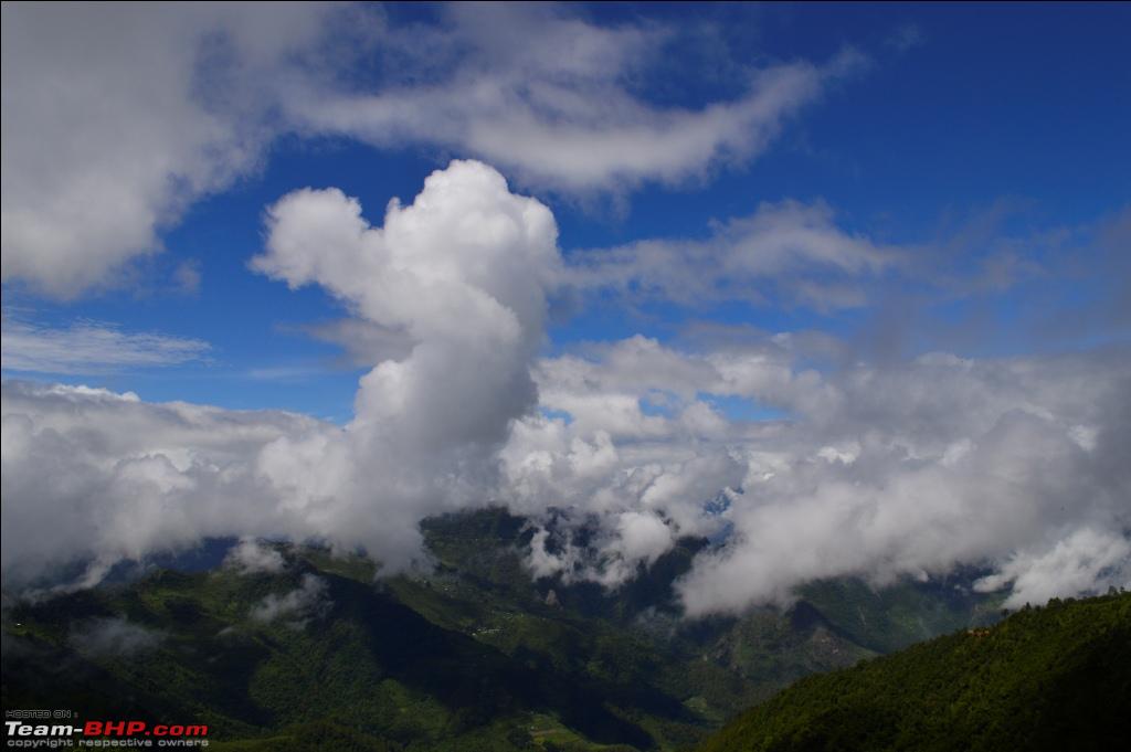   We got to drive on some beautiful roads initially   But this happiness was shortlived. It started raining again. We hit the Landslide area that we read in the local news papers. The Landslide happened at a distance of about 55 KMs from Samdrup. A video of the LandSlide clearance work. And then a video of us driving through the worst land slide site that we drove in so far But we forgot all about the landslides as my car touched 75,000 KMs in Bhutan.  The exact location where the car touched 75K mark.  And the road ahead from that point.  The rest of the drive was uneventful. The rains stopped and we could get a clear view of the valleys below with rivers flowing between the valley.  We could finally see India on the other side of the hills  We had to give our permit papers at the final checkpost in Bhutan  And proceeded towards the exit point  We finally exited Bhutan 5 PM when the Odo read 75,050 KMs. We covered a total distance of 1170 KMs in Bhutan and it was an experience of a lifetime. We still did not have our meal for the day. After entering into India, the road was in excellent condition, but only for about 10 KMs. What followed was 20 KMs through the worst stretch of the road I have driven in. The 20 KMs took 2 hours and by the time we reached Rangia, Assam, it was 8PM. We finally had dinner, our first meal of the day at Rangia at 8 PM. Our next attempt would be Tawang. So instead of taking a room at Rangia or Guwahati, we decided to continue our drive to Tezpur and take a room there. From Rangia, Tezpur is around 150KMs and the drive upto Guwahati was through heavy traffic. The road was being widened and it was very dusty. I had a terrible time negotiating through the traffic of the Guwahati road. Once we were off the Guwahati Highway, the traffic reduced considerably and the complete road was 2 laned. However, the road had lot of potholes. We reached Tezpur at Midnight took a room at one of the hotels and slept. The next day we would attempt to enter Arunachal Pradesh. Summary: This was the day we covered about 392 KMs ( 170 KMs in BHutan and 222 KMs in India). We started our day at 8:30AM and it ended at the stroke of midnight, 16 Hours on road. Our first meal of the day was at 8PM. The ODO read 75,255 at Tezpur at the end of the day Next up: Entering the Land of Dawn-lit mountains Last edited by himavanth_m : 16th August 2012 at 11:43. | |
|
| (1)
Thanks
|
| The following BHPian Thanks himavanth_m for this useful post: | saket77 |
| |
|
16th August 2012, 12:37
| #12 | ||
| BHPian | Re: Northeast Himalayan Escape - Bhutan and Tawang Day 9: Entering the Land of the Dawn-lit Mountains! Arunachal Pradesh Means land of the dawn-lit mountains. It is also known as the land of the rising sun Day 9 was a Sunday and we did not have Inner Line permits(ILP) to enter Arunachal Pradesh. When we enquired at the hotel, they gave us a bad picture and mentioned that we would not be getting permits on Sunday. However, we have enquired from some of the friends and they mentioned that ILP is provided at the Arunachal Pradesh border. When we asked about the same at the hotel, the denied it outright and said we would not be getting any Permits that day. However, keeping faith in the information that we got, we checked out of the hotel at 10 30 AM after having breakfast. The road taken: Tezpur - Balipara - Bhalukpong Distance: 60KMs The road is NH52 upto Balipara and it is in great shape. However there were lot of people walking on the road. So one needs to be very careful while driving here. After Baipara, the road just becomes non existant. In a Sedan, I am sure that there would be atleast a couple of places where the car will bottom out. Through the mix of bad roads to no roads, we entered Nameri Tiger Reserve. The forest on either side of the road looked really thick.  One of the few times on the way to Tawang where we actual saw the black color of the Tar road  The entrance to the Tiger reserve  The forest ranges on the Assam side is called Nameri National park while that on the Arunachal Pradesh side is called Pakhui Tiger Reserve. Even the Eagle Nest Wildlife santuary (that I remember from adc's travelogue) is adjacent to this sanctuary. We did not have time to visit the santuary as our first target was to reach Arunachal-Assam Border and get the permits We reached Bhalukpong at 1 PM. At the border the police stopped the vehicle. The asked us to park the vehicle at the checkpost, enter Arunachal Pradesh to the office, take permits and return to the vehicle. So we would indeed get the permits at Arunachal Pradhesh - Assam Border 24x7. However there in problem. The Govt. officer was not in office as it was Sunday and he was at home. However as we walked a couple of minutes, we found a shop owner who said he would send a person to the officer's house and get us ILP. We got the ILP from his house after providing necessary documents. By the time we got permits it was 3PM. We also had our lunch while getting the ILP. We immediately showed the ILP at the police checkpost and were soon given green signal to enter Arunachal Pradesh. The first view of the Kameng River flowing in a valley between mountains on either side.  Kameng River: (Source: Wiki ) Quote:
 One of the many waterfalls that we saw enroute. This water fall is near Sessa  The first 10 KMs of the road was in very very bad shape. Actually there was no road and it was just mud. We first reached Sessa. Sessa has a beautiful waterfalls, but we decided to skip as it involved taking a detour and it was getting late. Quote from Wiki: Quote:
Sessa is a future trekking destination for me. The rest of the journey was uneventful. We had to drive through roads with steep inclines. But after the first 10KMs, the road was in a very good shape. Rain also stayed away from us during our First day in Arunachal Pradesh. Tawang is still 253 Kms and it is evening. No way, we would be reaching there tonight  The last checkpost where they check for ILP before Bomdila  And then we finally reach Bomdila at 8 PM  We checked into a hotel at Bomdila for the night. The next day we would be attempting Tawang. We ordered dinner, had food and slept. We would remember day 9 as the day we had all the meals for the first time on the trip at proper timings. Sumary: 75,255 - Tezpur - 10:30 AM 75,320 - Bhalukpong - 12:30 Noon to 3 PM 75,347 - Sessa 75,396 - Tenga 75,422 - Bomdila (8 PM) Total distance covered - 167 KMs Next up: SeLa Pass Last edited by himavanth_m : 16th August 2012 at 12:41. | ||
|
| (1)
Thanks
|
| The following BHPian Thanks himavanth_m for this useful post: | spiritofmars |
|
17th August 2012, 00:09
| #13 | |
| BHPian | Re: Northeast Himalayan Escape - Bhutan and Tawang Day 10: Drive through mud to SeLa Pass! As has been the norm through out our journey, we started early, left the hotel without breakfast. Bomdila to Tawang was 170 KMs and we expected to reach Tawang by Evening (Around 7 Hours), another miscalculation. The rains lashed this region day in and day out for the past one week. This wrecked havoc on the entire route upto Sela Pass. The result was a one foot deep slush. Bomdila to Sela Pass is about 100 KMs. Out of the 100 KMs, 70KMs was filled with slush. We were not aware of this situation until we reached the first hurdle after crossing Dirang. There was huge knee deep mud in a small town that is 20 KMs from Bomdila. We slowly managed to cross the mudfilled road. The car was just moving sideways. Since it was a village, it posed no danger of sliding and falling off the cliff. We enquired here and what they told us was that no vehicles, apart from Army trucks have made it from Tawang the past two days. They scared us by telling that our safari would not make it. Taking their words with a pinch of salt, we proceeded further. The next sight we saw was that an Army Gypsy was stuck and army people were trying to tow it out. We offered help but they refused to take any help. However, the brave army people instilled confidence in us. They said that our 4x4 would make it and not to fear. They also warned us that the next 50 KMs was in knee deep slush that too on inclines. What we just saw was a trailer. After the conversation, within 5 KMs, a convoy of Army trucks with Army Jawans were stuck because one of the people movers got stuck and was struggling to climb a slush filled incline. To help that vehicle, all the Jawans from the trucks got down, put some stones (Actually rocks) where the slush was there so that the tyres of bus get more traction. The Yellow Bus in the pic got stuck.  This caused a delay of 30 minutes. So we stopped by the side of the road and clicked a pic of the Safari.  The rapid Kameng River flowing right beside the mountains!  After the bus made it, the rest of the convoy made it with ease. It was now our turn. I underestimated the size of the rocks that were put in the slush to gain traction for the bus. And then Thud!, a stone hit the underbody of the Safari. We stopped after a certain distance and thankfully nothing happened to the underbody. Just to give an idea, a video of a Sumo getting stuck in Slush. Again it was Army for the rescue Once the Sumo made it through the slush, it just could not hold a straight line. The sumo was sliding its way up the incline. If you have not yet got the idea of the challenge, this video is bound to show you the degree of difficulty We tackled most of these deep slush filled roads either in 4H or 4L. 4L was used if the inclination of the slush filled road was steep and 4H was used on Flat slushy roads. Most of the times in 4L, we could easily go along in 2nd or 3rd gear. 1st gear 4L was required only at one instance. It became a constant routine for us, in the slush shift to 4H, and if this is not enough shift to 4L. After shifting back to 2H from 4L, find a suitable place to reverse to disengage the diff lock. To our utter surprise, we saw a BMW X1 coming down from Tawang, which I think went to Tawang before the rains lashed and the roads were in much better shape. Wonder if he has managed to reach here without scrapping his underbody! Highly impossible. I felt sorry for the X1. We also met an Alto car driving down and he mentioned his car has taken a severe beating. During the 50 KMs of slush, the car hit the bottom on 2 or 3 occasions. An expert would have avoided the hit, but we were no experts. This was new terrain for us and it posed a big question mark on our skills. Thankfully we passed with a decent score . Once we crossed the 50Kms of slush filled roads, we were now at some high altitudes. It was becoming foggy and the slush on the roads reduced. However, we could not still increase the speed because there were more of potholes and less of road. Safari after crossing the Slushy roads. There was mud everywhere on the car.  We could not check properly underneath the vehicle because it was filled with mud. But from whatever I could gather, there were no leaks underneath and the underbody hit did not do much damage. Then we saw Yaks. Some Yaks were grazing calmly by the side of the road, like this one  And some were running away after seeing the vehicle.  The above pic also shows the pothole filled road near SeLa pass. Can you imagine, this stretch of the road will be completely under ice during winter season. That is a drive that I will plan to do in the near future. SeLa Pass in snow would be an awesome experience. The Our proximity to the peaks of some of the mountains indicated that SeLa pass was close by and fast approaching  The roads that lead to SeLa Pass  SeLa Pass Quote:
 On one side of SeLa pass is Tawang District and on the other side is West Siang District in Arunachal Pradesh On our onward journey, Tawang District welcomes us  While on the return journey, West Siang District would welcome us  The 90 KMs drive to SeLa pass took about 7 Hours. (We expected to reach Tawang in 8 Hours). We spent some time at SeLa pass and took some pictures. Below are some postcards from SeLa pass My Safari looks as graceful as ever. It has now taken me to altitude of 13,700 feet safely and brought me back home  The road that leads to SeLa pass from Bomdila side  A Shiv Mandir at the pass  And Prayer flags  I like the words on this.  After crossing the entrance, there is a huge SeLa lake. When we reached here, it was clear and there was no fog. But within minutes fog engulfed the lake and rain lashed hard on us. So we had to do a really quick photo shoot and escape. My Car Parked beside the lake. They complement each other. Stunning pic IMO  Slowly the fog engulfing the lake  After the fog took over, we had nothing to do at the lake. So we proceeded with our journey. We saw breathtaking view of twisty winding roads. What a view it was.  This information will be very useful for future tourists to this place. Some of the places of interest near Tawang and SeLa pass  A view of this winding road ahead and the awesome scenery surrounding the road made all our effort to reach this place worthwhile!  Next up: Memorable Drive towards Jung Last edited by himavanth_m : 17th August 2012 at 03:47. | |
|
| (1)
Thanks
|
| The following BHPian Thanks himavanth_m for this useful post: | saket77 |
|
17th August 2012, 02:04
| #14 | |
| BHPian | Re: Northeast Himalayan Escape - Bhutan and Tawang Day 10 (Contd): Memorable Drive to Jung This post will primarily be pics of the drive towards Jung. I want to dedicate the next post completely to the Jaswantgarh war Memorial and the 1962 India China War. Until then a few pics of the drive towards the War memorial. The winding and serpantine roads through the eastern himalayan ranges indeed provide a view into the heaven on our beloved earth! All the pics in this post are taken in a span of 15 KMs. We were slowed down by the beauty of this place rather than the state of the roads. Quote:
 Closer view of the bridge  Valley just after crossing the Pass  Blue sky peeking through the clouds  And the splendid drive in this weather 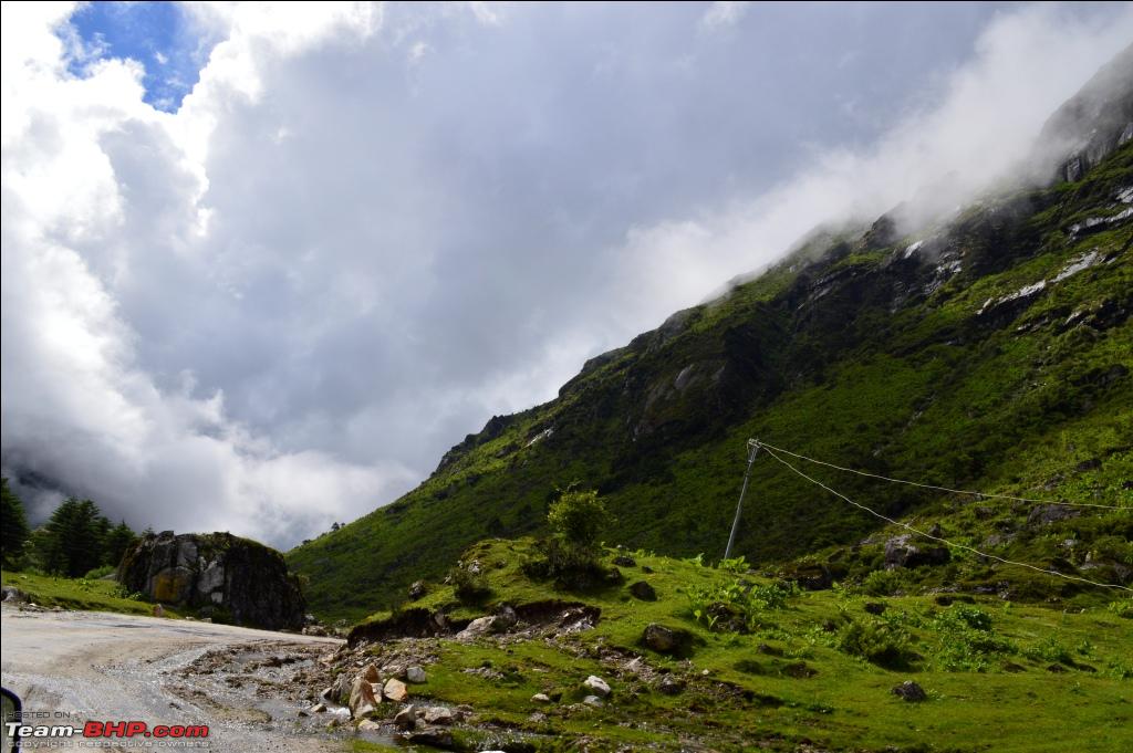 Steep slopes of the mountains  And the Misty Mountain Peaks  And more misty Mountain Peaks  The Dead Ends  The Beautiful Curves  And Gorgeous Valleys  Unforgettable scenery  Serpentine Roads through the valleys 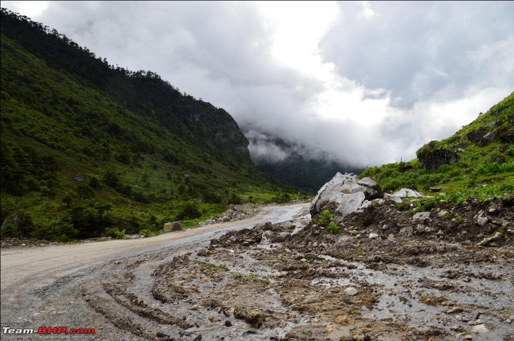 Hairpin bends with steep inclines make you gain and loose altitudes in a giffy  And then some waterfalls to add to the mix  How can we forget the alpine forests on the mountains slopes  These alpine forests are home to Yaks, wild horses and many birds. Untouched Nature at its best  Rivers gushing through the valleys that ultimately join the Mighty Brahmaputra  A Yak decided to show up on the road. Looks confused  Next up: Jaswantgarh War Memorial Last edited by himavanth_m : 17th August 2012 at 02:25. | |
|
| (1)
Thanks
|
| The following BHPian Thanks himavanth_m for this useful post: | ninjatalli |
|
17th August 2012, 03:19
| #15 | ||
| BHPian | Re: Northeast Himalayan Escape - Bhutan and Tawang Day 10 (Contd.): Jaswantgarh War Memorail There is something about this place that made us feel that we were proud to be Indians  In the year 1962, the Indian nation was convulsed by fear and eventual humiliation as its army was vanquished by the Chinese People's Liberation Army in a bitter and cold battle in the Northeast and at Aksai Chin. 1962 Sino Indian War: In 1961s, India initiated a forward policy by which it placed outposts along the border including several posts outside of the line of control. This was in accordance with McMohan Line of control that the British India and Tibet signed as the line of control. However, China was not a part of that agreement and does not consider that as the line of control. China always believed that The regions in Aksai Chin and Arunachal Pradesh were part of Tibet since a long time and so these regions should fall under Chinese territory. But India is of the belief that these regions are part of India since ancient times and the temples constructed in these regions are a proof for that theory. Given India's historic position that the original intent of the line was to separate the two nations by the highest mountains in the world, in these locations India extended its forward posts northward to the ridges, regarding this move as compliant with the original border proposal, although the Simla Convention did not explicitly state this intention. So India started sending Indian troops and border patrols into disputed areas. This program created both skirmishes and deteriorating relations between India and China.The aim of this policy was to create outposts behind advancing Chinese troops to interdict their supplies, forcing them north of the disputed line. China viewed this as further confirmation of Indian expansionist plans directed towards Tibet. And so all the ingredients for a war were in place. Since I drove to Arunachal Pradesh, I will mention about some details about the war in this area. Quote:
More about the War is given in detail in the Wiki page Sino-Indian War - Wikipedia, the free encyclopedia The Indians lost this war, but there were few heroic stories from that time. One such story is about Jaswant Singh. Quote:
War in the Himalayas: 1962 Indo-Sino Conflict Pics: The Clash of the Asian Giants, 1962 [www.bharat-rakshak.com] Official 1962 War History Now its time for some pics of the memorial: The entrance to the memorial  We were honored to be in this premises  A couple of pics from the war   Do not lament the death of a warrior killed in the battlefield as those who sacrifice their lives in war are honoured in Heaven  How can a man die better than facing fearful odds, for the ashes of his fathers and the temple of his Gods  Chinese Burial Ground. The Inscription on the burial ground says, they too died for their country. Indian Army truly honors the enemy soldiers after their death. Which other country does that? I think none  The memoral  The Statue of Jaswant Singh. We salute you  The Indian Army running the Jaswant Cafe. They say have a cup of tea and be a part of history at this place of great importance  We met an army officer and he told us some fascinating stories. He also mentioned that the 50 year treat that was signed in 1962 is going to come to an end in 2012. Have to wait and see what will happen now. Anxious moments for all of us, especially the army.  Some more pics from the war     My safari standing next to a place of historical importance  After spending a good amount of time here, it was time for us to say Good bye to the Army people we met here and continue with our journey. We bought ourselves some souvenirs like Cups and Tshirts made in memory of Jaswant Singh. Have a cup of tea and be a part of history  And then 'Sare Jahan se Acha, yeh Hindustan Hamara'  We continued with our journey. A signboards says Icing Zone ahead. Should be relevant in December.  The next time I plan a trip to this place, I will do so in December The skies slowly cleared in the evening.   By 4:30 PM we were in Jung. Our mileage took a severe beating. We finally filled diesel at Jung and 66 Litres of diesel was put in. Ridiculously close to us being stranded. For your information, Safari has a 70 litre tank. After filling diesel, we proceeded towards Tawang. And then our first view of the Tawang Monastery  We reached Tawang by 7 PM and we straight away looked for a hotel. We found a good hotel in the new market of Tawang called hotel Buddha. It was neat and clean with wodden flooring. We had dinner, again our first proper meal of the day and went off to sleep. Summary: 75,422 - Bomdila - 7 AM 75,530 - SeLa Pass 75,564 - Jung - 4:40 PM 75,595 - Tawang - 6:30 PM Total Distance: 173 KMs in 12 Hours. Next up: PT Tso Lake and Tawang Monastery Last edited by himavanth_m : 17th August 2012 at 03:45. | ||
|
| (7)
Thanks
|
| The following 7 BHPians Thank himavanth_m for this useful post: | Blue Thunder, Harshavarthan, manolin, parassoni, rkbharat, saket77, venki.bala |
|