Team-BHP > Travelogues
Register New Topics New Posts Top Thanked Team-BHP FAQ


Reply
  Search this Thread
10,366 views
Old 16th September 2006, 04:53   #1
sAP
BHPian
 
sAP's Avatar
 
Join Date: Jun 2005
Location: 10000 Lakes
Posts: 283
Thanked: 55 Times
Satellite images of Mumbai-Pune expressway and the Sriperumbudur racetrack

This is a different kind of travel experience. One done virtually on a computer using Google Earth. Google calls it the fly-by experience.

Below are a few spectacular views I came across while "flying over" the Mumbai - Pune expressway. Thought I'd share some with you. What you see are screenshots I captured while flying over it on my home computer.

The first one is a full size pic. The rest are thumbnails which you must click on to see the enlarged version.


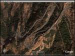
Below are a couple of views of the Sriperumbudur racetrack taken in the same fashion on Google earth. You can see the short circuit as well as the long one. (Wish I had these views the first time I drove on track... they didn't have a track map at the site). Hope these views help you see the "big picture" before YOU get on track. This is the real thing. Click on the thumbnails for a larger view.


Hope you had fun watching them as much as I did sharing them.
sAP
sAP is offline  
Old 16th September 2006, 14:19   #2
Senior - BHPian
 
v1p3r's Avatar
 
Join Date: Feb 2005
Location: BLR / DXB / LON
Posts: 5,334
Thanked: 6,896 Times

Nice find, but why the weird angle on the MMST pics?
v1p3r is online now  
Old 16th September 2006, 15:36   #3
Senior - BHPian
 
Join Date: Jul 2006
Location: Bangalore
Posts: 2,256
Thanked: 37 Times

wow this is cool, now I visited http://wikimapia.org/ and travelled from Pune to Mumbai in expressway, May be in few months I will fly Mumbai from Blre and travel in this expressway and fly back to blre from Pune, this might be quiet interesting journey within a day

Ravi.
ravibhat is offline  
Old 18th September 2006, 15:43   #4
sAP
BHPian
 
sAP's Avatar
 
Join Date: Jun 2005
Location: 10000 Lakes
Posts: 283
Thanked: 55 Times
simulated views

Quote:
Originally Posted by v1p3r
Nice find, but why the weird angle on the MMST pics?
Considering its being viewed from a satellite, perhaps it has limitations on simulated views (all views other than top down are simulated via the use of some complex algorithms based on elevation and other demographic data). A straight down view is also available, but I felt that this one gives a perspective that is quite close to what one sees on the ground.

sAP
sAP is offline  
Reply

Most Viewed


Copyright ©2000 - 2024, Team-BHP.com
Proudly powered by E2E Networks