| |||||||
| Search Forums |
| Advanced Search |
| Go to Page... |
 |
| Search this Thread |  3,427 views |
| | #1 |
| BHPian Join Date: Dec 2009 Location: San Jose, Calif
Posts: 58
Thanked: 102 Times
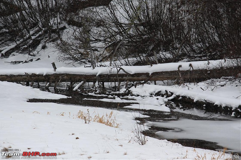
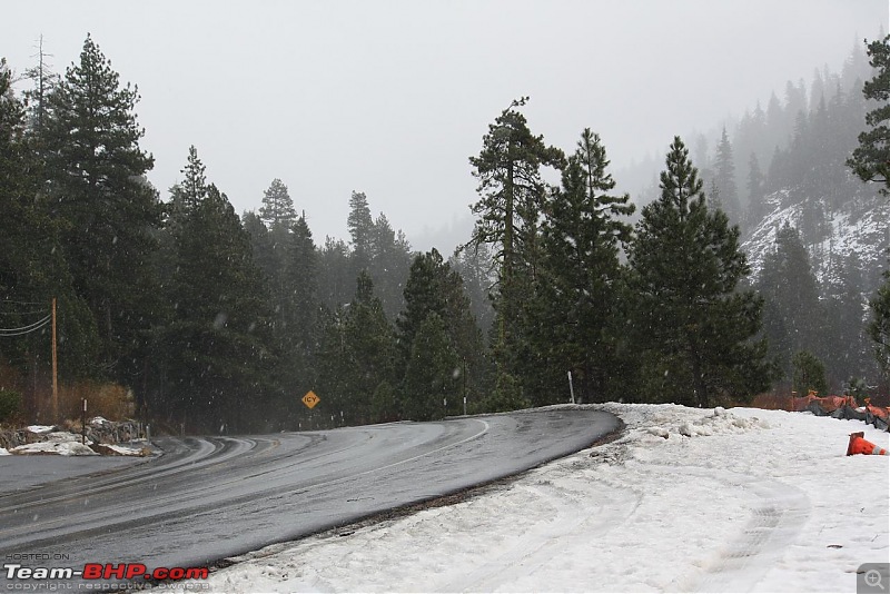
| A day trip to south lake Thoe This is my first trip report so forgive me if I make newbie mistakes. Hoping to learn and get better at writing these as time progresses. I live in San Jose and have been to South Lake Tahoe on multiple occasion but never during a winter storm. Over the thanksgiving weekend mother nature offered an excellent opportunity in a form of moderate winter storm that was supposed to dump about a foot of snow in the Tahoe area. I decided to grab it and head to Tahoe for my first real winter storm driving. I own two cars, Toyota Highlander 4WD and LexusES350 (which is my handle on the board). I decided to take Highlander as forecast was calling for a snowstorm. There are two ways to get to South Lake Tahoe from the bay area, I decided to take the longer but more scenic route via I-80 and CA-89 since I wasn't planning to stay there nor was planning to ski. This route also passes at an higher elevation, about 7200 feet at the summit of Donner Pass which meant there was a higher chance of encountering snowfall while traversing it which was my main goal for this trip. So I woke up at 5:30AM and ate breakfast, by 6:30 I was well on my way out of San Jose. Journey was uneventful as there was little traffic on the road and no rain in sight (Usually when it rains in the bay area, it translates into snow in the mountains). Took I-680 north till Dublin, CA then I-580 east towards the central valley town of Tracy. I prefer to take this route as opposed to continuing on I-680 north even though its slightly farther. However, my experience has been this one has no traffic whereas, I-680 does get quite busy around the I-80 interchange. From Tracy, I-580 merges onto I-5 which is the main north-south route that traverses the entire west coast of the US. You have to take I-5 north to head towards Sacramento from where you take I-80 east to get to the Tahoe area. When I was closer to Stockton, I got the sight that I was desperately waiting for. There were storm clouds on the horizon and it had started to drizzle a little. As I was heading north, the clouds became darker and darker and by the time I reached Sacramento, it was raining quite consistently. Near Sacramento, took a short break for the nature's call as well as for coffee during cold morning. After passing Sacramento, terrine changes from flat boring farmland to lush green mountains. As I kept on gaining elevation on I-80 slowly rain started turning into Snow. By the time I reached an elevation of 5000 feet, the snowfall was steady but roads were still clear as Caltrans crew was doing good job at keeping snow off of it. Shortly I-80 climbed some more elevation and terrine changed to wide open mountain tops and which were full of snow covered trees. As I reached the 6000 feet elevation snowfall was quite heavy and road was fully covered in at least 2 inches of snow. My Highlander was handling the conditions quite beautifully and had no trouble maintaining 40MPH even on the snow covered roads. By now, the chain controls were issued due to the detonating conditions and electronic road signs were warning the motorists to put on chains on their cars driving wheels if they are driving 2WD vehicles or risk being fined by California Highway Patrol. I continued on my way to the top of the mountain and saw an exit to the Suger Bowl ski resort near the Donner pass. I took the exit from the freeway and headed towards the ski area just because that road was fully covered in 6" of snow. By now, highlander was feeling the effect of snow and was applying extra traction. I could feel the ABS Corrections that my car was doing while braking which I loved. This was preventing the car from going into skid which can easily happen on the snow covered roads. Once my testing for snow covered conditions was done it was time to head back to the I-80 towards the town of Truckee from where you have to take CA-89. It was closer to lunch time so we decided to take a break and eat something. I searched for nearby Subway in my car's GPS and then headed towards it. This turned out to be right on CA-89 so I didn't had to make a long detour for lunch. By the time we had lunch the snowfall had decreased and roads were again cleared by Caltrans. I headed on CA-89 south towards South Lake Tahoe, the scenery was awesome on this road as the Truckee river runs right next to this one for most of the way and rivers with snow all around them look very scenic. Here are couple of pics which I took. Unfortunately I couldn't take more photos as I was busy driving.   Now, it was closer to 3PM and I had reached the town of South Lake Tahoe. I went, filled up gas at a local station and headed towards heavenly resort area as it had few nice eateries. Had small pizza by the fireplace and it was an awesome experience to watch snowfall from the window while eating great garlic chicken pizza by the fireplace. Around 5PM, I decided to head back towards the bay area. Since it gets quite dark here by 5PM, I decided to take the shorter route via CA-50 while coming back to the bay. Return journey was uneventful even though I had to pass through a brief snowstorm near the echo summit on CA-50. Once I came down from the mountains to the central valley, the storm had already passed and it was beginning to dry out. Once I passed Sacramento on my way back, the area was completely dry and I was back in SJ by 9:30. |
| |  ()
Thanks ()
Thanks
 |
| |
| | #2 |
| Senior - BHPian | Lovely---keep the pics coming! Reminds me of my trip to South Lake Tahoe and Reno 5 years ago from Dublin. We took the same route via Tracy/ Lodi as you did, but at Sacramento, we diverted to the state highway that goes via Rancho Cordova and Folsom. I recall seeing hundreds of Windmills near Livermore outskirts. I was reminded of them in my recent trip to Shimoga from Hampi, when I spotted a large number of wind mills near Chitradurga, Karnataka. On the return, however, we used the Interstate that passes through Auburn---I guess you used that route, right? Last edited by vnabhi : 11th December 2009 at 23:03. |
| |  ()
Thanks ()
Thanks
 |
| | #3 | |
| BHPian Join Date: Dec 2009 Location: San Jose, Calif
Posts: 58
Thanked: 102 Times
| Quote:
Yup...I took the I-80 route while going there and took CA-50 on my way back whereas you did it in reverse direction. Unfortunately I dont have any more pics since it was snowing or raining and I didnt take my camera out as I was worried about breaking it due to snow and rain. The place along I-580 near Livermore that has hundreds of windmills is called Altamont Pass that connects the bay area with central valley. Anyways, I have another exciting trip lined up for the next week as I'm planning to drive down to Las Vegas, Zion National Park and Death Valley. If weather cooperates, I'll be taking lots of pics and try to post them here. | |
| |  ()
Thanks ()
Thanks
 |
| | #4 | |
| Senior - BHPian | Quote:
| |
| |  ()
Thanks ()
Thanks
 |
 |


