The Grassland
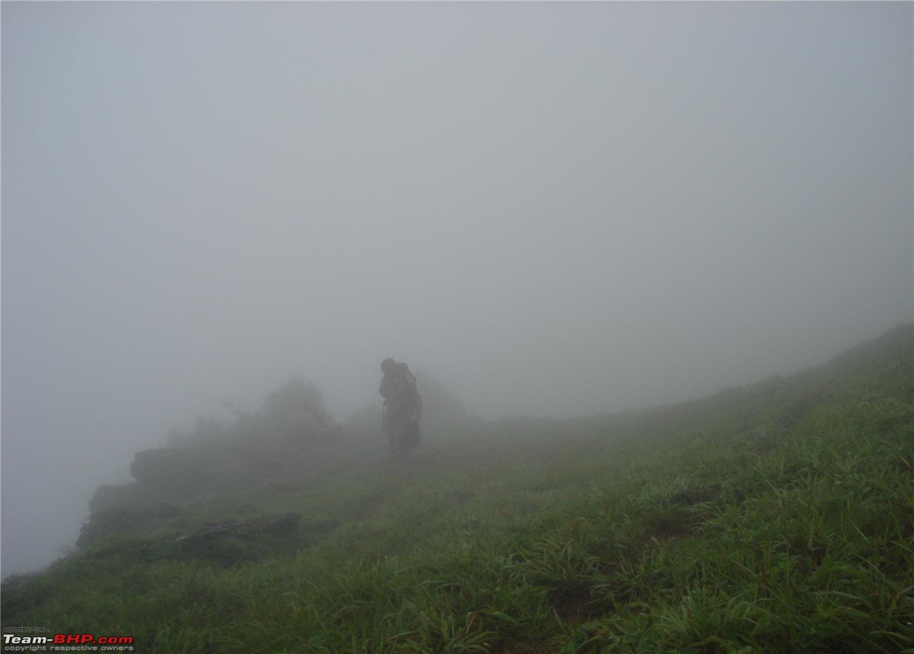
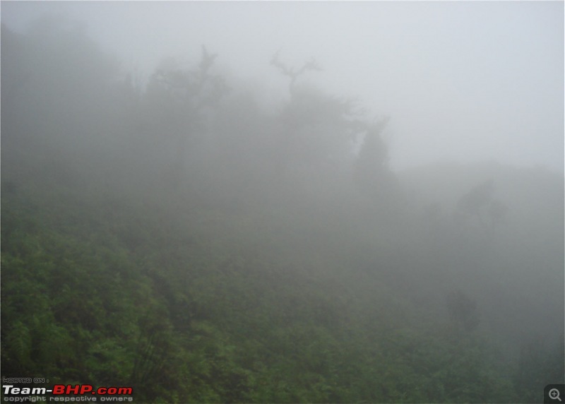
After some precarious climbing, we reached a grassland surrounded by rocks on top of the ridge. There was no let up from the mist and visibility still remained low. We were supposed to look out for a BSNL Tower located near Manikyadhara Waterfalls. This was supposed to be our landmark and we were to be heading in that direction. But, how do you see a tower some 5-6 kms away when you cannot see even a few feet in front of you??


We walked for a few minutes and then suddenly realized that we were not walking on any trail. Uh oh!!! Which side do we go now? We completely stopped in our tracks and pondered over which way to go. The other team which knew the route had gone far ahead of us and were not to be seen. It was already 4 pm and it would be dark soon. There was some man made structure to the left of us. It looked like some sort of wall. We first decided to follow the wall and it would have probably led to some sort of civilization. But, then we decided to push ahead and find the actual route.
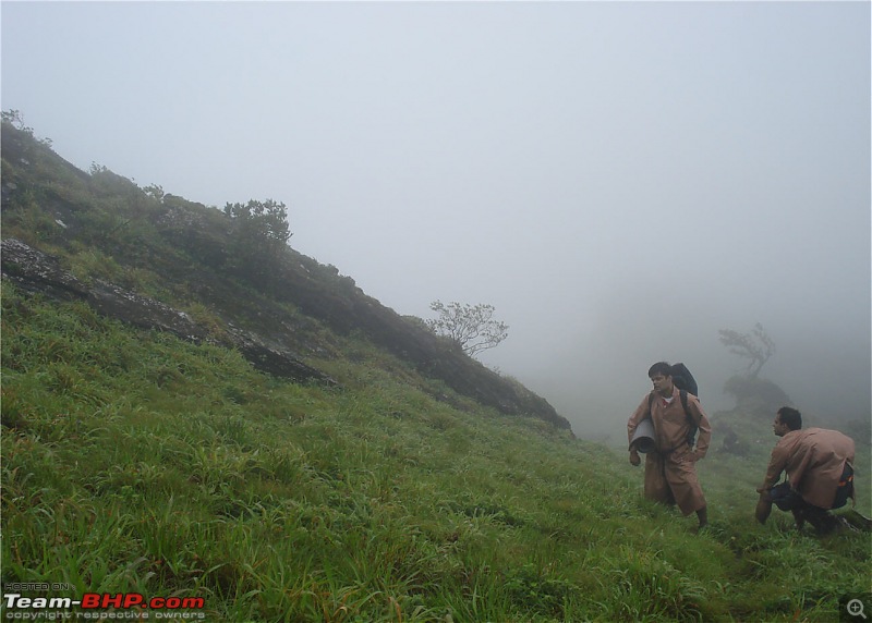
A little ahead, after climbing a hill, we found the trail. But, this time it was even more confusing. There was not one, but lots of trails parallel to each other. Since all the trails seemed to be going in the same direction, we decided to follow it. These trails were all animal trails mostly frequented by deer (we saw hoof marks all through the way). All this time, we were waiting to catch a glimpse of the BSNL tower so that we could verify that we were on the right track. But, in reality, we had passed close by the tower without even noticing its presence. The visibility was that bad.
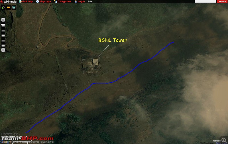
This screenshot from wikimapia shows where we passed by the tower. The blue line is the trek route.


We kept on walking and entered a small thicket where the ground was really slushy. Soon after we came out of the thicket, it seemed to us that we had rounded the mountain and made a ‘U’ turn when actually, we did not. We had passed the other group by this time.
Slushy ground near the thicket. Notice the multiple trails

We spoke to the guy who had come here before and he pointed out that we were on the right track. The other group did not stop and moved on while we took a small break. Meanwhile, the dog which had been following us all the way from Mullayanagiri had ditched us and started following the other group. Well, who would follow some guys who gave some biscuits rather than following people who give chips along with biscuits

.
We chatted for a while and had a few dates and were set to reach Manikyadhara in a few minutes. As we moved ahead, the problem of plenty came back. Lots of trails going in all sorts of directions. We kept on going straight when suddenly a few trails started going downhill. The ones going straight were getting narrow. We went a bit ahead and found that the trail was going left. We thought it is just circling back to where we started and came back to where another trail was going downhill.
This was a bad mistake as we were actually on the correct trail, but left it to get on the wrong one. So, downhill we went on the wrong trail. A few minutes later, a dead end!!! Now what do we do? It was almost dark now and we were thinking of pitching our tents there itself. But, the problem was the availability of firewood for cooking food. So, somehow we decided to move on. We came back to where we left the main trail and checked the maps. But, nothing came of it. We simply moved on to and fro on the same trail, but could not find it.
We passed these stones around 4-5 times trying to find the way

Then, we decided to move on the trail which went straight ahead and finally hit another grassland. Here too, there was no trail but we could hear the sound of the Manikyadhara waterfalls. Somehow, we went towards the sound and finally found the stream which formed the Manikyadhara Falls. We crossed it and we could see trash, bottles etc on the trail. Now we were sure that we had reached the falls
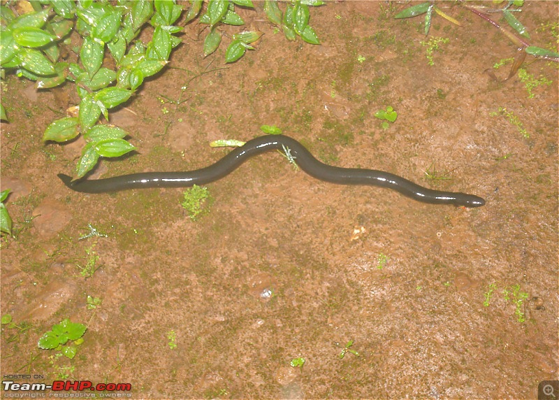
Just after the stream, we found this snake. My guess is that this is the Indian Shield Tail. Can anyone confirm?
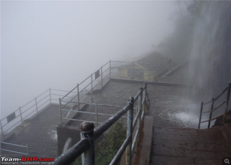
We reached Manikyadhara falls shortly and there was a small canteen which was just closing up. We had some tea over there and took some rest. Meanwhile, I went down to see Manikyadhara falls.
Manikyadhara Falls


We still had to trek 4 kms on a tar road to Bababudangiri and 4 kms from there to Gaalikere (as per our original plan). But, as I have said earlier, nothing ever goes according to plan. It was already dark by the time we left Manikyadhara and our sole aim was to reach Bababudangiri for the night. We thought that if our condition was any better the next morning, we could start for Galikere en route to Kemmangundi.
On the way to Bababudangiri. Oooh, Scary!!

Continued….


 3rd November 2010, 16:19