News
Travelling to the ghost town of Kudremukha in our Mahindra XUV700


Some of the views en route here are breathtaking but we didn't get down from our car to take pictures due to 2 reasons.
BHPian shrk_18 recently shared this with other enthusiasts.
There was a plan to visit temples in the coastal and Malenadu region of Karnataka. When this happens, Sringeri and Horanadu are always in the frame. There are a few roads to traverse between these widely popular temple towns, some bordering on non-motorable. However, an interesting thought crossed my mind, albeit longer, why not traverse the Sringeri-Kudremukha-Hornadu route?
After several deliberations with the family about timings, we decided to go ahead with this. The road from Sringeri is a straightforward one and well-marked on all maps (I prefer to avoid using Google Maps when in an unknown area). I used the built-in maps (MMI) in the 7OO this time. It was very accurate and guided us out of Sringeri and soon we were at the forest checkpost of Kudremukha National Park. One important point to note here is, you have to take a slip from the entry point with your vehicle number and entry time marked. You have 90 minutes to exit out of the park and at the exit checkpost you have to hand over this slip.
We made the entry and were on our way again. This road is through a thick canopy and sometimes even the sunlight doesn't make it to the ground. The road is also a bit narrow and the curves are blind. There is sparse traffic, but when it comes make sure you have sufficient space and time to get off the road if necessary. We encountered a few cabs and a few lorries. So drive with caution on this stretch.
After about 25-30kms you come across a settlement named Karekatte (I think whatever was here has been abandoned). There is an orchidarium here (which is closed and in ruins) and there is a fork. The right in the fork takes you towards Bajigoli/Karkala and then onwards to Udupi/Mangalore. The left towards Kalasa via Kudremukha. We took the left here at the fork.
Although the road is narrow up to this point, the surface is great. Once you take the turn towards Kalasa, the road quality is very average, to say the least. This road till about Samse (a few kms before Kalasa) is very average and broken at many places. We took the turn and started traversing the road towards the abandoned town which is about 17 kms from the turn off. It took us a good 35-40 minutes to cover this distance but some of the views while driving on this road are breathtaking. We didn't get down to take pictures because - one, it's a wildlife sanctuary and getting down is not the right thing to do, two, the road was pretty deserted and didn't feel comfortable getting down on a deserted road.
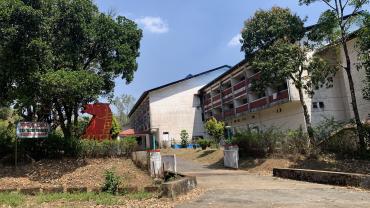
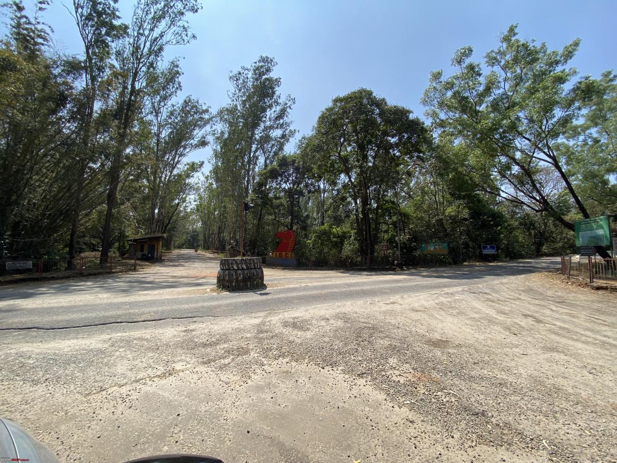
After navigating the road, we were at the entrance of the abandoned town. The entrance is marked by two earth mover tyres placed in the middle of the road and a huge KIOCL logo opposite to it. This picture is taken with our backs to the abandoned town and the road in the picture goes to the now locked and abandoned factory where the mined ore was processed.
The visit to this place was special because it brought back so many memories from 30 years ago when I was there with my parents (I had just finished my 7th Standard) as my Dad was invited to the Kendriya Vidayalaya (KV) there for some lectures for students of higher classes and even some teacher orientation. It was a flourishing and bustling township back then. I have vivid memories of the place.
The KV is now abandoned and this is how it looks now

As we drove further into the town, we came across this huge circle named Nehru Circle

This was one of the main junctions where there was a recreation hall (We had watched the Movie Saajan here during our visit), a hospital and a bus stand.
The abandoned recreation hall

The abandoned hospital

As we went further inside, we came across the Sahyadri Bahavan, the erstwhile guest house of the company. It's where we had stayed during our visit and memories came flooding back. While my dad went to the school for the orientation program, I and a few other kids (children of others who were here for teaching) had a gala time swimming in the huge pool behind the guest house and having sumptuous food served here. Picture of the guest house which was closed that day.

Finally a picture of yours truly in front of the guest house with my ride.

There were not many people around that day, saw a few people from the forest department working in a field nearby. A few people at a place of worship. There is a government school building at the entry of the abandoned town which was closed that day as it was a Sunday.
We eventually left the place with a heavy heart after seeing the once bustling town in shambles and nature gradually gobbling it up. I guess the mining operations were detrimental to the environment and they had to be closed. But still feels sad to see a place in ruins, especially if you have visited it when it was at its peak.
Thanks for reading through this.
Check out BHPian comments for more insights and information.
Find Car News
Just News


About Us