Ever since I got my S-Cross, one of the things I always had issues with is the maps. The maps are from HERE and no matter how many times you get to the latest version, they are many times useless. One of the features that is terrible in this device is the favourites. They are stored on the device and not an external storage. As a consequence, anytime you update the firmware, you lose your favourites and have to start all over again. There was NO WAY to save them to an external storage.
In my attempts to find an alternative solution, I stumbled upon the custom my POIs (Places of Interest) feature. After fiddling around with it for a few days, I figured out how to make it work. With this solution, you can store as many number of POIs as favourites on a USB drive and you can always reinstate them regardless of how many times your firmware of SLDA is updated.
This thread is about how to set it up.
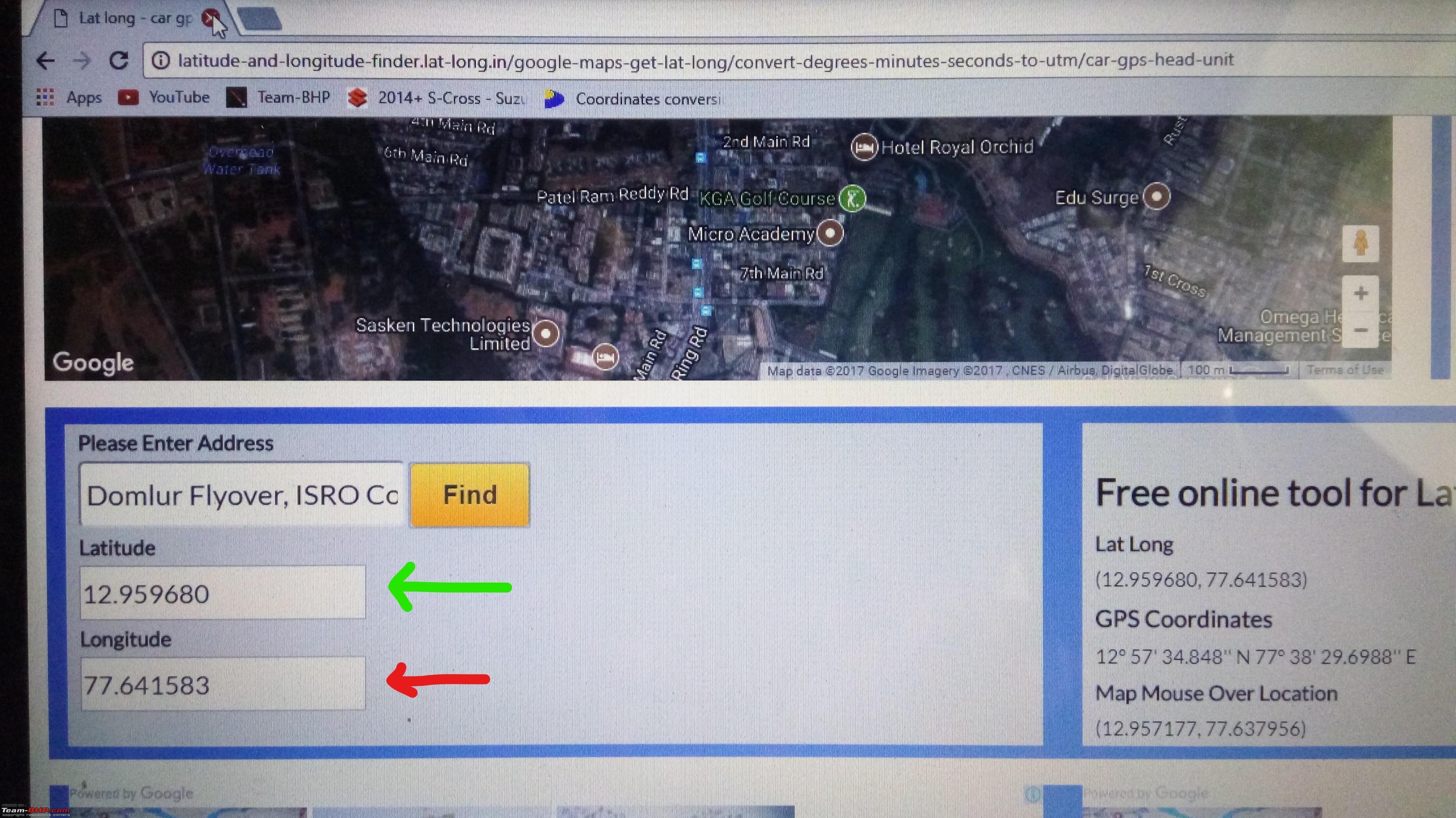
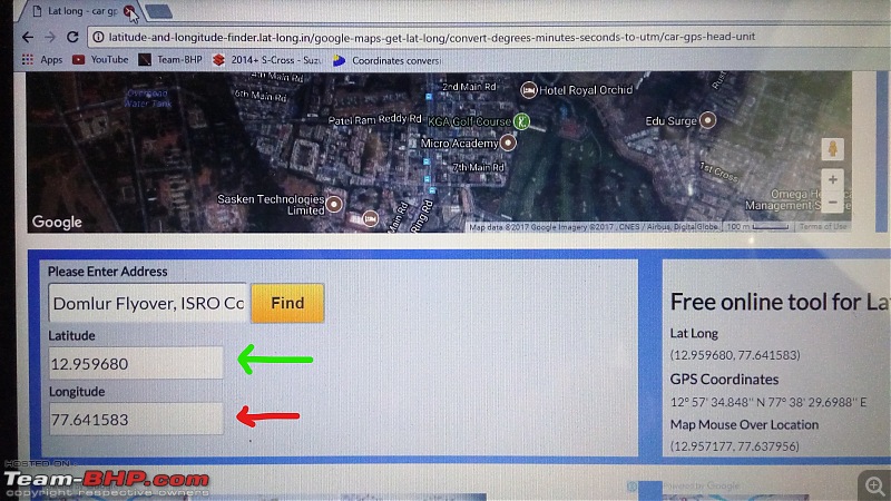
First things first - You need to find a reliable online service that gives you the
longitude and
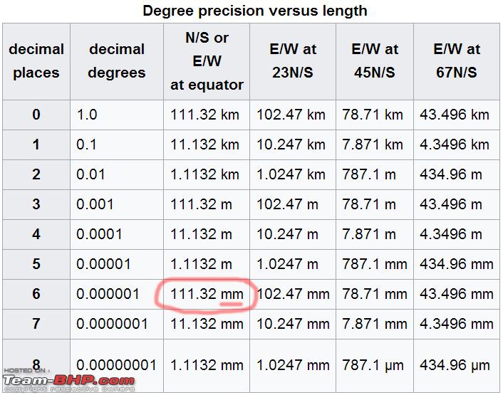
latitude data of your place of interest. I found the below online service to be reliable and also gives me the latitude and longitude to a accuracy of 6 decimal digits.
Longitute & Latitude Finder
With this service, you can find a point of interest such as your home, favourite restaurant, a dangerous curve in the highway etc and find the latitude and longitude of the place. Example
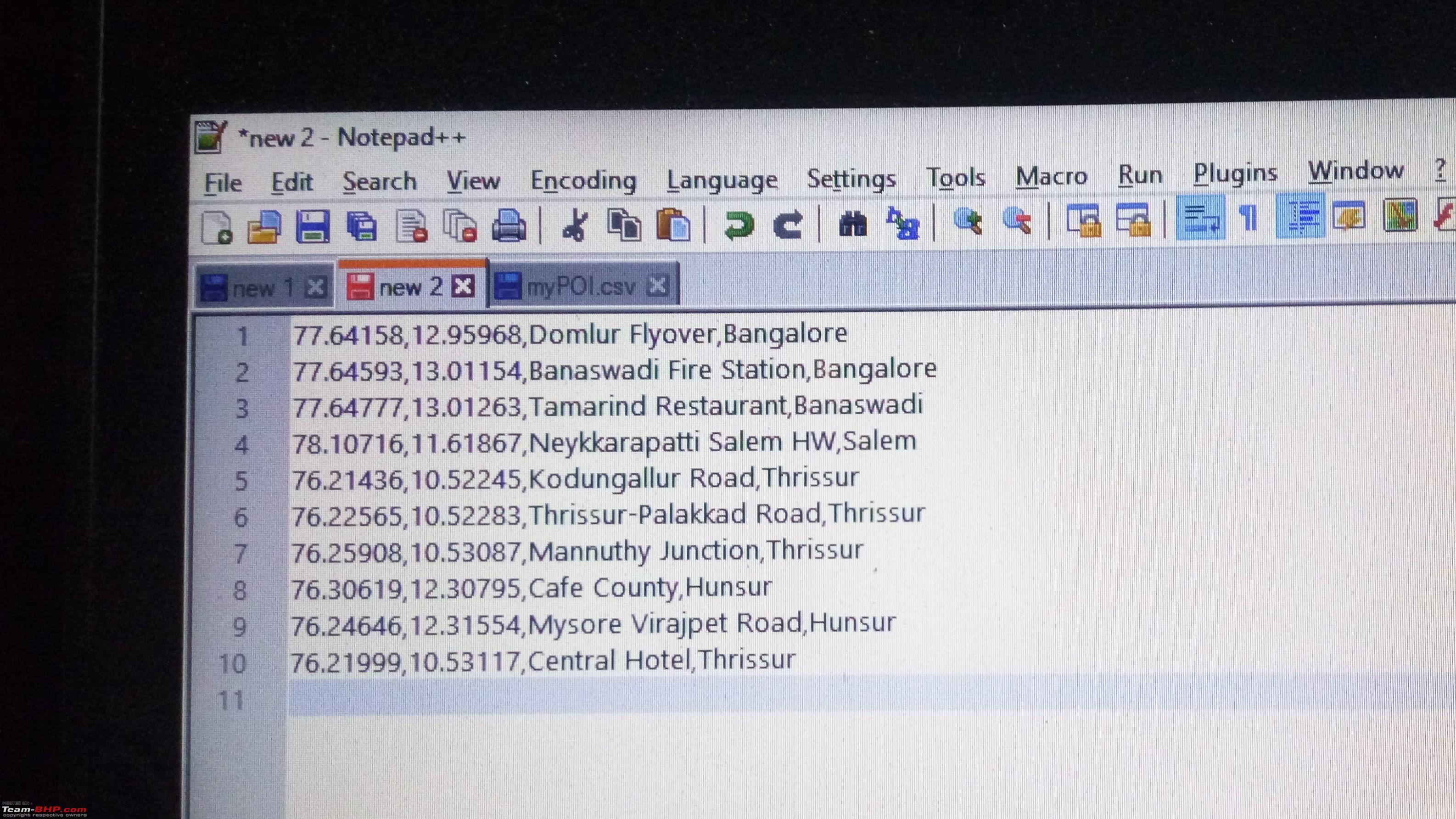
 The data format is important.
 The following is taken from the Suzuki SLDA user manual
<<
The file containing your own points of interes must comply with the WGS84 standard. The required fle format is .csv (Comma Separated Values). Each line of the fle may describe one point of interest containing the following pieces of information, in that correct order (Please note, the order listed below is important):
- Longitude
- Latitude
- Name
- Address (optional)
- Telephone number (optional)
For example, a line of the file may look like this: 77.61,12.92,Park,Bangalore City,00917829
Notes: Ensure that no piece of information contains a comma. Inside the fle, commas are exclusively used to separate the different pieces of information from one another
>>
Unfortunately, if your longitude and latitude data is not accurate to about 6 decimal places, then you will end up somewhere else. It will be off by several KMs or probably even more!! I found that the system does support accuracy of 6 digits. Thus a line of data should look like this
77.641721,12.960345,Domlur Flyover,Bangalore,<Phone Number Optionally>
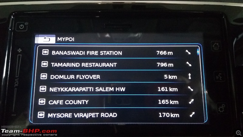
Each POI must be entered on a separate line and there should be no data with a comma as it is considered a delimiter of data for the system. You can enter as many POIs as you like. Here's mine

Save the file as myPOIs.csv. Once you ensure your data is all accurate, time to upload it into the system. Here are the steps
- Grab a USB drive and create a folder named myPOIs.
- Copy the file myPOIs.csv into this folder.
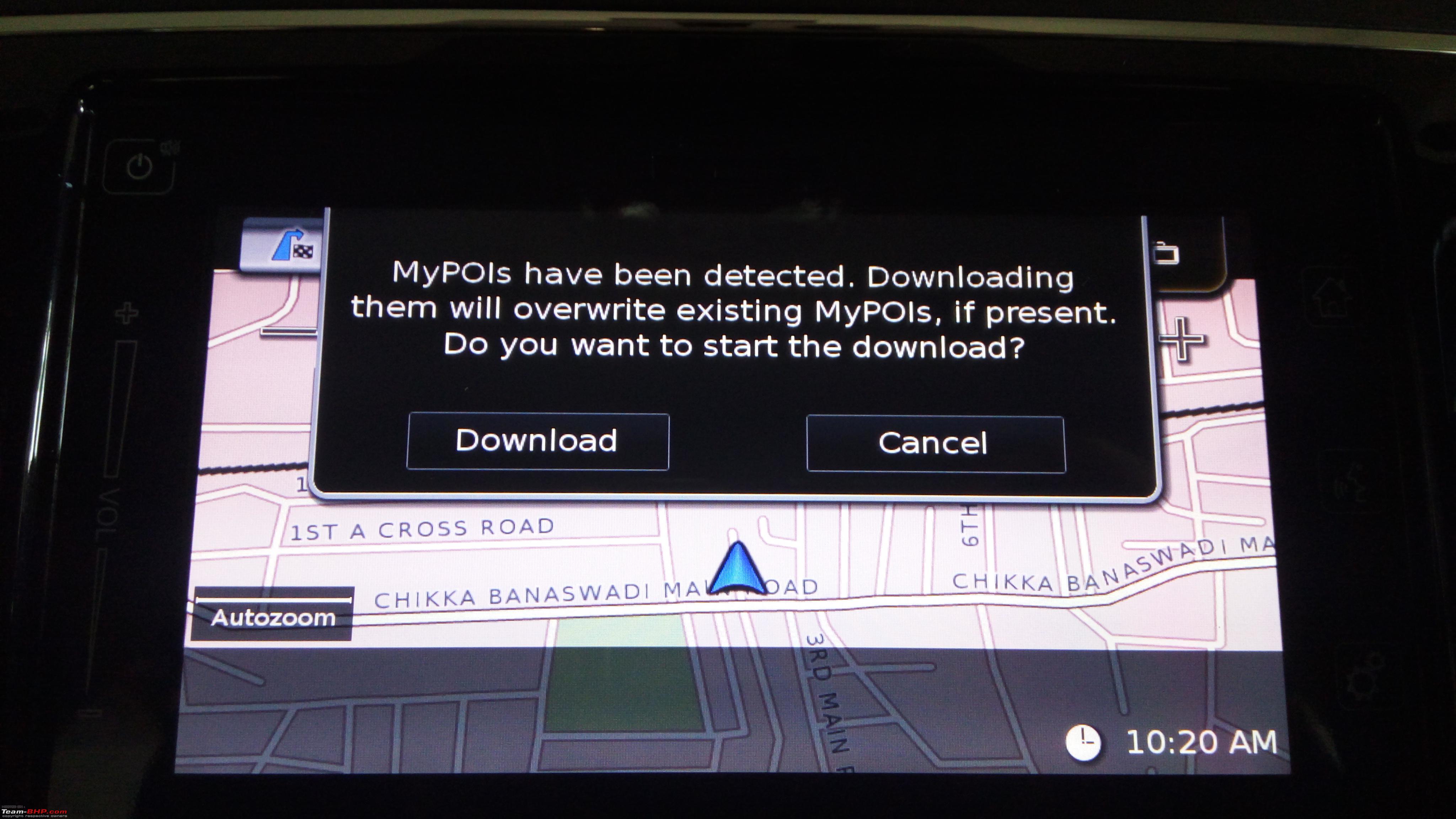
- Fire up the head unit and let the navigation system initialize completely.
- Switch to navigation mode and dismiss the confirm button.
- Once the maps and information is displayed, plug in the USB drive into the USB slot under the arm rest.
- Wait for a bit and the system should automatically detect your POIs file and prompt you to download the data. It may take up to a minute sometimes
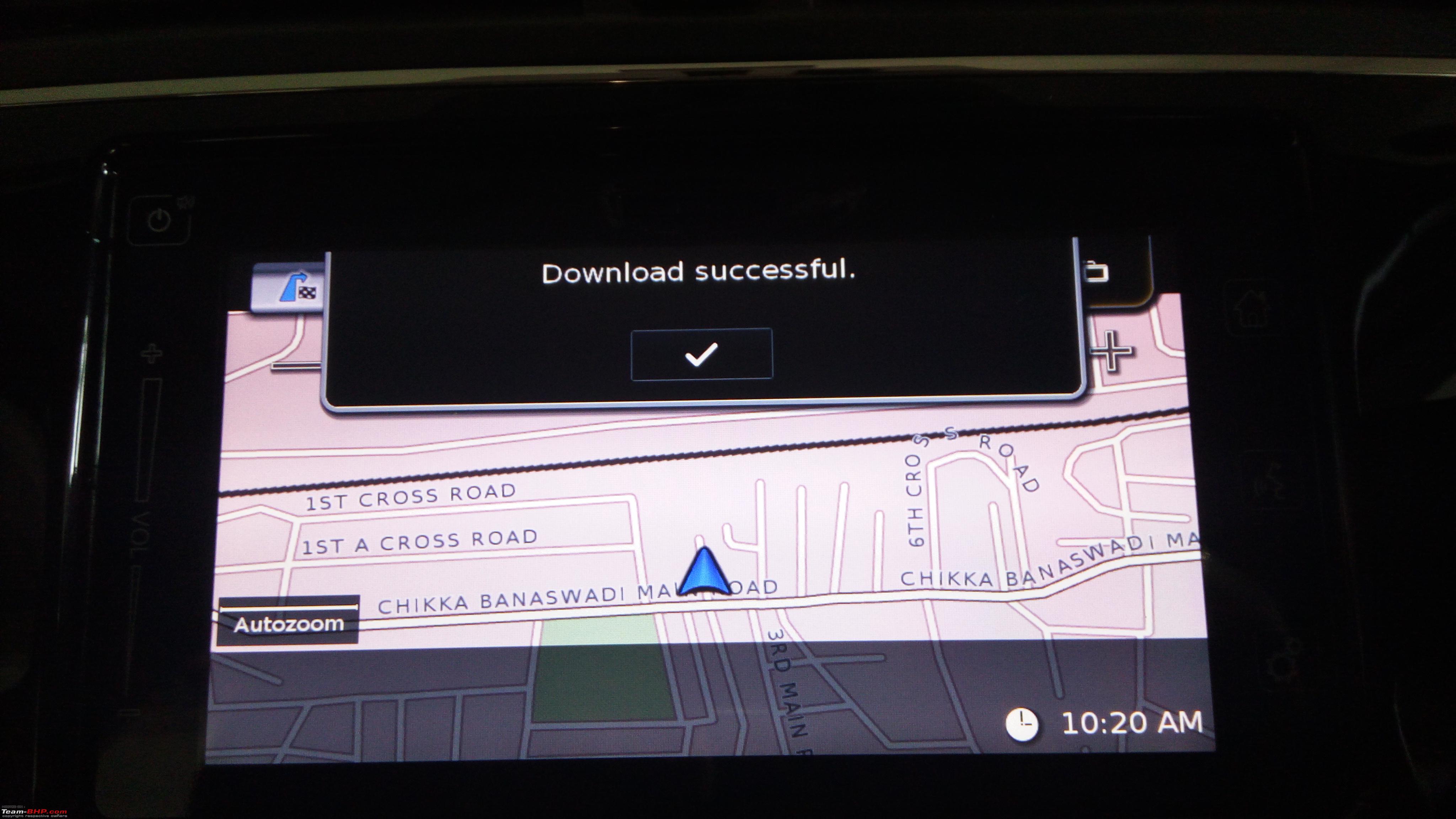
- Once your POI file is detected, confirm to download.
- You are ready to use your POIs (a.k.a. Favourites) now!
Illustration of some of the above steps
Auto detect the file after inserting the USB drive into slot

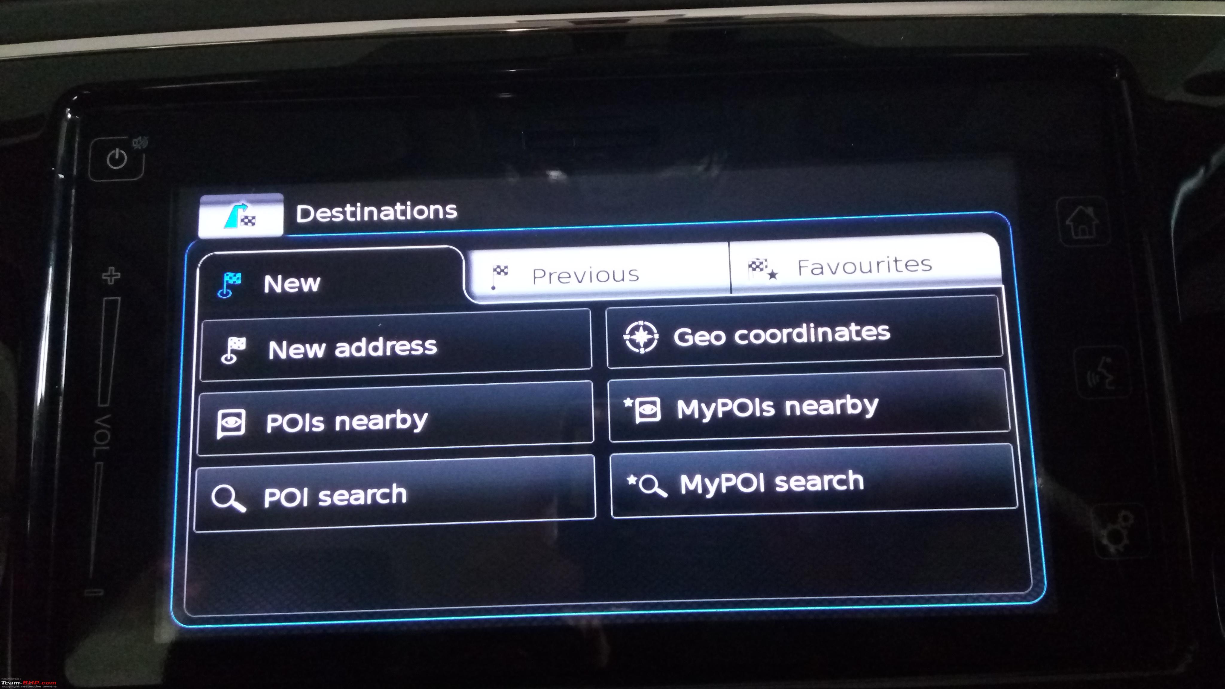
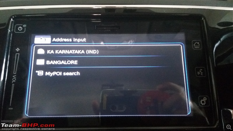
 Using your POIs
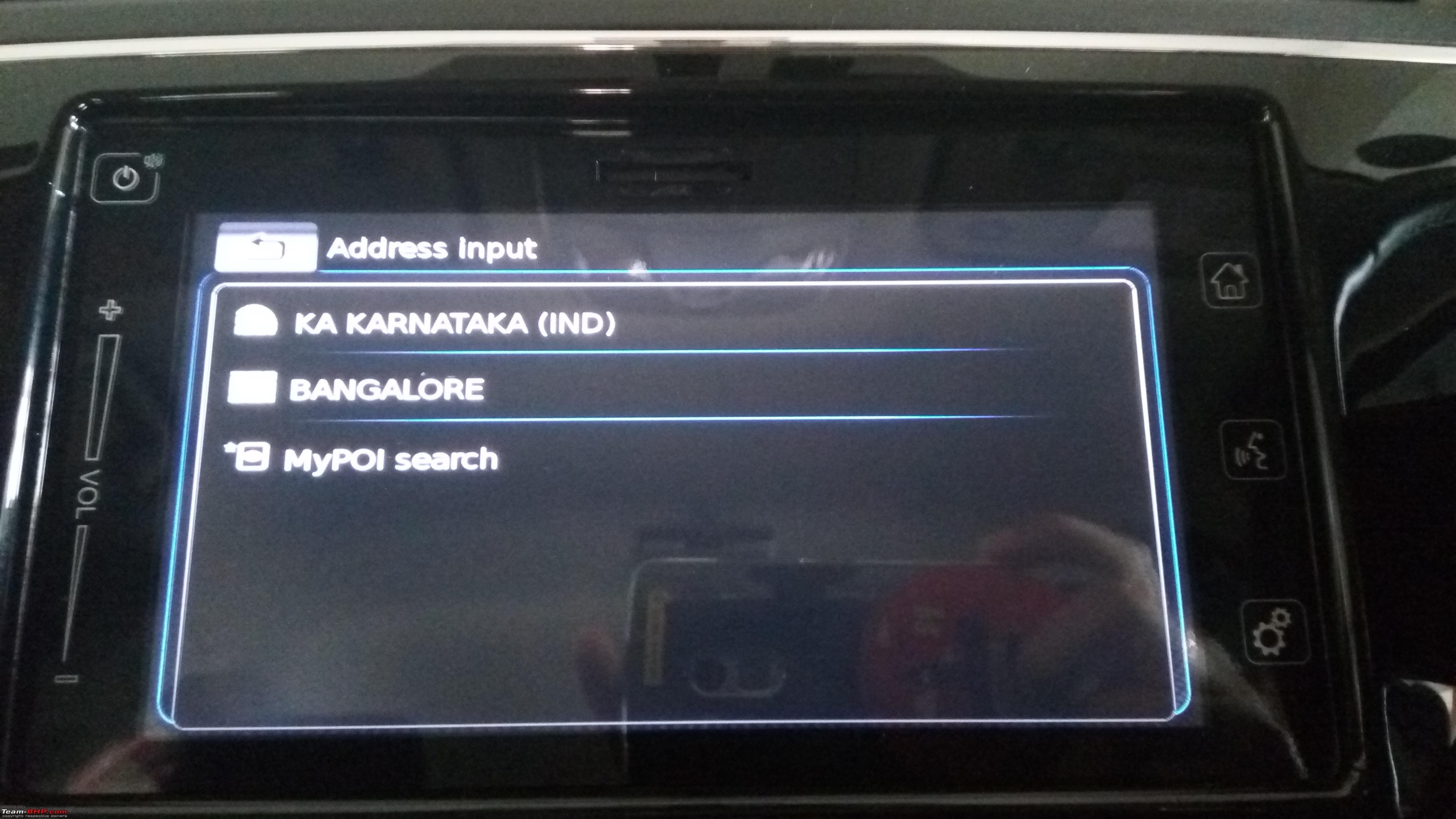
Select a new destination screen

Select MyPOI Search

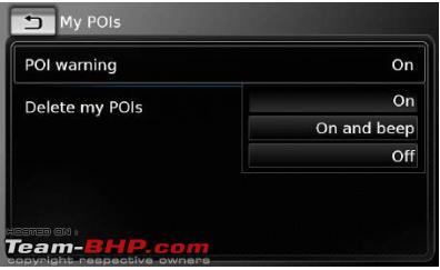
 Other things (Taken from SLDA Manual that works) A csv fle that contains POI warnings must be stored inside the folder "myPOIs" or any of its subfolders. The name of this fle must begin with "myPOIWarnings_" and end with ".csv" (for example: "myPOIWarnings_Curves.csv"). Otherwise the POI warnings cannot be displayed.
Point of interest warnings displayed during the journey on/off
When the displaying of point of interest warnings is enabled, the system displays a warning when you approach a point of interest warnings location.
When in navigation, you can use the Settings button to set this up
 Potential Pitfall Problem:
 Updated maps may cause the co-ordinates to go out of sync.
Solution: Always check and update the co-ordinates with the G-Maps.
NOTE: Anytime the file is updated, the system will auto detect the changed file and overwrite the existing POIs data.


 13th July 2017, 11:35

 (22)
Thanks
(22)
Thanks