Team-BHP
(
https://www.team-bhp.com/forum/)
Organization of the guide
- Introduction
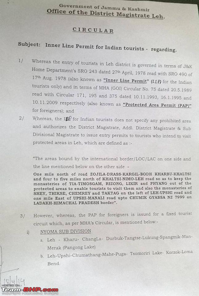
- Inner line Permit and the Protected Area Permits
- Getting to Leh
- Manali Leh Highway
- Srinagar Leh Highway
- A small note on the Kaza Route
- Leh and Around
- Circuits
- Nubra Valley
- Pangong Tso
- Changthang Desert - Hanle
- Tso Moriri/Tso Kar
- Off the Beaten Path
- Nubra to Pangong
- Pangong To Hanle
- Pangong to Loma Via Chushul Tsaga La
- Pangong To Mahe via Chushul Kakasang La
- Marisimik La
- Hanle - Nidar(Nyoma) - Via Kyun Tso
- Off Shoots
- Dha - Hanu route to Kargil
- Suru and Zanskar
- Vehicle instructions, and list of items to carry
- FAQ (Constantly updating)
Important News
(This section contains important information)
Manali - Leh highway : Open
Srinagar Leh highway : Open
Rohtang Pass is open, but one way system is being implemented
http://www.hindustantimes.com/india/...2l76yTDQL.html
This is not your regular culture of Ladakh etc., coffee table book.
This is not your what to see, who made what, who lived here kind of Guide.
This is not about the monasteries, who made them, who lived here, who dies here etc.,
For that there is the internet, with more detail than you ever need about what monastery, and when was it made, and who lived where, and who build what.
So what is this Guide about.
Well, this is about, getting to Leh, how and when, what are the circuits, and the wonders of nature.
Of course there will be historical information and geographical information peppered here and there, but trust me, Wikipedia will give you greater detail.
Before we actually start on the Journey to Leh, some important points you must remember.
1. The drive to Leh is extremely rewarding, if done right. If done wrong it can be your worst nightmare. So do not be lax about preparing your vehicle, as on this road trip, she will be the companion you will depend upon
2. Its not just about your vehicle its about you also. Read up on acclimatization and altitude sickness. Its real. While many do not get it, some people have died due to this. Sure, the sites on internet will scare you to death, but remember, you just have to take the precautions.
3. Know the limits of your vehicle, and your own limits too.
So with that out of the way, lets begin.
Ladakh is the district in the state of Jammu and Kashmir. The name means "Land of Passes". From a travellers point of view, Ladakh has come to mean everything beyond Baralacha-La on the Manali Leh highway, and beyond Zoji La on the Srinagar Leh highway.
An old Ladakhi Saying "Our land is so barren, and the Passes so high, that only the best friends or the fiercest enemies come to visit us".
I find it very ironic, because today everybody visits Ladakh. Before 3 idiots, it was part of the adventure circuit, but now, its the place to go for everybody and their dog.
Jokes aside, this boom in tourism is also accompanied by explosion of information, especially on the internet.
There are myths touted as gospel truth, and stories which were never part of History but now are part of the "accepted" history. As usually, the internet is quite responsible. So if you really want to learn about Ladakh, you have to actually read some books.
An excellent book I can recommend is
"Ladakh" by Romesh B. also known as
"Bhatto" on flickr :
http://bameduniya.blogspot.in/
Then there are some books, freely available on the internet as copyright has expired long back. These are written by explorers who first came to the region on foot, as part of the british empire. They climbed the passes on foot and mules, measured the rivers, the peaks and explored all the trade routes.
Sadly, with heavy army presence, the only way to do some "exploring" is get a chinese visa and then visit the nooks and crannies. Our side of Ladakh is highly restricted, but nevertheless, there is a lot to explore, esp in the non-sensitive Zanskar region.
If you want to learn, the old books you can download for free are
Ladāk, Physical, Statistical, and Historical: With Notices of the Surrounding Countries Western Himalaya and Tibet: A Narrative of a Journey Through the Mountains of Northern India, During the Years 1847-8 Travels in Kashmir, Ladak, Iskardo, the countries adjoing the mountain-course of the Indus and the Himalaya, north of the Panjab
Available in ebook format, these books will teach you stuff which you won't find on the internet, as such knowledge is of little commercial interest to the millions of tourist operators.
In the more recent times, mountaineer Harish Kapadia's books are a wealth of information.
http://en.wikipedia.org/wiki/Harish_Kapadia
So even though, monasteries and places of interest are a good place to start, if you really want to Enjoy Ladakh, and be one with the mountains, reading is a must. That way you can relate to the rivers, the ranges and the Glaciers, and your trip becomes from "Just another Ladakh Trip" to something extraordinary.
I have made three trips to the region, each one very different, exploring, searching, and even getting lost. I did read a some geological papers, but I was totally ignorant about the wealth of information in these books. Wish I had read more!
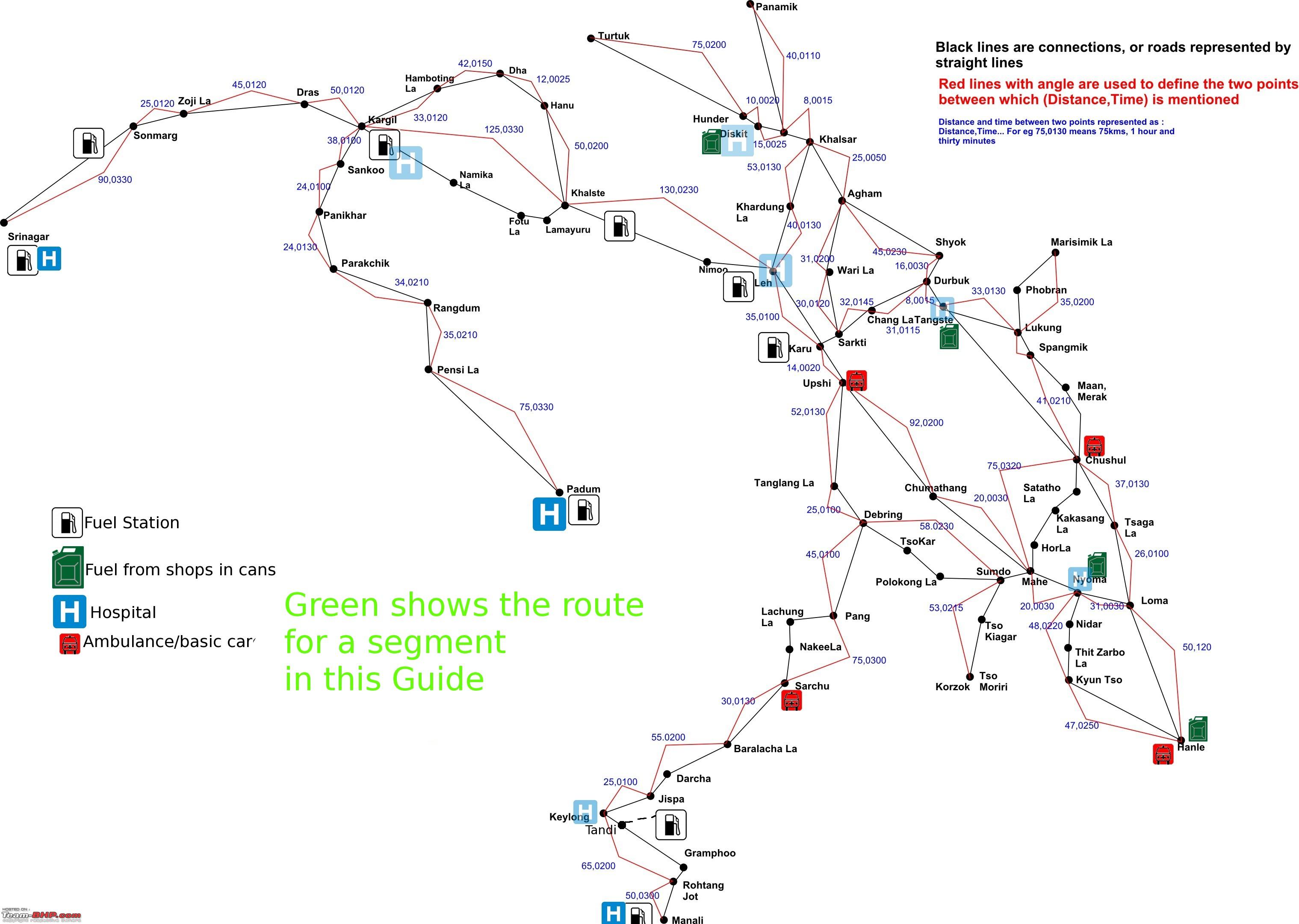
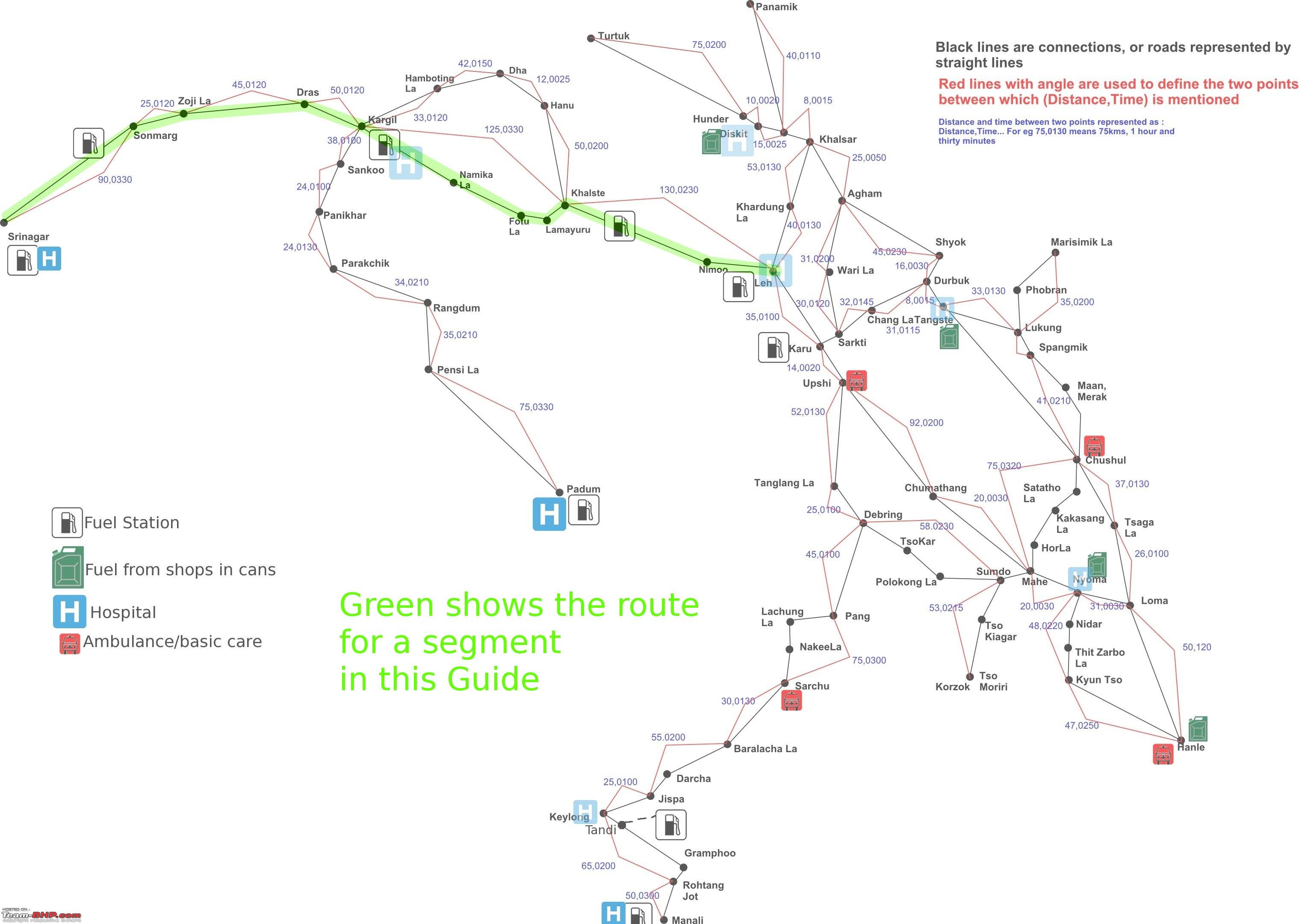
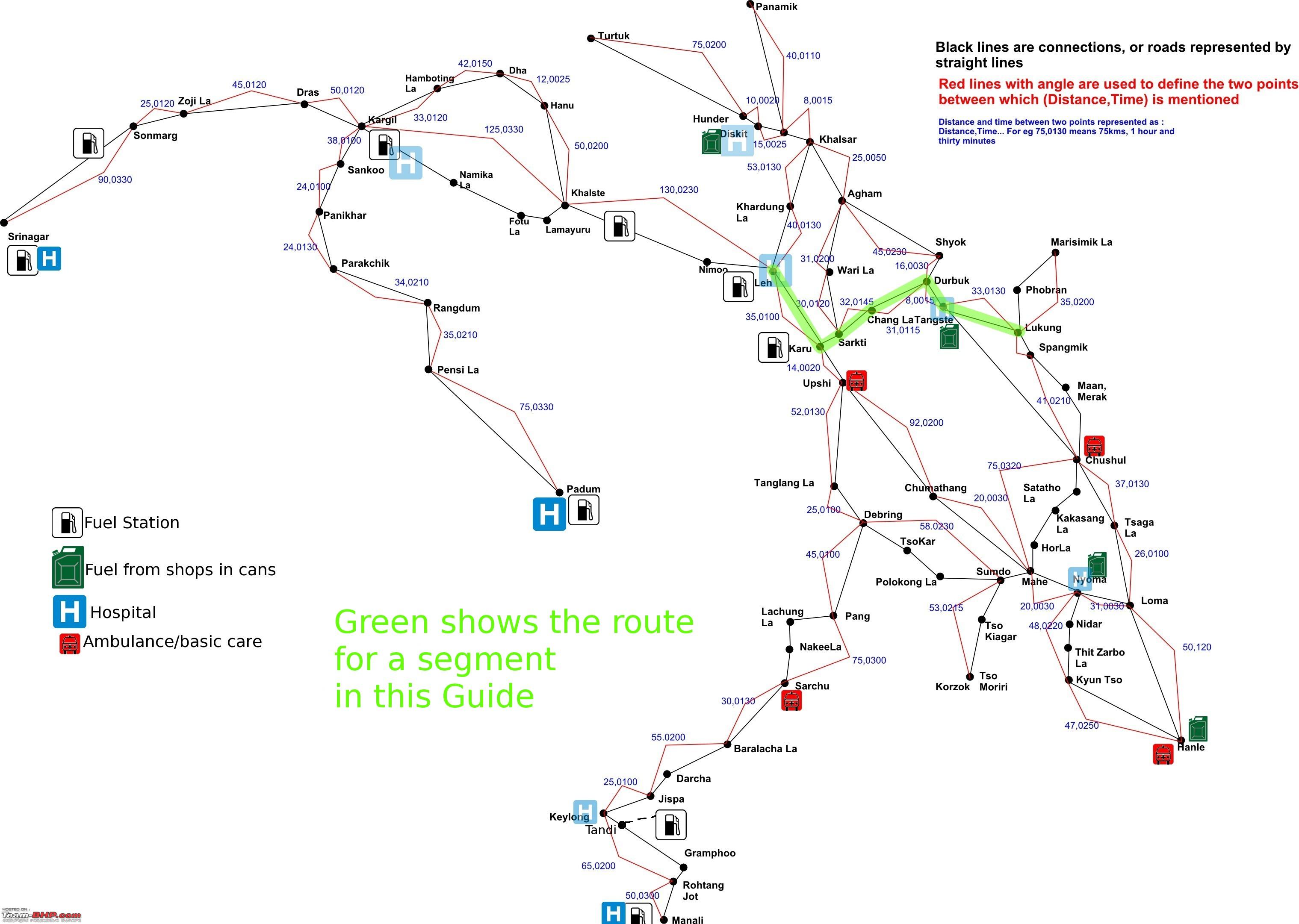
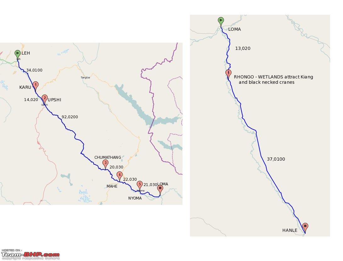
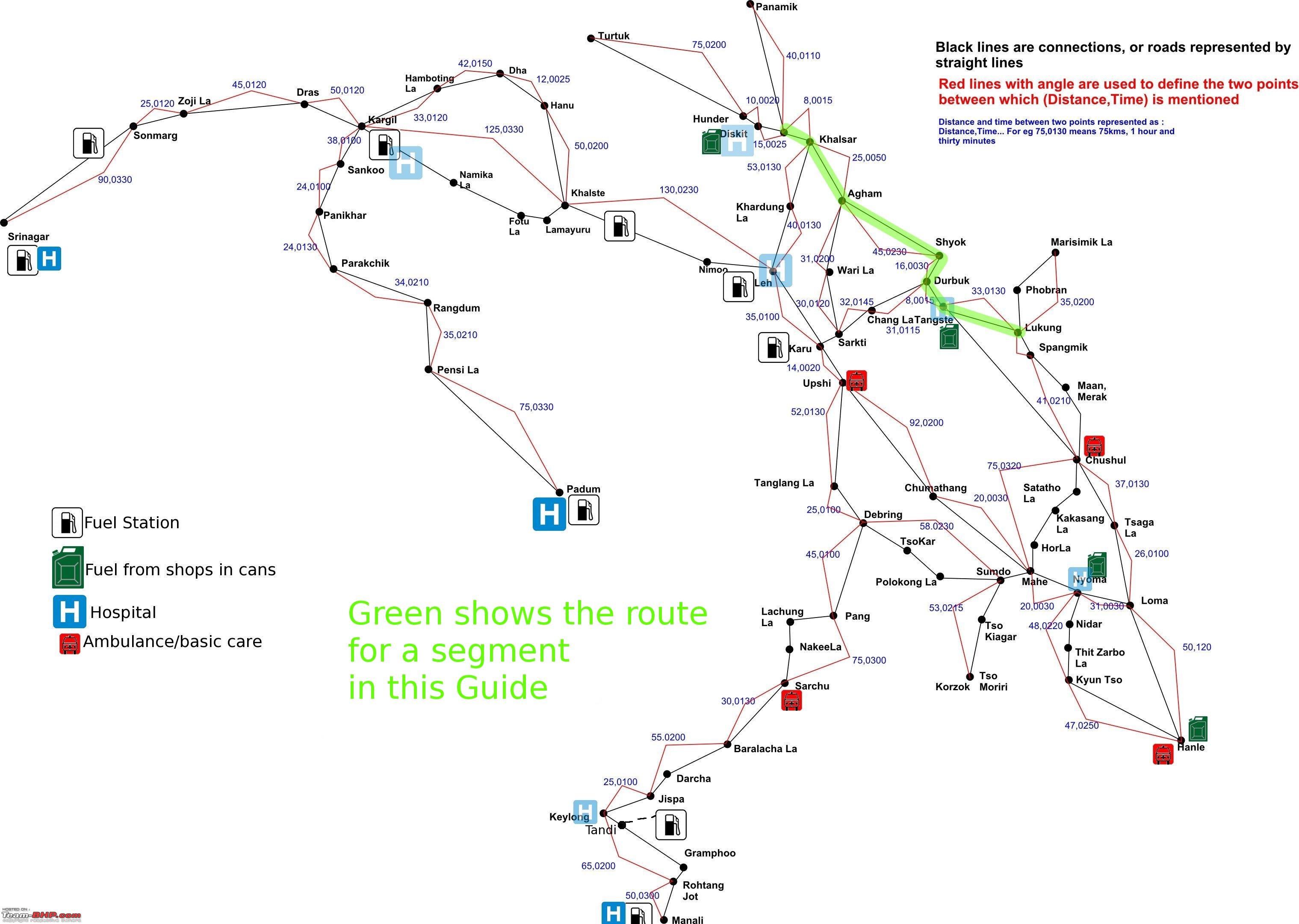
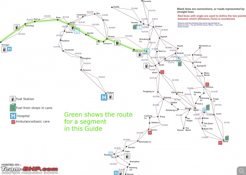
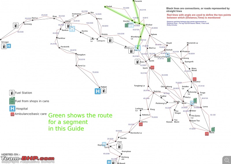
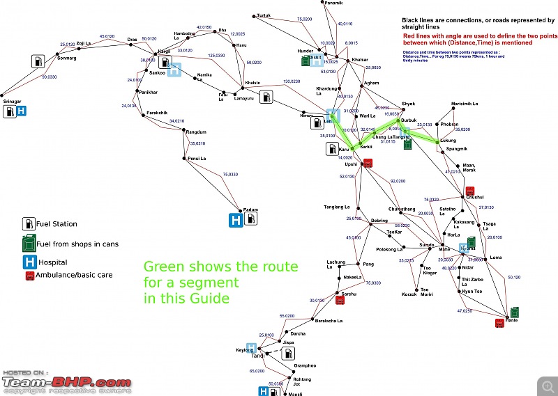
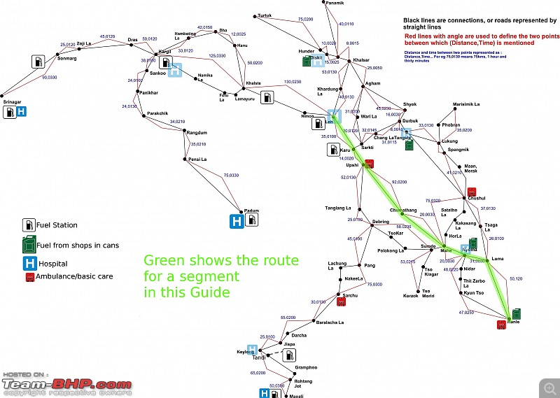
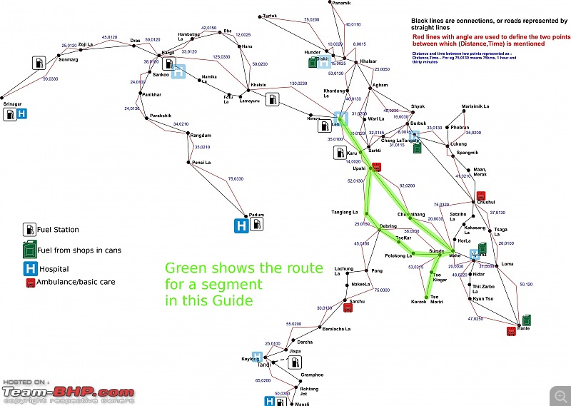
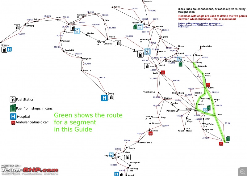
Before we proceed further, lets get antiquated with the region map.
The map below shows the Manali Leh and Srinagar Leh highways and also the local excursions.
The red connecting lines show distance and approximate driving time with normal speed driving. Be aware though, conditions on ground keep changing, and a fast stretch can turn into a slow stretch if there are landslides and water crossings.
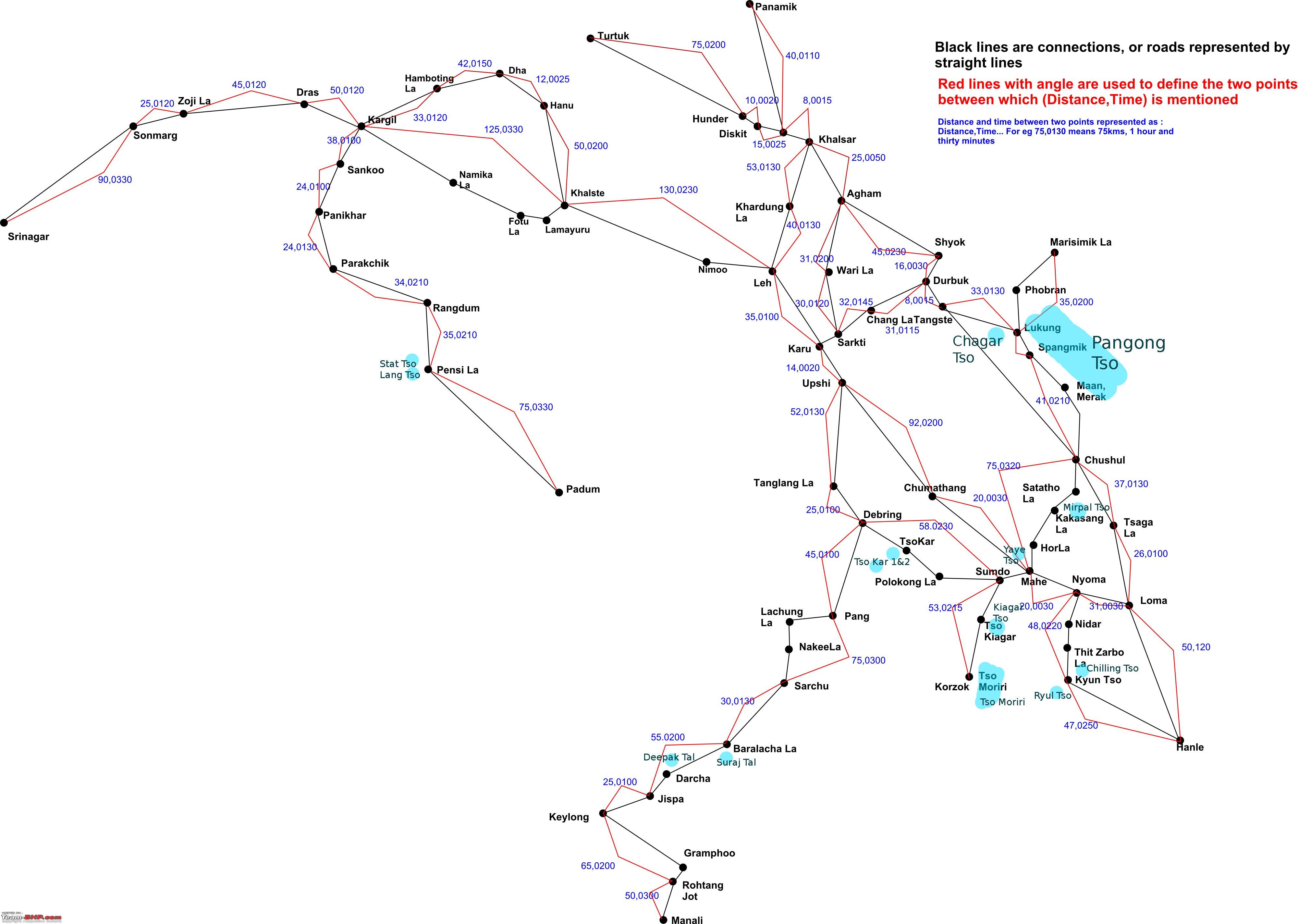
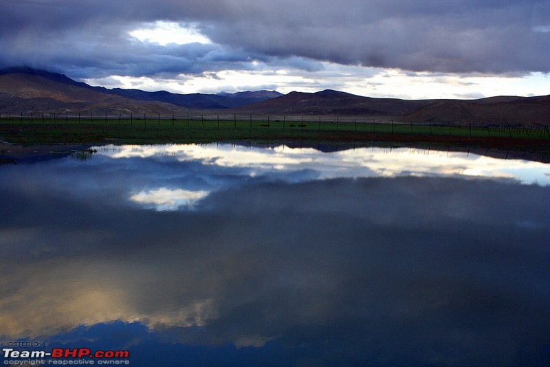
Another fact you should get aquanted with is that inspite of being a cold desert, Ladakh region is home to many lakes, the likes of which are not seen anywhere in the world, except maybe Tibet.
Here is the same map, with lakes marked in blue.
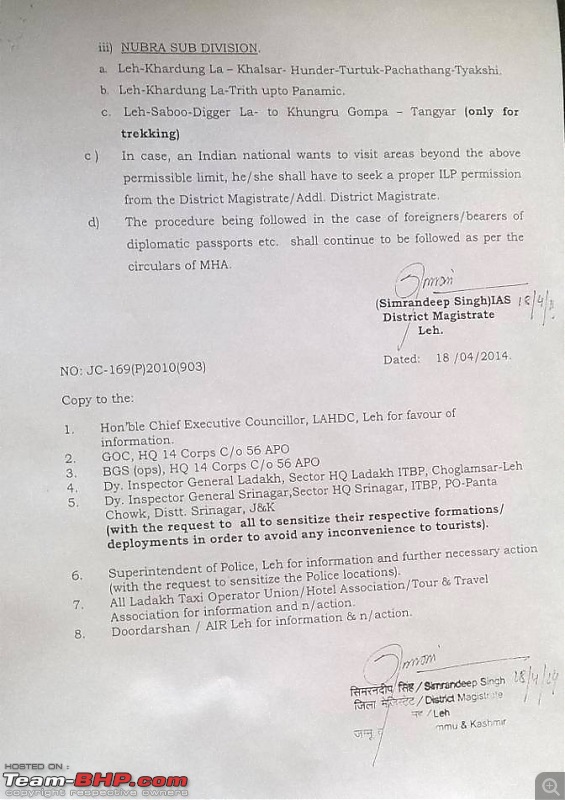
FROM FIRST MAY (1/5/2014) no Inner line Permit is needed for Indian citizens for regular tourist circuit i.e.
Nubra - Panamik and Turtuk Included
Pangong Tso - Till Merak
Nyoma - Till Loma Checkpost
Tso Kar and Tso Moriri lake circuit
Information courtesy H.V. Kumar
Circular Attached

---------------------------------------------------
Self drive Rental cars
Note. Self drive cars may not be allowed any more and you will be forced to park the car at your hotel and take local taxi
https://www.team-bhp.com/forum/route...ml#post3737077
-------------------------------------------------------------------
During the WWII, a distinguishing factor in the German occupying region was the phrase "Papers Please".
Wherever you went, you had to show "Papers".
This is highlighted in many war movies set during WW-II, where the protagnist has some fake papers, and she/he crosses the border, only to be called out, and then the chase begins, on those WW-II motorcycles with side-cars.
In contrast the western world was shown to be "Paper less". Nobody asked you "Papers please" as you roamed the streets.
Unfortunately, India kind of went the German way, when it came to the far flung regions of the country, and something called the Inner Line was created.
Till the late seventies, the inner line extended from Baltal. The ILP or Inner line Permit was difficult to get for Indians, and Foreigners had a snowballs chance in hell to get there.
Finally, sense prevailed, and the inner line moved to the border. Since our neighbors were allowing expeditions right to the border(a way of showing ownership), some babus somewhere must have realized the futility of not allowing citizens to visit their own country.
And thus you have the Inner line Permit system for Indians, and the Protected Area Permit system for foreigners.
Inner line Permit
First lets deal with the Indians. The Inner line permit document allows Indians to visit areas close to the border, and roam there for a duration of 21 days. Officially speaking as per the ministry of Home affairs, the purpose of the Inner line permit is to prevent settlement of outside state people in tribal areas to preserve indigenous cultures.
Till very recently (2005ish), permits were issued to only the popular circuit places, and then people started asking, demanding pleading for more remote places. Finally, MHA stepped in, and opened peaks close to border for exploration, and also sent a notification to the administration in 2010 to not deny and Indian from visiting remote areas.
Ground realities are different though. So I will here list the places which you can get and then the places which you can get with difficulty, and finally, the cow jumped over the moon places.
Common easy to get permit places
Nubra Valley, Turtuk, Panamik - Will allow you to visit as far as Turtuk ~ 20kms to LOC with Pakistan
Pangong Tso - Allow you to visit till Merak Village along the lake.
Tso moriri, Tso Kar, Mahe - Allow you to visit Tso moriri, and Tso Kar lakes
Hanle, Nyoma, Loma - Visit the site of Hanle, See Kyun Tso. Also take diversion to Yaye Tso, and ride out as far as Mirpal Tso(You cannot go further without permit for Chushul)
Tough to get places
Chushul, Tsaga - Needed for the Tsaga La route and Kakasang La route
Sasoma - Base camp for Siachin as well as Saser La routes
Chumur - Monastery with cut hands
Cow jumped over the moon or pigs can fly places
Demchock - China border in Changthang desert
DBO - Daulat Beg Oldie, or Daulat beg died place
Saser La - Goes to Depsant plane. Route to many mountain climbing expeditions
Fukche - Near Demchock
Koyul - Near Demchock
Regarding Demchock area, people have had some success last year and last to last year.
Remember, permit is your right. Be polite but firm, and you will get the "Tough to get places" atleast.
Another interesting titbit. Areas beyond Sasoma (eg Saser la and the mountain bases in Dapsang plane) are not in permit system. You require army and MHA permission. The best way to get that permission is to become a foreign national, and then pay a fee (4000$ for 8 people group including 4 Indians).
Yes, many areas unseen by us Indians due to Permit Raj are open to Foreign expeditions.
PAP or Protected area permits
This document is the best -
download link
If you are a foreigner, you are restricted till Nyoma and Merak. Its best to go through a travel agent for permits.
How to Get permit
Go to Leh DC office, fill up the form, and get it stamped. As an Indian you can get permit for upto 21 days at a stretch. Permits for some areas classified as forest require a 40rs/day fee. There are also things like green tax etc., added now and then. But all said and done, its rare for the cost of permit to cross 500rs for a couple.
To show proof of citizenship, the best document is your driving license. Other photo id like Passport photocopy is also okay because its proof of both address and identity. Always carry a few photocopies of your DL, or other govt issued document when you apply for permit.
After you get permit get around 20-30 photo copies. It will cost 50rs near the DC office where they do bulk photocopy.
34.16167, 77.58932 is the location where you can find photocopy shops near DC office.
At all check-posts you need to submit a copy and an entry is done in the register.
There are various methods of Getting to Leh. You can sit in a bus. You can sit in a plane and fly in.
you can take a shared cab, or if you can afford it, rent an entire cab to yourself.
This guide will just talk about driving to Leh, mostly from a car standpoint. I have never done any biking, so cannot educate you much on time taken and the challenges faced. But as far as four wheelers are concerned, this guide will tell everything.
That said, usually over long distances in such terrains, bikes take about 20-40% more time to cover the same distance, depending upon the fitness of the rider, and the class of Bike.
So lets begin on the driving to Leh part.
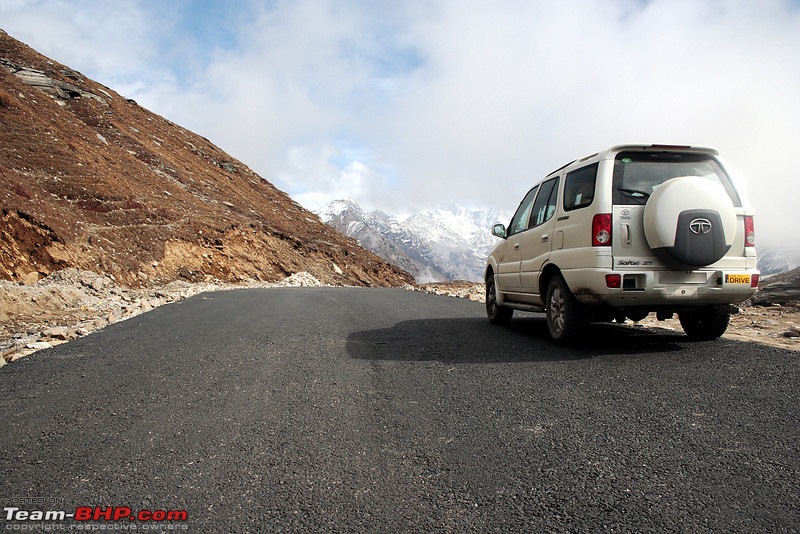
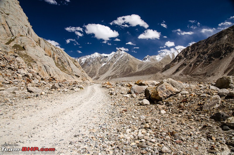
There are roads, and then there are roads. There are roads which inspire, awe and terrorize at the same time. To put the Manali Leh highway in that category would be an understatement.
 Route
Route
Manali - Rohtang Jot - Gramphoo(Take left) - Tandi(Take right towards keylong) - Keylong - Jispa - Darcha - Baralacha La - Sarchu - Pang - Morey Plains - Tanglang La - Upshi - Karu - Leh
No trip to Ladakh is complete without doing this route. This magnificent highway is over 500kms long, and crosses 5 highs passes, higher than many highest peaks of the Alps.
The internet is full of accounts about the toughness and the sheer joy and terror of riding this highway. But do not be scared. Post 2006, there has been a lot of construction activity, which has made this road very tame. In the non snow months of August-September, even small cars can do this highway with moderate difficulty.
Thirty years ago, when the first vehicles started doing this highway, it was a nightmare. A close contact of ours did it in the M800 then. They were four strong guys, who took 2 long bamboo poles with them. Every time there was a water crossing, they would put the poles under the car, and lift the 600kg machine across.
Thankfully, those days are over. Much of this highway is tarred. Infact the toughest section of this highway, the Rohtang Pass, is very close to the starting point.
From last couple of years, you need a permit to cross the Rohtang pass if your vehicle sports a non Himachal Pradesh number plate. From the looks of it, it has done little to DE-congest the Rohtang Pass, but has made the taxi union very happy.
Somebody from Mumbai has even filed a case against this practice, as this practice can be deemed unconstitutional, but we never know when and what will be the outcome.
The permit process starts soon after the BRO declares the Rohtang Pass officially open.
Our journey to Leh, as the name of the highway suggests, starts from the bustling hill town of Manali. Many find the riverside town very quaint and lovely, but I frankly find it a garbage dump, with unplanned construction and garbage dumps everywhere.
As you roll into the town, I suggest you tank up at the HP pump on the left, right at the start of the main street. Though there is a fuel bunk by IOC at Tandi, I suggest, do not take any chances, and fill up the vehicle here. Make sure you have at-least 600kms worth of fuel. To calculate mileage, subtract 10% from what your car gives in heavy city stop go traffic.
If you are going in the months of June-August, make sure you keep 700kms range, as there is a fair chance of getting stuck in Rohtang jams for hours, with engines idling.
As you leave the town of Manali and cross over Beas, you start traveling on the right bank of Beas. This area is cleaner, with less construction, and glorious views of the mountains.
The Road is tarred, and fairly wide, till you hit the Solang diversion. Most tourists will head towards Solang valley, and you will be in a long queue of taxis, headed up-to Rohtang Pass and beyond.
This is a tricky section with steep climbs and unruly local traffic who have never heard of "give way to uphill traffic rule".
Within five kms, you will be at the lovely village of Kothi. This the last place where you will get proper food for a long time. There is a hotel serving good food "Sagoo Cafe" here, and opposite Sagoo cafe there is an excellent dhaba run by a lahauli lady.
And from here, the real climb to Rohtang Pass starts.
I have went up this road numerous times. Both before and after the permit regime started. However, surprisingly, I have never needed permit, as I went during extreme off season, when there was nobody manning the post where permits are checked.
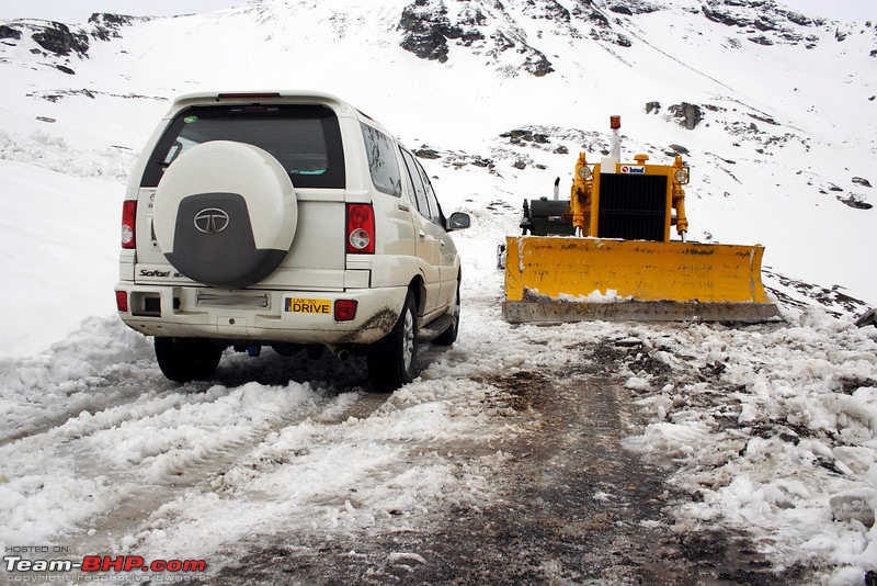
Rohtang Pass, is a dirty pass, with garbage, traffic jams and tourists. However, snowfall can change its character. A white Rohtang is the stuff of legends. However, do remember, any sort of precipitation makes Rohtang all but unclimbable for non 4WD vehicles.
In the past year, BRO has worked real hard to improve the pass.
Once you have the permit, make sure you are at Kothi at 6am. I have heard that now Rohtang will be one way. you go up from 6am-12pm, and then 12-6 you come down. At night its maintenance time. There is also talk about no passages on tuesdays.
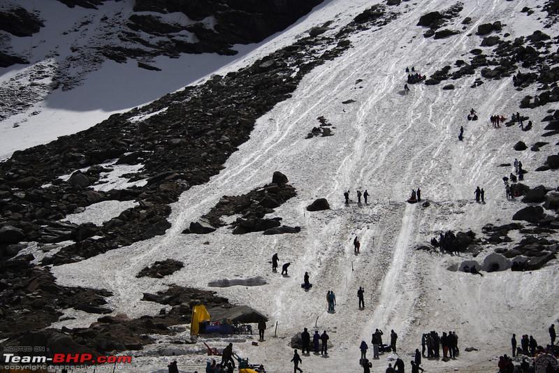
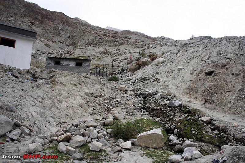
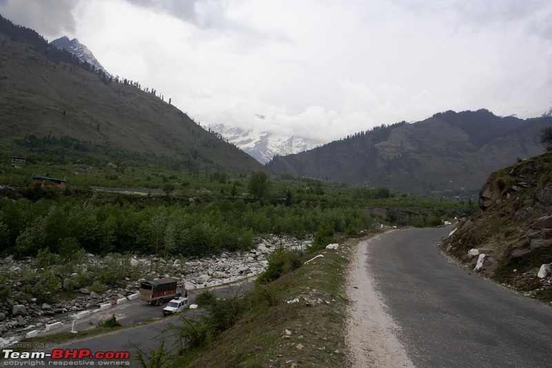
A picture of the views from Kothi

From Kothi, an excellent road goes up, with forests and meadows for view. When there is snow, you will find lots of tourists at Marhi. The road used to be tarred till Gulaba in 2009, but last few years have seen the road go beyond Marhi
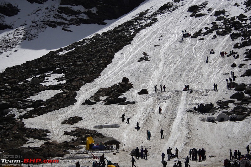
In the early summer months, such sights are common
Within 2 hours of starting from Manali, you will reach the Top, if there are no traffic jams. At the top again there is an excellent tarred road
The descent from Rohtang is easy, and at Gramphoo again the good roads towards Keylong start.
you will pass the truck town of Khoksar, and now you are in Lahaul District.
Most Manali Leh riders take a break at Keylong or Jispa. These are the last places, where you get proper hotel accommodation with hot water and excellent eating facilities.
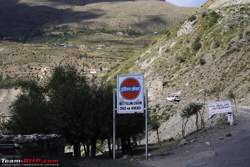
That said, if you do not have enough fuel, do tank up at Tandi, the last petrol pump for 365kms!
Road to Keylong is in excellent condition, except for a few tiny water crossings
If you are a first timer on your four wheeler, I urge you stop at Jispa, instead of the "midway" point of Sarchu.
There are three reasons for that
1. Jispa offers more comfortable accommodation with heated rooms, hot water, allowing you to recharge
2. At 3200 odd meters, altitude is lower, so you get time to acclimatize
3. An early start from Jispa, esp in the early months when snow rules the passes, you miss out the traffic jams which start from 8am onwards.
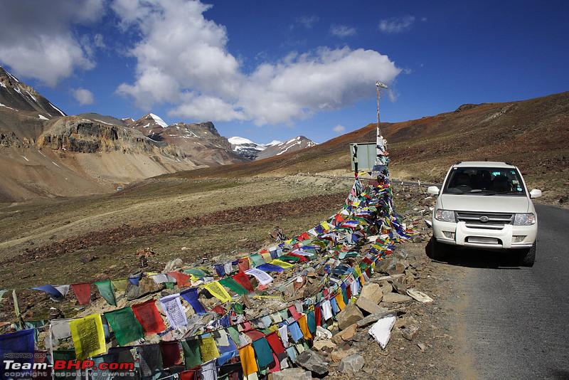
In about 1:30 hours from Jispa, you reach the first pass of your second days journey, or second pass of the trip - the Baralacha La.This pass is also the highest, and usually has the highest amount of snow. You will find snow as late as July on this pass.

On the way to the La, you will also come across two small lakes, Deepak Tal and the Suraj Tal. You are still in Himachal Pradesh, so lakes are "Tal" and not "Tso"
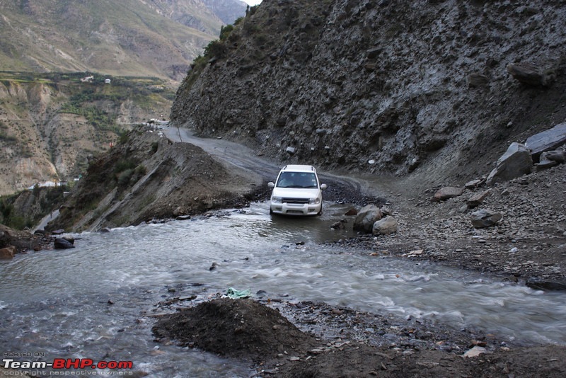
Post Baralacha La, as you descend, you will reach a place called Killing Sarai. The name is apt, for this place kills vehicles. There is a bridge on the river here, which breaks when the mountain wants it to break. When the bridge breaks, you have to wade through deep water. In the dry month of October, even early in the morning we found the water to be a couple of feet deep.
Couple of hours after Baralacha La you are at Sarchu. This is near the HP-JK border, and a favorite with the more adventurous. There are tented accommodations here, ranging from 2000/night luxury tents with attached toilets to 200/night basic tents.
If you must stay here, I suggest staying a night in Keylong anyways, and doing the highway over three days. A night in Manali (2000mts) followed by Sarchu (~4000mts) is recipe for disaster, and AMS can be deadly here.
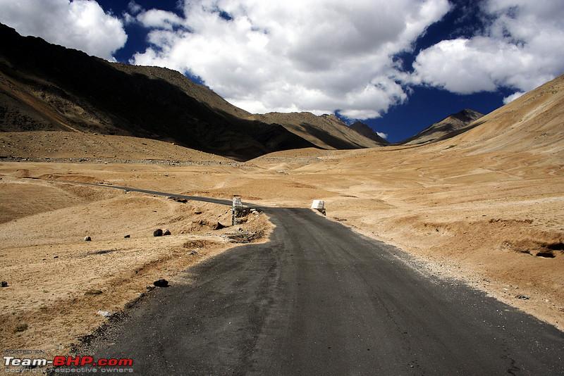
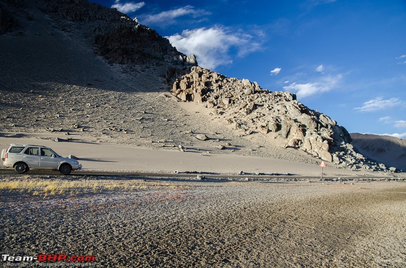
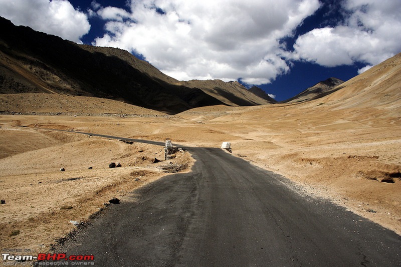
Post Sarchu, you enter Ladakh. The landscape is now truly barren, and if you are driving in September or later, expect clear skies and no traffic. For a first timer, its an awe inspiring feeling. This would be the loneliest road you ever drove on.
You soon hit the famous Gata Loops. There are lots of shortcuts here, but my suggestion, avoid them, esp uphill if you are not familiar with off roading.
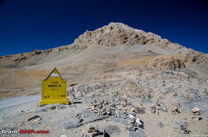
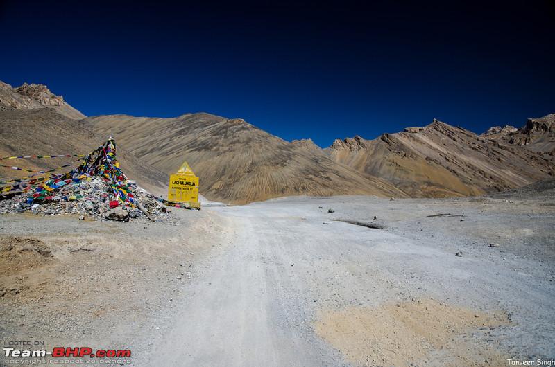
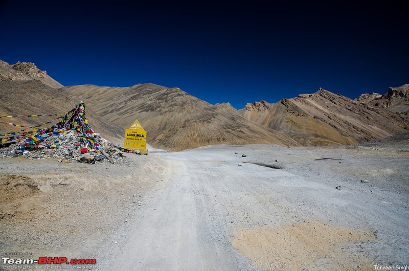
About 2 hours after Sarchu, Beyond the Gata Loops is the Nakeela, and then the Lachungla, 30 minutes ahead.
These two passes come in quick succession, and are quite barren. You are in true rain shadow region here.

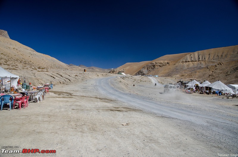
After crossing these you reach Pang, a traditional lunch stop. Some very adventurous people stay the night here, but at 4500mts, its not a comfortable place
Jispa to Pang usually takes a max of 7 hours, with relaxed "photographic driving".
Dhabas at Pang
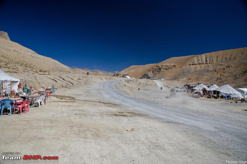
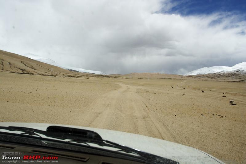
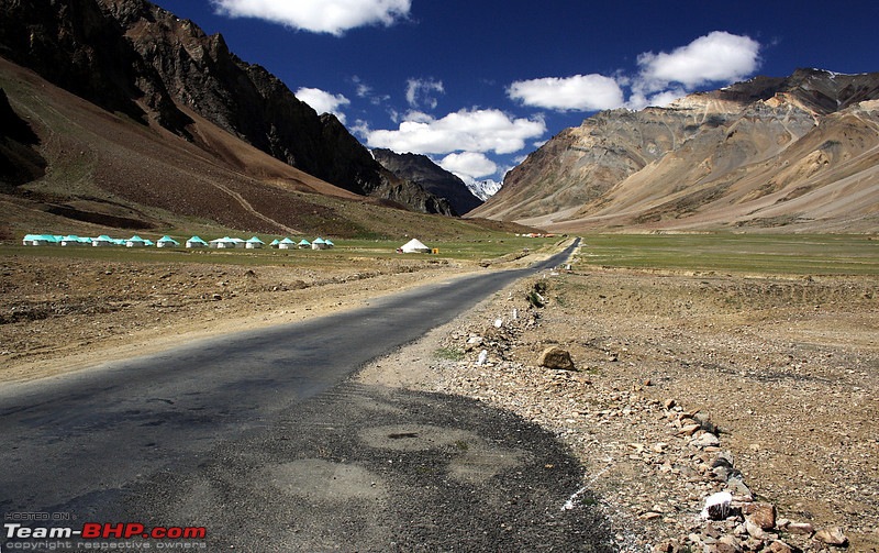
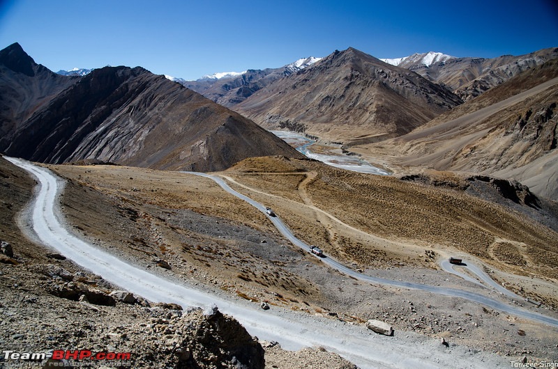
Take your fill of food and drinks here, for now we will cross the More Plains, and head all the way to Leh.
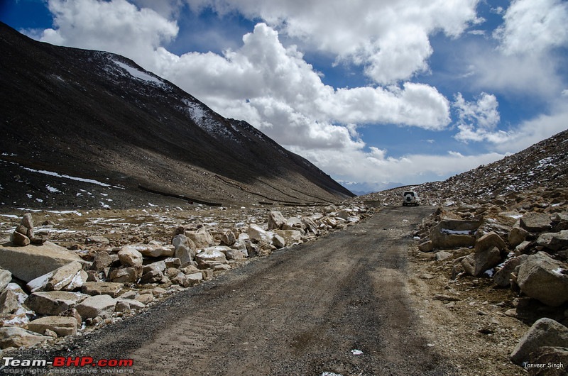
More plains used to be stuff of legends, with dirt tracks capable of sustaining 120kmph speeds, and sudden sand banks sinking even 4WD vehicles. However, now BRO has made an excellent road through the more plains. It may be an invitation to speed, but there are culverts all over for water passage, and they often come without warning. So please be careful
Yes, you wonder, whether its a highway or a runway
The arrow straight road will take you to Debring, the place where a side road goes towards Tso Kar. You need permits for Tso Kar region, so unless you have them in hand, keep going straight, towards Tanglang La
Tanglang La proudly procaims to be the third highest pass, after Khardung and Chang, however, the real story is different.
That said, its a dirty pass with lots of dust. Stop if you must, take a picture and move on
The road after Tanglang La is excellent barring a few bad stretches, and within 3 hours you can be at the outskirts of Leh.
However, it was not always so, and when the road was open, lot of vehicles, even buses used to take the extremely steep downhill shortcut.
Even today, you can see some, as it saves a few km of the road.
However the road is like this, so make your choice wisely!
As you reach Leh, you will first hit Chogmalsar. The locality of Chogmalsar was the one destroyed in cloud burst, however, much has been rebuilt. There is a very reliable petrol pump here. I always get a tank full here instead of the town. I suggest you also do the same. Fuel here is always clean.
Suggested Itenaries: 2 days
1. Manali - Jispa
2. Jispa - Leh
OR
1. Manali - Sarchu
2. Sarchu - Leh
3 days
1. Manali - Sissu
2. Sissu - Sarchu
3. Sarchu - Leh
-OR
1. Manali - Sissu
2. Sissu - Pang
3. Pang - Leh
Hotel accommodation
Hotels with attached toilets and hot water available till Jispa. Keylong and Jispa have good Accomodation suiting all budgets.
Luxury tents available at Sarchu
Basic tents available at Pang
Fuel available at Tandi, and then 365kms later at Karu
Route
Srinagar - Sonmarg - Zoji La - Dras - Kargil - Nimoo - Leh
In stark contrast to the tough and long Manali Leh highway, the Srinagar Leh highway is kind of the easy way to Ladakh.
The road surface is far better, accommodation at popular places is good, and you do not gain too much altitude thus its easier on your body.
Fuel is also available in plenty. That said, the route is not half as scenic or romantic as the Manali Leh highway. There is fair amount of traffic in every season, and its also a favorite with Army Convoys.
When going from Srinagar to Leh, there are two routes.
One is
Srinagar-Sonmarg-Kargil-Lamayuru-Leh
Second route diverges from Kargil, and goes through the "so called Aryan" villages of Dha and Hanu.
We will cover the Dha and Hanu route as separate circuits. Dha Hanu route requires inner line permit from Leh, so you need to have permits in advance if you do that route.
Coming back to the normal route, the journey from Srinagar is like driving in the plains. Till 90kms from Srinagar, or 2 hours give or take a few minutes, the road is simple and straight.
Watch out for taxis and trucks though. You will find the rashest of drivers here, cutting lanes, honking, and giving no thought to nicking your bumber.
Many taxis have a sticker which says "Risky Job". Take it seriously, and keep as much distance as possible from these.
Another thing you will notice on this route is the Army. There is Army everywhere. On the road off the road, in the river, across the river, on the peaks, on the meadows. Before Kargil 1999 happened, the enemy could take pot shots on the Dras-Kargil stretch.
Now, there is just army. No snipers taking shots at the vehicles. The route is well done, except for the Zoji La, but then its nothing compared to the mess that is Rohtang.
True alpine scenery comes into view at Sonmarg 90kms away
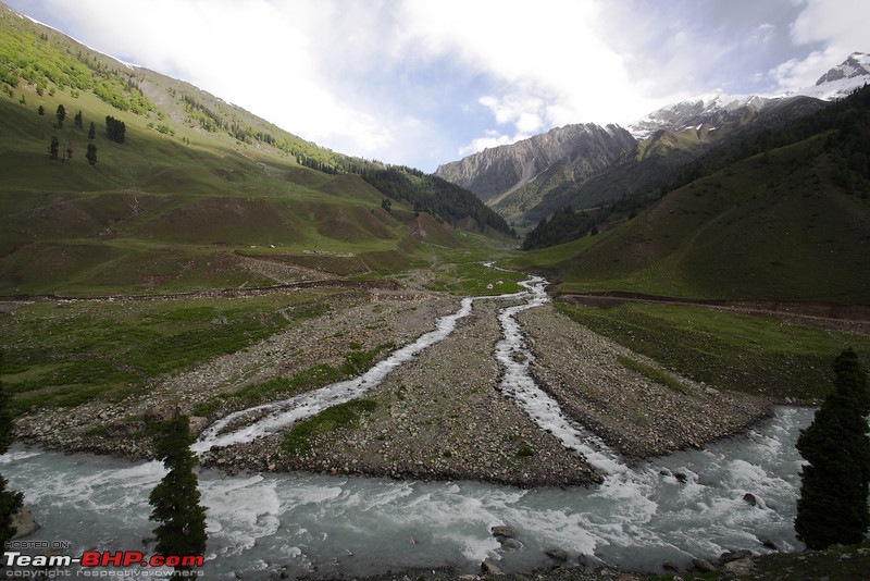
If you can make it to Sonmarg from the plains, I recommend staying here instead of Srinagar(unless you actually want to see Srinagar).
There is good accommodation available here, and the town is fairly lively.
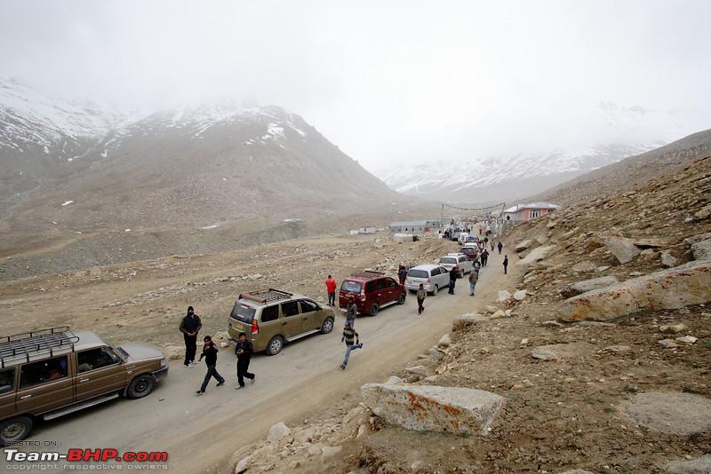
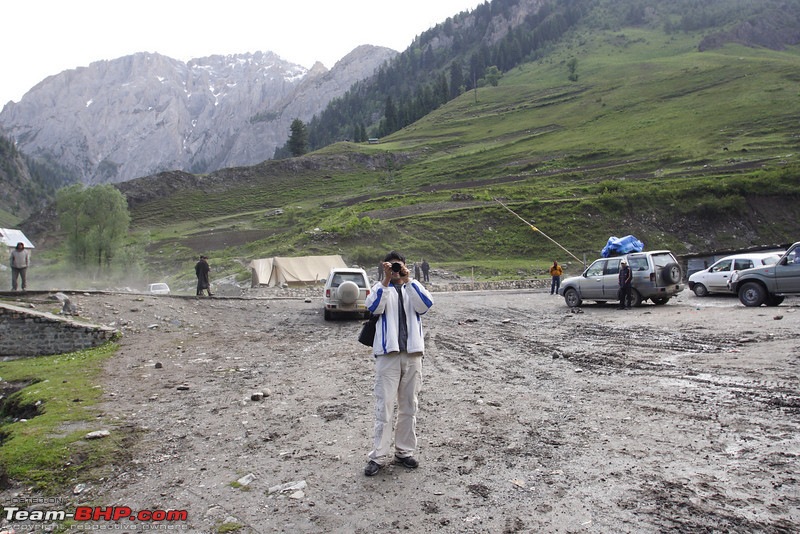
Immediately after crossing Sonmarg you will reach the checkpost. Based on the direction of winds in the Russian Jetstream, the up and down times of traffic are decided. Sometimes, it depends upon what the Japanese ambassador to Australia had for breakfast.
So, staying in Sonmarg for the night will also let you know in advance about when do the "gates" to go up open.
Thankfully, this system is in place till late August. In off season, you can come and go anytime.
If you do find the gates closed, do not fret. Just take out your camera and click pictures. Like I did. Eventually the gates will open. If not now, few hours from now
So why worry?
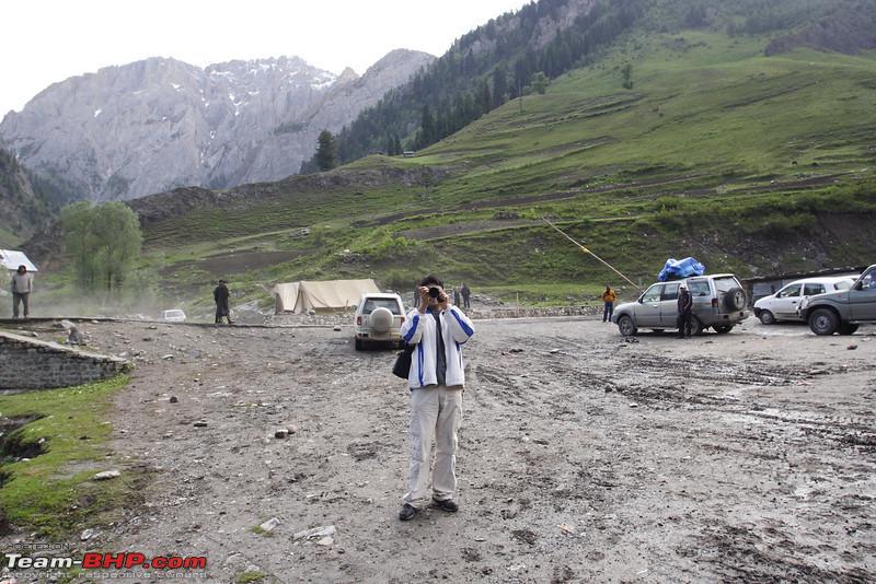
After this "gate" starts the climb to the Zoji La. For people coming back from Leh, Zoji La pass is like a breath of fresh air. The green hits you hard. After so many miles of brown and red, there is so much green. All over.
Zoji is a low altitude pass, by Ladakhi standards, not even touching 4000m. However, what it lacks in altitude, it makes up by snow. This pass is the gate from which the western disturbances enter the Ladakh region, and on the way dump tonnes of snow. That said, this is the the only heavy snow pass on this route, so by first week of April, its usually clear, and with it the highway to Leh. It closes farly late too, by end November, and sometimes even later.
They are now building a tunnel underneath this pass, which will make the Leh route all weather.
ZojiLa in June

As you descend, lovely meadows come into view. I suggest, you rest, and enjoy the views. This the loveliest region of this road, yet nobody stops here. In the month of June you can see many small glaciers giving birth to mini falls. The grass is a heady green, and some wildflowers also dot the mountain sides.

In the months of September and October you can witness shades of brown and yellow, as autumn comes to the mountains.
Soon after leaving this area you are in Drass. I takes about 3 hours to get to Dras from Sonmarg. When the tunnel is done all it will take is 1.5 hours.
Dras is famous for the war memorial. This is dedicated to the soldiers who laid down their lives during the Kargil 1999 conflict.
The complex also houses a museum with rare pictures of the conflict taken on site during the war

An hour and a half later you are in the town of Kargil. Many people break the Srinagar-Leh journey here, yet others who do an early morning start from Sonmarg get to Leh on the same day.
Kargil is a major town and boasts of many places to stay and a variety of eateries.
On the main street of Kargil sits an old guy making Kababs. Sometimes, his Kababs are very good. At 20rs/stick its quite economical.
Also take fuel here as its the last pump till Leh
After Kargil, it gets more barren and barren, and then the only green oasis you see are the small towns.

Kargil to Leh is an easy 7 hours max, and you cross two easy passes on the way. Around 20kms from Kargil is the town of Mulbekh, famous for the rock cut Buddha
The first is the lower Namika La. It means "Pillar in the Sky" or "Fingers in the Sky" depending upon who did the translation from original language.
After this comes the highest pass of the Road, the Fotu La.
Compared to Manali Leh highway, this road is mostly tarmac with few potholed stretches. Even a low slung car can do this route with low difficulty.
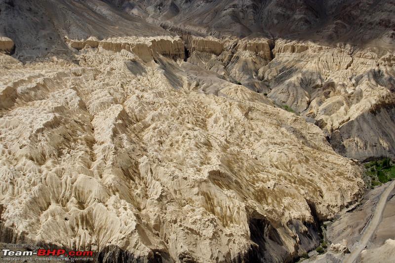
An interesting sight on this highway is the Lamayuru Moonland

Lamayuru is barely 3 hours from Leh, and is an important seat of Buddhism. Its also the gateway for trek routes into Zanskar, so you will find lots of European tourists here. While some come for salvation, most are here to do the trek to Padum.
After Lamayuru, the road turns from ordinary to extraordinary. So much so that there is a signboard which says "Its a highway, not a runway"
However do watch your speed. Corners are blind, and unexpected dips can make you lose control. Sometimes, there is rockfall right around that delicious drift invitation corner.
Near Leh you will come across the Magnetic hill(actually a scam, which does not cost you anything though) and the Pathar Sahib Gurudwara, and 30 minutes later you are in the City of Leh
Suggested Itenary from Delhi Fastest
Day 1 - Delhi to Patnitop
Day 2 - Patnitop - Sonmarg (Proceed to drass if gate open in evening)
Day 3 - IF previous day evening gate was closed, it means traffic from Sonmarg side is let off early morning - Proceed to Leh from either Drass or Sonmarg
Slow
Day 2 - Patnitop - Sonmarg
Day 3 - Sonmarg - Kargil
Day 4 - Kargil - Leh
Fuel available at Srinagar, Near Sonmarg, Kargil, Near Lamayuru/Khalste(Not always through, pump can be out), Leh.
Tankful at Srinagar, and then at Kargil, or if you have a 65 liter tank SUV, Srinagar Leh can be done on one tank, but best to take fuel as landslides can sometimes have you stranded needing to go back and forth
Hotel Accomodation
Srinagar - Lots of hotels
Sonmarg - Some hotels. In season best ones get booked and you may have to stay in a dingy damp sort of lodge opposite JKTDC.
Drass - Apart from JKTDC very few options
Kargil - Lots of hotels
Mulbekh - Some guest houses
Lamayuru - Many Guest houses available
The Manali Leh highway, but via the Kaza route was earlier done by people who wanted to combine a spiti trip with Leh trip.
However, the Rohtang Permit issue, and the gazillion traffic jams right after Manali have prompted people to go via Kaza.
Some also make it a statement where they do not want to enrich the coffers of the Manali adminstration, which they feel, is in cahoots with the local taxi association.
Nevertheless, this route will add one day atleast to your travel plans.
Typically, a Delhi person can do Manali - Leh in 3 days as
1. Delhi - Kullu (12hrs)
2. Kullu - Keylong (8hrs)
3. Keylong - Leh
Some even do Delhi Manali on day one.
For the Kaza route, the fastest way from Delhi is
1. Delhi - Rampur(12 hours)
2. Rampur - Kaza (12 hours)
3. Kaza - Keylong (9 hours)
4. Keylong - Leh
But do note, the road is very unstable in monsoon in Kinnaur region, esp Recong Peo area where there are frequent landslides.
Once you cross losar you begin climb to Kunzum pass.
The stretch from Kunzum Pass to Gramphoo (Base of Rohtang after coming down from Manali side) is pure hell, with rocks, water crossings, and a surface which constantly pounds the suspension.
If you are looking for a time saver, it makes sense to stay back in Manali an extra day for permits, or arrange through travel operator.
However, if you are set upon the Kaza route, do take a diversion to Chandertaal. Its s 12-13kms drive followed by a 500mrs trek. All in all, its a 3 hours diversion at the most, but totally worth it.

Chandertaal is on way down from Kunzum when you are going towards Keylong. The road is narrow, and vehicles with large turning radius like Safari can have a tough time.
After Chandertaal you get on the road to the base of Rohtang(Gramphoo)
Most of the surface is like this or worse
Sure the scenery is amazing, but if you are in a small car, do not attempt without a sump guard. With no mobile signal and few vehicles, esp in off season, you could be stuck here a long time.
Fuel Availability
Fuel is available in Kaza, but do not count on it. ITs best to tank up at Reckong Peo(you have to take 5kms diversion from main road)
Rekcong Peo to Tandi is less than 400kms, so even if you do not get fuel at Kaza, you can make it to Tandi. That said, carry a 20Lit jerrycan in hand to prepare for emergencies
Rekcong Peo is the headquarters if Kinnaur district, and is ~210kms from Kaza. Its also the gateway to Kalpa. a high perched village famed for views of Kinner Kailash and Apple orchards.
Hotels and Accommodation
Uptil Narkanda - Lots of hotels for every budget
Rampur (2hrs from Narkanda) - HPTDC is mostly available, but is hot in summers
Reckong Peo - Many hotels, but crowded town
Puh - A few guest houses
Nako - A few guest houses
Tabo - A few guest houses
Kaza and around - Some hotels, but mostly small guest houses
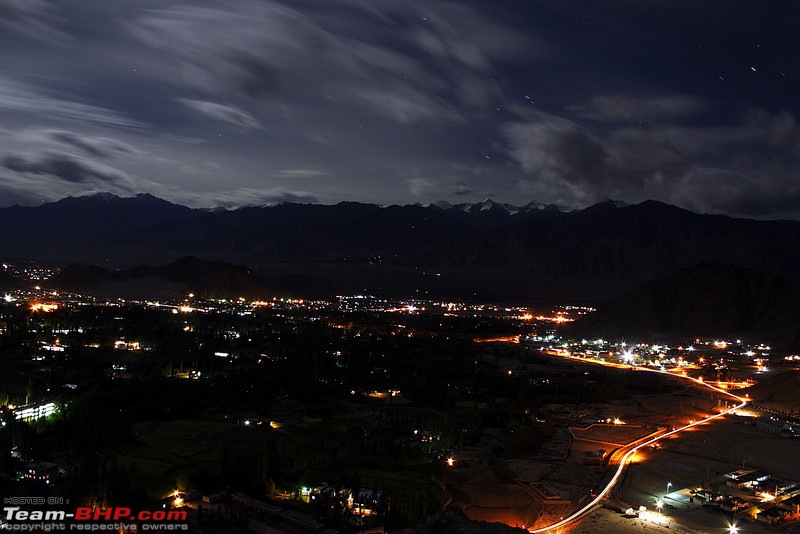
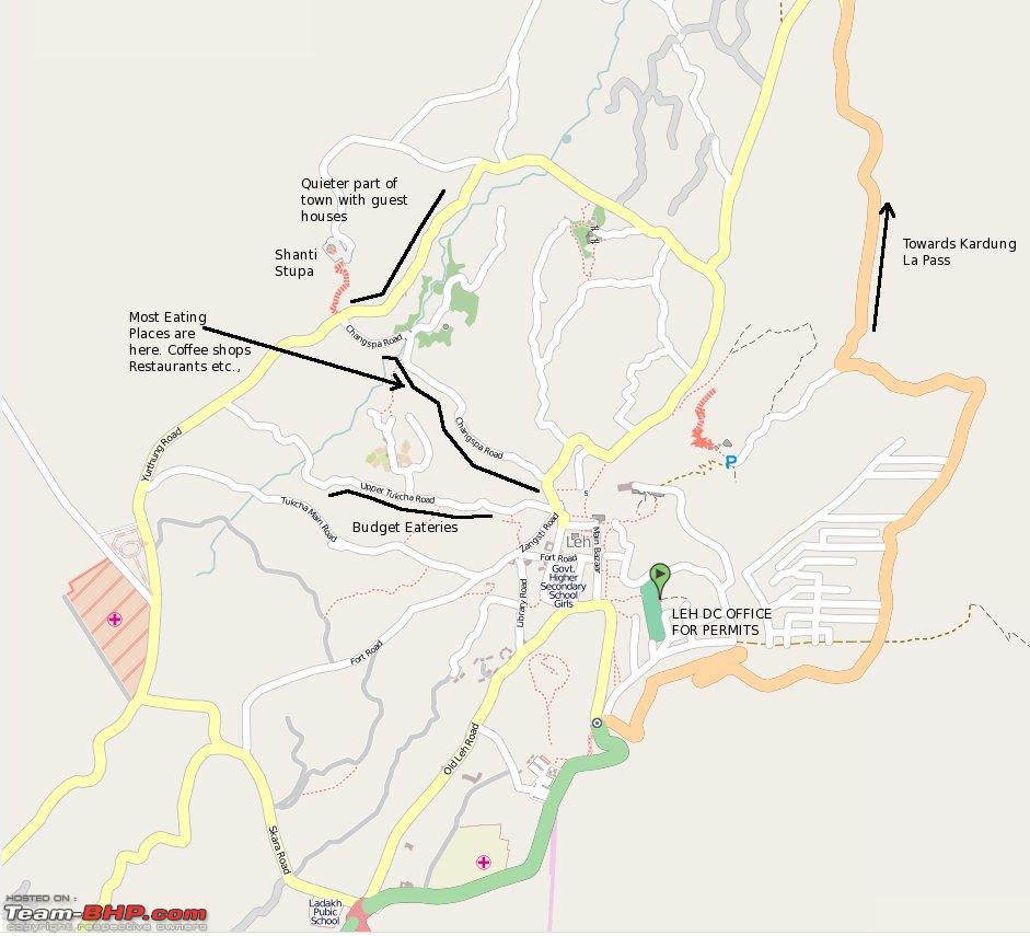
Leh is the capital of Ladakh, and also the seat of govt. The location of the city is somewhat central for most excursions in the region, and hence people make it kind of a base camp. Availability of comfortable accommodation, suiting every budget and air as well as road connectivity makes this a favorable location.
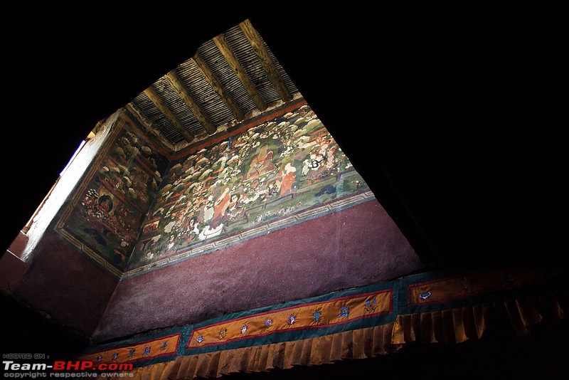
So what do you see in Leh. The obvious first answer is Monasteries. Leh was a seat of power for centuries, home to kings and monks, and also on the major trade routes. So there are a lot of monasteries to see. Unless you are an ardent follower of the Mahayana Buddhism, you won't see more than one or two.
I would not go into the details of monasteries here, as all over the internet there is enough information available about the historical significance and importance of various monasteries. There are also "festival" calendars, such as this one
http://lehladakhtourism.com/fair-and-festival.html
If your primary goal is "culture" then its best to contact the DC office and get all your details.
However, if you are like most tourists, and are here for the mountains, you can skip the monasteries altogether, or just see one or two. Usually, tourists go for the famous ones like Hemis or Thiksey. Stakna is good, esp when seen from outside
Pic Courtesy : Rudra Sen

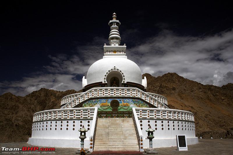
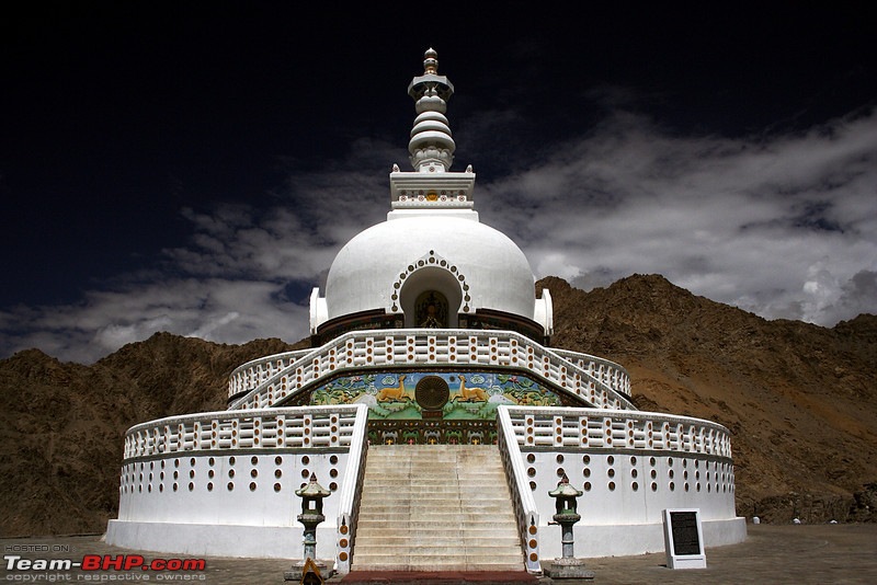
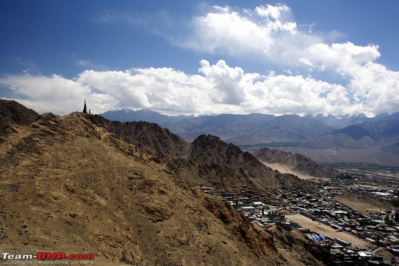
Right inside the city, a must see site is the Shanti Stupa. Gifted by the Japanese, this offers a birds eye view of the city. The location and the views attract a lot of people
Apart from Shanti Stupa. you can head to Leh Palace too.
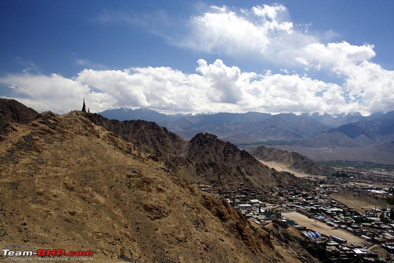
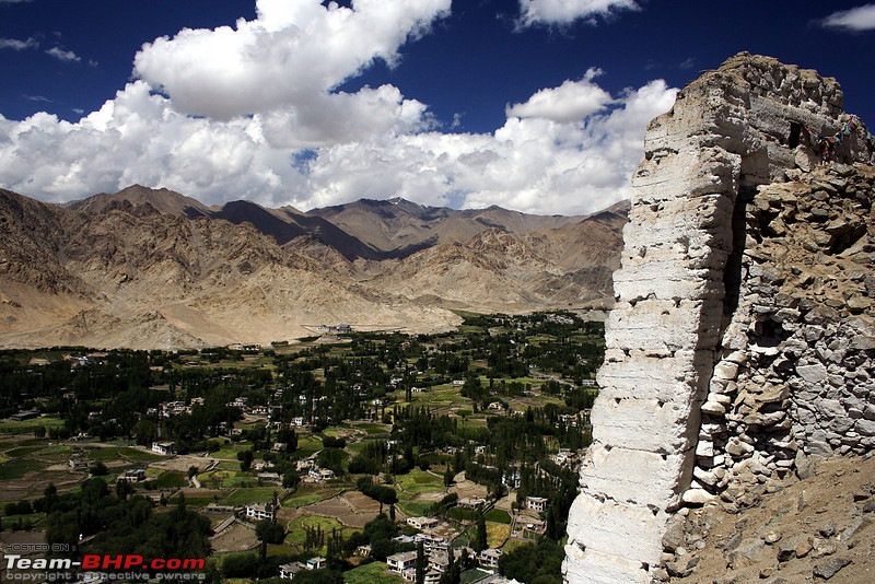
But the real adventure is the climb to Castle Tsemo, which offers even better panaromic view of the city
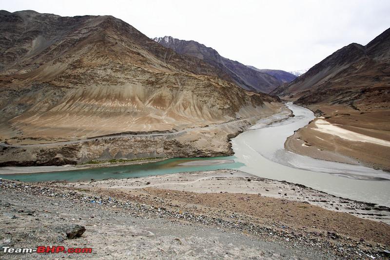
After you are done with this, there a a few other "obvious must see" places. They are the famous tourist trap of Magnetic hill, the confluence of Zanskar and Indus river, and the Gurudwara Pathar Sahib, a Sikh shrine managed entirely by the army.
These places lie on the NH 1D, the Srinagar Leh highway, and as you head on the road from Leh, you first come to Gurudwara Pathar Sahib. The Gurudwara serves excellent Langar on Saturday and Sunday.
Most people stop here and go on their way, and as a result they miss something amazing.
On the hill opposite the Gurudwara lies the Nishan Sahib of the Gurudwara. Its 600 stairs up.
The top gives you panaromic view of the mountain ranges, and the world below
Few kms ahead is the Magnetic hill. The Leh Taxi union rate sheet shows 2600rs per vehicle for Leh - Gurudwara Patthar Sahib - Magnetic Hill - Confluence trip. This 60kms round trip actually is one of the most lucrative for the taxis, because the road is very good, and distance is very less.
At the hill, due to an optical illusion it appears your vehicle is going uphill. Your driver will tell you stories about how airplane and helicopter do not fly overhead lest they be pulled in by the magnetism. But the truth is that a rubber ball also moves upwards. If you really want to do something at Magnetic hill, try breaking the white elephants record for hill climb on the hill opposite.
http://www.youtube.com/watch?v=exiYexW-cks&noredirect=1
And this brings us to the fourth location, the confluence at Nimmu. Approx 30kms from Leh, the hill gives you a view from the top.

The silt in Zanskar river is due to road construction. In a few years time, it will be an easy run to Padum in Zanskar when the all weather road is made.
And that brings us to the Leh and around.
A word of advice. Even if you have permits before hand, spend two nights in Leh. This will aid in acclimatization. If you are short on time, go to Nubra at 3000mts (300mts below leh). Its better than heading to much higher Tso Moriri or Pangong immediately during the start of your trip.
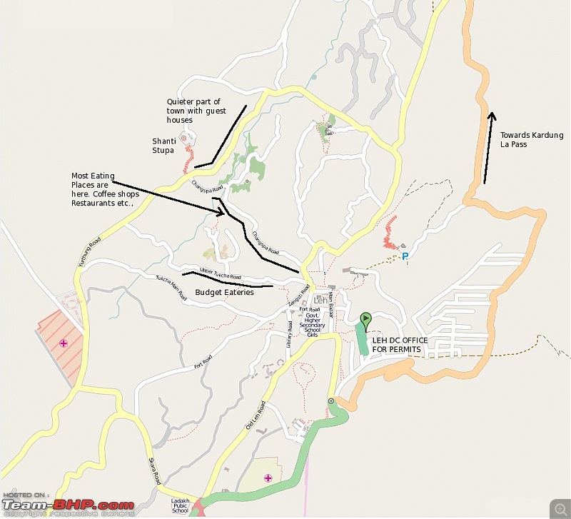
Google maps has a very detailed map of Leh city with most places like Restaurants, Guest Houses and Hotels marked.
Seasons
April,May,till Mid June - Mid-Low season, guest houses available
Mid June - July - August - Peak season, there can be difficulty in accommodation on all legs
September - Mid occupancy, Most tourists are leaving, easy to get accommodation as days get shorter. Places like Pangong get much colder and accommodation is easier, snow also vanishes
October - Last leg. Roads about to close. Hardly any tourists anywhere. Some guest houses may close down
Nov-Mar - Winter, Road routes close down. Only option is to fly in. Temperatures go to -15 in Leh, and upto -25 in places like Pangong. Hanle area can see -40 also. Most Guesthouses close down. Few remain open. Extremely harsh season to visit. That said, most Leh Passes are open.
Route
- Leh - KhardungLa - Turnoff in Valley
- Turnoff - Panamik
- Turnoff - Diskit - Hunder - Turtuk
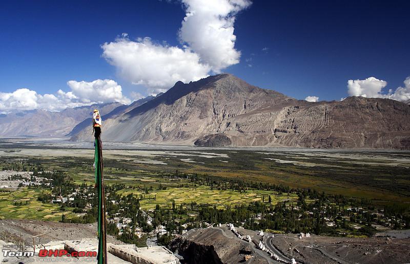
Nubra valley lies to the North of Leh. Its a popular tourist destination due to two reasons.
One, the white sand dunes with Bactrian double hump camels, and second, driving over Khardung La pass. Khardungla Pass holds the record for the "highest height signboard" on a pass in India, and also the world record for the most number of signboards on a pass. Some believe its the highest pass in the world, but it never was. Infact, its not even the highest in India. However, its height marker is very optimistic, like all old passes cut before the advent of GPS. Only newer cut passes now carry accurate height information.
Nubra valley can actually be considered to have "2 arms". The left arm goes to Diskit, the sand dunes of Hunder, and then all the way to Turtuk, a village just 17kms from the India Pakistan LOC. You can go upto Turtuk, but make sure your permit form says "Turtuk, Nubra".
The second "right arm" goes all the way to Siachin(tourists go till Panamik Hot springs". Though there are no sand dunes or camels to play with here, this arm is very scenic. The hot springs however are dissapointing.
Our journey to Nubra valley starts from Leh, towards the Khardung La pass. The first common stop is the Khardungla Frog, a grosteque piece of sculpture. I wonder who put it there. The climb to Khardung La is surprisingly gentle, and the road surface is quite good, barring a few kms at the top.
Your first check point is South Pullu, where permits are checked. Often this is the location of traffic jams whenever there is heavy traffic. If you have spent just one night in Leh after a road trip, or just two nights after a flight into town, head down on encoutering a traffic jam. At over 4000mts above mean sea level, I have seen people getting seriously ill.

Few kms later, or approx 40minutes, you reach the K.Top, which has dirty toilets and lots of garbage. Its best to move after a quick photo top
After Khardungla its time to head down. In the month of June, there is lot of snow there, but from July onwards, melt is fast, and by September, its all brown.
The road on the Nubra side is much better with smooth tarmac. About 4 hours after you start from Leh(Provided no jams), you should be in Deskit, the "headquarters". Diskit has a defunt petrol pump, and lots of hotels. It also has a famous Gompa ad a Giant Buddha statue overlooking the town

Most people stay in Diskit, but I would suggest go to Hunder 10kms ahead, as its much more scenic. Turtuk village is a good 90kms from Diskit, but an excellent road means less than 2 hours of drive.
Most of the tourists stay at Hunder.
There is also an "offroad route through the dunes" for diskit. The route origin is here
34.55393, 77.53635 -> Take the dirt track originating here parallel to the main highway. You would need to cross a small river also if the dunes shift and bury the track. Going through dunes can be tricky

The Second or right Leg goes to Panamik hot springs, which are quite disappointing. However the route is quite scenic, with scenic villages like Sumur. Sumur has quite a few accomodation options, and people wanting to stay away from tourist circuit often stay at Sumur.
Further down the road, probably an hours drive away, lies the Military town of Sasoma, the gateway to Siachin. From there head tracks and trekking routes over Saser La into the Depsang plains. The adventurous also try climbing the peaks of Saser Kangri etc., in the area. That said, I have never seen Leh adminstration giving anybody a permit to these regions. However, if you really want to go there, an easy way is to give up the Indian citizenship, and become a foreigner. After that, a group of 8 needs to pay just 4000$.
If you are already a foreigner, the details can be had from Indian Mountaineering federation.
http://www.indmount.org/aboutclimbin...aineering.aspx Hotel Accommodation
Diskit - Hotels and Guest houses
Hunder - Guest Houses
Turtuk - Guest Houses
Panamik - Guest Houses
Sumur - Guest Houses
Permit form
Write Turtuk,Nubra,Panamik
 Route
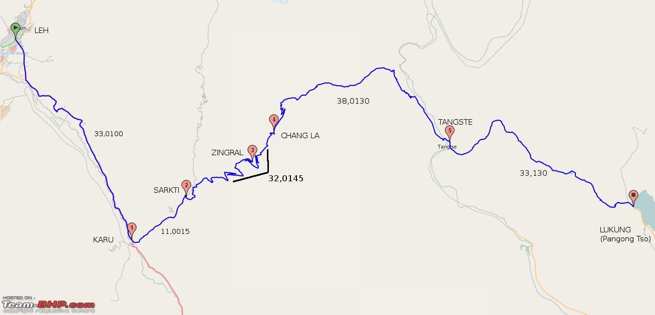
Route
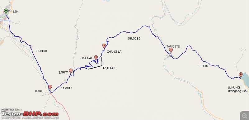
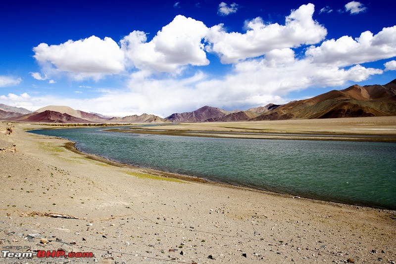
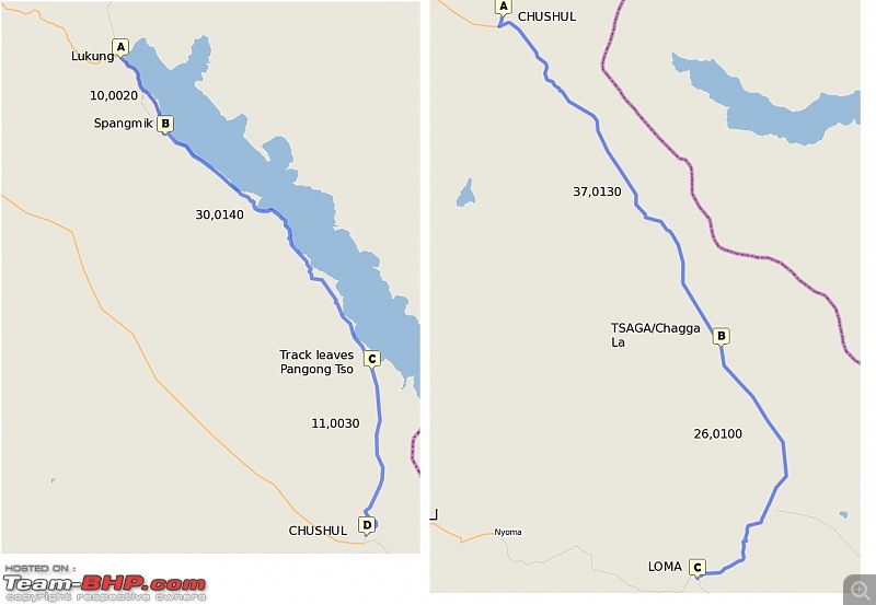
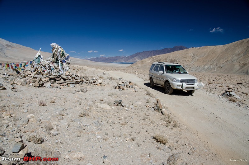
Leh-Karu(Take left),Sarkti(Take right fork towards Chang La) - ChangLa - Durbuk area(Take right) - Tangste (Take left, right goes to Erath,Chushul), Pangong
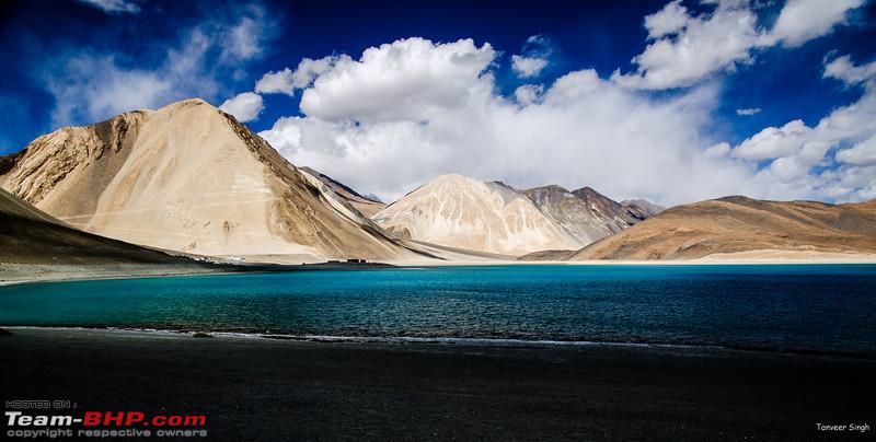
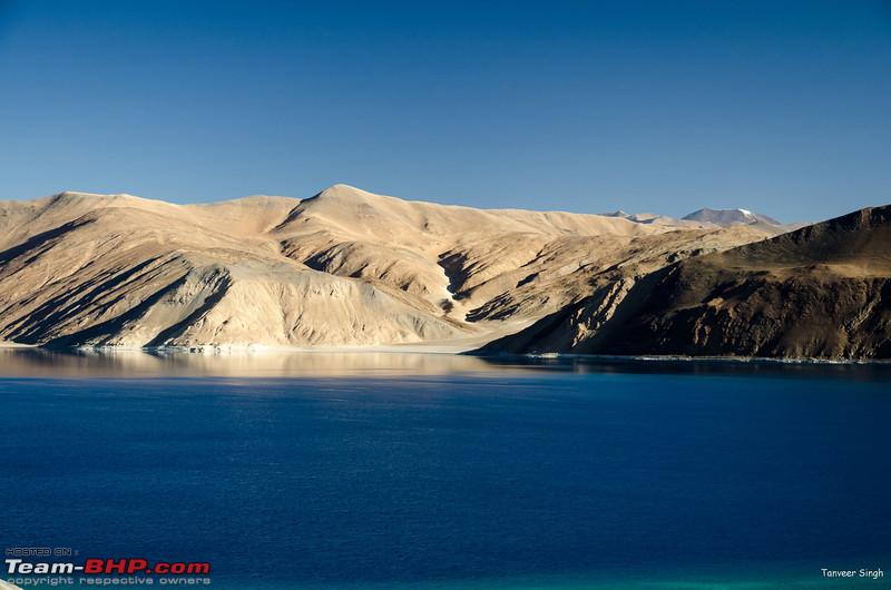
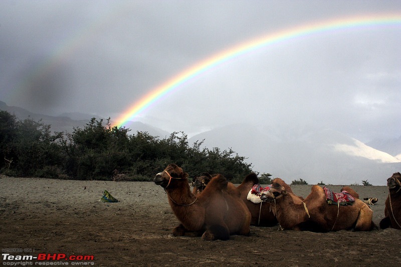
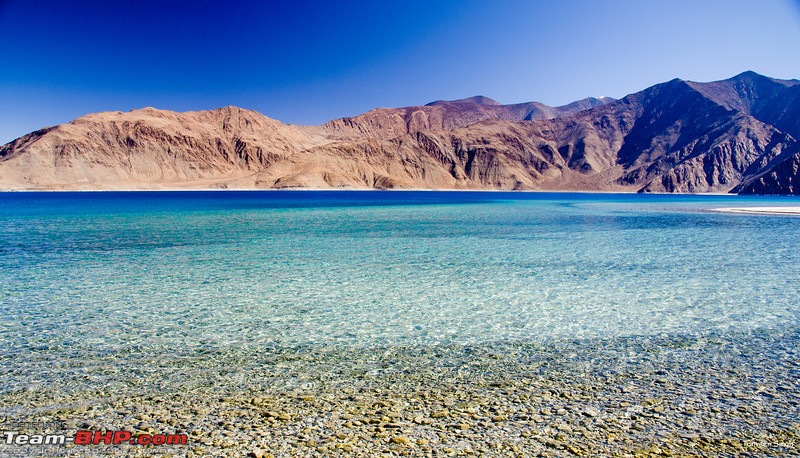
Pangong Tso is a high altiude salt water lake, or rather an inland sea, partially in China and Partially in India. Before 1962, a lot more of the lake was in India, but now a large part is occupied by China.
Pangong Tso has always been the most popular destination in Ladakh, however, the interest peaked, when movie 3 idiots was shot here. The three idios came and went, and now more than three thousand come, and leave behind their garbage and litter.
However, the beauty of the lake is still unparalleled, and its on the must do list of every visiter.
The road to Pangong Tso diverts from Karu on the Leh-Manali highway. Karu is also the last petrol pump on the route. After turning left, you reach the idyllic town of Sarkti, now renamed as Sakti. Some consider this a form of cultural terrorism, i.e. renaming towns, villages, and even sacred hills to suit the sensibilities of the people from the plains.
Sarkti means "Golden Throne".

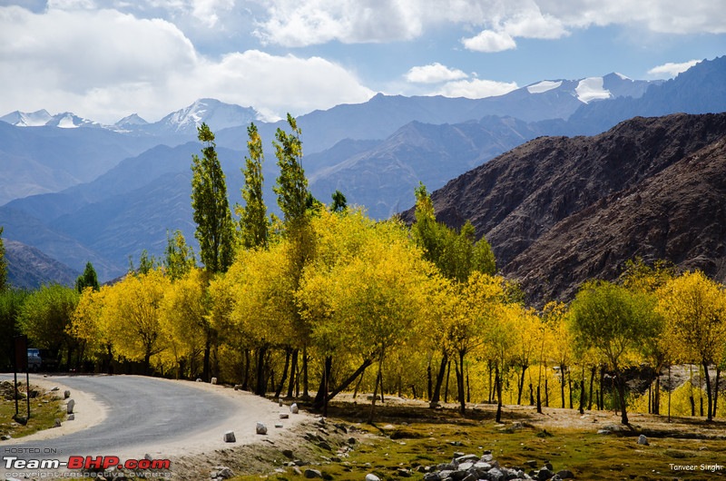
Most people, in their rush to climb the famed Chang La pass, often ignore this place, but the fact is that its one of the greenest and loveliest villages of Ladakh. In Autumn, you can see the trees turn a bright shade of yellow. In the land of brown, Sarkti shines like a Green oasis in most of the summer months.
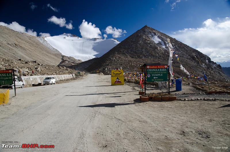
Post Sarkti starts the climb to Chang La Pass, which is steep. However, the road surface is quite good. Two to three years back, Chang La pass road was very bumpy and rocky near the top. Therefore maintaining enough speed to not stall the engine on the steep climb was difficult. But now, its good roads most of the way.

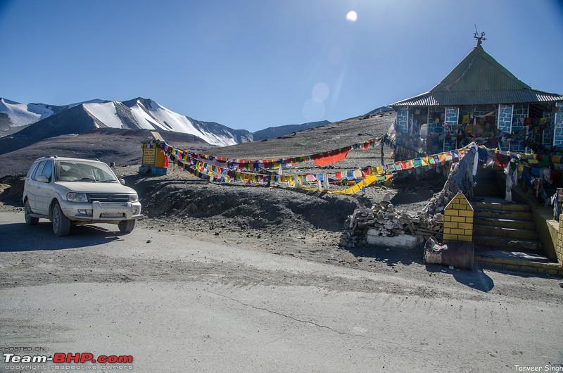
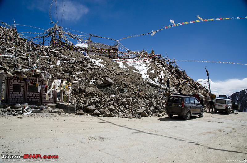
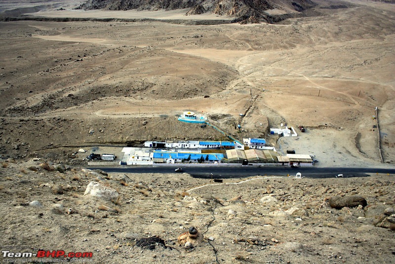
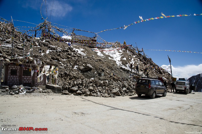
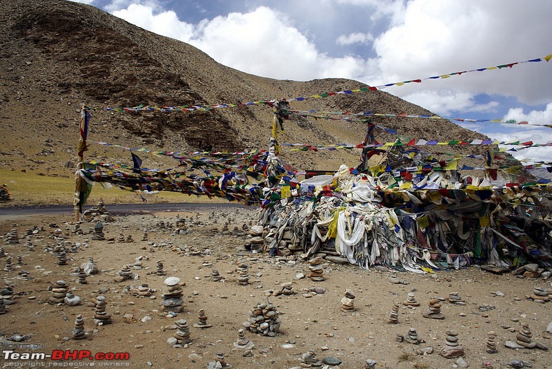
At the top there is a shrine of Chang La baba, and lots of prayer flags, like the other Ladakhi passes. The Army also provides tea to tourists(there is no charge for this service).
This, coupled with the souvenir shop makes the top a popular place, though not so much so as the Khardung La.
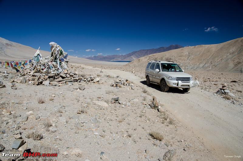
After the Pass the topography changes dramatically, with green all but vanishing. Till tangste, there is no major village, and all you find are Army camps. Five hours after Leh, give or take a few minutes, you will find yourself in the town of Tangste. Before the idiots, Tangste used to be the last place where you could find guest houses with proper toilets and other facilities. The lake side had basic tents. But now, you can get a room with attached bathroom right at the lake itself, which is around 35kms from the town of Tangste.
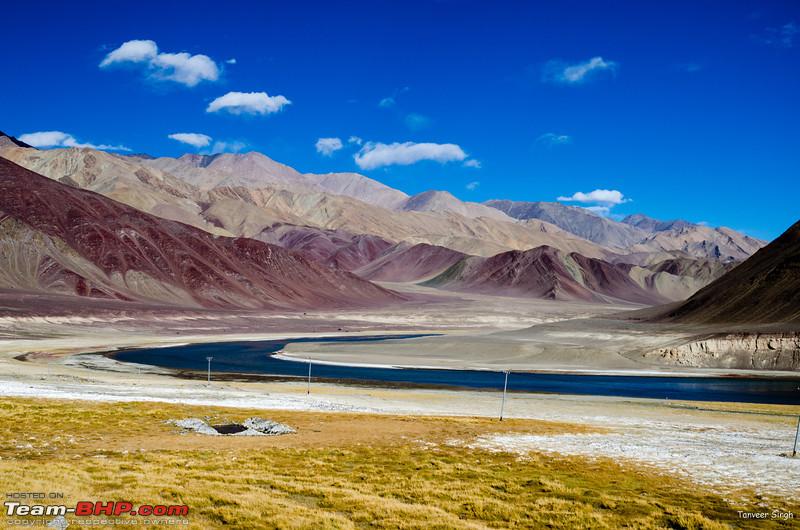
The route is very scenic, and few kms before Pangong you will see the small lake of Chagar Tso. In their rush to get to Pangong, most tourists forget this little jewel. Location -> 34.000250,78.335158
Post this, there are grasslands where the Mormots live. They often pester tourists for food, and being cute they get it too, but I would suggest refrain from feeding wildlife

This wide valley is full of their holes

Before 2010, the road to pangong meant crossing the dreaded pagal nallah, which was tough even in 4x4s due to deep water and loose round stones. Many a people saw their pangong dreams shattered, as the water level rose too much for small cars or even 2WD taxis to go through.
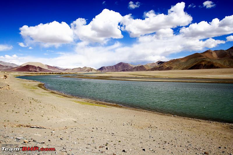
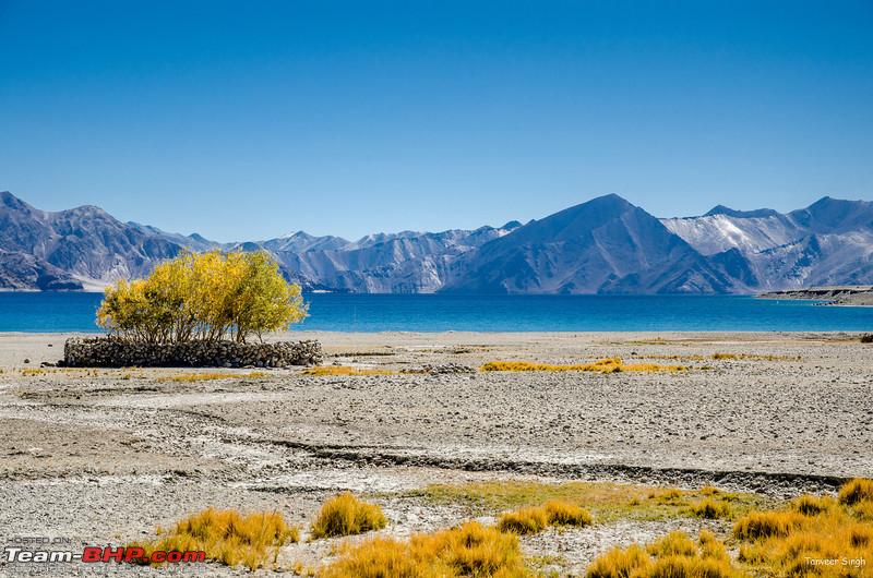
But with a new bridge, now everybody can get to Pangong. If you are a first timer, nothing will move you more than Pangong, such is its beauty

The point where Pangong Tso starts is the village of Lukung, offering accommodation and food. Army runs a very efficient canteen here. Most people eat at the Army canteen due to great food and even better prices.
Though over eighty percent of the tourists coming here are day trippers, some choose to stay the night, esp in the month of July when the weather is kinder.
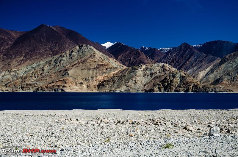
With Pangong Tso permit, you can go upto the village of Merak, which has some home stays. If you plan to stay the night, I suggest going atleast till the village of Spangmik, about 10kms away. A couple of years back, these 10kms could take over an hour due to the extremely bad road, but now well paved Tarmac follows you to beyond Spangmik. Only after Spangmik does the road turn into a dirt track, but villagers say that its going to be all tar in a couple of years time.
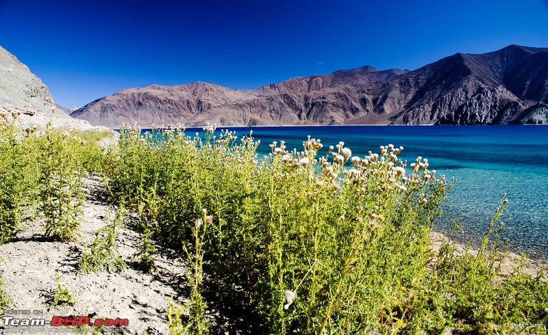
On the banks of Pangong, there are many "beaches" where tourists love to frolic. Take your vehicle, but beware, the sand is tricky, and it does not take long to sink badly.
A 2WD taxi followed us, and had to be rescued
http://www.youtube.com/watch?v=SIxss...ature=youtu.be
Some sections are very soft, and even 4x4s can have trouble. So if you are in doubt, park your vehicle near the road, and walk to the lake. Its a great spot to have a picnic, but do not litter. Many tourists leave bottles and other junk here. If you find some idiots junk, pick it up, and throw it in the dustbin near the Army canteen.
You can camp at the lake, but you have to stay on the right of the road while going from Lukung side, i.e. your tent has to be placed on the mountain side of the road, and not the lake side. Nobody checks, but if forest dept catches you its a heavy fine if you are camping on the lake side.
Also, building fires is prohibited.
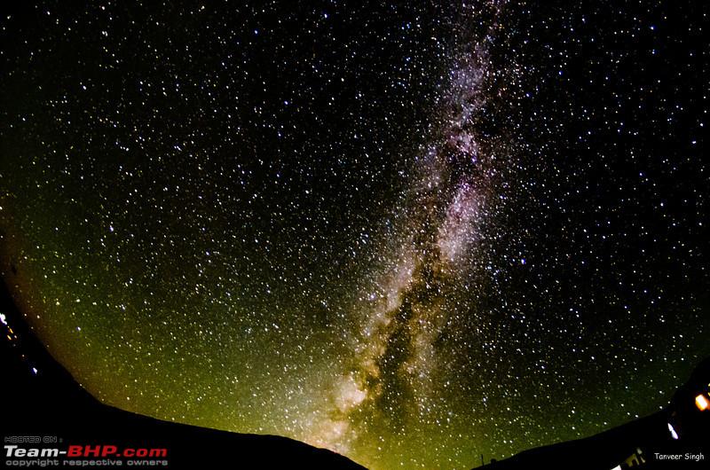
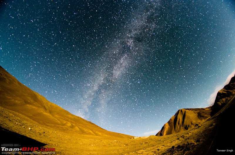
If you are a fan of night photography, Pangong is a great place to catch the milky way, esp when the moon is low
 Accommodation
Tangste - Guest houses
Lukung - Guest Houses
Spangmik - Guest Houses
Maan/Merak - Home Stays (Getting attached toilet difficult)
Permit Form
Write Pangong
 Route
Route
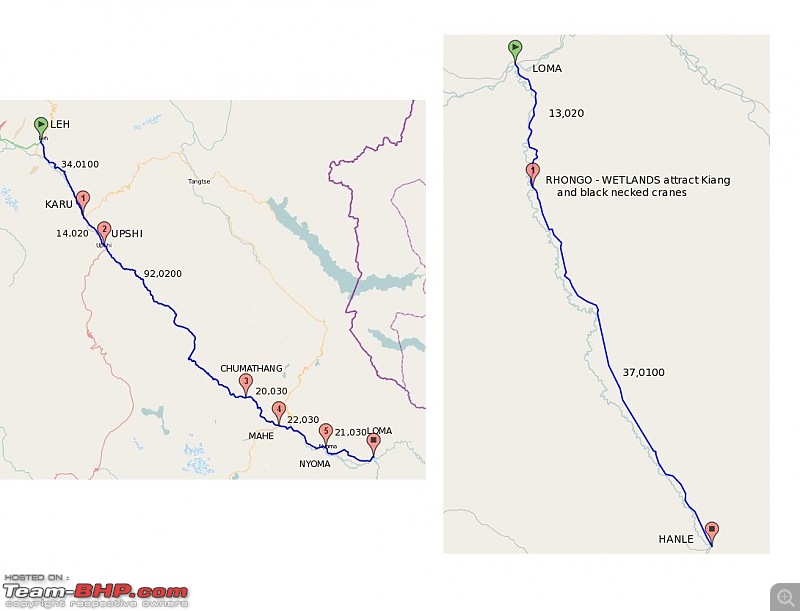
Leh-Upshi(Take left)-Chumathang-Mahe(Proceed straight)-Nyoma-Loma-Hanle
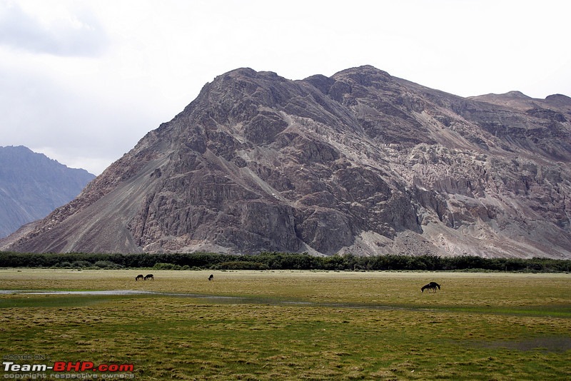
Almost diametrically opposite the Nubra valley, lies the Changthang Desert. The Nubra is tame and Benign, and in comparison, the Changthang is wild, really wild.
And it attracts a special kind of visitor. One who is not a stranger to roughing it out. Most ignore this region, prefering a camel ride on a tame beast, or simply looking at the well advertised beauty of Pangong Tso.
As far as the Changthang is concerned, its mostly ignored, on websites, in books, in itenaries of the travel agents. And the reason for this is two-fold. First and formost, this region is out of bounds for Foreigners. Until recently, they made the bulk of the tourist rush. Even now they outnumber Indians visiting, but till recently, there was not enough critical mass for the "travel agency" to target Indians. Moreover, its difficult to sell organized bike tours and stuff like that. Majority of Indians go via their own vehicles.
Second reason is the lack of tourist infrastructure. Very few Guest houses are available, and even fuel is not available anywhere.
However, if you are the adventurous kind, this is actually the best thing to happen. Hanle is sort of like the last bastion. Away from the maddening crowd. Away from click happy tourists. Far away from the garbage dumps which adorn the more popular tourist stops.
Its where you become one with the wild ass. Migratory birds like the black necked crane and the Brahmi duck are among the many visitors who make this "desert" their summer home.
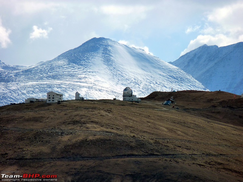
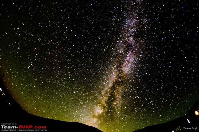
However, Hanle is not just about wilderness or the wildlife. Its famous for the Chandra Telescope, one of the highest observatories in the world. Hanle is famous for having a very high number of cloud less days. Therefore, you have very good opportunities to gaze at the stars. When the site was decided, parallel locations in spiti and west ladakh were also scouted, but Hanle was chosen, as this offered the best location. No big towns within 80kms means there is very limited light pollution.
For an exotic destination, getting to Hanle is surprisingly easy. There are no passes to climb, no tracks to rough it out, no water crossings making it a daring adventure. A level straight road, with minimal mountain driving gently rises through the region.
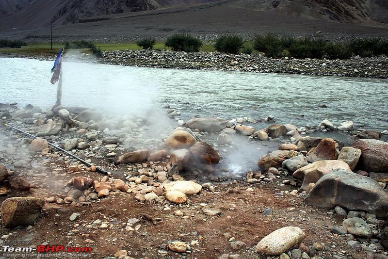
Our journey starts from Leh, and proceeds southwards on the Manali Leh highway. At Upshi, its time to take left, and go towards Mahe. The first major tourist destination is Chumathang with its hot springs.
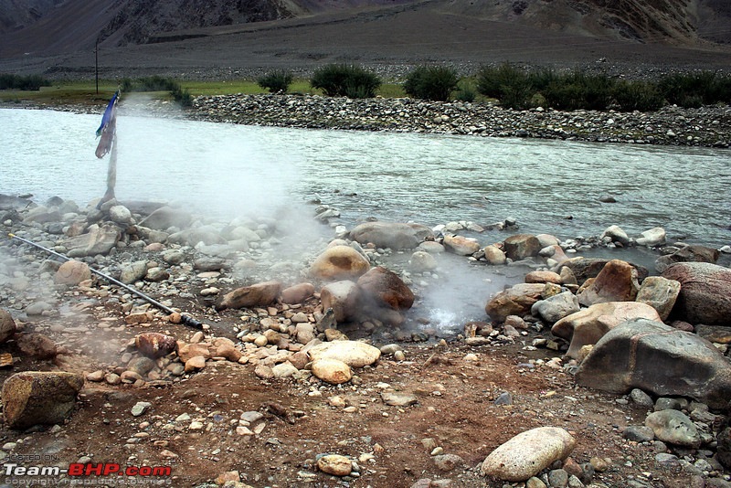
There are quite a few guest houses here, and many stay here to enjoy the hot water of the springs. Next up is Mahe. At Mahe you have to stop for permits and only if your permit form says Hanle, you will be allowed to proceed. Beyond Mahe its less than two hours to the town of Nyoma(Last place till which foreigners are allowed).
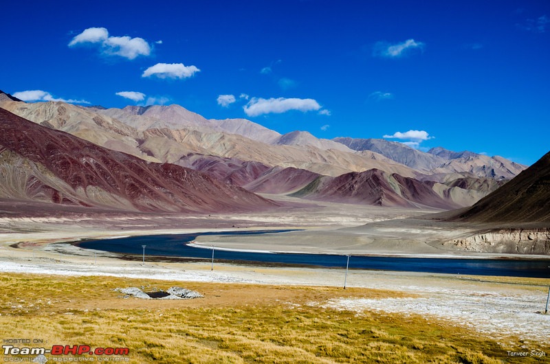
The Indus near Nyoma
Barely twenty kms ahead is the checkpost of Loma, where permits are checked again. And then its a brisk seventy km run to Hanle.
Pic of sand dunes a km before Loma post
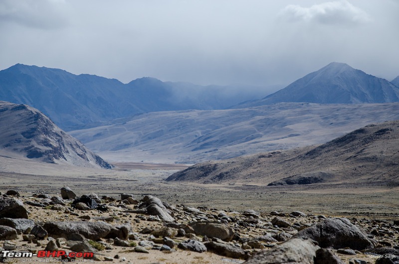
However, it would be foolhardy to push hard and try and reach Hanle in 6 hours, for the charm of Hanle is its unique landscape, and the wildlife. Multi colored hills, red, brown and blue all together, and clouds forming patters not seen anywhere else.
Its best to go slow, stop and enjoy the landscape which changes color with every passing hour.
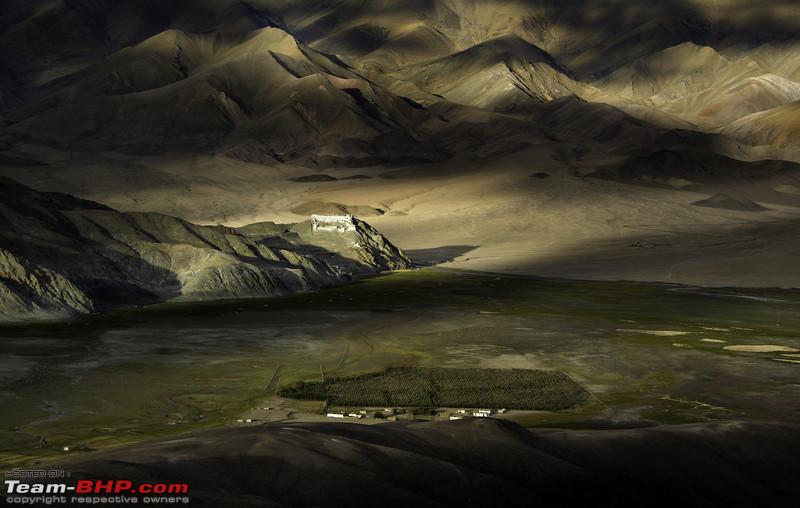
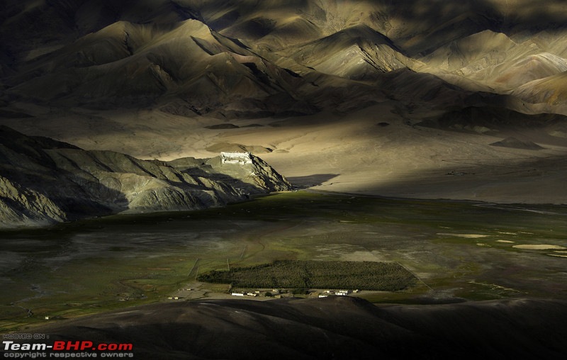
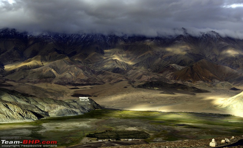
As you approach Hanle, the Hanle Monstery/Palace comes into view.
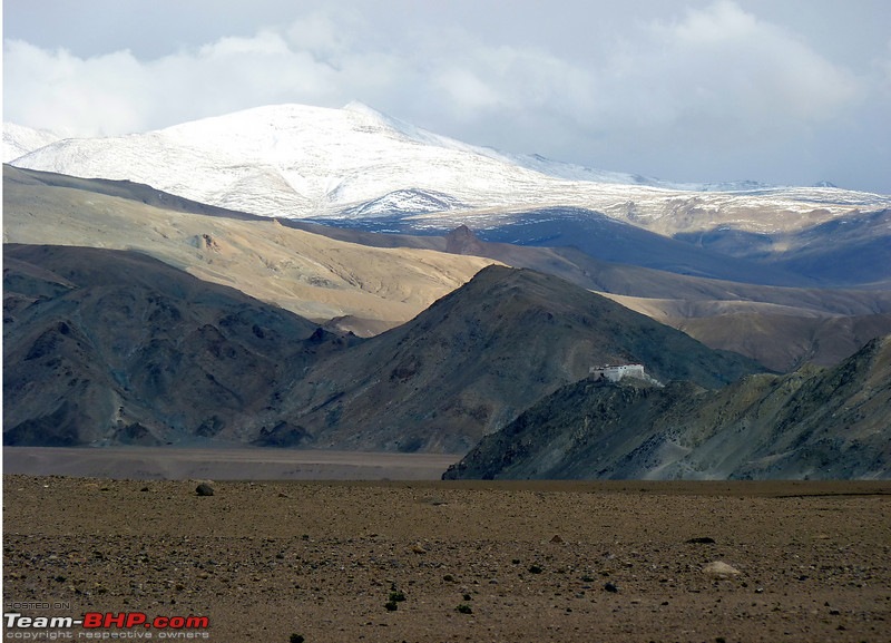
Over 400 years old, this is one of the oldest in the region. And as you take a right towards the village, the sight takes your breath away. Right across the village, rising alone is the Digpa-ratsa Ri, the mountain on which sits the high altitude Chandra telescope.
Most people unfortunately know it as Mount Saraswati and the original name is all but lost.
A narrow road leads up to the hill, and the hospitable staff will show you around. Always cheerful and patient, they explain everything in detail. A word of caution. Do not use lights/headlights if you are there at night. It interferes with the telescope.
At the base of the hill is Gamma ray array, which became operational around 2008.
The hill top, of course affords the best views, all around.
However, the true charm of Hanle is the night sky. Hanle has one of the clearest skies in the world, due to almost nil light pollution, and rarified air. Being away from any city or town means, sights like this are common on no moon nights
Its best to look for accommodation in the village. Home stays are few, but slowly number is increasing. If you are a camping fan, its best to head behind the hill, towards the west. The grasslands of Punguk are rich in flora and fauna.
 Accommodation
Chumathang - Guest houses
Nyoma - Guest Houses
Hanle - Home Stay
Permit Form
Write Hanle, Loma, Nyoma
 Route
Route
Leh-Upshi(Turn left)-Chumathang-Mahe(Turn right at police checkpost. You will cross the river),Sumdo(Take left here, straight goes to Tso kar)-Namshang La-Kiagar Tso-Tso moriri(Korzok)
Tso Moriri-Sumdo(Turn left at the T, right will go back to Mahe)-Polokong La-Tso Kar(Twin lakes actually)-Debring(You merge with Manali-Leh highway, so take right at Debring towards Tanglang)-Tanglang La- Upshi - Leh
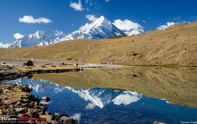
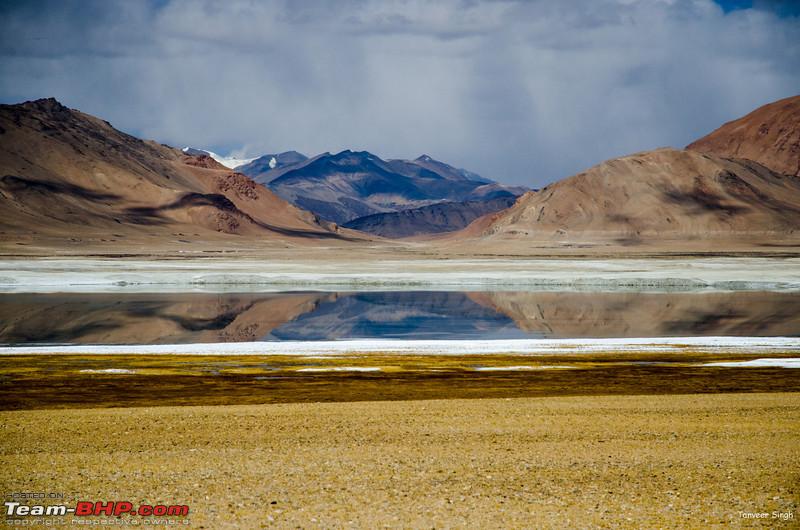
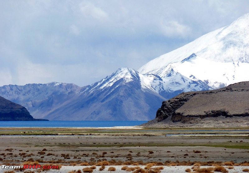
Pangong is not the only big lake in the region. Many tourists, esp those with spare time, or those wanting to extend their Changthang circuit also visit the lake of Tso Moriri.
Though not as big as Pangong Tso, Tso Moriri is a magnificent lake. As a bonus, a round about circuit of the lake also allowed you to visit the twin lakes of Tso Kar and Starstup Tso, as well as the tiny Jewel like Tso Kiagar.
The region is an extension of the Changthang desert, so the lake is extremely rich in birds. The topography is also very beautiful.
To visit Tso moriri, our journey from Leh takes us to Upshi, and then onto Mahe. In the last post, we went straight towards Nyoma/Hanle. But for Tso moriri, you take a right turn across the river Indus and proceed towards South-west.
Twelve kms ahead likes a fork at Sumdo, from where you must take left. After that you cross the easy pass of Namshang La,
and then reach the lovely lake of Kiagar Tso

This is the place till which there is a tar road. The road ahead is dirt, however, the Tso Moriri is just 20 odd kms away, hence its not too bad. You also cross flat plains, not unlike the morey plains, and then right at the ridge, you get your first glimpse of the lovely lake.
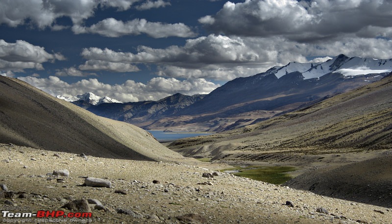
The road goes along the lake, where you will find lots of aquatic birds, and soon you are at the tiny village of Korzok.
Many return from here as a day trip, but if you can survive basic accomodation, then you can look around.

So now we have seen Tso moriri and Tso Kiagar. What about the Tso Kar combo.
Well this is a part of our return journey.
We go all the way back to the fork(Sumdo), and instead of heading to Mahe, head westwards towards a pass called polokong La.
This easy pass will give you the view westwards, towards the lake, and as you descend you reach the Tso Kar basin. Tso Kar often has the highest density of birds due to its marshes.
Polokong la Poc

Stay options are basic tents mostly. However, in recent years couple of good home stay type options have come up.

From Tso Kar, you do not need to go back. Further proceeding on this road will take you to the Manali Leh highway. you will merge at the base of Tanglang La climb at Debring, and Leh will be just around 5 hours from Tso Kar.
This completes a circle, and a full trip takes around 11 hours. Some start early and do this circuit.
My advice.
Start from Leh, visit Tso Kar, and then stay the night at Tso moriri.
Then next day you can go back to Leh via Mahe and reach by evening even if you start after lunch.
Accommodation
Chumathang - Guest houses
Tso Moriri - Guest Houses
Tso Kar - Home Stays/Tents
Permit form
Write Tso Moriri, Tso Kar
Off the Beaten Path
Away from the tourist circuits exist routes and regions which seldom see tourists. For the true adventurer, these routes offer solace from the tourist rush, and allow you to witness landscapes right out of a middle earth epic.
There are many reasons for these routes and areas not being popular. The first and foremost is permits. Permits for many such regions are difficult to get for Indians, and impossible for foreigners, hence there is not much push from the travel industry.
Apart from that, many of these routes are not used much, and are therefore unstable, and often require a four wheel drive to complete without vehicle damage.
However, towards the end of season, i.e. September/October, the snows and the low glaciers have melted, and these routes are mostly dry. So all you need a high GC MUV and an appetite for adventure.
So what are these routes.
In brief
Nubra to pangong - Direct route with no passes, and a route through Wari La
Pangong to Hanle - Via Chushul Tsaga La, or Chushul Kakasang La, Mahe
Marsimik La - A 3 hours excursion from Pangong Tso
Hanle - Kyun Tso - Nidar(near nyoma) - A visit to the exotic high altitude lakes
So lets start
Nubra to Pangong 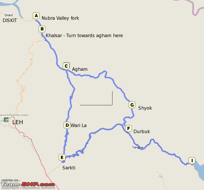
If you geography interests you, and you can read DEM/countour maps, you will realize that Nubra and the Pangong region are connected by a "valley" with minor ranges to cross.
If you are into history, you will also know, that caravans between the regions did not need to go through Leh.
And with this, we will explore the Nubra to Pangong routes. The direct access from Nubra to Pangong interests travellers due to two reasons
1. No extra permits are needed
2. A day is saved for people who see both Nubra and Pangong.
And if the reasons are two, the routes are also two!
The first more common route we will talk about is
Nubra-WariLa-Pangong 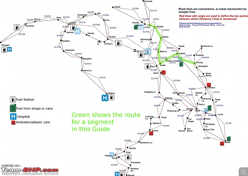 Route
Route
Nubra valley - Khalsar - Agham - Wari La - Sarkti(Shakti) - Chang La - Tangste - Pangong
If you wanted to go from Nubra to Pangong, you could obviously cross the Khardung La, and then do the Leh-Pangong route. But why? Why do this route when there is a slighly shorter, much more scenic route awaiting you.
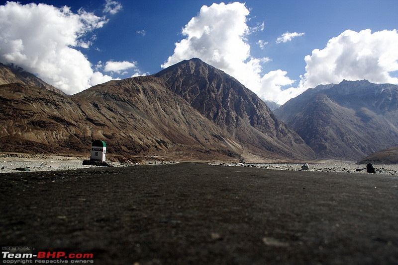
We start from Nubra valley, and proceed towards Leh. Along the river Shyok we reach the village of Khalsar. Pic below shows "Khalsar 10"
Here the main road takes off towards the Khardung La, and we branch off, along the Shyok river. A very good road, broken only in patches snakes around the range hugging the river, and then you enter the Tangyar region.
Here an arrow straight road among boulders takes you. There are some twists and turns, and then you are at a "forest". Local forest authorities have planted a big plantation here. This is an amazing place to stop, with great views of the shyok river.

Shortly after, you will reach the Agham village. Here, one road goes upwards, which we call the right fork. The Left fork goes along the river.
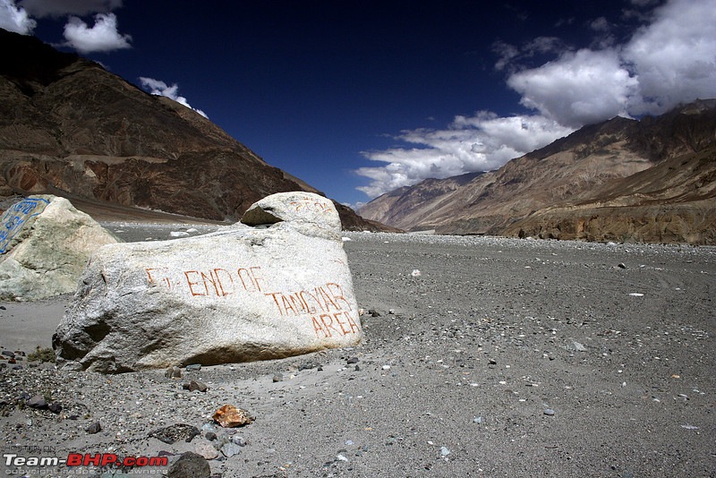
Just before agham, you see the stone, end of Tangyar region
For now, lets talk about the right fork. The right fork goes towards Wari La. Wari La is special. Very special. For some its a challenge due to its extreme ascent. Due to sharp hairpins and steep grade you will climb it all in first gear. Secondly, its a watershed pass. There are streams to keep you company all along the way, and where there is water, there is life
On the way you will also see Tangyar Gompa perched on top of a hill. A road goes almost till the top. If you are interested, you can take a short break here

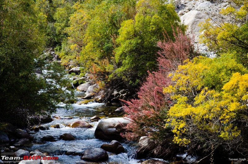
As you can see in Autumn its a delicious red and yellow. As you gain altitude, the bigger shurbs give way to grass.
Water is still with you. Grass and water mean Yak. wild yak
http://www.youtube.com/watch?v=Uo5wWc7A57Q
Yes, this is probably the only pass in Leh where you will find large concentration of wild Yak's. They are shy but ferocious animals. keep your distance, and stay in the vehicle.
As altitude rises, vegetation also begins to dwindle, and the majestic mountains come into view. The road surface also deteriortates with potholes and minor water crossings.
Long back there were tricky water crossings here, but they have been bridged. So keep the first gear on and keep moving.
There are some which are still tricky
A point to note here. Wari La gets a lot of snow, sometimes even in september. If you visit at a time when the pass has gotten a shower, you will need 4WD or snow chains to climb the steep gradients. Do not attempt the pass otherwise, as there are not many places to take a U turn.
After agonizing 30 straight kms of steep climb, you reach the Wari La top. Its a deserted pass with hardly any tourists or signboards. But from the other side, many cyclists come here for training. Low traffic and steep gradient means a peaceful climb.
Right after the pass, good tar starts, and the downward path to Sarkti, where we meet Leh-Pangong road is fast and good
Do pause at Sarkti, because this is one of the greenest villages of the reason, and in Autumn its all yellow.
 Nubra to Pangong Via Agham Shyok
 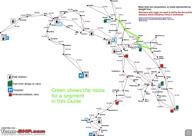 Route
Route
Nubra - Agham-Shyok-Durbuk-Tangste-Lukung(Pangong)
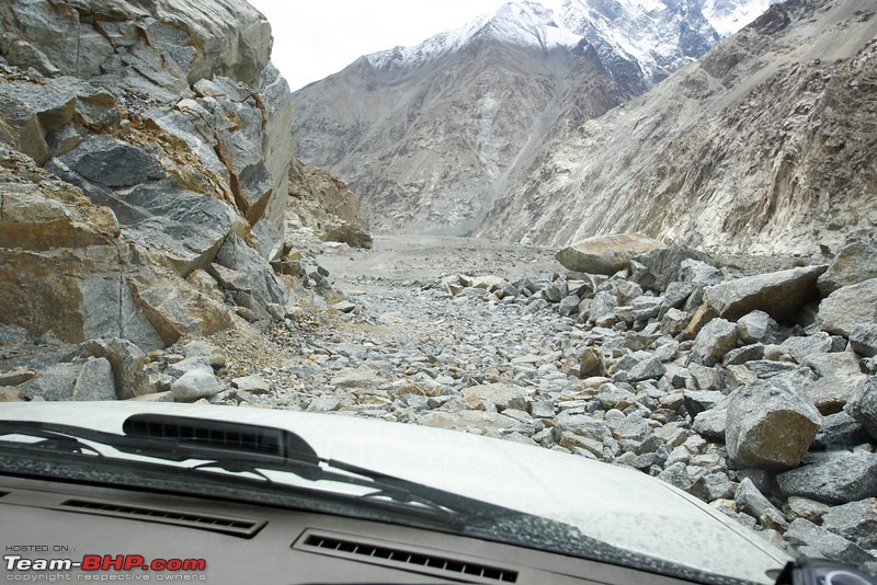
There are routes. Then there are difficult routes. Then there are very difficult routes. This route is not of these three classes. Its beyond it all.
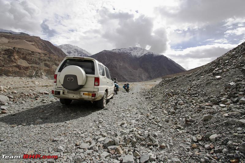
Its a route which can be a mule track if it wants to. Its a route which will defeat the toughest 4x4 if it demands. Its a route where people have returned with busted suspension, or more just 1/4th of the way, ending their entire trip.
If the mountain has free will, its on this route you can see it in its full strength. There are some routes you do. This is a route which will decide whether it will let you do it.
Just once on my trips has this route allowed me to tread. And when this route allows, Nubra to Pangong is just 6 hours, if not less.
No doubt, this route then becomes the most saught after for adventure lovers. Even more so because all you need are Nubra and Pangong permits.
This route shares its first leg till Agham village with the above route. and then the party starts. The tarmac vanishes, and you are left with a rocky road. Keep a lookout for sharp stones, as many have lost tires here.

Then comes the landslide zone, where rocks keep falling. The clear path through the landslide is just a mount of stones, kept there.
When we first attempted this we were few bikes, the Safari and a swift.
http://www.youtube.com/watch?v=NlQswCLDkos http://www.youtube.com/watch?v=m6c5lviH_Hw
As you can see, even with 205mm, the safari got underbody hits. Such is the size of the rocks. The swift of course had to turn back.
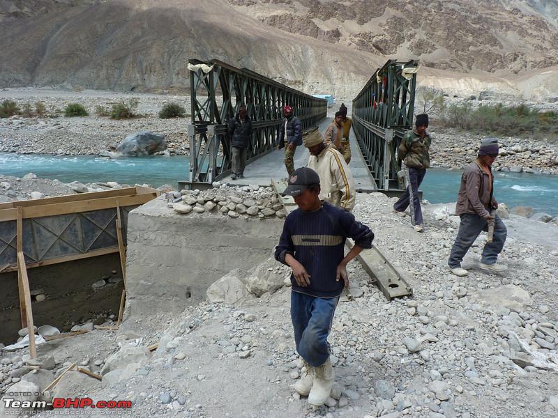
If you manage to cross all this, wait, the party is not over. Ahead of you is the river crossing. There is a bridge over it, but don't count on it. When the mountain wants, the bridge goes away. And then you cross it like this

In the months of April and May, and October, you can wade through the river, its not very deep, but do not have any hope without 4WD.
After this the worse is over, but many more landslides come, requiring tricky crawling in 4L
And then finally, after a few kms, tar road starts. But wait, rocks on the road will mean you need to get down and clear
Only when you near shyok you will get a breather to enjoy the scenery. Your palms will be sweaty. A good opportunity to look at the mountains, and take some reset
After Shyok you merge with the Leh-Pangong Road near Tangste, which means, you will reach Pangong without crossing any high Passes!
At the north end of the Changthang Desert is the Pangong Tso. And at its south end is the village of Hanle. Then why we must go back to Leh?
Makes sense right.
Such sense making route exists from Pangong to Hanle, which involves driving over not so difficult tracks for less than eight hours. Of course, most cannot make it in eight hours. There are some routes which are so lovely, that you are forced to stop at every turn, to admire and stare.
Pangong to Hanle is one such routes, or to be correct, two such routes.
These are
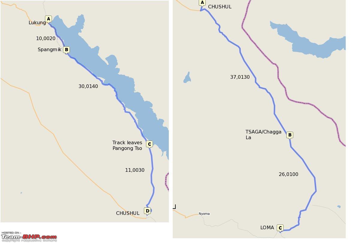
Pangong to Chushul -Tsaga La - Loma - Hanle
Pangong -Chushul - Satatho La - Kakasang La - HorLa - Yaye - Mahe - Nyoma - Loma - Hanle
The latter is a roundabout route.
Pangong Chushul Route
Pangong to Chushul -Tsaga La - Loma - Hanle
First lets talk about Pangong to Chushul route. Till a few years ago, Chushul never figured on the travellers map. Few ventured there, as permits were hard to come by. In 2008-2009, the local adminstration relaxed its rules, and Indian Citizens could get chushul and Tsaga permits. This meant, now you could ride along the Pangong lake all the way to Chushul.
Our Journey starts right at Lukung, at the start of the lake, its northwest shore. Make sure you start early. The journey ahead many not be long, but we will be stopping often, esp for the first stage till Chushul.
We proceed south-east, on a good road along the lake. In this region, finding such a road is a revelation!
Ten kms ahead lies Spangmik. Till a couple of years ago, getting to Spangmik was enough to ruin your vehicle. A glacier fed stream system on the way made it un-predictable. Even when water level was low, round stones meant that even with 4x4 there was danger of getting stuck.

When water level is high, you don;t know where is the actual track! However, now the main road starts going up the mountain, away from the lake. As you rise, you get a glimpse of Pangong few ever see. Pangong from height looks even more majestic.

After Spangmik, the road deteriorates, and by the time you are at Man village, its a track. About eighteen kms from Spangmik lies the village of Merak. This is the last place you are allowed to go if you have Pangong Permit. Foreigners cannot go beyond this point at all. A small checkpost here will check your permits, and you go along.
On this track, you will realize that what you see at Lukung is just a little bit of the majestic Pangong.
The landscapes here are awe inspiring, and if its your first time, you will simply stop and gawk. We have done this route twice, and both times, we just could not make haste.

As our journey progresses, the track becomes dirt. This is where you must be careful. choose the path carefully, following tracks of other vehicles, because there are some deep sand traps. This is a rarely done route, and if you get stuck, help could take a long time to come.

The track goes along the lake for around 40kms, after which its time to turn southwards. The lake continues, right into China
You cross a small unnamed pass as you reach the village of Chushul after around 10kms. Pangong shows itself again
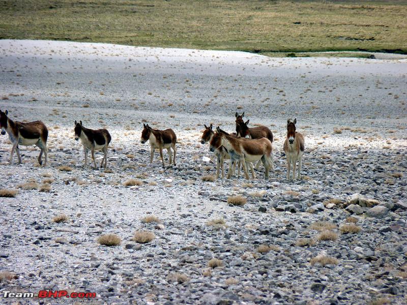
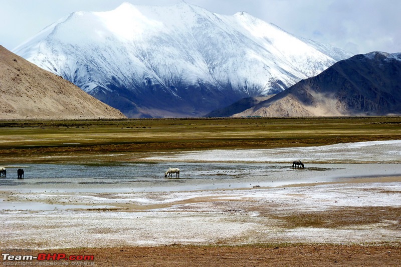
This section is one of the most interesting, because here you will find wild kiang running across the road
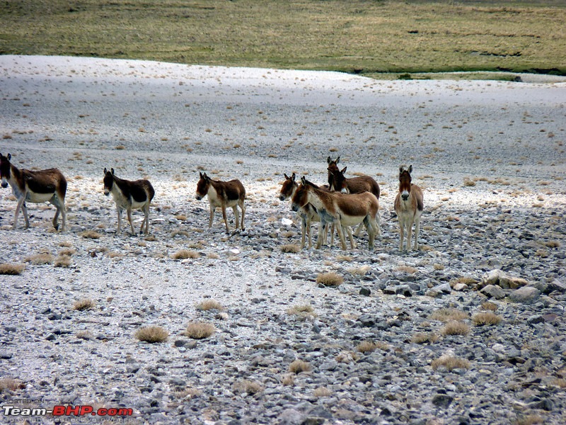
The rich marshes attract all kinds of animals, and the area is rich esp around the month of June/July, when there is ample water from the snow melts. As you look east, you can see the mountain range which makes up the current line of actual control.
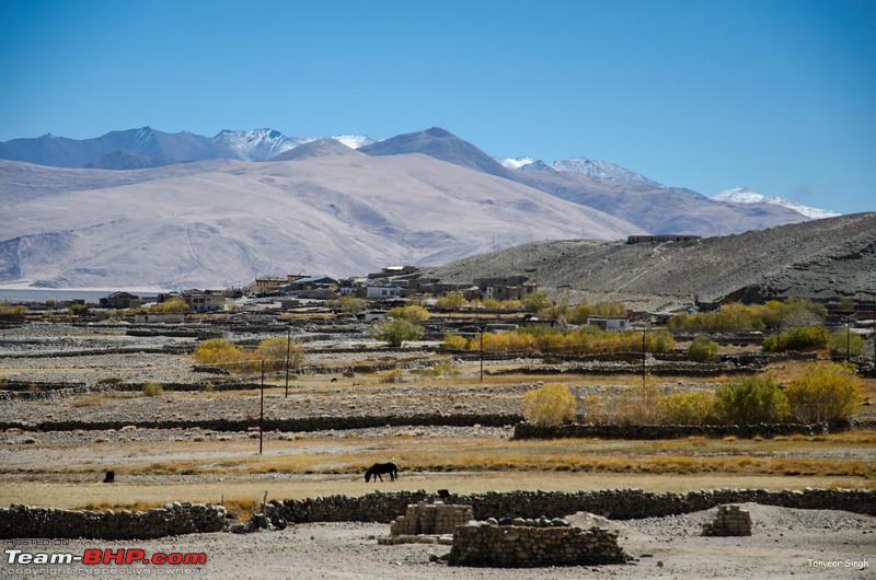
At Chushul, there are a few home stays, and a couple of eateries. There is also a satellite Public telephone.
At the end of the town is a police checkpost. If you are going towards Tsaga La, you need to get your permits checked here. Your permit must mention Loma and Tsaga La if you want to proceed further, otherwise you will be sent back.
This brings us to the end of this section.
At chushul, you have two choices. Head straight for Tsaga La and Loma, or head via the longer route of Kakasang La.
Tsaga La route
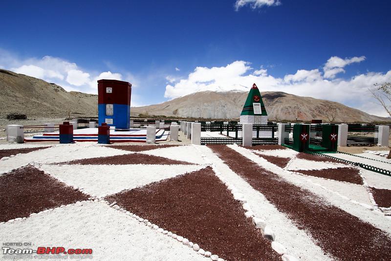
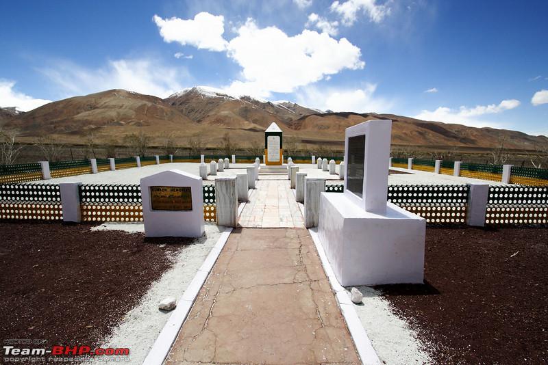
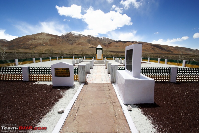
Chushul holds historical significance because of the major battles of Chushul and Rezang La, few kms ahead of Chushul.
Many tourers stop at the Chushul war memorial first. Right at the edge of Town, its a humbling structure. The memorial carries the names of all those fallen
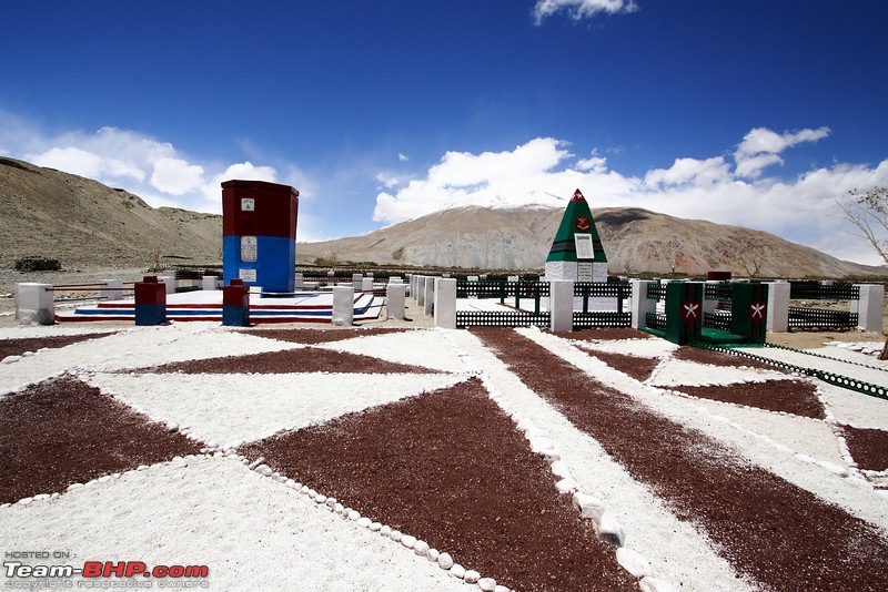
About 5kms ahead you will reach the Spangur Gap. This is a lovely marsh, and also site of fierce battles.
About 7.5kms lies ahead lies the famous Rezang La, where Major Shaitan Singh (
http://en.wikipedia.org/wiki/Shaitan_Singh) and his 'C company' fought to the last men. The memorial, like the one before it, carries the names of all the soldiers.
After the memorial, you continue on the track. You will see tracks diverging here and there. IMPORTANT : Do not go left!! Go RIGHT! To the left lies the LAC, and if you stray from the main track, you can be in serious trouble.

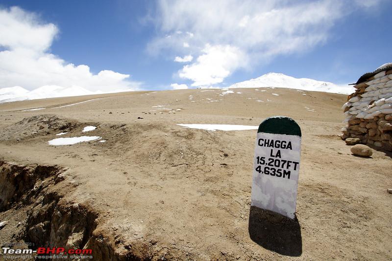
Twenty five kms later, you will find yourself at the Check post of Tsaga La, or Chagga La
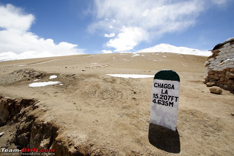
This pass is among the special few, where the sign board matches the actual altitude.
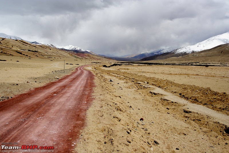
The road after this improves, with tar keeping you company. In 2010, the road was "Red" for quite some time
Soon after there is smooth black tarmac going all the way to Loma(On our Leh-Nyoma-Hanle route). But be were careful. The road sinks in places. If you are fast, even in an SUV you can hit the front bumper on the hard road.
Loma is just 26kms from Tsaga/Chagga La pass. Here permits will be checked, and you can proceed to Hanle.
Accommodation
Chushul - Home Stay
Hanle - Home Stay
Permits
Write Chushul,Tsaga,Loma,Nyoma,Hanle
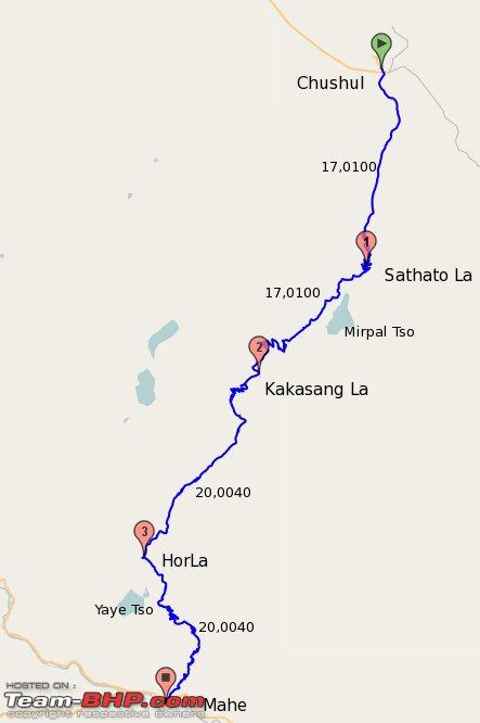
Pangong - Chushul - Mahe via Kakasang La Route
Pangong-Spangmik-Maan-Merak-Chushul(Take right fork here)-Kakasang La-Mahe-Nyoma-Loma-Hanle

What is it, you expect to find the least in a cold high altitude desert. Well, water. However, this route will leave you speechless, because in one day you will cover three lakes, and then merge with the road snaking its way along the Indus.
The first lake of course is the grand Pangong, and the route till Chushul is common. At Chushul, right before entering the village, we take the right fork. You hit a T junction where right will take you to Tangste through Erath. Its a little used route, and fully tarred. The Pangong-Chushul route being more scenic is preferred.
Town of Chushul from near T

Left at the T junction will take you to the Army camp where permits will be checked. They recieve hardly any tourists, so be prepared for raised eyebrows.
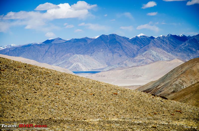
And right after the camp you start rising slowly, towards a pass called Satatho la. A few kms ahead, the switchbacks start, and a very steep road, with not so bad surface makes you gain altitude quickly. These switchbacks are special. In your hurry to reach the top, don't forget to look back, for you will get a surreal view of the mighty pangong. This is the highest altitude from where you can see pangong in the region while in a vehicle.
The climb is steep, but short, and soon you are at the prayer flags of an unmarked Satatho La.
View of Pangong from Satatho La

After a pass, usually you go down. But not here. You continue at the same altitude, and then you witness a sight which will stop you in your tracks.
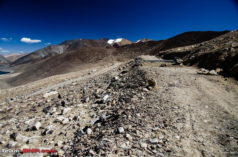
This is the Mirpal Tso. An Emrald green wonder in the high mountains. Don't let the scenery distract you, for now the track is sharp stones. In 2012, it was in bad shape, but hopefully, in a couple of years it should be all tar road. This region is dry and gets very little snow, so roads once made stay good.

The track continues, and then starts rising, steeply. A few agonizing switchbacks, along with very bad surface and off road shortcuts(hopefully all will be fixed soon), and you are at Kakasang La.
This would be the highest pass of your trip(Barring Marsimik, if you have done it). Yes, this pass stands higher than the Khardungla. There are no signboards here shouting. There are no tourists here. Unlike the plastic and garbage of Khardungla, this pass offers only views. And what views! It has its pet lake too!
After the high Kakasang, its time to head downwards. Look to your right and you will see remenants of dead glaciers
A small stream keeps you company as you head down rapidly.
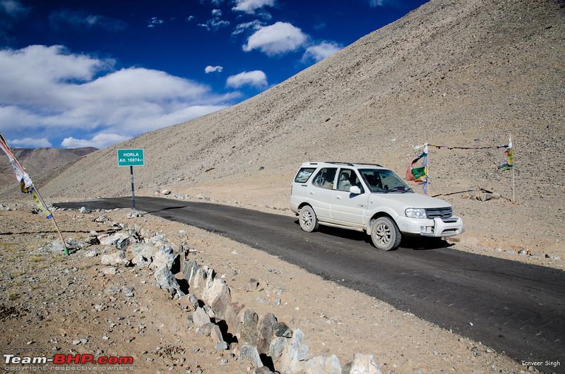
Surprise, surprise, you reach another pass the Horla. That makes KakasangLa the only pass which is preceded by passes on both its ascents.
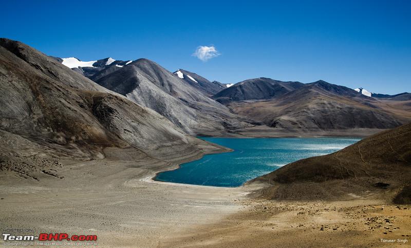
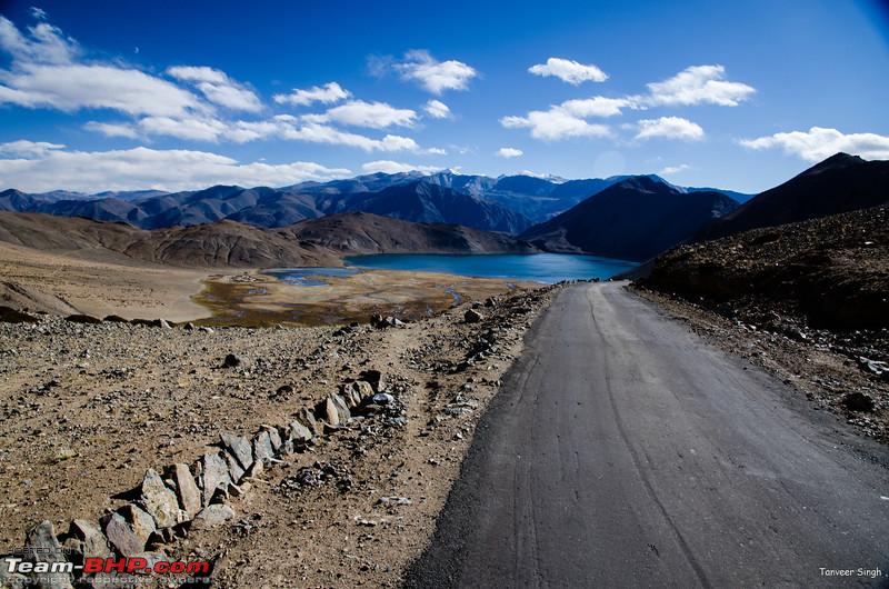
And guess what, Horla has its own lake, the Yaye Tso
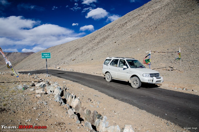

You can also take a dirt track right down to Yaye Tso.
Less than 15kms more on the road, and you will meet the main road at Hanle.
Accommodation
NA
Permit
Write Chushul, Mahe
Its best to have Tsaga La and Loma mentioned on permit for to be on the safe side. This route avoids the police checkpost at chushul, as you do not go towards Tsaga, however, the Merak Checkpost is there.
| All times are GMT +5.5. The time now is 05:09. | |