Team-BHP > Travelogues > Route / Travel Queries
Register New Topics New Posts Top Thanked Team-BHP FAQ


Reply
  Search this Thread
20,977 views
Old 22nd November 2009, 12:40   #1
Team-BHP Support
 
Vid6639's Avatar
 
Join Date: Jul 2006
Location: Bangalore
Posts: 17,730
Thanked: 43,483 Times
Bangalore boys: How do I go from Marathahalli to BIAL?

Yes I do know we can go from ORR to Hebbal and get onto BIAL but this is filled with truck traffic and sometimes takes ages.

I had read somewhere that there is way to go from Marthahalli/Whitefiled near ITPL towards BIAL. Some state highway which goes all the way around the airport or something and one has to drive back towards the city and go to the airport.

I want to give this a try but have no idea where this road is and if it does really exist. Where do I get onto it from Marthahalli and where does it come out near airport?

Has anyone tried it? Pls. post the details here.
Vid6639 is offline  
Old 22nd November 2009, 12:53   #2
Distinguished - BHPian
 
condor's Avatar
 
Join Date: Jun 2006
Location: Speed-brkr City
Posts: 15,864
Thanked: 16,018 Times

Viddy, check the maps for the area : it doesnt show any such sufficiently good road to by-pass this traffic.

Red - standard route
Blue - is it even possible ? Well, unless you are considering reaching the airport perimeter - on the far side of the terminal. And, the first 30% of this route is not free of trucks anyway.

Bangalore boys: How do I go from Marathahalli to BIAL?-airport-alt-route.jpg

At the most, you could go into HBR Layout (right just before Manyata) and reach NH-7 after Yelahanka.


EDIT :
That road may even take you there, if you follow these directions given by MapMyIndia :

Take the KR Puram Hanging Bridge and continue on Old Madras Road (NH 4)10.55 KmCross the following on way:
Krishnarajapura, Bangalore South Taluka at 2km
Basavanapura Nr Krishnarajapura at undefinedkm
Medahalli at undefinedkm
Veerenahalli at undefinedkm
Hirandahalli at 8km
Cheemasandra at undefinedkm
Bandapura at 9km

Turn left on Hoskote Road1.91 Km9Continue straight23.31 KmCross the following on way:
Bommenahalli at 0m
Mandur at 2km
Shringaripura at undefinedkm
Jothipura at 5km
Thirumenahalli, Bangalore South Taluka at undefinedkm
Manchapana Halli at 10km
Gollahalli, Bangalore North Taluka at 11km
10Turn left on Bangalore Bellary Road (NH 7)

Last edited by condor : 22nd November 2009 at 12:58. Reason: Adding directions
condor is online now  
Old 22nd November 2009, 12:57   #3
Senior - BHPian
 
sammyboy's Avatar
 
Join Date: Jul 2006
Location: Ggn/Dehradun
Posts: 1,842
Thanked: 521 Times

I know of one route from the Hennur signal. Take a right from the main road (Hebbal Rd while going from KR Puram to Hebbal) at the Hennur signal. Keep following the road, you will see lots of boards guiding you. It will take you a while though, to figure out which is the best way as they get you close to different areas on the airport road.
The best one I follow is the one which comes out next to the petrol pump, about 1km from the Airport. The pump is on the opposite side of the road (if u are going towards the airport)in the service lane. The road is under construction in a few places, lots of speed bumps so you need to be careful but very little traffic. I prefer taking this route to the normal one. Though, would suggest you to take a drive to explore that route before using it as you might end up getting stuck and missing a flight 
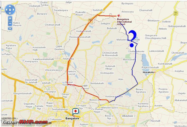
. There is some construction happening somewhere and lots of options, which my wife realised when she took that route a few days back. She took one wrong turn and when she came back, the car looked like it has just come after the Paris Dakar.

There is another way, coming from KR Puram OMR, cross the flyover at the tin factory junction and that road curves left somewhere taking you to the airport. Have been thru it just once so cant really give you 100% directions.

Tell you what, will map the route the next time I go on it and create a thread with pics so its easy .

Last edited by sammyboy : 22nd November 2009 at 13:00.
sammyboy is offline  
Old 22nd November 2009, 13:37   #4
BHPian
 
sureshurs's Avatar
 
Join Date: Jan 2008
Location: Bangalore
Posts: 139
Thanked: 51 Times

I stay in HSR Layout and have taken alternate routes to go to BIAL. This depends upon the time of the day.

Early Morning before 7.00 AM : Through the city and then getting onto Raj Bhavan- Mekri Circle - Airport

Between 7.00 AM to 11.00 PM : Through Marthahalli--> KR Puram--> Hennur Cross Signal--> Hennur Bund Road-->Kannur - Reva Instititute-- Yelhanka Air Force Base Station-- BIAL


I would suggest taking the Road via Hennur Bund Road. The directions are as below

Hennur Signal - Take right to get onto Hennur Bund Road . Continue on the road and drive past Kothanur. In Village Kannur , you would get a sign board with BIAL and Bagalur to go straight and Take left for Yelhanka. Take a left at this T Junction. Continue on the road till you get an under construction under pass. Take a right here and head strainght to Bagalur Cross road by crossing Reva Institute. On Bagalur Cross Road, take a left to join the NH to Airport.

I would not recommend going through the other road (Old Madras Road, Hoskote)which joins NH7 after Aiport
sureshurs is offline  
Old 22nd November 2009, 14:09   #5
Distinguished - BHPian
 
theMAG's Avatar
 
Join Date: May 2006
Location: Avon, CT
Posts: 7,217
Thanked: 1,807 Times

Vid,

The signal opposite to the new BEL HQ, opposite to Manyata Tech Park, ORR, Nagawara.
One smallish road leads inside - bordering Lumbini Gardens lake, in the general direction of the airport. This is said to lead to Yelahanka and is said to be good. Dont know the name of the road nor I have tried it personally.
theMAG is offline  
Old 22nd November 2009, 15:46   #6
Senior - BHPian
 
Join Date: Jun 2006
Location: bangalore
Posts: 1,266
Thanked: 309 Times

Quote:
Originally Posted by vid6639 View Post
Yes I do know we can go from ORR to Hebbal and get onto BIAL but this is filled with truck traffic and sometimes takes ages.

I had read somewhere that there is way to go from Marthahalli/Whitefiled near ITPL towards BIAL. Some state highway which goes all the way around the airport or something and one has to drive back towards the city and go to the airport.
vid, I have done this route many times from ITPL to Airport, and even back. It always takes 1hour (mostly I took the Meru cabs, but also drove a couple of times) w/o speeding. A delay of 10 mins or so can happen at the level crossing at Kadugodi near Sai Baba ashram. From your starting point, you need to add the time.

From Marathahalli, go over the flyover and straight onto Forum mall, Whitefield (turning left). Follow this SH straight past the raliway crossing till you end at NH4. Take left, drive for a km or so, and take right. You drive through Budigere cross, following the main road (you see one or two signs indicating airport). After Budigere town, you'll come to a fork. The left goes through some narrow roads and turns and ends up on NH7 before the BIAL exit loop. The right is the main road joins upto NH206, and then your turn left onto Devanahalli town, and you turn left back to BIAL exit loop (from the Hyderabad side). In the latter, you pass BIAL from the other side, and can see the runway/terminal etc in the distance.
If you are driving the first time (esp in the evening), I would take the ~10km longer route through Devanahalli town.

The roads are great for most part (the scenery is pretty good too in daytime), and see pretty less traffic (though increasing a bit of late). Look out for unmarked big speed breakers near the villages / town , though.
Cheers,

Last edited by lancer_rit : 22nd November 2009 at 15:58.
lancer_rit is online now  
Old 23rd November 2009, 12:43   #7
Team-BHP Support
 
Vid6639's Avatar
 
Join Date: Jul 2006
Location: Bangalore
Posts: 17,730
Thanked: 43,483 Times

Perfect Lancer_rit, that was the road I was looking for.

I know it will be longer in distance but should save on travel time if the traffic is thin.

Also, does this road go through Hoskote town?

From the map NH207 is through the town.
Vid6639 is offline  
Old 23rd November 2009, 14:14   #8
BHPian
 
deepaktpatil's Avatar
 
Join Date: Dec 2006
Location: KA 05, MH 10
Posts: 303
Thanked: 128 Times

Quote:
Originally Posted by sureshurs View Post

Between 7.00 AM to 11.00 PM : Through Marthahalli--> KR Puram--> Hennur Cross Signal--> Hennur Bund Road-->Kannur - Reva Instititute-- Yelhanka Air Force Base Station-- BIAL
vid6639,
I have been taking ring road towards Hebbal from my apartment in Marathahalli, but I normally use it during night.

The road which diverts from Hennur cross from ring road is advisable only during day time as its not safe during night time. Probably not many people know about it and there is less traffic. During my recent trip the Meru Cab driver who was taking me to airport commented that there have been some instances of muggings on this road. Better to be on safer side. Also I feel that ORR is a better option that you can get an alternative just incase you have a breakdown of the vehicle you are using, may be this is a bit far fetched but just incase, who knows.

Anyway if you are commuting during night after 9:00, road marked in red by condor is the best option as there will not be much traffic and is much faster.

Last edited by deepaktpatil : 23rd November 2009 at 14:15.
deepaktpatil is offline  
Old 23rd November 2009, 14:27   #9
BHPian
 
deepaktpatil's Avatar
 
Join Date: Dec 2006
Location: KA 05, MH 10
Posts: 303
Thanked: 128 Times

Quote:
Originally Posted by vid6639 View Post

Also, does this road go through Hoskote town?

From the map NH207 is through the town.

Yes it does, watch out on the left hand side after you enter into the town for merging of NH207 with NH4. I had seen a sign board indicating the directions towards BIAL.
deepaktpatil is offline  
Old 23rd November 2009, 14:43   #10
BANNED
 
Join Date: Apr 2008
Location: Bangalore
Posts: 11,368
Thanked: 23,156 Times
Infractions: 0/2 (8)

I would still advocate going straight through town - I ve been using this route for some time instead of the outer ring road because the outer ring road frankly is quite dangerous with the lorry traffic etc.
The route through the city if used in the early morning (around 5-7am) or in the mid afternoon (around 2-4 pm) or in the evening (around 8-930pm) (as per my experience) is perfectly fine. I say this because it takes me 1 hour to 1.5 hours usually from my residence to the airport in a Meru cab if I use this route. Even if I go on the ORR it still takes me roughly the same amount of time.
Being located in Marathahalli would mean going past HAL, the old airport and hitting MG Road, going through the Ulsoor bit, Dickenson Road, then alongside the parade ground, hitting the Raj Bhavan, passing Windsor Manor, getting onto the Bellary road and out! - I think it is much better than the ORR and Hennur etc most definitely.

The one non-negotiable here is to always leave plenty of margin for delays/traffic chaos/errors when one is heading to BIAL.

Last edited by shankar.balan : 23rd November 2009 at 14:56.
shankar.balan is offline  
Old 23rd November 2009, 14:48   #11
Senior - BHPian
 
Join Date: Jun 2006
Location: bangalore
Posts: 1,266
Thanked: 309 Times

Quote:
Originally Posted by vid6639 View Post
Perfect Lancer_rit, that was the road I was looking for.

I know it will be longer in distance but should save on travel time if the traffic is thin.

Also, does this road go through Hoskote town?

From the map NH207 is through the town.
Hi Vid,
no you don't have to go through Hoskote town. Basically, you take the SH (sort of parallel to NH207) which meets NH4 to the left of Hoskote town.

If you are driving in daytime (early evening rush hours included) from Whitefield area, this is much better than going by ORR! I should know having been once stuck in 1hour + 1hour crawls on ORR and then on NH7 and barely making it to the airport at the flight departure time (luckily flight was delayed).
lancer_rit is online now  
Old 23rd November 2009, 14:51   #12
Distinguished - BHPian
 
theMAG's Avatar
 
Join Date: May 2006
Location: Avon, CT
Posts: 7,217
Thanked: 1,807 Times

There goes the serenity of this route! I am sure TBhp stickered cars with exhausts will be the norm on this road now.
theMAG is offline  
Old 23rd November 2009, 21:10   #13
Team-BHP Support
 
ampere's Avatar
 
Join Date: Sep 2009
Location: Bangalore
Posts: 17,952
Thanked: 12,944 Times

It all depends on what time of the day that you are going? In fact you can also hop on the the Volvo service at Marathahalli. Thats the best you can get.
ampere is offline  
Old 23rd November 2009, 21:16   #14
Senior - BHPian
 
Join Date: Sep 2008
Location: Bangalore
Posts: 1,891
Thanked: 42 Times

Quote:
Originally Posted by ampere View Post
It all depends on what time of the day that you are going? In fact you can also hop on the the Volvo service at Marathahalli. Thats the best you can get.
i second this fully,
Vayu Vajra Service (= volvo service for BIAL) is the best public bus service i have seen in India at least.
StarVegabond is offline  
Old 23rd November 2009, 21:35   #15
BHPian
 
Join Date: Jan 2008
Location: Bangalore
Posts: 453
Thanked: 990 Times

Hey Vid, i know a route from Hennur signal which connects to Kogilu cross (Yelahanka new town junction) via Kothanur and Hegde Nagar. There a lot of twists and turns involved. I can accompany you and show this route whenever possible. Absolutely no truck or bus traffic. You will even hardly find cars on this route. It passes throught all possible villages surrounded by Farm houses (Kothanur etc). Let me know.
Torque123 is offline  
Reply

Most Viewed


Copyright ©2000 - 2024, Team-BHP.com
Proudly powered by E2E Networks