Team-BHP
(
https://www.team-bhp.com/forum/)
Kālidāsa (4th-5th century CE), is regarded as the greatest Sanskrit poet and dramatist.
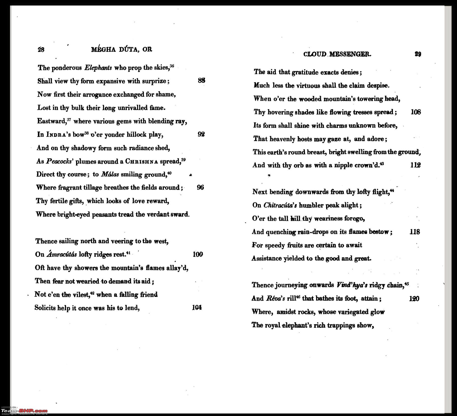
Around 375CE, he penned down the 120 stanza poem, Meghadūta, a.k.a. Cloud Messenger.
The story goes thus:
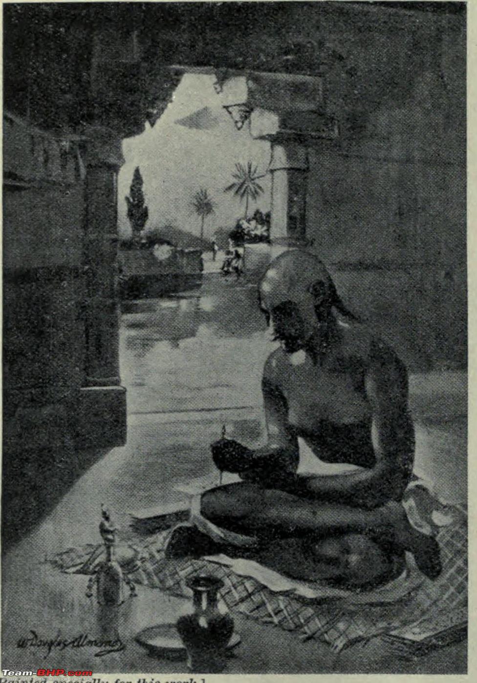
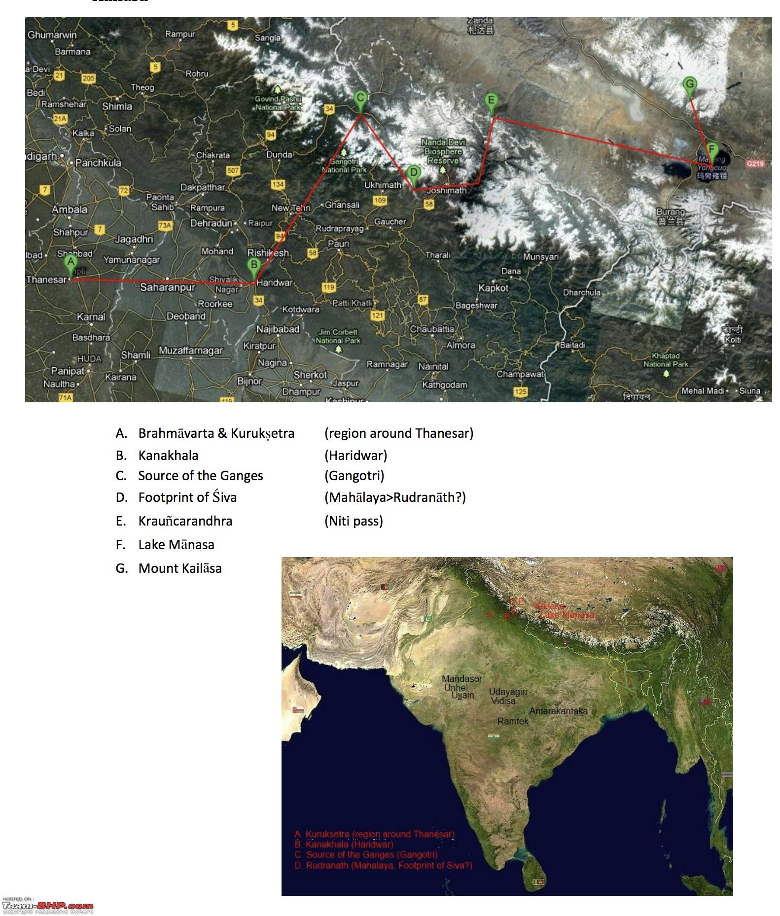
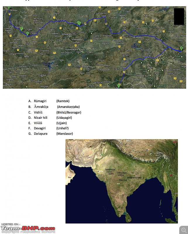
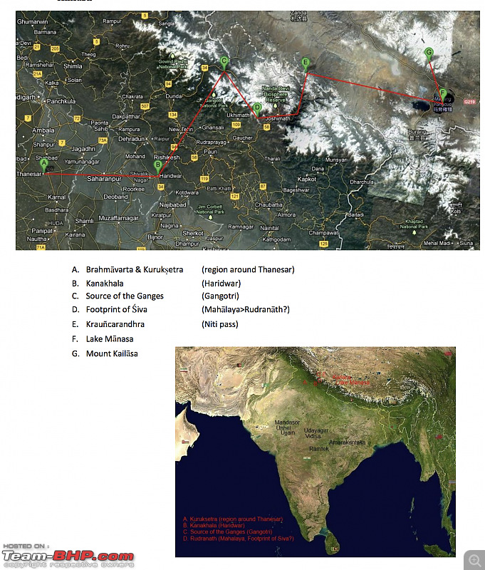
Long ago, King Kubera found one yakṣa guilty of some transgression, and exiled him for one year to Central India. The yakṣa, left with no choice, had to relocate his residence temporarily. Unfortunately he had to leave his beloved wife behind. Pining away for her, he tried to make the best of the situation, but soon it became unbearable. He chanced upon a passing monsoon cloud, and inspiration struck him. He pleaded the cloud, to take a message across to his wife, Alka, whose domicile back then, was on Mount Kailas.
All the world loves a lover.
The cloud took pity and yielded.
But one problem. How to find Alka?
And so, the yakṣa laid down a detailed itinerary for the cloud.
This is perhaps, the first instance of a
detailed navigation system.
Here is how it would look, if the cloud was a TBHPian and wrote a travelogue!
-----------------------------------------
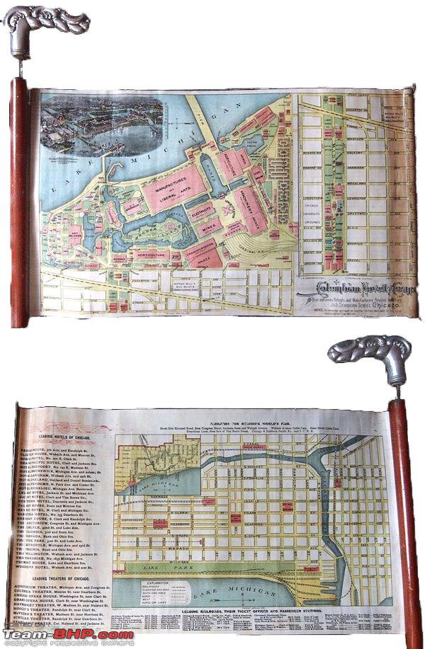
In 1893, Chicago hosted the World's Columbian Exposition, to celebrate the 400th anniversary of Christopher Columbus’s discovery of the new world, and 46 countries participated.
In the 6 months it ran, from May to October of that year, the exposition received a mind boggling
27,300,000 visitors! Remember it's 1893 we are talking about, where the most predominant mode of transport was either 2 or 4 legs!
So many visitors!
Besides the exposition, spread over 690 acres, so many other places to visit.
In a nutshell, so much prospective bu$ine$$ !!
But how to attract prospective customers?
So someone came up with the brilliant idea of…cane maps!
Exposition map on the front and Chicago tourist attractions on the back
This is perhaps the first known instance of what we would (or rather used to call)
yellow pages. -----------------------------------------
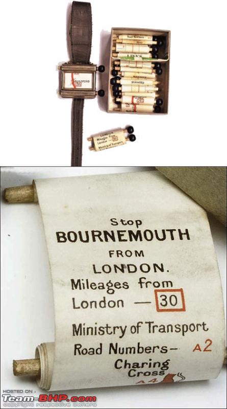
O Romeo, Romeo! wherefore art thou Romeo?
No idea my love. Let me check my Plus Fours Route finder, a.k.a. The wrist map!!
In 1921, one John J Bovy hit upon an idea of a wearable map, and he even obtained a patent for it !
In 1927, this concept materialised as a product. This was a wrist worn device, with small paper scrolls inside it. The “face” of the watch of course, showed you the map.
The idea was to load the required scroll, and advance it manually using the knobs, to synch with the travel.
This is perhaps the first know instance of a
smart watch.
-----------------------------------------
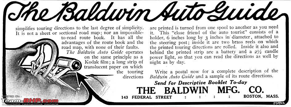
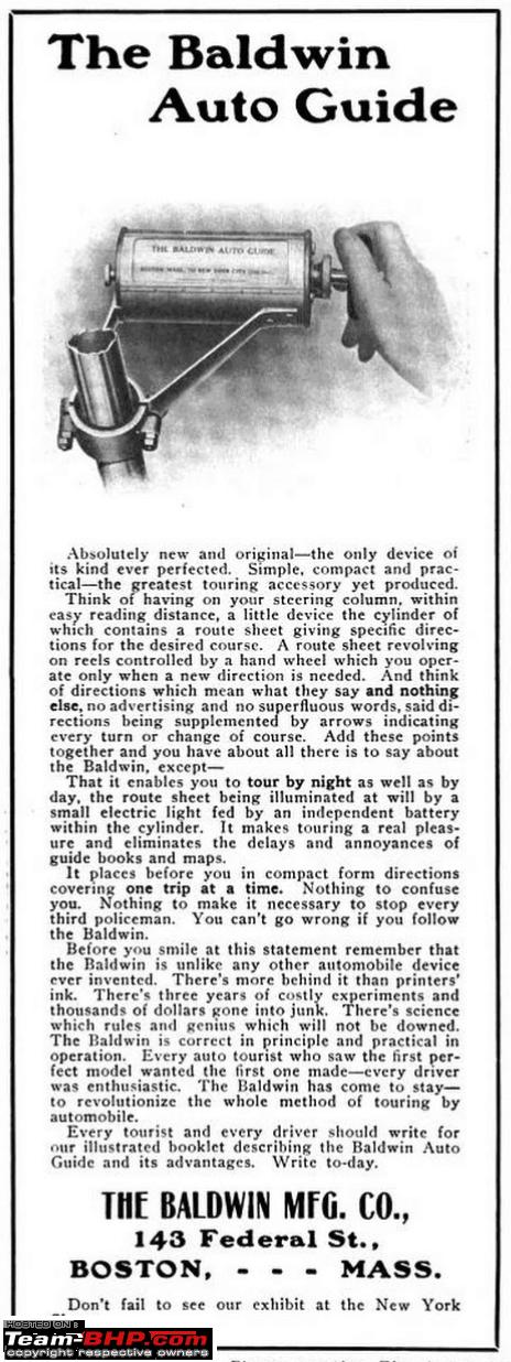
Henry Ford introduced the Model T in 1908 and drove into the history books.
Next year, these ads appeared in “The Automobile” magazine, which are pretty self explanatory.
Note the mention of a light to enable nocturnal navigation
This is perhaps the first known instance of a
vehicle navigation system -----------------------------------------
It is no surprise that Mr Baldwin’s idea found traction amongst other manufacturers.
In 1930, Touring Club Italiano introduced the Iter Avto. Drawing heavily on the idea of changeable and scrollable maps, they went one step ahead and synched it up with the car’s speedometer.
One small step for Iter Avto.
One giant leap for vehicular navigation We are getting there now. More reliably than ever.
Avanti! -----------------------------------------
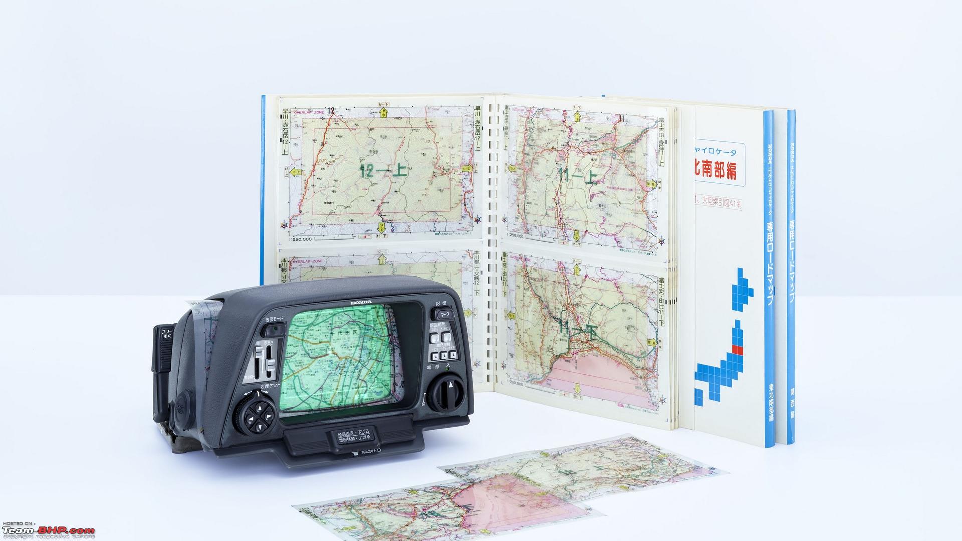
The 1980s saw the dawn of the electronic era. Not surprisingly, it made it’s way to cars as well.
Gone were the paper scrolls. Gone was the mechanical linking. Those technologies were replaced by manually inserted transparent maps displayed on 6 inch monochrome screens. A blinking dot showed you your current position, which moved along with the car, powered by gas gyroscopes and guided by the car’s transmission.
Honda christened it the Electro Gyrocator but sadly, it didn’t catch up much. Probably the cost (~$3000) was prohibitive.
Few years later, the Etak Navigator superseded the Gyrocator.
Map transparencies were replaced by digital maps stored on cassettes which were plotted on a vector display. It still continued to feed on telemetry fed by the wheel sensors and built in compass. However, there was one further improvement in the Etak. It could translate addresses to latitude/longitude, and as such it was perhaps the first system which
guided you to your destination.
All devices till now, relied on telemetry fed input. The flaws in such a system were obvious. For long, auto manufacturers had experimented with other methods to determine the location. Come 1995 and satellite based GPS tech was opened up for public consumption.
Henry Ford changed the auto industry back then.
His company did an encore, when they introduced Tripmonitor
Digital display: ✓
Automated: ✓
Relying solely on satellite triangulation: ✓
Our journey has ended.
We have safely arrived, precisely at our destination.
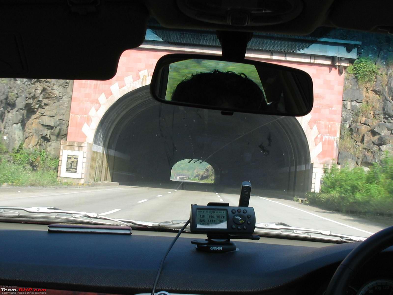
The wholesaler who sold me this Garmin GPS way back in 2005 or 2006 told me I was the first person in Bangalore to own one. This unit had a "line map" (looked similar to Etak navigator pictured above) of Bangalore and Mumbai pre-loaded. The quickest way to find destination was to input the name of the road (Eg: MG Road)

No map coverage on highways. But it recorded and displayed data like current speed, average speed, time taken, elevation etc.
Price? Rs. 40,000!
Quote:
Originally Posted by RedTerrano
(Post 4737296)
Henry Ford changed the auto industry back then.
His company did an encore, when they introduced Tripmonitor
Digital display: ✓
Automated: ✓
Relying solely on satellite triangulation: ✓
Our journey has ended.
We have safely arrived, precisely at our destination.
|
Thanks for sharing RedTerrano! Lovely thread. Just shows how much we have progressed. Imagine a road trip today without all the aids that we take for granted. Today a trip without Google Maps is unimaginable.
There was an article on this very thing on Arstechnica just a few days ago:
https://arstechnica.com/cars/2020/01...e-early-1900s/ Quote:
Turn-by-turntables: How drivers got from point A to point B in the early 1900s
Long before GPS, drivers still wanted tech that could simplify the navigation process.
|
It talks about the evolution from the First American Roadmaps to the modern navigation systems. Very interesting read while having your coffee.
But even today, Google Maps and Apple Maps lead you down paths unseen.:Frustrati
Augmented reality projected to a large screen (perhaps the windshield and windows itself) would perhaps be the pinnacle (for today's imagination and demand).
Here maps tried something looong time back (If I remember correctly sometime in 2011-15 era) but sadly pulled the plug.
Very nice and informative thread RedTerrano, thanks for sharing. Much of the information is new to me.
I still remember the clunky hertz GPS unit that came with the rented car on my first trip to US around 2010. Back then google maps was still not as ubiquitous as now.
Regarding Google maps, I always go by the fact for 99% of the journey it'll be perfect and it'll inevitably mess up the last 1%, atleast in India.
Super informative thread! Thanks a lot of sharing this..!
Quote:
Originally Posted by Anduril
(Post 4737703)
Regarding Google maps, I always go by the fact for 99% of the journey it'll be perfect and it'll inevitably mess up the last 1%, atleast in India.
|
It messed up at times when I was in USA also but as you said 99% its perfect and the 1% mess sometimes pops up.
Quote:
Originally Posted by RedTerrano
(Post 4737296)
Kālidāsa (4th-5th century CE), is regarded as the greatest Sanskrit poet and dramatist......
|
Happy to see the historical anecdotes guiding us into the lifecycle of navigation.
I was just waiting to read the mic-drop line "
And then Google Maps arrived".:)
Correct me if I am wrong, Google Maps is now the golden standard for navigation at least for regular public traversing in safe city to city routes. The only competitor that I have heard (for Overlanders) is Maps.me
Haven't used it myself, but it seems to be more helpful for folks who use mobile GPS based navigation with little or no tower based geo-location.
Thanks for sharing, very interesting. I am a huge fan of everything to do with navigation, and thus GPS.
These scrolling type of devices are interesting. The 1955 Milli Miglia was won Stirling Moss and his navigator Denis Jenkinson. Denis had developed a new system of pace notes and hand signals. He had his pace notes (all 1100 km of it) on a similar scrolling roll.
Some added comments; the first consumer type of GPS came onto the market in 1989, Magellan NAV 1000. in 1990 the first GPS navigation aid was introduced as a car accessoire/option by Mazda.
But it would take quite some years before GPS navigation really come about for consumer.
My first GPS was a very simple Garmin Etrex. That did not have a map, just a tracking and trace facility. I am on my umpteenth TomTom. Which I think is still superior to any of the built in systems. (even the ones provide through TomTom)
Jeroen
Lovely thread, thanks for sharing it.
Thank you RedTerrano for sharing such an informative thread. I had no idea about the history of navigation systems. The wrist watch with changeable scrolls for instructions is really an innovative concept. Google Maps has made things so easy nowadays with regards to the real time traffic situation and alternate routes available instantly.
Red Terrano, What a delightfully written thread replete with historical facts that I at least did not know of. Thank you for the effort in researching all these facts and sharing them. Rated a well deserved 5-stars.
All, As we get more dependent on road navigation devices will we diminish our ability to remember routes and markers that help us to day? Will the average Joe forget how to read a map and get somewhere just like today thanks to calculators some of us have weaker mental arithmetic abilities than a generation ago.
A lovey thread, I was not aware of scrollable maps in the cars. I remember how every one used to take AAA membership right after getting a DL in USA. If we had to drive long distance to any place, the first trip was to the local AAA office. We told the AAA clerk about our destination, and she would give a bunch of maps, marking the route we must take, using a marker pen. This was all free because we were AAA members. :)
Later came Mapquest, which let us create maps online, get turn-by-turn maps and print it. I thought mapquest would kill AAA maps, I had no inkling what GPS would do. :)
So driving to any place required planning, getting the maps, studying the routes, find alternatives if we wanted to include some extra places, etc. We also had to track our progress and know where we are on the map. GPS has made it too simple now. Just like how mobile phones made us forget phone numbers, GPS has removed the need to plan routes and track them on the way.
Around 2005, there was an interim stage of using digital maps with GPS in a little complex way:
Install Microsoft Maps on a laptop. Yes, there was MS Maps before Google Maps and it came with MS Office on a CD. Connect a small GPS dot to the windscreen of your car and you get guided navigation on your laptop screen. This was definitely much cheaper than buying a Garmin or Magellan.
| All times are GMT +5.5. The time now is 08:08. | |