| |||||||

| Search Forums |
| Advanced Search |
| Go to Page... |
 |
| Search this Thread |  45,133 views |
 8th July 2012, 16:48
| #16 |
| BHPian Join Date: Apr 2009 Location: New Delhi
Posts: 130
Thanked: 71 Times
| Re: A journey through Leh & Ladakh Barren beauty at its best So we proceeded downhill towards Diskit. On the way, we found this beautiful stream flowing right next to the road. A part of it was frozen. We took a 15mins break. A few pictures of the beautiful stream.     Pictures on way to Diskit      Traffic jam  The dogs guarding the flock of sheep. It was a common sight everywhere.  Halt at the diversion between Diskit and Panamik. At this diversion, we enquired about the condition of roads through WariLa Pass and through Shyok Village. The locals informed that the Shyok Village route is open, but the bridges were not restored. There are wide streams with huge boulders. Apparantly 2-3 days earlier, an Innova and a Xylo had made a run through that route. The Xlyo was able to cross the rivers (with a lot of damage), the Innova was badly damaged and was stuck there. As regards Wari La Pass, they had no information. So we thought we will ask at the army TCP the next day morning and then take a call whether to take either of those two routes, or go back through Khardungla. Going through Khardungla would mean we would reach Pangong very late. Continued journey to Hunder    Sand dunes   Anyway, we reached Hunder at about 4pm I think. The Habib Guest House (as recommended by SS Traveller) was full (they had only 5 rooms). So the owner told us to stay at his relatives place called the Shyok Guest House a couple of kilometers down the road. A young guy accompanied us to the Shyok Guest House. The approach road was through a water stream. The Guest House was more like a private residence with the upper floor having two rooms that they let out to travelers. The guest house was surrounded by trees and streams of water, and also a small garden where they grow their own vegetables. Luckily the guest house had a huge room (4 beds) and a geysor for hot water. They also had lights. After freshening up, and having some maggi, we went to the sand dune to take a ride on the double humped camels. We returned by around 7pm, had dinner (roti, rice, dal and sabji) and retired for the night. The charge was Rs.800 (for all 3) and Rs. 200 per person for dinner. We found the dinner rates to be a little expensive compared to the food served, and charges at other locations.  Double humped camels      Evening view from the Guest House   Vegetable garden on the left side  View of the Guest House. We were on the rooms on the 1st floor.  |

|  (1)
Thanks (1)
Thanks
 |
| The following BHPian Thanks souravdebiswas for this useful post: | Thar4x4 |
| |
|
8th July 2012, 20:32
| #17 |
| BHPian Join Date: Apr 2009 Location: New Delhi
Posts: 130
Thanked: 71 Times
| Re: A journey through Leh & Ladakh Barren beauty at its best June 22nd This day was supposed to be tiring. We woke up early, and left the guest house by about 7am.  Wild horses strolling around  Sun rise We had breakfast of maggi at Khalsar and headed towards the Khalsar TCP.    The TCP was located at the junction of the road going towards Siachen. We met the army person and had a long chat with him about the road conditions. He served us some good tea also. He gave us the same information regarding Shyok Village route (the same as what we heard the day before), and advised us not to take that route. He also mentioned that if vehicle gets stranded, then there is no chance of recovery soon. As regards the Warila Pass route, he called up the TCP at Tangste to enquire. The Tangste TCP had not heard of any vehicles taking that route, but mentined that the pass should be open. The local TCP mentioned that GREF (which maintains the passes), had not yet gone to WariLa pass, so the roads would be horrible, and again no chance of immediate recovery. He advised us to take the Khardungla route, but left it at our discretion. We were in two minds whether to go back through Khardungla or not, but after deliberation, we decided against taking the risk through those two routes. Our only option was to head to Leh, tank up at Karu and then head to Pangong. On our way to Khardungla, we saw a gypsy that had overturned (just before the K-Top). The gypsy had five woman in it, and luckily all of them survived because the slope was not too steep and it was covered with thick snow.  Road condition from North Pullu  Road condition  Road condition   The gypsy which had toppled over  The gypys - close up shot  Another shot of the Gypsy We did not stop at K-Top, but headed straight to Leh. Again, on the downhill climb, we saw another accident. Just 30mins before we reached, a Santro car had fallen off the edge. There were four occupants in the car. Two of them died on the spot. Their dead bodies had been retrieved and were lying on the road covered with plastic. The other two individuals (brother and sister) had been taken to the hospital at Leh. An army person (who was overseeing the incident) took a lift from us to go to the checkpost at South Pullu and explained that these individuals were locals, and were returning from a marriage party. As per the army people, they were most likely drunk and were speeding. Anyway, we finally reached Leh by about 11am. When we reached, the main petrol pump at the Chowk had just run out of diesel. The other two petrol pumps (near the airport and towards the Manali road) has also run out of fuel. We were asked to return by about 1pm. So we had no option but to wait, since we had to do a tank full, and also fill up our jerry cans with 40 ltrs (for the Chusul route we were to take). We had an early lunch at the Chopsticks restaurant and headed to the pump by about 1:30pm. We tanked up, took reserve, and headed towards Karu. At Karu we again filled in diesel, about 4 ltrs, and headed towards Pangong. The climb up towards Chang La pass was really bad. A lot of streams had to be crossed, but nothing unmanageable.  The diversion at Sakti. You can reach upto this point from Khalsar.  The initial climb was good, though steep     We halted at the Changla Pass for a while, and then headed towards Pangong again.  Reached Chang La   Though this picture has low exposure, the perspective came out very well. Same goes for the next picture too.   Chang La accomplished.   Crossing a stream. It turned out to be deeper that I thought. By the way, a little further down from this spot, there was another very wide stream crossing. They are building a bridge across it, which is not yet complete. So we had to cross that raging stream. There was a lot of water, so I was a bit hesitant to cross it. But after seeing other cars going through, I made it quite easily actually.  Road behind  Way down towards Tangste  Another bridge to cross... There was a checkpost at Durbuk where we submitted our ILP. I remember there was this group of 3 cars from Gujarat (2 safaris and 1 indigo) who wanted to take the Chusul route through Merak. The TCP officer clearly told him that it was not possible for them to take that route since their permits do not state so, and the DC office does not issue permissions anymore. They scanned through all copies of ILPs submitted by others and showed that no one has that permit. At that point, the TCP guys saw my permit and was surprised to see Chusul mentioned there. He showed my permit to the travelers and told them that this is how all places should be mentioned if Chusul was to be visited. The TCP guys did not enter my name in the register since I was to exist through Chusul and not via Dubruk again. Pictures follow:   Contd on next post... |
|
| ()
Thanks
|
|
8th July 2012, 21:06
| #18 |
| BHPian Join Date: Apr 2009 Location: New Delhi
Posts: 130
Thanked: 71 Times
| Re: A journey through Leh & Ladakh Barren beauty at its best  Landscape while driving towards Tangste  Landscape while driving towards Tangste  Reached Durbuk  Durbuk Arch  Lovely roads ahead, with miles and miles of fencing on your right. That appeared to be some firing range for the army.  Straight and smooth roads ahead  The checkpost right across the bridge  The break-off towards Pangong and Chusul. A separate route goes through Chusul also (via Man, Merak)  Another signpost The drive to Pangong after Tangste was memorable. There were mountains on both sides of the road, leveled green grass (as if someone has manicured them), clean and clear streams flowing by, wild horses, tibetian wild asses and sheep grazing around lazily. It was as if heaven had been brought onto earth. We went through a few water crossings and then finally caught the first sight of the Pangong Lake.   What beauty it was all around. These pictures arent doing any justice. Trust me, the color was much better.  This picture is not doing justice. It was simply heaven.  Wild horse grazing merrily. Never had I seen a wild horse before.  The grass was so green, and smooth. With clear streams flowing by in a winding manner, and wild animals grazing so close, it was beyond any imagination.  Crossing another stream in the middle of the road  Crossing the stream  Done  I use to only dream of such beautiful places. Never thought I would be there myself.  View of the road from drivers seat  Driver side view  Light and Shade  Yet another stream  Tibetial wild ***  Sand dunes yet again  Winding roads towards Pangong  Cross the bridge and you soon get to see Pangong Lake  First view 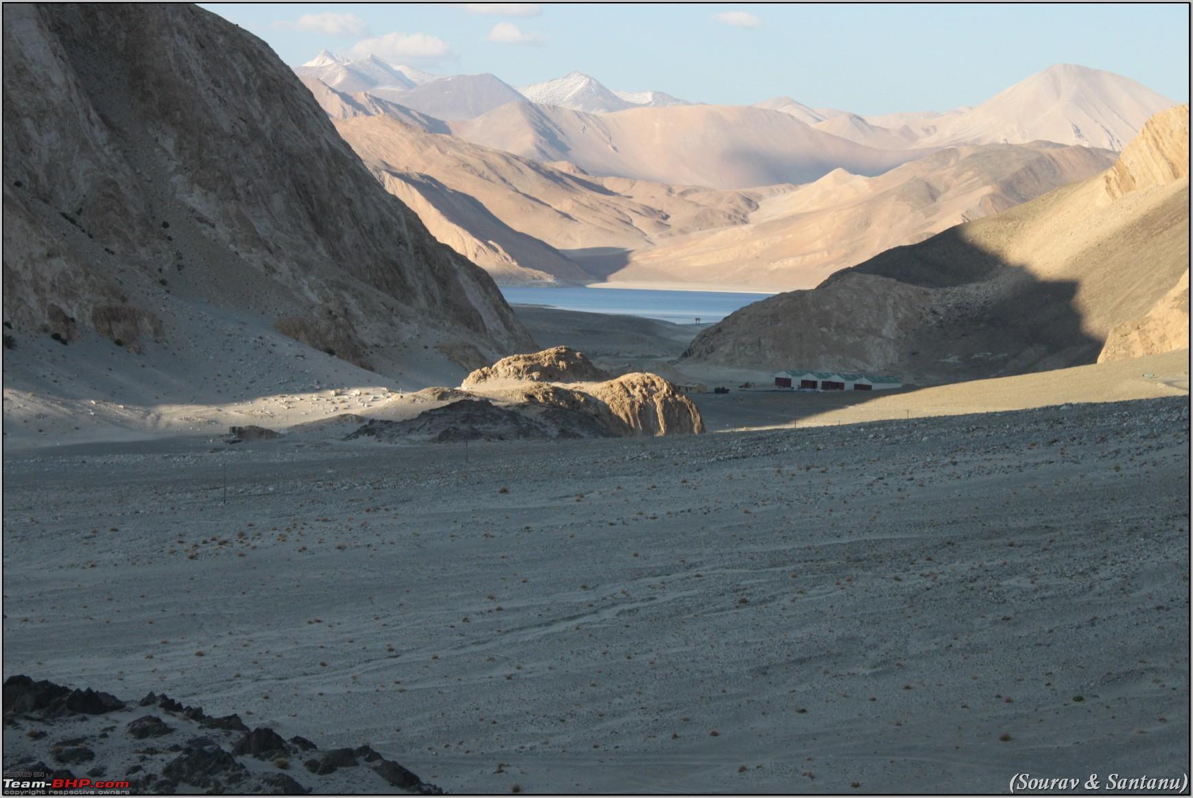 First view  Drive past the lake. Take the road on the left (just before the point you join the lake) towards Phobrang. There is a huge arch which welcomes you to the Model village of Phobrang.  Drive past the lake The road towards the left went towards Phobrang Village, and the road towards right goes to Spangmik. We saw a number of restaurants on the banks, but did not stop. We headed straight to Spangmik. |
|
| ()
Thanks
|
|
8th July 2012, 21:44
| #19 |
| BHPian Join Date: Apr 2009 Location: New Delhi
Posts: 130
Thanked: 71 Times
| Re: A journey through Leh & Ladakh Barren beauty at its best We did notice a dirt track going next to the lake, but due to lack of knowledge we took the broken road up the hill to reach Spanmik.  This road going beside the mountains basically breaks up. The lower road goes towards the dirt track (far ahead left).  3 Idiots shooting took place at that point. More pics later. We reached Spangmik at about 4pm I think. Out there, the camps were charging quite high. Finally after a lot of searching, we settled at a new camp that had opened this year called Sky Camps. They charged us Rs. 3000 for one tent per night (for all three of us including breakfast, lunch and dinner). This camp was located about 100mtrs from the banks of the lake and had a lovely view all around. The tent itself was decent. It had an attached makeshift toilet with a washbasin. Hotwater was available on demand. The owner was very hospitable. Immediately on checking in, he served us tea, and biscuits. There was strong cold breeze blowing all the time. We rested the evening, had a lovely dinner of hot dal, rice, sabji and papad. Since there was no other guest in the camp that night, we were taken care of quite well. Pics from the camp  The Beast standing in the evening infront of the camp  Late evening view of the lake from our camp  View from the camp  Thats our camp. Sky Camp. We were on the 1st tent from the right side. All tents were empty that night. June 23rd This day we were planning to visit Marisimik La. My brother in law dropped out of the plan and wanted to take rest. So it was me and Santanu. We were up and ready by about 10am and left the camp. We took the dirt road down the camps towards the shooting point where the 3 Idiots last scene was shot. We parked the car a bit away from the edge of the lake and walked down all the remaining distance. The place was absolutely empty when we reached. There were a lot of birds and ducks around. Took the customary photographs and returned to the car. By the time we were about to leave, the group of 3 cars from Gujarat had arrived. Though their Safaris made through the loose sand, their Indigo got stuck. Anyway, since they were a group of almost 8 to 10 people, we left them and headed towards Phobrang. A few pictures from this place:  The spot where 3 Idiots was shot  The Beast standing safely  A view from the end   Shots of the lake  Lovely waves  Birds Lots of birds  My favorite snap with the Beast  Another shot  Solo shot of Beast  The lake changes colors The road to Phobrang was pretty good, but had a lot of uneven surface. At Phobrang, we were stopped by the ITBP who wanted to check our permits. After 5 mins, we were allowed to go up the mountain. The road out here was one of the worst I had faced till now. There were no roads actually. It was all dirt and gravel. A lot of construction workers were around who appeared to be in the process of buildiung roads, but nothing was yet complete. We were literally lost and kept following the heap of stone chips lying all around. Finally we reached a spot where we saw an army Gypsy just ahead of us (he followed a different route till that point). We started following the Gypsy for about a kilometer or so, when suddenly it stopped. A gentleman came out of the Gypsy (who appeared to be pretty senior), and started asking us questions, and our answers were pretty much as follows: Major: Where do you think you are going? Us: Marisimik La Sir. Major: Why? Us: Sir, its the highest pass and we wanted to visit that. Major: Do you think this is a joke? Do you have permission? Us: Uuuhhh .No Sir. But we thought it would be a great achievement for us. And yes, we have taken permission from the DCs office at Leh. (we started looking for the permit copy). Major: DCs office? Who are they to issue you permit? They have no authority. This is my jurisidiction. You have to take permission from the Core Headquarters of the Army at Leh to come over here. Us: Ok. Sir. Sorry about that. But we did not know it. We showed the permit to ITBP at Phobrang and they allowed us. Major: ITBP? Who the hell are they to permit you? Us: Sir, whatever you say. If you think we should not go ahead, its fine, we will turn around. Major: I thought you guys were overseeing the construction work here. Construction people come here occasionally in their cars, but when I saw you guys were following me, I stopped. Anyway, is your vehicle a 4/4? The gypsies we use here are all 4/4. Nothing can go up without a 4/4. You will get stuck, and if you get stuck there is nothing and no one to rescue you. Us: Yes Sir. This Safari is a 4/4. We have already engaged 4Low and thats why we have been able to come this far. Major: Ok. Come on. Follow me. Us: Yes Sir. Thank you. Are the roads ahead better? Major: Much worse than you can imagine. So after the conversation, we realized he is a Major in the Army. This was my first interaction with a senior army person at a battle position. Anyway, the road thereon got much much worse. Huge stone chips, rocks, loose soil etc, and I kept thinking about Tanveers posts about tyre side walls being ruptured at this place. Finally we reached towards the top. It was the worst road/dirct track we had driven on. The last few kms there were no tracks at all and we just blindly followed the Gypsy. Near the top, we again spoke to the Major for about 15-20mins. He was kind enough to give us time. He gave us a wonderful insight into the terrain around and the tense situation with the Chinese. He refused to let us go any further. He was going to the Checkpost ahead. After bidding farewell, we started climbing down the mountain. Same road conditions, so nothing more to elaborate. Just that the Major refused to allow us to take pictures at the top, and told us not to take pictures when going down. We obliged as much as we can, but did take some road pictures which descending. Finally we had done Marisimik La. I realized why Tanveer had said in one of this travellouges that this was a tough climb. I could feel that the car ran out of breath initially. Only after engaging 4 Low was I able to climb up smoothly. By the way, this is one fact that you all should be aware of that the Major enlightened us with. Marisimik La is also not the highest pass. There are two others ahead of it called as Q La, and Ani La. Not sure how they are spelled, but thats how he pronounced. Marisimik La is somewhere around 19000 ft presently, and Khardungla is way 4th. But yes, Khardungla is the highest motorable pass, since at Marisimik La and others, they are just mountain tops, and civilians cannot just pass through llike Khardungla. Its restricted only for Army. Following are some pictures of the track that we were able to take while descending: 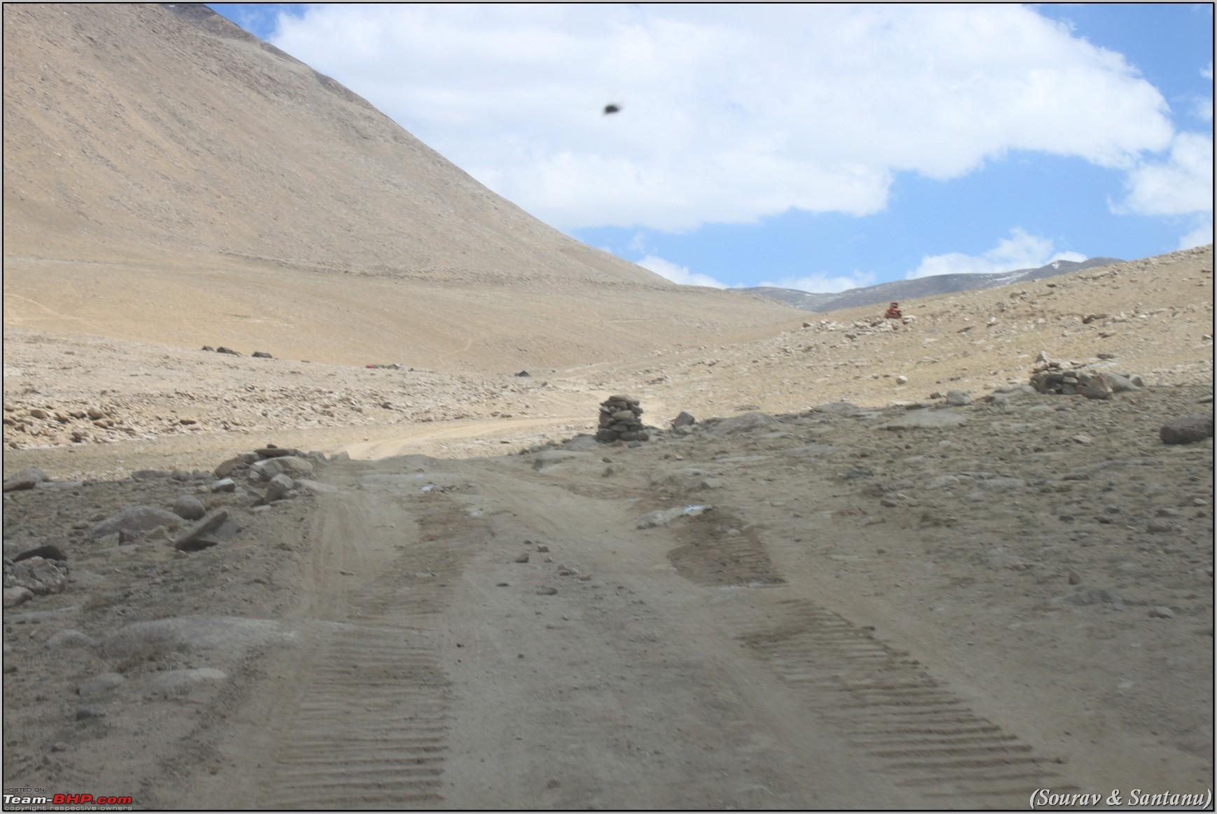 Initial Climb  construction work - loose soil all the way  lots of sharp stone chips on the way  Road block being cleared  Flat stretches with tracks  worker shelters  worket shelters. Tracks all around.    Tracks all around. Loose soil and flying stones  Drivers view of tracks ahead on flat land. All tracks lead you to Phobrang.  So thats M La for you. |
|
| ()
Thanks
|
|
8th July 2012, 22:17
| #20 |
| BHPian Join Date: Apr 2009 Location: New Delhi
Posts: 130
Thanked: 71 Times
| Re: A journey through Leh & Ladakh Barren beauty at its best We were on our way back to base at Spangmik. We reached our camp by about 4:30pm. En route, near Spangmik, we took our car on to the banks of the lake to take some pictures with two of the wheels in the water. After photoshoot, the car got stuck in the loose sand. Thanks to 4L, we emerged from the waters and decided not to try such stunts again.  Beautiful view of the Pangong  The Beast in water  Another shot of the lake At Spangmik, there is one STD booth from where we made calls to our families to let them know that the next 2-3 days there would not signal or STD booths either ;-). In the evening we went next to the lake. Chilly winds kept blowing on our face. I even tried dipping my feet into the water. The water was so cold that I could have got a frost bite!!! Heh heh.  Waves splashing on to the shore  Another shot  View of the camp from the lake  My foot froze in the water  This constructed hotel wanted to charge 4500/- for a shitty room!  This dorm was charging Rs.100 per bed with common bathroom  View of surrounding camps from our camp  Inside the camp - pardon the dirt  Inside the camp - another angle  Bathroom  Washbasin We retired for the night a bit early since the next day we were to head to Tso Moriri via Chusul. June 24th This day we were going to try our luck with the permit for going towards Chusul. I remember SS Traveller telling me that we should try to reach the checkpost at Merak early since no one is usually there very early morning. We checked out of the Sky Camp by about 6:30am and started for Chusul. This became the most memorable drive for me. After crossing Spangmik, there were no roads, but only dirt tracks. Some place you had to deivate from the tracks since the original tracks just led to some ditch. We crossed small streams and small sand dune etc to reach Man and then Merak. Not a single soul we saw until Merak. By the way, at Merak, there are 2-3 camps available for staying.  Early morning departure from Spangmik  The Beast all ready to take another adventure  That how it looked behind the camp  Road to Man - Merak  Somewhere between Man and Merak  Passing through Man I guess  Tracks next to the lake and hugging the mountain. Straight fall into the lake  Sun light  Sun light on the tracks  Pathetic tracks Right after crossing the Merak town (at the boundary), there is the checkpost. It says No visitors allowed beyond this point. Violators will be prosecuted. It does not say, without permission. So we stopped. Looked at the makeshift tent where the guards were supposed to be. We thought they would be sleeping. But no one was there. We even peeped inside the tent. Finally not knowing what to do, we decided to move ahead since we had permits. Just when we about to board the car, we saw some person far away waving his hand and telling us to go ahead. I dont know if he was trying to say otherwise, but it definitely did not look like as if they were asking us to stop.  Merak CheckPost We then proceeded. Not a single soul or car in sight. We just kept following tracks next to the lake, keeping in mind to always take tracks away from the lake. It was awesomely beautiful around. Flat stretched as far as we could see, mountains on the right side, left side, and the huge blue lake. The lake actually changes color with the sunlight every few minutes. We kept going and going and going, crossing ditches, streams, and what not.  Tracks ahead - blurry picture due to motion  View towards lake side  Tracks  This thing is made of bones and horns of Yaks and Sheep. Dont know its significance here...  The Beast standing on the way |
|
| (1)
Thanks
|
| The following BHPian Thanks souravdebiswas for this useful post: | roy_libran |
|
8th July 2012, 22:51
| #21 |
| BHPian Join Date: Apr 2009 Location: New Delhi
Posts: 130
Thanked: 71 Times
| Re: A journey through Leh & Ladakh Barren beauty at its best  The landscape view was awesome on this route Finally at one spot, we were leaving the lake and heading towards a valley between mountains. There we were kind of lost about which road to take. We saw a gravel track to the left where there were a few white tents (just below a mountain). Did not want to take the risk of going out there. Not sure what was it. But right around that place, there was a track which was going towards the tents and then upwards on the hill next to it.  The white tents We moved ahead after crossing another huge stream with quite large rocks strewn all over. My friend had to get down and give me directions so that I do not hit huge rocks.  On the way, we saw a number of wild horses, wild asses, grazing away to glory without any human intervention.     Chusul village ahead We reached Chusul at about 11am I think. Not sure of the exact timing. After entering Chusul, we asked locals for the direction towards Nyoma, and soon reached a police checkpost. Though the checkpost was on the right hand side towards the inside, and there was no barricade on road, there were a few plain clothes man sitting outside waving us down and asked us to chow permits. They took a copy of the same and went inside the checkpost. Came out quickly and allowed us to go ahead expressly telling us to keep towards the right tracks closer to the mountains since the tracks on the left veer off into China most of the time. We reached a small bridge from where the road towards the right goes towards Mahe, the roads towards the left goes to Nyoma. So we take the left diversion. After that it was quite a scary drive. Dirt tracks again. It started drizzling lightly. While moving on this road, we first came to the Chusul War Memorial. Reading the note on the stone was very touching. Thereafter we kept noticing small bunkers on the mountain tops/edges on the right side. They were clearly not houses, but very evidently army bunkers. As we proceeded, we came across similar bunkers on the mountains on the left hand side. I did not know who those bunkers belonged to, but I presumed China. As per HV Kumar those mountain ranges also belong to India. I am not very sure about that considering that everyone we met at Chusul told us not to go towards the left since China border was very very close by. Interesting thing to note is that there is an electricity line/telephone line that connects the entire region (which definitely belongs to India), and if you follow those lines, you will at all times be in India.  The Beast at Chusul War Memorial  The road ahead  Thats me at the Memorial After sometime we came across a small army barrack on the right side called as the Rohit Post, and at one small dirt track crossing, some senior army person (realized it by his dress, sunglass and stance) was standing with 2 other guards, having a cup of tea (the other 2 guys were carrying hot flask, and a tiffin carrier). There was also a telephone lying on the ground. God only knows for what. Soon we reached the Rezang La Memorial. We stopped and again read through the tombstone which was extremely touching. How this group of kumaon regiment force gave their lives for us in 1962 fighting against the mighty Chinese army.  Rohit Post [ATTACH] 953506[/ATTACH] Tracks ahead  Approaching Rezang La  Rezang La Memorial  Rezang La Memorial  Road ahead Soon we headed forward again, and after some 5-6 hours of journey, we saw the first car on the road. It was a gypsy and a xylo, both with red beacons moving towards Chusul side from Nyoma. As the cars went by, I could see the army men inside turning their head to see who these mortals were and what they were doing there. After sometime we reached Tsaga (aka Tsaka). The pass we crossed to reach this place is called Chagga La which is at about 15,027ft. It was no pass as such, as it was on pretty much flat land. Tsaga had one STD booth from where we again called our respective families. Soon after Tsaga, we hit metalled roads. The road from here onwards all the way till about Karzok (about 30kms before actually), was smooth tarmac. At Tsaga, we saw a Scorpio with 3 people inside who were travelling from Gujarat, had visited Spiti valley, and was returning from Hanle at that point. We exchange greetings, road conditions and information and proceeded. Our next point was to reach Nyoma. Sights on the way -  This wild *** srated running aside our car, we slowed down, it then kept running ahead, crossed the road, and kept running on the other side...it was as if we were chasing him.  Wild horses again. And all white ones too...  A stream to be crossed.This was tough with huge rocks lying here and there  Yaks and nomads  Chagga La (also called as Tsaga La I guess)  Roads ahead of Chaga La  Tsaga. There is an STD booth out here from where we made phone calls.  The roads going forward (from Tsaga) were tarmac and good (but with uneven surfaces)  The Beast  Thats me with the Beast  Santanu with his pose  We followed the Indus river for a long distance  The bridge across which is the route to Hanle |
|
| ()
Thanks
|
|
8th July 2012, 23:16
| #22 |
| BHPian Join Date: Apr 2009 Location: New Delhi
Posts: 130
Thanked: 71 Times
| Re: A journey through Leh & Ladakh Barren beauty at its best Before reaching Nyoma, we stopped at the ITBP checkpost at Loma where our permits were once again checked. It was a T junction from where the road on the left leads towards Hanle, and the road on the right goes towards Nyoma. On the way we tanked up with one of the 20ltr jerry cans. Thereafter we headed towards Tso Moriri.  Loma Checkpost crossing 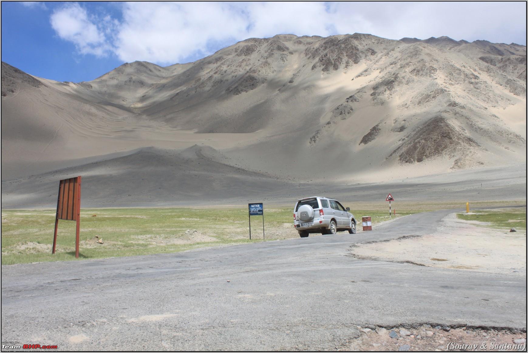 Loma Checkpost crossing  Good roads. Miles of fencing. And sand all around towards Nyoma  A reverse shot  Miles of fencing with sand dunes around  Lovely spot. The road on the right goes to a small village which can be seen.  Refuelling Just before reaching Sumdo, we saw an ambulance van completely in flames. A police party had just arrived to see what happened. We took a diversion through the river bed next to the road and continued.  Road to Model Village of Korzok.  Ambulance on fire ahead  The ambulance on fire  The track through river bed At Sumdo, there is a road turning left towards Tso Moriri. Though the uphill climb over here was on tarmac roads, after a while, the roads turned into gravel, and then a complete dirt/gravel track. Before reaching Tso Moriri, we passed a smaller lake which we assumed to be Tso Kiagar. On reaching the Tso Moriri lake, we noticed a small bridge and a left turn. We initially did not see any track going towards the right. So we took the left turn and proceeded on tarmac roads. After driving for about 10-15mins we did not notice any habitation. That is when I realized that we may have taken the wrong route, and Korzok should be on the other side of the lake. We looked through our binoculars on the other side and saw a small settlement of camps on the other side of the lake, which we assumed to be Korzok village. So we took a U turn, and proceeded towards Korzok. The last few kilometers was a good scenic drive, but through extremely bad roads. We did not take much pictures of this route since we were finally dissapointed with Korzok and Santanu had fallen off to sleep in between.  First sight of Tso Kiagar  Tso Kiagar. There were nomad tents around it 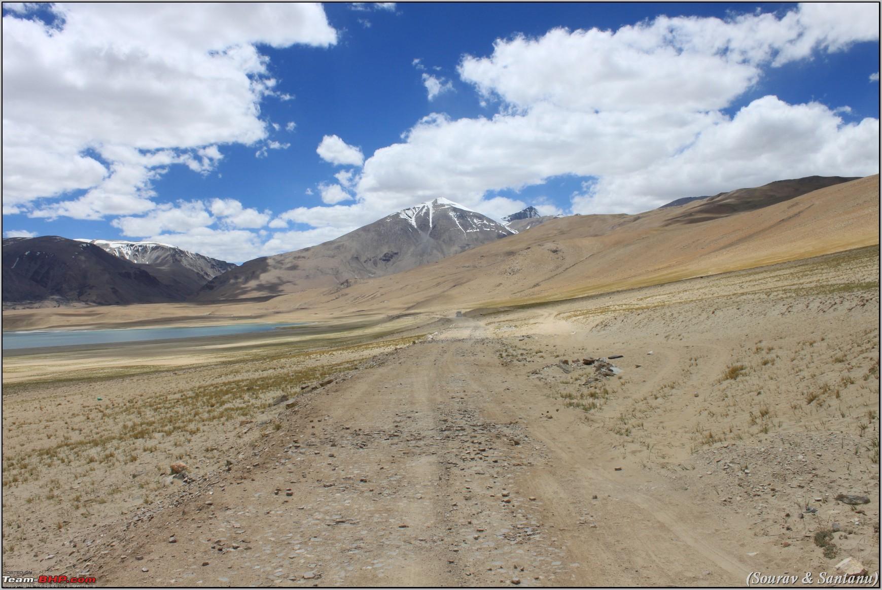 The drive beside Tso Kiagar on way to Tso Moriri. The drive is quite horrible with dirt tracks all the way.  Tso Moriri. The lake was really beautiful with crystal clear waters and lots of birds. But after seeing Pangong Lake, this will not amaze you much. We reached Korzok where we were greeted by the ITBP checkpost again and submitted our permit. We searched for camps, but nothing came to our liking. We noticed that the camps were all too far away from the bank of the lake (unlike Pangong). We went up the slope into the village, and then again went down further to notice a few more camps. On enquiry, they were charging nothing less than 3500 per night, and extra charges for the third person. We did not find this place to be very exciting, so we asked some locals about where can we find accommodation if we head towards Tso Kar. They all mentioned that accommodation at Sumdo would not be possible, but at Tso Kar we should get something. All this time, we were extremely hungry. We had neither breakfast, nor lunch. It was almost 3pm. So we took a chance and proceeded towards Tso Kar, which locals mentioned would take us about 3-3.5 hours. Just after Sumdo, we stopped at a local shop for some Maggi.  This picture was without posse. It was very natural and was taken in an instant by Santanu. Loved it. Their lives appear so much simpler than our, and they seem to be more happy. We do all things possible to make our own lives miserable. Here we met a huge group of foreign bikers (almost 20-25 of them), which was accompanied by a Mahindra Thar, an ambulance and a recovery team. They were taking proper videos with huge video cameras, as if they were shooting some documentary. Anyway, one of their team members informed us about a new camp at Tso Kar. So we headed off after our Maggi session. The road towards Tso Kar was extremely bad. No pictures again as Santanu was half asleep. We climbed mountains, cross some streams, and so on and so forth. Nothing new to explain here since the road conditions were very pathetic. Finally we had our first sighting of Tso Kar at about 5pm. As soon as we reached the Tso Kar village, we came across a small camp (which also had 4 - 5 constructed rooms). We thought we would check out some more places so we did not stop. Just 2 minutes driving and soon we were out of Tso Kar, without noticing any other place to stay. We realized that the first camp was the one and only camp out there. So we headed back and checked into the camp. I forgot the name of it. After some negotiations, we were going to be paying Rs. 3000 (for all 3 of us) for one night, including dinner. The camp was empty. Not a single traveler was around. The care taker mentioned that it is only foreigners who stay at his camp. Though the lake was a little distance from the camp site, but we had unobstructed views of the lake and the surroundings (since it was the first structure on entering Tso Kar).  Tso Kar lake  Tso Kar lake from our camp  The tents  We chose to stay at the constructed rooms. It was too windy and chilly out there. We rested the entire evening. Dinner was delicious with the usual rice, dal, chappati, sabji and papad. While having dinner, Shammi (from bcmtouring) also arrived with his group in his Innova. We chatted for a long time about our respective experiences, how they got stuck at Wari La Pass and had to be rescued using a dumper truck, etc. We decided that next day we would head out together at 7am towards Manali since the drive would be about 12hours. We also decided that if it was getting too late, we might halt at Keylong or Jispa. Lights went off at 10:30pm, and we were off to sleep by 11pm (my emergency light was very useful at times). OK. ENOUGH FOR TODAY. SPENT ALL DAY WRITING THIS LOG. WIFEY IS PRETTY ANGRY. HAVE TWO MORE DAYS OF LOG LEFT WHICH IS PRETTY SHORT. WILL COMPLETE TOMORROW. |
|
| (2)
Thanks
|
| The following 2 BHPians Thank souravdebiswas for this useful post: | rahul_sinha, samarjitdhar |
|
9th July 2012, 00:20
| #23 |
| Team-BHP Support  | Re: A journey through Leh & Ladakh Barren beauty at its best Great travelogue and pictures. We lost cell phone connection after entering Jammu as we had pre-paid connections. So could not contact you anymore :-( It was nice meeting you and we were to many of the places where you had been. It is nostalgic to look at the pics. The time went too fast, but we hope to be back there next year. I do not know if I will be able to put up a travelogue, but will try. If not I will take your permission to post a few pics and the GPS track here :-D |
|
| ()
Thanks
|
|
9th July 2012, 02:03
| #24 |
| BHPian Join Date: Jul 2008 Location: Aurangabad
Posts: 163
Thanked: 307 Times
| Re: A journey through Leh & Ladakh Barren beauty at its best Awesome ! It took me a good 2 hours at this inhuman time to read every single word of this thread. I am planning to visit Marsimik La in my Fortuner and your thread will serve as a Guide! |
|
| ()
Thanks
|
|
9th July 2012, 10:41
| #25 |
| Senior - BHPian Join Date: Nov 2006 Location: Mumbai
Posts: 7,369
Thanked: 3,454 Times
| Re: A journey through Leh & Ladakh Barren beauty at its best Nehru Hotel on Dal Lake, Srinagar - how much do they charge? Good? Can you also list out the places where mobile connectivity is available now? BSNL or otherwise? Is data connectivity in Leh good now? Any idea if they are they still issuing permits at DC's Office on Sunday afternoon? Further feedback on Wari la road status? Last year, I saw a petrol pump of sorts at Nyoma, but they were not selling to civilians - any update on that one? There used to be a luxury tent camp a little beyond Tso Kar - way down in the Valley after the road starts ascending from Tso Kar "village" - looked good, full of foreigners - looks like it is not open this year? |
|
| ()
Thanks
|
|
9th July 2012, 10:55
| #26 |
| BHPian Join Date: Nov 2011 Location: Sydney/Kolkata
Posts: 973
Thanked: 493 Times
| Re: A journey through Leh & Ladakh Barren beauty at its best Awesome travelogue. You are lucky to be one of the few who have scaled Marismik La. Hope the roads they are making are not only meant for the army and would be thrown open to civilian use. I feel with our vast billions of population we too must infiltrate the border areas right up to the Chinese posts to stop the PLA from their hanky panky and redefining the borders whenever they choose to. |
|
| ()
Thanks
|
| |
|
9th July 2012, 11:32
| #27 | |
| BHPian Join Date: Apr 2009 Location: New Delhi
Posts: 130
Thanked: 71 Times
| Re: A journey through Leh & Ladakh Barren beauty at its best Quote:
Nehru's Hotel charged Rs. 2800. This was their standard charge for a double bed room (facing the hill) with extra person (Rs. 500 included). When we gave them a call just before reaching Srinagar, they said only suites are available costing Rs. 4200. But on reaching the hotel, they said the standard DB room was available. Liars! Our rooms were facing the hill, and also opened right infront of the common parking space behind the hotel (avoid the last room on the 1st floor). Rooms are just about decent. Nothing worth that much money defintely. I did not like their room service either. It is fine if you are staying 1 - 2 nights. The good thing is that they have ample parking space. I had taken an MTNL connection (which is the same as BSNL in Delhi). I donot recollect all the places where it worked, but some of them were as follows: Drass, Leh, 1km downhill drive from K-La Top, Hunder, just after Tsaga, and then around Keylong/Jispa and onwards. However, STD booths are now available at every village almost. At Kargil, there was full signal, but no calls ever went through. In all the places above (inlcuding Leh), it was difficult to make calls. Probably after 4-5 tries would I be able to connect. Everytime it showed 'network busy'. But data connectivity at Leh is good. My blackberry GPRS worked very well and I was flooded with office emails!!! I am not sure about DC office being open on Sundays. Not sure about the present condition of the Wari La route. But on the day that I bypassed that route, I was informed by a bcmtouring guy that the road was horrible. They had encountered snow fall, got stuck somewhere close to the WLa Top, there were raging streams and slush. Two of the guys spent the night in their Innova (which got stuck) and the other two walked downhill and got a dumper truck next day early morning to rescue their car. GREF had not cleared the roads until then and were not present anywhere on that route. I really do not remember seeing a petrol pump around Nyoma. Maybe I missed it or just cant recollect. But there are the army wet canteens out there from where Diesel can be bought (as per the ITBP personnel at Loma). At Diskit though, there is a petrol pump. It was non-functional. The locals said that once or twice in a month that petrol pump is operational, and no one knows when does it open. Also, at Kargil a new petrol pump may open in the near future. Saw one being constructed just before entering the main town. As regards the camp ahead of Tso Kar, yes we did see one. I think they are operational else the camps would not have been there. It would be around 7-8kms after crossing the Tso Kar village. From the straight road towards Debring, you have to take the dirt tracks below to reach towards the camps. We could not notice any cars/bikes since it was too far away. | |
|
| (1)
Thanks
|

| The following BHPian Thanks souravdebiswas for this useful post: | hvkumar |
|
9th July 2012, 11:37
| #28 | |
| BHPian Join Date: Apr 2009 Location: New Delhi
Posts: 130
Thanked: 71 Times
| Re: A journey through Leh & Ladakh Barren beauty at its best Quote:
I realised your connection went bust. I had tried calling you, but the number was always switched off. Feel free to use my pictures. No problem at all. Even if you do not write a travellougue, please do post a photologue. We can atleast enjoy the sights that you had seen. How did your Bolero perform through out the route? Any issues at all? I salute you boss or driving all the way from Kolkata and back. Thats some stamina! Am not sure about going back to this place next year, but its definetely on my cards 2 years down the line. You just cant get enough out of this place. Next time I will definetely visit the Zanskar valley. Next year I plan to visit the Lahaul Spiti region. | |
|
| ()
Thanks
|
|
9th July 2012, 11:58
| #29 |
| Senior - BHPian | Re: A journey through Leh & Ladakh Barren beauty at its best Awesome TL, the pictures do most of the talking and the running commentary is like cherry on the cake. Did any of you felt altitude sickness or heaviness in the head? How did the beast performed? I did not see any mention of any problem that you faced so assuming it came out in flying colors. |
|
| ()
Thanks
|
|
9th July 2012, 13:57
| #30 |
| Senior - BHPian | Re: A journey through Leh & Ladakh Barren beauty at its best Sourav Da - Waiting for the remaining Travelogue and Videos. This has turned out to be an extensively detailed and photographed trip, and gets a well deserved 5 Stars from me. I'll look to your help in route planning my own trip next summer. By the way, your Spreadsheet of Items is intriguing and hilarious at the same time. |
|
| ()
Thanks
|
|