| |||||||

| Search Forums |
| Advanced Search |
| Go to Page... |
 |
| Search this Thread |  14,466 views |
 18th January 2024, 22:27
| #16 | |||
| BHPian Join Date: Jan 2024 Location: Bangalore
Posts: 32
Thanked: 314 Times
| Re: East Arunachal & West Meghalaya | 8000 km road-trip to the North East Quote:
Quote:
Quote:
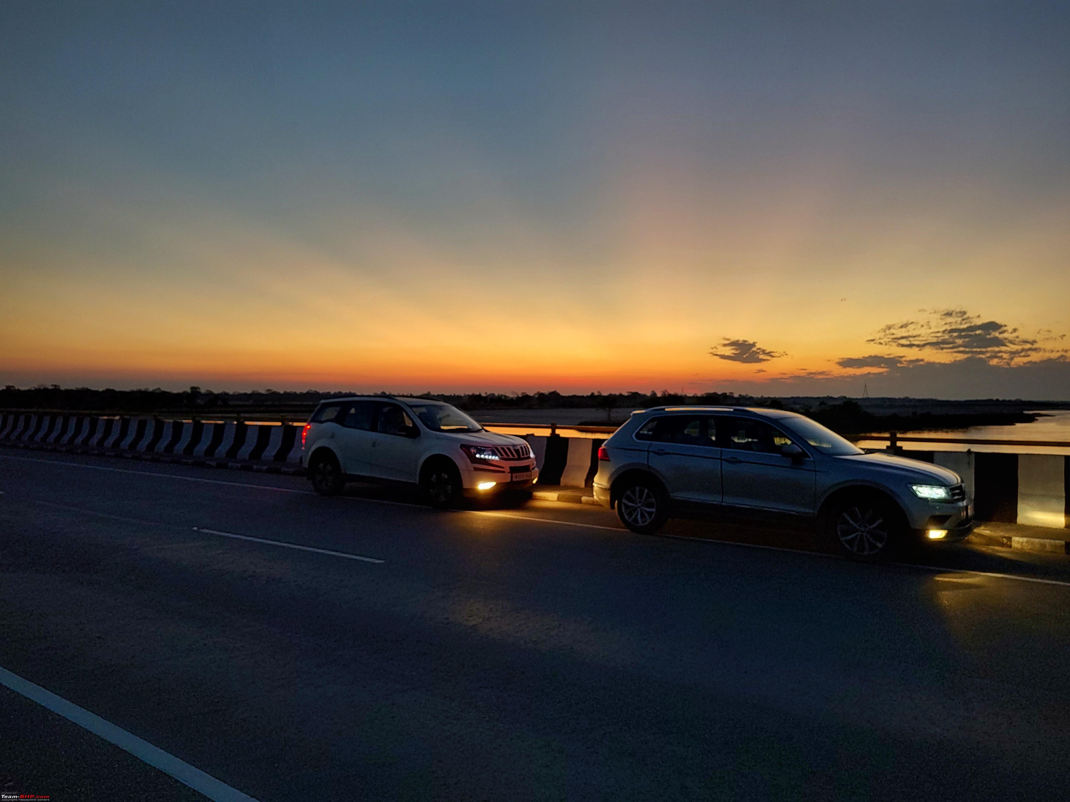
 ). JK's Ecosport has been catching up on miles due to the NE trips, now around 140K. The usual Ertiga in the group which couldn't join this trip had crossed 300K recently ). JK's Ecosport has been catching up on miles due to the NE trips, now around 140K. The usual Ertiga in the group which couldn't join this trip had crossed 300K recently | |||

|  (7)
Thanks (7)
Thanks
 |

| The following 7 BHPians Thank adetour for this useful post: | aargee, abirnale, denver85, haisaikat, jithin23, KK_HakunaMatata, Madrasin_selvan |
| |
|
19th January 2024, 00:03
| #17 |
| BHPian | Re: East Arunachal & West Meghalaya | 8000 km road-trip to the North East Wowwww! The attention to detail and the way you have documented is gonna be bookmarked by all including me for my next trip! The irony is I have hardly planned something like this. Almost every drive is unplanned. My last visit to NE was half complete and I had to head back due to time and bad weather conditions (Red alert was issued in NE on Oct 2022). Kudos to your trips and energy! I know JK in person and Ive heard the trips you guys have pulled of over the years. Take a bow for organising such massive drives in groups! |
|
| (1)
Thanks
|
| The following BHPian Thanks jithin23 for this useful post: | adetour |
|
19th January 2024, 20:09
| #18 |
| BHPian Join Date: Jan 2024 Location: Bangalore
Posts: 32
Thanked: 314 Times
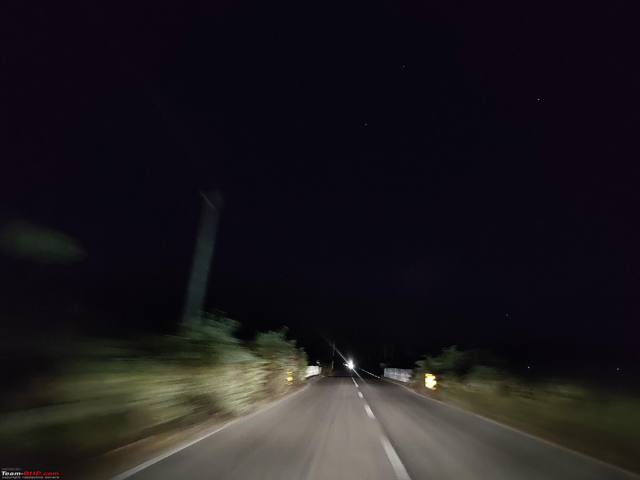
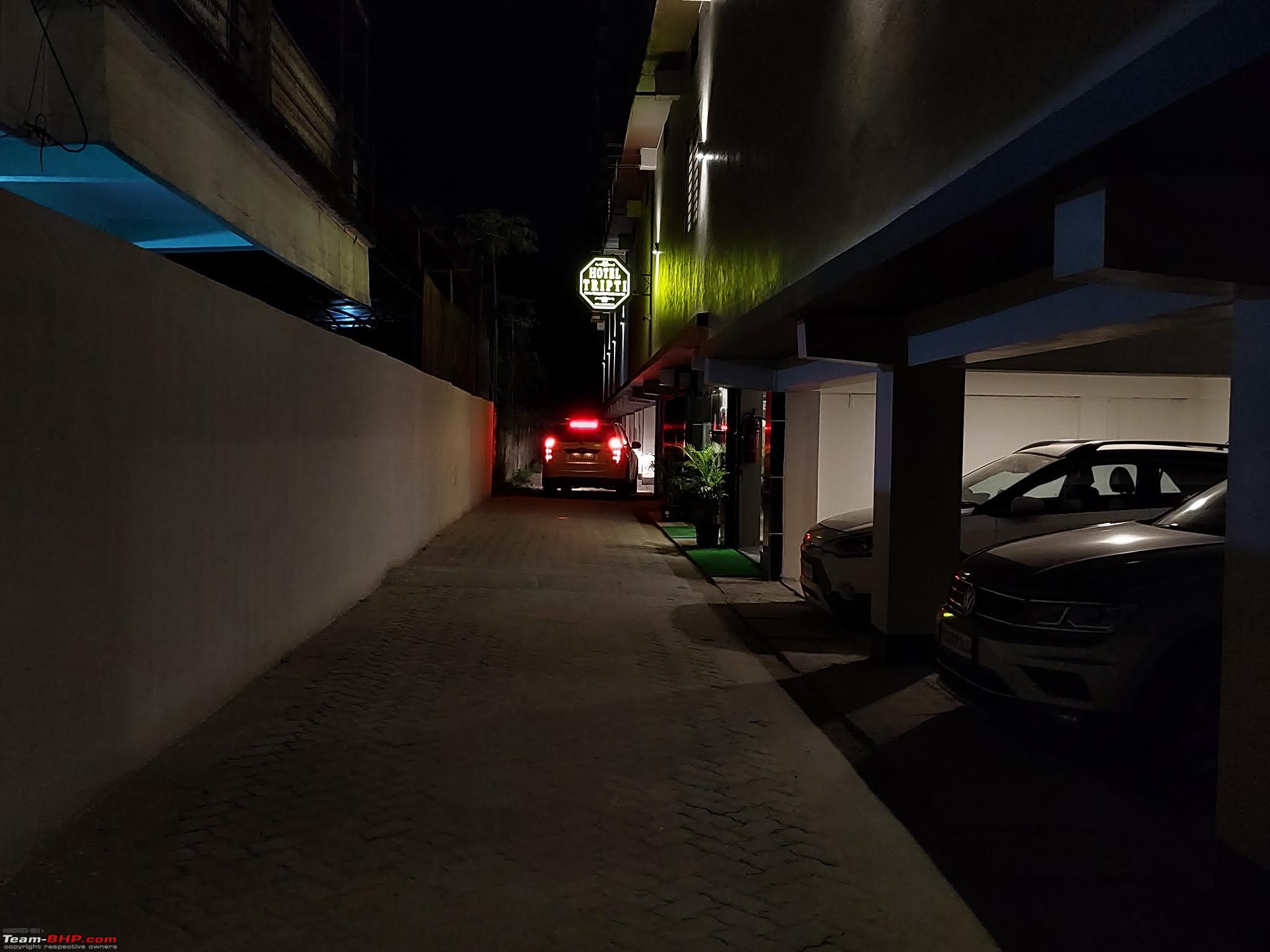
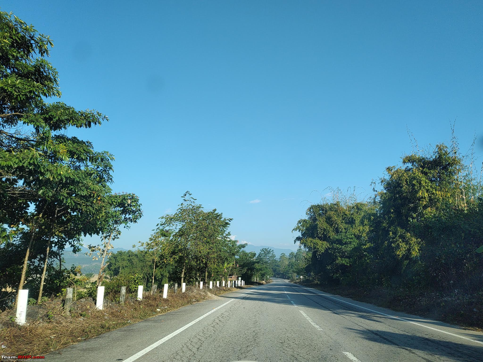
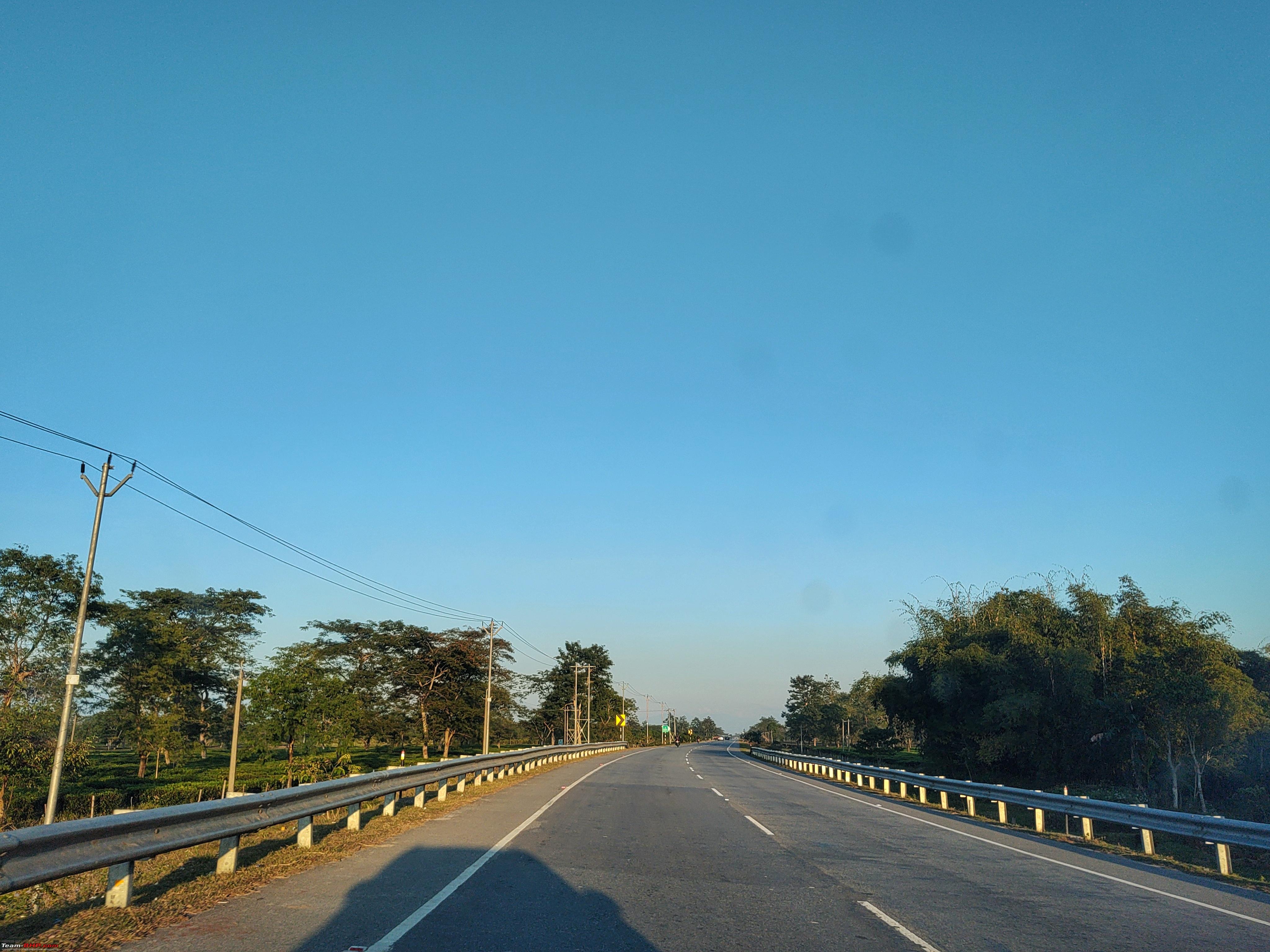
| Re: East Arunachal & West Meghalaya | 8000 km road-trip to the North East Day 3 : Raiganj, WB to Biswanath Charali, ASDistance and timings : 774kms (623am to 955pm, total breaks ~2.5hrs, traffic jam at Manikpur ~30min, drive time ~12.5hrs) We took the narrow road directly out of Vinayak towards the new Bypass, instead of heading back via the old route After crossing Raiganj Bypass, there was fog in patches, not the typical dense Gangetic Fog, but in stretches where there are lots of empty lands. It used to clear up in few hundred metres and appear again. When it cleared up, we stopped for a very quick photostop to capture the Sun finally appearing. The barricades till Dalkhola had not come up yet, local crowd was just coming out. So it was pretty decent progress after the initial fog stretch. After getting into NH27 E-W corridor at Dalhkola, the road is patchy, in October this stretch had lot of potholes, but now all were patched up, it was decent progress. We crossed Islampur Bypass around 8am, after which we started looking out for Breakfast options. They were all still closed or just opening up. We got onto Ghoshpukur-Fulbari Bypass by 835am and crossed Fulbari junction in another 20 minutes. What a relief from yesteryear route through Siliguri Town! Another 20 minutes ahead, we found a restaurant open just after Fatakpur Signal (https://maps.app.goo.gl/UtrqhKGUBbA6KvJP7). To get food quickly, we ordered Maggi and Omelette, but turned out they were just firing up the kitchen for the day, and breakfast stop yet again took over an hour for a mediocre Maggi.  As breakfast took time, we were discussion the stay options for the day, as we had to communicate it to the Tiguan folks too. RKG's copax flew in the previous day to Guwahati, and they were visiting Kamakhya Temple early in the morning. Meanwhile, HH (XUV copax) flew in from Chennai early morning and directly went to Kamakhya for darshan. He would come in Tiguan to the destination, as we wouldn't be going to Guwahati. We found a good new place, Hotel Tripti in Biswanath Charali, on the highway. With the Jamgurihat Kameng River Bridge just open a few days back, it would be a quick drive from Tezpur, hence we decided to stay at Biswanath and communicated it to guys in Guwahati. Also booked the hotel over call. After breakfast, traffic slowly picked up, we had started around 1020am. The Maynaguri Railway Gate wasn't very crowded, the Railway Bridge work was happening pretty fast and seemed to be opening soon (as I write this, it was open for traffic recently). The 2 laned section starts just before Dhupguri as NH27 isn't done yet till Salsalabari (after Alipurduar). So the routing is via NH517+317 Dhupguri - Telipara - Birpara - Hasimara - Alipurduar Bypass - Salsalabari, about 100kms of 2 laned road. Close to Alipurduar, a new Tea Lounge has opened up a few months back besides Majerdabri Tea Estate - Dabri Tea Lounge (https://maps.app.goo.gl/MYnueorUvA4HtZJB7) (I had been here in Oct'23 and it was a very nice breakfast stop, and place to purchase Dooars Tea). Because of the breakfast delay yet again, we were thinking of either stopping at Dabri or stop for Lunch only. After discussing a bit between both cars, we decided to stop at Dabri, for tea as well as tea shopping meanwhile get some Lunch packed which we would have on the go. We reached Dabri around 1230pm, and it was yet another hour's stop, but 3 things done in one place, the masala tea was superb! In another 30 minutes from Dabri, we were into Assam after crossing Srirampur Border. We had packed Sandwiches from Dabri which we had on the go. By 330pm, were were crossing Bongaigoan, where bridge work diversions start. Around 20kms after Bongaigaon at Manikpur, there was a diversion for bridge as well as road relaying before that, and it was suddenly standstill jam. Within couple of minutes, the jam built up behind us, so we couldn't turn back too (as viewed from across the road) Had we seen it a bit earlier on map, we could've taken service road to bypass half the jam. So we asked Ecosport to take the service road as they hadn't entered the section yet. It took a while to cross, as we were wondering why there was a Jam. It wasn't for road relaying as speculated. Meanwhile, it was a beautiful sunset. Finally we got to know that it was due to an accident between trucks at the diversion crossover point which caused the Jam (we had a similar jam in NE2022 drive near Gossaigaon diversions, this time at Manikpur!) From there to Rangia was about 100kms, there were 3-4 more diversions but traffic kept flowing. Road condition is fairly okay too, typical NH27. By 615pm we were at Rangia, we had decided to take the Rangia - Gerua - Udalguri route to Orang instead of the traditional route via Baihata and Mangaldoi - as the diversion at Baihata in evening hours is messy and Mangaldoi route will be crowded in evening. After crossing Rangia, roads were pretty empty, just a few vehicles here and there, lots of tea estates in the surroundings. Rangia to Orang took 2 hours for the ~110kms (with a mud road detour for Udalguri Bridge). Definitely faster than the Mangaldoi route. From Rowta onwards, the NH15 road surface was a bit bumpy. The SHs before that were fabulous. This bumpy road continued all the way to Tezpur. We crossed Tezpur by 920pm. There's flyover work happening after Mission Chariali. At 930pm, we were onto the new 4 laned road at Dolabari Chariali. From here it was very quick drive to Jamgurihat. This bridge over Kameng river has reduced the distance to Jamgurihat from Tezpur by half, and atleast 40 minutes saved. The 4 lane road is done till almost Biswanath Charali (bypass isn't done yet), so it just took 25 minutes for the 37kms. We reached Hotel Tripti (https://maps.app.goo.gl/RDUMndK1Rs6W2U4v8) just before 10pm, faster than expected from Rangia. Meanwhile Tiguan had reached in the evening by 6pm, they started from Guwahati after Lunch at Michinga. Rooms although bit small are good, covered parking too. Overall good stay in VFM rates than Tezpur town where prices were 3-4K for similar stays. Dinner was from Dominos, as most restaurants close by 9pm in this region. |
|
| (11)
Thanks
|


| The following 11 BHPians Thank adetour for this useful post: | aargee, abirnale, blackwasp, Footloose_BM, gunin, haisaikat, NPV, Red Liner, Samba, thirugata, Turbanator |
|
20th January 2024, 16:50
| #19 | |
| Senior - BHPian | Re: East Arunachal & West Meghalaya | 8000 km road-trip to the North East Quote:
| |
|
| (1)
Thanks
|
| The following BHPian Thanks pypkmsrikanth for this useful post: | adetour |
|
21st January 2024, 21:52
| #20 |
| BHPian Join Date: Jan 2024 Location: Bangalore
Posts: 32
Thanked: 314 Times
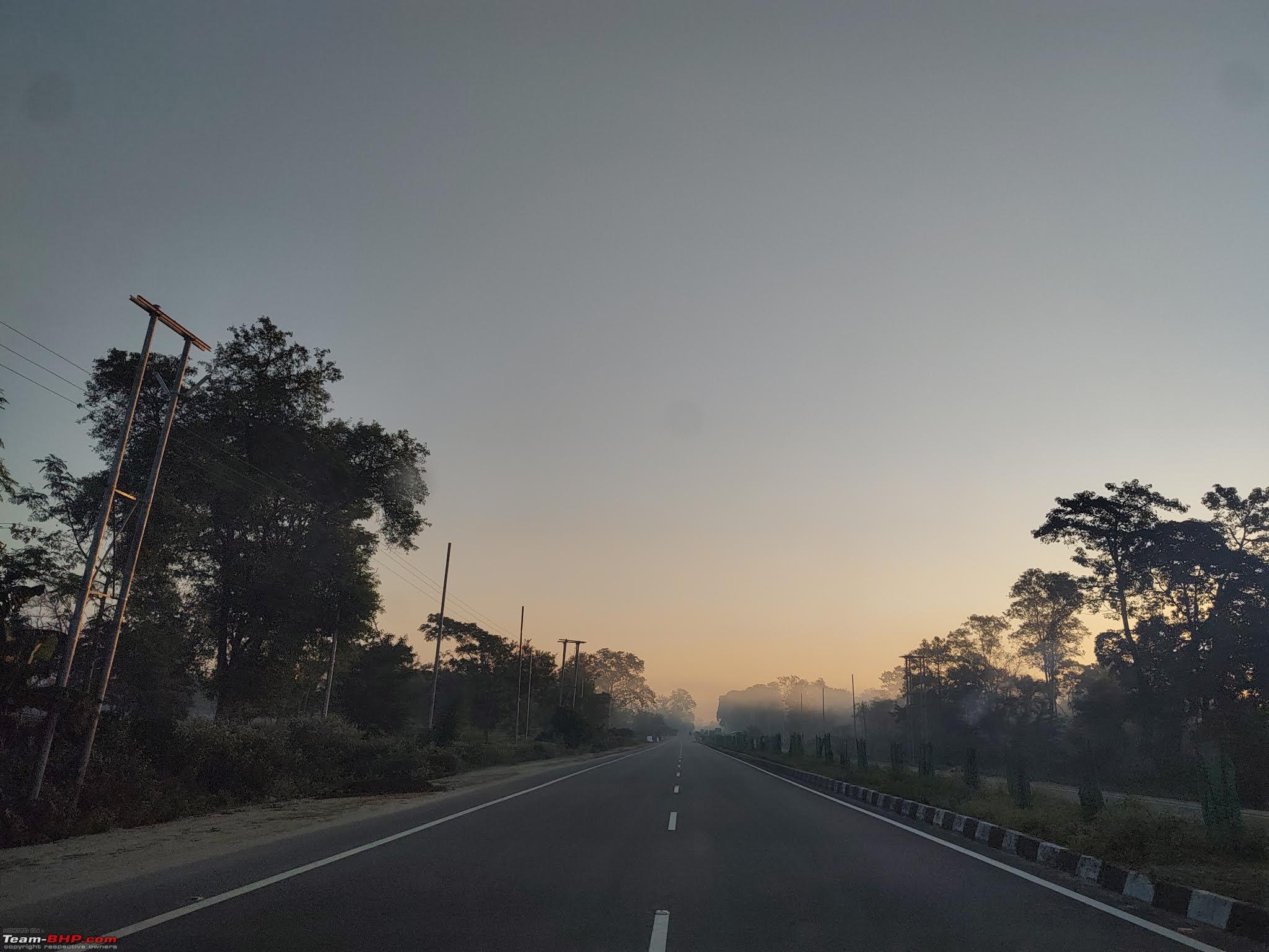
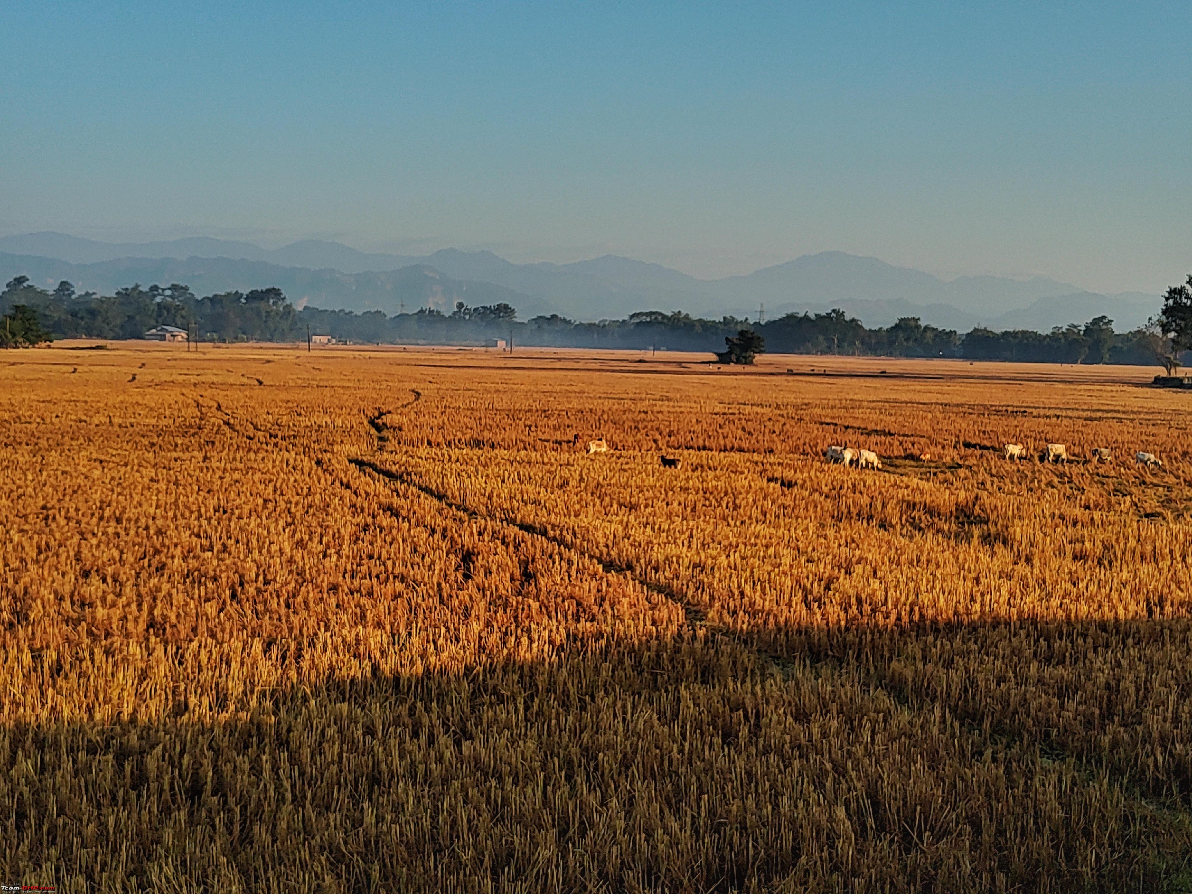
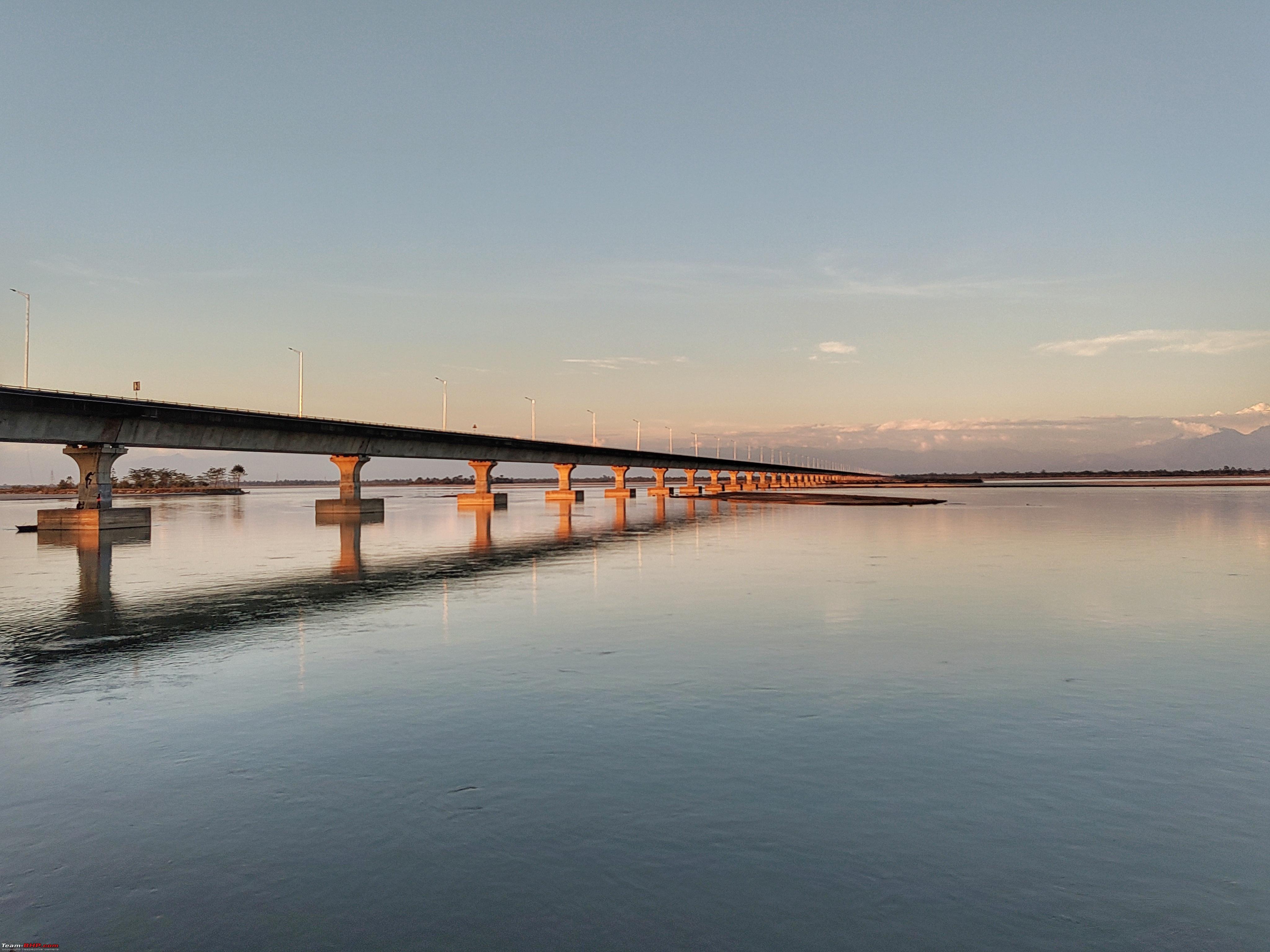
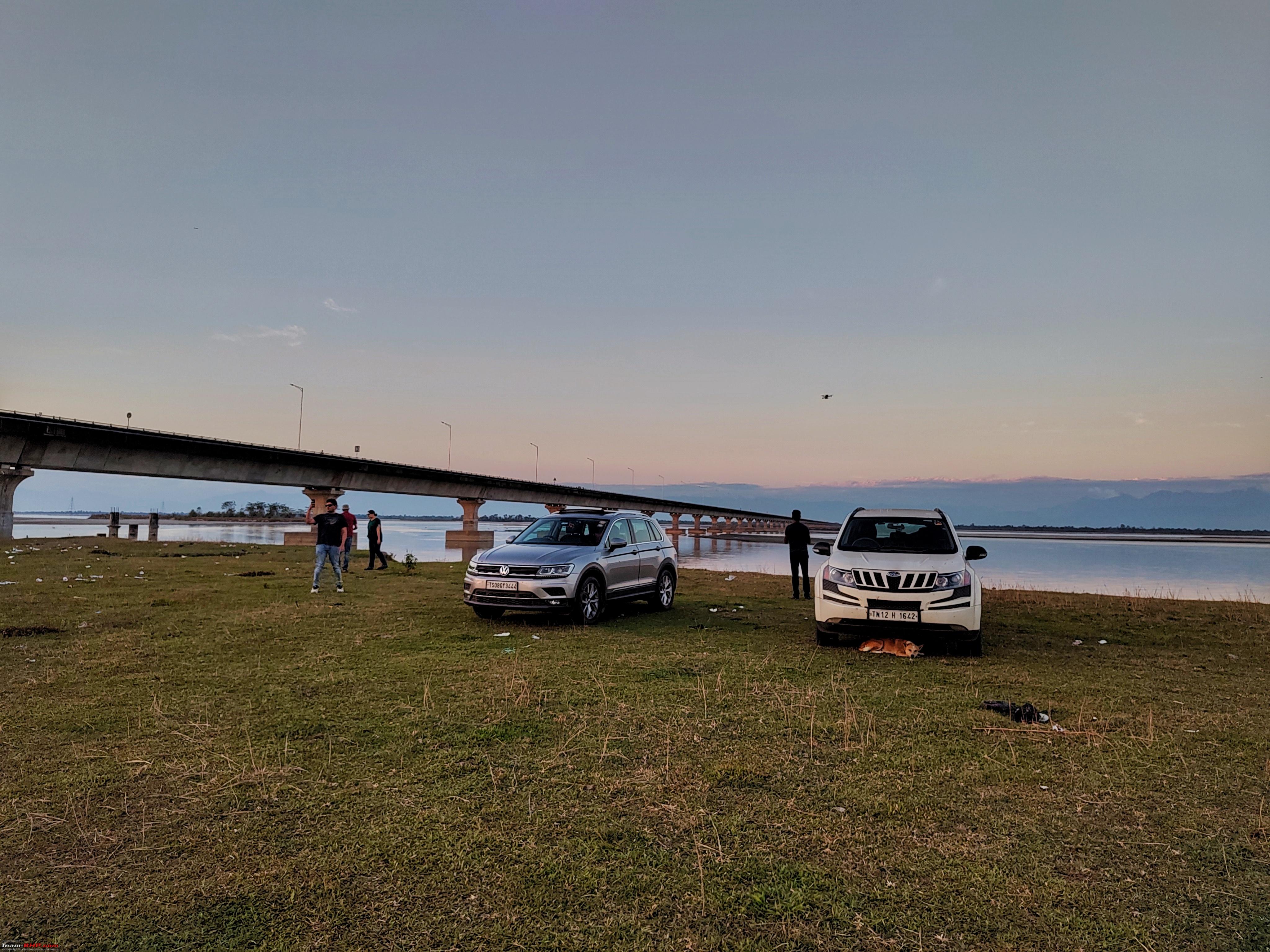
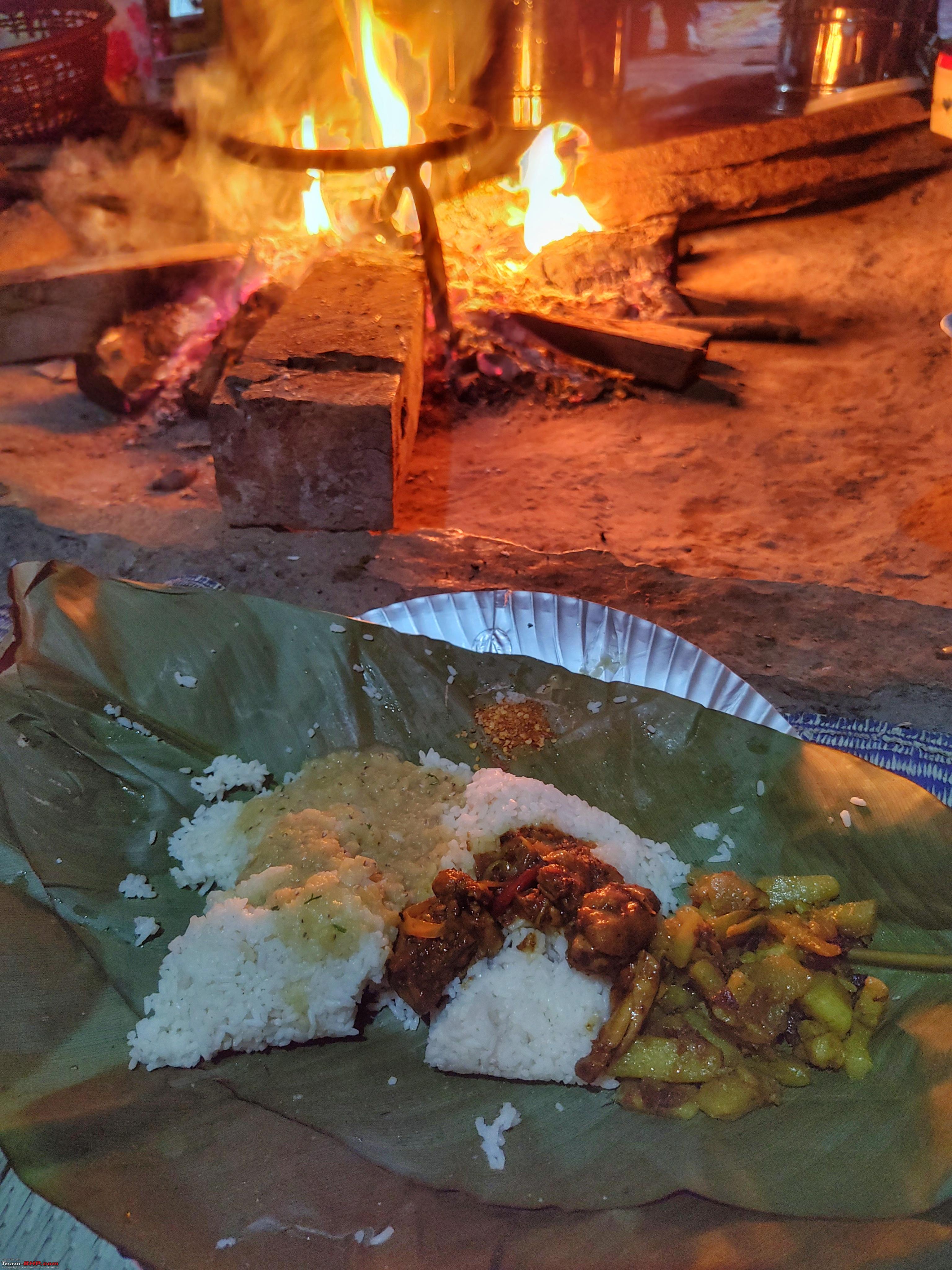
| Re: East Arunachal & West Meghalaya | 8000 km road-trip to the North East Day 4 : Biswanath Charali, AS to Roing, ARDistance and timings : 440kms (625am to 540pm, total breaks ~3hr30min, drive time ~7hr45min) We started before 630am from Biswanath Charali, it was going to be a day's drive through the length of Assam into Arunachal through the easternmost parts of Assam. Just after the town, the 4 laned roads started again, and it was superbly done road till Gohpur turnoff - from where the 4 laned road goes to Itanagar. There were lots of fields enroute, it was beautiful as the sun rays were coming up After Gohpur, it was the traditional 2 laned road (new NH15) From Narayanpur, there are two routes, the SH fully through Assam goes straight to Laluk. And the left is the NH15, which goes through a small distance of Bandardewa, Arunachal back to Assam (https://maps.app.goo.gl/1ayv5XmHXcatBew36). We took this route to refuel in Arunachal. There are 2 IOC pumps of Arunachal (left side of the road, as right side is Assam). It was the cheapest refuel of the trip, Diesel Rs. 81.99 (eastern parts of Arunachal are around Rs. 85) Bandardewa, Harmoti markets were dusty and busy with morning hours crowd, although it was worth the detour for refuel. Just before North Lahkimpur Bypass, we stopped for a quick photo stop at this temple North Lakhimpur Bypass The Arunachal hills inviting! We started looking for breakfast options after North Lakhimpur, around 9am, finally we found Harinandan Restaurant (https://maps.app.goo.gl/NCPyzhemuktEEDbN9) to be open. As usual, we were the first customer for the day and breakfast took over an hour. It was a good breakfast of Puri Bhaji and Aloo Parathas. Finally Tiguan joins the group We started after breakfast around 1015am, the roads are pretty good, broad 2 laned. We crossed Gogamukh(we remembered the turnoff to Majuli back in NE2016 drive from here), and Dhemaji. Around 1130am, we turned off towards Bogibeel Bridge - as we were taking this route to cover both the Bridges to Roing (instead of the direct route via Pasighat). Bogibeel Bridge is the largest rail-cum-road bridge in India, and currently the 6th longest Bridge over Water in India (used to be 5th until MTHL opened recently) The mighty Bramhaputra! We stopped for a few minutes at Bogibeel Bridge to enjoy the vistas around After Bogibeel Bridge, we were on the Dibrugarh Bypass. Lunch was planned at Dhaba NH37 before Doom Dooma (https://maps.app.goo.gl/8zz5oYgSSSPETxG99). Tiguan headed straight to the restaurant, Ecosport took a detour into Dibrugarh Mohanbari airport to pick up the final member of the trip - VK who flew in from Bangalore that morning via CCU. Meanwhile, we in XUV detoured into Dibrugarh Town in search of a very specific memory card compatible for the Drone. Tiguan and Ecosport folks had lunch in Dhaba NH37, it was a good standard Lunch, Rotis, Rice.etc (it's one of the good restaurants between Dibrugarh Bypass and Roing). While, we spent sometime in the town shops to fulfil the Memory Card scouting. As we were delayed, we bought the famous Tinsukia Oranges on Tinsukia Bypass, this was our Lunch. We skipped Lunch so as to catch up with rest of the gang, as well as reach Dholla Sadiya Bridge in time for Sunset. The road goes very close to the railway line at Doom Dooma But roads have been brilliant 2 laned roads thus far (except Dibrugarh Tinsukia Makum Bypass where road work is happening as part of AT road) Before the start of the Dholla Sadiya Bridge, we took adetour to reach the side of the bridge below. It was a narrow road for 3kms till the river point. Dr. Bhupen Hazarika Setu (which was the longest bridge over water in India when we visited. Now MTHL which opened recently is the longest, making this the 2nd longest although Dr. Bhupen Hazarika Setu is still the longest bridge over river water in India), a mighty 9.15kms We reached the Sunset Spot in time. It was beautiful hues around the Lohit River, and distant hills over Arunachal After spending around 30 minutes here, we went back before dark to get onto the Bridge for the Sunset Hues, which were fabulous We started the night drive from the Bridge after Sunset around 445pm, it was another 30 minutes drive to Arunachal Border at Shantipur Gate (https://maps.app.goo.gl/sbL1cUxnUGxe9yN46). Here, the ILP documents were checked. Once we entered Arunachal, roads were even better, it was a quick 20 minutes drive to Roing. We first directly went to the IOC to tank up and then reached the stay. We reached around 540pm. 4 Season Homestay (https://maps.app.goo.gl/deENyrgn4CVdCUYA8) is located on the outskirts of Roing, amidst their plantations. They had newly made the Cottages, and ours was the first booking. It is a rustic stay with just basic amenities but warm hospitality and good food. We had some maggi around 6pm just after we reached. Bonfire was put up near the Cottages, we spent some time there as it started getting colder. Few of us headed to Roing town to buy some snacks.etc for the next few days. Roing Bazzar although looks small has all the essentials needed. While Dinner was getting ready for our group, we got details about the notification of road cutting near Anini and time restrictions. We were discussing about that and we had to cross the point by 230pm. Dinner was ready around 945pm in the traditional fireplace setup. It was a typical Adi Tribe Dinner served in Leaf, and was very cozy place. We enjoyed it a lot, we discussed with the hosts about the Adi Tribe and their culture, food. (https://pasighat.wordpress.com/adi-tribe/) It was past 11pm as we finished dinner and got back to the cottages. |
|
| (9)
Thanks
|


| The following 9 BHPians Thank adetour for this useful post: | aargee, abirnale, Dhar's, gunin, haisaikat, Madrasin_selvan, NPV, Samba, Turbanator |
|
27th January 2024, 19:10
| #21 | |
| BHPian Join Date: Jan 2024 Location: Bangalore
Posts: 32
Thanked: 314 Times
| Re: East Arunachal & West Meghalaya | 8000 km road-trip to the North East Day 5 : Roing to Acheso, Dri Valley - PART 1Distance and timings : 251kms (656am to 441pm, total breaks ~1hr45min, drive time ~8hrs) Finally, after 4 days of onwards drive, it was the day of the actual trip, to the Mishmi Hills in Eastern Himalayas. There was lots of excitement. Sun was up by around 530am. We were supposed to start at 630am, but we ended up tripping the electricity (it was new cottages and perhaps never tested with all 4 Geysers on  ), so it took a while for it to get fixed and all of us to get ready. ), so it took a while for it to get fixed and all of us to get ready. We managed to start finally around 7am, also after clicking some pictures with the homestay owners. Crossing Roing Town towards Mayodia Pass. There was a Forest check post just after Roing near the Sally Lake turn, we had to pay entry fees for the Cars and people. The road continues to be broad 2 laned newly done road till here.(https://maps.app.goo.gl/YcyTZRMtCmXiQRp97) which is about 16kms from end of Roing Town. From this point, it is the old narrow 2 laned road for the next 89kms till Ithun Bridge. The path on the left goes to the under construction Greenfield Road which would skip Mayodia Pass by going along the river. It would reduce the time by perhaps 2 hours as it won't have have a big ascent and descent. Quote:
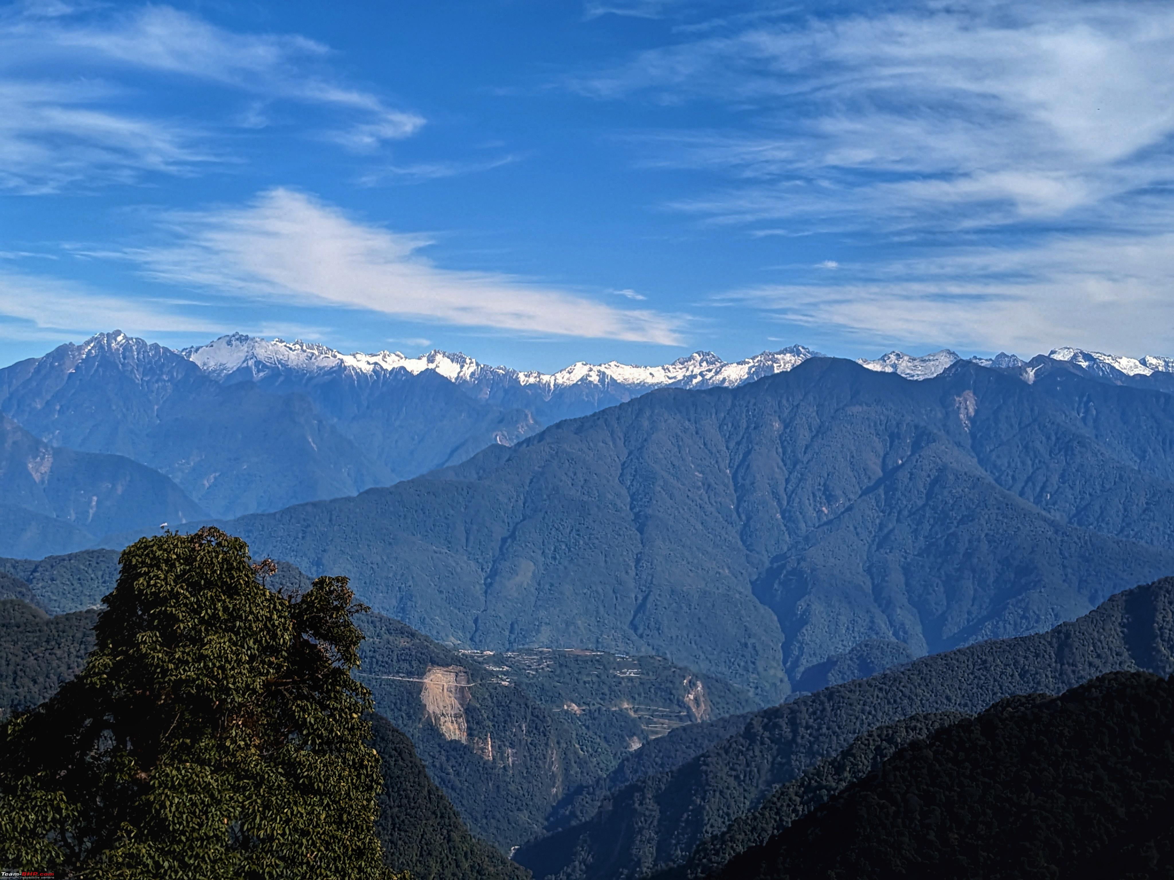
There is a small shop at this point selling biscuits.etc. The mighty Dibang River Flood plains! The ascent from 800m to 2600m in 37kms, through narrow winding roads. It was tough to overtake the Sumos which were enroute Anini, as there was hardly any space, they weren't giving way, so it was slow progress for a while. Another photo stop at a view point (https://maps.app.goo.gl/BjnUFNZvcTbxE2bD9), for a quick break from the winding curvy narrow roads. And another view of the Dibang River Flood plains. Around 9am we crossed Mayodia Village, which has a few houses. And a dilapidated Guest House. It was another 4kms to Mayodia Pass from the Village, winding roads continued, as we climbed up to 2600m elevation. We reached Mayodia Pass at 910am, about 2+ hours from Roing for the 60kms, with 3-4 photo stops. We spent around 30 minutes here at the Pass capturing the views around. This was the first network point after the end of broad roads. It was Airtel network all the way from here, Jio is still non-existent beyond Roing. The high ranges had snow all across in the peaks, and it was a nice sight (these are all 4000+m peaks N to NE of Mayodia). As we were back into network, DE who was tracking us, pointed out to this landslide in pictures and geo-referenced it for us, this is close to Hunli - (https://maps.app.goo.gl/ovVk6bSnMb2M6CYJ8). Hunli village also is visible next to the landslide. Around 10kms aerial distance, 30kms(1hour) by road, from Mayodia. After Mayodia Pass, the descent starts, the narrow and good road continues, so does the Snow Peak Views. We stopped again at 2-3 places for photos. We reached 65km village which has 2 restaurants, we had Brunch at the Old 65km restaurant. This is the only place with facility after Roing all the way to Riyali (even Hunli doesn't have restaurants). There are a couple of extremely basic but usable public restrooms too. It was standard fare of Roti Sabji, Rice Dal Sabji. We resumed the drive after about 40mins for breakfast. Another view of Hunli and the landslide, few kms after the 65km village. The initial stretch after 65km Village is good, after which the road slowly deteriorates as we descend down towards Hunli. And this is the landslide section which was visible from Mayodia Pass. Just a km before Hunli, we stopped at this beautiful view point of the village, which also has surprisingly superb broad marked road with a set of curves. And nice mountains in the background. It surely wasn't the road going towards Anini, as the broad marked road is only after crossing Ithun Bridge which is further away. When I checked the maps on satellite, it was leading to nowhere after a few kms. As we crossed Hunli, we saw a new board for Hayuliang! Its part of the new Trans-Arunachal Road, 175km getting constructed from Hunli to Hayuliang via Mentengliang. (https://infracon.nic.in/WriteReadDat...1486330509.pdf) And only a few kms from Hunli is done, rest are all still in Bids stage (https://www.constructionworld.in/tra...ayuliang/49553) And we crossed Hunli at 1124am, down to 1200m elevation... to be continued in Part 2 post of Day 5. | |
|
| (6)
Thanks
|


| The following 6 BHPians Thank adetour for this useful post: | aargee, abirnale, denver85, Dhar's, haisaikat, Samba |
|
29th January 2024, 14:52
| #22 | |
| BHPian Join Date: Jan 2024 Location: Bangalore
Posts: 32
Thanked: 314 Times
| Re: East Arunachal & West Meghalaya | 8000 km road-trip to the North East Day 5 : Roing to Acheso, Dri Valley - PART 2The <20kms from Hunli to Ithun Bridge was a continuous gradual descent, from 1200m to almost 500m elevation. Road was a mixed bag, some sections were decent, some sections had broken tarmac. It was foresty, with lot of road side waterfalls. Less the 1km from the current Ithun Bridge, there is a Y fork here (https://maps.app.goo.gl/Aeq6PmWK9ZVnYoDj9), the road leading down is the current route to Anini. The road coming from left is the new Greenfield road bypassing Mayodia, at this point, the new bridge construction is happening across the Ithun River. Hence, the existing 1km road is in poor shape (would be tough to traverse in Monsoon). The Ithun River (left bank tributary of Dibang River, originates close to the borders East of Hunli, and joins Dibang River South of Riyali) Quote:
After crossing Ithun Bridge, in exactly 2kms the broad newly done road starts (we can actually see it in a distance long before Ithun Bridge descent itself). Time was around 1230pm, we regrouped at the new road start (https://maps.app.goo.gl/pkPFbcA7GUeNeSKW6 - the board along with its shadow is visible in the Satellite image). From here it is 110kms to Anini. We were informed the previous day by our homestay owners that there is road cutting going on some 20-30kms before Anini and road there would be closed between 230pm and 430pm. So, by that estimate, we had around 80-90kms to go, it was already 1230pm, we just had <2 hours to cover the distance with just rough idea of how much the road is completed, and only a probable area where the road cutting section could be. We knew that atleast 75% of the road work would be completed from here, as it was visible in the Satellite. The notification with the timings. It was a dilemma whether to have Lunch at Riyali and then reach the point after 4pm(but this meant, once the road opens, it would be night drive to Dri). Or directly go ahead and try to cross it before 230pm, finally we decided to try the latter, without much photo stops. Just in another 2kms, we had a diversion for a pending section. (It is clearly visible in Satellite - https://maps.app.goo.gl/R7RMf4BA9muyLyBd7, but new road markings isn't done yet). It was narrow, slushy and steep. Hills around had cutting going on for the new Greenfield road, along the Ithun River. New Bridges in the completed parts of the road. The next diversion back to the old road was just ahead. This was a longer one of about 5 kms (https://maps.app.goo.gl/pLXvrvNhs381E29AA), the end of diversion isn't marked in Google, it shows the old alignment while the road climbs up to Kano Village to join the new road. This old alignment is at a lower level than the new road, few bridges are pending, as its visible in Satellite images. The main bridge work which is happening on top has triggered landslides on the old road too. This currently would be the trickiest section in Monsoons. After Kano Village, it was newly done sections, only 1-2 culvert work was pending. We crossed Riyali too and good roads continued. Signboards were confusing though (at the broad road start, it was Anini 110 and Etalin 60, now Anini 103 and Etalin 40, we had come around 20kms for sure) Couple of kms ahead of Arzoo was the 3rd diversion, the long and old alignment through Embolin (as marked in Google) is not used anymore. Along with the new alignment construction, there is a makeshift narrow road for the pending Bridge work (https://maps.app.goo.gl/iRNMw28DM9KntpEWA - clearly visible in Satellite images). We climb down the hill, cross the river and then climb up again to New Embolin. The WIP section just above this Bridge in the image is the new alignment Bridge work. Far away the landslide is the old alignment near Embolin (https://maps.app.goo.gl/qkiMngTW9TLzNSXd9) Airtel network was available all the way so far from Mayodia Pass, we were seeing new towers in every other village (Anini and Dibang Valley got Airtel 4G network in 2023 only). @denver85 was tracking us all along and informing us about the diversions ahead, in advance. After New Embolin, there were no other diversions till the road cutting section near Anini. We did not know where exactly the road cutting point was, so we assumed it was around 40kms from New Embolin, probably doable in an hour with the info that new roads done. Roads were pretty empty, no one in our direction as people are probably aware that they can't make it by road cutting closure. Meanwhile, a vehicle every few minutes from the opposite direction gave us hope. There were so many river view points, waterfalls next to the road.etc, we noted to stop in many of those on the return drive. We assumed the road cutting point to be here : https://maps.app.goo.gl/FrMsnbZZVpMpkfzYA, as after that in Sat Images, road is under construction. But as we reached here around 220pm, we realised that the road is done, and it kept going on and on. Finally at 232pm, at https://maps.app.goo.gl/o4BPfXpKR24eDR9t9, we reached the road cutting point. It was just 2 minutes late, but the rope was already put. We had overtaken a Petrol Tanker just before this and luckily reached the point just behind a local AR vehicle. After a quick discussion by the AR vehicle with the worker, the worker conveyed on walky to the other end and let us through. We followed the AR vehicle along the 1.5km road construction narrow section. All equipments were ready to start the work. Meanwhile, Ecosport which was behind us by just 4-5 minutes, reached the point right behind the Petrol Tanker. Since the JCBs were already in position at narrow cutting sections, they didn't let the Tanker through, so Ecosport also got stuck and had to wait till 430pm  We thought of proceeding ahead till Anini and see if they are let through. From https://maps.app.goo.gl/Evma2dKbSppVzkS8A, the new alignment road to Anini is done - visible in Satellite. Google Map still shows the yesteryear route. Just before Anini on this new road, there is a new View Point. We stopped here for 10 minutes. It's called the Anini View Point (not to be confused with the one above Anini Town). We reached Anini Bazzar in a few minutes. There was a shop selling Bondas and Kachoris, we took parcel from there. Meanwhile, we decided to proceed to Acheso. The Dree Afra Campsite in Acheso doesn't have network. We knew that somewhere outside Anini town onwards there wouldn't be network, till we come back to Anini the next day evening. We conveyed to Ecosport that we're moving ahead, and informed about the new road into Anini, route to Acheso.etc. We also informed Mishim Takin Resort about arrival of Tiguan after 5pm as they were behind Ecosport enroute. Since Tiguan folks were staying in Anini, we also relayed the info for the next day's plan.etc To be continued in Part 3 post of Day 5. | |
|
| (5)
Thanks
|


| The following 5 BHPians Thank adetour for this useful post: | aargee, abirnale, haisaikat, Madrasin_selvan, Samba |
|
3rd February 2024, 20:33
| #23 |
| BHPian Join Date: Jan 2024 Location: Bangalore
Posts: 32
Thanked: 314 Times
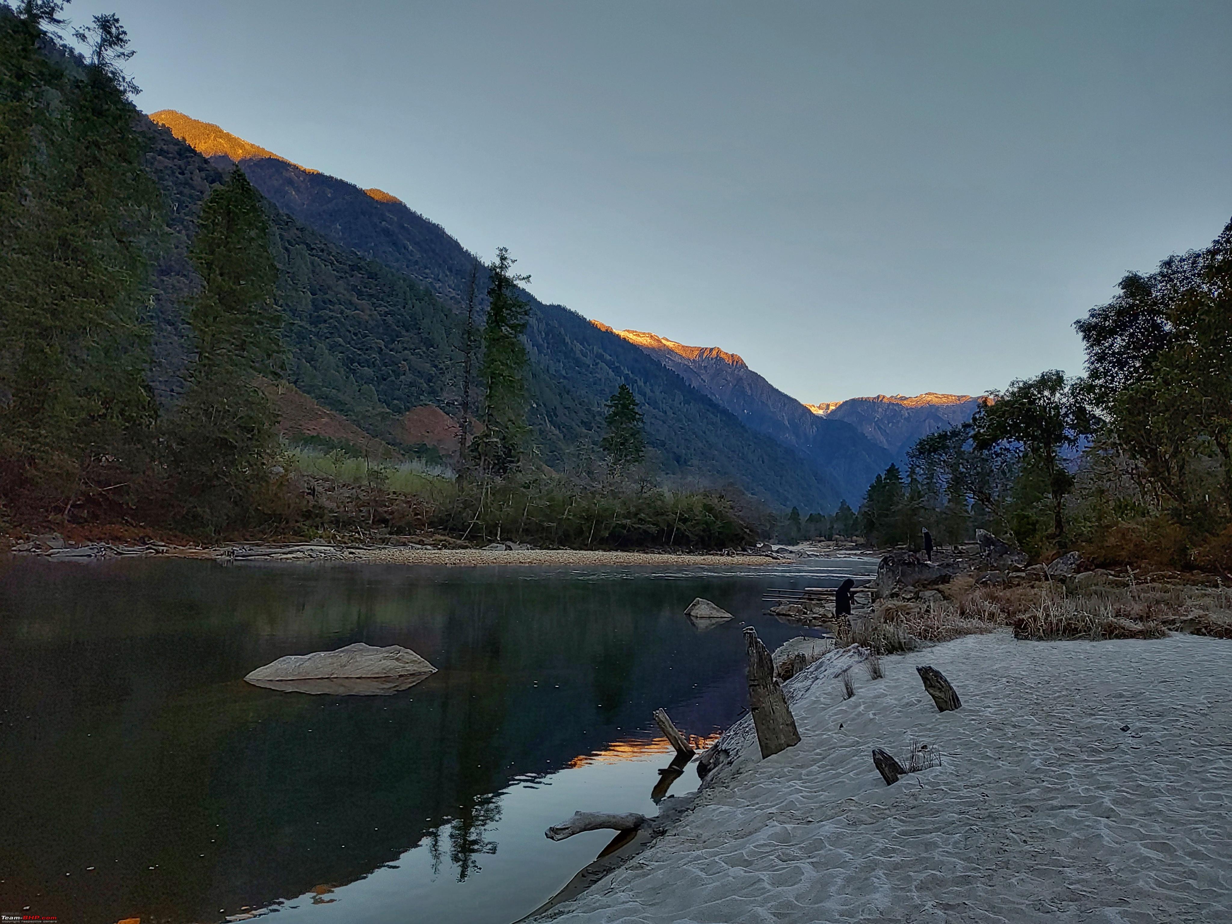
| Re: East Arunachal & West Meghalaya | 8000 km road-trip to the North East Day 5 : Roing to Acheso, Dri Valley - PART 3We started from Anini Bazzar at 340pm, with 30-40 minutes of daylight left, and 30kms to the destination. The Dri Valley vistas opened up as we descended from Anini, it was the old rough road. These Gates are common in this part of NE to prevent Mithun moving across villages. We reached down to Dri River and crossed over to the left bank through a Bridge. Rest of the journey was along the River all the way. There were many such bridges for streams joining Dri River. Surprisingly there was Airtel network, along the villages of Alinye till Angrim. We could spot new Airtel 4G towers in some of the villages. As we neared Acheso, it was almost sunset time. We crossed the Dembuen Checkpost where details were noted, and just after that was our destination, Dree Afra Campsite (location : https://maps.app.goo.gl/qtshLvijCM2HqSd17) which we reached by 430pm. It's a campsite right next to the Dri River, has permanent setup of tents, some of the tents have cots too. We checked in, ordered Maggi(lunch) and Tea. The tents and the dining area. It started getting cold after sunset, as the place is next to the river. 3 layers were on along with Thermals. Meanwhile, the bonfire was setup next to the Dinner place. By then, Ecosport had reached too. They had a fun drive in dark, without any vehicles all the way from Anini. We spent rest of the evening next to the bonfire, from 6pm till after dinner around 10pm. We discussed with the Campsite Host Mr. Ganga Milli, about various things, 7 Lakes Trek, new roads, the culture, about Reh Festival, Mithuns.etc. It was a nice cold evening, remote place with no network, and sounds of Dri river flowing. Dinner was Rice, Roti, Dal, Sabjis, local Chutney and of course local Apong. Day 6 : Morning at Dree Afra CampsiteWe woke up around 530am to capture some sunrise hues on mountain tops. Direct Sun doesn't peep into the valley until around 8am. It was biting cold when we woke up, hands went numb without gloves. The view right outside the tent. Car windshields and windows had frost. It was frost filled on ground too. Temperatures dipped to -2/-3c early morning as per weather models, when we checked in the car sensor around 6am, it was -1c. The famous "reels" location in Dree Afra Campsite. We took a stroll along the property around the River, and spent all the time till Breakfast enjoying the place. Every few minutes the lighting was changing, so were the reflections in the river. Our host was kind enough to lit up the fireplace in the morning too. The frost on ground around the place started melting visible. Tea with a view. The riverscapes got vibrant as sun started shining over the hills. Sun was out in the valley around 830am. The frost melting over the building tops created a nice scene. Looking at that, we started the cars and parked them facing the sun, to melt the frost. And within couple of minutes, it was all clear. Dree Afra Campsite details at the Breakfast place. Breakfast was a standard fare of Roti Sabjis. |
|
| (5)
Thanks
|


| The following 5 BHPians Thank adetour for this useful post: | aargee, abirnale, denver85, haisaikat, Samba |
|
14th February 2024, 17:33
| #24 |
| BHPian Join Date: Jan 2024 Location: Bangalore
Posts: 32
Thanked: 314 Times
| Re: East Arunachal & West Meghalaya | 8000 km road-trip to the North East Day 6 : Acheso - Bruni - Mawu Aandho Falls - Chigu Camp - Acheso - AniniDistance : 105kms After Breakfast, rest of the day was for driving till the end of road in Dri Valley. BRO recently completed the ICBR Road from Dembuen(Acheso) to Bruni ~37kms , it wasn't opened in 2022 but opened up by Summer of 2023. This route also has the Chigu Camp which has been promoted aggressively by Arunachal Tourism, hence making it pretty famous in social media. We started just around 10am from Acheso, the new ICBR road starts right outside the Dree Afra Campsite(DAC). With NHIDCL and DAC signboard.  The Dri Valley vistas open up few kms into the drive, tall mountains all across, with snow peaks.  Mithuns were all around the place.  There was a check post around 8kms from DAC, we had to do the usual data entry.  The entire road beyond Acheso isn't marked in Google Maps, its not even visible in Google Satellite as the imagery is from Feb 2021. Its vaguely visible in satellite images from Sentinel but road across tall mountain has a lot of shadows in images, so it doesn't help too. Someone has roughly marked it on OSM (https://www.openstreetmap.org/#map=16/29.1526/96.1473) without the proper alignment. We need to wait for Google to update its Satellite Imagery, or scrape through my Google timeline/MyMaps data   Around 19kms, <30 minutes from DAC, we reached the Chigu Camp Point. We decided to visit it on return as Sun was just peeping out in the Camp area.  What fantastic roads!  There were many waterfalls along the route, just across the road. We stopped at this one, named Deeha Waterfalls. This is just after the more famous Mawu Aandho Waterfalls which we decided to visit on return.  The mountain views continued.  Finally an hour from DAC, and about 37kms, we were at Bruni.  Just after crossing the ITBP Bruni Camp, we reached the end of road at Bruni! (Location : https://maps.app.goo.gl/rZktr2atWyPNoF466) - this is perhaps the Northeastern most motorable road of North East India. We had climbed up from 1700m elevation at DAC to almost 2600m here. The route all the way is surrounded by 4000+m peaks on both sides. The road after Mawo Aandho till Bruni for 15kms goes parallel to the LAC just 4-5kms aerially away, but located on the 4000+m peaks of watershed divide.  After few quick pictures at Bruni, we started the return drive. There were lots of such snow peaks visible. These areas generally get some snow above 3500-4000m elevation in December, but the main snowing period is January-February where snow comes down to <2000m elevation too. This Feb 2024 too, all these places we visited were snow-filled.  By 1130am we were at Mawo Aandho Waterfalls. It is a short 10 minute hike from the road side, through nice foresty trail. (Location : https://maps.app.goo.gl/UCJu1RVstwAoFbop9)  The trail was covered with such views, bamboo bridges, steps, lots of greenery. Frost on the floor as sun doesn't peep through in many places.  The Mawo Aandho Falls. Sun had just come up above the moutains, right behind the waterfalls,  this tree helped though. this tree helped though. We waited for Sun to rise up and enjoyed this places for over an hour.  When we hiked back to the road, Tiguan had also just reached there after visiting Bruni. They had started from Anini stay after Breakfast, visited Chigu Camp too. They would visit the Falls, while we checked out the Chigu Camp.  One of the countless pictures in this route.  We detoured into Chigu Camp (Location : https://maps.app.goo.gl/dLN25wniwZVaENbc6). The facilities are almost done, although some pending works were happening. They had opened up for staying too. The place is beautiful, surrounded by the Dri River. MK flew the drone around from which the view was too good.  Heading back to Acheso for Lunch.  Last views of Bruni side mountains just before Acheso.  We turned into the Dree Afra Campsite, just after this signboard.  Lunch at Dree Afra Campsite, standard fare.  All 3 cars at DAC. After Lunch, we discussed a bit with the host about the day and the memorable stay. We paid the stay and food cost.etc, then checked out from the tents. It was 330pm when we started, with less than an hour's daylight left, and about 30kms to go.  Rest of the drive was uneventful and quick, sun was setting and we didn't stop anywhere as we had photo-stops the previous day. We reached our stay, Mishmi Takin Homestay (Location : https://maps.app.goo.gl/dDRPPLdAMapKxy4r6) by 440pm.  One of the rooms. It was a wooden+bamboo house, usual in this part of NE.  The hall area. It was maintained very neatly. The restrooms aren't attached, they are in a separate building.  The kitchen and dinner place. We spent rest of the evening here after checking in, it was cozy traditional fireplace. We were here 3-4 hours until after dinner. Dinner was again Rice, local curries, chutneys and Dal. We had a lot of discussions with the humble hosts and the grandma there, they have a wonderful kitchen setup.  Outside view of the traditional Kitchen.  The main building which has the rooms. The night sky was brilliant, many stars visible even in random phone held pictures.  |
|
| (5)
Thanks
|
| The following 5 BHPians Thank adetour for this useful post: | aargee, abirnale, haisaikat, Madrasin_selvan, Samba |
|
22nd February 2024, 22:43
| #25 | |
| BHPian Join Date: Jan 2024 Location: Bangalore
Posts: 32
Thanked: 314 Times
| Re: East Arunachal & West Meghalaya | 8000 km road-trip to the North East Day 7 : Anini - Mathun Valley (Basam, Dri, Emuli) - AniniDistance : 106kms Today's drive was into Mathun Valley, till the end of road. Mathun River is the other river branch around Anini, along with Dri River. Mathun also originates from the high range peaks of the LAC watershed areas. This route has villages of Emuli, Mipi, Basam. Quote:
The morning hues after Sunrise. 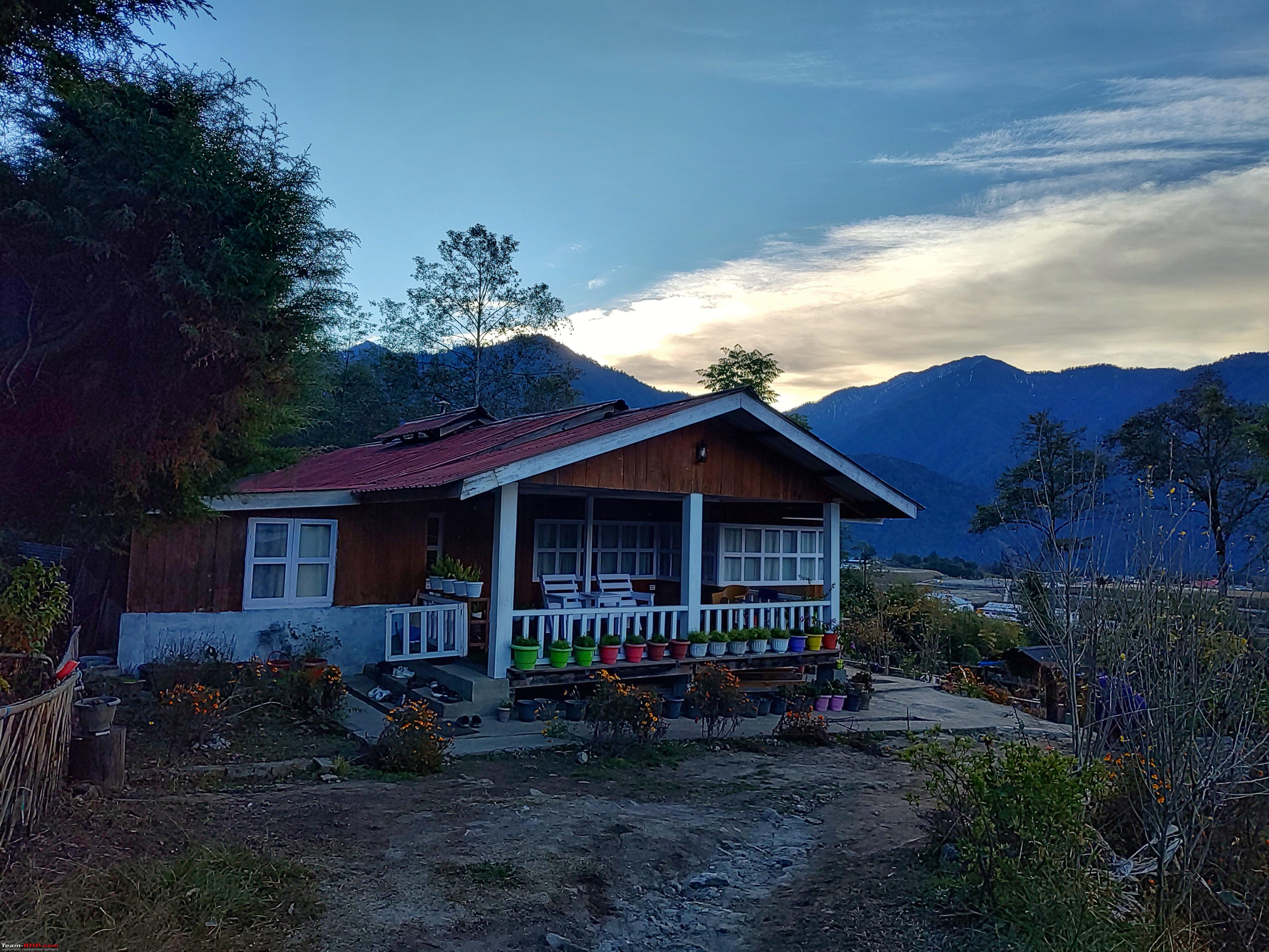  The traditional kitchen bamboo hut in daylight.  The homestay served us very tasty Parathas for Breakfast.  The cozy fireplace which was lit up in the morning too.  We started the drive at 945am. The road till Mipi is the old road, not the upgraded NHIDCL road (similar to Anini to Acheso road).  Unlike yesterday, all 3 cars were together today.  A Mithun Gates just before Emuli Village.  Many such new bridges have come up in this route, this one over Tahu Pani (Searching for Tahu Pani on Google led me to the alignment map : https://forestsclearance.nic.in/Down...ddata/Addinfo/ )  We reached the New road fork just before Mipi turnoff (https://maps.app.goo.gl/YPUwDFUMqrqwndAt7). From here left goes to Mipi through a Bridge across the Mathun River (we would come back and go there). The right fork is the new NHIDCL road being constructed between Mipi and Basam (project status https://nhidcl.com/wp-content/uploads/2023/11/AN.pdf page 3 ICBR row 3)  Climbing up the new road, access is not tarred yet.  After which is it fabulous tarmac almost all the way.  Wonderful ICBR Mipi - Basam Road.  These new ICBR roads(both Dembuen-Bruni and this Mipi-Basam) are not yet marked in Google Maps, neither have the Satellite imagery been updated. They are partially marked in OSM though (eg : https://www.openstreetmap.org/way/985282109)  Some 1-2 bridges aren't done yet, otherwise it was all good roads. Towards the current end of road before Basam.  Reaching the current end of road. They are making a Bridge across Mathun River from here, to Basam. About 95% of the whole project is done, pending part is a couple of bridges and mainly this Bridge to Basam which is across the river. Location of Basam https://maps.app.goo.gl/8hjjE85NHJXmmW329 looks more like a ITBP post rather than a village, someone with more info please do add.  Current end of road location (https://maps.app.goo.gl/z8JW92WMGZ1dTPsV6) is a POI in itself with Mathun river accessible. The road was much higher than the river almost all the way till here. Now at this point the road and river is around 1700-1800m elevation. While around Anini, the road is at 1700+m and river is below 1200m elevation.  There are a couple of walking bridges made for the pending road bridge work, the first one had tamed river flow.  The transparent, snow melt waters of Mathun River! The rocks at the edge of the river was a beautiful place to sit and enjoy as time stood still, we spent easily an hour+ here gazing at the mountains midst the river flowing across.  The second bridge had gushing waters.  After Basam, we retraced back the ICBR road, then took the old road at the fork to Mipi. This is at the Mipi Bridge over Mathun River. 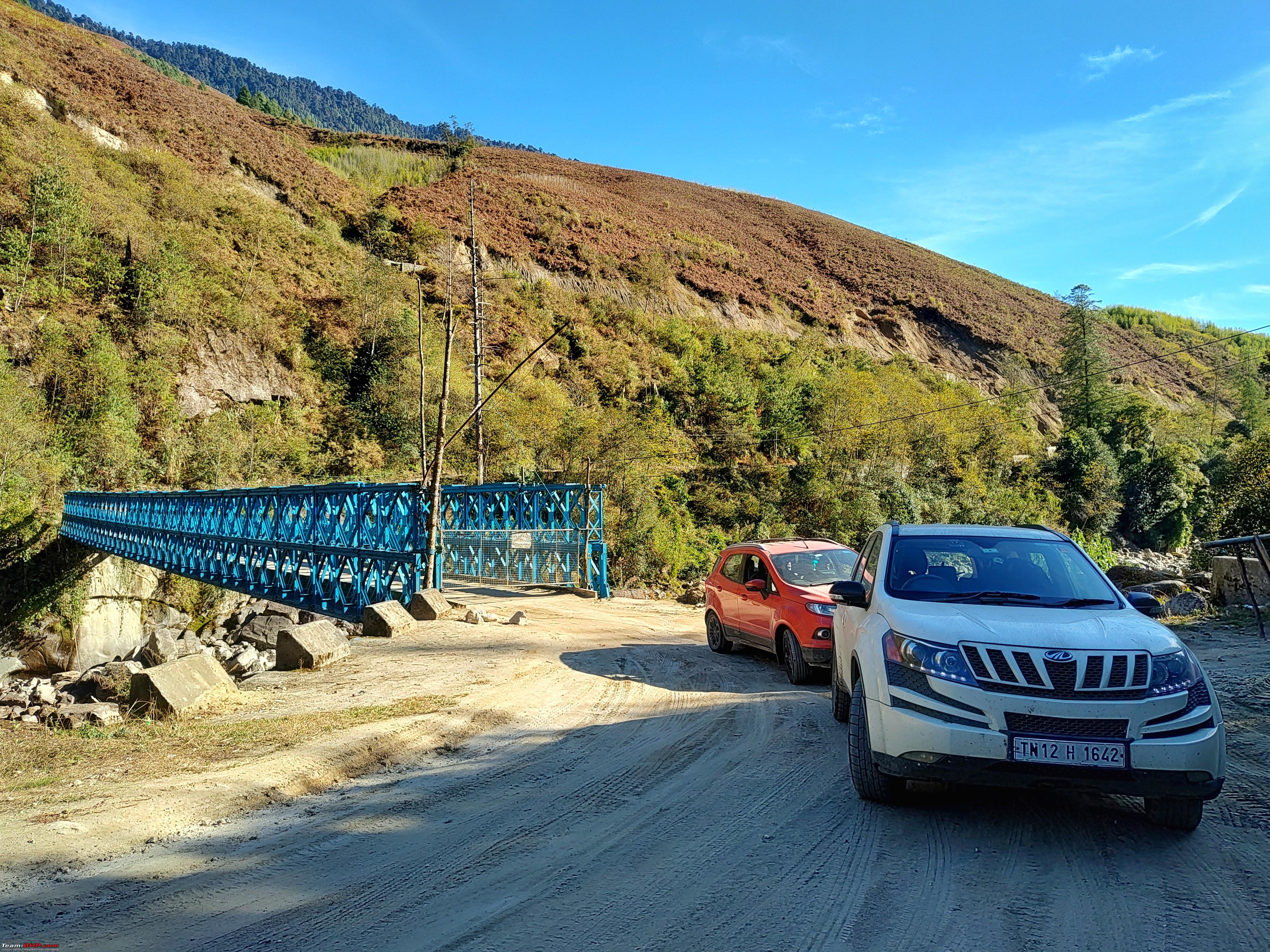 After the Bridge, we didn't head into Mipi village, but took the new road to Maronli, as there is a viewpoint halfway enroute (https://maps.app.goo.gl/upfWWbEKkAzUywyh9)  It had wonderful elevated views of the grasslands around Mipi. They would be super beautiful in Monsoon (but reaching these areas in Monsoon havoc is still a challenge ) The one with the cars from the Brango-Maronli View Point.  It was already 130pm when we started back the return drive, after spending 10-15 minutes at the View Point. Crossing back the Mathun Bridge again.  We reached back Anini at 3pm, return drive was uneventful for XUV, as we decided to return back to cover Anini View Point for Sunset. While, Tiguan and Ecosport stopped at Emuli to hike up the grasslands.  The Homestay in bright daylight.  Overall Mathun Valley was different experience compared to Dri Valley. Mathun terrain is different, lots and lots of grasslands, river and road at various elevation difference, wider valley with distant mountains visible, far from the actual LAC. While Dri Valley had narrow valley, with huge tall mountains on both sides, sun peeking out after 8am and going behind hills by 2pm, lots of waterfalls and foresty terrain, river and road at similar levels, and very close to the actual LAC and ofcourse the North Eastern corner above Fishtail 1. | |
|
| (4)
Thanks
|
| The following 4 BHPians Thank adetour for this useful post: | aargee, abirnale, haisaikat, Samba |
|
17th March 2024, 11:32
| #26 |
| BHPian Join Date: Jan 2024 Location: Bangalore
Posts: 32
Thanked: 314 Times
| Re: East Arunachal & West Meghalaya | 8000 km road-trip to the North East Day 7 - Contd.. Anini View PointAfter reaching back Anini from Mipi Valley, we visited the Anini View Point around Sunset time. The View Point is located atop the hill besides the town, the route was 2.5km mud road with a few hair pin bends. 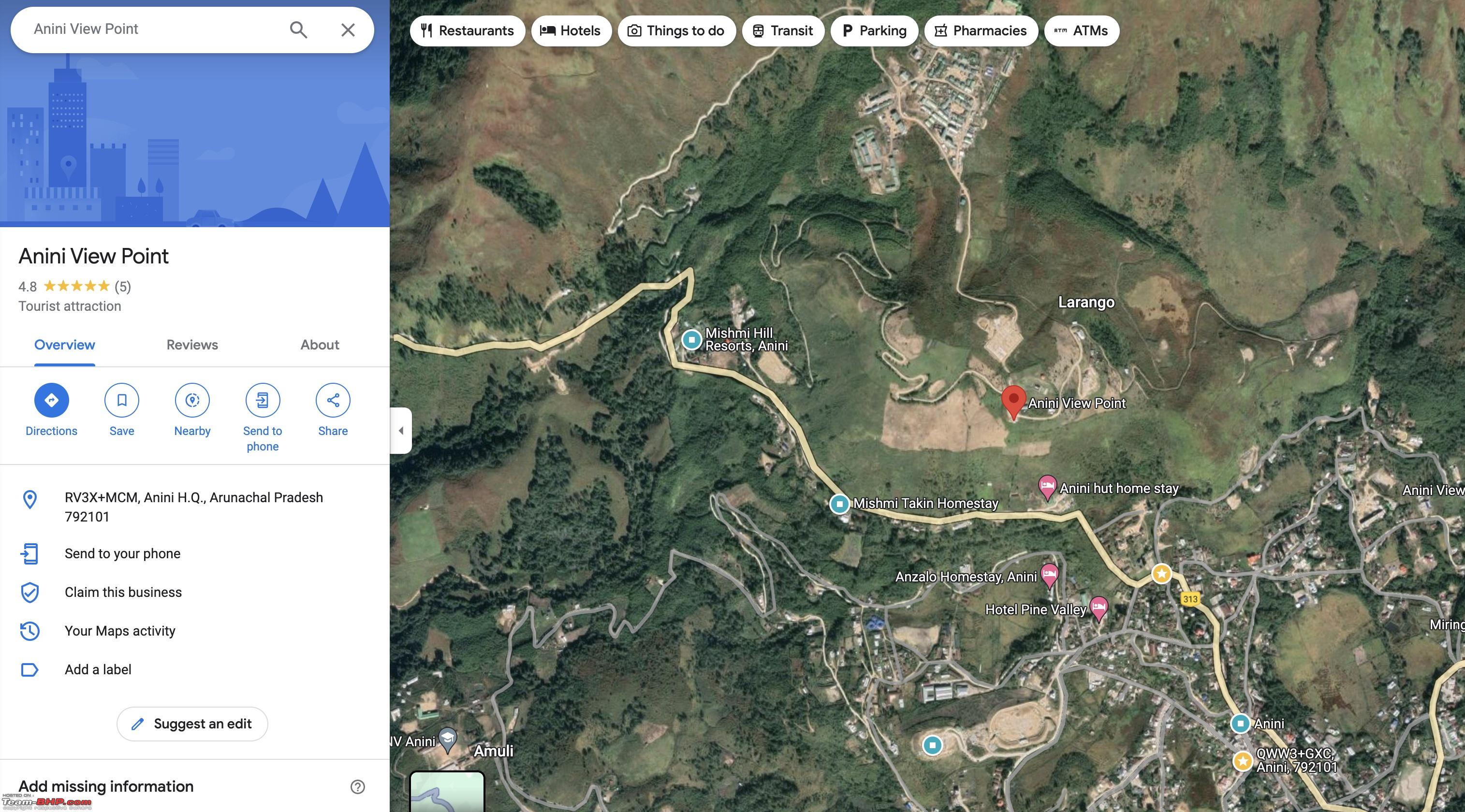 The Eastern high ranges visible enroute.  The beautiful road leading to the View Point.  First views of Anini Town some 400m before the View Point.  The Eastern high ranges, the view point in distance all decked up with Twilight, as Sun was sliding down the hill ranges.  The View Point with India Flag.  Perfect Bird's eye view of Anini Town.     It started getting dark by 4pm, so we headed back into Anini Town for late Lunch. There were a few small restaurants, we had nice Maggi and snacks. Ecosport and Tiguan gang who had visited Emuli Grasslands also reached back Anini around the same time for Lunch. As per original plan, we had not booked the stay for the next day, as we wanted to keep it open based on the time taken for Roing-Anini. Now that we knew the exact road conditions and approx time taken, we decided that we can push till Wakro by evening. We called up the already shortlisted stay, Ninashi Homestay, and luckily they had 4 rooms that we needed, so immediately booked it. With that, we firmed up the plan of starting around 6am and taking it slow with lot of photo-stops in the completed road sections till Ithun Bridge (as we skipped the stops onwards) and then no stops till Roing. After Lunch, we reached back the homestay around night 5pm, rested for a while and were back at the Kitchen fireplace until Dinner. It was the last day at Anini, finally we visited this place and covered a few places as well, after many years of planning. Surely we want to come back again for the Seven Lakes Trek sometime in the near future. We settled the homestay bill after Dinner and bid bye to the hosts as we would be starting early the next day. Day 8 : Anini - Roing - Wakro : Part 1 till EtalinWe started at 620am from Anini, around 330kms to be covered today.  We crossed the Construction Point just outside Anini.   And then quick photo stops started, whenever we spotted some waterfalls or good views of the river.  Waterfall, the Dri River, the new road at higher level and the old path below closer to the river.  Sun had started peeping into the Valley and this was giving a good contrast. 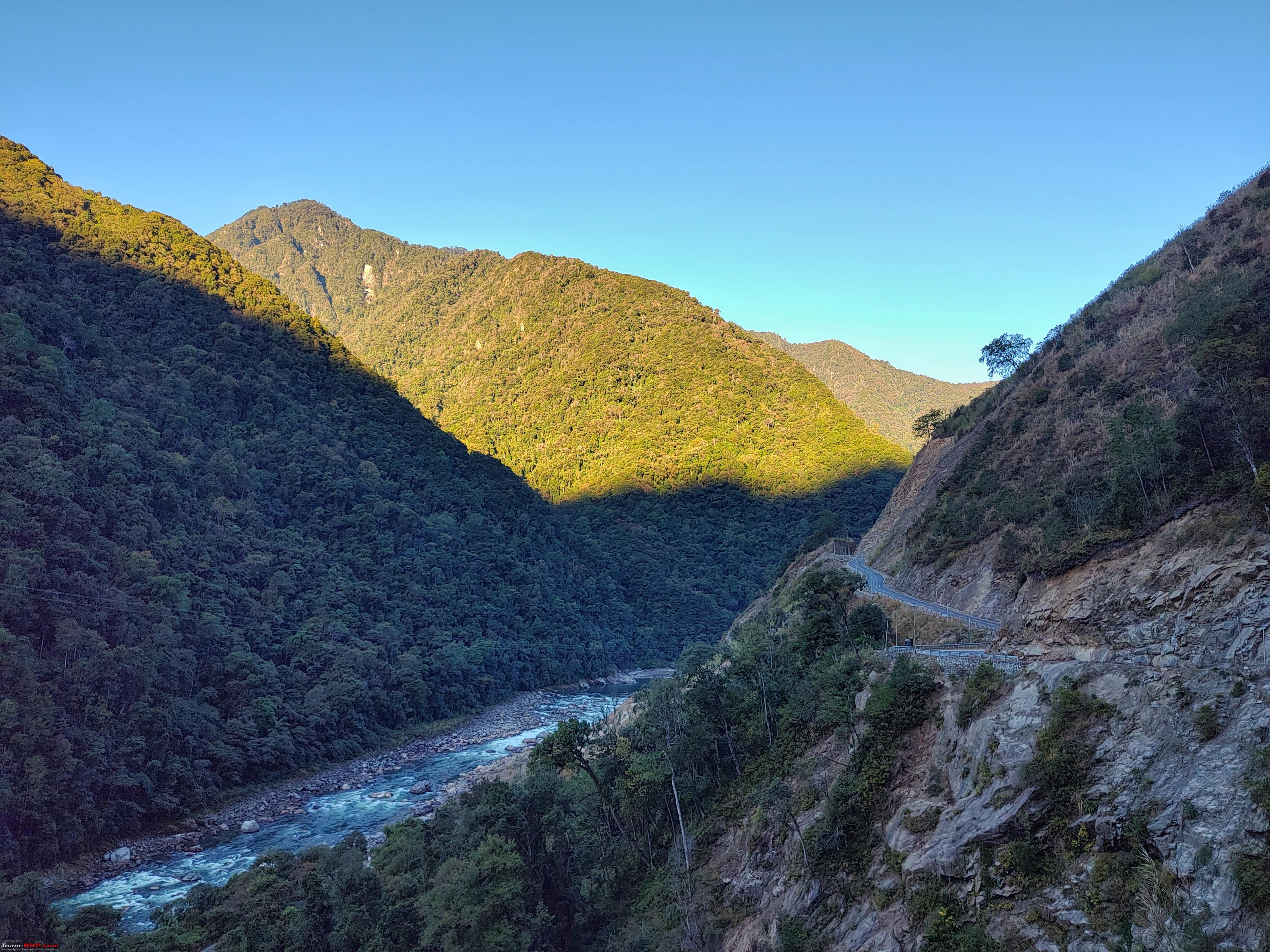 Notice the old road below, as expected the new road work had caused lots of landslides over the old road through the last few years. Imagine driving on that old road during Monsoon full of slush and rocks  there are lots of such videos in Youtube before the road got tamed. there are lots of such videos in Youtube before the road got tamed.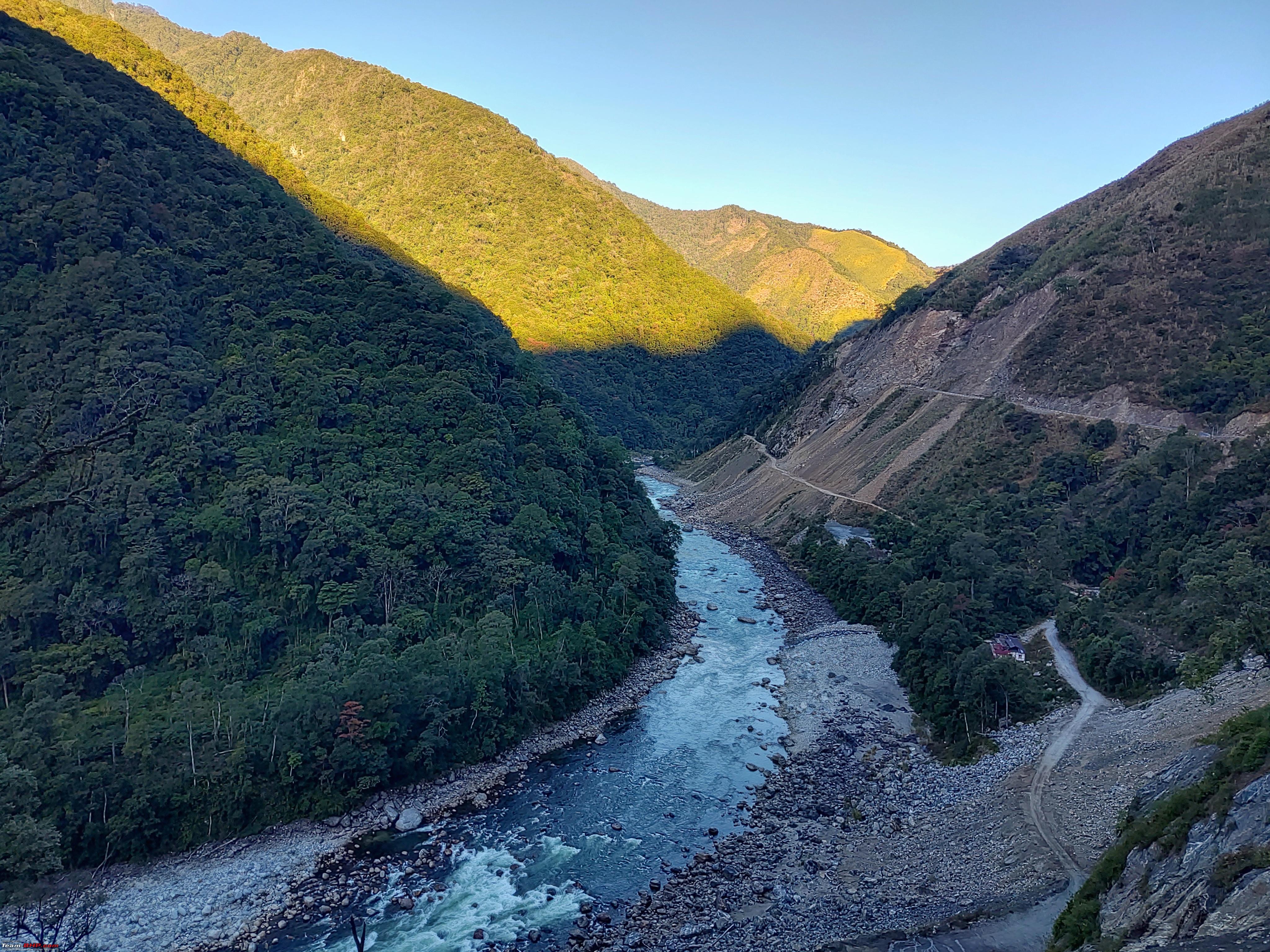 Some small detours for waterfall photoshoots.   ...and then some on road ones too.   More views of the Dri River.  Around 8am were were around Etalin. This is where Talo(Tangon) River from Maliney side (originates near Kaya Pass) joins the Dri River to become Dibang River. A Dam is being planned here as part of the Dibang Hydro Electric Project, and this is probably why the landslides in the picture.  At Etalin village, we found a shop open for breakfast serving Maggi. The elevation of Etalin is just around 600m. About 1000m below Anini elevation. And surprisingly Etalin didn't have Airtel tower yet, rest of the route right from Mayodia to Anini had a tower almost at every village. So this area of 5-6km around had no network.   |
|
| (3)
Thanks
|
| The following 3 BHPians Thank adetour for this useful post: | abirnale, haisaikat, Samba |
| |
|
6th April 2024, 11:46
| #27 |
| BHPian Join Date: Jan 2024 Location: Bangalore
Posts: 32
Thanked: 314 Times
| Re: East Arunachal & West Meghalaya | 8000 km road-trip to the North East Day 8 : Anini - Roing - Wakro : Part 2Crossing Tangon River at Etalin.  Dibang River after the confluence of Dri River and Tangon River, downstream of Etalin.    One such road side waterfall stops.  The famous U turn view of Dibang River before New Endolin.   After New Endolin, we were back onto WIP road stretches, this was the first one.  Last views of Dibang River in the Hills, around Riyali.  The second WIP section after Kano Village.  The last WIP section (28.387418881884848, 95.93022475950107) just before end of newly done roads, had a steep descent and then an ascent after the bridge. It was dry during onwards drive, but slushy during return drive.  We reached the end of new road around 11am, 110kms from Anini for which we took 4.5+ hours in a relaxed way with photo stops (the same took only 2hr45min onwards). We planned to have late Lunch at Roing town, and do the stretch ahead without any stops.  The Ithi River at Ithun Bridge, the climb to Mayodia starts from here.   Regrouping after Ithun Bridge.  The state animal of Arunachal, Mithun.  Cloud cover was increasing through the day.  We reached 65km village around 110pm, a quick stop after the broken roads from Ithun Bridge till here. Hunli village is visible in this pic next to the landslide.  We crossed Mayodia Pass around 130pm, the downhill drive towards Roing after that on narrow but good roads was uneventful.  We reached Roing at 3pm. Some of us headed to the Bazzar area, while a few went to QSR M&E restaurant. After Lunch, we did some medical shopping, snacks shopping and then refueled at IOC. We finally started from Roing at 410pm. By then sun had started setting.  The flat plains and wonderful NH13 roads ensured good pace, we wished to catch some hues at Alubari Bridge.  At Digaru, we turned off from NH13 towards Alubari Bridge, which is 2.9km bridge over Lohit River. We caught some glimpses of the hues.   The destination, Ninashi Homestay was another 57kms from Alubari Bridge, it took us 80 minutes, NH15 roads were narrow after Chokwkham but arrow straight till almost Wakro climb. We were finally back in cozy plains weather and good geyser with piping hot water. Ninashi homestay was a really good choice, food was excellent too. We enjoyed the Miju Mishmi hospitality and discussions with the hosts, of course in the traditional kitchen dining fireplace.  |
|
| (2)
Thanks
|
| The following 2 BHPians Thank adetour for this useful post: | haisaikat, Samba |
|
6th April 2024, 13:48
| #28 |
| BHPian Join Date: Jan 2024 Location: Bangalore
Posts: 32
Thanked: 314 Times
| Re: East Arunachal & West Meghalaya | 8000 km road-trip to the North East Day 9 : Wakro - Walong - 160 kmsToday's drive was into Anjaw district towards the famous Kaho Kibithu easternmost areas of India. We had booked our stay at Nomkholong homestay in Walong, some 20+ days before the drive. We had booked 2 nights, so as to cover Dong Trek as well. The day's plan was to visit Parashuram Kund and then drive towards Walong enjoying the vistas along Lohit River. It was a late start after 930am from Ninashi Homestay, Parashuram Kund was just 10 minutes away. 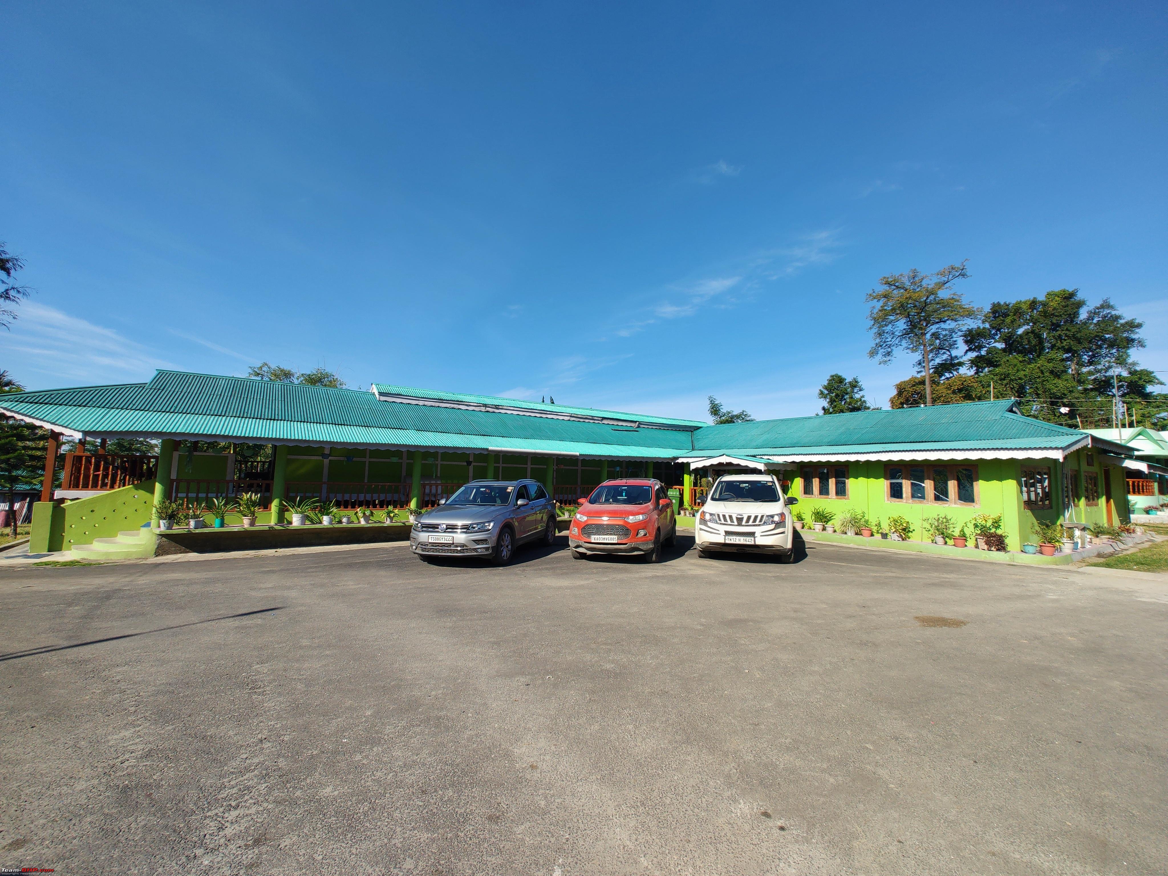 Mesmerising sight of Lohit River at Parashuram Kund.   We hiked down till the river level and temple next to it. There is Stairs construction happening all along the 15 minutes hike.  The Lohit Bridge as seen from the Parashuram Kund hike path.  After spending some time at all the temples, we then proceeded towards the Bridge. Views from the Bridge of Parashuram Kund rock.  The other side.  We started at 1120am from the Bridge after about 1.5 hours at Parashuram Kund. Its a uphill climb after the bridge, every hair pin bend gave a nice elevated view of the River.  The last 300meters towards the Tezu road junction is landslide prone (https://maps.app.goo.gl/foPW72xMK4Xeg4NE7). This area got washed away in the Monsoon.   At the Tezu road junction. Left downhill is the way we came from Parashuram Kund. Right uphill is the road coming from Tezu. This route has lot of WIP sections after Tezu, that's why we preferred to take the Wakro route.  The BRO completed greenfield road starts from here (previously one had to go via Demwe to Tidding).  And it is a fabulous road till Tidding.  Lohit views.  End of good road at Tidding (the distances are wrong here).  Tidding Bridge. We entered from Lohit district into Anjaw district here.  ...and the bad WIP roads started.  Some sections had broad mud road, some sections had broken tarmac.  Although it was only for around 20kms which took about 45-50 minutes. We got back into completed roads after Khupa-Swami Camp area.  It was Lunch time when we were nearing Hayuliang, there was nothing on the main road, and the actual town was inside, so we turned into Hayuliang Bazzar at 130pm for Lunch. Standard rice dal fare.  We started after Lunch around 2pm, more Lohit views continued.   and superb roads continued till Hawai.   One such waterfalls enroute.  55kms from Hayuliang, we were at Hawai turnoff. The broad road ends just before Hawai (greenfield being constructed directly to Hawai town). It was 330pm, and we took a small detour to Hawai Bridge to see Lohit again.    After 15 minutes there, we started the last leg towards Walong. Sun had started setting already. It was 43kms to Walong, there was network till Sarti Camp (13kms before Walong) after which it is complete blackout except BSNL voice. We reached Nomkholong Homestay, Walong at night 510pm. The rooms were made of bamboo and wood, there was active construction work happening around the property, so it wasn't very comfortable stay. Yet we enjoyed the evening without network.  The homestay was understaffed and dinner was served only around 10pm, while waiting for that we discussed about skipping Dong Trek as it had been cloudy since the previous day and we had already checked weather forecasts for possible rain/snow in the higher ranges. So a sunrise trek on very cloudy weather won't be great especially if waking up at 2am for that . With that, we also decided that since we would have a lot of time with Dong cancelled, we could skip the stay again at Nomkholong and head back to Ninashi ,Wakro after visiting Kaho Kibithu. |
|
| (3)
Thanks
|
| The following 3 BHPians Thank adetour for this useful post: | haisaikat, Mr.Fawlty, Samba |
|
10th April 2024, 18:53
| #29 |
| BHPian Join Date: Jan 2024 Location: Bangalore
Posts: 32
Thanked: 314 Times
| Re: East Arunachal & West Meghalaya | 8000 km road-trip to the North East Day 10 : Walong - Kaho - Kibithu - Wakro : 246kmsAs we had planned to drive back to Wakro for stay, the main thing in the morning was to call and book Ninashi Homestay, from the only working BSNL voice phone in the group. Luckily they had availability but only 3 rooms, we requested them to book another room in the nearest homestay. With that sorted, we planned to check-out from Nomkhlong Homestay after Breakfast. Morning views, surrounded by tall mountains across, the Walong Advance Landing Ground and Lohit River in the edge.  Breakfast with a view. It was a cloudy morning as expected, with some snowing happening in the higher altitudes.  We managed to start by 9am, the first stop was a quick one at Walong War Memorial, just at the end of the village.  The road ahead towards Namti.  After Namti, the climb starts and road work is happening here for 5-6kms. Notice the fresh snow on the peaks.  Closer to Karoti and just before the First Tibet Border View Point, the road on the other side is connecting Dong to Karoti and then Kaho.  At the "First View of Tibet(China) Point"  The view of Zayul County across the two mountains.   The other side view of Karoti fields, the new Karoti Bridge across Lohit and the Dong - Kaho road on the other side of the river.  After the view point stop, we descended down to Karoti, and took a right(straight goes towards Kibithu) to Karoti Bridge (https://maps.app.goo.gl/URdWTr8qLuH51tCp8).   The colourful Lohit River!   2kms after the bridge we reached the T junction (https://maps.app.goo.gl/bDzMNiTd3vqALjPF9) with this signboard, where we took left towards Kaho. This is the "Easternmost road of India" towards Meshai, Kaho and Dichu. Kaho is around 11-12kms from here, beyond that is restricted for general public. The road towards right from here leads to the "First Sunrise point of India", Dong.  The Easternmost road is narrower and goes parallel to Lohit all the way to Kaho. We reached the last point in Kaho at 1040am. It's a small village with few shops, couple of homestays have come up as well. After spending 15 minutes around the place, and after ticking off visiting the currently still easternmost drive-able place in India, we started the drive back towards Kibithu.  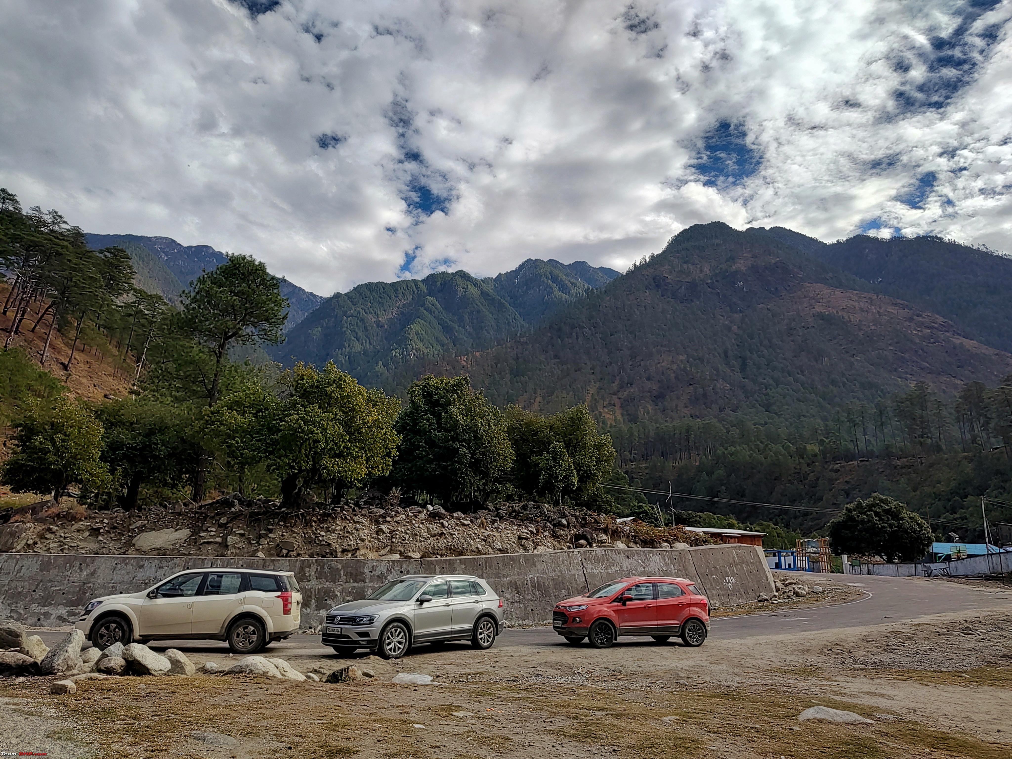  Another view of Karoti Bridge and Lohit after Meshai.  At 1150am, we reached Kibithu View Point (https://maps.app.goo.gl/yPFTrZAYAoa44gFz5) (PS : we got some patchy data network at Kaho and enroute around Meshai, as well as Kibithu)  The View Point along with General Bipin Rawat Dwar has been recently made here.   10km Tibet Signboard and a bunker at the view point. 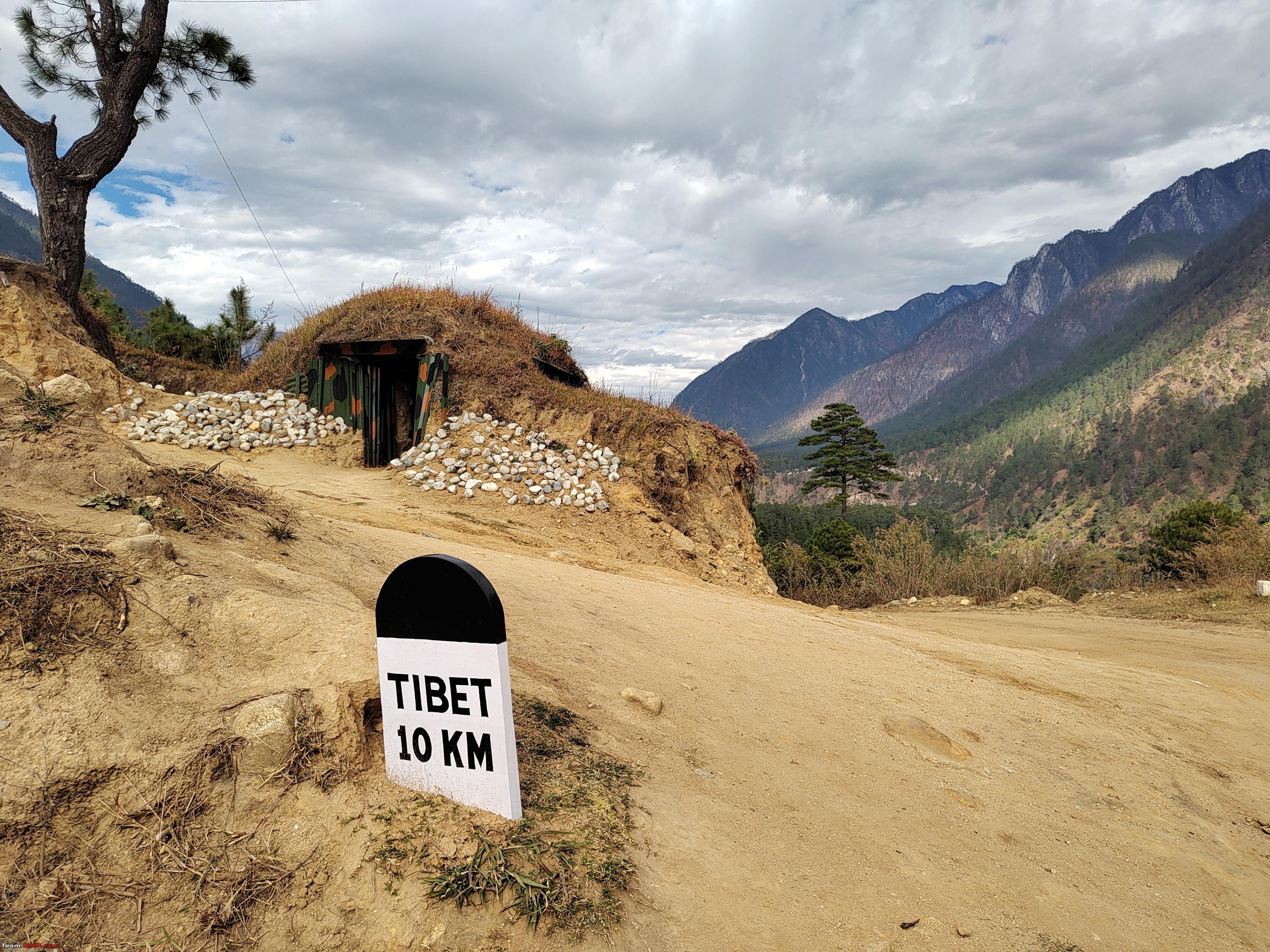 The history.  We started the return drive from Kibithu at 1230pm, this one is at the famous Y intersection (https://maps.app.goo.gl/9v9YnxPgkH3hBoXq5), the other road leads to Meshai and then Kaho through a Bridge near Meshai. This was the first bridge which had made Kaho accessible before the Karoti one came up recently.  Driving back through the WIP section before Namti.  We crossed Walong at 130pm and continued the return drive skipping Lunch, as we wanted to cover as much distance as possible in daylight, and also cross the Swami Camp - Tidding section in daylight. After Walong and Sarti, as we went southward, we got few drizzle bands, snowing was clearly visible over the 3000+m peaks ranges South East of Hawai.  We crossed Hawai turn and got into the newly completed roads just around 3pm. We had around 130kms to Ninashi.  A quick tea break at Hayuliang junction around 4pm, and sun was already almost set.  We reached Ninashi Homestay at 6pm. The other room they had booked was in Mepong Homestay(https://maps.app.goo.gl/oCQyCKQ356fScjWm6) nearby, Ecosport guys went there. It was yet another cozy evening at Ninashi, this time they had more guests as it was Christmas Eve. We spent the evening discussing about NE and other general things with few other guests. By dinner time, we had to decide the next day's plan as we were ahead of the schedule. We had booked Dec 26th stay in Guwahati with a plan to reach by evening for the Sunset/Dinner Brahmaputra cruise. But now that we were already in Wakro on Dec 24th evening, we had a discussion about whether to spend time elsewhere enroute like Kaziranga or Sibsagar, then go to Guwahati.etc. Finally everyone agreed upon directly reaching Guwahati the next day and then get a full day in Guwahati on Dec 26th, which also gives some rest for the cars. So with that, we booked the same Treebo for another night, Dec 25th, along with already booked Dec 26th. And that's how we ended the last night in Arunachal for the trip.  |
|
| (3)
Thanks
|
| The following 3 BHPians Thank adetour for this useful post: | abirnale, haisaikat, Samba |
|
21st April 2024, 13:08
| #30 |
| BHPian Join Date: Jan 2024 Location: Bangalore
Posts: 32
Thanked: 314 Times
| Re: East Arunachal & West Meghalaya | 8000 km road-trip to the North East Day 11 : Wakro - Guwahati : 630 kmsWe started from Ninashi Homestay around 615am, with a long drive ahead through the length of Upper Assam. It was Christmas Day and we expected some crowds in Guwahati, so planned to take it slow and enter after peak hours. The arrow straight roads after Wakro towards Medo.  The left turn at Chowkham from where broad NH15 roads start (right is the road coming from Alubari Bridge)  At 715am, we detoured into Golden Pagoda (known as Kongmu Kham in Tai).  The main Pagoda was not yet open as we were pretty early.  But we were able to visit the Buddha Statue next to it, it was serene and peaceful early in the morning (https://maps.app.goo.gl/ZChaPPQahNGwcN8w5).  We refueled around Namsai before exiting Arunachal (as fuel is Rs. 6-7 cheaper than Assam). By 8am we were at Dirak Gate, Dumsi.  BRO boards at the border, entering back Assam after a week's stay in Arunachal.    Superb broad roads continued after we entered Assam. Flat terrain and open fields meant some fog.  We took the new Bypass skipping Rupai - Doomdooma, directly to Makum-Tinsukia Bypass. Facilities were sparse, we didn't find any restaurant open yet around 9am too. After getting into the 4L Tinsukia-Dibrugarh Bypass, we found The Astros open just before Mohanbari.(https://maps.app.goo.gl/JZYjKarGYJgcVpAX8). Standard fare of Roti Sabji was available for breakfast.  ...along with "Egg Push", We were curious to know what it was and it turned out to be what we call Half Boil in the South.  The drive after breakfast was mostly uneventful and purely highway drive on AT Road till Kaziranga. Only eventful part was the varying road conditions. Dibrugarh Bypass from Mohanbari was almost completed and 4 laned, after that too has road work has progressed well. Closer towards Moranhat, it is fully 2 laned for 10kms. We crossed Moran around 1115am. Moran - Demow - Sibsagar was more or less 2 laned with some road work happening in places and few diversions. Again from Sibsagar Bypass to Jorhat was a mix of completed 4 lane and in progress 2 lane, some sections were dusty. From Jorhat Bypass, it was competely 4 laned till Numaligarh. We crossed Jorhat by 120pm, and Numaligarh around 2pm. From here, it is 2 laned all the way till Kaliabor. We could have pushed on the above sector and reached Guwahati around 6-7pm but decided to take it slow, and also take stops in the Kaziranga sector and reach after peak hours. We stopped for craft shopping around Bokahat and Kohora. Speed restrictions were on, and there were frequent checks after Bokahat. It was 40kmph restriction at most places.  After Kohora, around Bagori and Kuthori, we started spotting some Rhinos, we stopped atleast 2-3 times enroute.  Some pics from the SLR. We saw 5-6 of them in total at different places.   By time we were finally out of Kaziranga after Kuthori, it was dusk. We crossed Kaliabor at 510pm. From here it was 4 laned road all the way. Ecosport folks stopped for late Lunch in one of the restaurants on Nagaon Bypass, while we decided to push ahead towards Jorabat. We again stopped at one place for bamboo crafts shopping. Finally, we reached Rajasthani Dhani at Jorabat (https://maps.app.goo.gl/ykpjge8qfmVmGiUc7) for Dinner at 740pm. It was a good fare of Rajasthani Food (Kadhi Pakodi, Bajra Roti, Dal were the highlight). We took it slow so that Guwahati traffic reduces further.  We started after dinner at 910pm from Jorabat, and reached our stay (https://maps.app.goo.gl/7s4xgMVcMLyD6nhJ7) at 945pm. The trucks from Shillong side had been just let, so initially km was full of trucks after that it cleared up, especially the roads into Guwahati. For comparison, Ecosport folks who took lesser breaks had taken 1 hour for the same around 8pm. And Tiguan which didn't take any breaks, took 1hr45min around 6pm, phew! 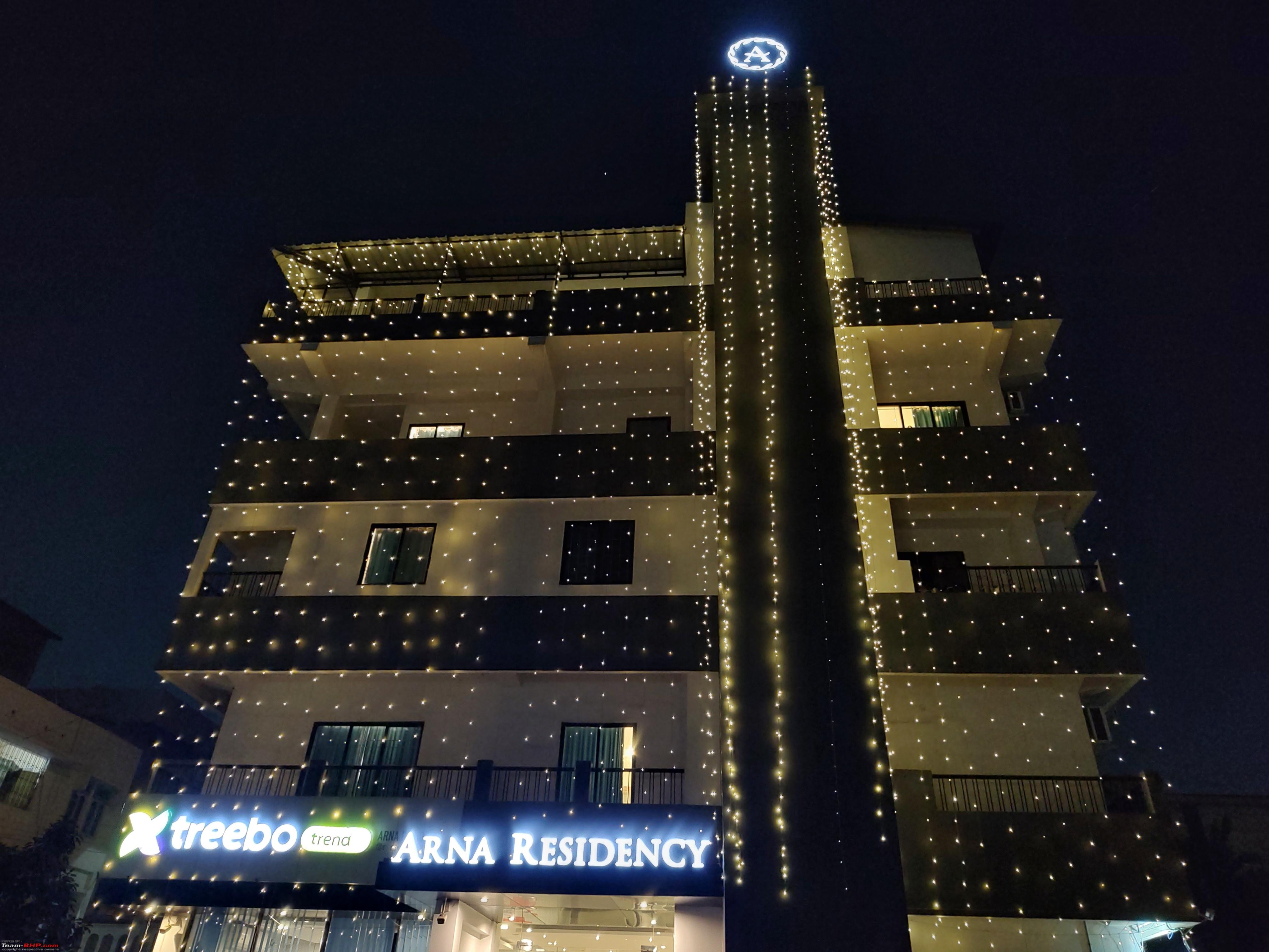 Standard Treebo rooms.  |
|
| (2)
Thanks
|
| The following 2 BHPians Thank adetour for this useful post: | haisaikat, Samba |
|