We had to begin early again on day 4 since we planned to visit Koteshwar and Lakhpat, and also return to Bhuj before sunset to collect our permit. A tasty breakfast of packed sandwiches and juice awaited us at the reception, and we were thus able to leave for Lakhpat by 7:30 am. The route follows the SH heading west from Bhuj towards the bustling town of Nakhtarna and into the vastness of Lakhpat. The highway till Nakhtarna is densely populated with villages on both sides, and thus the average speed is not very good. However, once the hustle bustle is crossed, and the zillions of speed breakers negotiated with, the countryside opens up and one can feel the proximity to the Great Rann. It took us about an hour from Bhuj to cross Nakhtarna and a short while thereafter we were staring at a huge board informing us that we were crossing the Tropic of Cancer. I am not a fan of such milestones myself, but it was fascinating to watch Aarti getting all excited. From here-on the road is quite straight, devoid of population and marred with shrubs on both sides.

Crossing 23°26′N 68°23′E

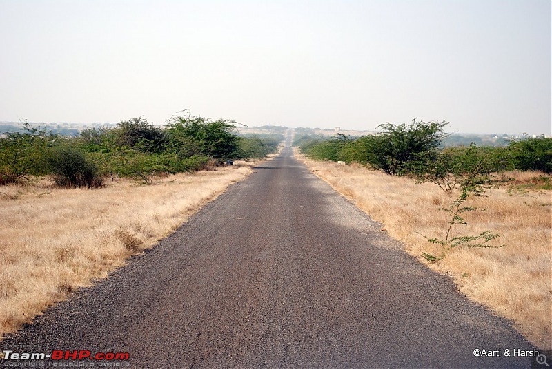
Several roads in Gujarat are dead straight like this one
About 45 km or so before Lakhpat, we crossed a small village called Gaduli where the road from Koteshwar joins the SH. Past Gaduli, one rides next to the Chinkara Narayan Sarovar wildlife sanctuary all the way to Lakhpat.
Quote:
|
Originally Posted by Board at Lakhpat Fort Lakhpat perhaps derives its name from the prosperous maritime trade in the past that generated a daily income of one lakh kori, the then currency of Kachchh. Situated at the western tip of the Indian subcontinent at the junction of the Kori creek and the Rann of Kachchh, Lakhpat lost its maritime significance in 1851 AD after the displacement of the Indus river in 1819. Another legend says that since Rao Lakhha founded it, it is named as Lakhpat. Guru Nanank is believed to have camped in Lakhpat on his way to and from Mecca. The house where he stayed was later sanctified as a Gurudwara. The other places of tourists interest include the tomb of Gosh Mohammad and a number of old hindu temples.
Now Lakhpat is a fortified town with high walls, several gates and a bastion made out of hard stone. It wears a deserted look and is scarcely inhabited. |

A panorama of the Lakhpat Fort

A board describes the story of the fort.

The entrance of the fort where the recent Tata Sumo Victa ad has been shot. Brother-hood is what Kiyang believes in ;-)
We reached our first destination by 10:00 am. The striking fort of Lakhpat is visible from quite a distance, and it is only from this distance that it can be captured in its entirety. Two sign-boards at the entrance describe the Lakhpat fort, but the chai-wala at the entrance spiced it up for us with his ramblings about the shooting of two movies here, Refugee and Lagaan. After a cup of hot masala chai, we head towards the Northern wall of the fort, completely unaware of the vistas beyond it.

It was VERY windy up there, and the views were to die for.

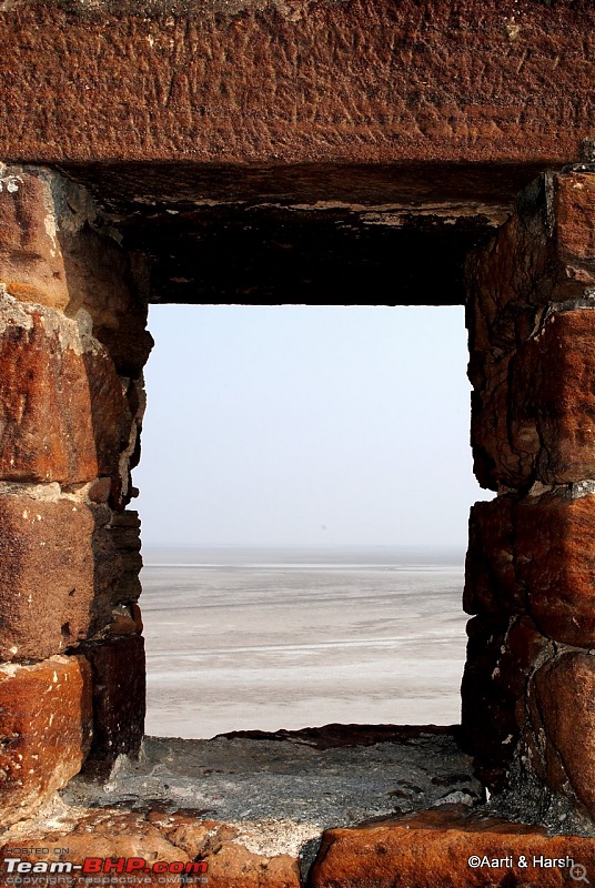
A panorama of the Great Rann from the ramparts of the fort. The vista unfolded all of sudden when it was least expected.
The experience of sitting there silently, while both us took in the views was fantastic and difficult to describe.

The views themselves are difficult to capture. The magnitude of the landscape is very overwhelming.
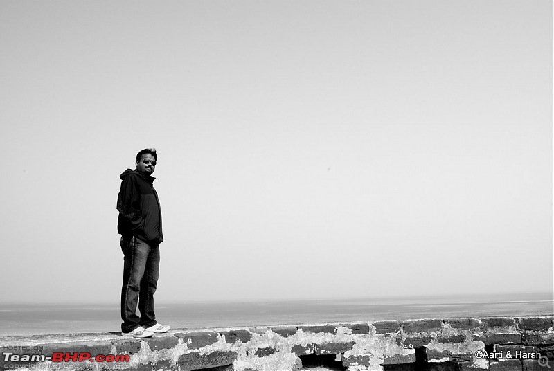
It was time to pose, with the tummy tucked in securely. ;-).

The inner green contrasts with the reddish boundary and the Great Rann

I could not resist posting this one. Definitely for keeps.
We spent a lot of time at the Northern wall of the fort, admiring the vastness of the Rann, and also trying to capture it on camera. To the west of the fort lies the Kori creek and to its North is the marshy Rann. We drove around the village inside the fort for sometime, which despite the saying on the board is not all that deserted. We also tried to venture into the Rann, but failed as the exit was guarded by BSF jawans who refused to let us through. We decided to proceed towards Koteshwar, our second destination for the day.
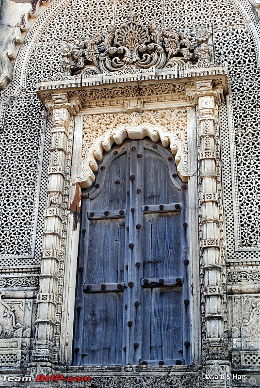
An intricately carved door at the tomb of Gosh Mohammad

The tomb of Gosh Mohammad

A deserted road in the village inside the fort

Apparently the wooden gate outside is about 150 years old and still stands, although unhinged
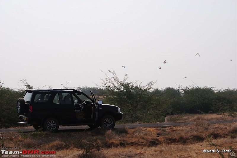
The road to Koteshwar from Lakhpat moves south, crosses the BSF post there and is largely devoid of any human population. The road runs parallel to the Kori creek. We took a small detour towards another BSF post right next to the creek which, I think, was called Biwi ka Kua (wifes well), only to be scolded and sent back by a Jawan. The road here too is largely straight and marred by shrubs on either side. A bit of advice when driving on this road, be careful when you see a vehicle approaching from the opposite side, lest you want to get a paint job done on your vehicle.
The straight road towards Koteshwar
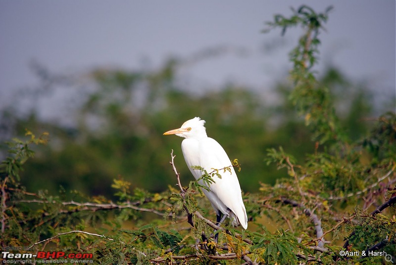
A cattle egret on the side of the road
I dont know why but I love this beauty shot of Kiyang

An Indian fighter jet!

. (Sorry, dont know the name of the bird, but I like the shot enough to post it)
Soon we reached Narayan Sarovar, which mythologically is one of the five holiest lakes of the Hindus, one of the remaining four being Mansarovar. However, since the lake is easily accessible, and also possibly because Gujarat overall is a non-glamorous state when it comes to tourism, it does not get the required publicity. The temple crowd there was a major put-off for us, and we headed straight towards Koteshwar. The final approach road to Koteshwar has the Arabian Sea on both sides and is fun to drive on. The pier at Koteshwar itself is nothing to boast of, apart from being the western most point of land in India. We saw some fishermen boats, and were told by a BSF Jawan posted there that all fishermen are supposed to sport the Indian flag on their boats for identification purposes by the BSF patrol boats. The Pakistani fishermen do the same, Karachi after-all being quite close. The temple at Koteshwar also did not seem much to write home about, so we decided to give it a miss. Yes, we are horribly non-religious.

Some fishermen working on their boat

It is not allowed to venture past this board, but since all sign boards in Gujarat are in Gujarati (a sign of the state not being too tourism friendly), we did not understand what was written on it, and went ahead, only to be immediately sent back by a Jawan. We did so reluctantly, wondering what possible harm it could cause if tourists did in fact go up till the pier. The only possible conclusion we could arrive at was that the Army must fear that someone might decide to jump from the pier and swim to Pakistan!

The western-most temple in India
The drive from Koteshwar to Gaduli went through the same wildlife sanctuary. Beautiful as it was, we did not sight any animals. The drive to Nakhtarna was boring, and the distance of about 100 km was covered in 1.5 hours. The roads, though narrow, are in pretty good shape. Lunch happened at a non-descript hotel at Nakhtarna, and despite our request for non-spicy food, there was a liberal dressing of green chillies even in Dal Tadka! We reached Bhuj by 4:30 pm, well in time to collect our permit for Vigakot from the BSF sector headquarters. As it happened with us at the DCs office in Leh (link to old blog), we had butterflies in our stomachs due to anticipation. However, unlike Leh, major babudom happened here which irritated the hell out of Aarti (who hates bureaucratic red-tape), so much so that I had to drop her back to the hotel and come back to collect the permit. Finally, after a 2.5 hour struggle and knocking on several doors, the permit was expedited and handed over to me at 7 pm. Wed lost another beautiful sunset, and the only saving grace was the hope that the permit would make the next day memorable. Anticipating a long day ahead, we hit the sack early, and ditched our plans to go out to look for non-veg, settling instead for our hotels nice vegetarian fare.


 15th January 2011, 22:16


 (2)
Thanks
(2)
Thanks


