| |||||||

| Search Forums |
| Advanced Search |
| Go to Page... |
 |
| Search this Thread |  32,271 views |
 11th January 2012, 17:09
| #1 |
| BHPian Join Date: Feb 2008 Location: Mumbai
Posts: 377
Thanked: 1,199 Times
| Mumbai -> Leh -> Mumbai Travelogue (August & September 2011) This is a story of my trip to Leh in the months of August_September 2011. Firstly- my travel itself was made possible by the contributions of many many people who have done this ahead of me. Across many websites and from the memories of people who had been there in the decades preceding- the wealth of information available is fantastic and very very encouraging. The fantastic cooperation of the men and women of the Indian Army ensured that there was no fear anywhere on the road- and always a smiling face or an oxygen tent available at all altitudes. My travelogue is meant to be a pictorial, and it is a very heavy one at that- Its a sequential one, that progresses with my route, Mumbai-Leh-Mumbai. Notes and points made are made keeping the fact that I am writing this for those who may go and more for those from around the world who may not be able to get here. The drive spanned 23 days and I thank Ferdi of Milestone for prepping my car with TLC, and many friends in the Army who chased me thru the drive, silently watched my progress and in more ways than one cared for my whereabouts all through. That should explain my routing on the way back. Thank you, people. As a hobby, having driven around much of the country along the western longitudes- Muzaffarabad-Poonch Border south to Cochin, I decided to go after the Leh sector. The objetive of this write up is give a complete visual tour of the road. I took about 3500 images with a friend Manish who was a strong support to me and the wheel- when needed most. Manish- thanks for the Chang La bail out. It is to serve as an inspiration to all those automotive enthusiasts to be on the 2012 Season from Srinagar-Leh-Manali. Planning, financially, leave-wise, ticket-wise you have to start 3 months before. The coming season should be fully open (from both sides) from about 15th-20th June and will close around 10-15th October 2012 (to the south first, and to the west later.) This leaves you with a three month window to do this spectacular drive, with my personal preference being the end of August/early September as you will avoid the majority of the tourists then. My story started 3 months in advance, like my advice, as I was going to be the sole driver from Mumbai, with friends joining in by flight at Chandigarh and family flying into Leh later. Physical fitness and almost daily gymming, didnt get me to be in 6 pack shape- nor two packs, but ensured that I could drive almost 10-12 hours every day for the 23 days I was on the road. An almost slavish dedication to the internet got me amazing notes, perspectives to the drive and remained the 'key' to the preparation and the 'inspiration to go.' Many have written about their trips and experiences. And many have had more adventurous tales to tell. I remain jealous of them. My second Scorpio, the mHawk had done about 40K in its 16 months with me, and all I did was to make sure the rear suspension bushing was changed as a precautionary measure. No other particular service care was taken. Other than reaching Jaipur and Jispa post last light, all other sectors were completed in daylight. For the curious, my Scorpio averaged about 11KmpL all along, and much to everyones amusement, I got 14KmpL in all sectors around Srinagar-Leh- Manali, probably proving appoint that lead-footed driving doesn’t help. The Scorpio went and came and ran up a zero repair bill. I am really thankful to Mahindra & Mahindra to have made such a vehicle, affordable and reliable- for me to have done all this. Thanks. My Images broadly are based on my sectors: My detailed route (night halts are mentioned) followed thus- Mumbai-Ahmedabad-Jaipur-New Delhi-Chandigarh (+1 day service halt)- Udhampur- Srinagar- Kargil- Leh. After a 1 day acclimatisation halt, we did Chang La+Pangong Tso-Leh in a day, followed by local Leh, Thiksey and Shey in a day, then Khardung La-Deskit/Hunder- night halt- back to Leh, then to Alchi (along with Patthar Sahib Gurudwara, confluence of rivers, Magnetic Hill) and back on our last day in Leh. Both family+friends flew back and I started the journey back from Leh, via Manali. The usual drama of road block, landslides added to my departure woes and finally at 0800 ona fine Sunday morning, the BRO signal came as 'Road Clear to Manali'. I managed to reach Jispa, via Pang and Sarchu a little after last light, in about 11 hours of steady driving. I did Jispa-Manali, then Chandigarh, Bikaner, Jaisalmer, Ahmedabad and Mumbai. I was finally on the road for 23 days/ 8800Km of driving across our beautiful country. The images are categorised in geographical sectors to make sense, to me. The data, captioning is from my notes, liberally borrowed from people, google, wikipedia, and web sites that are of public domain. These first 30 images will take you from somewhere near Udaipur to a few Km short of Chang la, south-east of Leh ______________________________ The amusement of the Indian Highways started somewhere in Rajasthan  Beautiful Rajasthan roads, till date they remain the best I have seen in India  Sunset over the Aravallis  Quick halt in Delhi to catch with the Parathewali Galli- here is the menu for all future visitors.  As we came out through the Famous Banihal Pass (Jawahar Tunnel) thru the Pir Panjal Range @9291 Ft Above Mean Sea Level (AMSL), the spectacular view of the 'Vale of Kashmir.'  The ever-so beautiful Dal Lake, Srinagar.  As you have follow the Sind River from Srinagar to Sonamarg, you will see one of the may Hydel Projects in the area, tapping the vast water resources- the Baglihar Project after Srinagar.  The climb to Zoji La started just minutes after the 'Scenic Sonamarg Seduction' ended. We faced a down-coming Army Convoy, the first of many that we would see on this trip.  We marvelled at the terrain, the morraine and the absolute crumble left behind by retreating glaciers  And the the road turned bleak, as did it seem our future @11500' AMSL. Forced to the side by oncoming traffic- some stragglers straying on the road when we were let to climb up, we were squeezed against the hillside twice before for the first time, we were forced to the outside- with the sheer cliff on our side. For a driver who had never experienced these kind of terrain- it was just terror at its best. Missing the edge would have meant- curtains- we crawled and goose-stepped a few times- that after this picture, we drove the rest of the particular stretch with cameras tucked inside and in deafening silence. After a few Km we started to breathe easy and descend as well- and we asked a puzzled GREF engineer- 'Zoji La kahan hai?' (Where is Zoji La?) - his amusement, looking at out white knuckles- "Peeche gaya, aage Dras hai. Is saal board beh gaya" (You passed it behind, Now Dras is ahead.)  Crossing Zoji La, possibly the most fearsome of all passes, the terrain changed dramatically and you entered the realm of Ladakh- geographically at least. Zoji La also is the western boundary of the Ladakhi Terrain. The geography and ecology has now changed, and is unlike any other square Km of territory you could have seen/ or see in the world.  The mountains and fearsome peaks that called the Brave of India, and convinced a few to lay down their lives to protect the nation stare down at you form the left of the NH. The war memorial at Dras is overlooked by the Tololing Heights. Unarguably the coldest place in India and outside the Antartic and Siberia- probably the world. temperatures of -50C and under are often recorded and wind chills are reputed to be about -75C for 3 months at a time.  Along the northern bank of the River Dras, is the Op Vijay Monument. You should stop here and look at the mountains and be proud of the soldiers who protect our nation. A monument to the men and women who fought here. You can request the Army Guard stationed there for a quick tour of the layout and they oblige with a proper storyboard- a must listen.  The amusing mass of pebbles, and river sand that you would see in the Konkan Rivers of Maharashtra- so much to learn about the 'Continental Drift Theory' and where parts of Gondwanaland met the Laurasian land masses. As Gondwanaland clashed with the upper land mass, small rivers existed for 1000's of years creating this rubble, before being crushed out of existene and then upward to this altitude. You will see this in the area before Kargil.  The fascination for rivers continues, with the River Wakha now accompanying you on the right. You will soon chance on the oasis of sorts in the mountains around Kargil, where life abounds for 4 months of the year, and then Hell Freezes Over. Mulbekh Village.  Spectacular views of Ladakhi Terrain on moving further east from Kargil. By this time you are already into 100+ photos of the landscape and trust me your amazement will continue for the next ten days- an from Khaltse onwards the mighty Indus will ensure you glide into Leh.     The road after Dras is leisurely, and for that matter all roads after Zoji La are leisurely till you reach the 'slush wars of Rohtang.' You soon reach the highest point on the Srinagar-Leh Rado. Fotu La- and the breeze. I think after the terror of Zoji la, this is the first time one ventured out of the vehicle on the highway to 'look around.' Much to the amusement of the family, as I was driving alone all this time, the Scorpio was present in every 3rd picture (according to them) and well, ladies and gentlemen- here is the Scorpio.   The view of the town of Lamayuru, the fantastic geographical creations due to a draining of a lake millions of years ago, and the first taste of Loops descending to Lamayuru. You are faced with the moonscape and the town, and its best to keep up gentle speed to reach here just about after noon, as you can get spectacular photographs of this soil art and the town. Halfway down the loops, you will ge a left that will take you towards Leh, by passing Lamayuru- we ahd to take this alternate as there was blasting being done to clear a blocked path. We thought we would do Lamayuru later- it was not to happen.     On reaching Leh we rested and the next morning my wife+son flew in to join us. We headed promptly to our accomodation and didnt venture out till 1700Hrs. After the rest to acclimatise at Leh, the following morning saw us take what seemed to be walk in the park- the road starting towards Chang La and Pangong Tso. The oh-so gentle switchbacks and then the snow roads hit- in the end of August (!!) and the sudden glimpses of towns far below and then the snows and clouds. It was a most entertaining drive with one learning how Diesels behave at 15000+ Feet AMSL.  We marvelled at the view to the rear, the town of Shakti. In fact you should see the scale of this switchback- its visible on Google Maps between Shakti and Zingral, you can almost imagine yourself on the road looking at the greenery down hill.  And in a few minutes, the weather all but packed up and we tried to race upward to get past Chang La- or atleast get the Baba's blessings.  The drive picked up momentum and you realise that driving here is sapping on your mental strength. You have two options, slow down, or keep sharing drivers. I prefer that you get into an exercise routine, to get fit and be able to manage the ride.   The tour continues. Last edited by Hammer & Anvil : 23rd January 2012 at 08:28. |

|  (4)
Thanks (4)
Thanks
 |
| The following 4 BHPians Thank Hammer & Anvil for this useful post: | amitwlele, anandpadhye, JoseVijay, mitrajdeep |
| |
|
19th January 2012, 10:17
| #2 |
| BHPian Join Date: Feb 2008 Location: Mumbai
Posts: 377
Thanked: 1,199 Times
| Mumbai-Leh-Mumbai Travelogue Part 2- Aug-September 2011 The spectacular climb to Chang La @17586' AMSL, took us thru snow and our first high-altitude crossing after Fotu La. In deference to the many warning against AMS, we stayed at Chang La for about 15 minutes before starting the descent to Pangong Tso via Tangtse. Only one word of advise, if you plan to stay at Pangong Tso @14270', you would want to do the Nubra Valley area- Deskit/Hunder part first so as to be able to handle the 14000'+ altitude at Pangong Tso- which is about 4000' more than Leh- more so because of the lack of medical facilities at night there. Tangtse is the nearest medical aid post. The drive from Chang La to Pangong Tso was mostly downhill or level and by about 1030Hrs the melting snows at about 12-14000' had started to form rivulets. You need to watch for them to ensure that on a warm day these streams turn into large ones and prevent crossing by even Scorpios after 1500Hrs. The other worry we had was when we crossed Chang La (see change in weather and road in less than 6 hours), the entire downhill to Karu and west to Karu, you face the blazing sun, which became quiet discomforting when navigating the switchbacks facing west. Good sunglasses are a MUST on your entire drive, more so here. Scenic views of Pangong Tso and the Road back- few words are needed. __________________________________ The road to Chang La form Leh was pretty good till Karu and then Shakti, from where the climb started in earnest. The roads are not too bad till you cross Zingral and then start to climb for Chang La- when we got hit by snow and some pooor visibility.  On reaching Chang La- SNOW!  Altitude taught us that we could play for 5mins before running out of steam  The weather around end-August at 0930Hrs- should explain the prayer flags!  I really think this is brief, and absolutely worth following- besides if anything goes wrong only the Army can bail you out there.  Someone with a sense of humor, I am sure put this up- at that altitude?  These minor streams become knee and waist height streams by 1400Hrs and it remains in your interest to turn around from Pangong Tso early.  Fresh anything, in this case, fresh Cabbage for the Army formations at Chushul  Marmots- these rascals fight for Five Star bars and Kit Kats, and the poor souls giving them Glucose biscuits get the cold shoulder. I could just imagine the Snow Leopard sitting high in the mountains thinking of his feast- 'chocolate flavoured marmot fat' later in the season. Very cute, and very photogenic creatures. Am sure there is a request not to feed them, but tourists just indulge in feeding the greedy fellows.  First glimpse of Pangong Tso in the distance. Blue colour lovers, you be ready for the ride of your lives.  The next 14 images are of various vistas of Pangong Tso- a third of the lake is in India, and 2/3 in China. The images are taken from the west bank. Most of the south-east looking photos are of chinese controlled territory on the far bank. The temperature and the salinity ensure that its is devoid of life as we know it, except for probably a few crustaceans- and therefore pristine. The point to note and recognize- the power of altitude and winter is that the lake freezes, inspite of its salt content. The altitude of 14000+' is detrimental to longer duration of stay, if not properly acclimatised. After about 45 mins here, we turned around and left for Leh.                Some tourists thought being on top of the world was made better by this view on top of an Innova  The drastic changes in weather are more evident here, that in 5 hours the scene at Chang La was completely different. I cannot but emphasize the severity of the glare of the sun. Please be careful driving down into the sun. It not about your judgement, its more about being able to enjoy the ride.  ________________________ Amongst other things, I continue to thank my support staff. This is the Thakoor family, Zai, Gayathri and Manish- who were there all through. Here seen posing along the earths roofline.  Thanks for following the thread. More images follow. Last edited by Hammer & Anvil : 22nd January 2012 at 19:40. |
|
| (5)
Thanks
|
| The following 5 BHPians Thank Hammer & Anvil for this useful post: | amitwlele, anandpadhye, JoseVijay, mitrajdeep, SDP |
|
19th January 2012, 10:35
| #3 |
| BHPian Join Date: Feb 2008 Location: Mumbai
Posts: 377
Thanked: 1,199 Times
| Mumbai-Leh-Mumbai Travelogue Part 3- Aug-September 2011 This part of the drive took us north of Leh to Khardung La @18380' and the highest motorable road open to one and all. The altitude discrepancies in the media are due to the triangulation methods followed by the Surveyor General of India versus the GPS Satellite-driven GPS devices. Clear weather made it a 'better drive' than was Chang La and also we were abreast the pass in shorter time. It gave us adequate time to then do 'Meggi Noodle' at North Pollu before an easy lunch at Deskit. _____________________________________ Mornings at Leh  The ascent from Leh to Khardung la 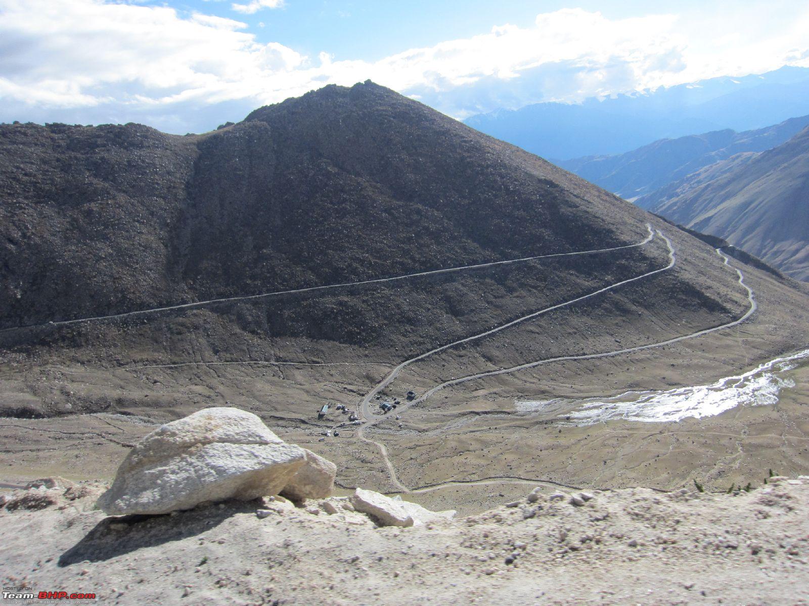 The view to the south, with Stok Kangri, 20182 feet, the highest mountain in the Stok Range of the Himalayas in the Ladakh region seen in the distance.  Deceptively good roads make their appearance along the climb  Boulder clearing- this one fell between us the the preceding Innova. Phew!!  Leh is the green patch in the far distance  Approaching Khardung La Top  K Top  K Top  North side descent, the rising sun and melting snows made slush instantly and then the slide to the bottom was a real possibility  Welcome! The Nubra Valley, the coming few Images, after a small town called North Pollu 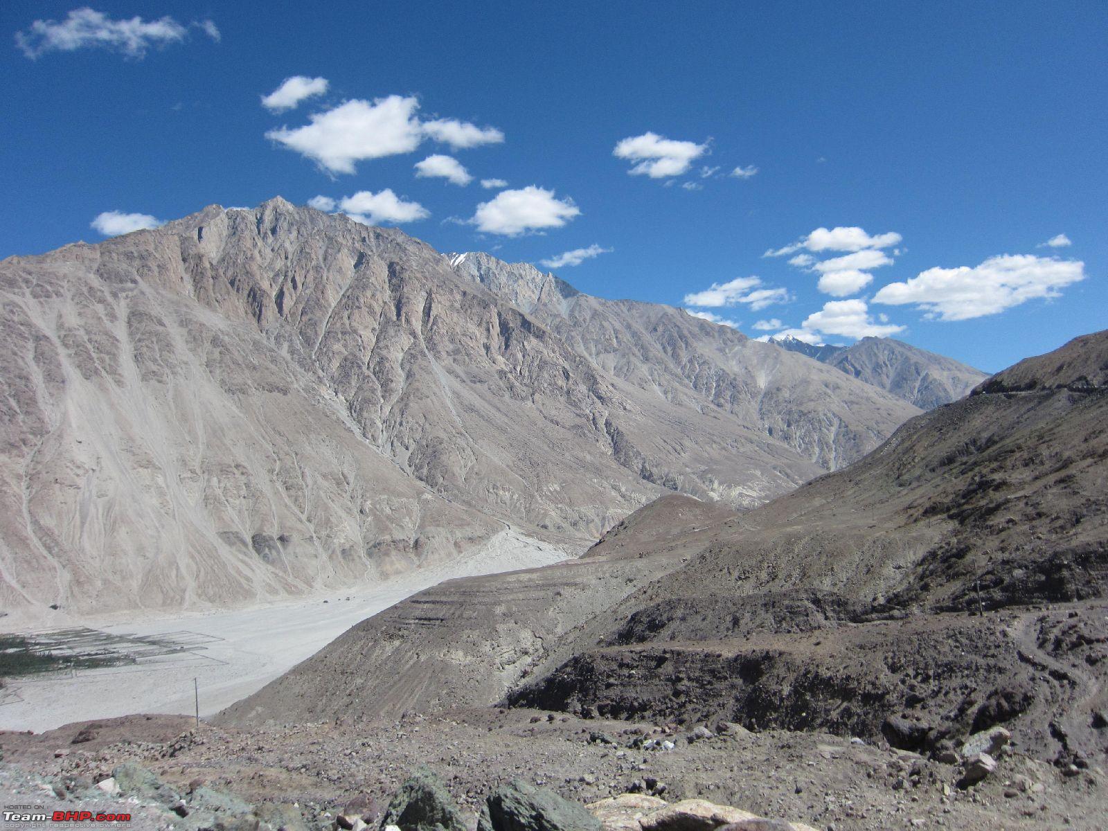      Bactrian Camels- remnants of mongol traders- double humped- now back in vogue with tourists wanting a ride on them, in possibly the highest desert in the world.  Hunder  Washing the Scorpio, with a dear friend, Manish! The waters coming off melting snows took steely resolve! Thanks- Manish.  If you doubted the mongol traders, you should see the botany and geographical spread of these Seabuckthorn berries, from Norway to Istanbul!  Hunder valley, now we were east and then south bound for Leh  Approaching K Top from the north  Earlier slush, and now boulders, this north side approach is dicey at all times of the day it looks like.  Jolly Army Chap with Aryaman  Thsi convoy came crumbling up!  We were waiting, taking in the south scenery while the Army teams dismounted for tea- and we were told to wait. So we took in the views- little aware of the chaos that had erupted to the left of this image.  And them some local drivers rushed down before the 'Dandaman' truck came- causing an instant jam at 18000'- at the first left at K Top.  Where is the space? The army man got down to stand guard at the left wheel- while Stok Kangri in the distance was mute witness to this drama. And so were we.  "What was all that jam? Where are the kerb stones?" - A delighted couple from Netherlands in a Land Rover- were thrilled to bits with the experience. And so were we.  _____________ Here is a picture of Manish and myself at the Dal Lake at Srinagar.  Last edited by Hammer & Anvil : 22nd January 2012 at 23:16. |
|
| (4)
Thanks
|
| The following 4 BHPians Thank Hammer & Anvil for this useful post: | amitwlele, JoseVijay, mitrajdeep, SDP |
|
19th January 2012, 10:37
| #4 |
| BHPian Join Date: Feb 2008 Location: Mumbai
Posts: 377
Thanked: 1,199 Times
| Mumbai-Leh-Mumbai Travelogue Part 4- Aug-September 2011 This part takes us through Leh and the small towns that surround it- Views of the many monasteries that dot the hill tops especially to the south, like Thiksey and Shey, and then we veer west for views of the Indus meeting the Zanskar, the town of Alchi, Magnetic Hill and its 'car pulling charm,' and finally a stop at the famed Gurudwara Patthar Sahib. Funnily, the vistas and the terrain on the western side of Leh, are what greeted us when we arrived into Leh from Kargil, but then we were just too happy to get onto some firm tarmac and level roads that we got to enjoy the setting sun highlight the fantastic terrain on the return from Alchi. The trip to the south, was done to get a break from the altitude runs to Pangong Tso and then the Alchi and westside tour was a recoup from Deskit and Hunder. The trips over the passes are not visibly tiring, but it is better to be safe where AMS is concerned. The issue is when it strikes if you are out of medical coverage area, then you will inconvenience everyone in your entourage. The strange thing being it is indiscriminate in afflicting young or old, fit or infirm- and a 60 year old with Arthritis could get by but a 18-year old could get laid up solid. Read all across the internet about preventive measures and emergency treatment- and always remember where the last medical tent and last Army outpost was. Do not run, do not hide. Do everything deliberately. __________________________ The clear weather is a blessing to the locals, given the terrain and loose soil, cloudbursts or sustained rains have the potential of creating havoc with life. Such an evening bodes well for all.  The monastery at Thiksey- and houses possibly the largest Maitreya Buddha Statue of the region- 12M, made of clay and gilded with Gold.  The terracing at Thiksey due to heavy snows- interesting architecture  Ladakhi kids at school- school breaks are happiness everywhere!  A view of Thiksey valley  The sunlight and glare is VERY different from what you have in the plains. you must be prepared for it- lip balms, sun screen, hats, sun glasses, full sleeves shirts are recommended  Colours and textures in a monastery  Monastery courtyard at Thiksey  Now on the road to Shey, about 15Km out of Leh at about 11000' AMSL  Hilltop remnants of housing attached to Shey Summer Palace which is about 500+ years old. A quick visit here would also warrant a look into the Gompa, which houses an equally impressive 'sitting Buddha' Statue.  A view of the Shey Palace- also it is situated vey close the Sindhu River, where the Leh Festival is held, usually in the first 15 days of September. Please check before you make travel plans for your year of travel.  The second half is the trip to the west of Leh, in the direction of Alchi.  We stopped at a location The army Gypsy wanted to try the 'pull' of the Hill. Tracks are ample proof of the magnetic effect. And for proponents of the optical illusion theory- this picture is a disaster.  We met another Scorpio from Delhi, and while we came 'up' the Delhi guys came 'in' in reverse- both cars at neutral+idle- while Zai watched is disbelief!  The abrupt right turn off for Alchi leads you to a bridge crossing the Indus towards Alchi. It is interesting to stop here and watch the roaring Indus, having swallowed the Zanskar a few Km to the east!  The bridge belonging to the 'Bailey Bridge' family is a must know- it is a completely dismantle-able bridge, truck and man portable. Being light, its easy fabricate and keep in stock in some Army grounds, for use in an emergency. The best part is that it was designed by Donald Bailey, a British Civil Services Officer, in 1942- as a hobby.  The truck and the family show the gradients of roads in this area 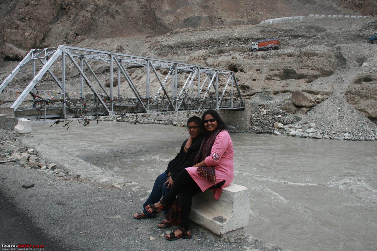 A pretty clean and logistic nightmare market at Alchi.  The pathways of Alchi, quaint, clean and closed for 8+ months of the year.  Intricate carvings- centuries old at Alchi  A ladder is a ladder, but how different is an Alchi ladder  We started back for Leh after lunch- and the next imagery is of Ladakhi terrain  Amazing and changing at every mile, all around- a photographers delight and nightmare together. Cameras need two things- megapixels+wide angles.  The confluence near Nimoo- of the Indus coming in from Leh, and the Zanskar coming northward from the Zanksar Valley  Good roads that lead you into Leh  These are a few images of Leh town, with the imposing Leh Palace and the Shanti Stupa in the background.  The entrance to the Palace 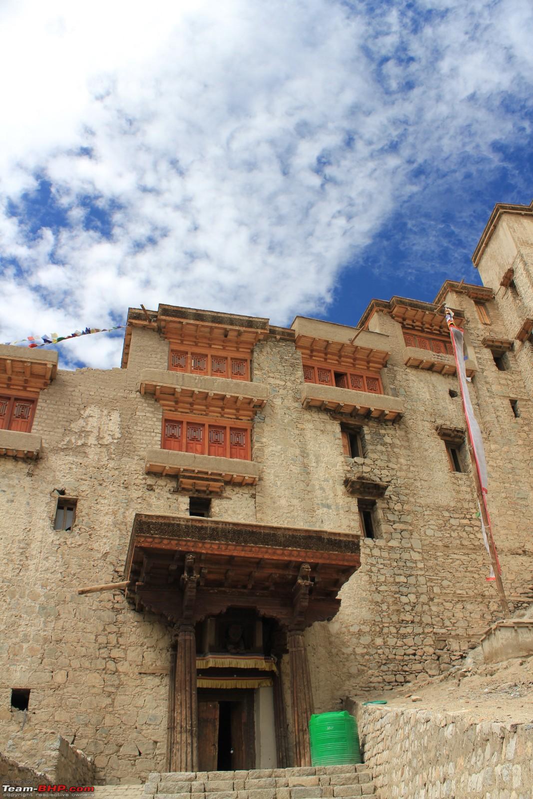 Overlooking Leh Town  ...and surprisingly the outhouse (?) near the Palace was inhabited.  Every day, an hour was dedicated to logging images, charging phones (mostly useless), charging camera batteries, laptops, looking at maps, reading trivia, and notes made from others visits.  Last edited by Hammer & Anvil : 22nd January 2012 at 23:15. |
|
| (2)
Thanks
|
| The following 2 BHPians Thank Hammer & Anvil for this useful post: | JoseVijay, mitrajdeep |
|
20th January 2012, 08:21
| #5 |
| BHPian Join Date: Feb 2008 Location: Mumbai
Posts: 377
Thanked: 1,199 Times
| Mumbai-Leh-Mumbai Travelogue Part 5- Aug-September 2011 The return journey started one fine morning from Leh. The BRO had worked through the night to clear a block just south of Pang and the road was declared 'Open till Manali.' The few pictures at the start are of Leh town- amazing food- salads and chicken dishes from all corners of the world abound- Chicken Kievs to Israeli Salads. Enough said, and we set sail south for Upshi and Pang via Tanglang La @17583'. Past Upshi, the road deteriorated and settled down to a rubble-tarmac but bereft of potholes. This set of images will take you through Pang, Lachulung La and Nakee la and till you start the descent thru the Gata Loops. 21 of them, bringing you down by about 1500' in 7Km- the amazing thing being the horizontal distance being about 400-600 meters. ____________________ Downtown Leh. Amazing how digital pictures eliminate the need to write down stuff. Lazy Boy.  Clean streets, and everyone works to keep them like that.  The home journey began with the smooth tarmac to Karu and Upshi  And as the road veered to the right after Upshi- it abruptly ended and you were faced with this track and fast running waters of the River Khyammat alongside for company  A few Km afer Upshi, I lost bearing with altitude and suddenly found myself meandering along the skyline, and often higher than peaks in the distance. The charm of Tanglang La, the second highest pass @17500'+ is that you will be driving at about that altitude for 45 minutes wondering when the pass would come, had it come, had it gone, and 'where is it?' Unlike Khardung La and Chang La, you dont have to worry about halting here too long, there is nothing once you reach the pass, its abandoned - but the drive along the rooftop will have ensured that you want to take a few pictures and move down. And yes, thats a Maruti 800 in front.  Unending approach to Tanglang La- can you notice the road stretch on the mountain in the front.?  And it goes on along where 'the mountains scratch the skies.' Now see where I had to go to the far left, and then come around the mountain in the front... and on and on...  And on and on...  Finally Tanglang La. 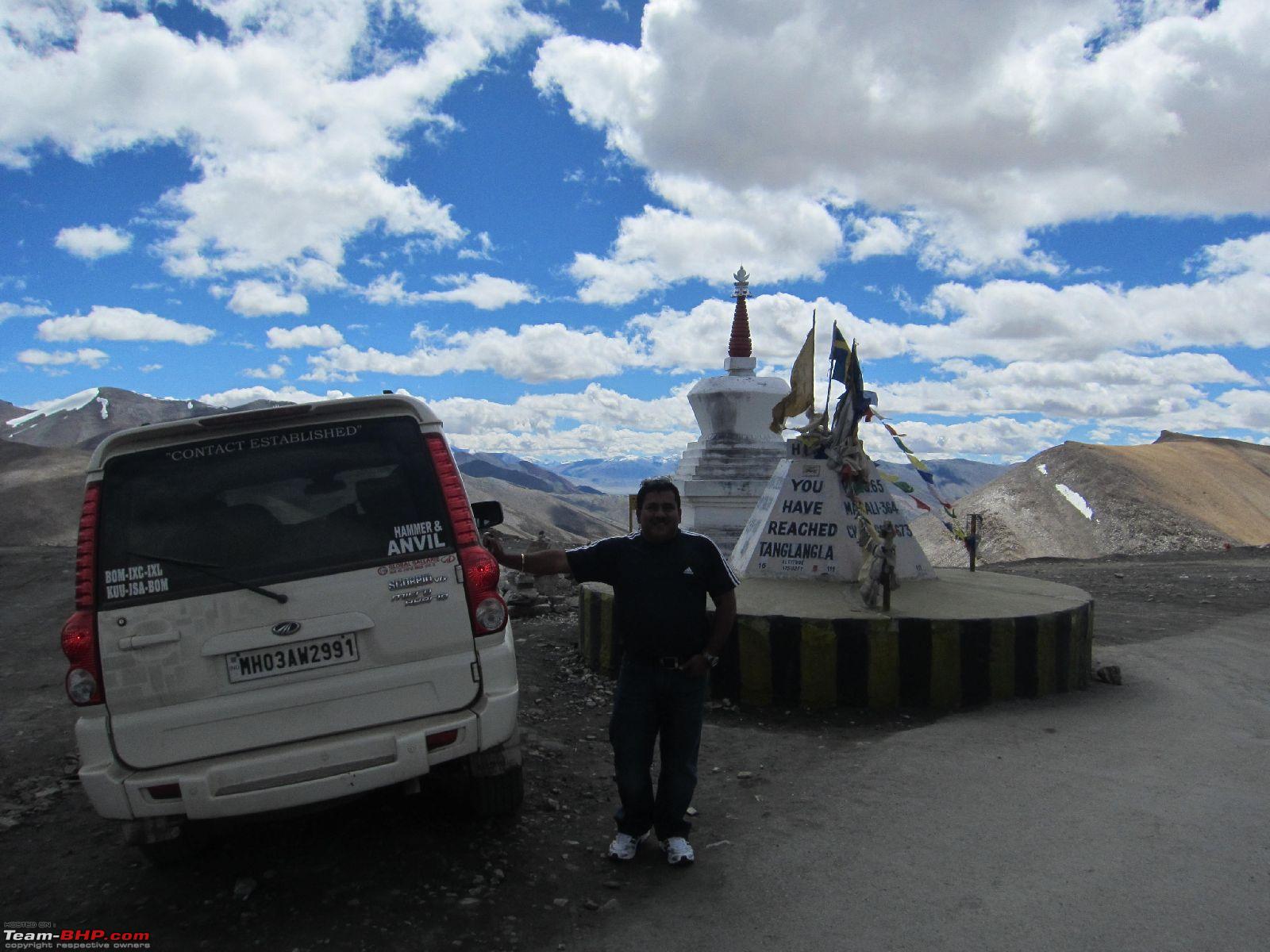 Terrain after Tanglang La, on the way down to the Morey Plains which have an average altitude of 13100' AMSL.  The Morey Plains- a fantastic geographical feature, as were all in this region. Flat for miles ahead and possibly miles across too.  The Plains. Extend south for about 30Km  More Morey  The heart took fancy to the roads and I think I was doing 80-100Kmph after ages. Nomadic herders with their sheep and bikers heading towards Leh- asking 'How much more to go?' is all that you get in this area.  Camps for cyclists and bikers- and then tourists who screw up the area by littering. Sorry to include this, but please dont do this when you go there.  Tar Road, and they are planning on double laning this. It was exhilarating to drive off road and doing diagonals... phew...  Mahindra should note this for their future gearing and whatever- 80KmpH@ 2000RPM. Excellent. Thanks again M&M.  The company, again of the stream, indicated down slopes and the last 5-odd Km into Pang @15640' AMSL. For early 'lunch.' The road after Pang reveals a receding river line, and what must have been an awesome river once, is but a stream now. Senior Army officials can tell of the reduction in size over the last 25 years. The global warming is real, folks- we need to watch out for our environment  The quick omelette and the 20 minute soupy-Maggi put me in touch with this segment Leh-Manali road, the spectacular sand erosion art after Pang. And possibly the most popular image on the entire stretch.  A few hundred images of this stretch also wont do justice and we stopped to include this picture of Lachulung La.  The terrain between Lachulung La and Nakee La  The terrain continues to mesmerise before Nakee La  @Nakee La  The breeze @Nakee la @15547' AMSL  The terrain after Nakee La  Stop at Gata Loops, shortly after Nakee La  Gata loops @15200' AMSL  As you can almost never stop looking down at them, a few more images follow in the next post.  ________________________ The Desai Family.  Last edited by Hammer & Anvil : 23rd January 2012 at 08:29. |
|
| (5)
Thanks
|
| The following 5 BHPians Thank Hammer & Anvil for this useful post: | arjab, JoseVijay, mitrajdeep, Ripper, SDP |
|
20th January 2012, 10:28
| #6 |
| BHPian Join Date: Feb 2008 Location: Mumbai
Posts: 377
Thanked: 1,199 Times
| Mumbai-Leh-Mumbai Travelogue Part 6- Aug-September 2012 This is the final set of images- starting off from the descent from Nakee La, the Gata Loops- a few more images, and then the 20Km drive circumventing the Tsarap Chu river, to get to a bridge in a far corner. I presume it is possibly to make it difficult for enemy to bomb it. The river crossing takes you to the Himachal Police cehckpoint at Sarchu. The journey turned quite nasty after Sarchu where the HP Police warned me that I was alone, and had been driving in the hills from morning- to get rest at Darcha. I was too tempted by the lure of the 'wonderful' IBEX Jispa hotel about 8 Km further south of Darcha- which was all that it wa supposed to be and more. However, it got too dark too quick after Darcha- with the last 7Km taking me almost 45 minutes to cover. I finally entered , nearing Darcha at about 1800 and 1845 was the 'Parc Ferme.' Jispa @10500' is the ideal halting place heading south if you crossed Darcha early, as it put you in striking distance of Rohtang and its 'do it in the morning' woes. Also, I think if you clear Rohtang northbound, then also this is the nicest place to stop, or then the camps at Darcha and for the adventurous- the camps at Sarchu (for the altitude issue). And wake up @0500Hrs @Jispa and do a run straight into Leh. Morning was as exotic as have been all mornings enroute with the sun rising over the mountains and highlighting the little peaks around Jispa with the Bhaga River flowing rapidly to the east of the hotel. The quick drive to Tandi is alongside the Bhaga- where you turn left and now follow the oncoming Chandra River, and a fuel check again returned 14KmpL, followed by the slog uphill to Rohtang. Enroute you start meeting other hikers and cyclists coming up from the Lahaul Spiti side and a nice entourage forms. I did the mandatory Maggi (soup-style this time) on the south side of Rohtang- with its usual circus of conned 'south of the Narmada-Indians' on mule back trekking it to the snows in the shadows dressed in ludicrous pink woolens on hire from the outskirts of Manali. Then it took 3 hours to clear the next 3 Km. I left Jispa at 0730, and had Maggi at noon, enjoying the last of the Himalayas, and then reached Manali at 1730. The drive from Manali was along the scenic via the ever rushing Beas and the various strange hydel projects like the Sutlej-Beas link canal and the likes. The drive was an amazing art for the numbers of turns. The road between Bilaspur and Swarghat on Google Maps itself looks daunting. The far-distance reservoir formed by the Bhakra Dam for once gives you the scale of what your text books told you- largest dam and reservoir combine in India is Bhakra and then downstream-Nangal. The Manali-Chandigarh Sector- took me to Sector 17, where I didnt see any slips and so no one paid a fine. The Drive to Bikaner was a drag, and possibly the most mentally taxing one- to stay awake and not wreck the car on pathetic road stretches. After a night halt at Bikaner, I motored down to Jaisalmer, where a dear friend orgnanised an absolute-pefect finish to my drive- a drive along the desolate roads of the Indian Border with Pakistan, and a whirlwind tour of the sector in which the Famous Battle of Longewala was fought. The Tanot Mata mandir and the Zero Mile Marker at the Indo-Pak International Border was a sight to see-behold and cherish. Thanks Rajnish. Jaisalmer-Barmer-Ahmedabad made the next day, and Ahmedabad-Mumbai being the last leg. I begin this section, the last with a few more views of the Gata Loops, which are of 21 Loops, about 7Km in length and the descent begins at about 15100' AMSL. ___________________________________________ I had stopped the car at the first bend, to get down, walk around and see the loops-   Before walking back to the car and starting off for the first bend.  This is what the shortcut looks like, I took many, and have no idea how many loops I un-circumvented  At the base of the Loops, about 1500' lower than the start point, you start a long drive along the Tsarap Chu River towards Sarchu.  The phenomenal size of the river is what you must see and appreciate and the effects of global warming become so evident- that the once gargantuan river (as seen by the erosion marks and levels above midline) is now but a rivulet in peak Himalayan sumer  After about 24 Km on either side of the river, you land up at possibly the first Police sign after Leh- all other authorities being Army till now.  The Police took me in, admired the Maharashtra effort and gave me a cup of tea, before packing me off to Darcha. The sunset made it pretty dark and I managed to drive the last 7 Km from Darcha to the Ibex Jispa Hotel in headlights. Somewhere along this stretch, I think i stopped at ZingZingBar- emblazoned on an army tin shed, and forgot to stop by at Baralach La- the common excuse being, it now seems, that the snows knocked the sign board over. How ironical I was to miss the photo-op at Zoji La and then Baralach La, my first and last passes in Ladakh.  The much heard of IBEX Jispa... and it was shared by a bunch of Enfield Fanatics from southern France.  Morning saw the speedy Chandrabhaga River outside the hotel!  And the morning sun rays strike the mini peaks around the area  Refueling at Tandi (THE MANDATORY REFUEL POINT) and after clocking 14 as my average, I was on my way to the famed Rohtang, a full 2 hours later than the 0700 that people had asked me to be there at.  The Climb to Rohtang, meets up half way with the road coming up from Lahaul Spiti and the many hikers, trekkers and cyclists that meet you...  I stopped to exchange notes (ask people why they would cycle here, only to be asked why are you 4000Km from home, alone, here?) with people from Russia, Australia and England.  I drove past the 'Rohtang Pass' marker (which had collapsed due to snow) and landed on the south side to see a sea of yellow plastic tents- selling everything from Maggi Noodles to fake Pashmina shawls to silver jewellery that would put van Cleef & Arpels to shame. I wasted an hour taking in the scenery here, and this put me into thick traffic at 1330, facing downhill and then the slush hit me.  More mud  The edge and mud- and did you notice one thing that a local taught me while in the jam- Get out of the car if you are on the edge side :-)  Slushy slope  More slope, and it was this that took an hour a Km. And locals and many told me that it was a good day. I think you have to hit it before the slush forms at 0600, or then wait till the afternoon heat kills some of the slush- I have one piece of advise- stick behind a truck, bus, anything heavier than you, and stay in his tracks. Upward or down- stay in a bigger boys tracks.  And a very decent BRO truck that waited for me patiently on the 'side' of the road.  After this turn, which I think was barely about 2-3Km long, you reach Marhi- and then there was no difference between the Gateway of India at 1800Hrs on a weekend- there were Indians trying to crawl up to the snow line, there were hang-glider fanatics trying to locate drafts, and there was someone selling steamed American corn... No pictures here worth showing- so direct to the seemingly most secure parking lot the car had seen after Delhi. 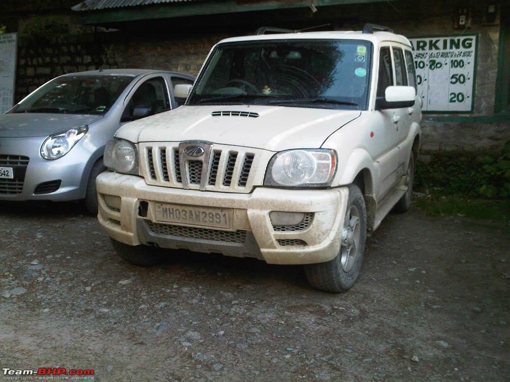 The Beas river made a perfect companion to the highway to Bhunter, curving along the cut hillside.  Some humor at a Chandigarh, Sector 17 parking lot sign-  We reached Bikaner- to see the glorious sunsets in the clear skies, pollution free clarity  From there I went to Jaisalmer, and then took the road to Tanot via Ramgarh and its monster TV Tower beaming our TV into Pakistani hearts. The desolate road continues with the electric supply line for the border fence running alongside  The scenery enroute the border, and the brilliant road that invited all that the Scorpio could give. The steady greening of the desert is also a witness to the sustained decades long canal system effort put in by the Government.  The famous Tanot Mata mandir, manned and maintained by the BSF todate.  The Road ended here a few meters before the International Border Fence.  The Narmada Bridge- after which we put the camera away. Too much had gone into this trip, to now allow for anything to happen. I put on double concentration glasses and drove home quietly.  ________________________ Apart from wanting everyone to visit Ladakh- my effort is dedicated to two Colonels, Col Kamat and Col Manral. Both, generations apart joint by a single minded focus of serving the nation to the best of their ability. Their descriptions of our nations boundaries and the experiences they have had in protecting them, have made me want to travel and explore these regions, for over three decades. I cannot but thank them enough. I thank all you viewers, who read/viewed this travelogue. A few words of wisdom- that are different from all seen on the media- print or electronic. If you dont take a 1000+ pictures a day, you will find yourself wondering when you will go back. And even if you do, like I and Manish have done, there is no guarantee that you wont. 'Manish- August 2013 Right?' Last edited by Hammer & Anvil : 23rd January 2012 at 08:18. |
|
| (8)
Thanks
|
| The following 8 BHPians Thank Hammer & Anvil for this useful post: | AGwagon, amitwlele, anandpadhye, h14, JoseVijay, mitrajdeep, rahul_sinha, SDP |
|
23rd January 2012, 09:44
| #7 |
| Team-BHP Support  | Re: Mumbai -> Leh -> Mumbai Travelogue (August & September 2011) Thread moved from the Assembly Line to the Travelogues Section. Thanks for sharing! |
|
| (1)
Thanks
|
| The following BHPian Thanks GTO for this useful post: | Hammer & Anvil |
|
23rd January 2012, 10:17
| #8 |
| Senior - BHPian Join Date: Nov 2006 Location: Mumbai
Posts: 7,369
Thanked: 3,454 Times
| Re: Mumbai -> Leh -> Mumbai Travelogue (August & September 2011) Can you also share with us info on hotels you stayed in? How long did you take from Rohtang Pass down to Marhi & Manali? |
|
| ()
Thanks
|
|
23rd January 2012, 12:21
| #9 |
| Senior - BHPian | Re: Mumbai -> Leh -> Mumbai Travelogue (August & September 2011) Wow is the word of this pictorial travelogue. Brought back nostalgic memories of my own trip in 2009 done in a Scorpio..! |
|
| ()
Thanks
|
|
23rd January 2012, 12:58
| #10 |
| BHPian Join Date: Jun 2011 Location: Gurgaon
Posts: 753
Thanked: 805 Times
| Re: Mumbai -> Leh -> Mumbai Travelogue (August & September 2011) Awesome! very nice pictorial and writeup. It is amazing - so many TLs on Leh/Ladakh and so many pictures, still one never tires of looking at more pictures from the region. Tremendous! |
|
| (1)
Thanks
|
| The following BHPian Thanks sach.sri for this useful post: | Hammer & Anvil |
|
23rd January 2012, 13:39
| #11 |
| Senior - BHPian | Re: Mumbai -> Leh -> Mumbai Travelogue (August & September 2011) Beautiful pic and pretty concise. We too had almost similar trip in June 11. What was the condition of Moray planes ? |
|
| (1)
Thanks
|
| The following BHPian Thanks v&v for this useful post: | Hammer & Anvil |
| |
|
23rd January 2012, 14:00
| #12 |
| Senior - BHPian | Re: Mumbai -> Leh -> Mumbai Travelogue (August & September 2011) Beautiful pictures to say the least Mr Desai, do provide us with more details on the dates/routes. It has been very pictorial TL compiled so far. |
|
| (1)
Thanks
|
| The following BHPian Thanks ku69rd for this useful post: | Hammer & Anvil |
|
24th January 2012, 20:04
| #13 |
| BHPian Join Date: Oct 2011 Location: mumbai
Posts: 450
Thanked: 188 Times
| Re: Mumbai -> Leh -> Mumbai Travelogue (August & September 2011) Hammer and Anvil Hi Great photographs I wonder if you noticed a cocktail green Beat with MH 01 number plates and an old man alone at the steering wheel. In the later part of august and early part of september I was north of Sonemarg. The pass where you were asked to go above Lamayuru is known as jalebee pass.That was one of the 2 places where I lost my nerve(the other was when Zoji La was closed and I had to take the route above the Zoji La one).It was so deserted that I turned back after going up for 3/4 kms.That is when I met 3 cabs and they pumped up my courage(the tourists were from Chembur,Bombay) and I completed the Jalebee pass. If there are more photos please post. Regards |
|
| (1)
Thanks
|
| The following BHPian Thanks faustus77 for this useful post: | Hammer & Anvil |
|
25th January 2012, 09:53
| #14 |
| BHPian Join Date: Feb 2008 Location: Mumbai
Posts: 377
Thanked: 1,199 Times
| Re: Mumbai -> Leh -> Mumbai Travelogue (August & September 2011) HVK- All my stay was arranged by friends and I think Ahmedabad was the only place I stayed at a hotel. Given that I was travelling at the end of the season, there were few tourists on the road, at Leh and at other spots as well, and actually locals (shopkeepers, traders etc) were reducing on a daily basis while the weather was still excellent- hotels anywhere north of Jammu shouldnt be a problem at all. It is a solid recommendation to people to follow this schedule- as you get very little traffic from Srinagar, around the passes and to Manali as well. The oncoming traffic of Xylos, Scorpios and Innovas driven by the Ladakhi Cousins of Ari Vatanen and possessed by the spirit of the late Colin McRae can be quite intimidating to us down-country cousins in the mountain roads. The traffic was absolutely thin and therefore a complete pleasure (aka- absence of terror) and made for a very unhurried and picturesque drive. V&V- As you could see from the few images- the Morey Plains are in excellent shape. I will be uploading a few more images, of lower resolution in a week- but rest assured- it was 80KmpH for about 25+ of the 35Km plains. :-) Ku69rd- Day DATE Route Halt at Thursday 25-Aug Mumbai- Udaipur Jaipur Friday 26-Aug Udaipur- Jaipur Jaipur Saturday 27-Aug Jaipur-New Delhi Jaipur Sunday 28-Aug New Delhi New Delhi Monday 29-Aug New Delhi New Delhi Tuesday 30-Aug New Delhi-Chandigarh Chandigarh Wednesday 31-Aug Chandigarh - Jammu Udhampur Thursday 1-Sep Udhampur-Srinagar Srinagar Friday 2-Sep Srinagar-Kargil Kargil Saturday 3-Sep Kargil-Leh Leh Sunday 4-Sep Leh city- Rest. Leh Monday 5-Sep Leh-Chang La- Pangong Tso- Tangtse- Leh Leh Tuesday 6-Sep Leh Thiksey-Shey Leh Wednesday 7-Sep Leh- Khardung La- Deskit- Hunder Hunder Thursday 8-Sep Hunder- Khardung La- Leh Leh Friday 9-Sep Leh city- Rest. Leh Saturday 10-Sep Leh- Alchi, Nimoo, Patthar Sahib Gurudwara Leh Sunday 11-Sep Families fly to BOM.*Kamlesh to*drive*to Jispa Jispa Monday 12-Sep Jispa-Manali Manali Tuesday 13-Sep Manali-Chandigarh Chandigarh Wednesday 14-Sep Chandigarh-Bikaner Bikaner Thursday 15-Sep Bikaner-Jaisalmer Jaisalmer Friday 16-Sep Jaisalmer-Ahmedabad Ahmedabad Saturday 17-Sep Ahmedabad-Mumbai Mumbai Sunday 18-Sep Rest. Faustus77- I am working to sort out a few more images, reduce the sizes and then load them, about 100 more? a weekends work- but will do. Its really a slog to eliminate images... I am so glad you met the taxi drivers- every one meets an angel so close to heaven, na? I hunted for MH Cars- and am sorry , I dont seem to have crossed your car. KD Last edited by Hammer & Anvil : 25th January 2012 at 09:59. Reason: Grrr- Spellings. |
|
| (1)
Thanks
|
| The following BHPian Thanks Hammer & Anvil for this useful post: | ku69rd |
|
25th January 2012, 11:17
| #15 |
| Senior - BHPian Join Date: Sep 2009 Location: Hyderabad
Posts: 1,045
Thanked: 458 Times
| Re: Mumbai -> Leh -> Mumbai Travelogue (August & September 2011) Good pictures and nice narration of the events. Which route did you take from Chandigarh-Bikaner. Last time when I was travelling back from Manali I had driven through Chadigarh-Ambala-Narwana-Hisar-Rajgarh-Taranagar-Sri Dungargarh-Bikaner. The road from Rajgarh-Sri Dungargarh was bad. |
|
| (1)
Thanks
|
| The following BHPian Thanks gajadonga for this useful post: | Hammer & Anvil |
|