

 10th October 2013, 14:22
| #16 |
| BHPian Join Date: Apr 2012 Location: Bangalore
Posts: 100
Thanked: 287 Times
| |

|  (1)
Thanks (1)
Thanks
|

| |
|
10th October 2013, 14:51
| #17 |
| BHPian Join Date: Jun 2012 Location: Kolkata
Posts: 422
Thanked: 918 Times
| |
|
| (1)
Thanks
|
|
10th October 2013, 15:12
| #18 |
| BHPian Join Date: Sep 2013 Location: Bengaluru
Posts: 39
Thanked: 35 Times
| |
|
|
|
10th October 2013, 19:39
| #19 |
| BHPian Join Date: Apr 2012 Location: Bangalore
Posts: 100
Thanked: 287 Times
| |
|
| (2)
Thanks
|


|
10th October 2013, 22:13
| #20 |
| BHPian Join Date: Apr 2012 Location: Bangalore
Posts: 100
Thanked: 287 Times
| |
|
| (3)
Thanks
|
|
11th October 2013, 15:32
| #21 |
| BHPian Join Date: Nov 2007 Location: Bangalore
Posts: 128
Thanked: 36 Times
| |
|
| (1)
Thanks
|
|
15th October 2013, 16:30
| #22 |
| Senior - BHPian | |
|
| (2)
Thanks
|
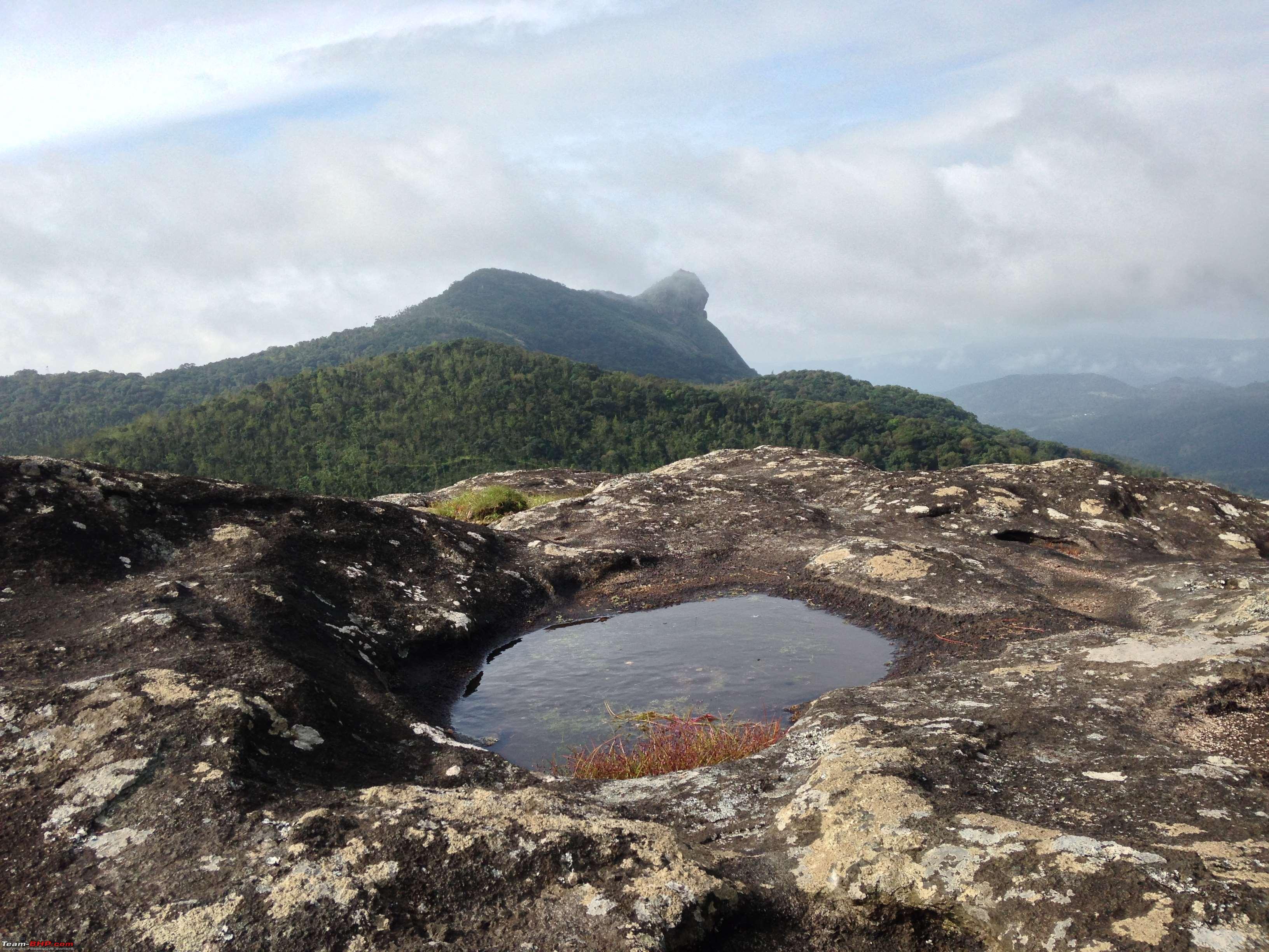
 . The shot of Gaalikere, Bababudangiri & Mullayanagiri is fantastic to say the least. I really did not know you could cover all the three in one shot. I was really surprised to see clear skies during this time of the year. You were very lucky in that sense. Everytime I have been to this place, it was always foggy. I haven't even seen the full lake clearly even though I've been there a few times. And the lake looks very clean in your pictures
 . Thanks a lot for posting these.
|
15th October 2013, 21:33
| #23 |
| BHPian Join Date: Apr 2012 Location: Bangalore
Posts: 100
Thanked: 287 Times
| |
|
| (2)
Thanks
|
|
16th October 2013, 16:21
| #24 |
| Senior - BHPian | |
|
|
|
18th October 2013, 20:03
| #25 |
| Senior - BHPian Join Date: Nov 2010 Location: Bangalore
Posts: 1,482
Thanked: 1,008 Times
| |
|
|
 . Keep it coming.
|
21st October 2013, 13:59
| #26 |
| BHPian Join Date: Feb 2008 Location: Bengalooru
Posts: 323
Thanked: 289 Times
| |
|
|

| |
|
24th October 2013, 19:05
| #27 |
| BHPian Join Date: Apr 2012 Location: Bangalore
Posts: 100
Thanked: 287 Times
| |
|
| (3)
Thanks
|


|
13th December 2013, 13:20
| #28 |
| BHPian Join Date: Apr 2012 Location: Bangalore
Posts: 100
Thanked: 287 Times
| |
|
| (1)
Thanks
|
|
13th December 2013, 20:38
| #29 |
| Newbie Join Date: Nov 2013 Location: Bangalore
Posts: 11
Thanked: 17 Times
| |
|
|  |
|
14th December 2013, 13:34
| #30 |
| Newbie Join Date: Sep 2013 Location: chennai
Posts: 16
Thanked: 6 Times
| |
|
|
 |
Most Viewed