Team-BHP
(
https://www.team-bhp.com/forum/)
-
Travelogues
(
https://www.team-bhp.com/forum/travelogues/)
After the trip to the two
dhams of
Yamunotri and
Gangotri in June 2012, the next on the itinerary was the trip to the remaining two
dhams of
Kedarnath and
Badrinath. Had shared the travelogue of
Yamunotri-Gangotri trip on Team BHP (Here's the link:
http://www.team-bhp.com/forum/travel...hatchback.html). As the monsoon is quite vigourous in the Himalayan region in general and in the state of
Uttarakhand in particular, so it was decided to undertake the
Kedarnath-Badrinath trip after the rains were over. Finally it was decided to embark on the sojourn in the month of October, 2012.
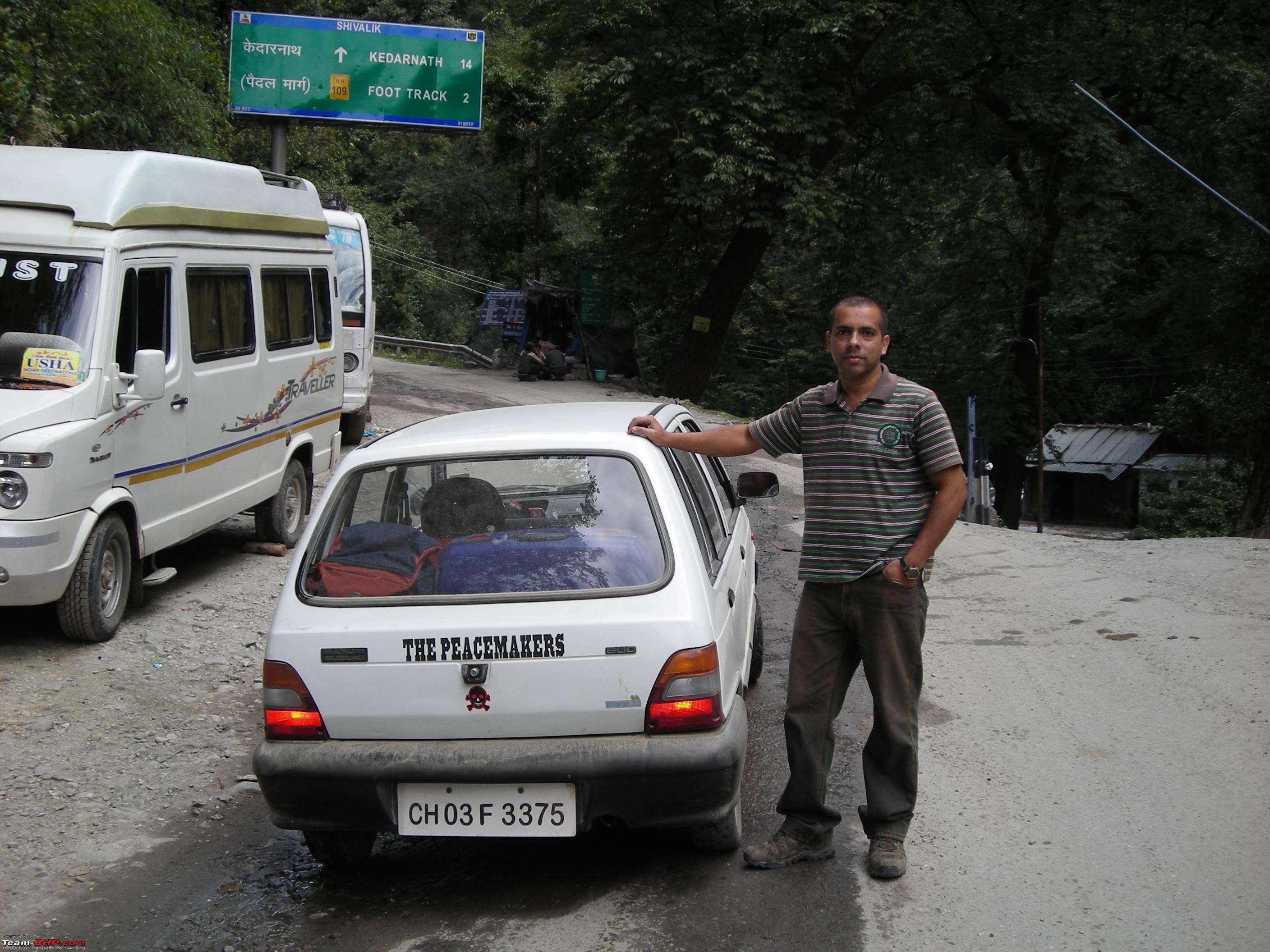
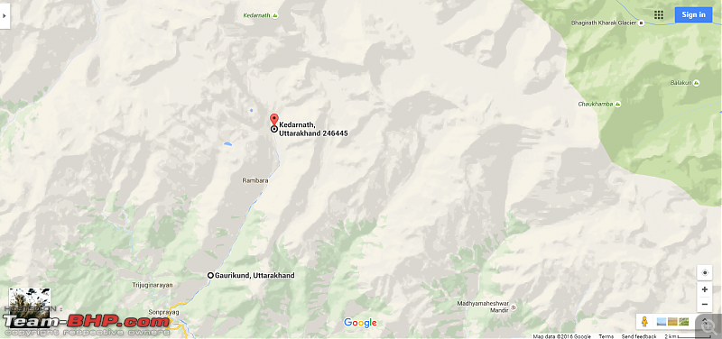
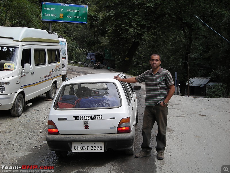
Itinerary of the trip was decided as follows: Day 1: Chandigarh to Guptkashi (Driving) (Via Dehradun, Rishikesh, Srinagar, Rudraprayag)
Day 2: Guptkashi to Gaurikund (Driving)/ Gaurikund to Kedarnath (Trekking)
Day 3: Kedarnath to Gaurikund (Trekking)/ Gaurikund to Guptkashi (Driving)
Day 4: Guptkashi to Badrinath (Driving)
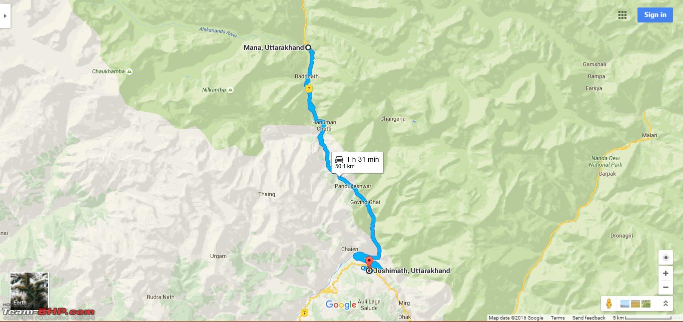
Day 5: Badrinath-Mana-Badrinath and then to Joshimath (Driving)
Day 6: Joshimath-Auli-Joshimath and then to Rudraprayag (Driving)
Day 7: Rudraprayag to Chandigarh (Driving) (Via Rishikesh, Dehradun) Some random photographs from the trip: 


So after the usual customary planning we were on the go.
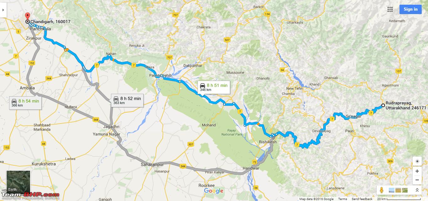
Day 1: 20th October, 2012 Chandigarh to Guptkashi: 394 kms (Driving) Route Map Day 1: 
On the first day of the trip we started at 0710 Hrs. Joined the
Ambala-Haridwar NH-72 at
Narayangarh and entered Himachal Pradesh at
Kala Amb. After crossing bridge over
Yamuna River at
Paonta Sahib, entered the state of Uttarakhand and stopped for breakfast at
Asan Barrage. Reached
Dehradun by 1200 Hrs and continued heading towards
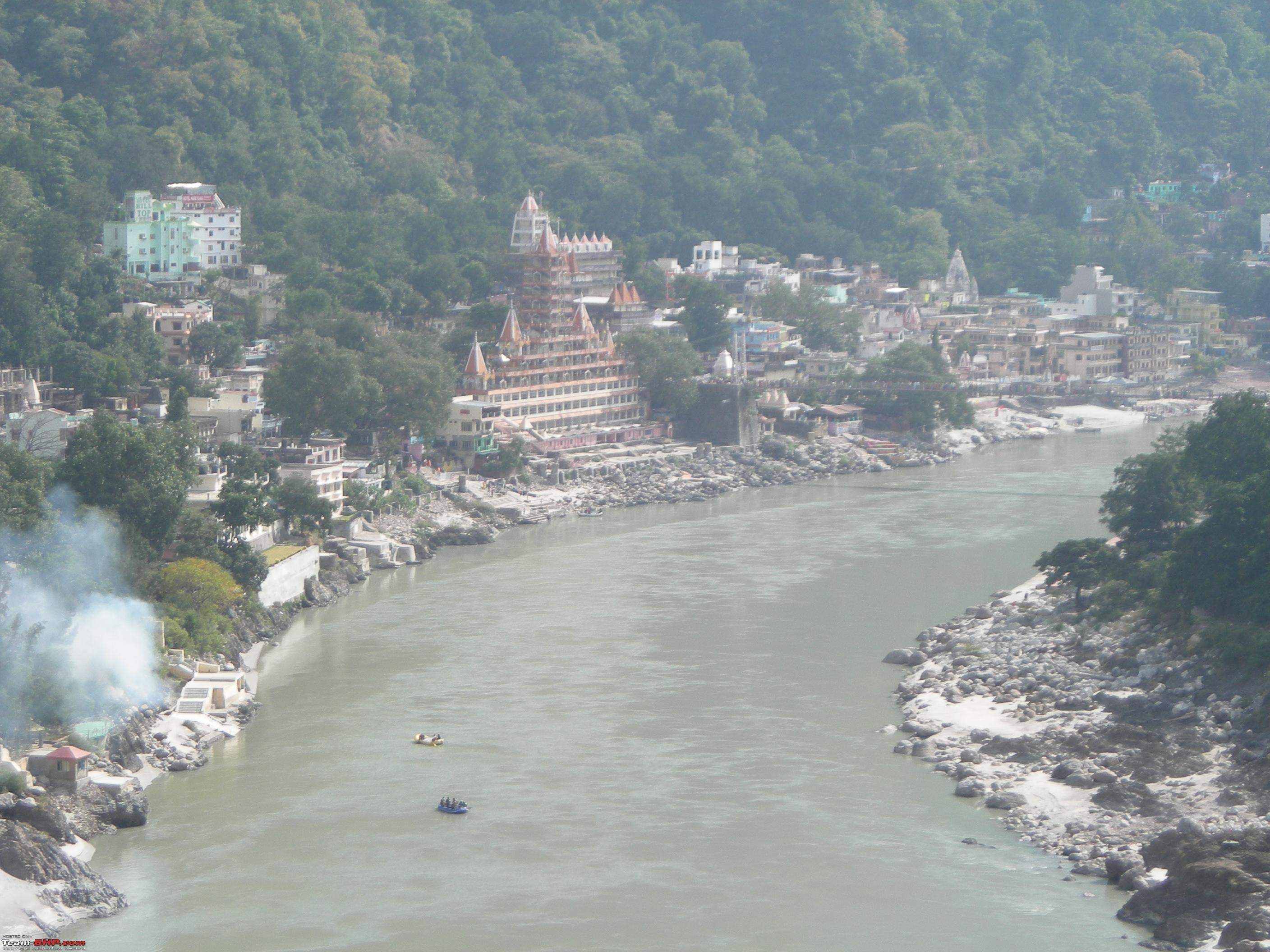
Rishikesh. Reached
Rishikesh by 1305 Hrs and joined NH-58. With the start of hilly ascent, stopped for a while a few kms ahead of the town by the side of River
Ganga.
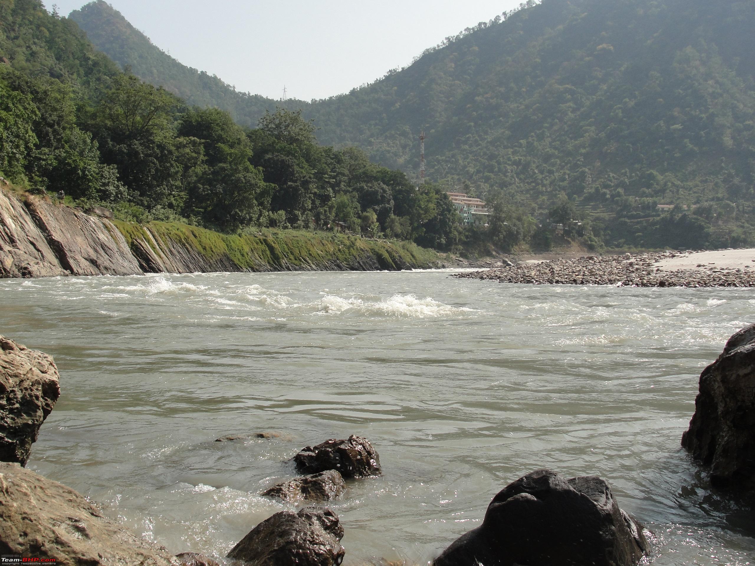
Views of Rishikesh Town from NH-58. 
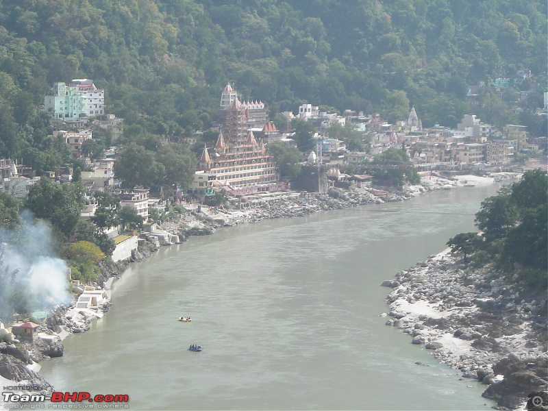 River Ganga flows along the highway till Devprayag
.
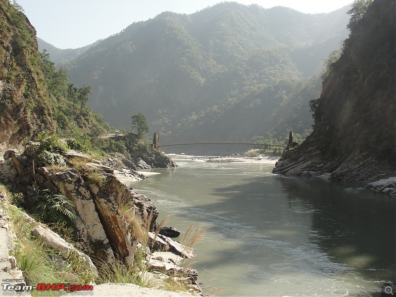
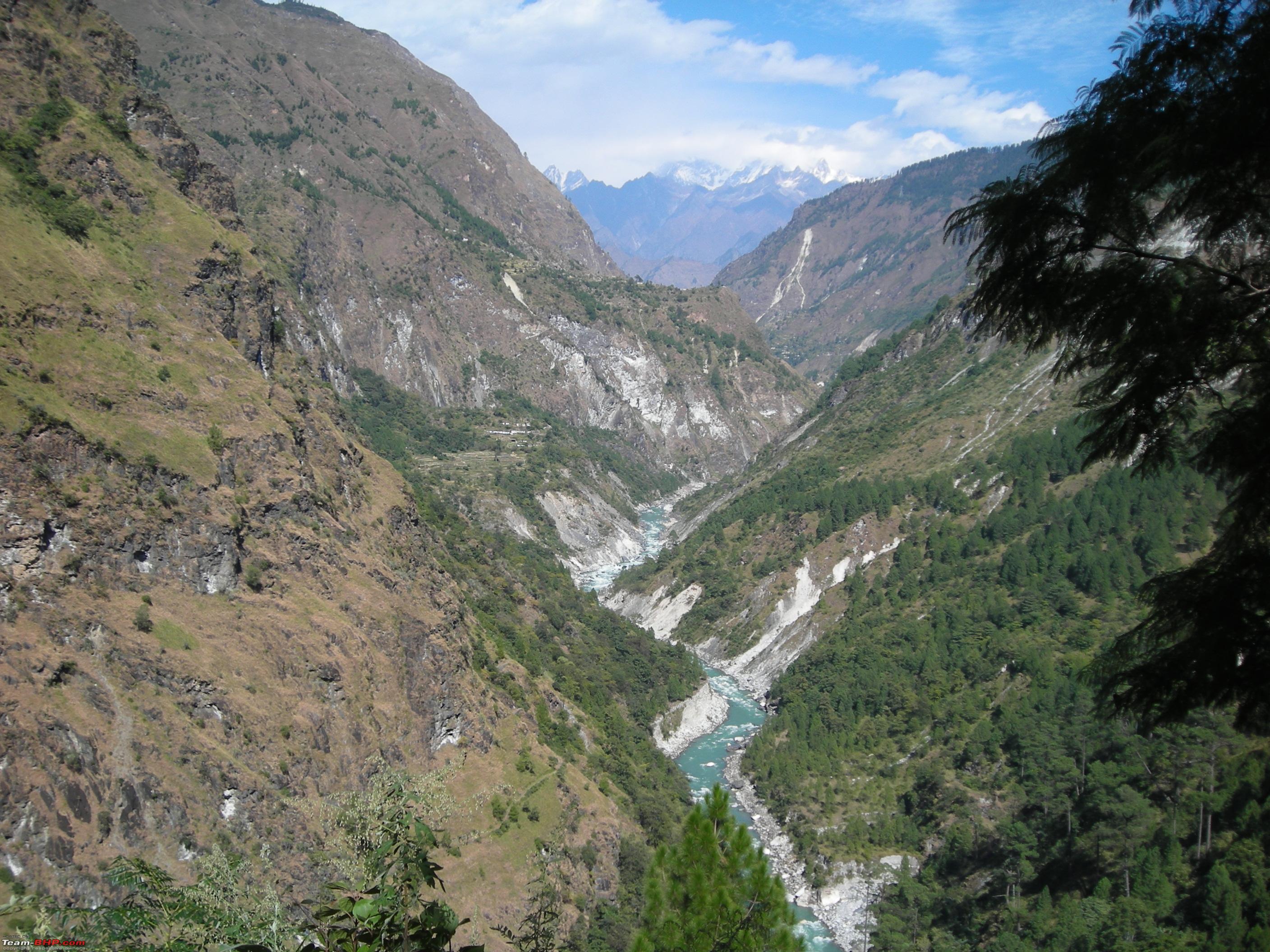
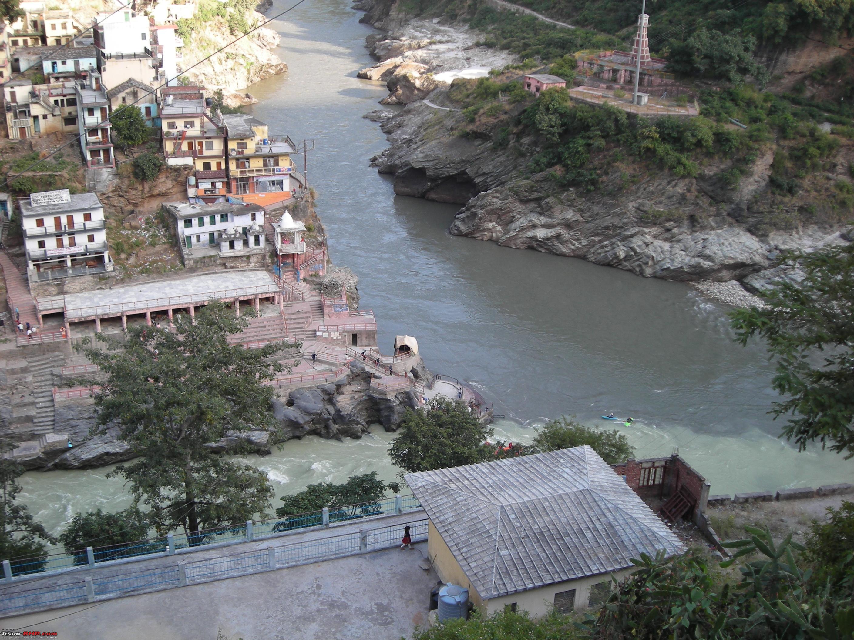
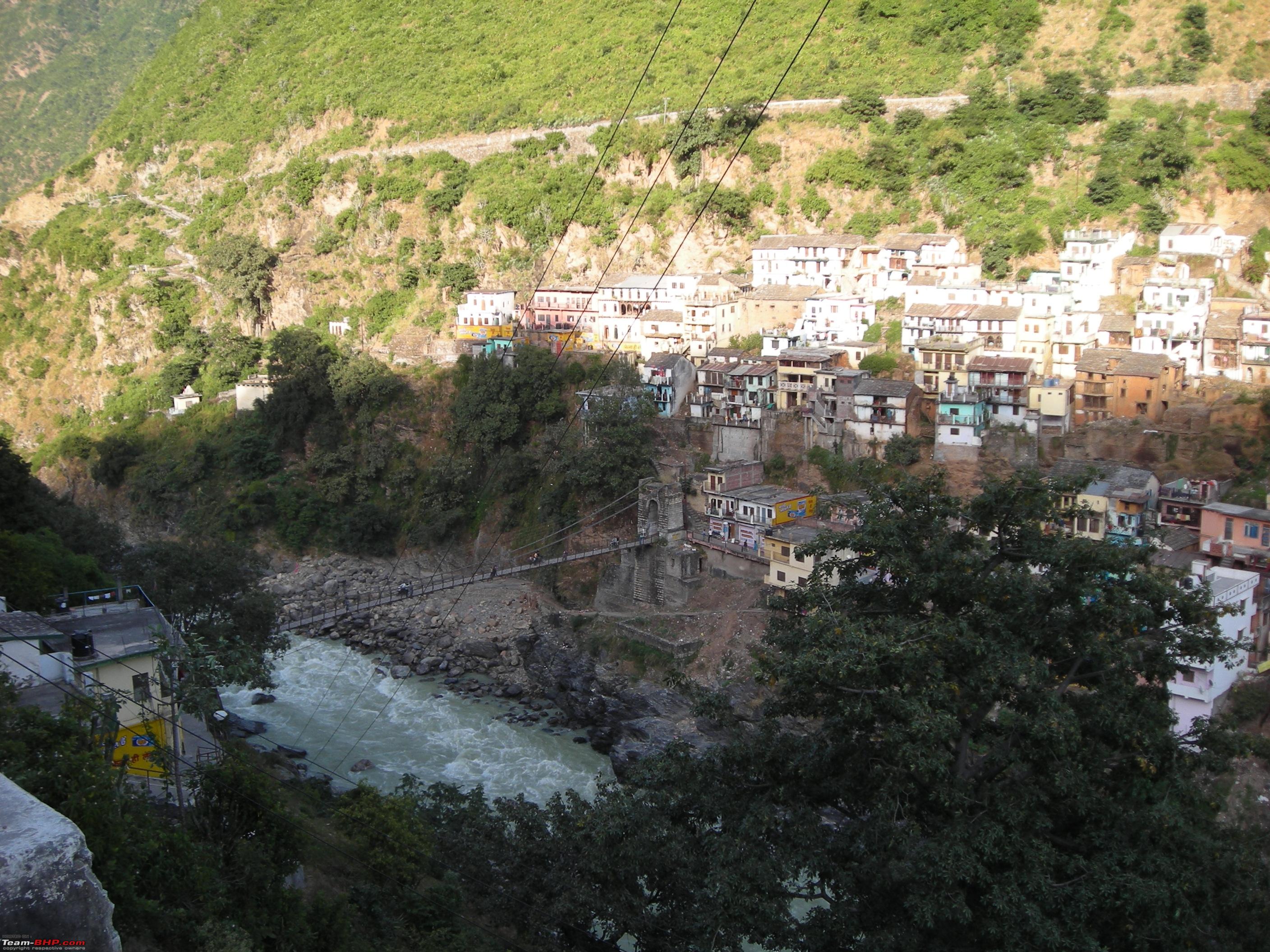
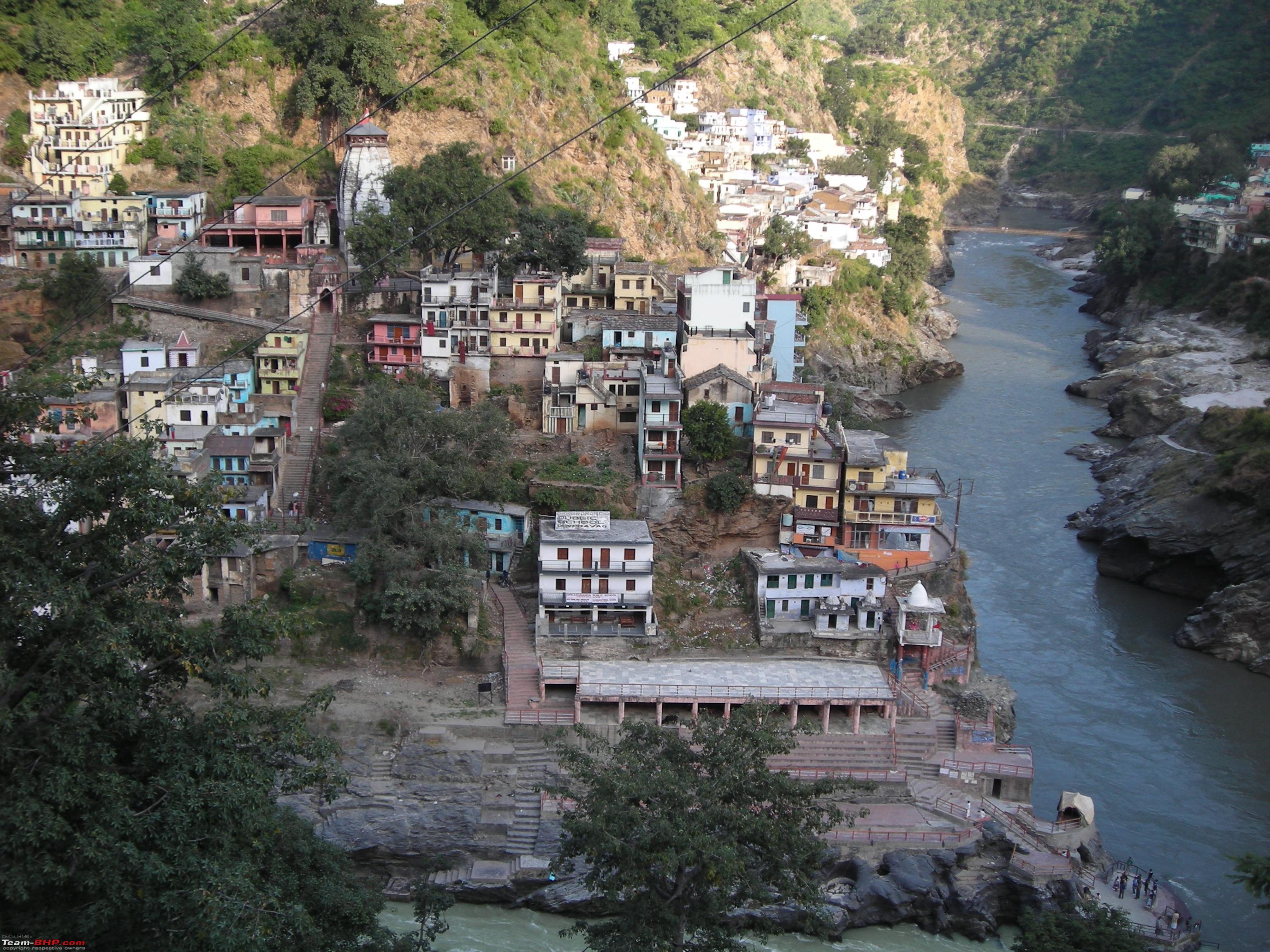
By 1555 Hrs, after a drive of 80 kms, reached the holy town of Devprayag which is famous for being the confluence point for River
Ganga and its major tributary River
Alaknanda.
River Ganga (flowing from left) meets Alaknanda at Devprayag.
 River Ganga enters Devprayag after flowing from Tehri Dam
.
 River Alaknanda originates near Badrinath
.
 Pilgrims offering prayers at the confluence point of the Rivers at Devprayag
.
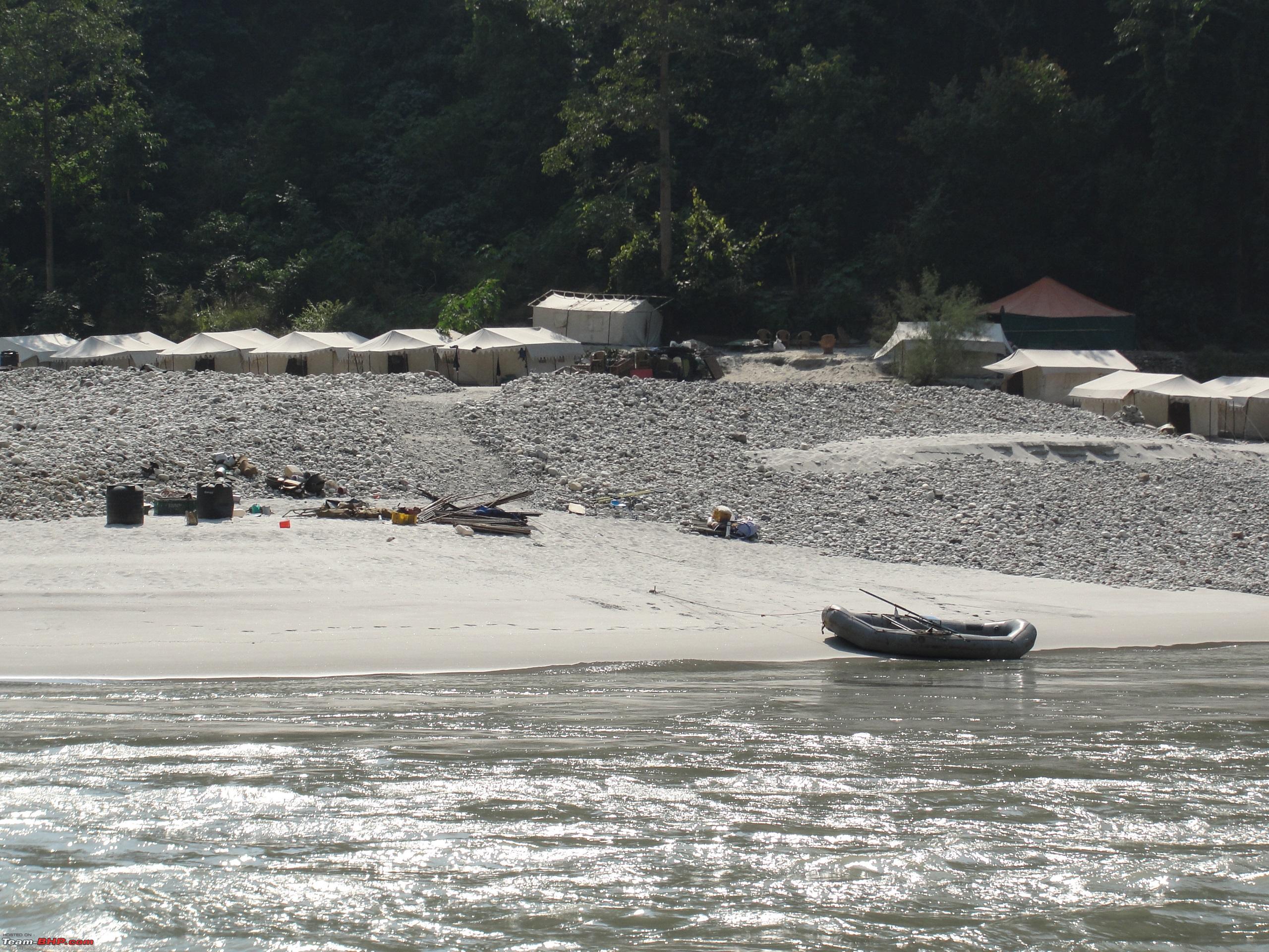
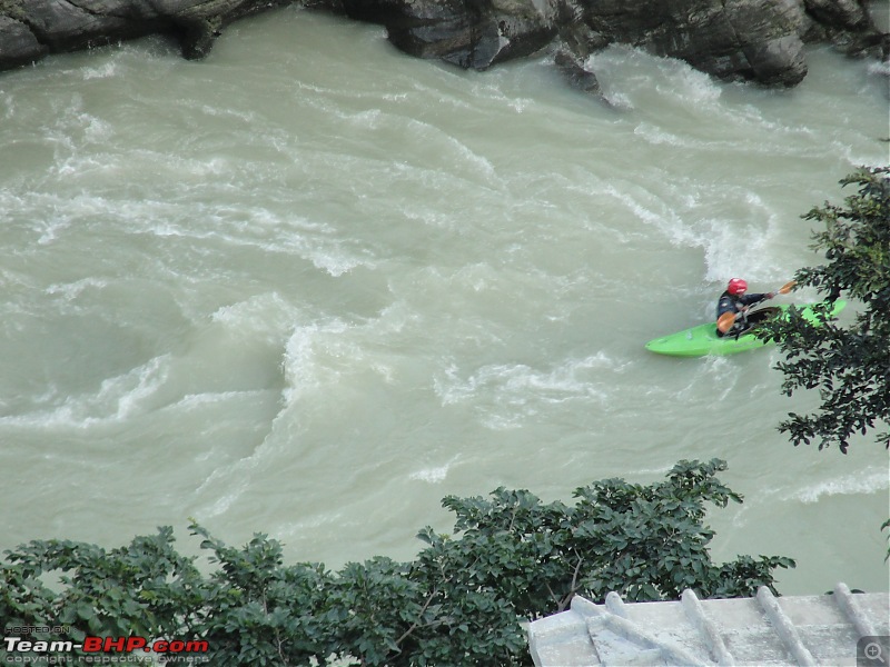
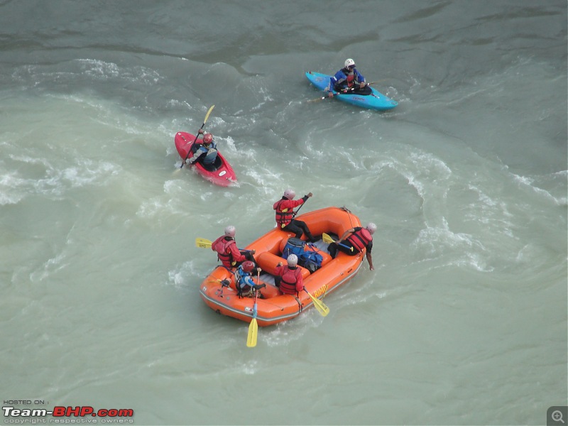
 Noticed some adventure freaks enjoying rafting at the confluence point
.
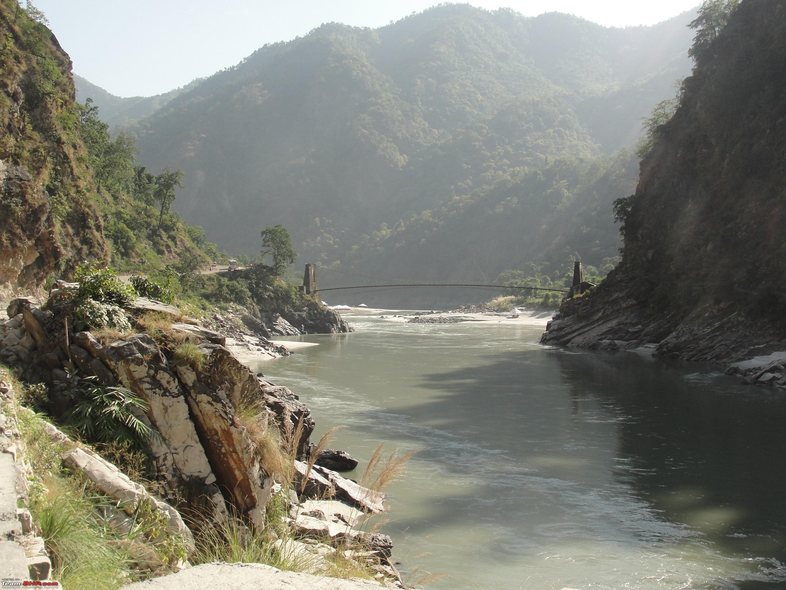
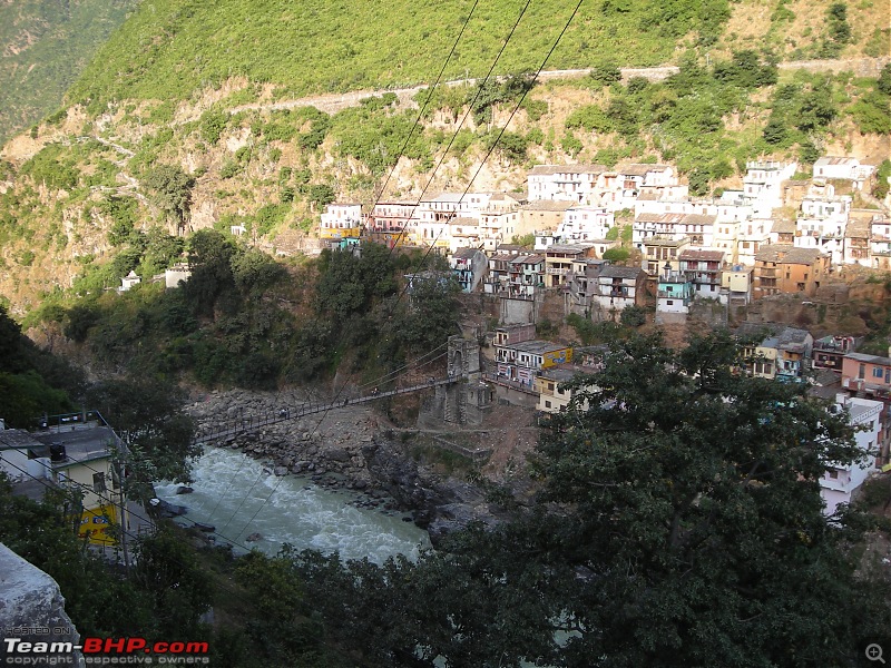
After savouring the natural beauty, started off again at 1620 Hrs and after drive of 40 kms reached the beautiful town of
Srinagar located on the banks of River
Alaknanda. The valley is widest at
Srinagar, which is an important town in the
Garhwal division of
Uttarakhand. Earlier we had plans to have a night halt at
Srinagar itself but as the time was 1730 Hrs with ample daylight, we decided to move on further. After driving for 35 kms, reached the town of
Rudraprayag, which is famous for being the confluence point of River
Alaknanda and its tributary River
Mandakini.
It is at
Rudraprayag from where the highway branches off towards
Kedarnath from NH-58. The time was 1900 Hrs and it had started to get dark. We tried looking for accommodation at
Rudraprayag but found most of the Hotels full. At one such hotel we were advised to continue our drive towards Guptkashi which was 45 kms further, the staff at the hotel assured us that we will find accommodation at
Guptkashi as it was fag end of the
Yatra season. We again started off and after a drive of one hour and fifteen minutes reached our halt for the day at
Guptkashi by 2045 Hrs. Luckily found a decent guest house by the roadside. After dinner we called it a day by 2230 Hrs. That was the end of day one of the trip.
Day Travel Log:
Total Distance Covered: 394 kms
Time Taken: 13 Hrs 35 Mins (Including Halts Totalling 2 Hrs for photography, food etc).
Route Taken: Chandigarh-Narayangarh-Kala Amb-Nahan Bye Pass-Paonta Sahib-Herbertpur-Dehradun-Rishikesh-Devprayag-Srinagar-Rudraprayag-Agastmuni-Guptkashi.
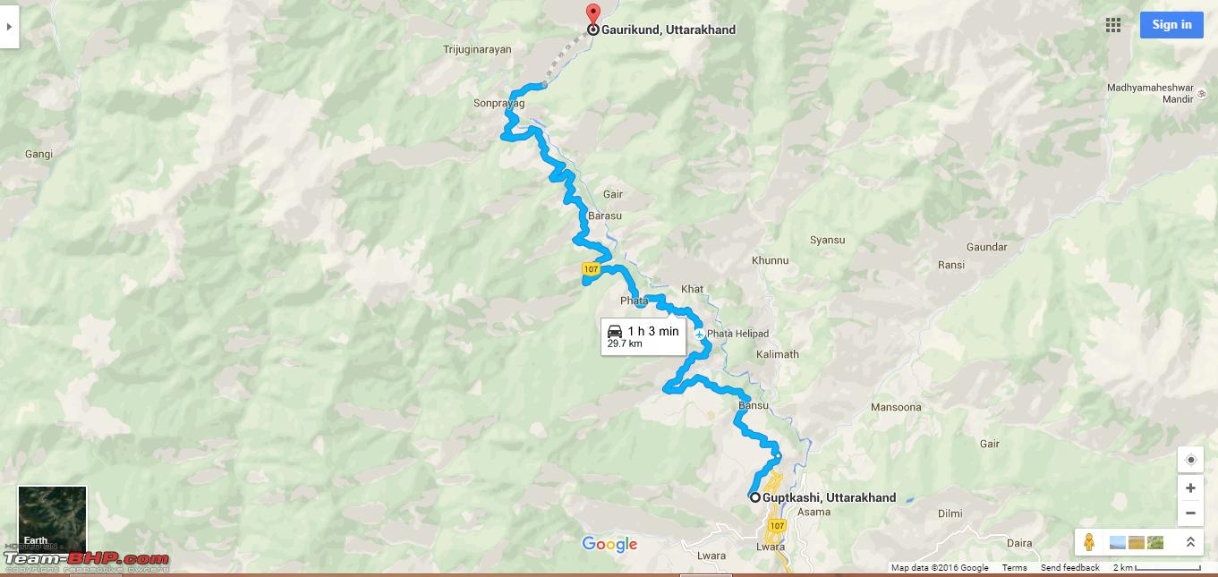
Day 2: 21st, October 2012 Guptkashi-Gaurikund: 33 kms (Driving) / Gaurikund-Kedarnath: 14 kms (Trekking) Route Map Day 2 & 3 (Driving):
 Route Map Day 2 & 3 (Trekking)
:
The itinerary for the day was drive from
Guptkashi to
Gaurikund and then trekking from
Gaurikund to
Kedarnath. By 0745 Hrs we headed for
Gaurikund, which is the base camp for trek to
Kedarnath. The very first striking view of the morning from Guptkashi was of the
Chaukhamba massif.
Chaukhamba massif is a group of four peaks, amongst which
Chaukhamba 1 (Elv 7,138 meters) is among the highest Himalayan Peaks in India.
View of the mighty Chaukhamba mountain massif (Elv 7,138 - 6,854 meters) from Guptkashi. 

The road between
Guptkashi and
Gaurikund was damaged at many places due to landslides, which slowed the progress. It took 2 Hrs to cover a distance of 38 kms. Reached
Gaurikund by 1000 Hrs and after parking the car started for our trek towards
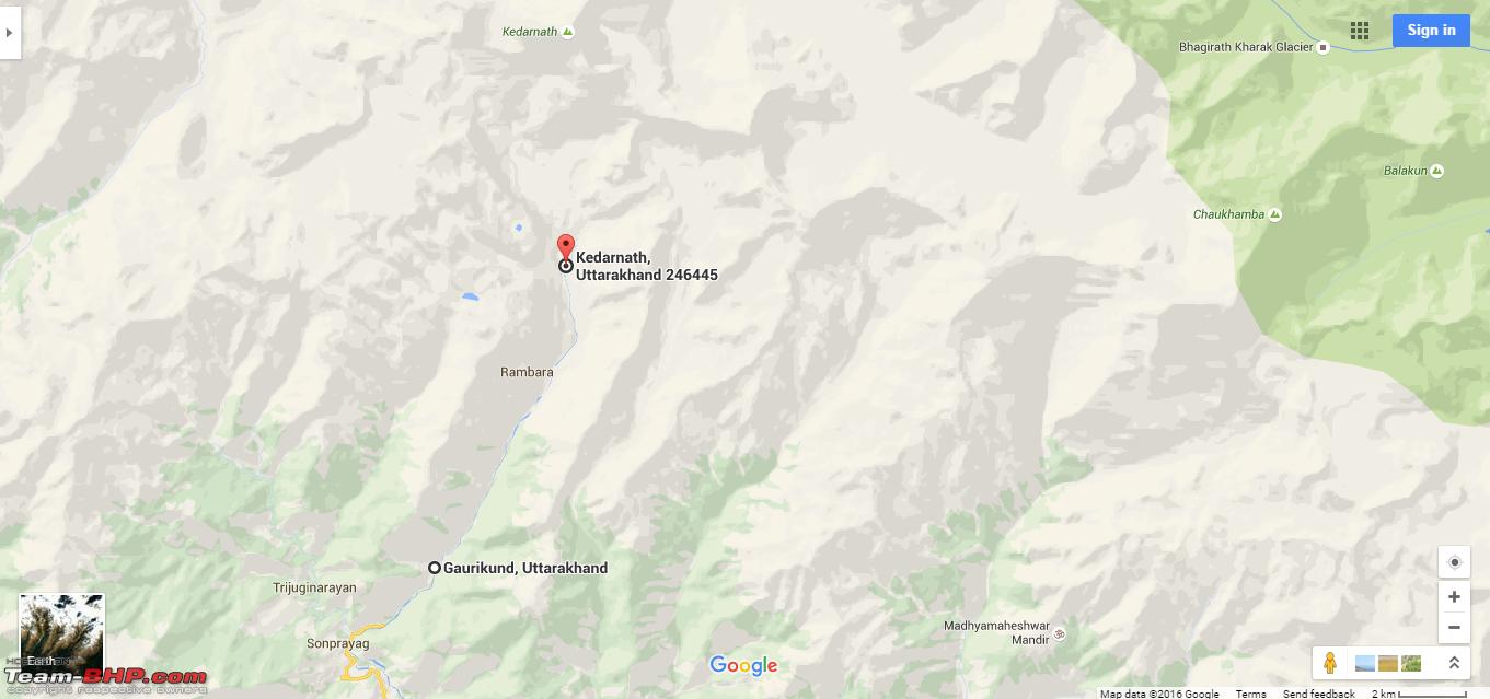
Kedarnath by 1040 Hrs which was 14 kms away.
The trek from Gaurikund to Kedarnath is a tough one as the ascent is too steep right from the starting itself. The altitude rises from 1,982 meters at
Gaurikund to 3,583 meters at
Kedarnath, a rise of 1601 meters (5252 feet) within a span of 14 kms, making the trek a challenging one.
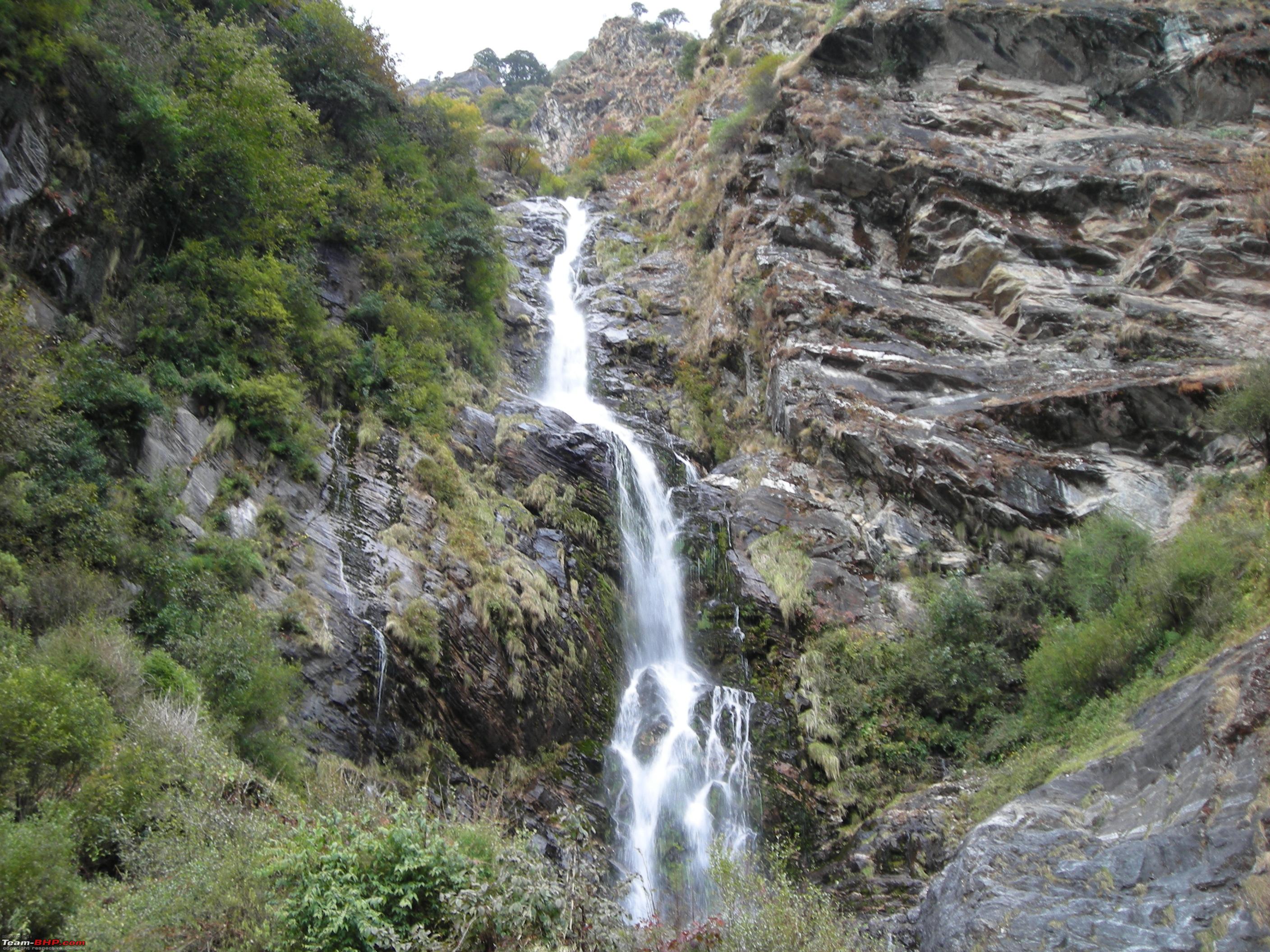
Milk or Water? A beautiful waterfall on the way.  View of Kedar Valley from the trek.

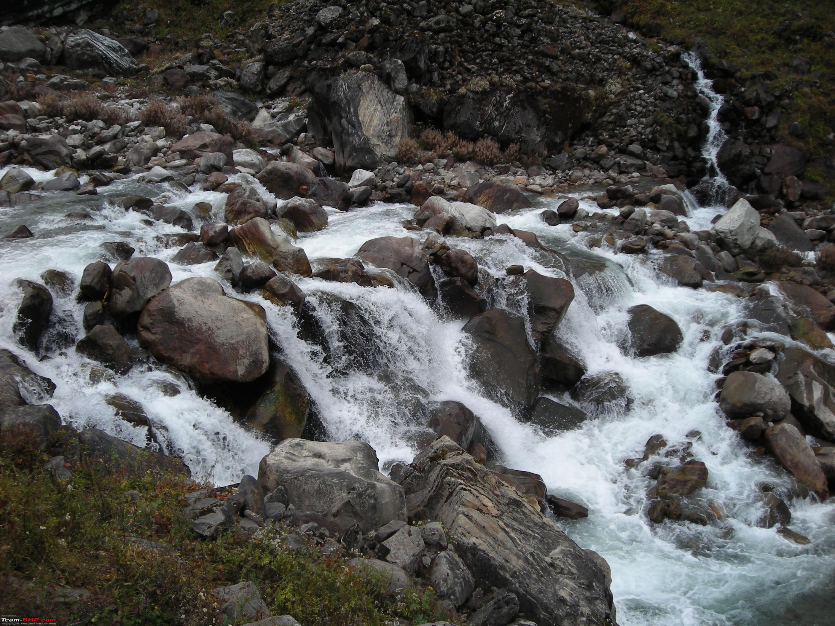
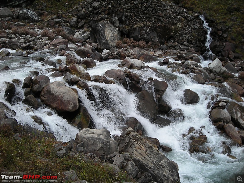
 River Mandakini flows as a mild stream along the trek
.

We stopped for lunch enroute at
Rambara, which was a major halt on the Gaurikund-Kedarnath trek before the massive flash floods of 2013. The trek is much steeper from
Rambara onwards.
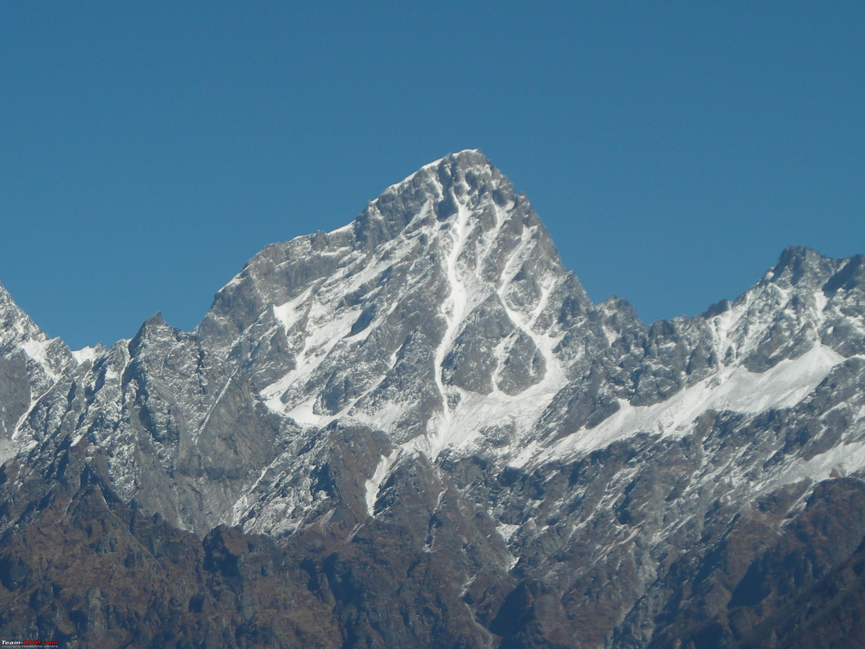
Closing in towards Kedarnath with views of Kedarnath Mountain Range. 
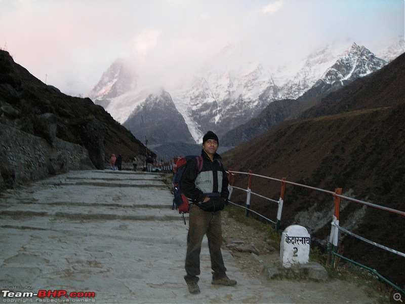
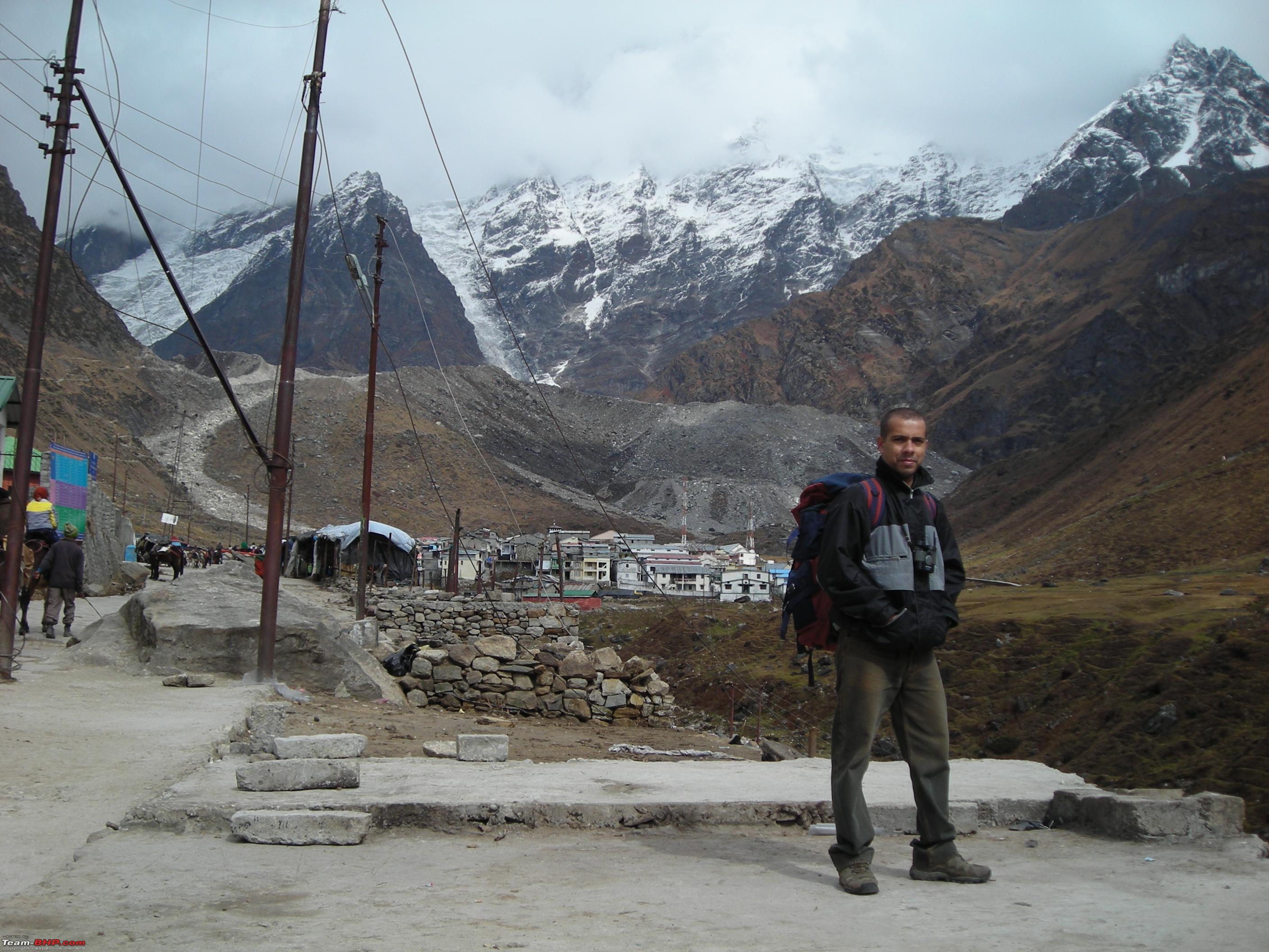
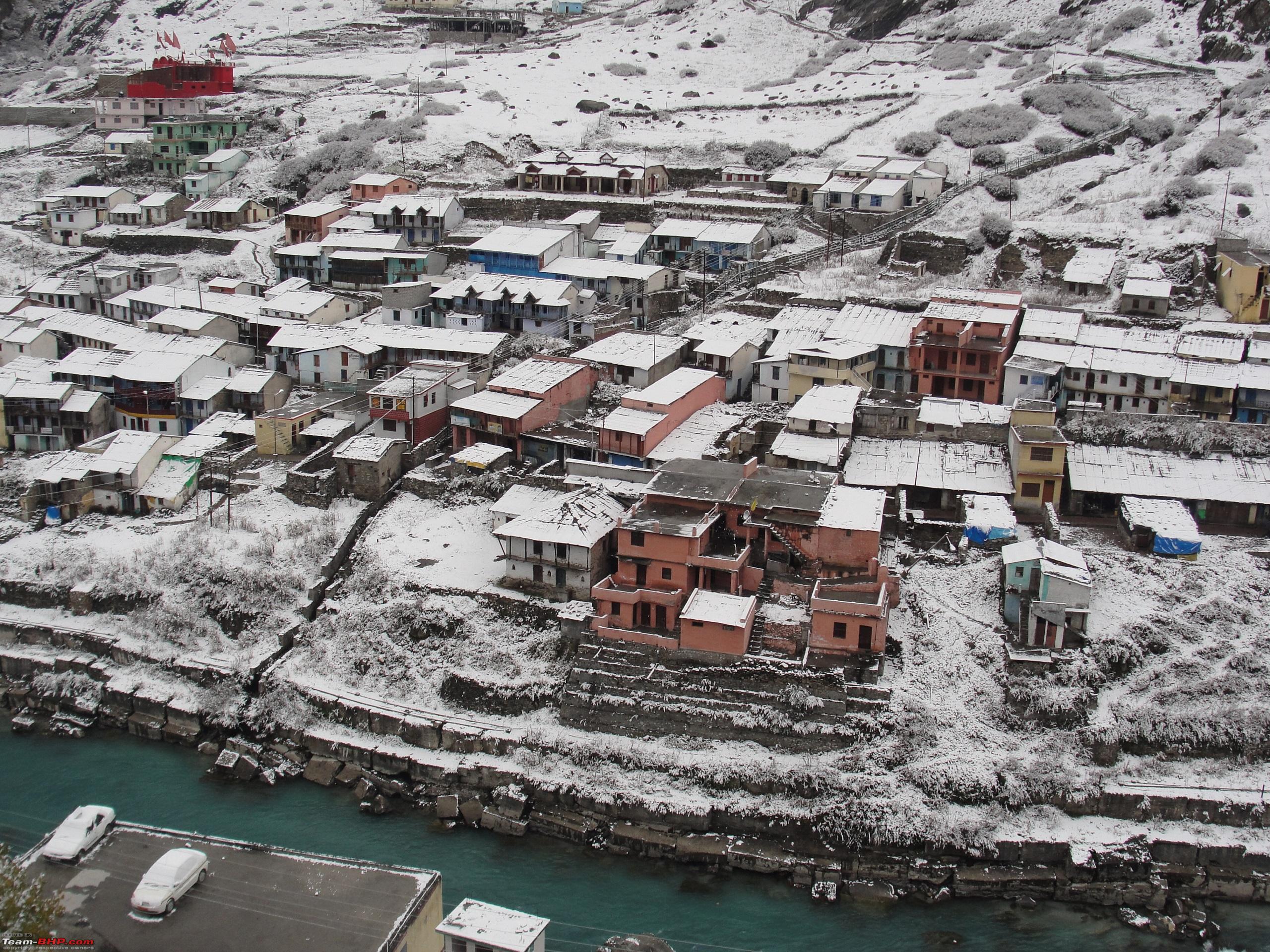
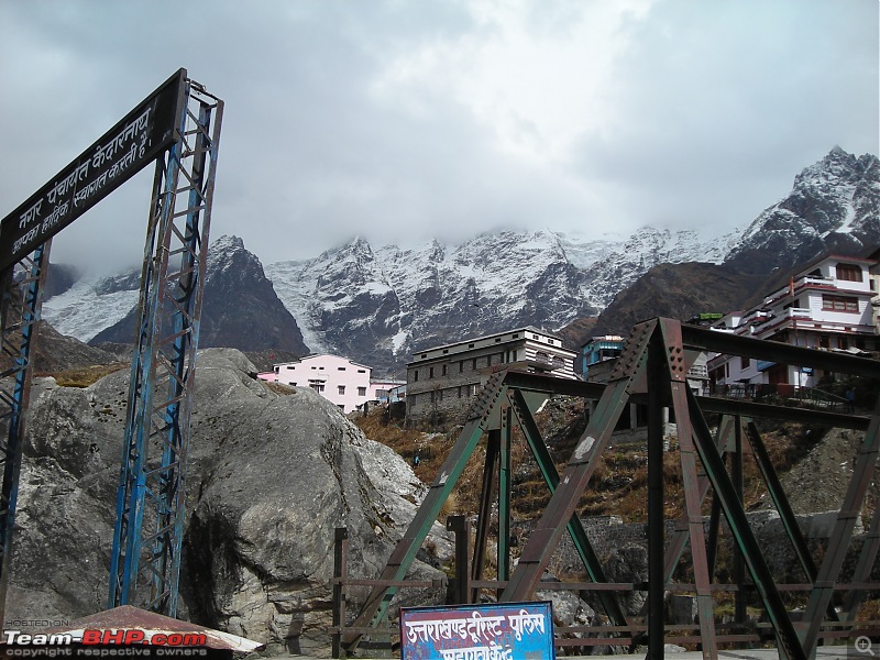
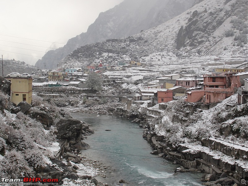
After a tiring and arduous trekking of 14 kms, reached
Kedarnath Town by 1840 Hrs. It took us a total of 8 Hrs to trek from
Gaurikund to
Kedarnath, the actual trekking time was 5Hrs 40Mins plus 2Hrs 20Mins of halts for relaxation, food etc. The temperature was pretty low and we could feel the chill in the air. We checked into a lodge near the temple and decided to stay indoors as the temperature outside had reached around freezing point after sunset. After relaxing for an hour we had our dinner by 2100 Hrs and went to sleep by 2230 Hrs for a much deserved rest after an exhausting day. That was the end of day two of the trip.
Day Travel Log:
[i]Total Distance Covered: 47 kms (33 kms Driving & 14 Kms Trekking)
Time Taken: 10 Hrs (2 Hrs of Driving & 8 Hrs of Trekking (Including halts of 2Hrs 20Mins for rest, food etc.)
Route Taken: Guptkashi-Fatta-Gaurikund (Driving) / Gaurikund-Rambara-Kedarnath (Trekking)
Refuelling: Tank full at Guptkashi (22.95 ltrs) (1st refuelling of the trip).
Day 3: 22nd, October 2012 Kedarnath-Gaurikund: 14 kms (Trekking) / Gaurikund-Guptkashi: 33 kms (Driving)
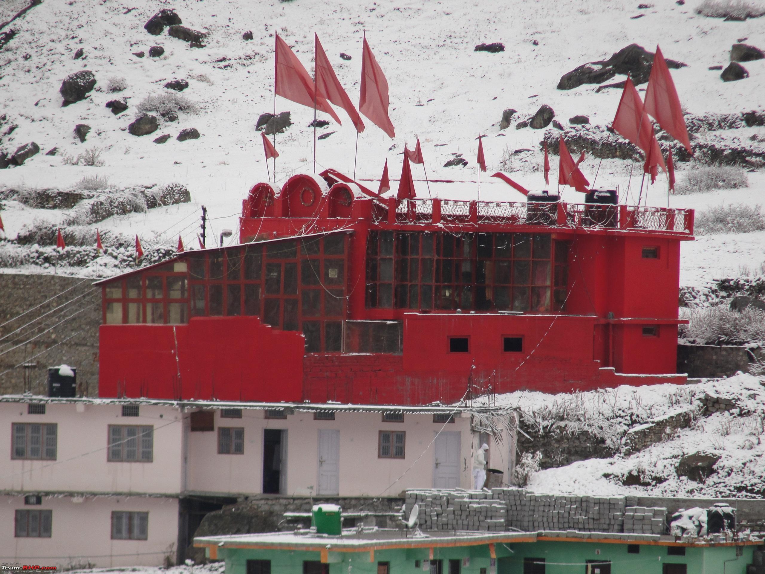
Woke up to a cloudy yet comfortably cold day. After getting ready visited the
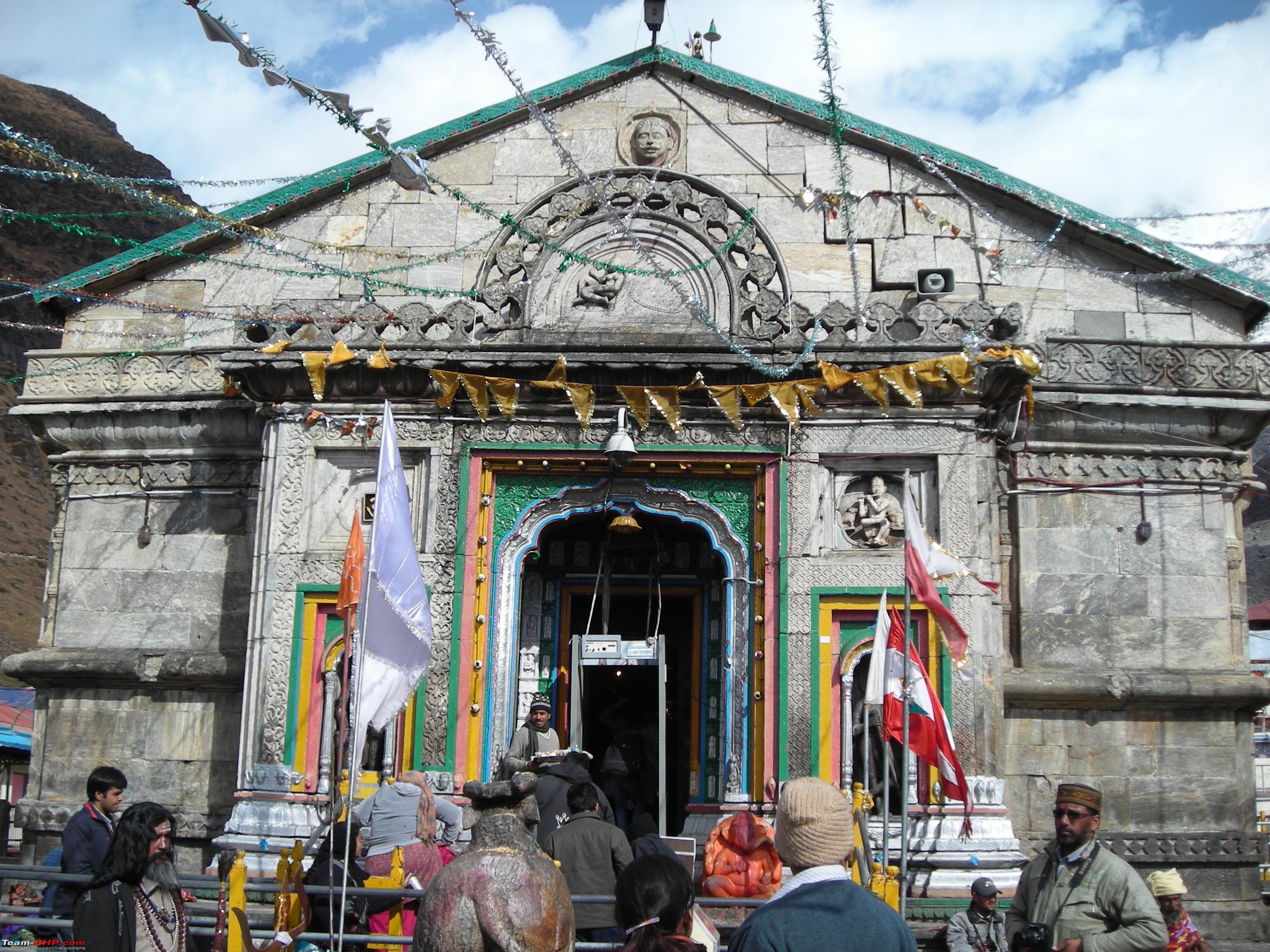
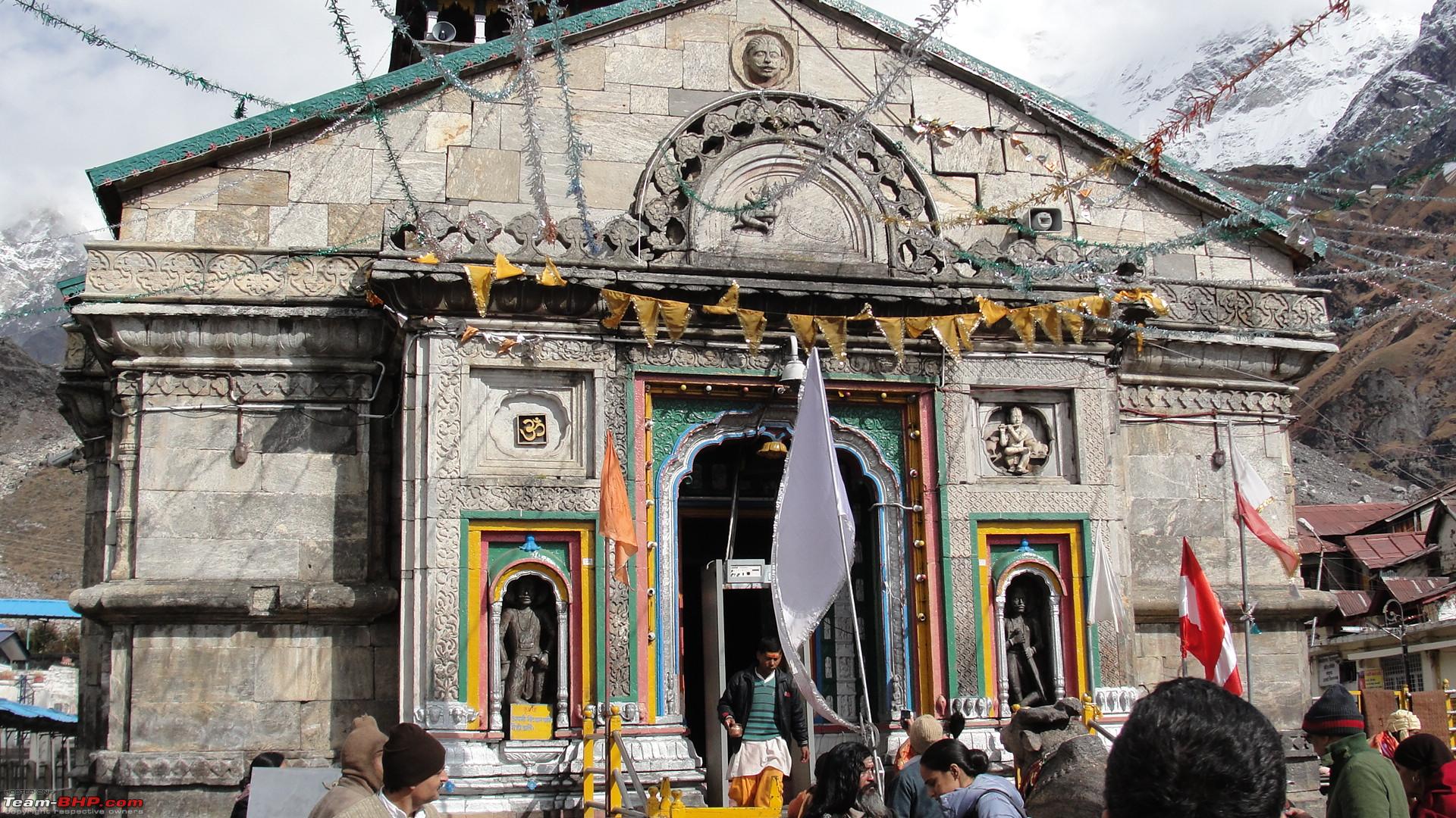
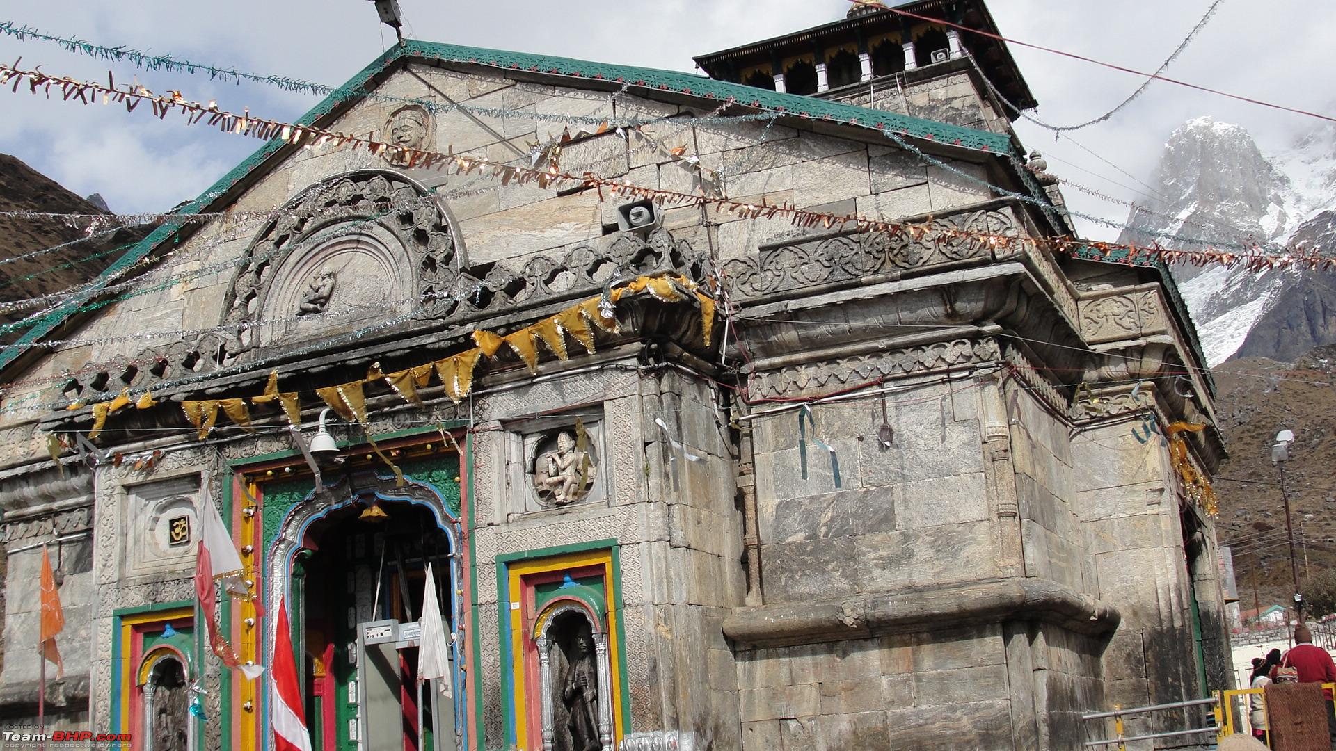
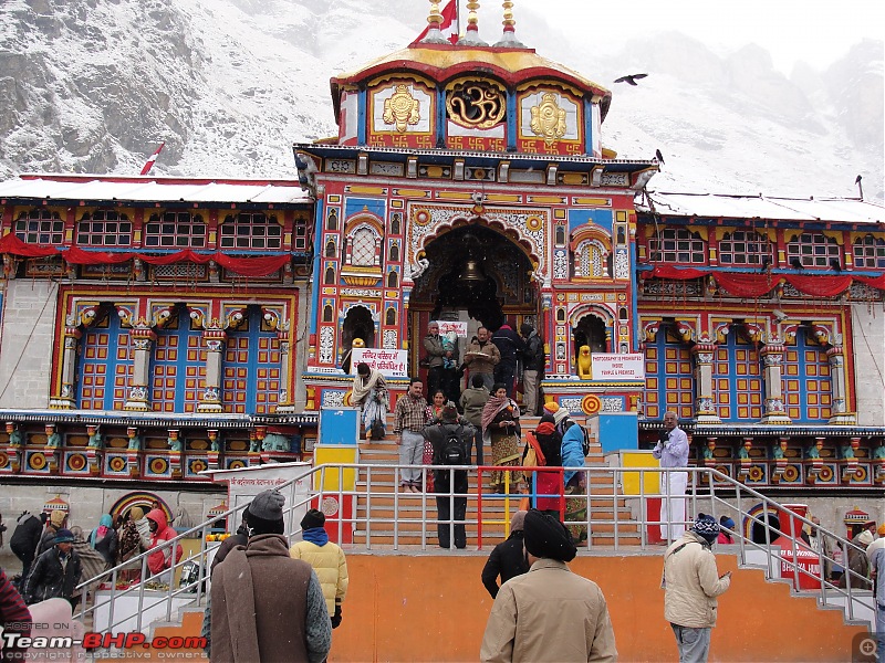
Kedarnath temple and explored the town.
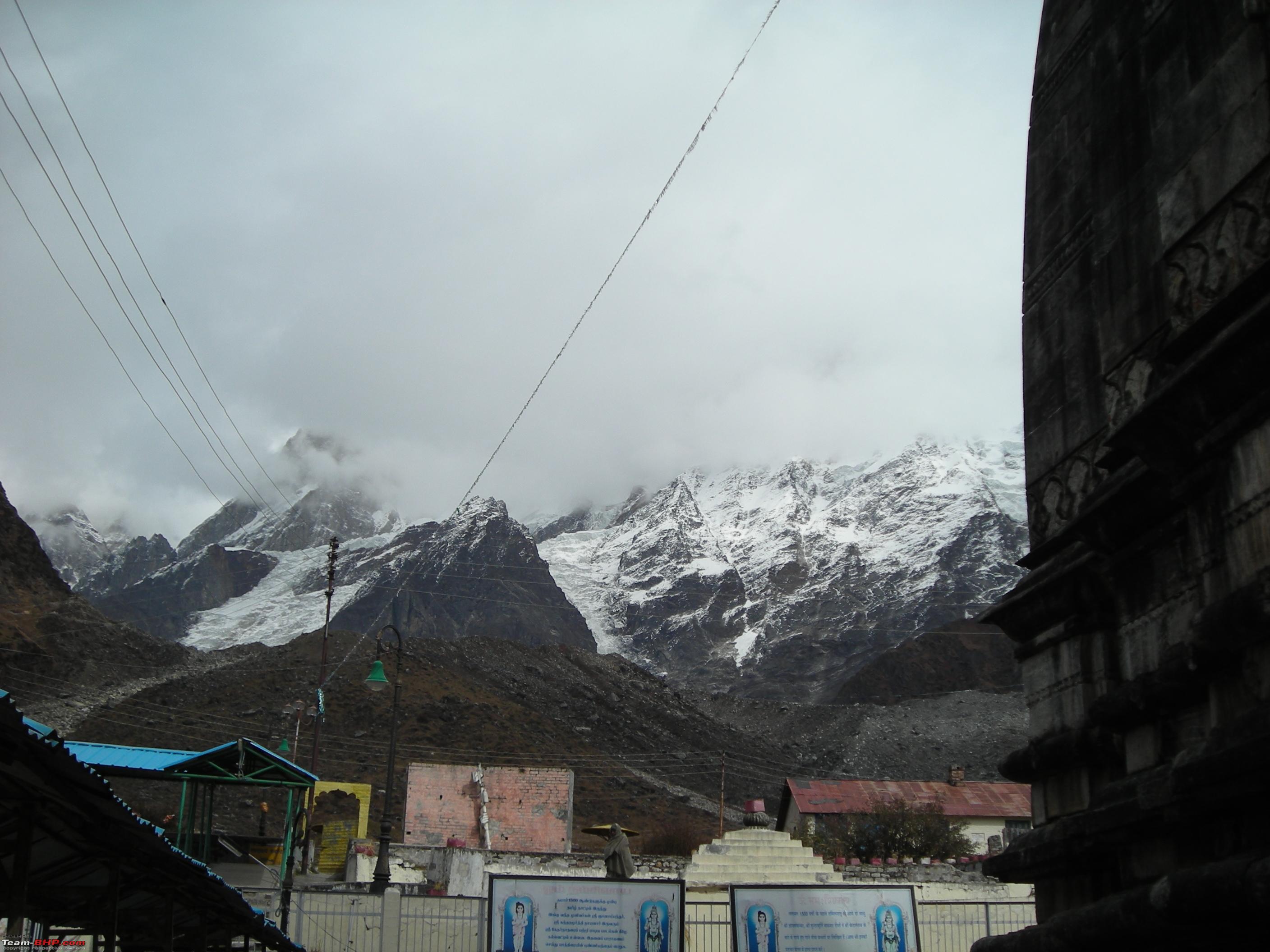
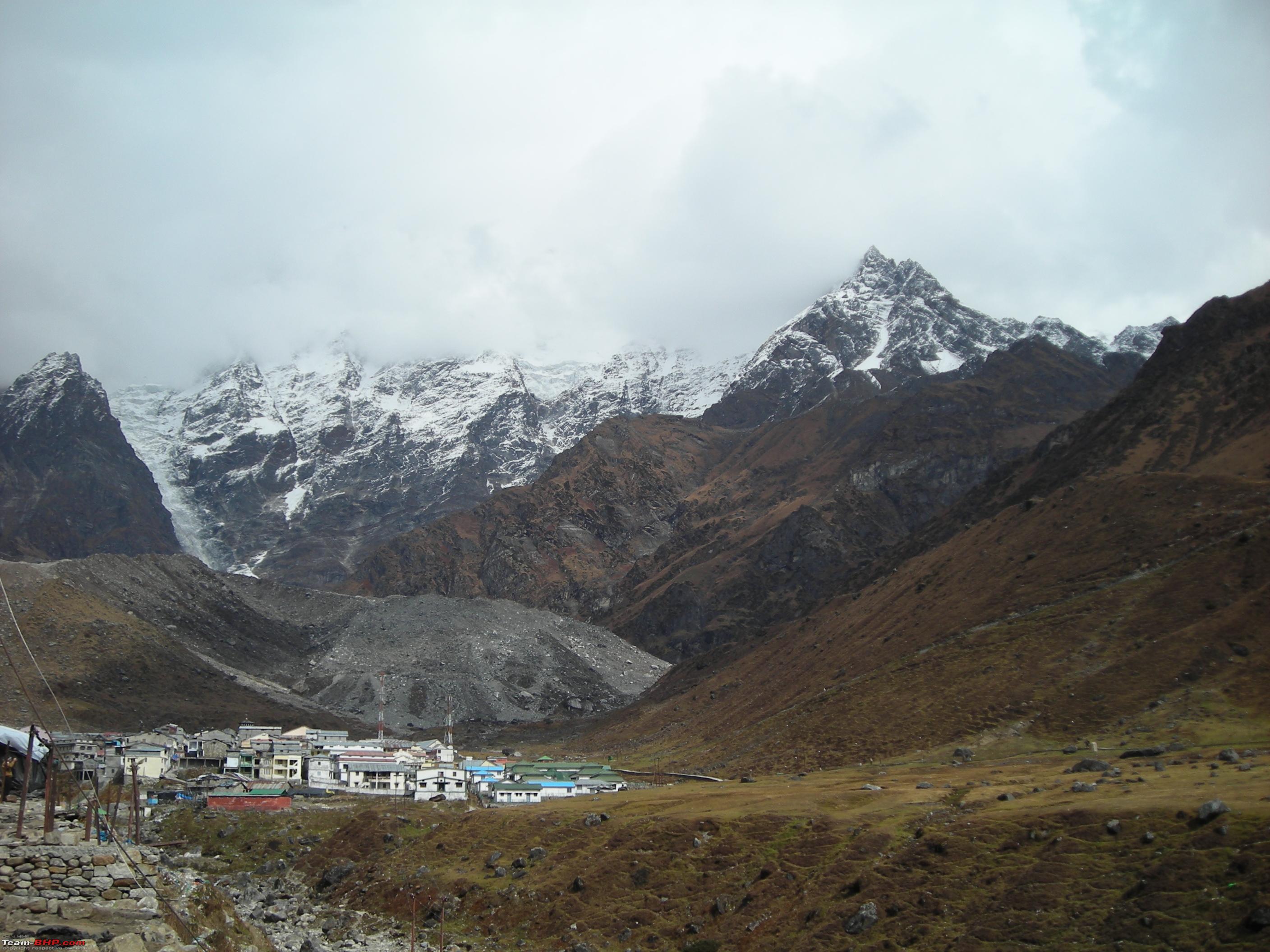
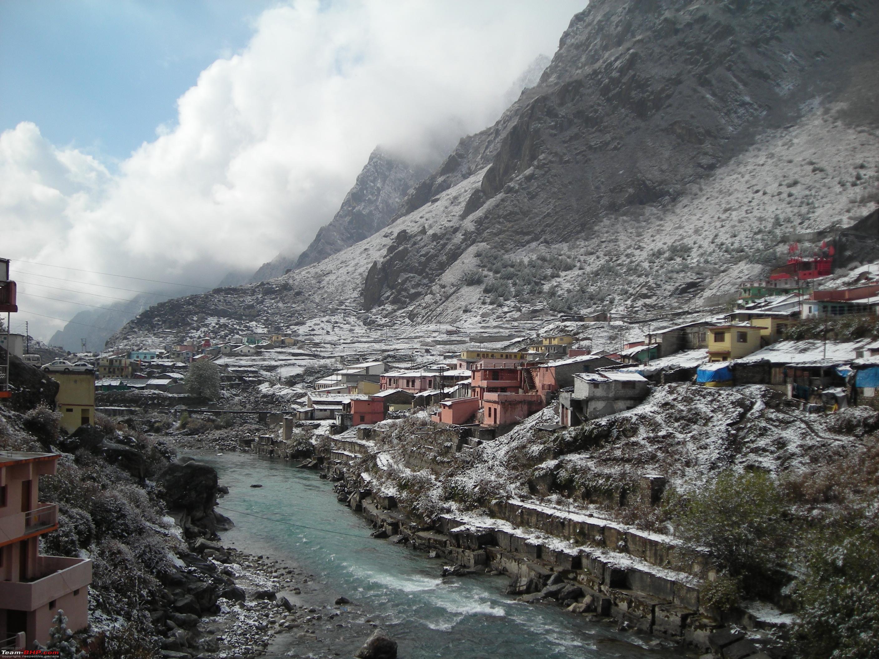
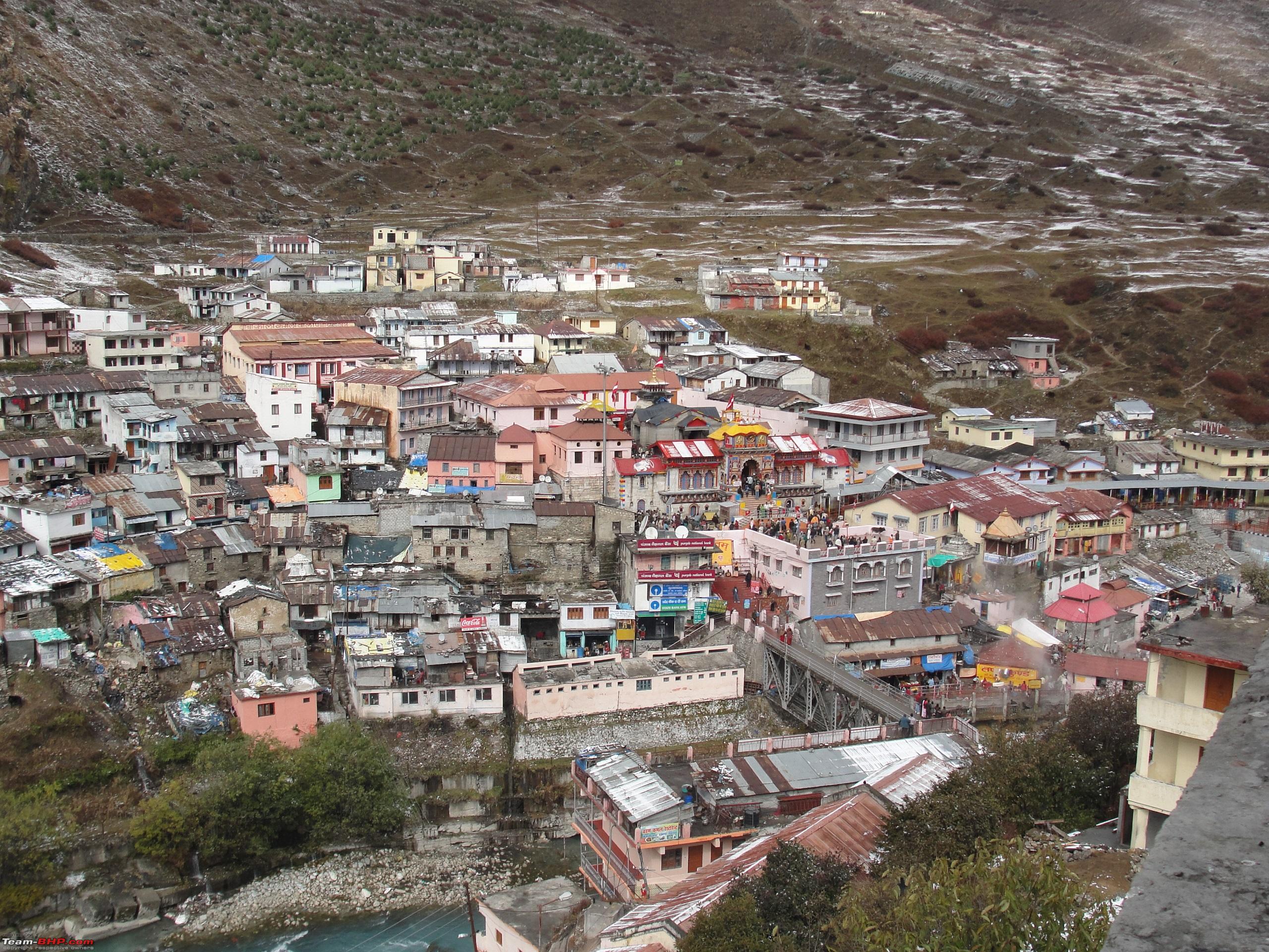
Link to information about Kedarnath Town: https://en.wikipedia.org/wiki/Kedarnath (Source: Wikipedia) Link to information about Kedarnath Temple: https://en.wikipedia.org/wiki/Kedarnath_Temple (Source: Wikipedia) Kedarnath is a scenic town set in a bowl shaped valley surrounded by towering Himalayan peaks, the most prominent amongst them are the
Kedarnath Main and
Kedarnath Dome with an elevation of 6,940 meters above sea level. The
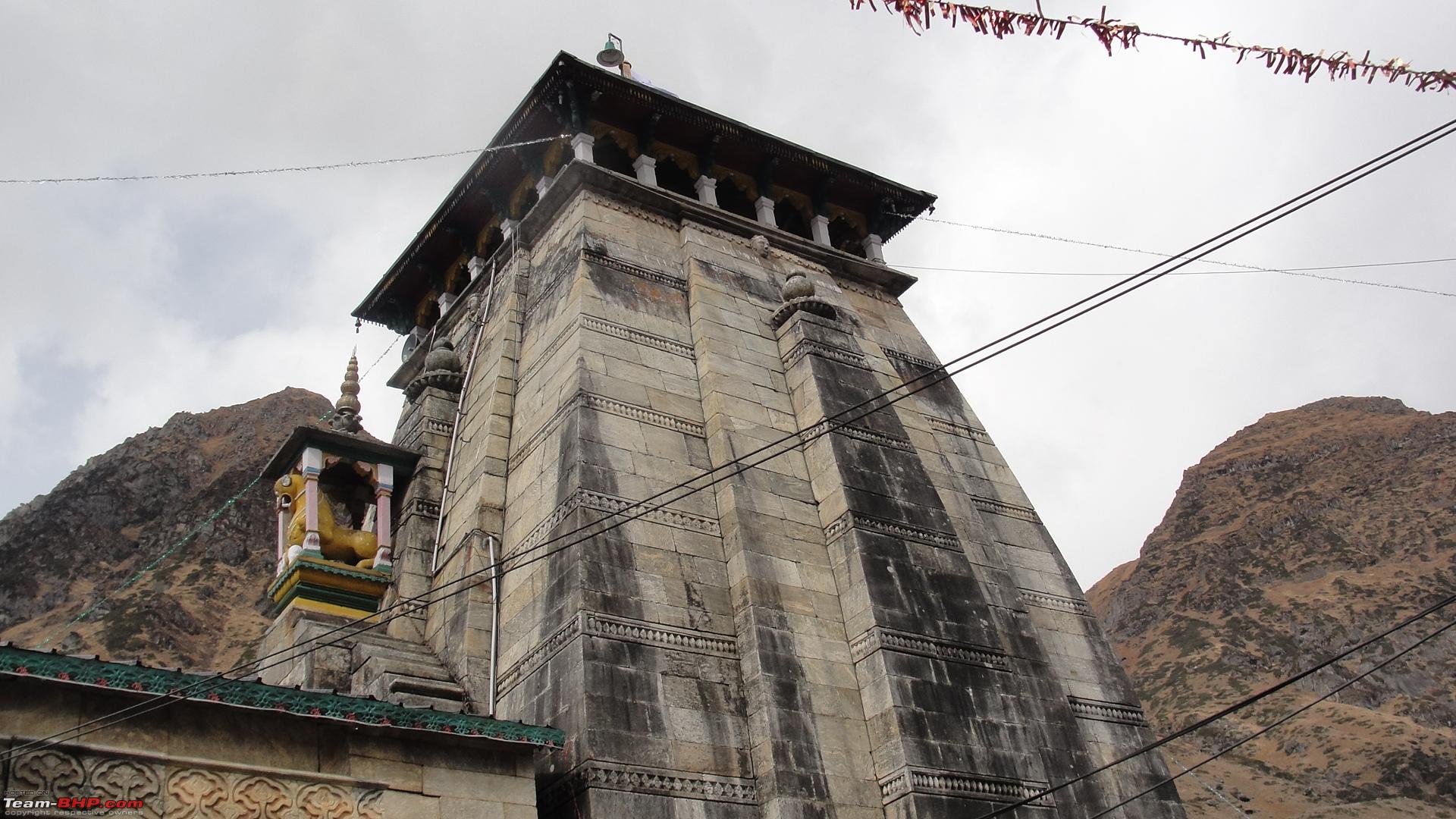
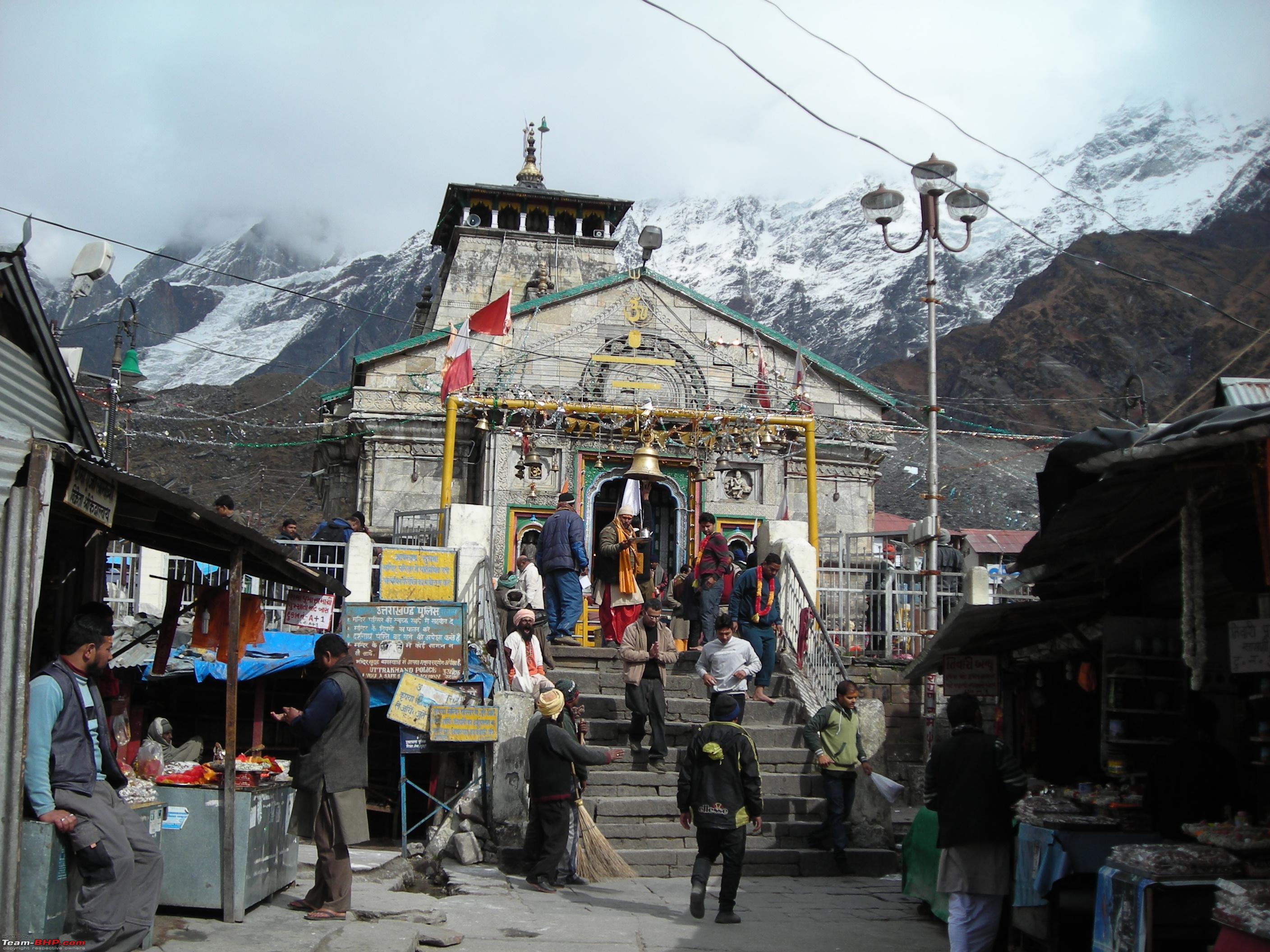
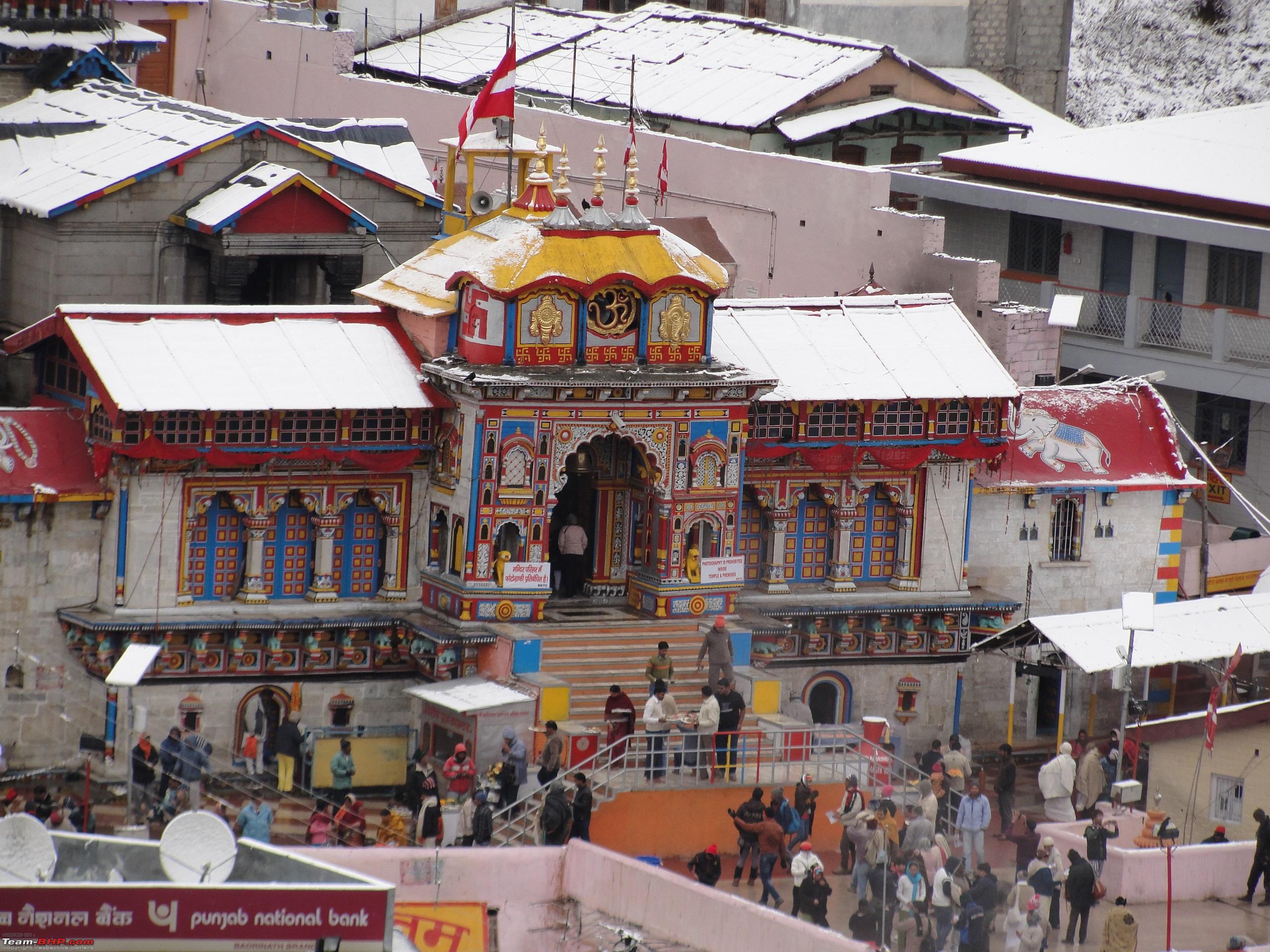
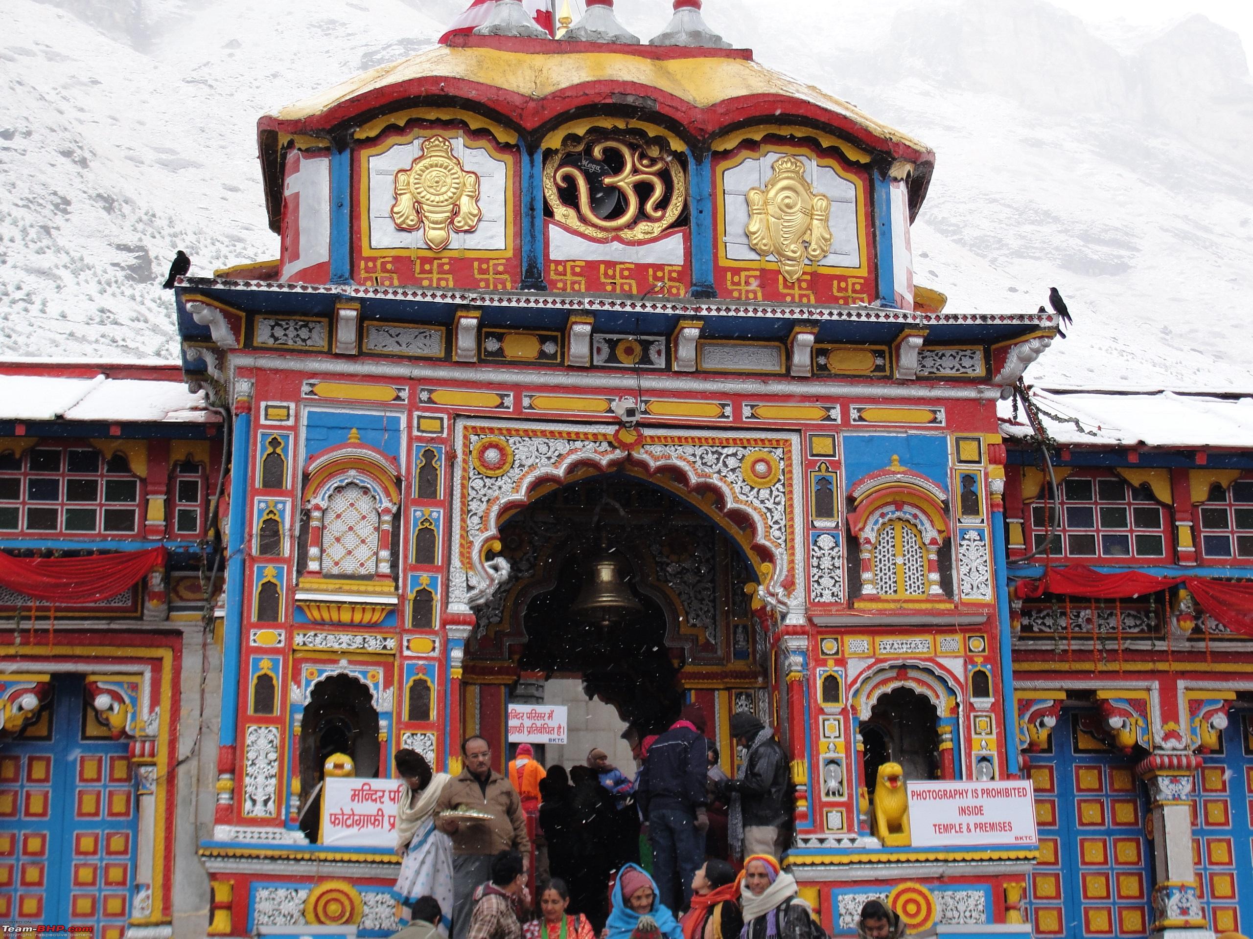
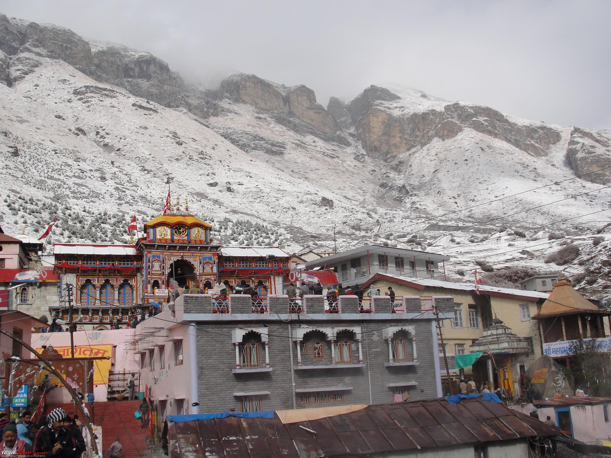
Kedarnath temple lies in the center of the town and is believed to have been constructed in 8th century AD. The whole structure of the temple has been marvelously carved out from huge boulders. Such was the architectural acumen of those times that the temple stands to this day despite bearing the countless vagaries of nature in the form of floods and earthquakes.
Views of Kedarnath temple. 

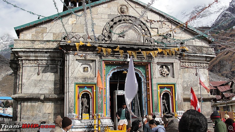


The temple has been beautifully constructed on a raised platform made of huge stones cut into rectangular shape, to give it a firm and strong base. It is amazing to note that how difficult it would have been for the workers and architects to construct the temple at such a remote, dangerous and high altitude terrain during the historic times, bereft of any modern day technology.
The towering snow capped mountains provide a striking background to the temple. 
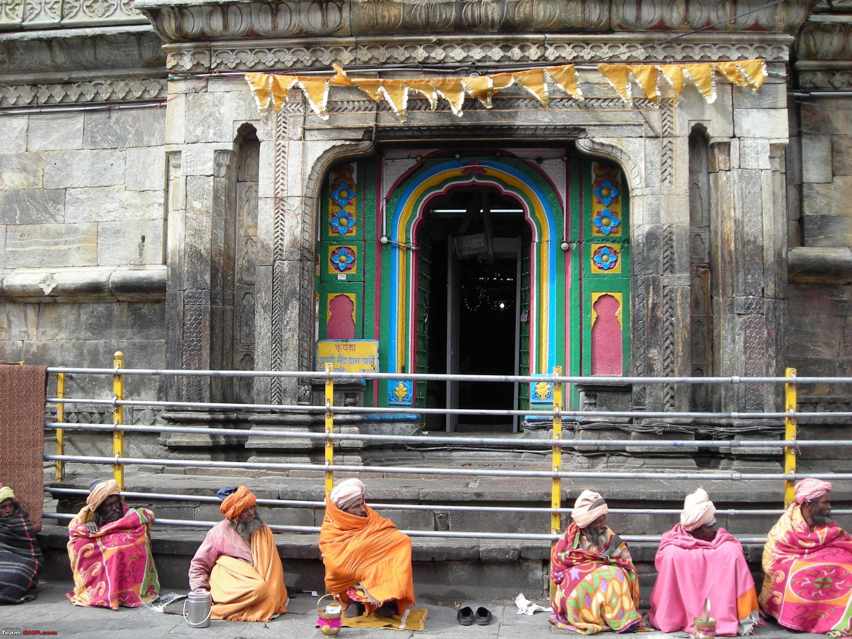
 Sages and holy men at the temple.


It being the fag end of the
yatra season, there were not many visitors in the town, which otherwise bursts to the seams during the peak season in the months of May and June.
Day 3: Continued...
After exploring the town and the natural beauty around, we started for our return trek to
Gaurikund by 1045 Hrs. On the way we continued to savour the Himalayan beauty.

 Pilgrims on their way to the temple.
  View of Kedarnath town and mountains in the background
.

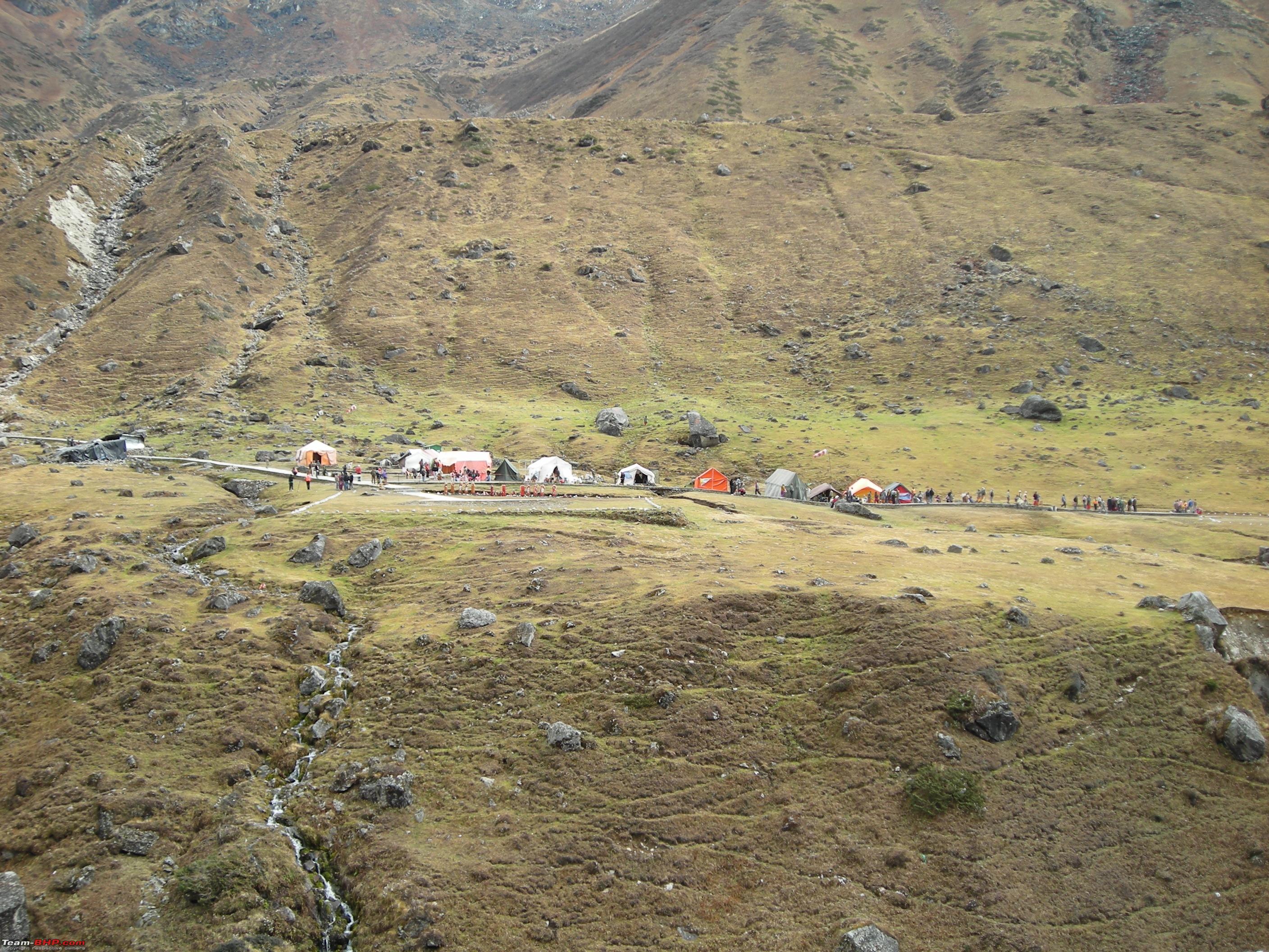
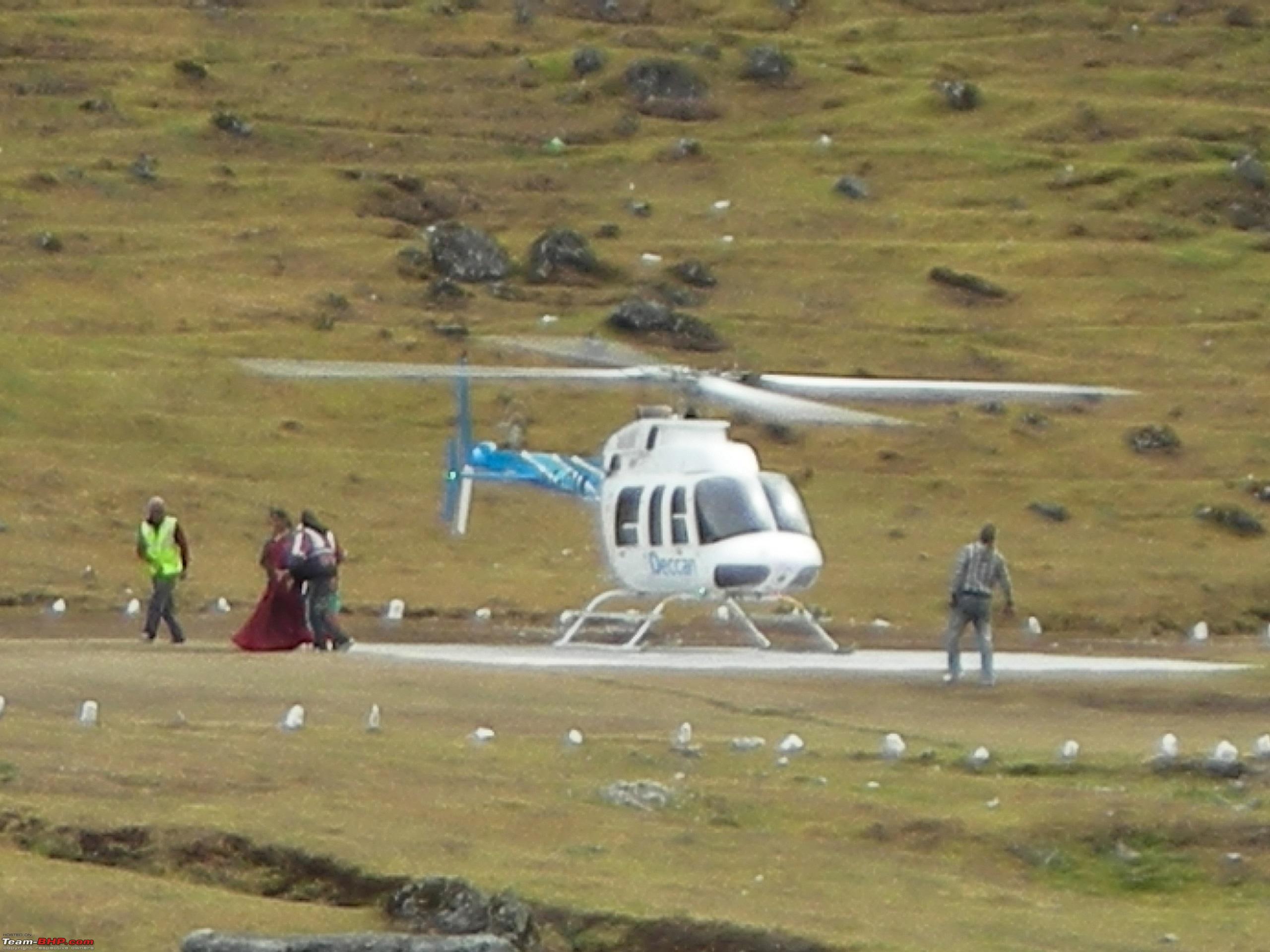
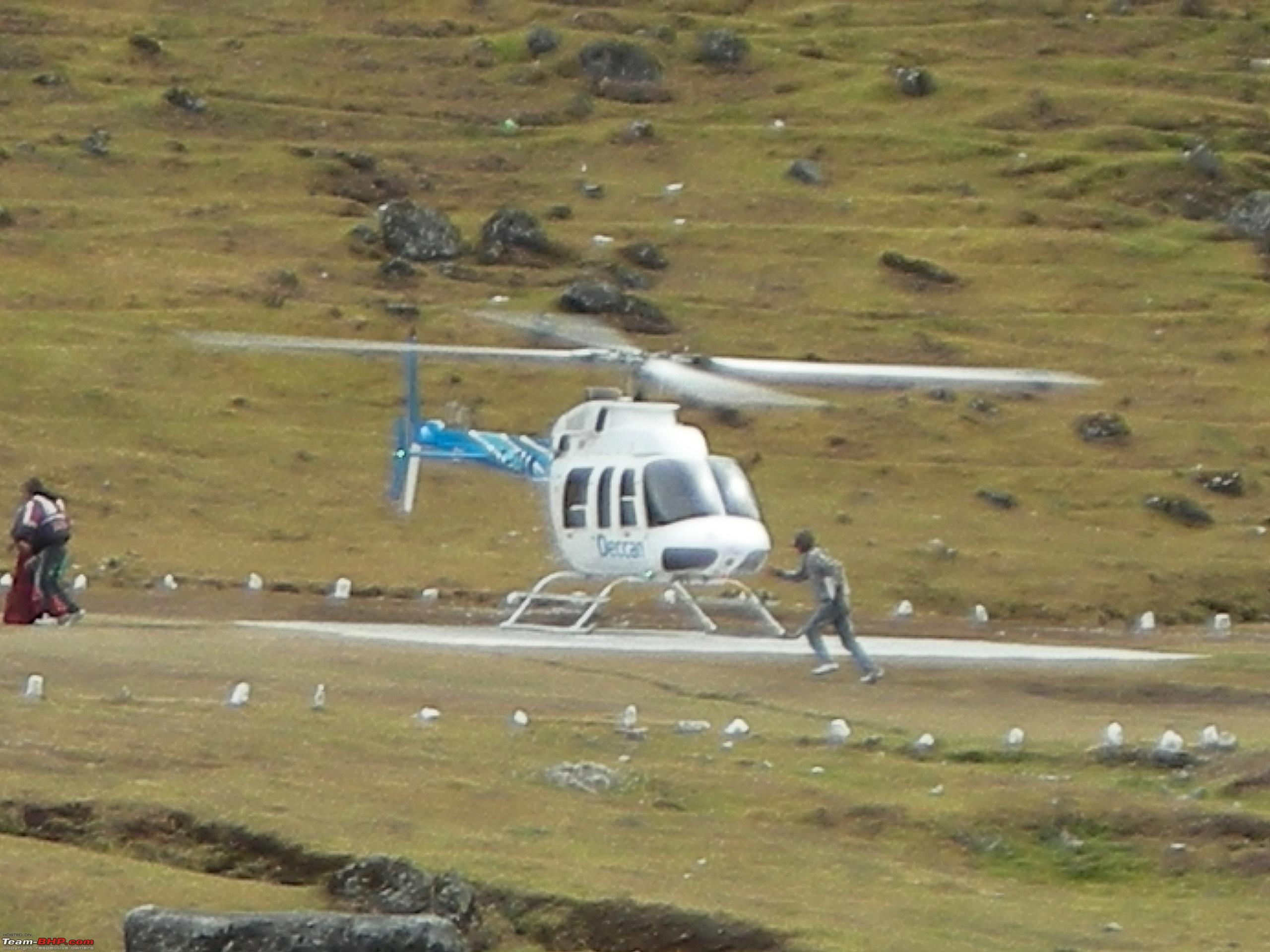
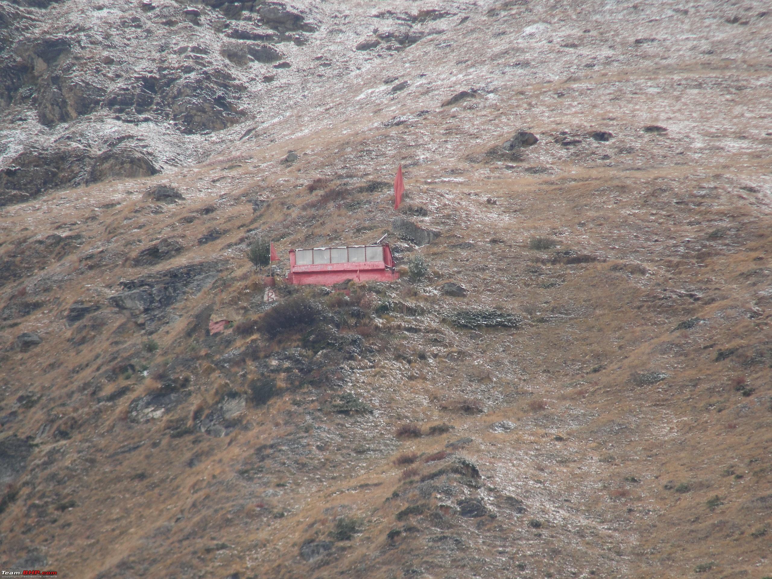
There is a helicopter service for those tourists and pilgrims who do not wish to trek up to
Kedarnath. The helipad is located across the river and heli service is provided to and from
Fatta, which is a village by the roadside on the
Gaurikund-Guptkashi road.
View of Helipad. 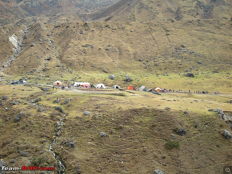

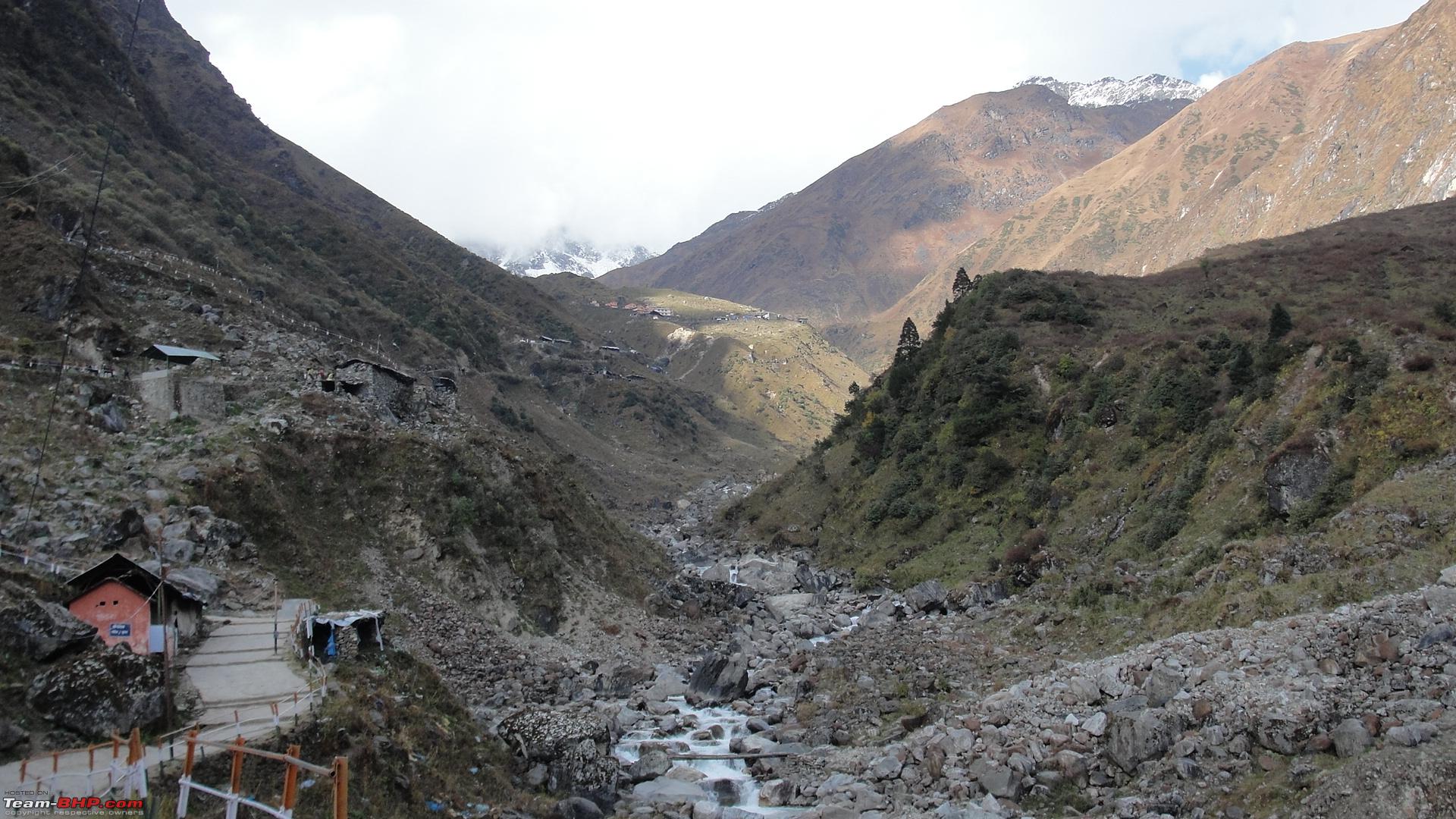
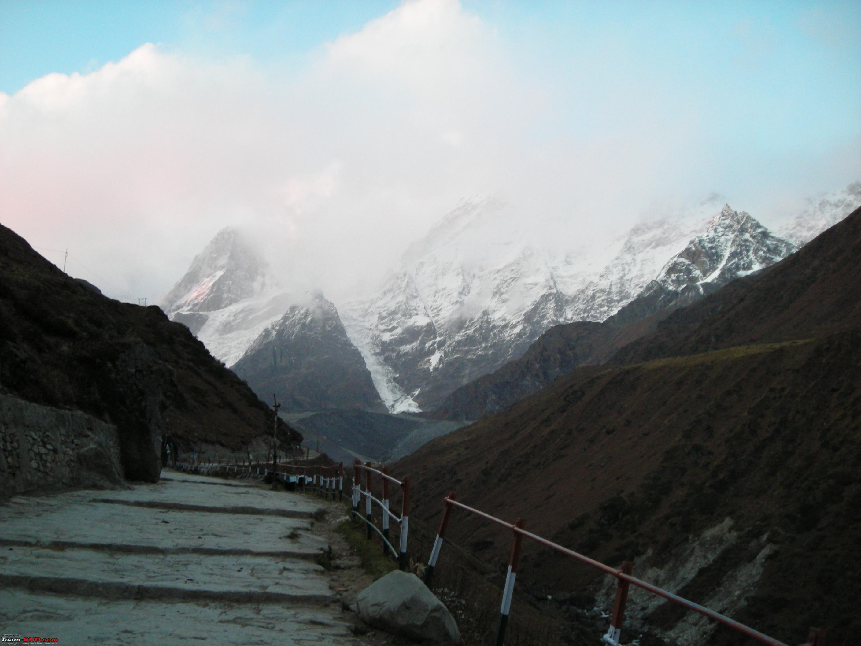
 The high mountains around Kedarnath remain snowbound throughout the year.
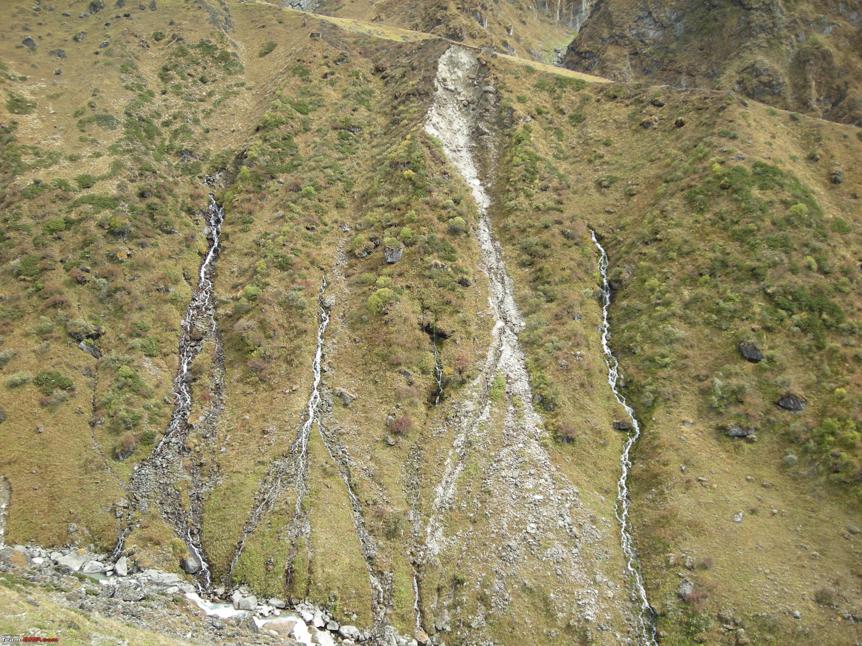
  As was the ascent, the descent till Rambara was quite steep.
 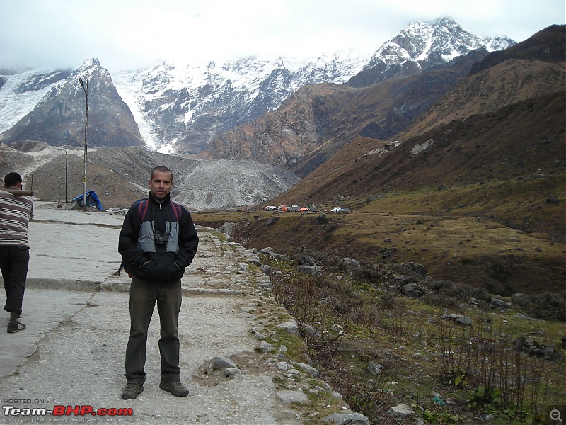 Many small rivulets and streams join Mandakini River
.


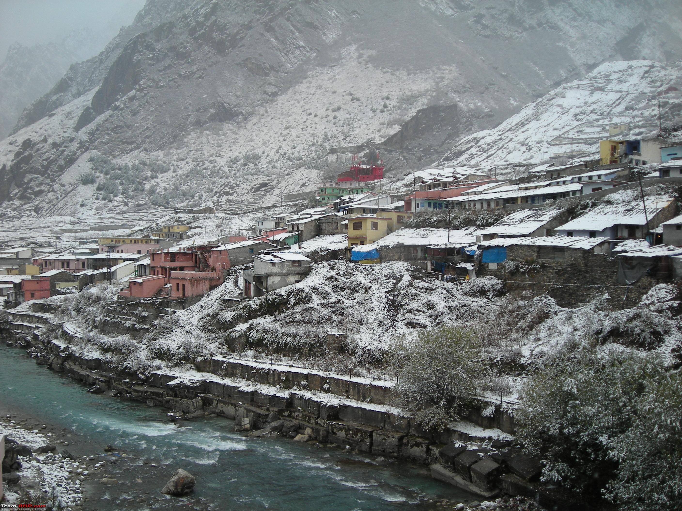
By 1230 Hrs reached
Rambara and stopped for lunch. Started off again by 1300 Hrs and continued with the downhill pace. Reached
Gaurikund by 1755 Hrs and stopped for relaxation and a refreshing tea. It took us 7Hrs 10Mins to cover downhill trek out of which the actual walking time was 5Hrs 30Mins and the halt time enroute was 1Hr 40Mins. After tea started again, this time it was a drive of 33 kms to
Guptkashi. Reached our lodge by 2000Hrs. After the dinner at 2130 Hrs the chit chat continued recounting the experience of the trip so far. After packing up for the next day we called it a day by 2300 Hrs. That was the end of day three of the trip.
Day Travel Log:
Total Distance Covered: 47 kms (14 Kms Trekking & 33 kms Driving)
Time Taken: 9Hrs 15Mins (7Hrs 10Mins for Trekking (Including halts of 1Hr 40Mins for rest, food etc.), 1Hr 30Mins for Driving plus tea break of 35 mins before starting).
Route Taken: Kedarnath-Rambara-Gaurikund (Trekking) & Gaurikund-Fatta-Guptkashi (Driving).
Day 4: 23rd October, 2012 Guptkashi to Badrinath: 208 kms (Driving)
Started for the day at 0745 Hrs. The itinerary for the day was drive from
Guptkashi to
Badrinath.
Route Map Day 4: 
Initially planned to travel via
Chamoli town, which offers a short route but the locals informed that the highway is blocked at a couple of points on the way due to landslides and the road clearing operation will take a better part of the day. So finally it was decided to travel by the most frequented route i.e via
Rudraprayag. By 0930 Hrs reached
Rudraprayag and joined NH-58. Had breakfast at a roadside eatery a few kms ahead of town. The
Rishikesh-Rudraprayag-Badrinath stretch of NH-58 due to its strategic importance, is maintained by Border Roads Organization (BRO). The highway offers picturesque views all along.
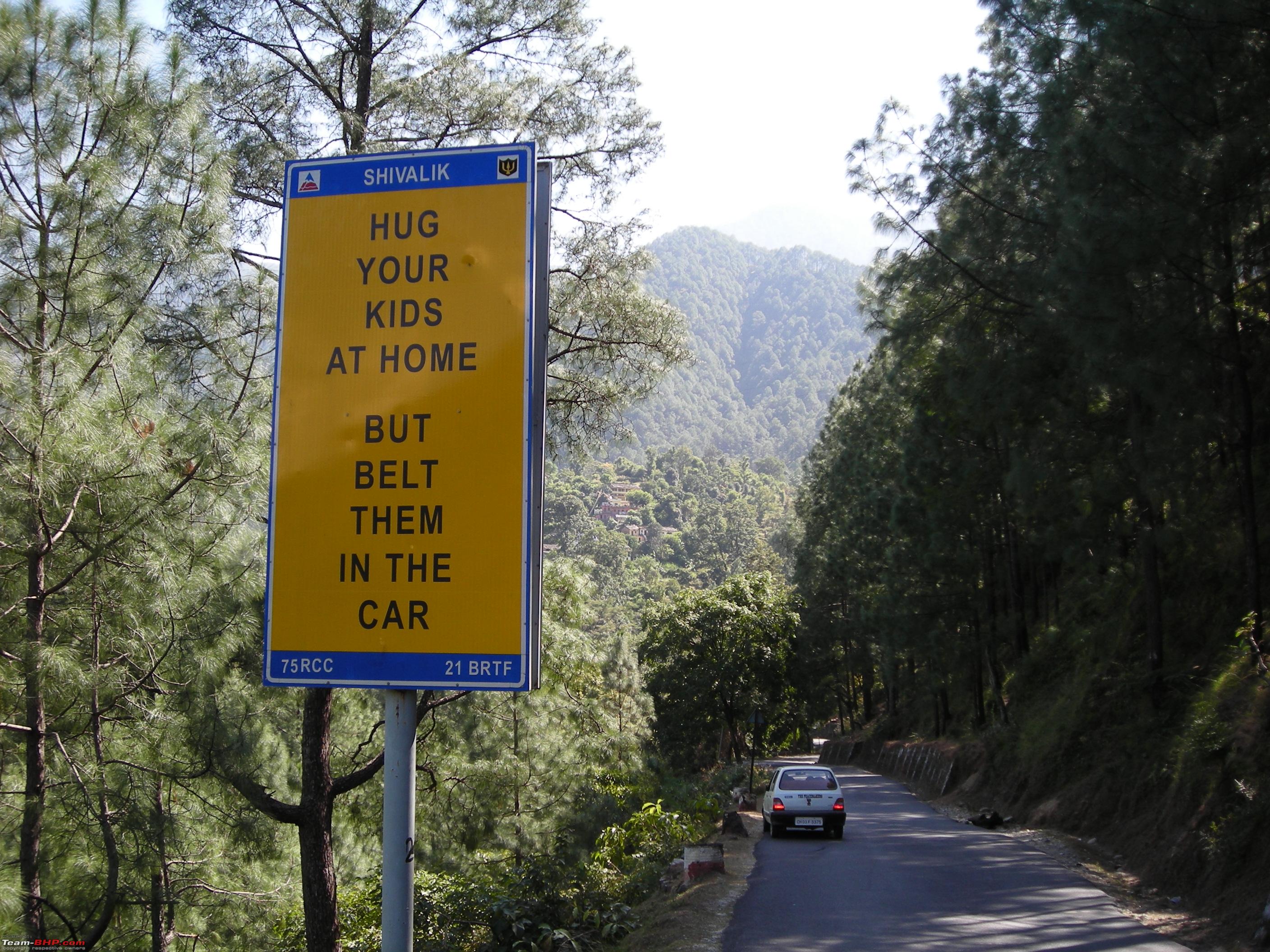
Quite Thoughtful Indeed!!!  Beautiful view of River Alaknanda flowing through the valley.

 BRO is doing yeoman's job by maintaining NH-58.
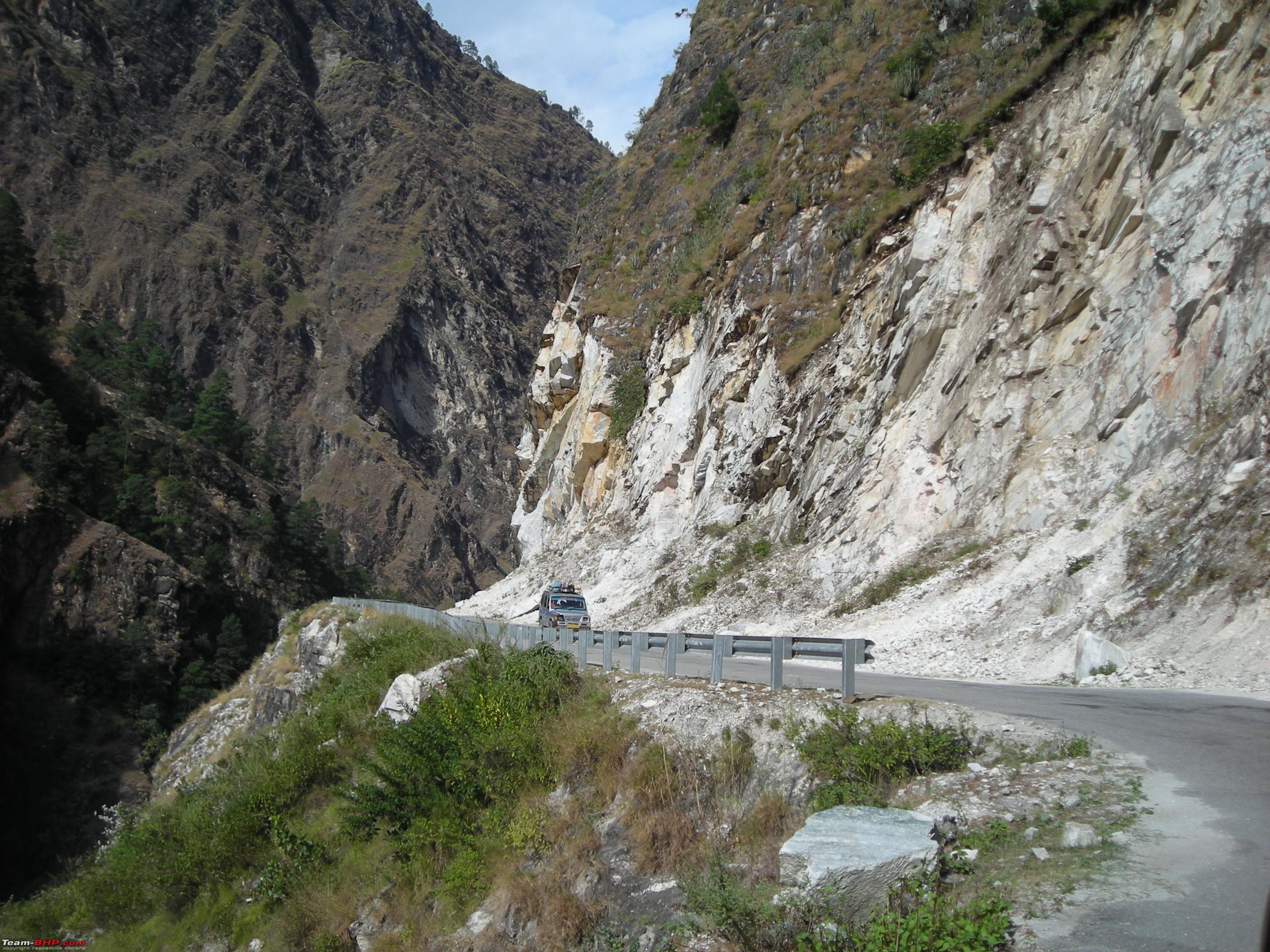
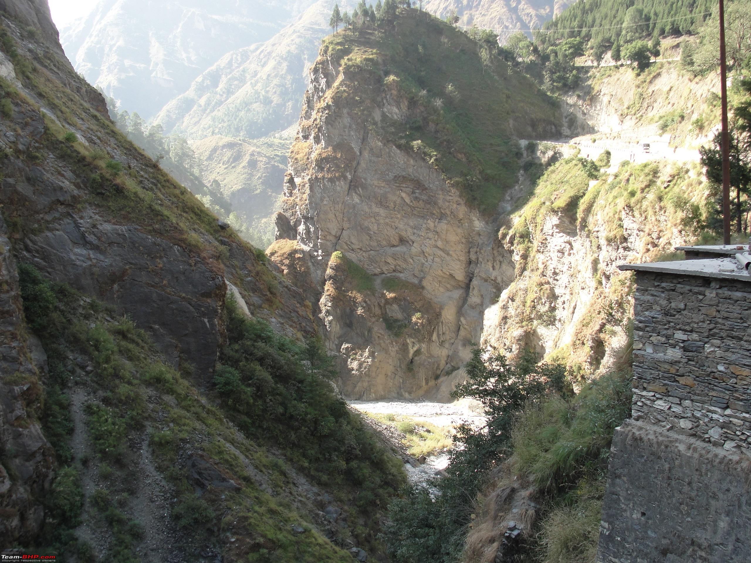
  Gorges along the highway.
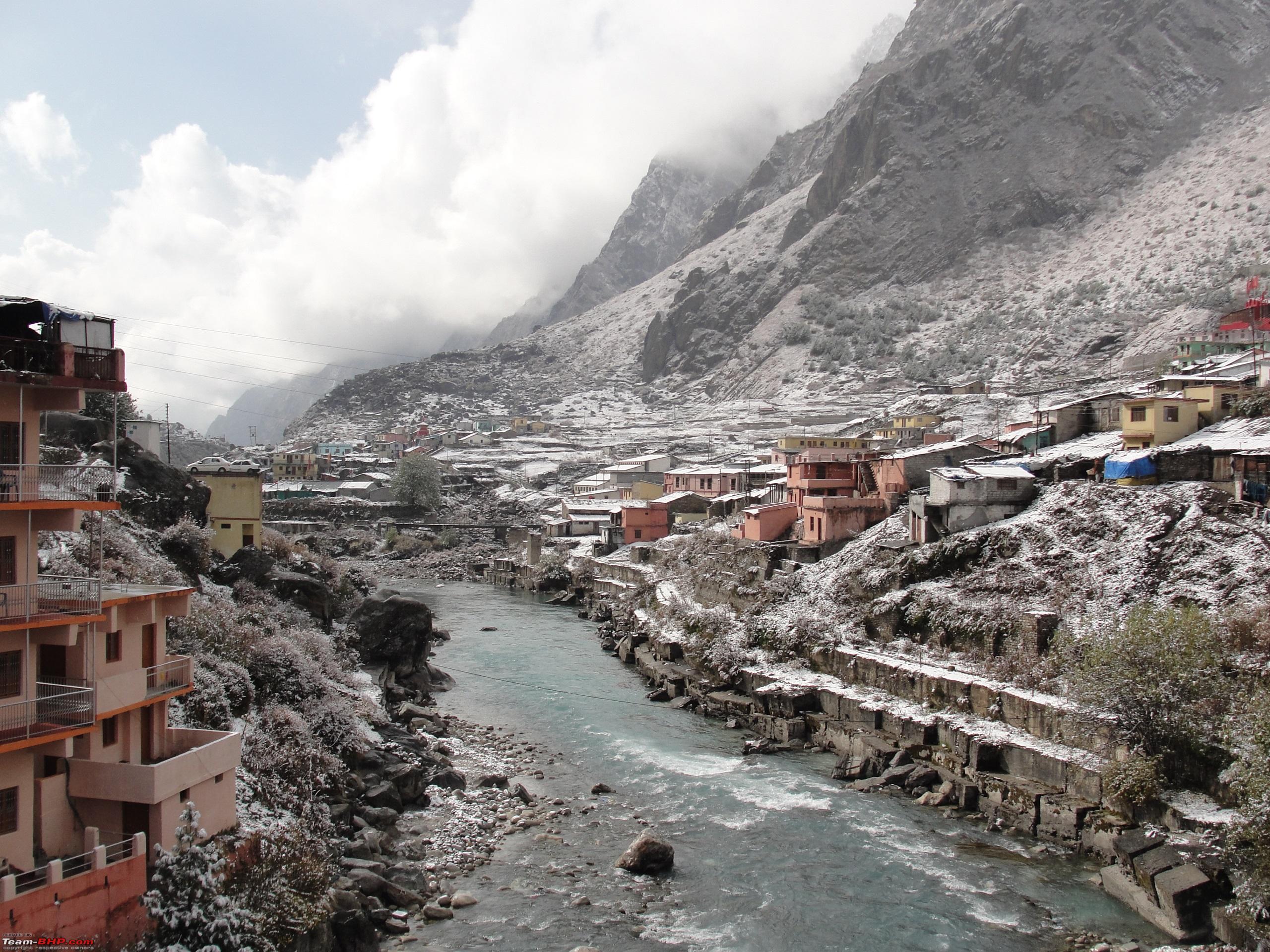
Reached the town of
Joshimath by 1430 Hrs and stopped for lunch. From
Joshimath onwards the highway to
Badrinath passes through landslide prone stretches all through, which results in the blocking of highway at number of points during the monsoon season. Restarted at 1520 Hrs for the penultimate stretch of 45 kms to
Badrinath.
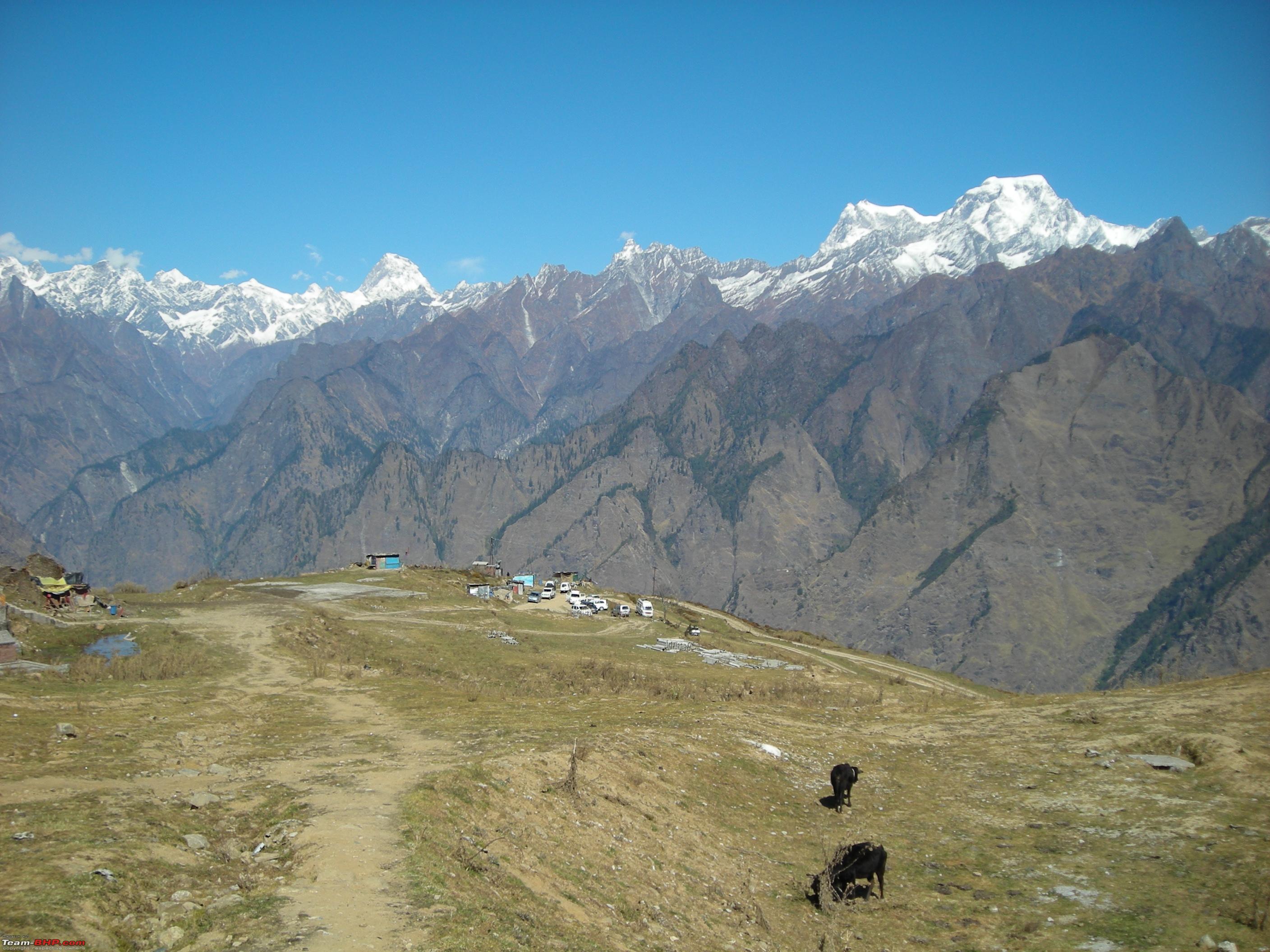
Views from Joshimath town. 

By 1610 Hrs reached the important town of
Govindghat, from where the trek to
Valley of Flowers and
Gurudwara Hemkund Sahib starts. As it was the fag end of the pilgrimage and tourist season, the town wore a deserted look.


The valley is quite wide at
Govindghat with River
Alaknanda flowing by the side.
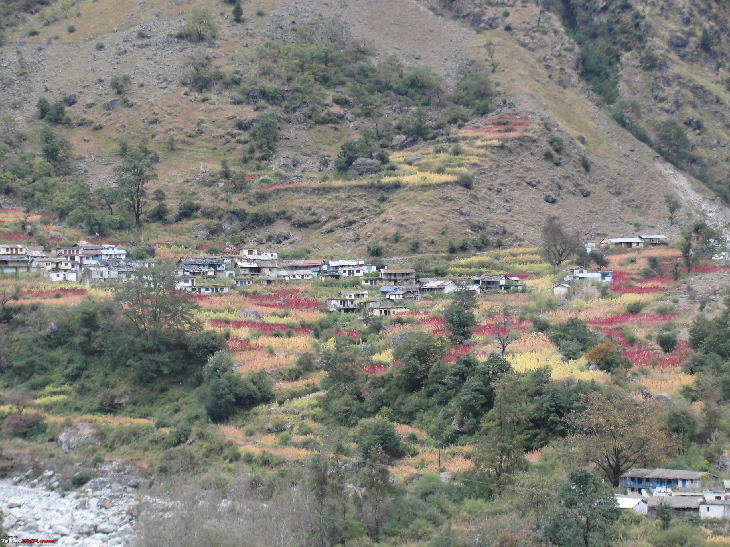
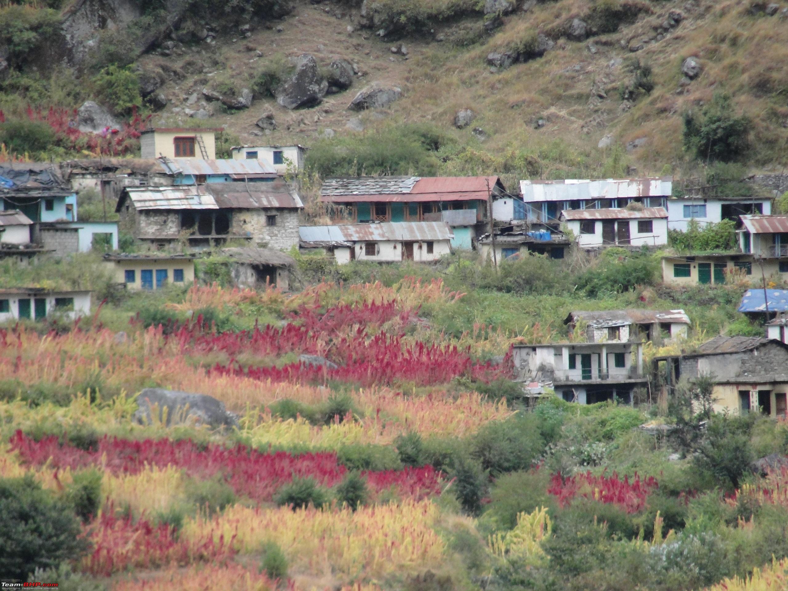
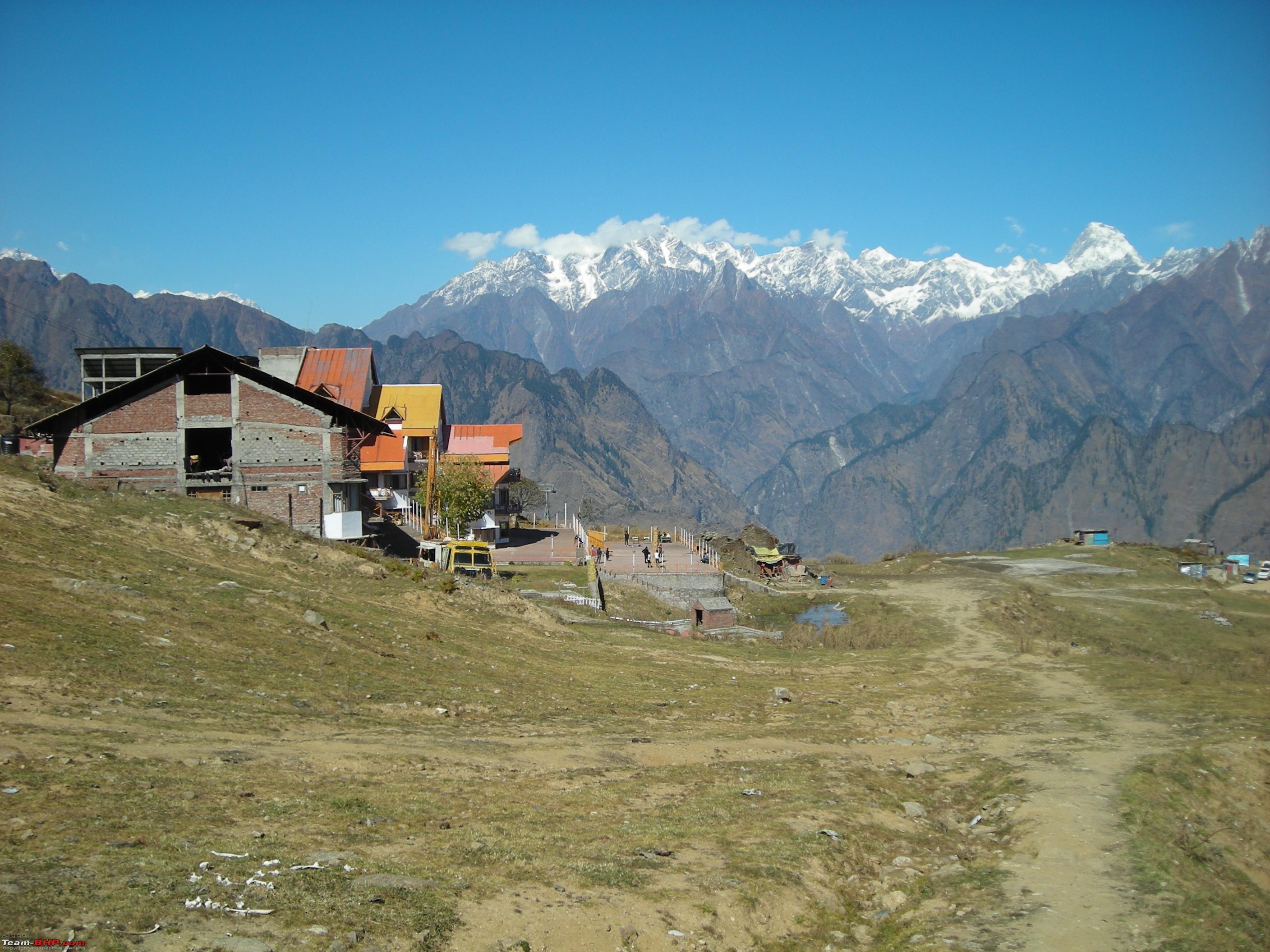
Beautiful villages perched on the mountain sides as viewed from highway. 

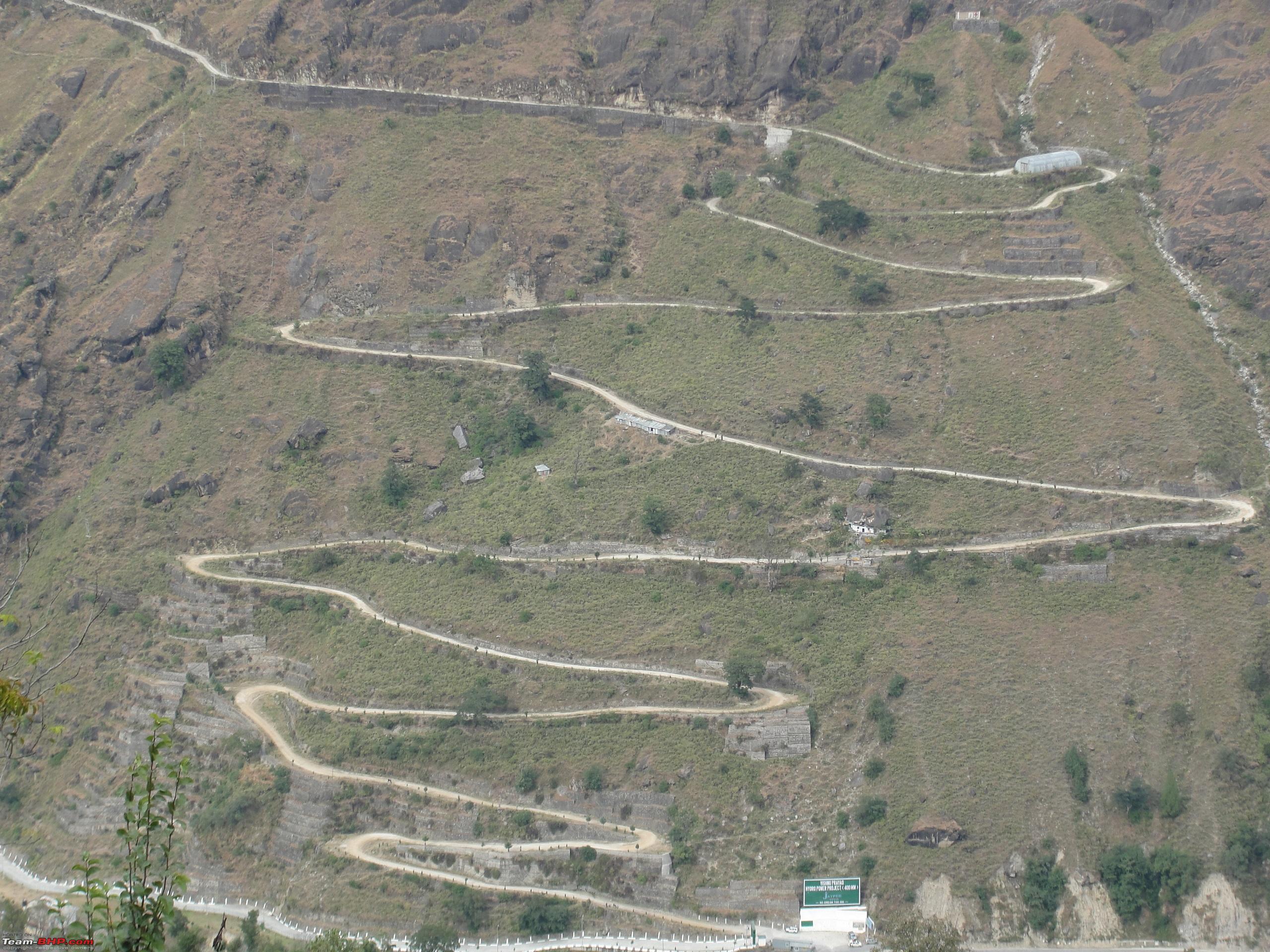
From
Govindghat onwards the steep ascent to
Badrinath starts wherein the road meanders through the mountains in a series of switchbacks. Most of the stretch is landslide and avalanche prone. The highway stretch from
Hanuman Chatti onwards is notorious for avalanches and rockslides. The road is unmetalled from here onwards till
Badrinath, a stretch of 12 kms.
Avalanche prone stretch near Hanuman Chatti. 
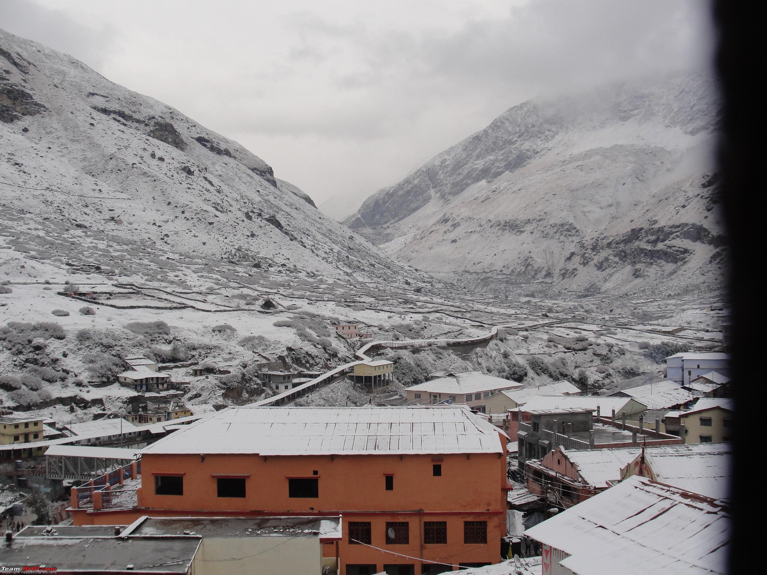
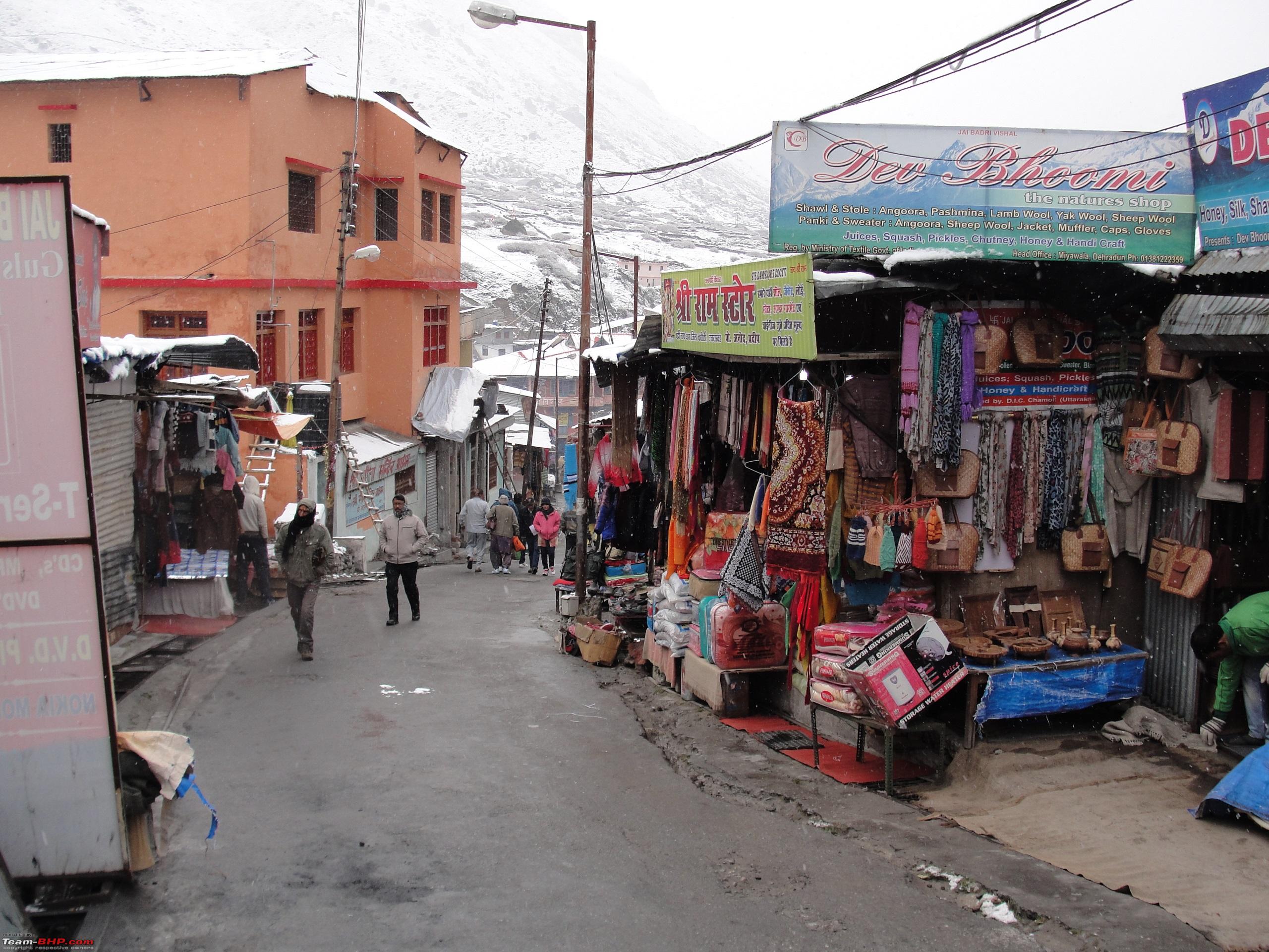
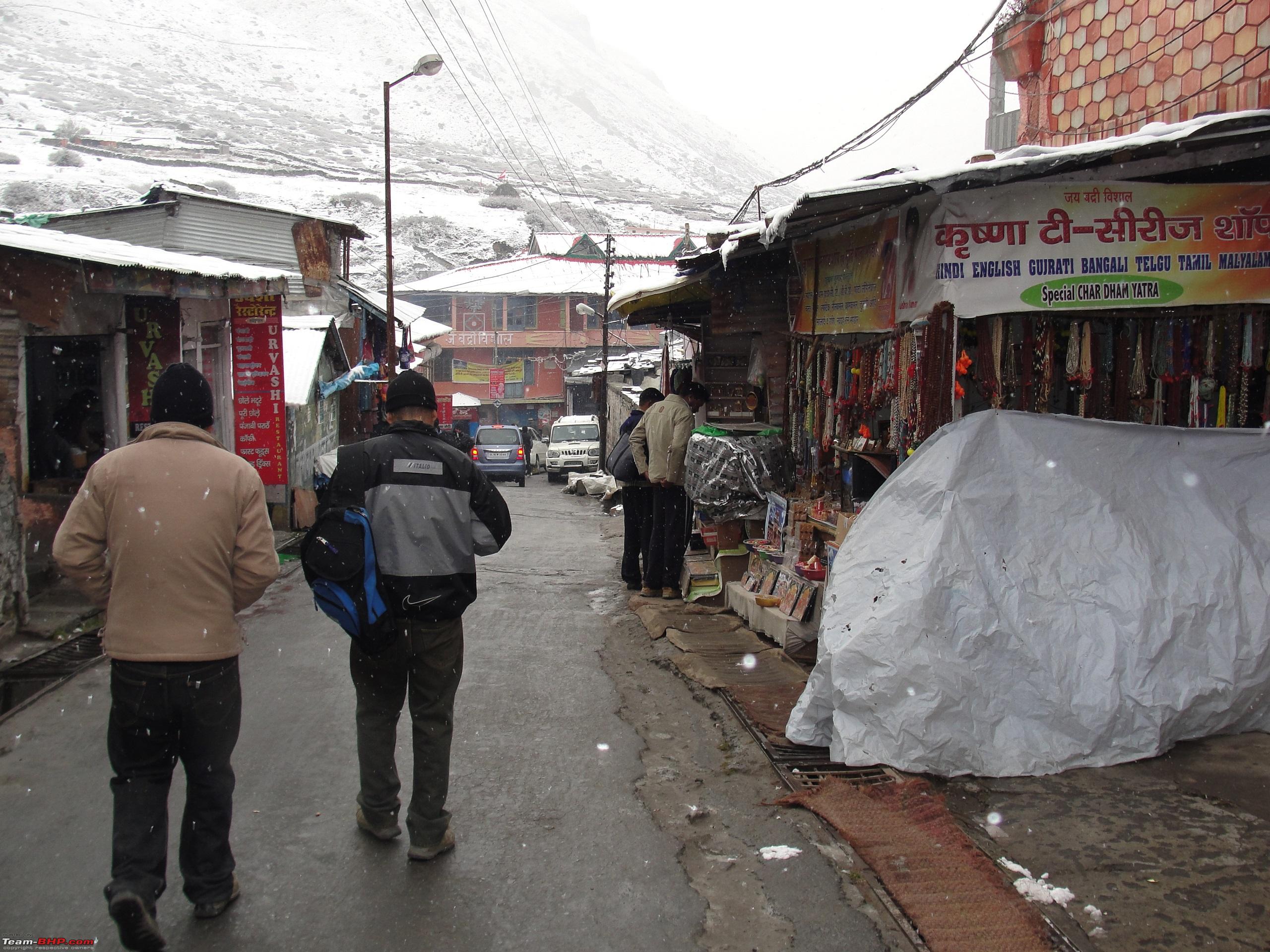
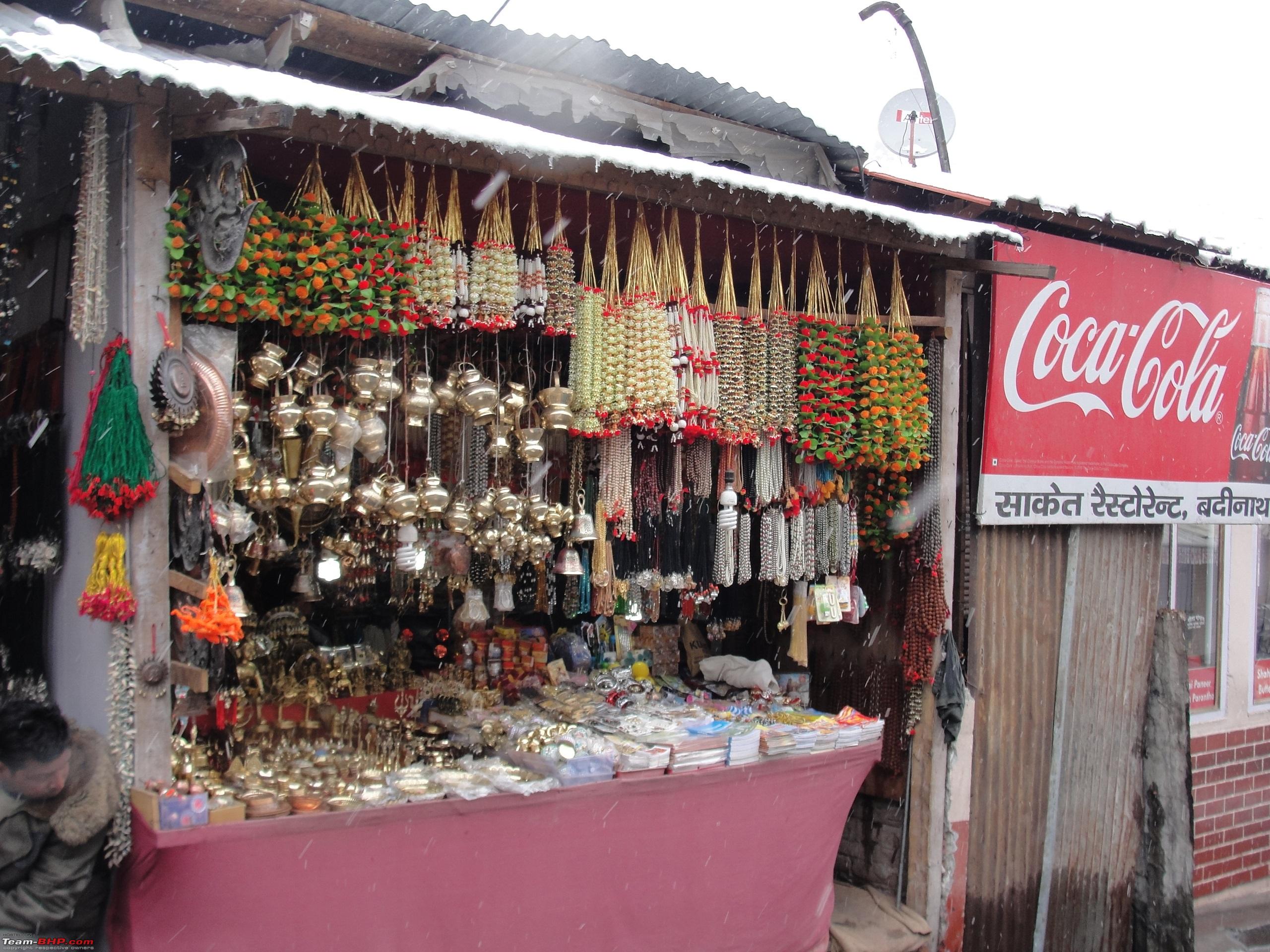
After a slow and cautious drive on the last toughest stretch from
Hanuman Chatti onwards, finally reached Badrinath by 1830 Hrs and checked into a lodge near the market. After settling down went for a walk around the market and had dinner by 2130 Hrs. The weather had become quite chilly after sunset with overcast sky and rain further lowering the temperature. The weather condition was quite conducive for snowfall by late in the night or early morning. After dinner we came back to the lodge and retired for the day. That was the end of day four of the trip.
Day Travel Log:
Total Distance Covered: 208 kms
Time Taken: 10Hrs 45Mins (Including halt time of 2Hrs 15Mins enroute for food, photography etc).
Route Taken: Guptkashi-Agastmuni-Rudraprayag-Karnprayag-Pipalkoti-Joshimath-Govindghat-Hanuman Chatti-Badrinath.
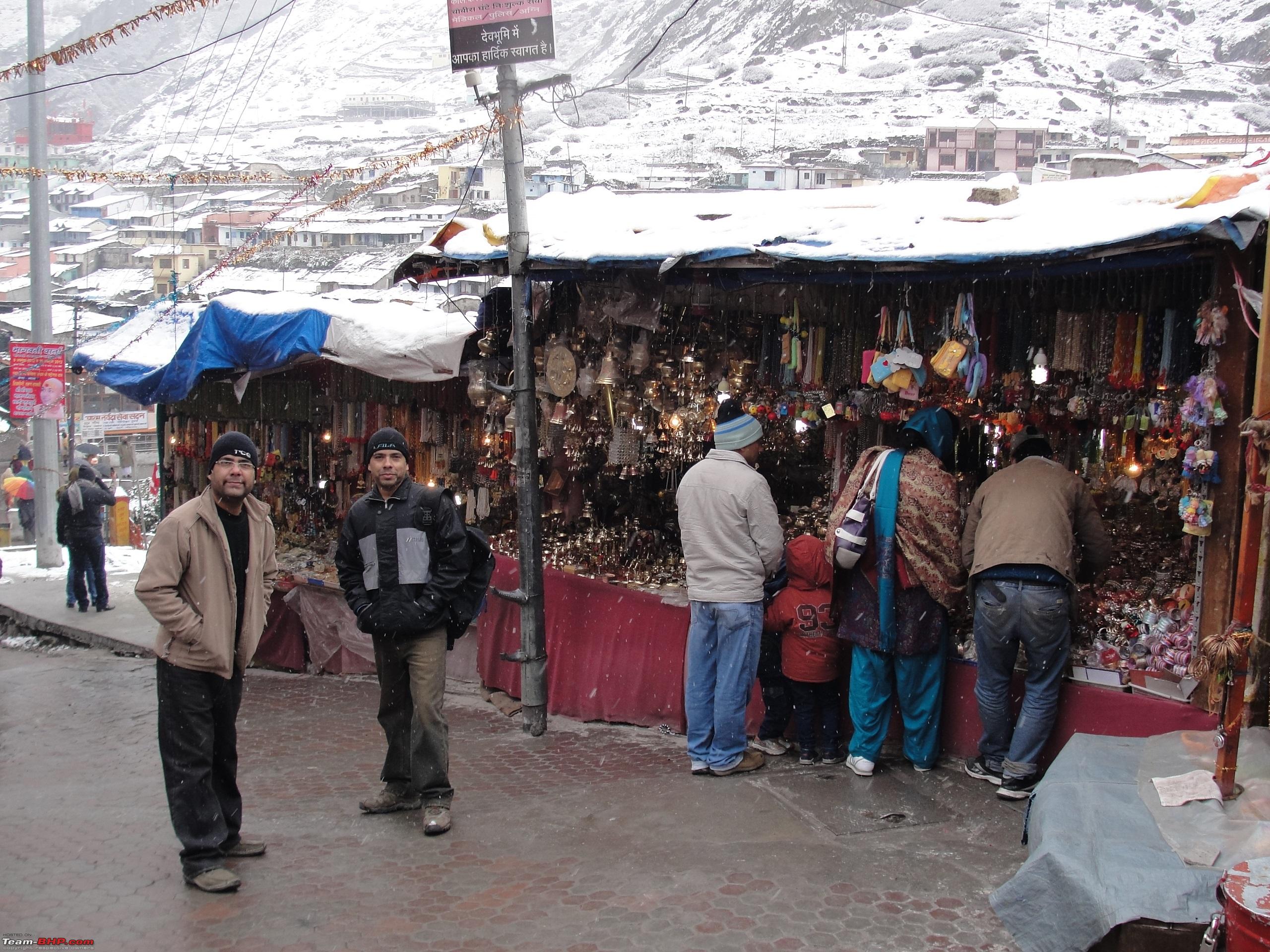
Day 5: Continued... Most of the tourists were heading towards the temple to offer prayers.  River Alaknanda flows through Badrinath Town.

 The temple was full of pilgrims offering prayers and paying obeisance.
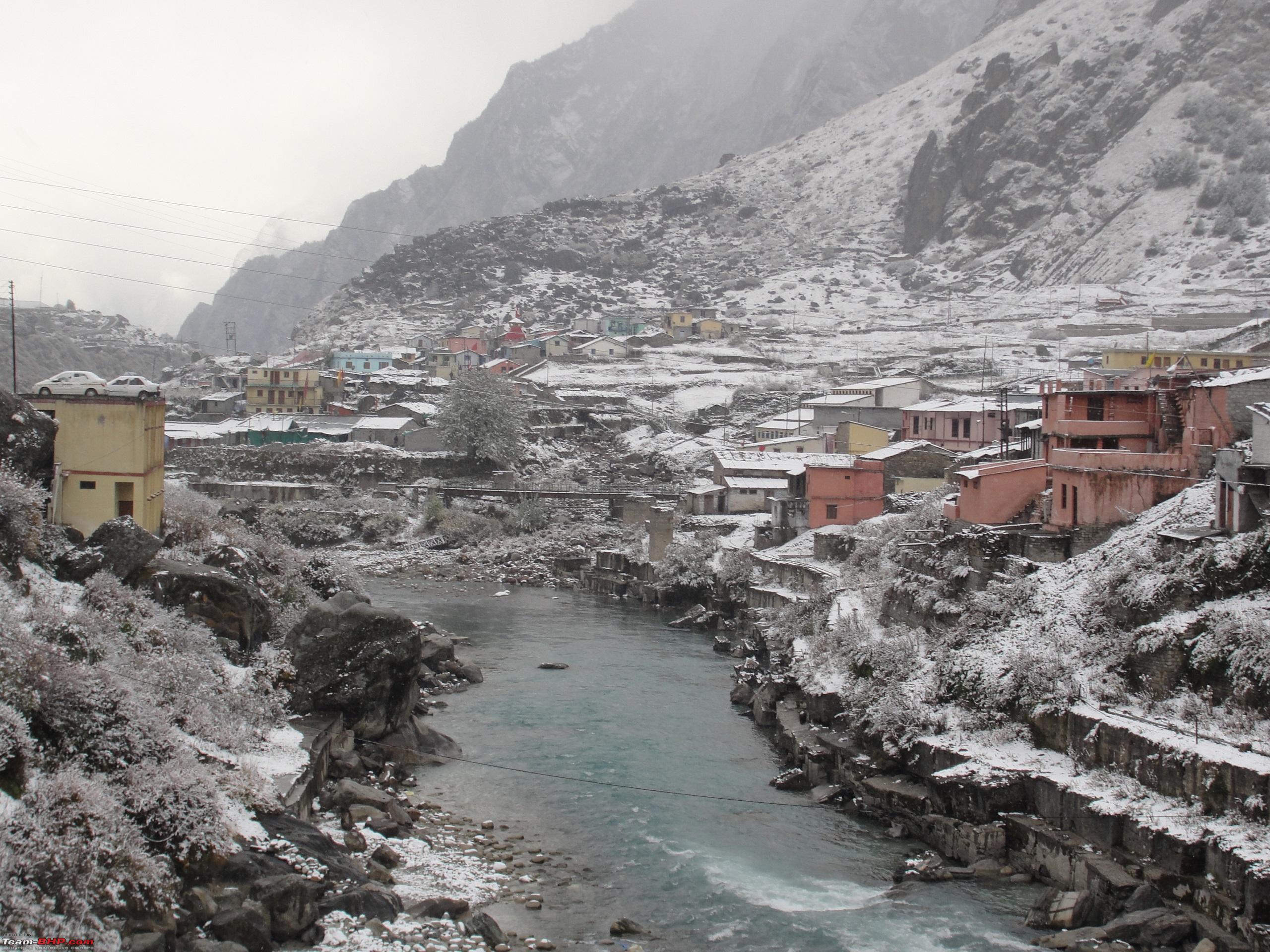
 The beautiful surroundings lured us all day long. With sun playing hide and seek, the shades kept changing.

 A hutment perched high on mountain above the town.
  As the day progressed the thin sheet of snow started melting.
Day 5: Continued...
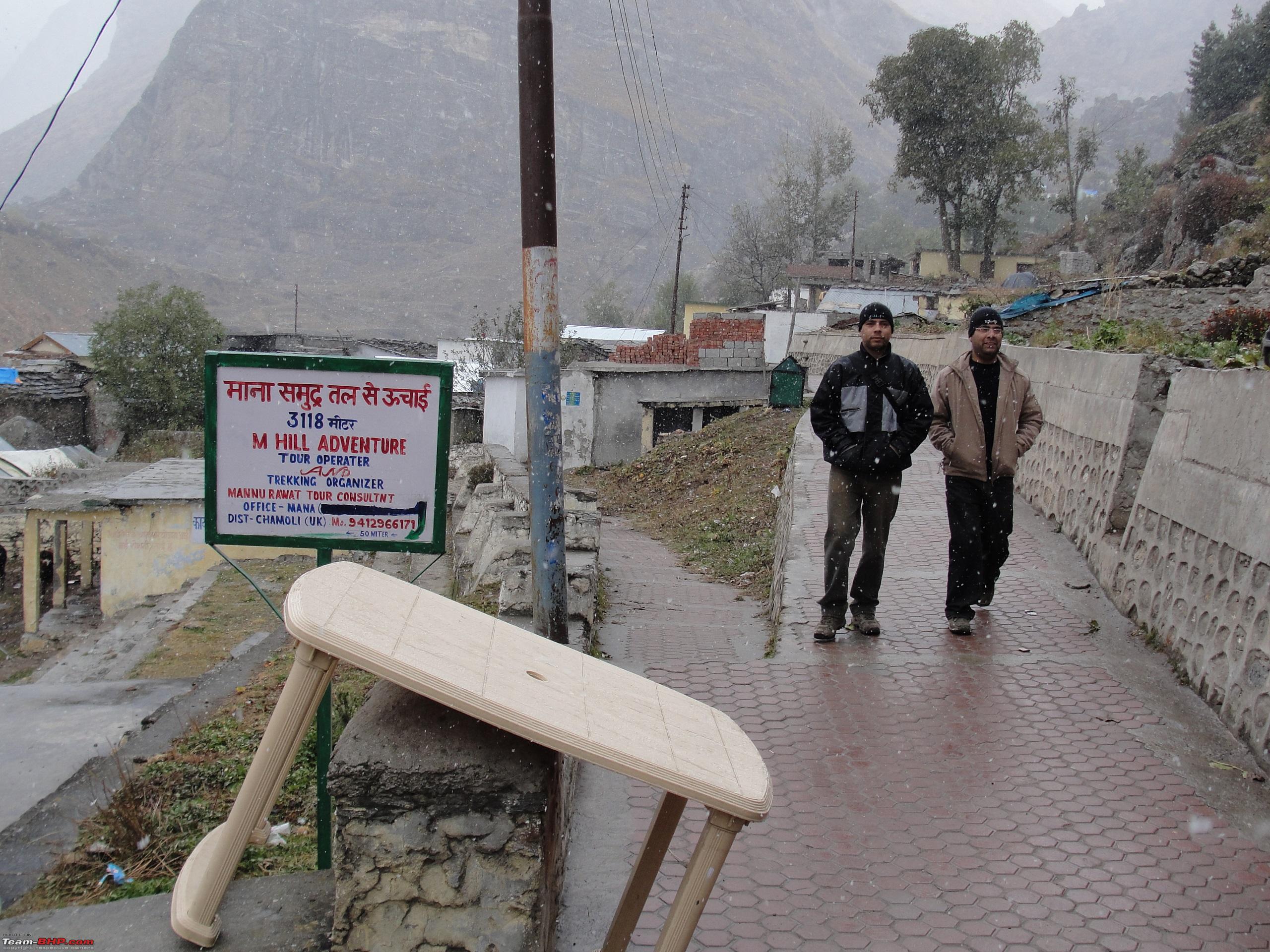
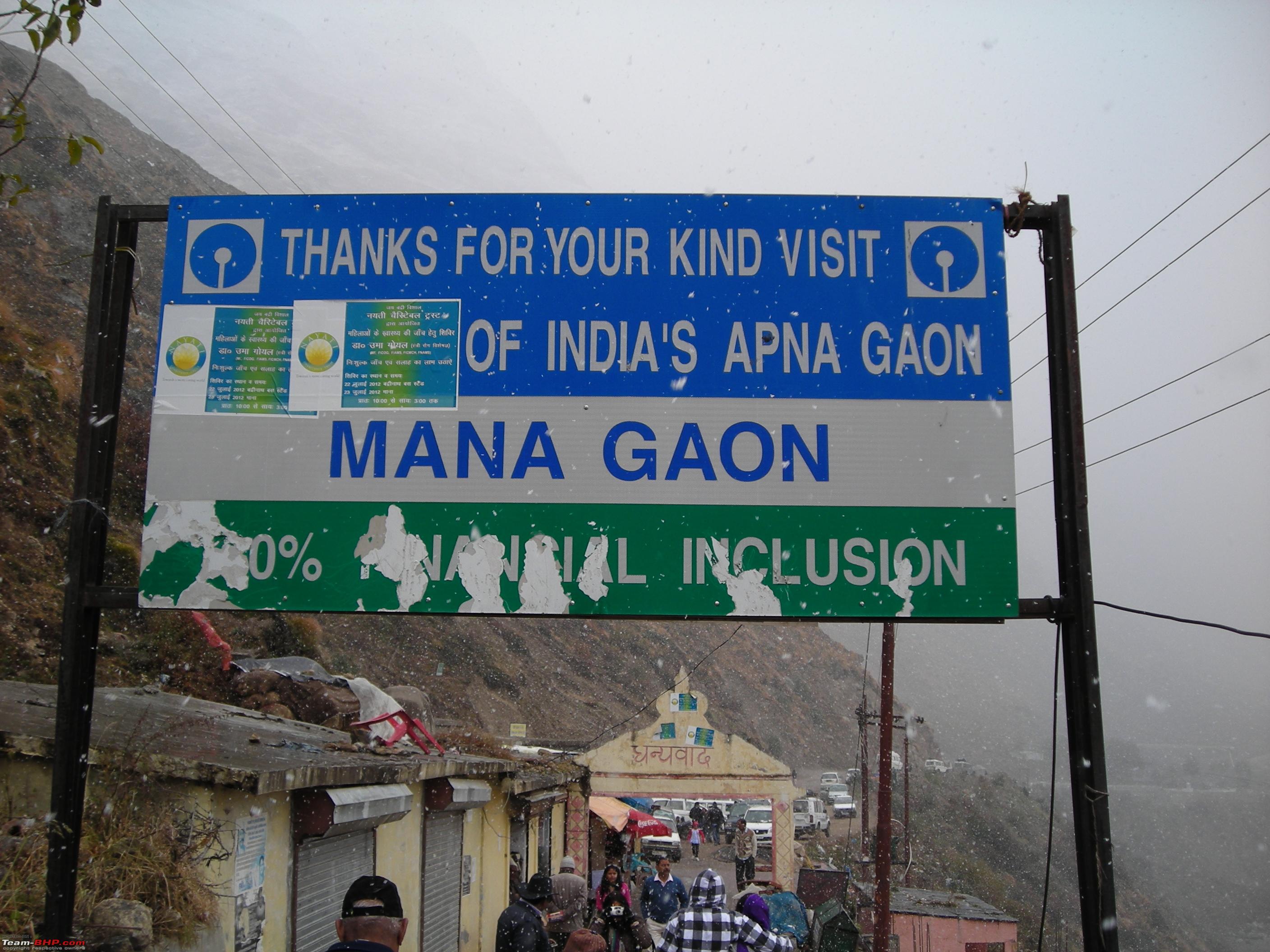
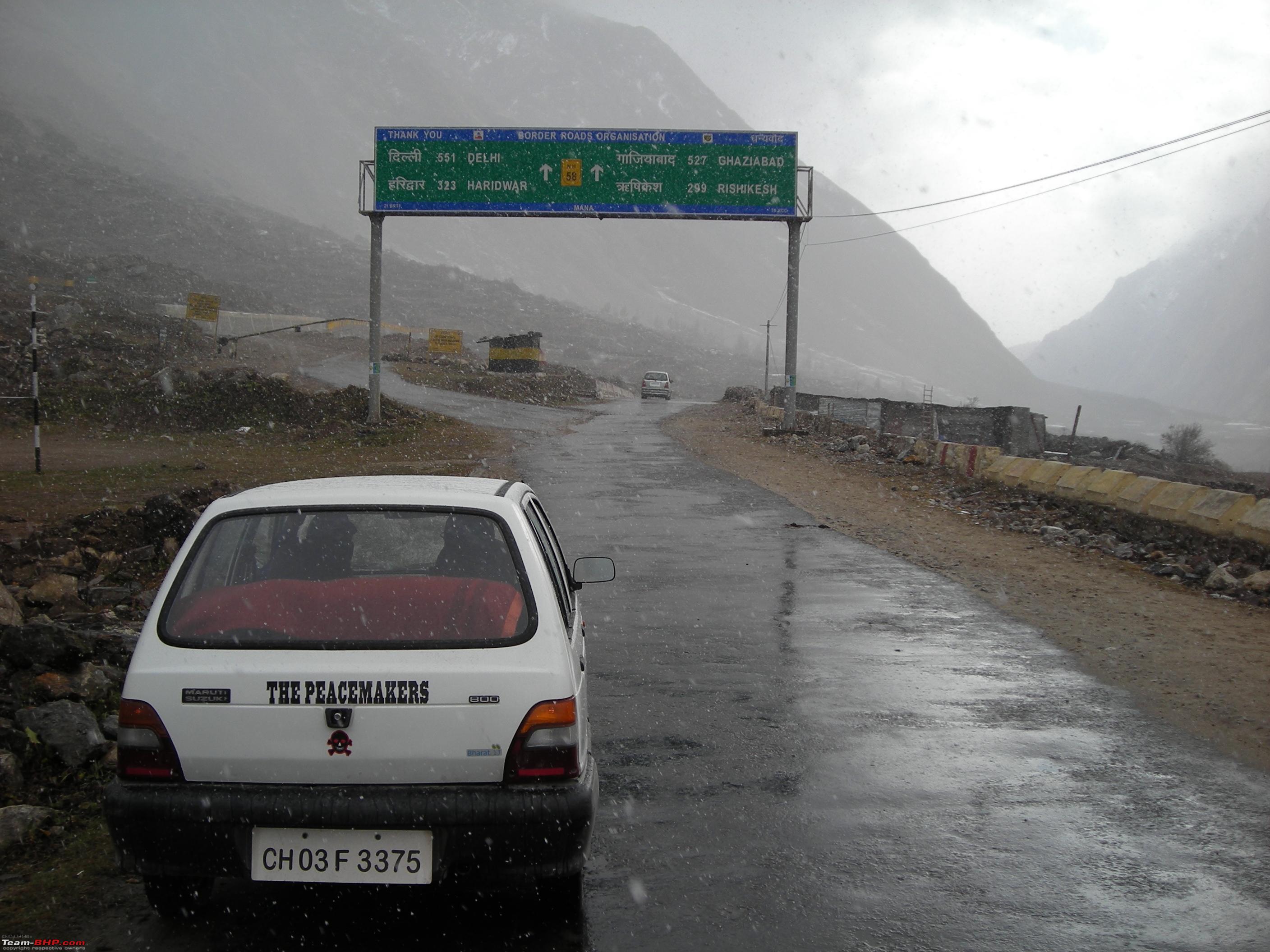
After exploring the town we headed for last Indian village of
Mana, located at a distance of 4 kms from
Badrinath. From Mana Village the road further leads up to
Mana Pass (Elv 5,545 meters) which is further 48 kms ahead on the
Indo-Tibet border. The entire road is constructed and maintained by BRO. We had to abandon our plans to visit
Mana Pass due to snowfall and inclement weather. Nonetheless it's always better luck next time.
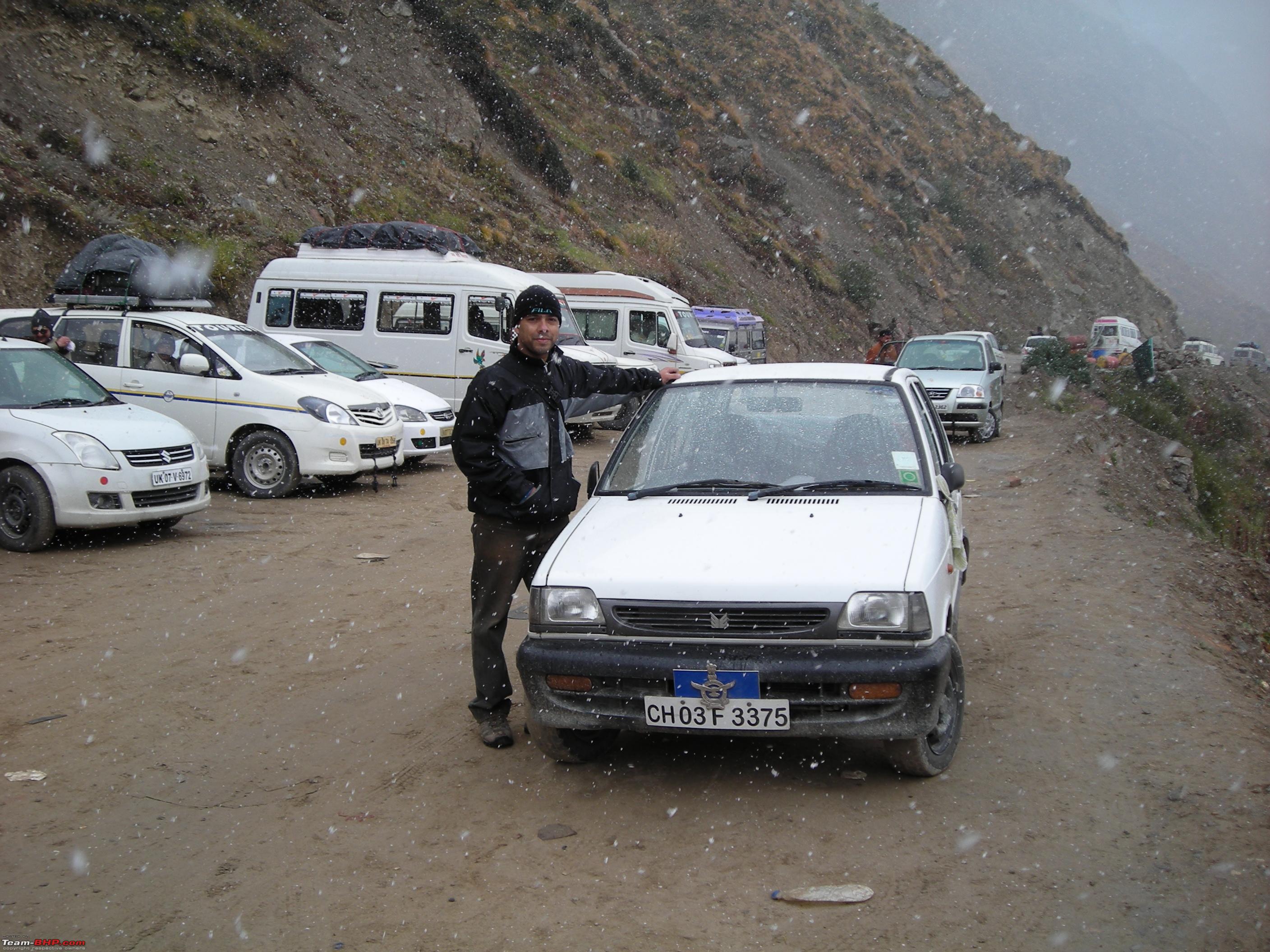
At the last Indian village. 


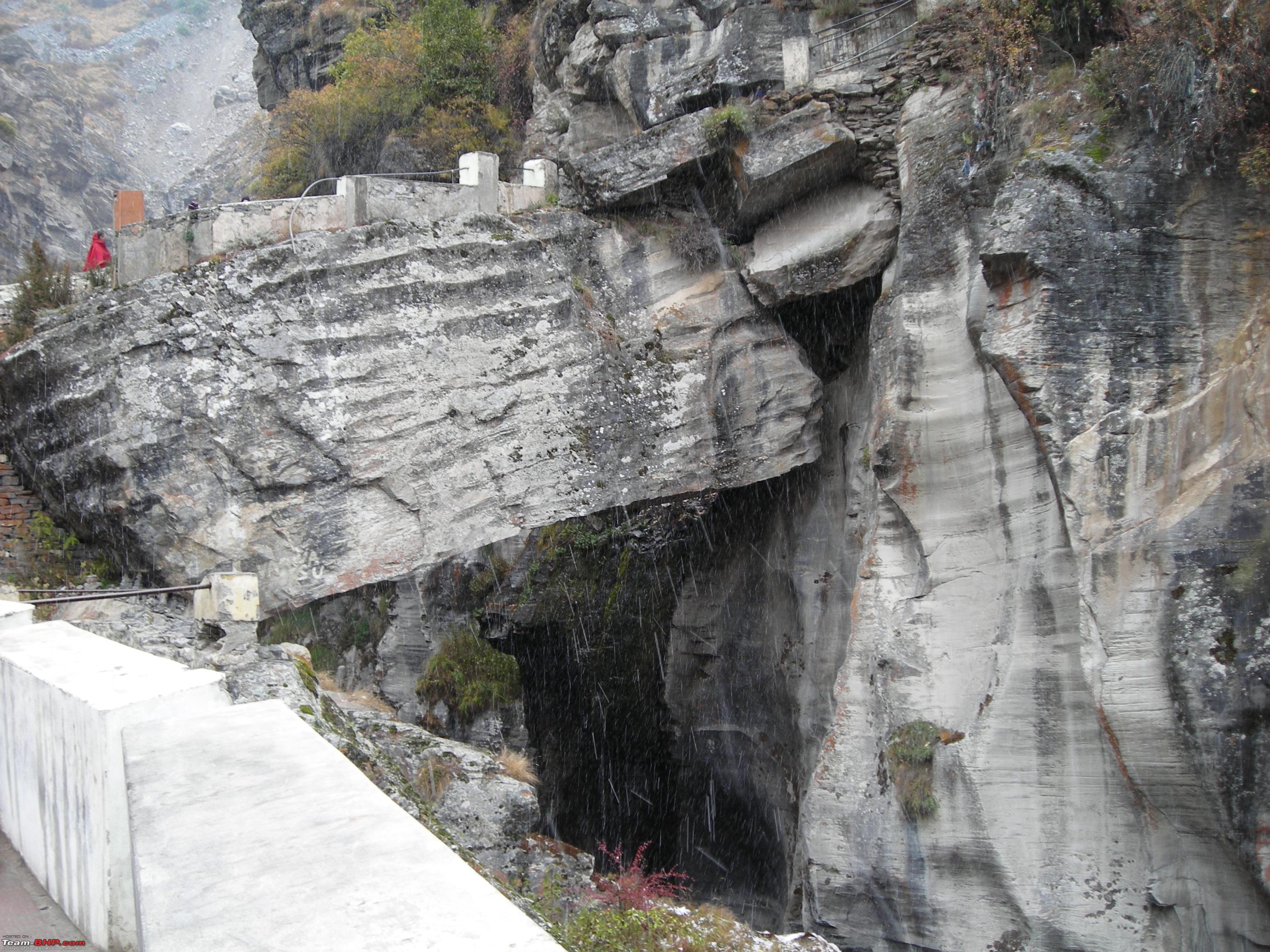
 Bheem Pul is an important tourist attraction near Mana.
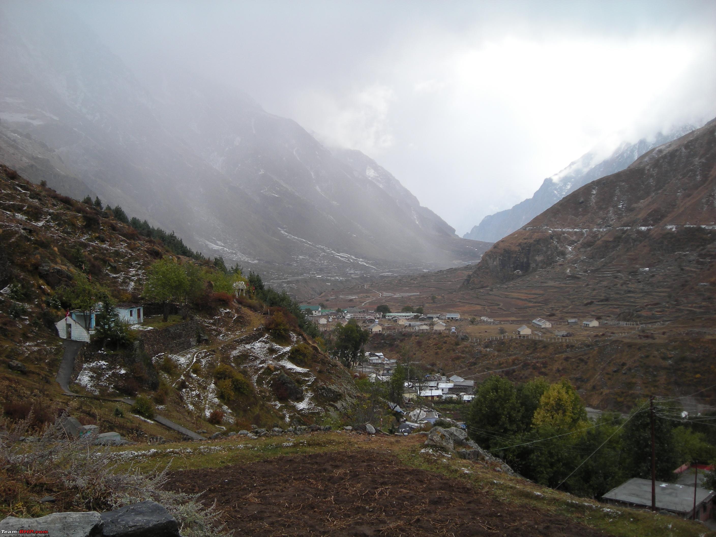
 As usual the views around the village were amazing.
 The last Indian cold drink and tea shop at Mana Village.
:D

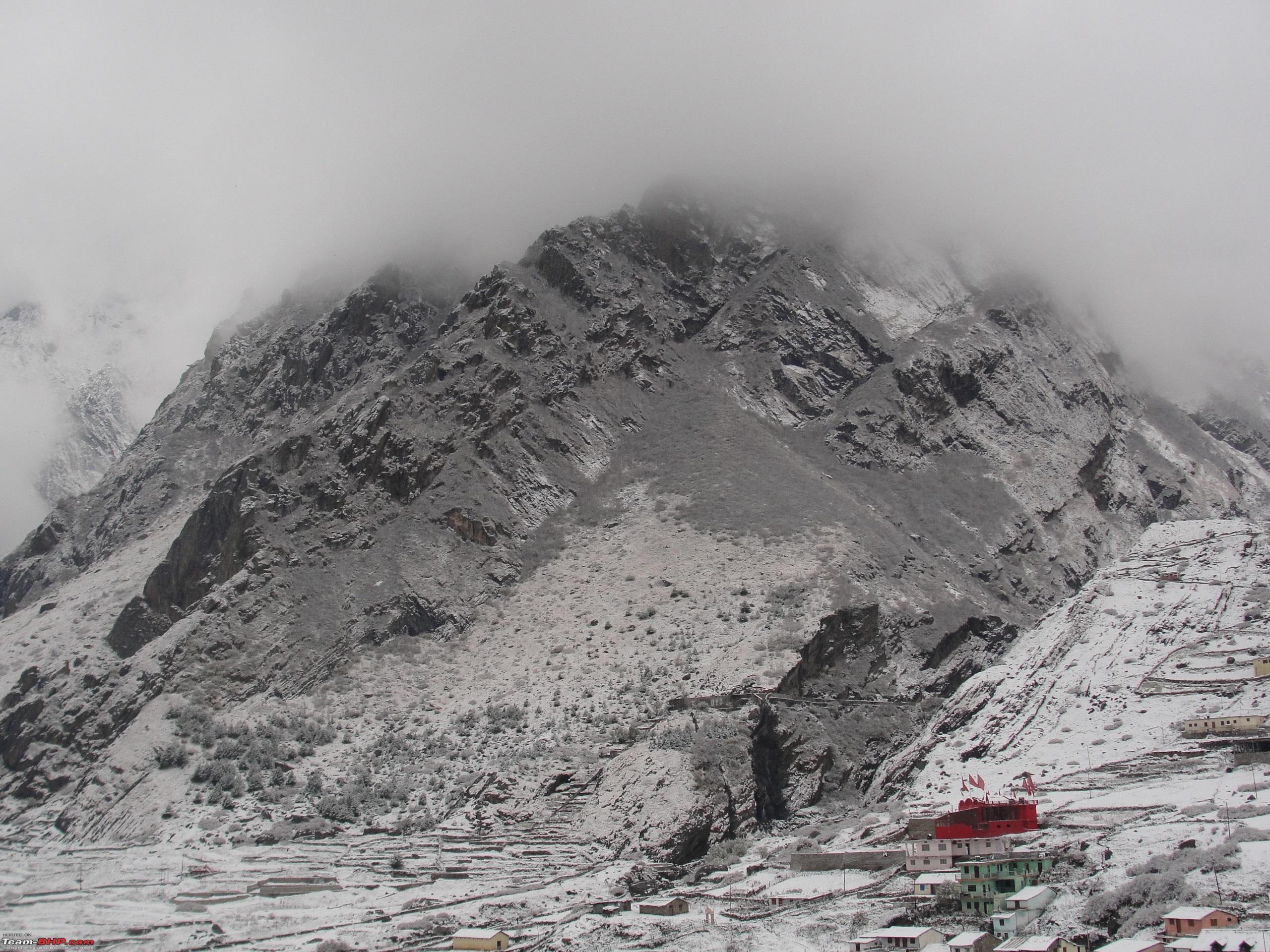
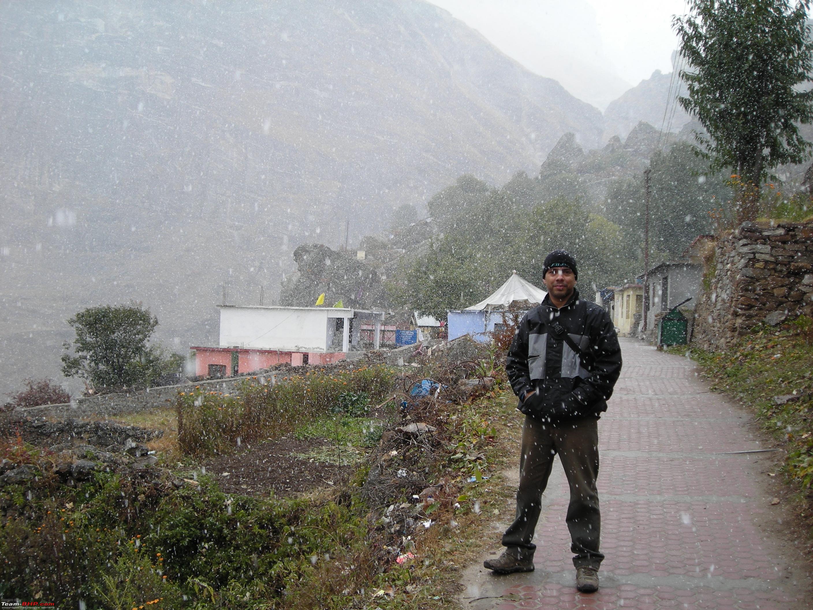
 After a break of about three hours it again started snowing.
After staying around in
Mana village for over an hour we started our return journey and it was decided to have a night halt at
Joshimath as we had plans to explore the
Joshimath town and the famous ski resort of
Auli.


Finally started off at 1220 Hrs for the onward journey to
Joshimath. Had to drive slowly and cautiously as the entire stretch between
Badrinath and
Hanuman Chatti had become slushy due to rain and snow. By the time we reached
Govindghat the weather had improved and the sun was out. Nonetheless the wet road slowed down the speed. Reached Joshimath by 1600 Hrs and checked into a home stay near the market. In the evening explored the town which also holds great cultural significance. After dinner at 2130 Hrs we came back to our home stay and retired for the day by 2230 Hrs. That was the end of day five of the trip.
Link to information about Joshimath Town:
https://en.wikipedia.org/wiki/Jyotirmath (Source: Wikipedia)
Day Travel Log:
Total Distance Covered: 63 kms
Route Taken: Badrinath-Mana Village-Badrinath-Hanuman Chatti-Govindghat-Joshimath.
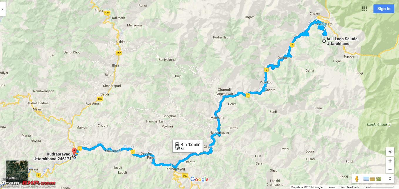
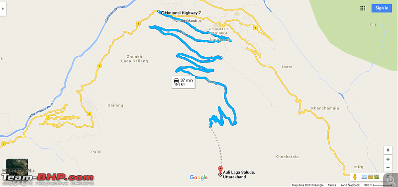
Day 6: 25th October, 2012 Joshimath-Auli-Joshimath and then to Rudraprayag: 152 kms (Driving)
The plan for the day was to visit the famous ski resort of
Auli and then proceed to
Rudraprayag for night halt.
Auli is a wide meadow located higher above the
Joshimath town at distance of 18 kms. The road leading to the meadow has a steep ascent as the altitude increases from 1,875 meters at
Joshimath to 3,050 meters at
Auli.
Link to information about Auli: https://en.wikipedia.org/wiki/Auli (Source: Wikipedia)
Route Map Day 6 Leg 1 (Joshimath-Auli-Joshimath):
After breakfast we started at 0915 Hrs and reached
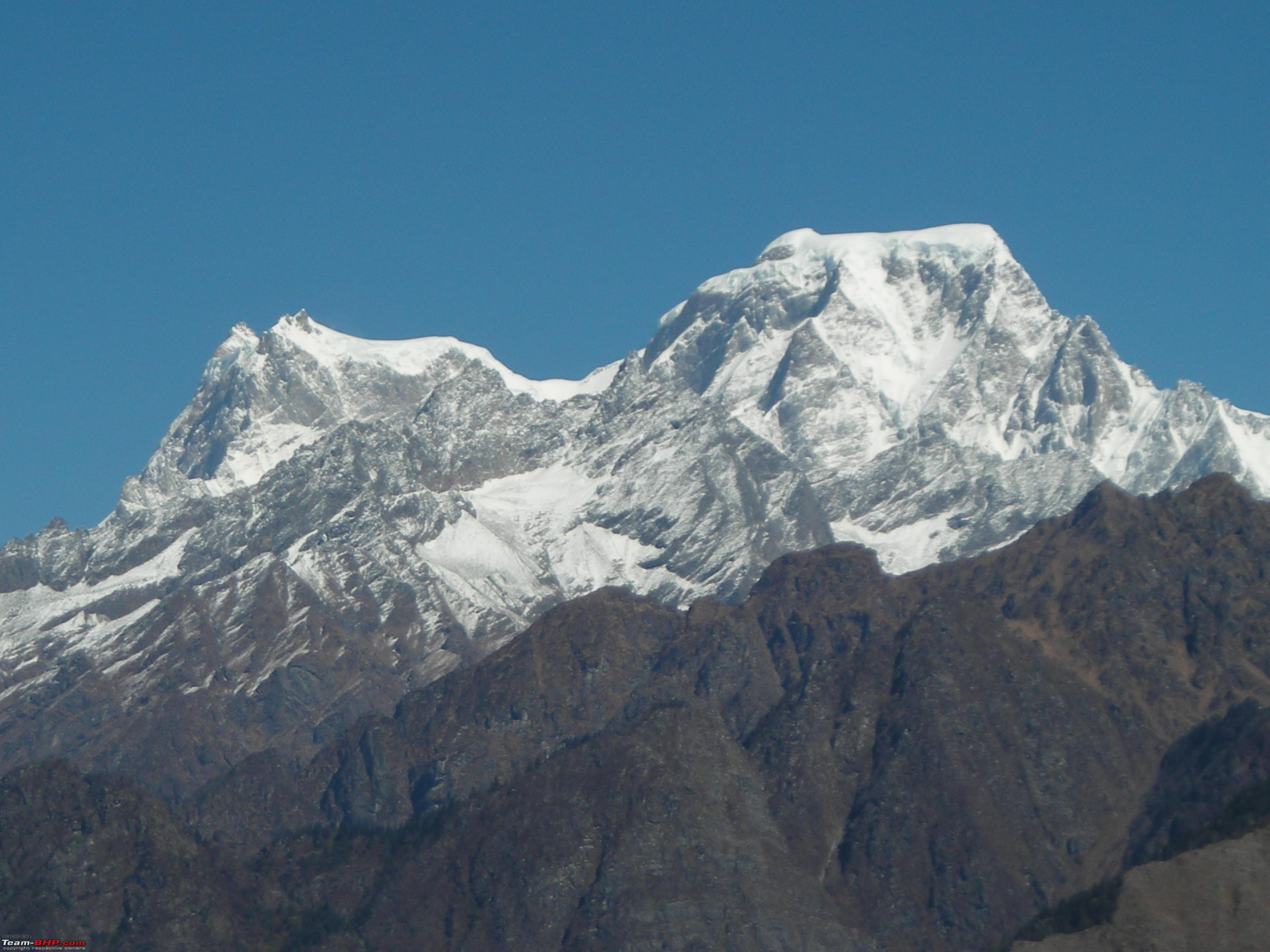
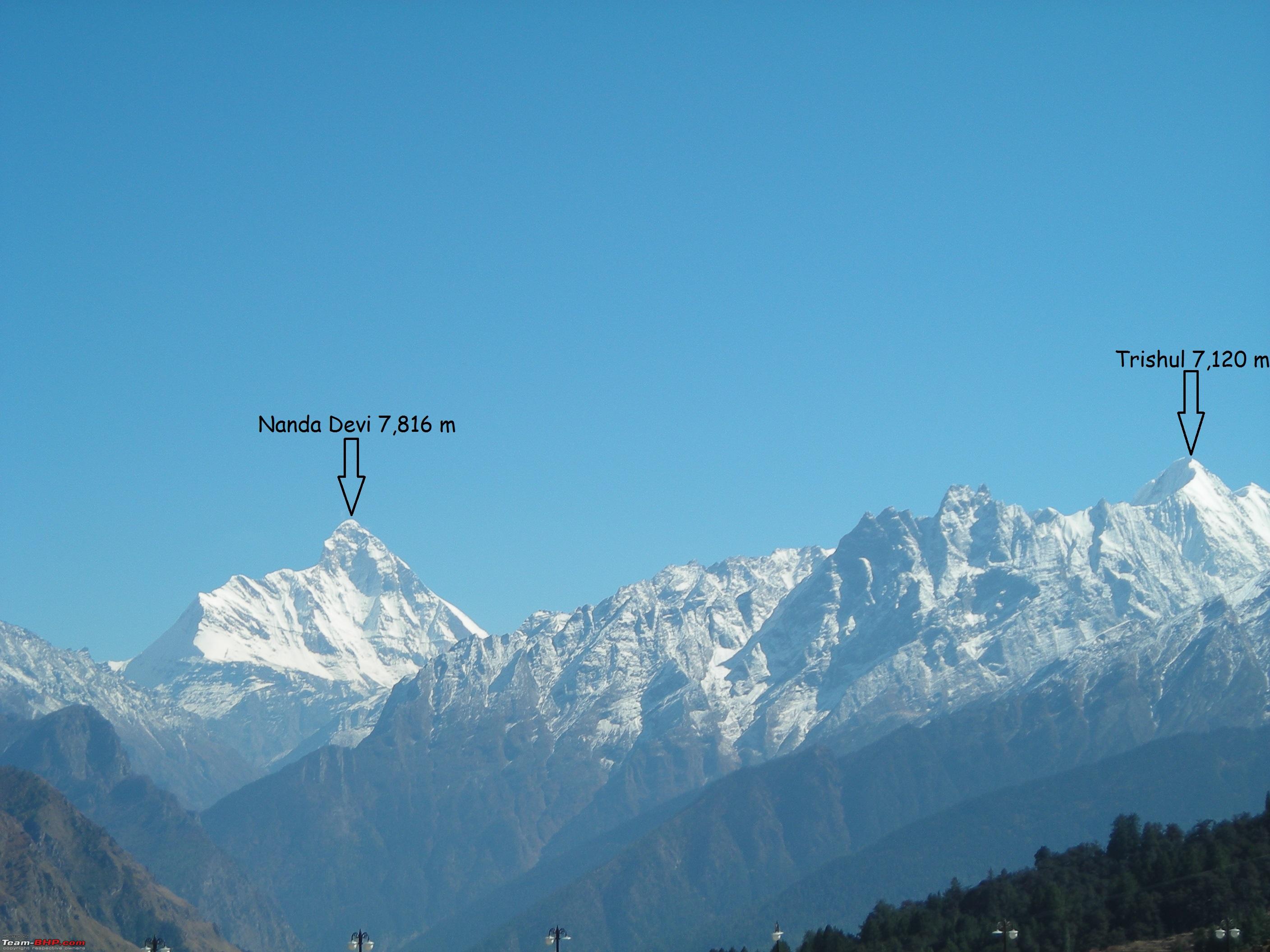
Auli at 1000 Hrs. The drive was through a narrow winding hill road offering some of the most spectacular views of high Himalayan peaks. The day was bright and sunny, which revealed the Himalayan panorama at its best. The most prominent peaks visible from
Auli are
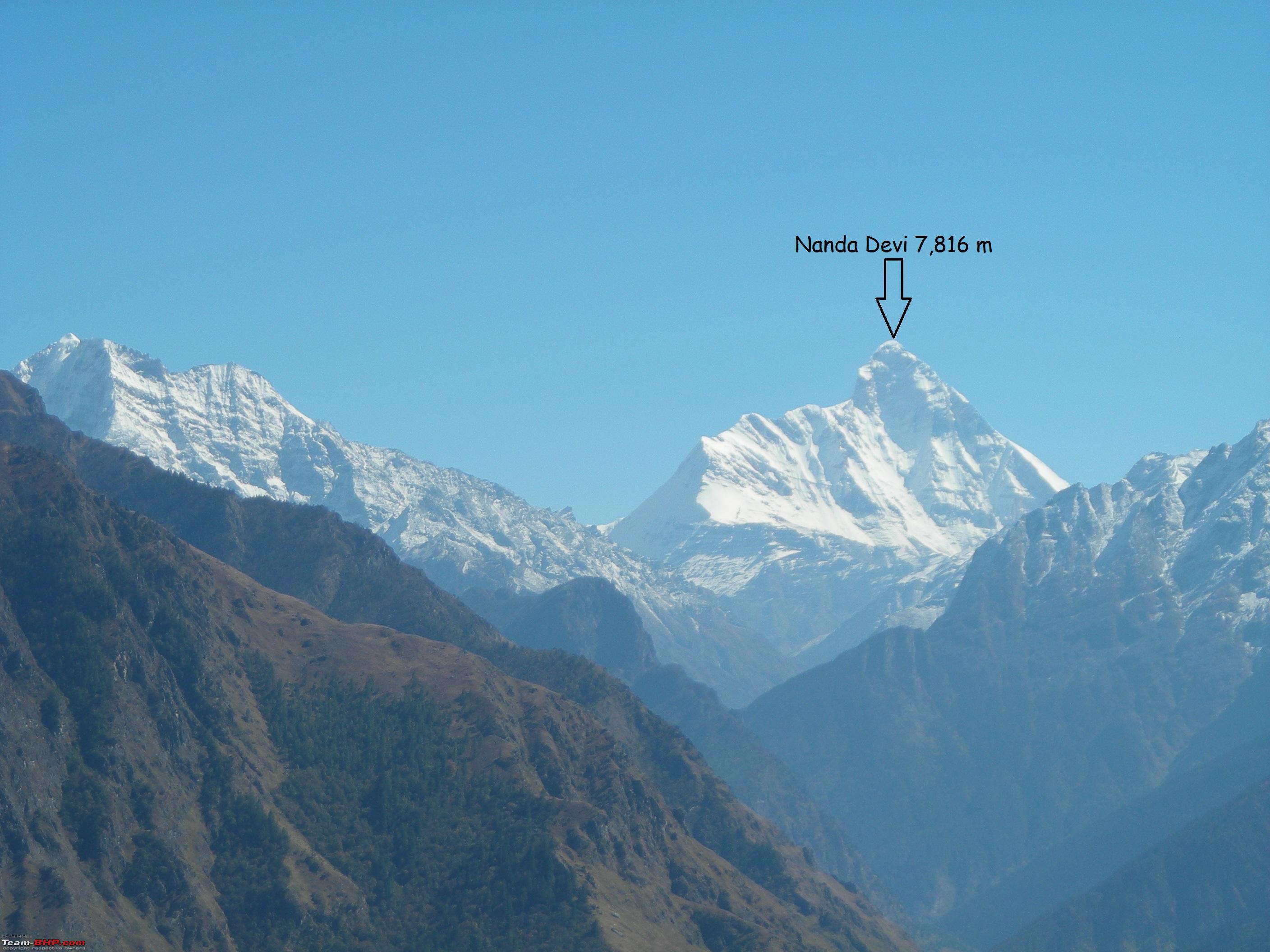
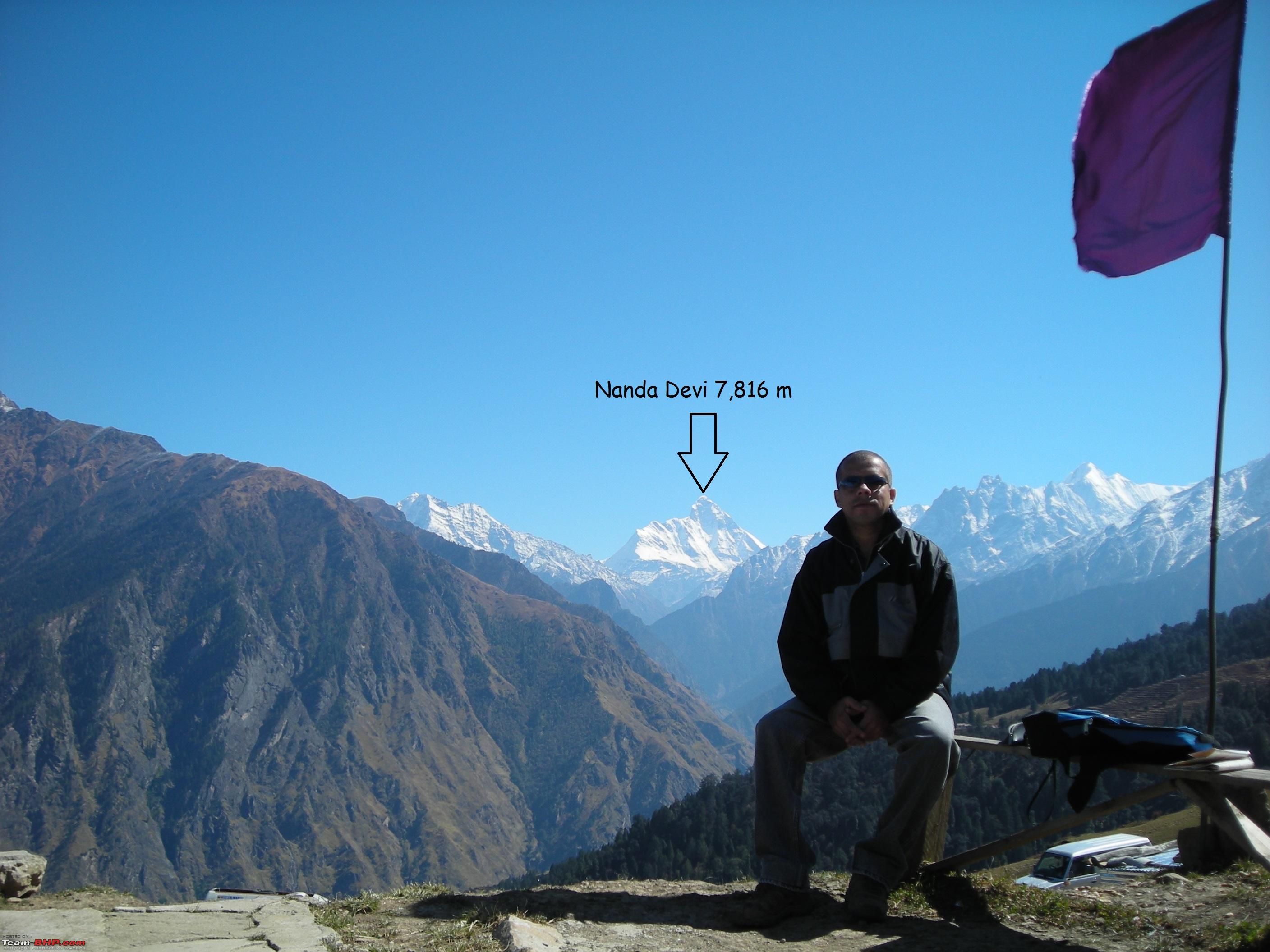
Nanda Devi,
Kamet,
Trishul,
Nilgiri Parvat,
Haathi Parvat and
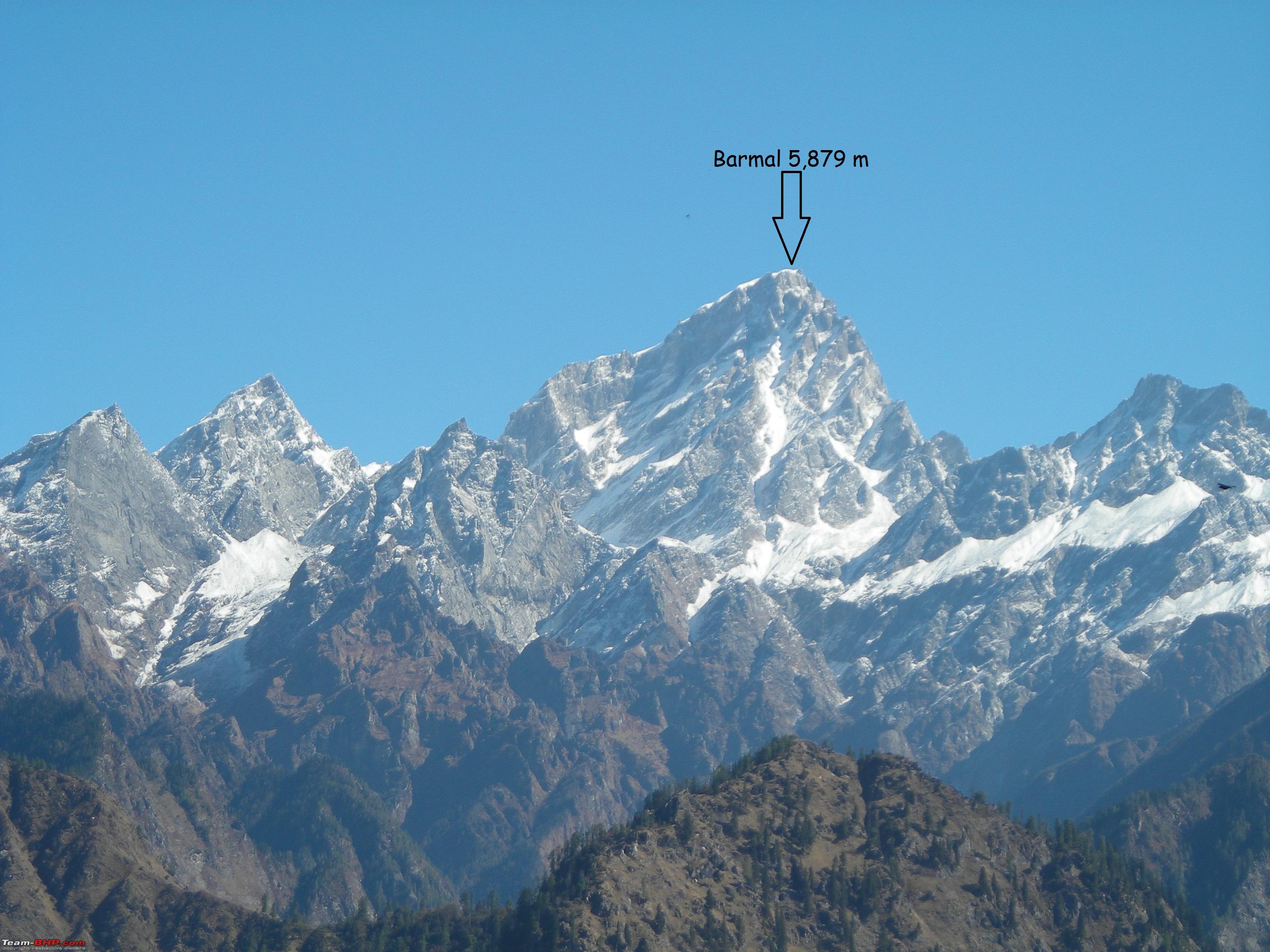
Barmal. Out of these peaks
Nanda Devi is the second highest peak in the country after
Kanchenjunga.
Joshimath-Auli road has beautiful views around.
 View of Barmal Peak (Elv 5,879 m)
.
 Close up of Barmal Peak
.

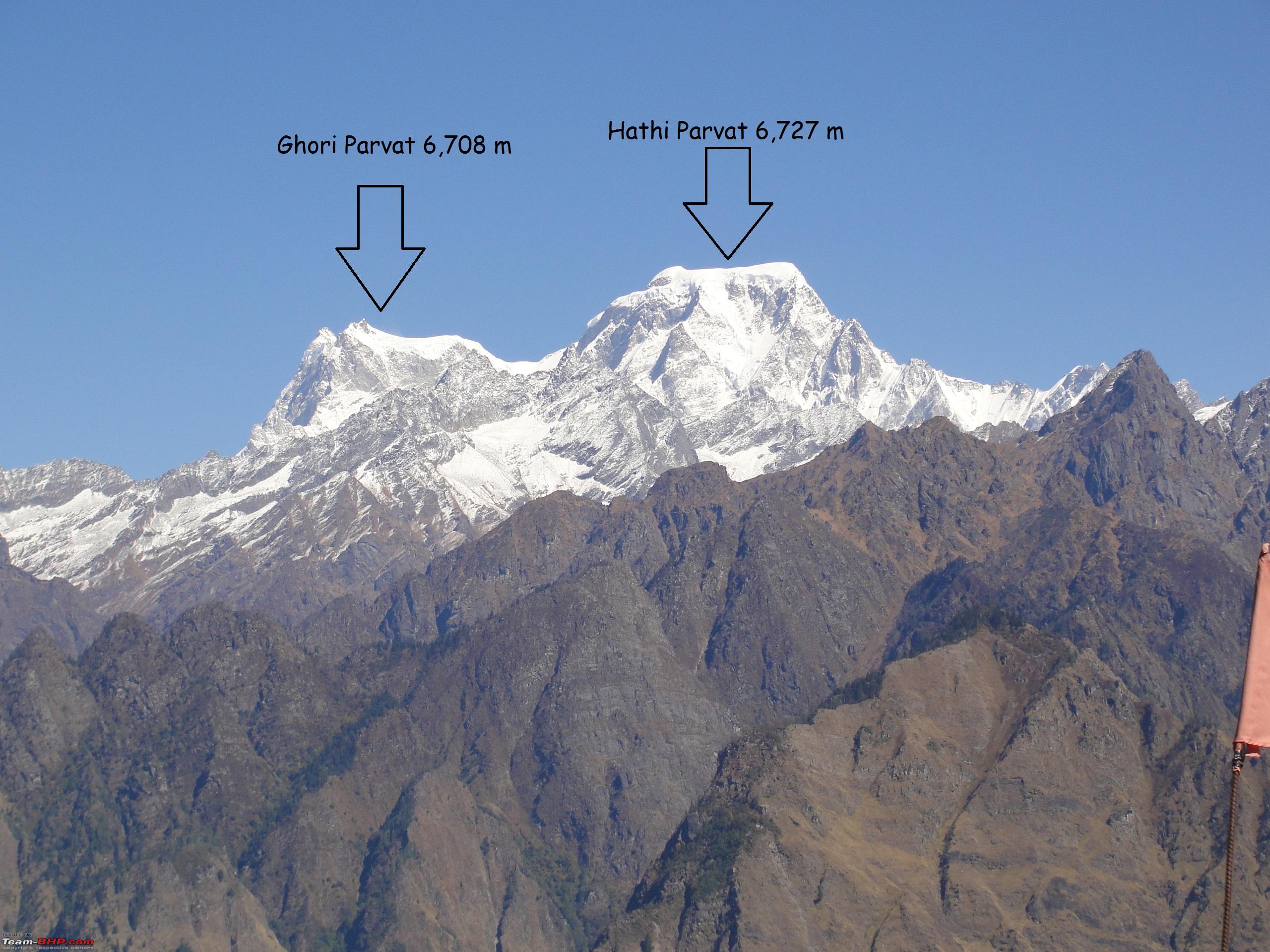
 View of Ghori Parvat and Haathi Parvat Peaks.
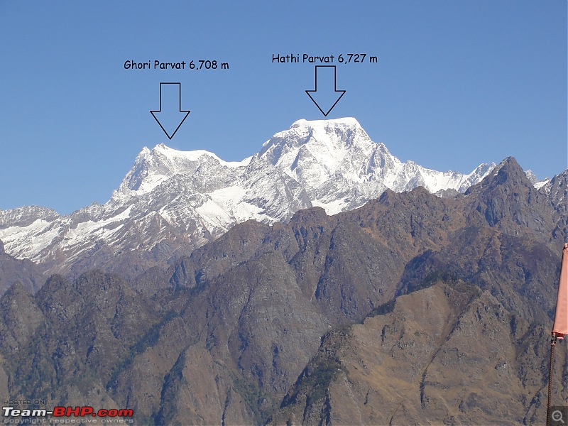
 Close up view of Nilgiri Parvat.
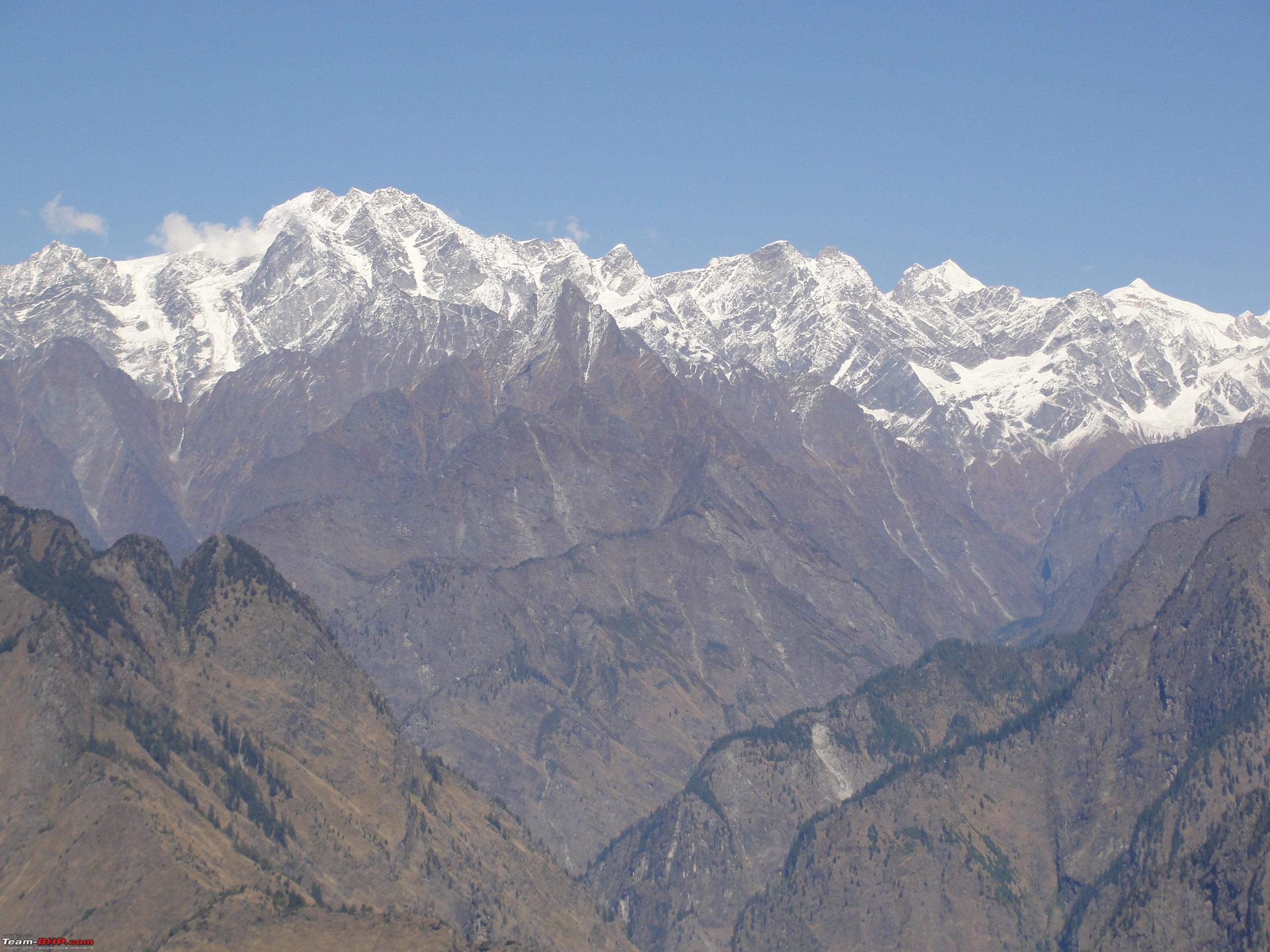
 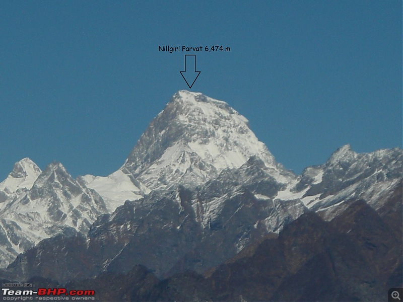 The entire panorama of Himalayan peaks of the region is visible in this photograph
.
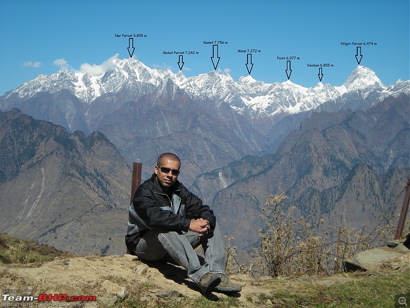
Took the above photograph randomly and later located the position of the peaks by checking the maps. Finally verified their locations by analyzing the satellite images on Google Earth.:D
 The most prominent amongst all the peaks visible from Auli is Nanda Devi, which stands apart and is the second highest mountain peak in India.

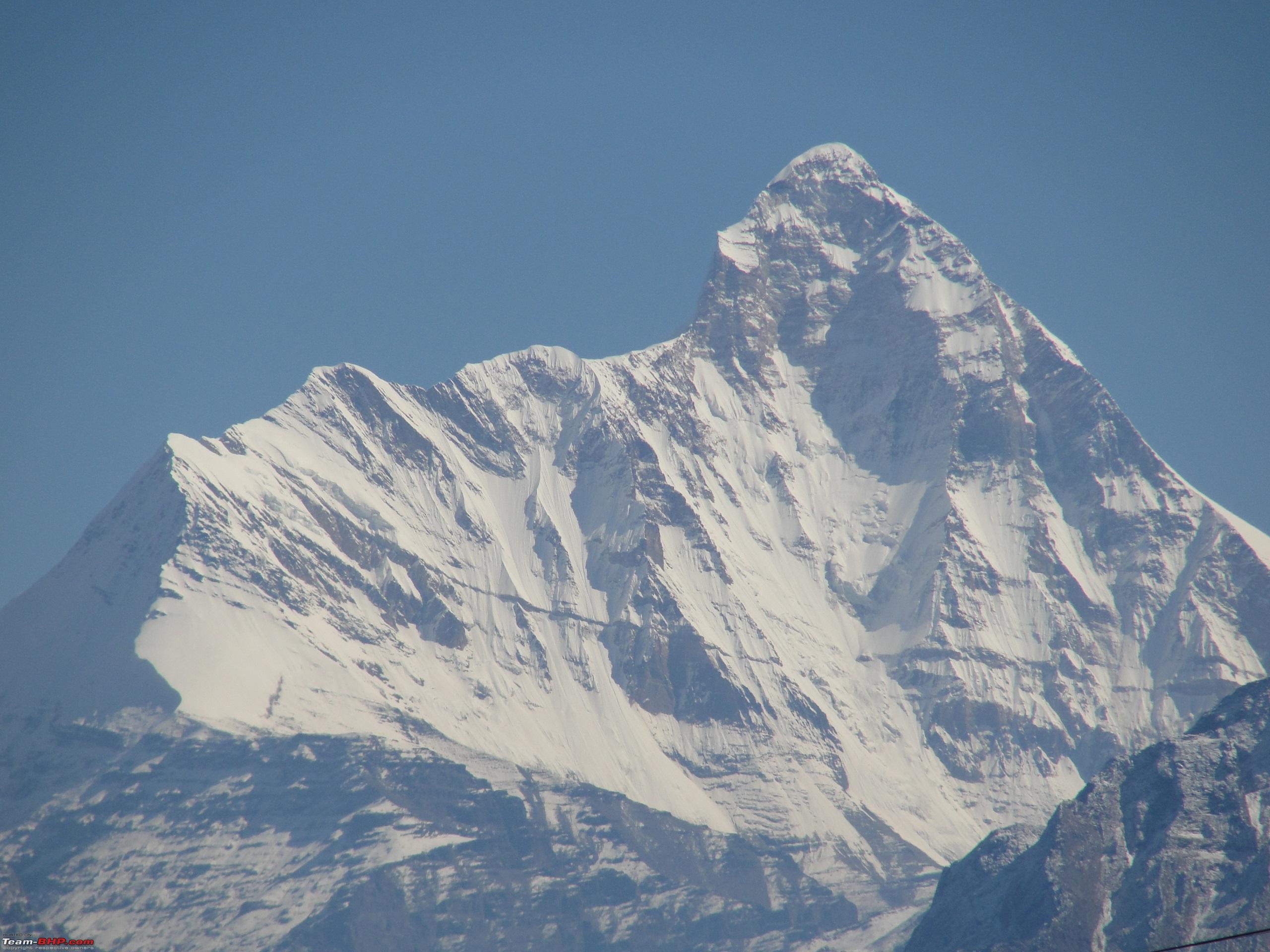
Day 6: Continued... Close up views of Nanda Devi Peak (Elv 7,816 m). 
 Nanda Devi Peak is surrounded by towering snow capped mountains.
  Trishul Peak (Elv 7,120 m) lies close to Nanda Devi Peak.
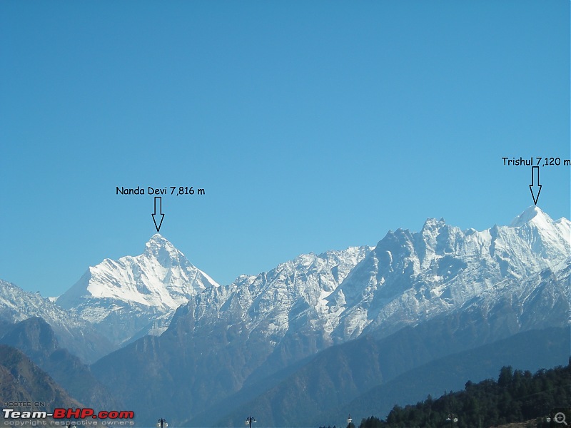
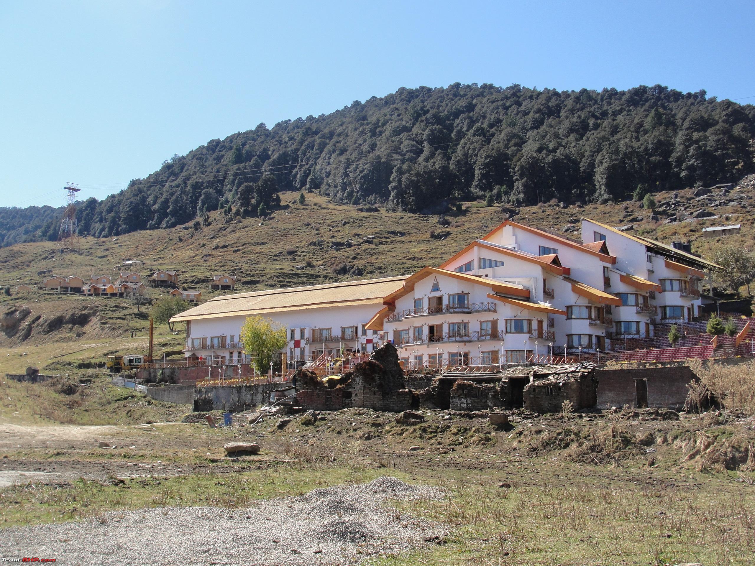
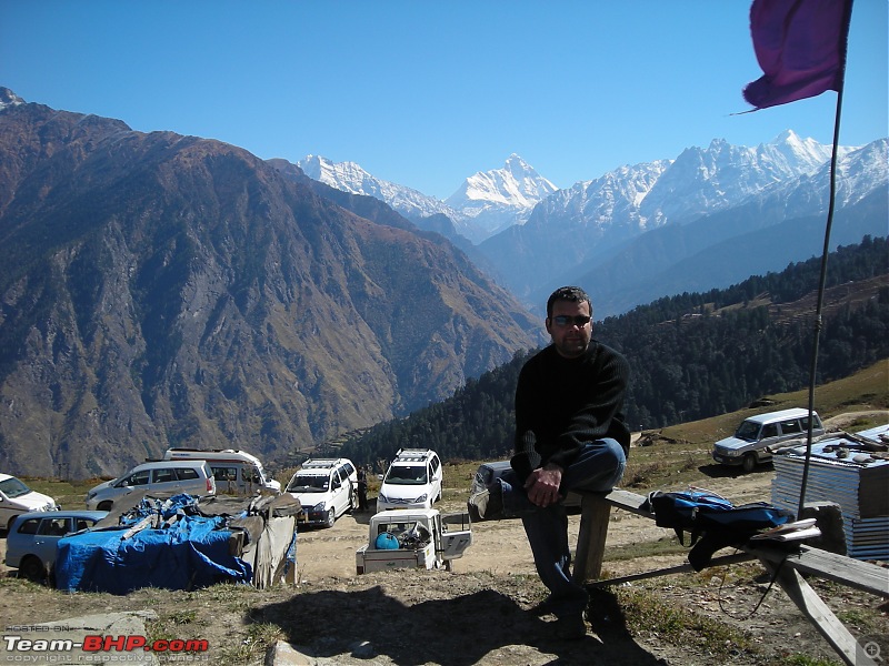
 A resort located in the Auli meadows.
 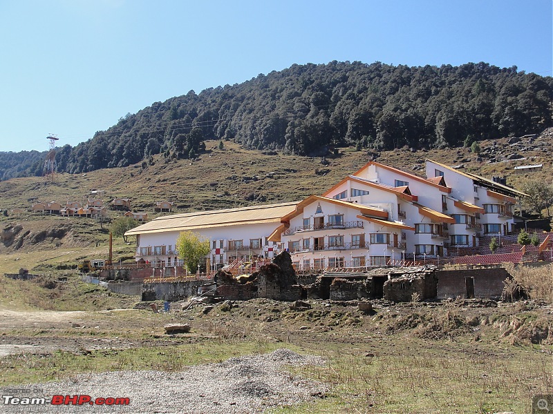 Views from further up the meadows.

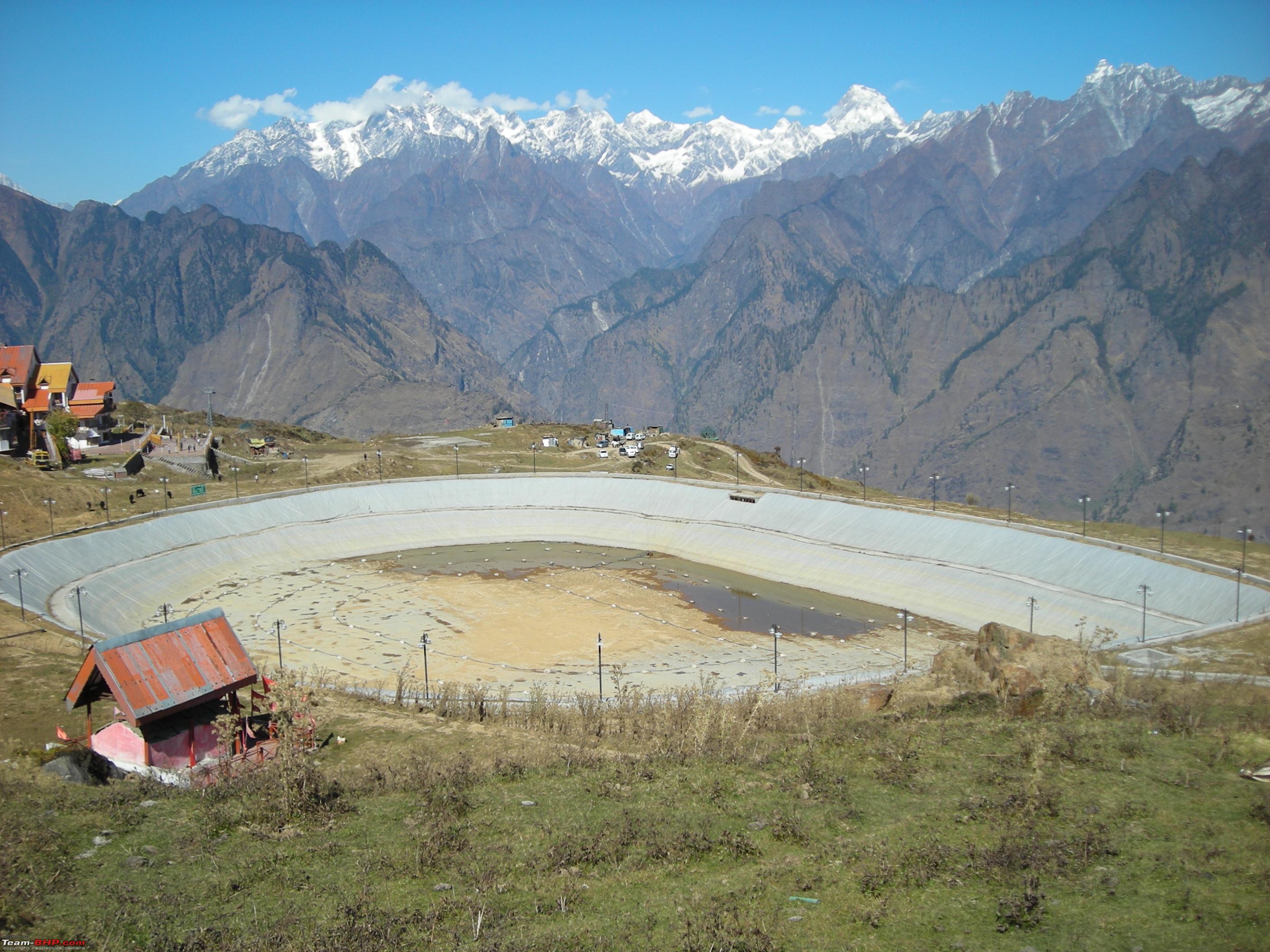
 An artificial lake at Auli
The lake has been developed in view of creating artificial snow on the ski slopes in the event of less snowfall. The water from this lake is used to feed the snow guns stationed along the ski slopes to provide for decent slopes for skiing and thus further extending the skiing season.
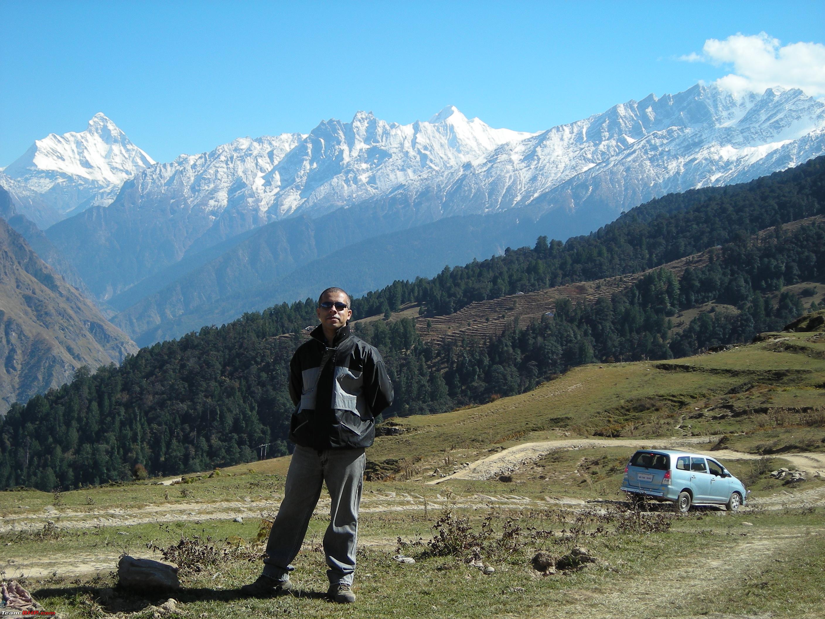
We stayed at
Auli for over three hours and thoroughly enjoyed the pristine Himalayan beauty. After having tea and snacks for a light lunch, we were ready to move.
Time to move. 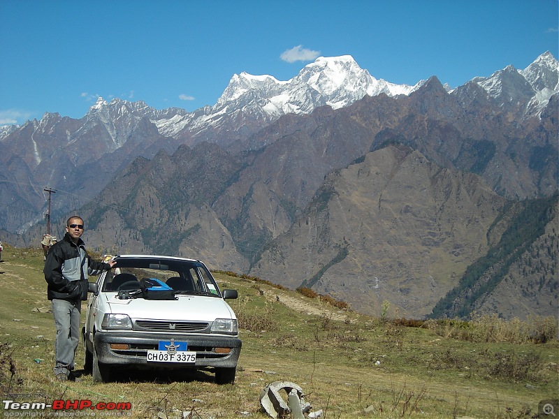
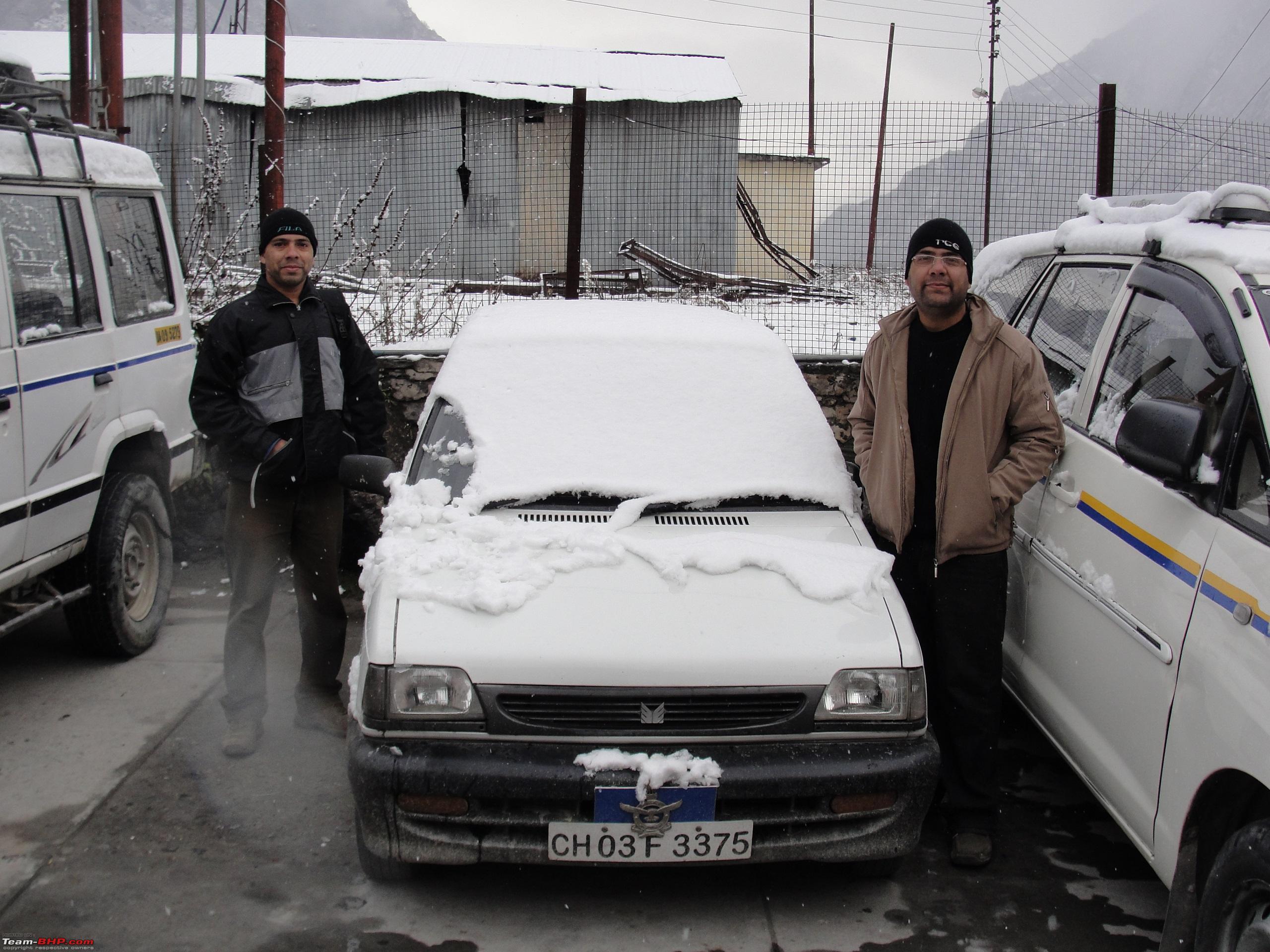
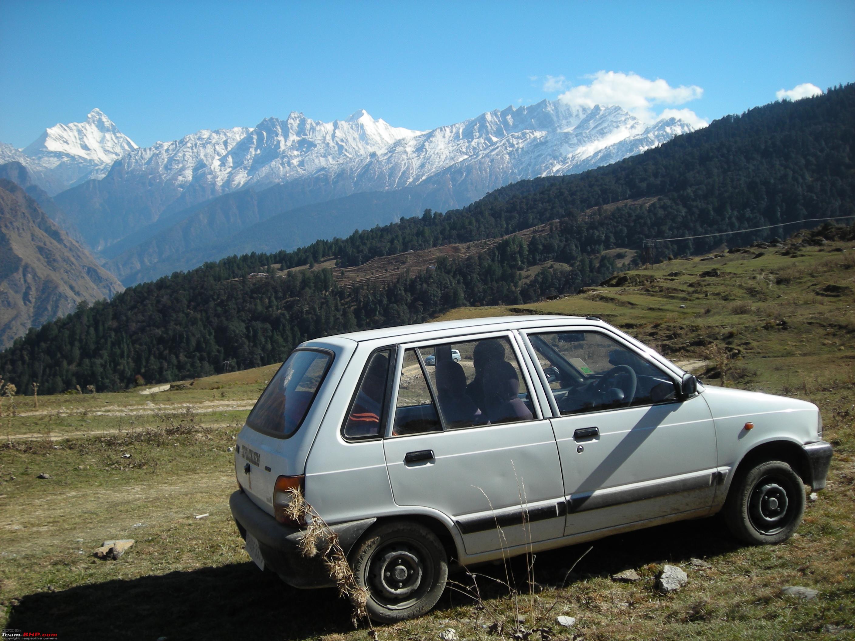
 Maruti-800 did exceptionally well during the trip and scaled new heights.
:D

We started from
Auli at 1320 Hrs and joined NH-58 at
Joshimath. Our destination for the day was
Rudraprayag, a distance of 134 kms.
Route Map Day 6 Leg 2 (Auli-Joshimath-Rudraprayag):

After covering a distance of 65 kms, stopped for refuelling at
Pipalkoti, town on NH-58. Finally reached
Rudraprayag at 1830 Hrs and checked into a lodge located along the highway near the market. After relaxing for an hour, went for a walk in the town. After dinner we retired for the day at 2300 Hrs. That was the end of day six of the trip.
Day Travel Log:
Total Distance Covered: 152 kms
Time Taken: 9 Hrs 15 Mins (Including Halt of 3 Hrs at Auli)
Route Taken: Joshimath-Auli-Joshimath-Pipalkoti-Karnprayag-Rudraprayag.
Refuelling: Tank full at Pipalkoti (24.40 ltrs) (2nd refuelling of the trip).
--------------------------------------------------------------------------------------------------------------------------------------------------------------------
Day 7: 26th October, 2012 Rudraprayag to Chandigarh: 347 kms (Driving) Route Map Day 7:

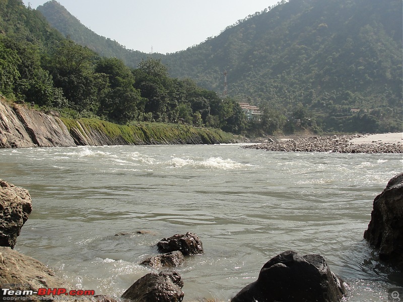
Started from Rudraprayag at 0800 Hrs and reached
Rishikesh by 0130 Hrs. Enroute stopped for half an hour by the side of River
Ganga near
Bhairgarh, which is famous for riverside camping sites.
Stopped for a while by the riverside. 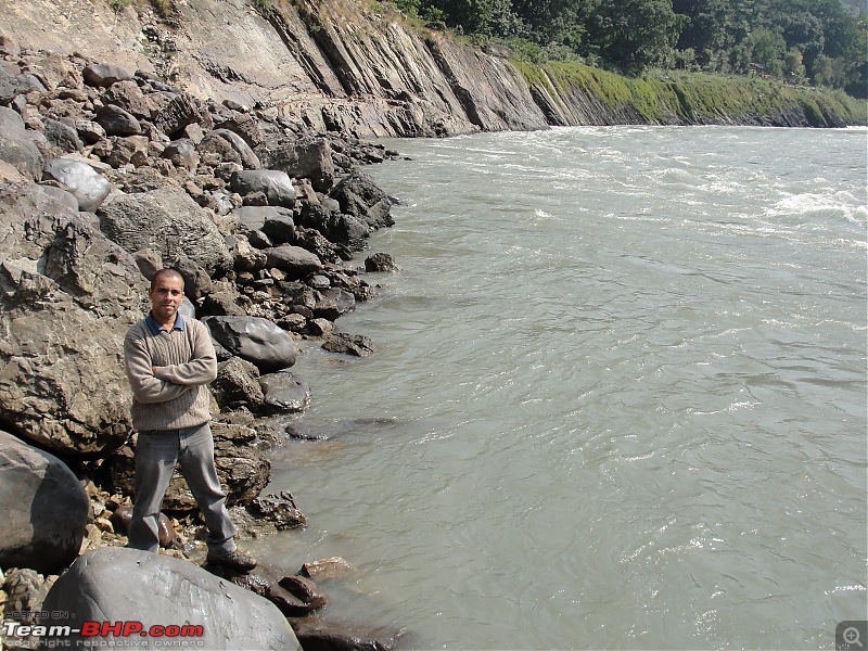
 A camping site across the river.
After a leisurely lunch, started from
Rishikesh at 1445 Hrs. Encountered heavy traffic while passing through
Dehradun. Finally reached the base by 2030 Hrs. So finally with the completion of this trip, the trip to all the
Char Dhams of
Uttarakhand was completed.
Day Travel Log:
Total Distance Covered: 347 kms
Time Taken: 12Hrs 30Mins (Including Halts of of 1Hr 30Mins)
Route Taken: Rudraprayag-Srinagar-Devprayag-Rishikesh-Dehradun-Paonta Sahib-Kala Amb-Narayangarh-Chandigarh.
Refuelling: Tank full after returning to the base (21 ltrs) (3rd and final refuelling of the trip). Entire Trip Log:
Total Distance Travelled: 1236 kms
Total Fuel Consumed: 68.35 ltrs
Mileage Achieved: 1236/68.35=18.08 km/ltr
Salute to you sir! Really great achievement.
In another thread of yours, I had wished get a chance to cover other two dhams soon. Within couple of days you are back with great set of pics and very valuable info of Kedarnath and Badrinath. clap:
Now I wish you cover Kailsah Mansarovar as well soon.
One curious question. Still you have that trusty 800 with you?
Quote:
Originally Posted by Nempuguru
(Post 4017540)
Salute to you sir! Really great achievement.
In another thread of yours, I had wished get a chance to cover other two dhams soon. Within couple of days you are back with great set of pics and very valuable info of Kedarnath and Badrinath. clap:
Now I wish you cover Kailash Mansarovar as well soon.
One curious question. Still you have that trusty 800 with you?
|
Thanks once again for the kind words of appreciation.:) It always feels nice to share travel stories with like minded travel enthusiasts on Team BHP. If destined will cover the Kailash Mansarovar Yatra too. Yes still have the trusted Maruti-800. It has been a great companion throughout many journeys.
quick question: where did you get the Air Force emblem from? Considering the car is CH registered I'd hazard a guess that the car was bought when you were with 44 Sqn?
Quote:
Originally Posted by duke
(Post 4018127)
quick question: where did you get the Air Force emblem from? Considering the car is CH registered I'd hazard a guess that the car was bought when you were with 44 Sqn?
|
Now that's really a good sense of observation.:thumbs up Actually during the trip we were accompanied by our uncle who is a retired Indian Air Force Officer and he provided this emblem. Personally I've never been in the Air Force.:)
| All times are GMT +5.5. The time now is 14:16. | |