| |||||||

| Search Forums |
| Advanced Search |
| Go to Page... |
 |
| Search this Thread |  26,281 views |
 11th July 2019, 21:26
| #1 |
| Senior - BHPian | Ladakh Re-Juleh'd! With Siachen - Panamic - Agham - Mitpal Tso - Kaksang La - Tso Kar - Kyun Tso "I'll be back!" Not just a phrase from the Terminator movies (not a fan of them anyway), but also something that I said while bidding adieu to the plains of Ladakh the last time!! The lure of getting to Ladakh the first time was very strong. One can read all about it on this thread. https://www.team-bhp.com/forum/trave...h-episode.html (Marengo conquers the Marsimik La - The Ladakh episode) It was a very fulfilling trip, the coverage was decent too. However still, while driving back the last few miles on the valley, the heart was heavier than before. 5 years passed, lots of other places covered in the intervening years, but the craving for getting back to Ladakh was strangely higher than the first time. It was so bad that some forum members actually derived entertainment from the frustration. Ofcourse, from our area, to undertake a trip to Ladakh, especially late May, there are loads of uncertainties. Most important being the opening of the mountain passes and the approval of leaves. For our case, a minimum of 2 weeks of leave would be necessary. Looks like we managed! 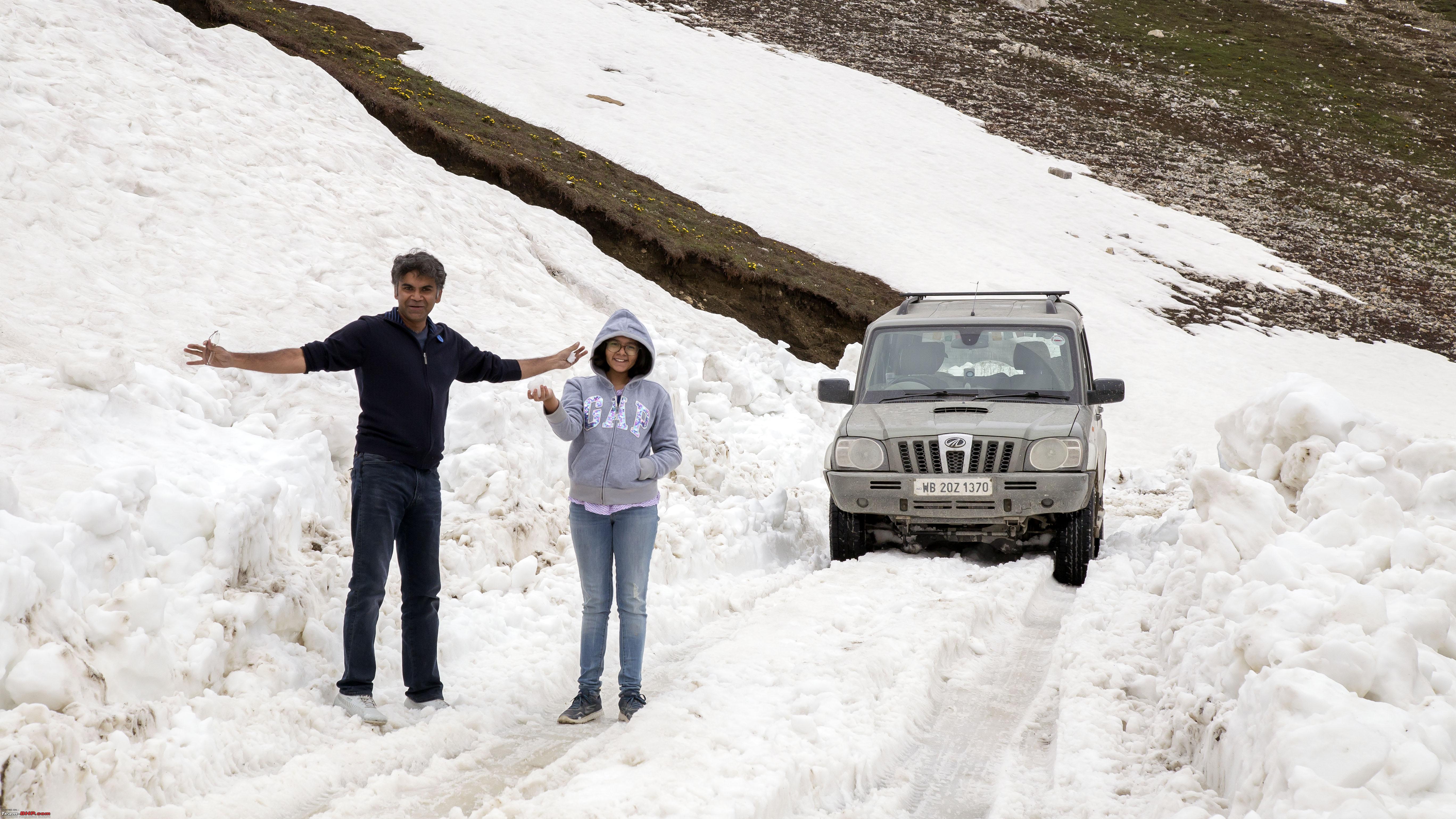 However, like last time, even this year, the Leh-Manali route managed to remain inaccessible. So our entry and exit was from ZojiLa. Not a bother at all, because Srinagar is one place I will always love to set foot on. Especially compared to the chaos Manali has become. Another uncertainty was due to the Jammu Srinagar route, being one-way on opposite way on subsequent days at that time. Seemingly we made up for it (more of that later). Another thing to note is that, on this travelogue, more than a third of the total number of pictures (around 112 of 333) were shot by my daughter Anoushka! Just in case she is reading this, maybe way later, I have her permission for using her pictures!! So on 25th May early morning, we started with loads of open ends on our plans. Managed to reach Allahabad that evening, with extensive roadwork going around the Varanasi-Allahabad section. The next day managed to reach Karnal, even though we did utilise the fabulous Agra-Lucknow-Expressway from Etawah and the Eastern Peripheral Expressway (EPE) to circumvent the NCR. (We actually were doubly lucky to face traffic hold up on both days for more than an hour each). 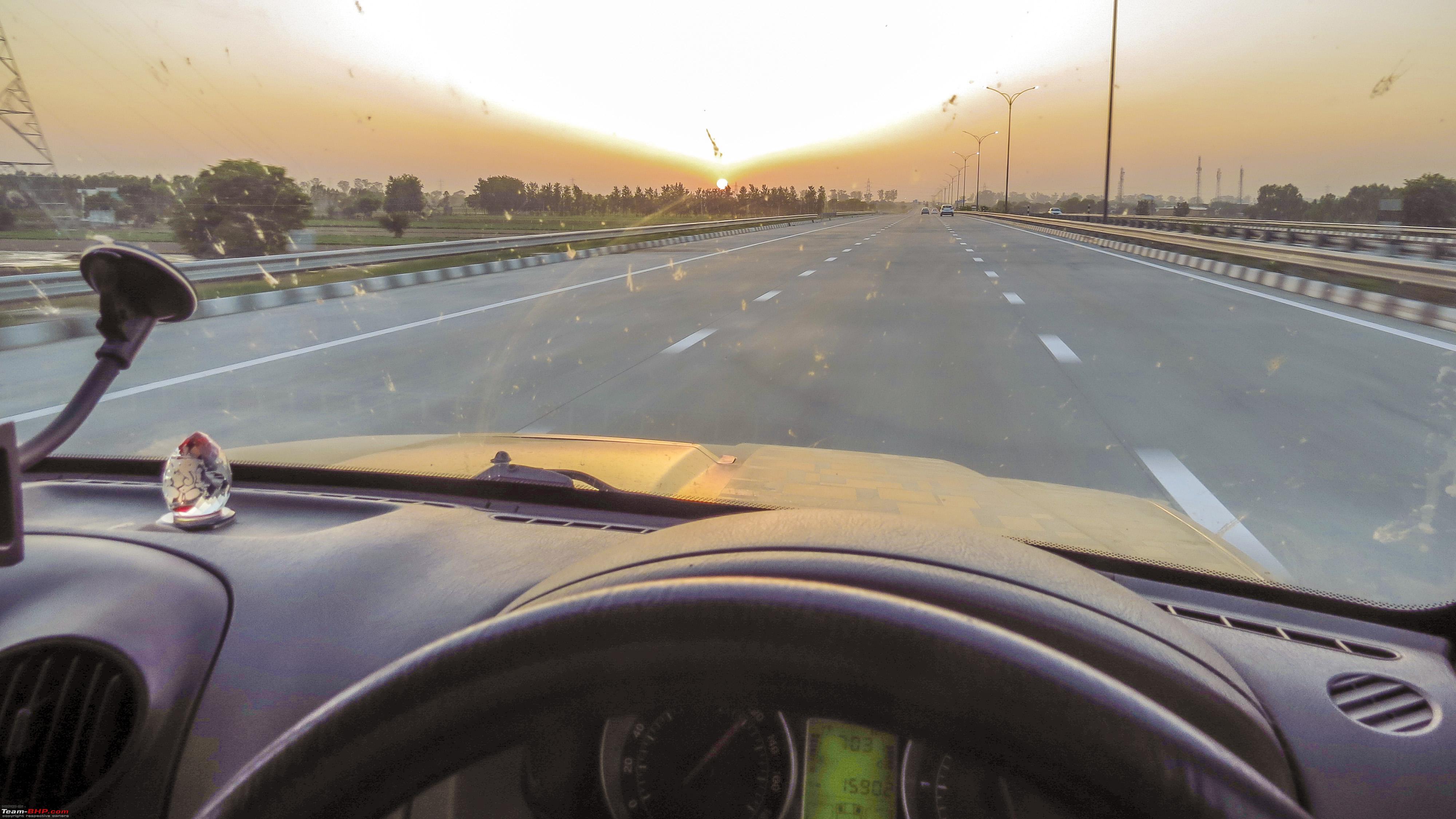 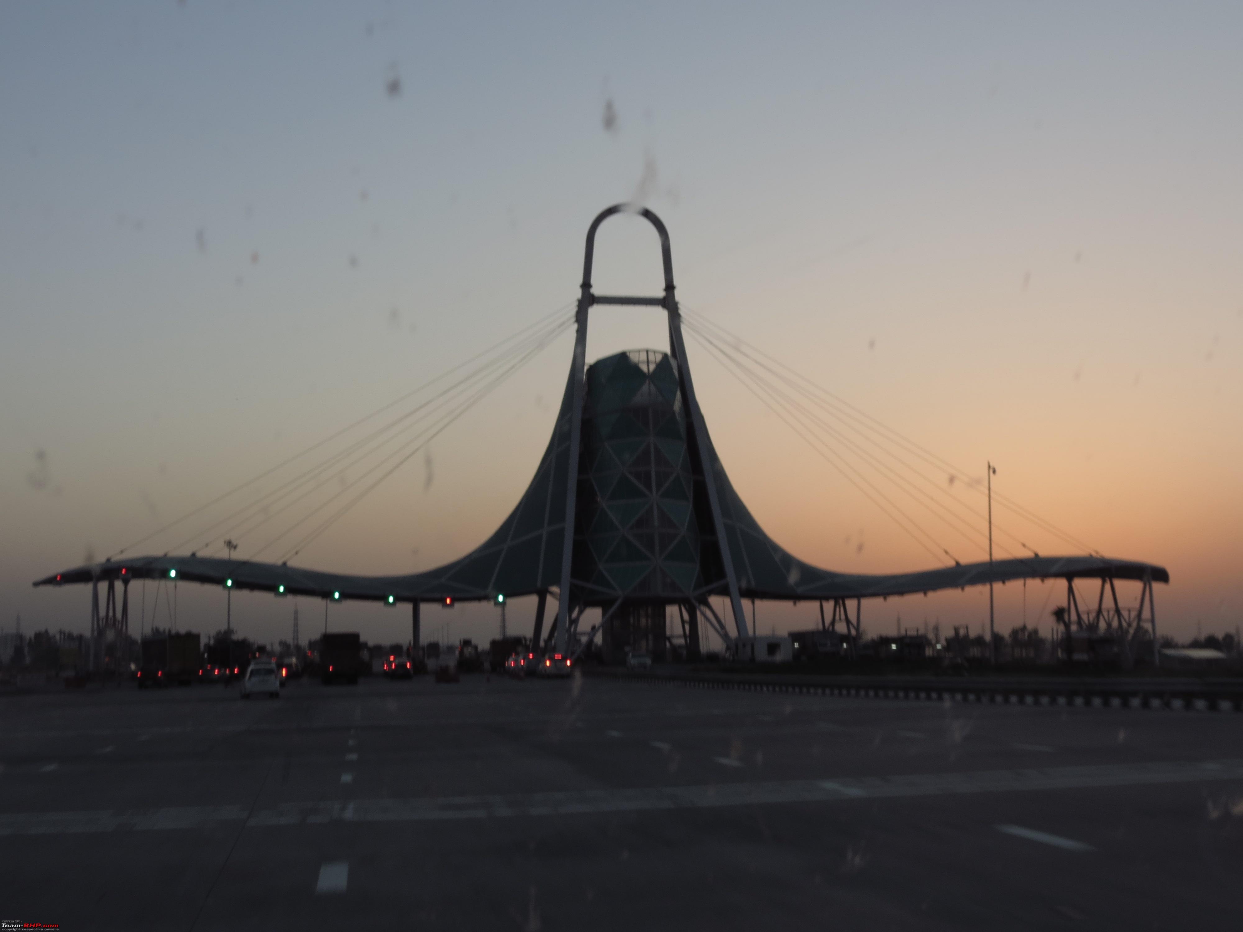 The Third day, our only option anyway was to go till Jammu as the Srinagar Highway was open the wrong way. The Fourth Day, we took a conscious decision to take the Mughal Road to Srinagar 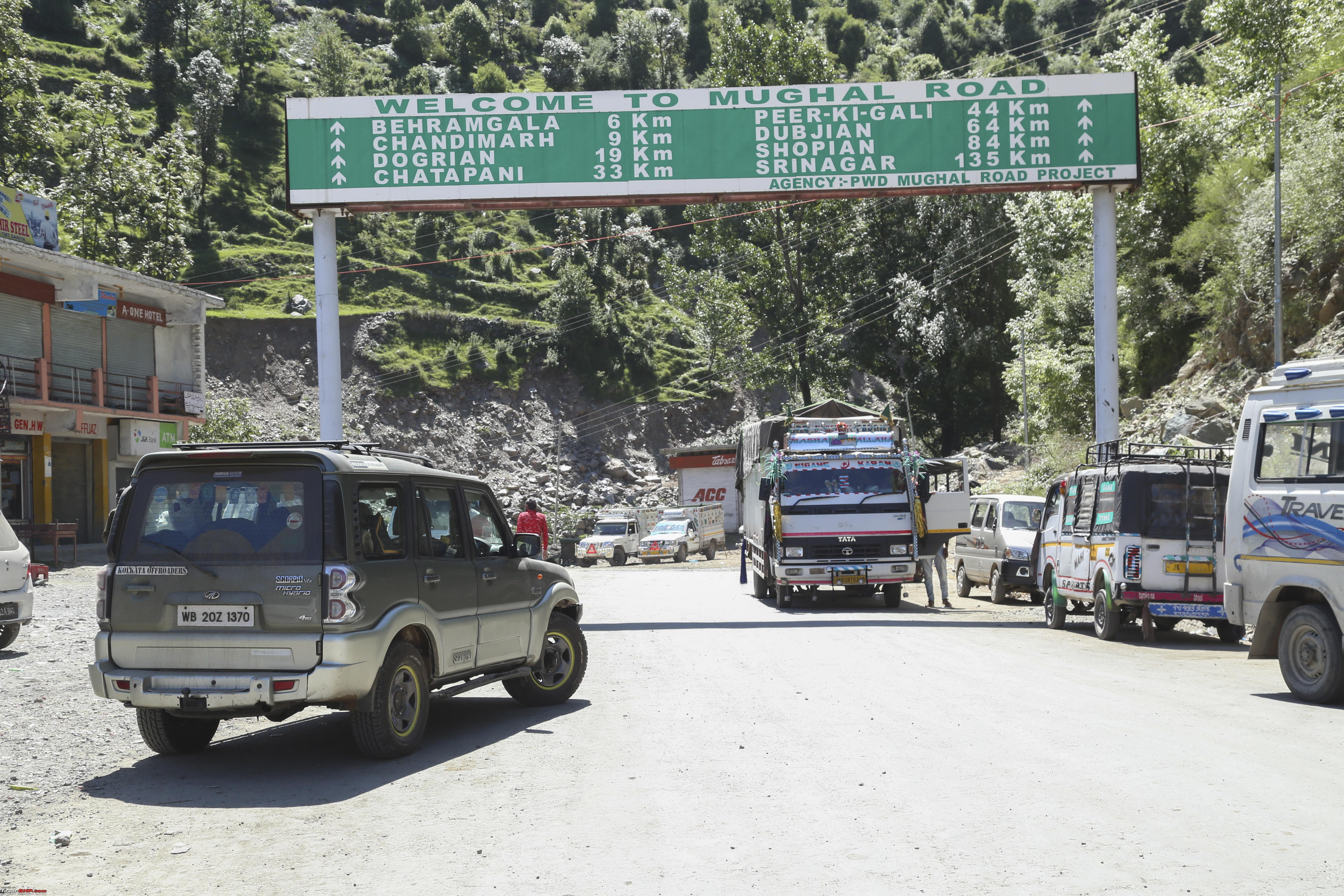 and was there by 2pm. Enough time to have one's fill of Srinagar, the Dal Lake and the Wazwan! 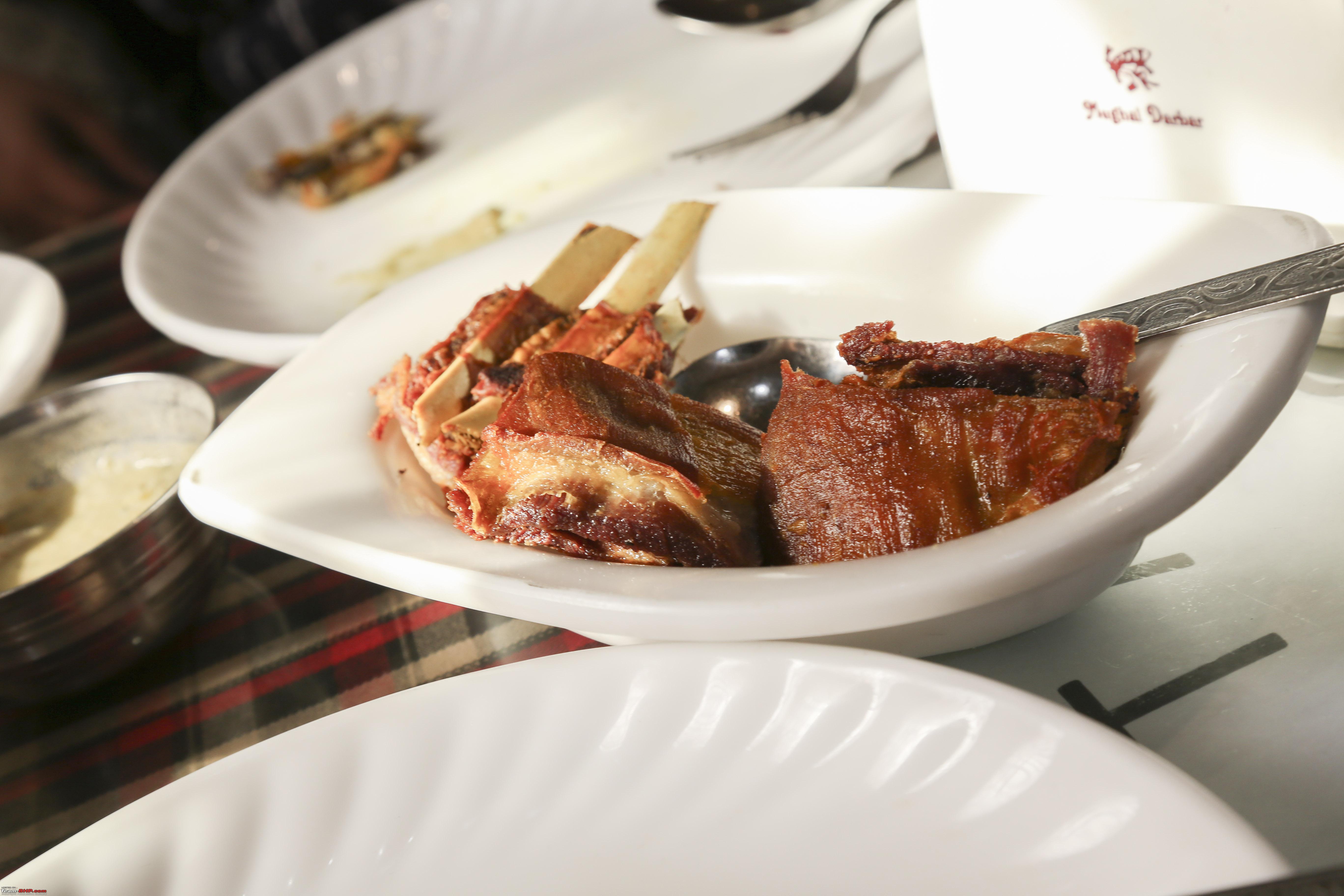    The Fifth day, we were planning to just go till Sonmarg, so as to take the early morning convoy across the ZojiLa the next day. But to my surprise, when we reached Sonmarg, was informed that the traffic checkpost at Sonmarg will allow vehicles to still ply towards Kargil at that hour (10:45am), Bingo!! Soon we were jostling for space among trucks, hired REs but still managing to climb across ZojiLa  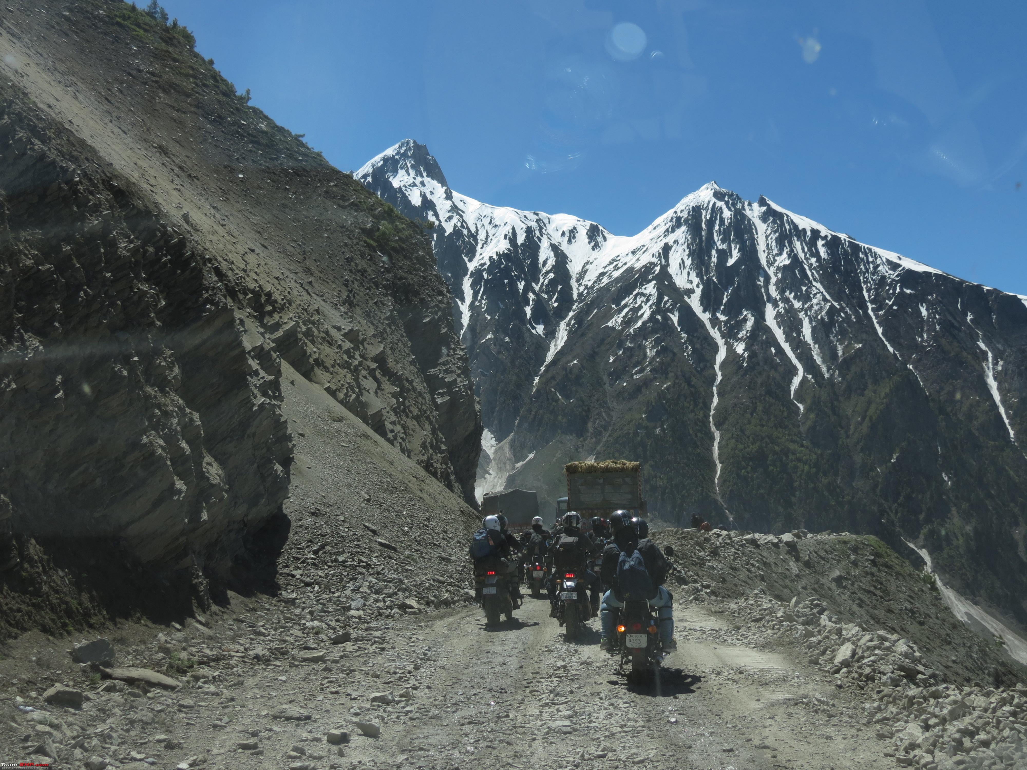 Our trip had begun! 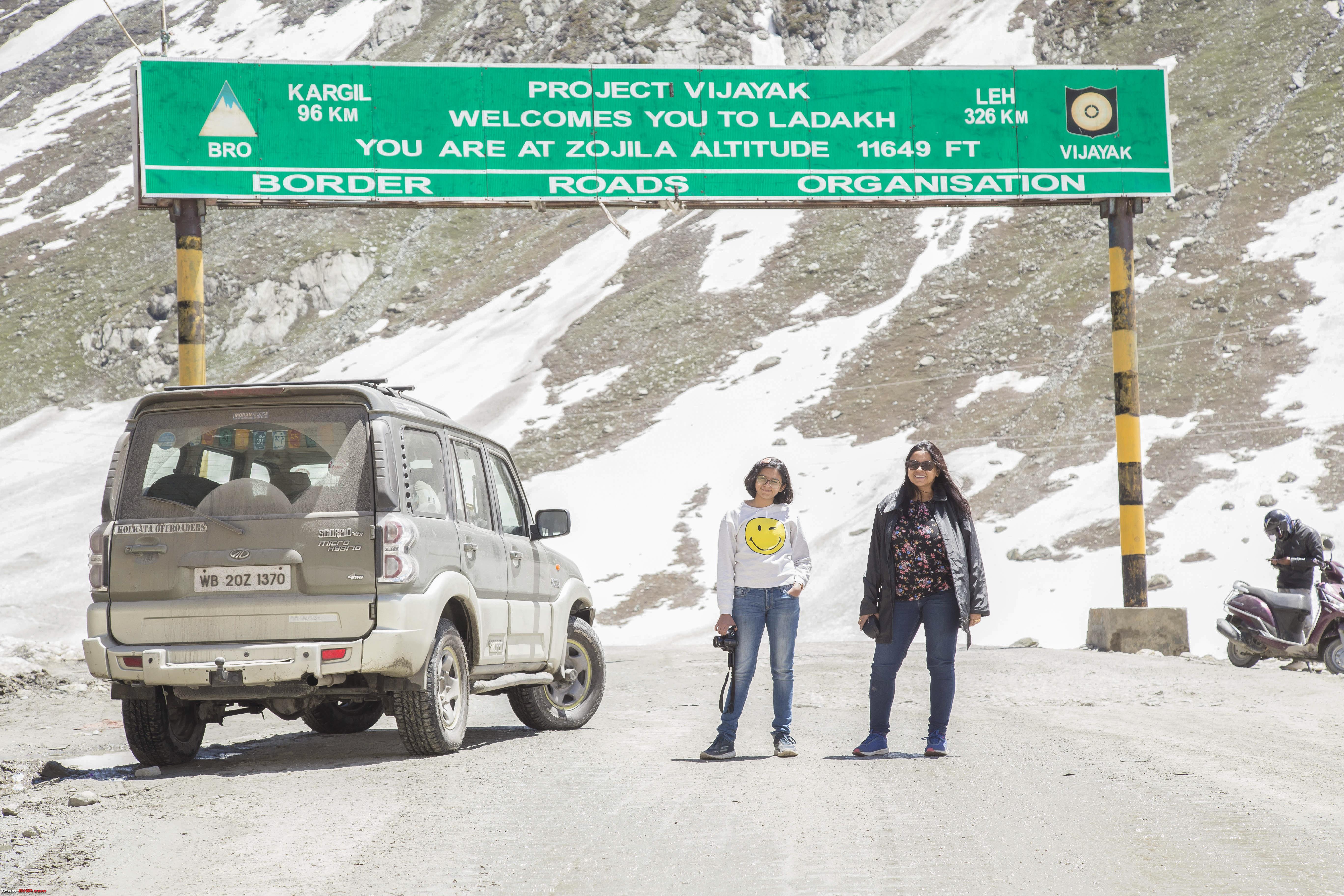 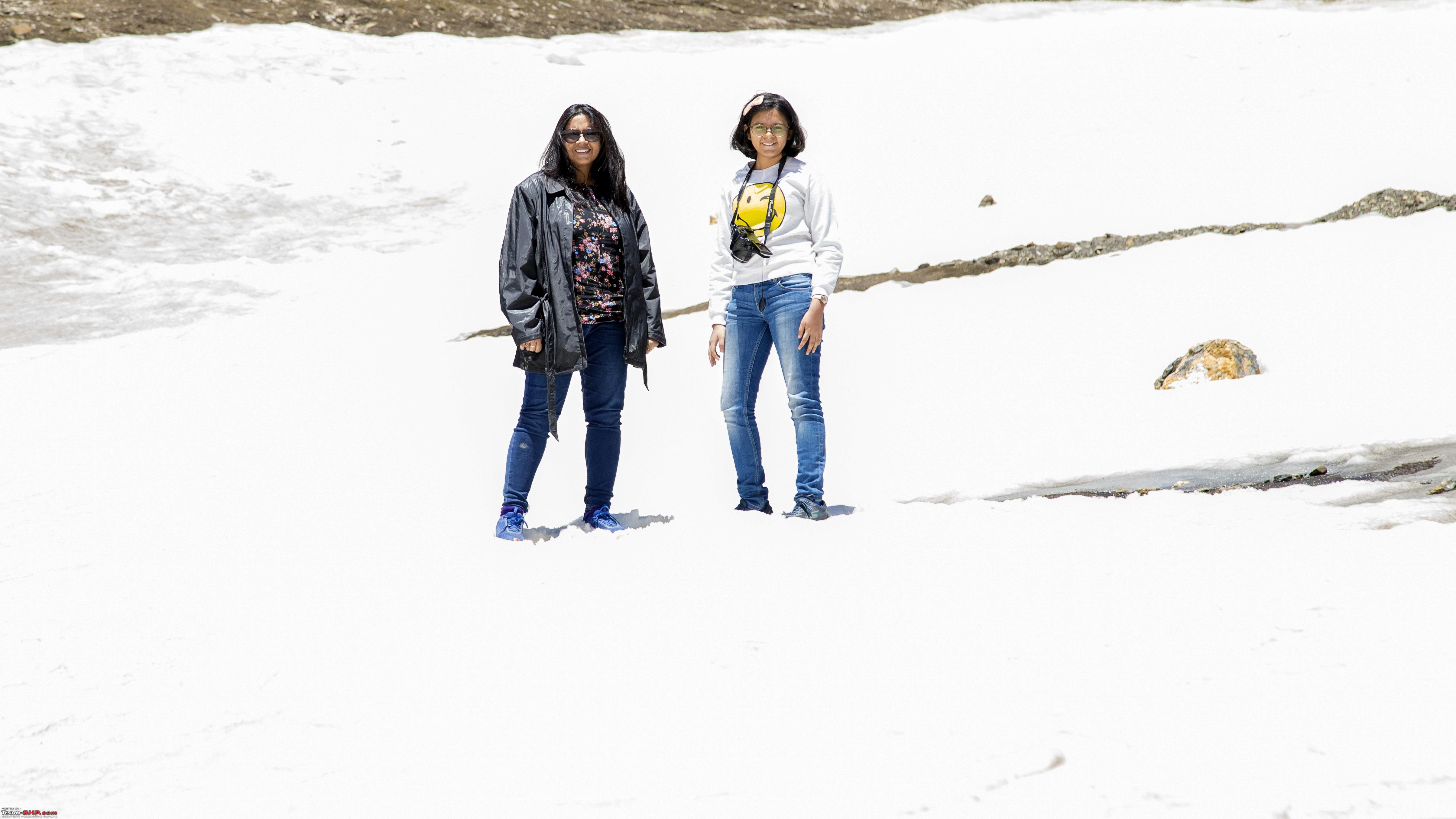 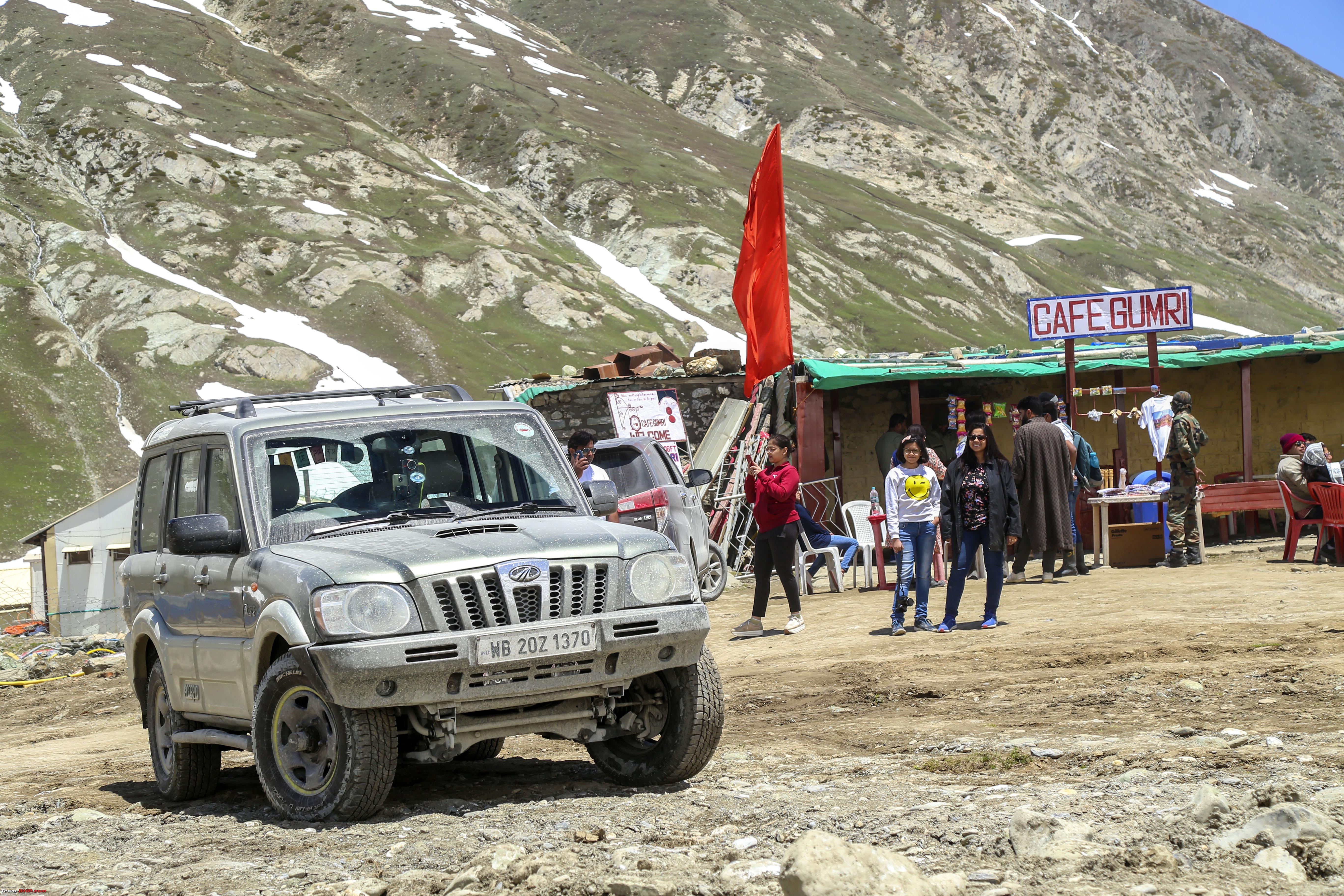 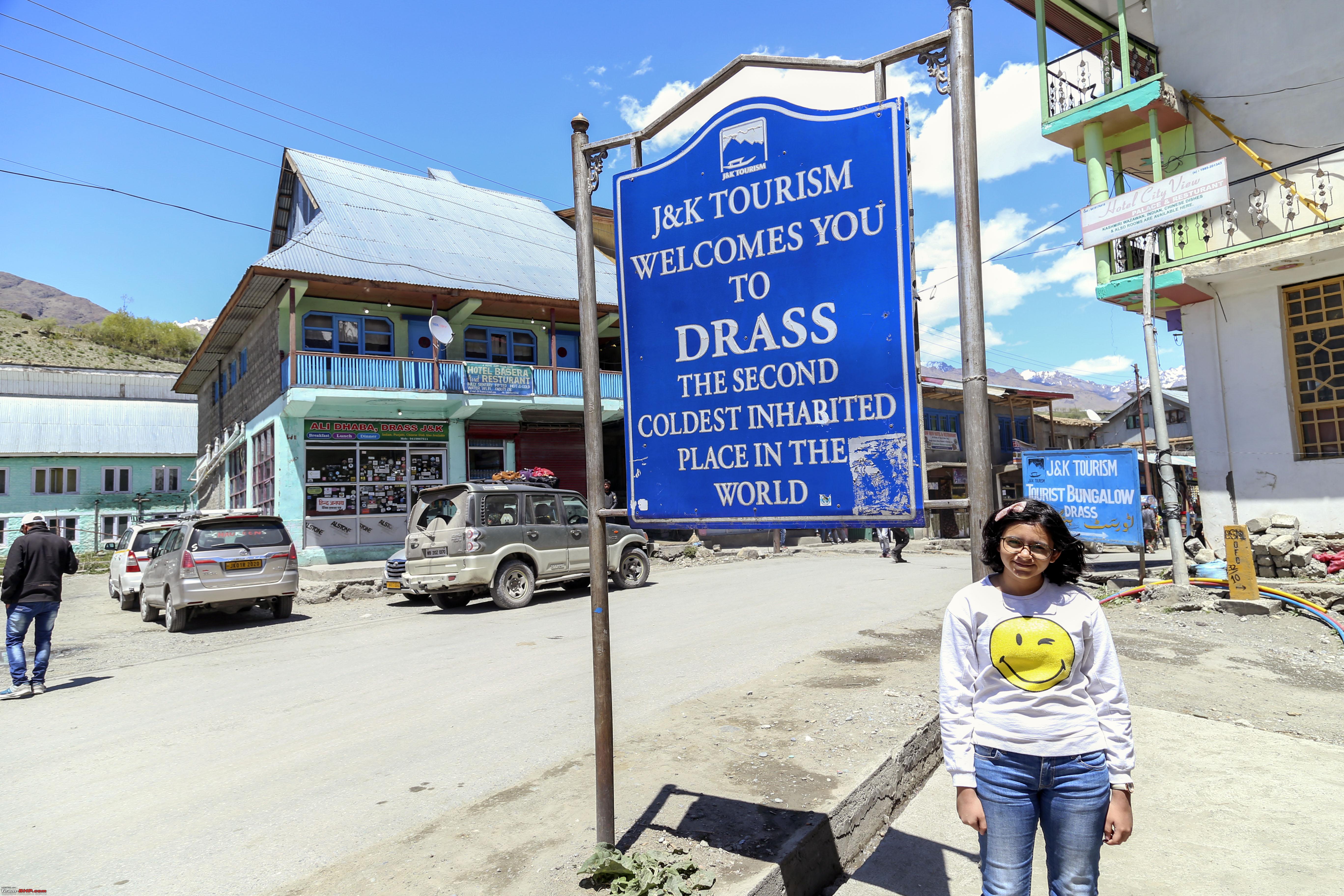 By 2pm we were at Drass, taking in the special bread from the area.  A quick but mandatory stop across the war memorial.   While we were flying past the Kargil Byepass, the clock ticked to 3pm. A brief, 40 minute traffic hold up over a bridge being repaired on the aforementioned byepass (Defeating the purpose of taking it in the first place), by 18:20 we were at Lamayuru after having taken snaps at NamikLa, and FotuLa! 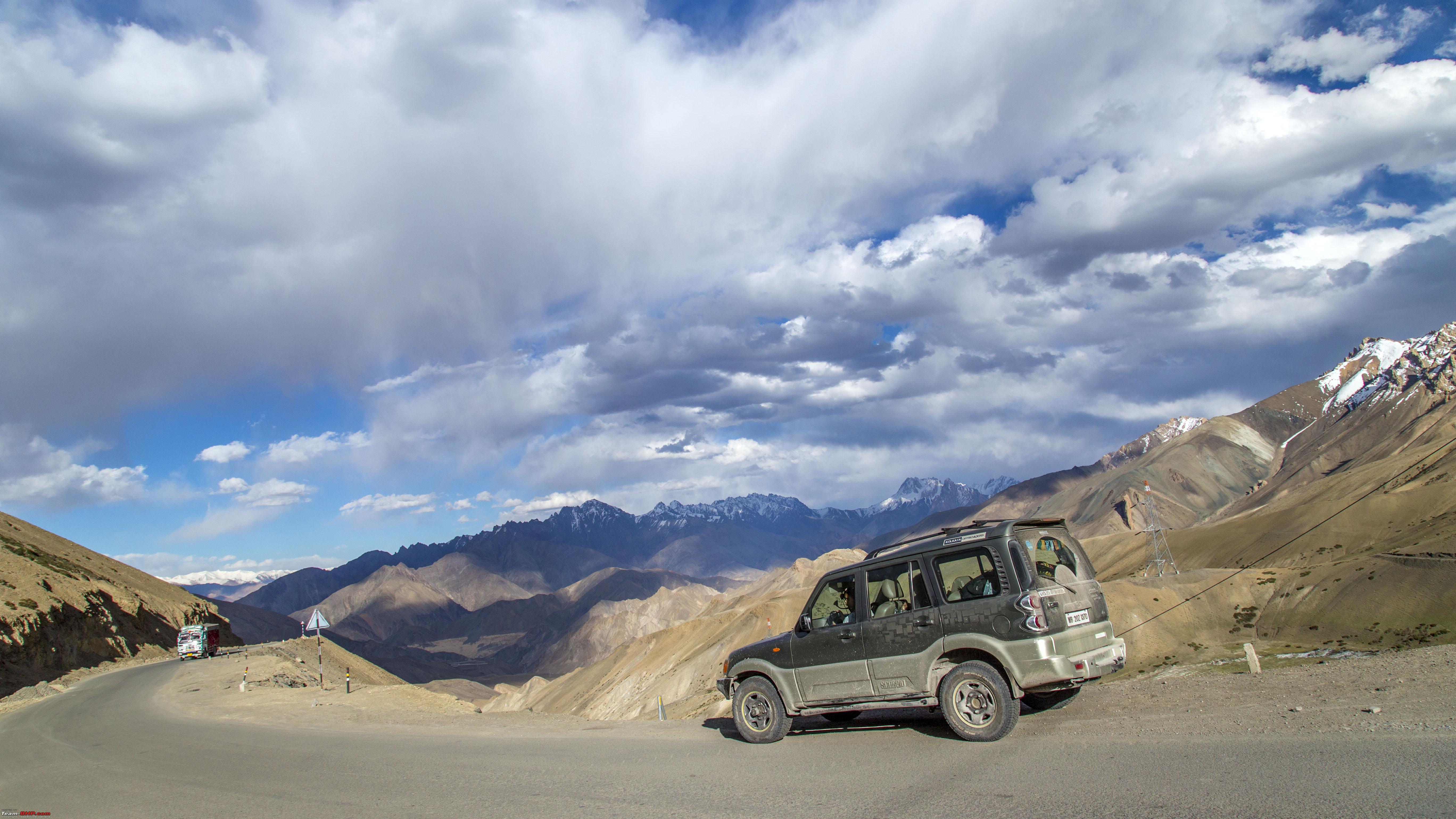 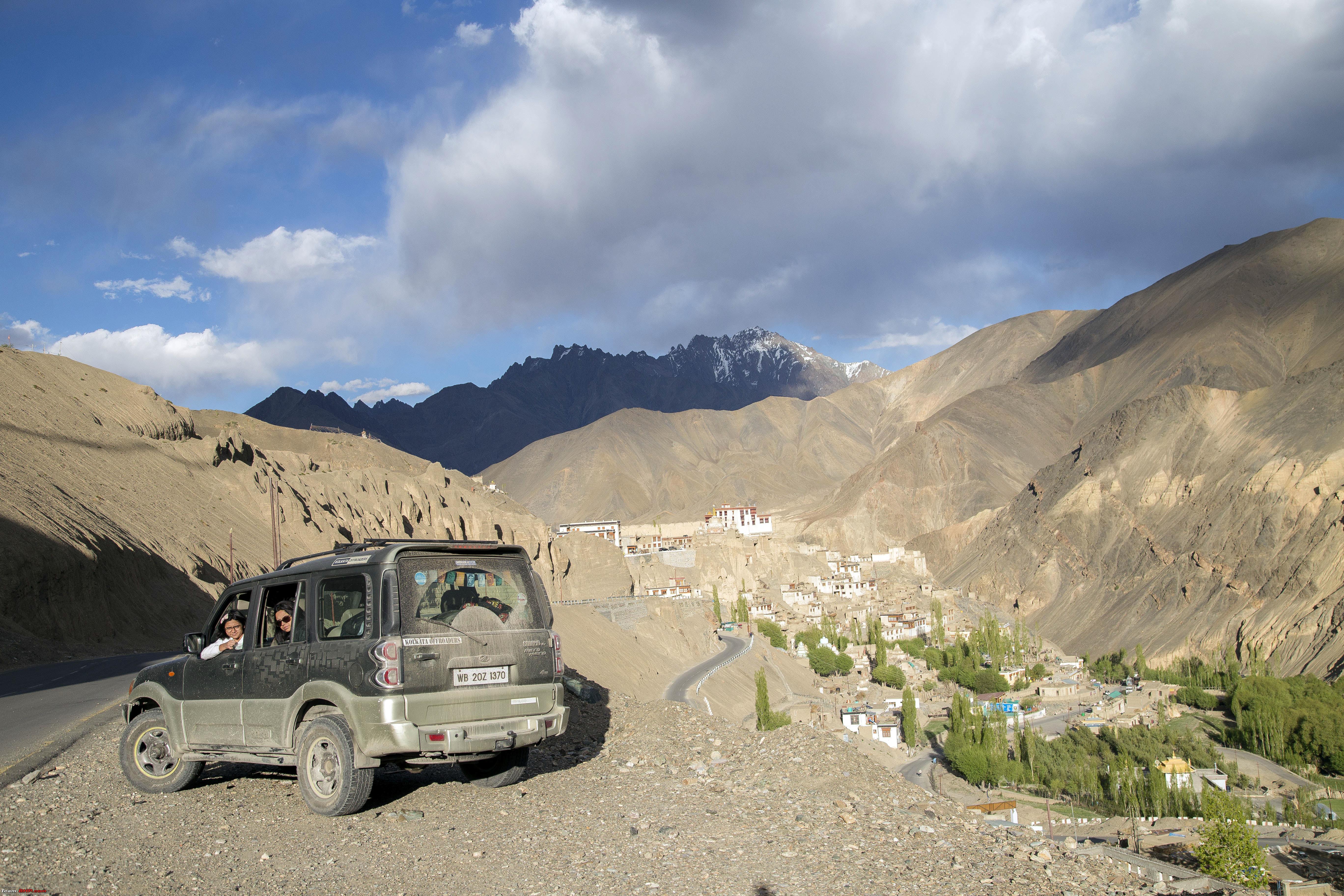 CNTD... Last edited by 1100D : 11th July 2019 at 21:45. |

|  (40)
Thanks (40)
Thanks
 |
| The following 40 BHPians Thank 1100D for this useful post: | abhijeetp, aniket17, ARAY, CrAzY dRiVeR, dailydriver, desiaztec, Dr.Vikas, DrANTO, Durango Dude, gmhossain, GTO, GutsyGibbon, haisaikat, haria, i20ian, jailbird_fynix, jaunthead, Leoshashi, maximus., mh09ad5578, mi2n, mp417, neil.jericho, PGA, Ronak_7, Rudra Sen, Samba, Samfromindia, Sayata, Sheel, siddarthab, ssambyal1980, streetfighter, suhaas307, Surprise, Thermodynamics, The_Outsider!, vaasu, Varun_HexaGuy, wanderernomad |
| |
|
11th July 2019, 21:43
| #2 |
| Senior - BHPian | Re: Ladakh Re-Juleh'd! With Siachen-Panamic-Agham-Chusul-MitpalTso-KaksangLa-TsoKar-KyunTso! The Fifth Day CNTD 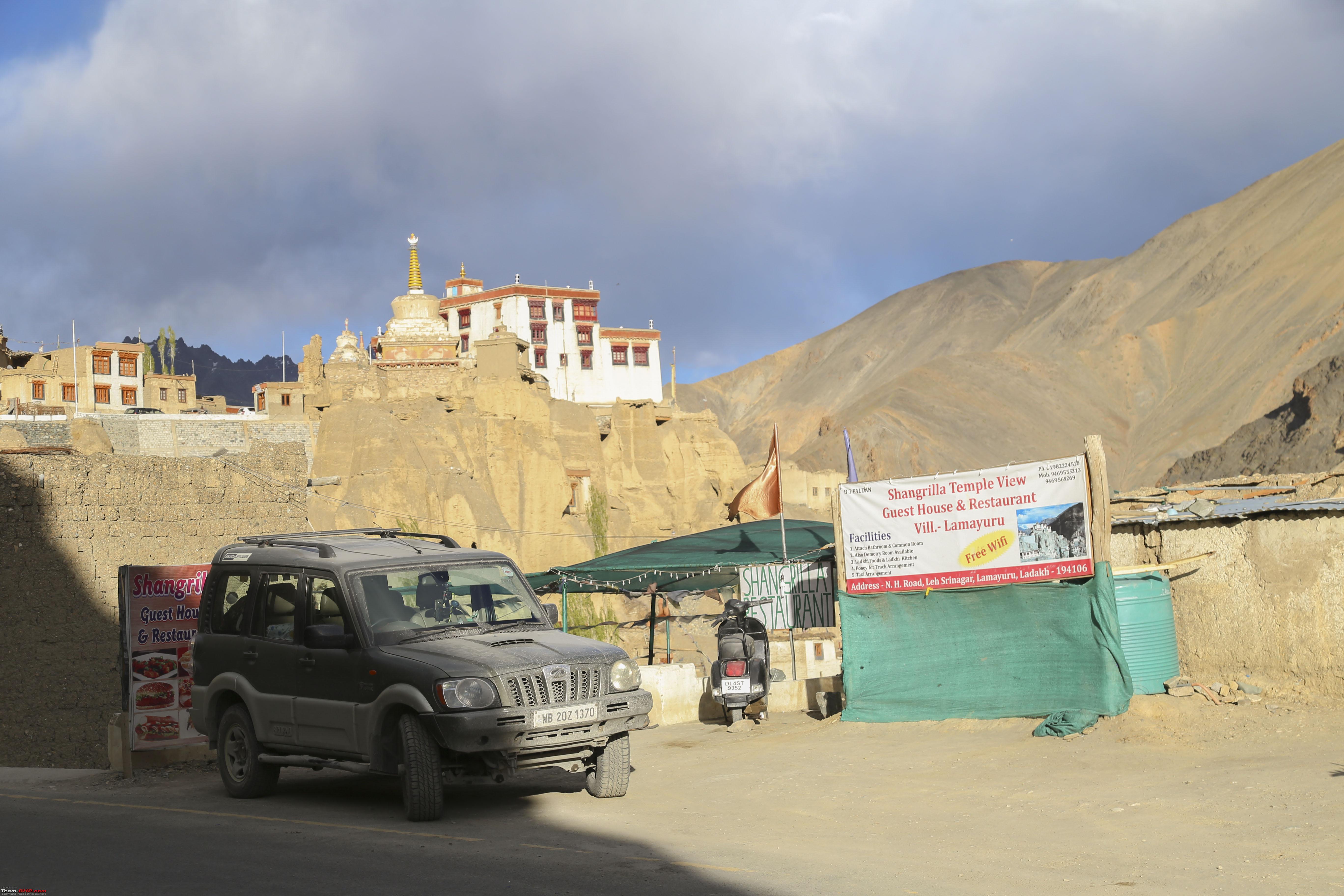 Quick Tea time at Lamayuru (no point rushing to Leh, without letting the place and situation sink in adequately) 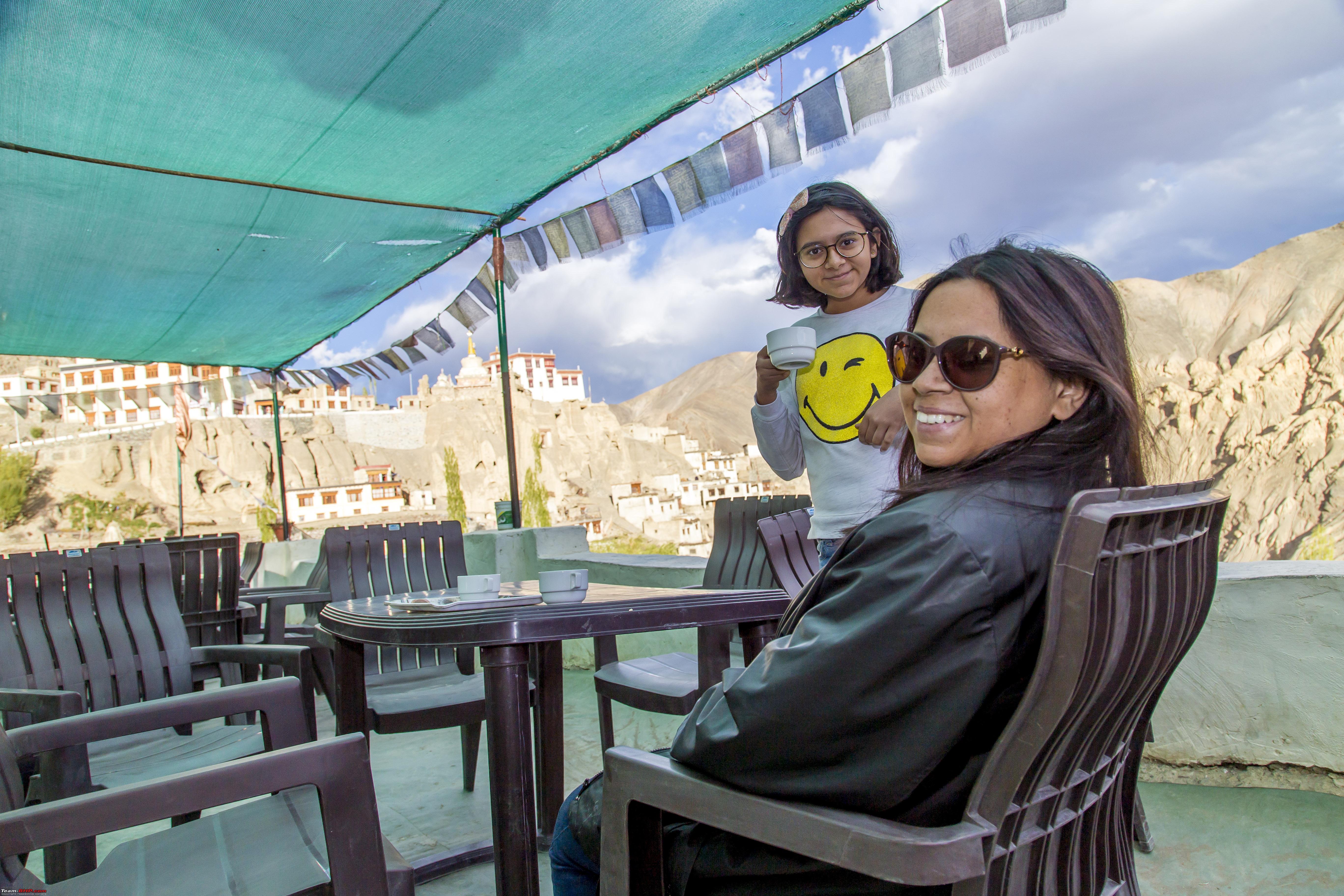 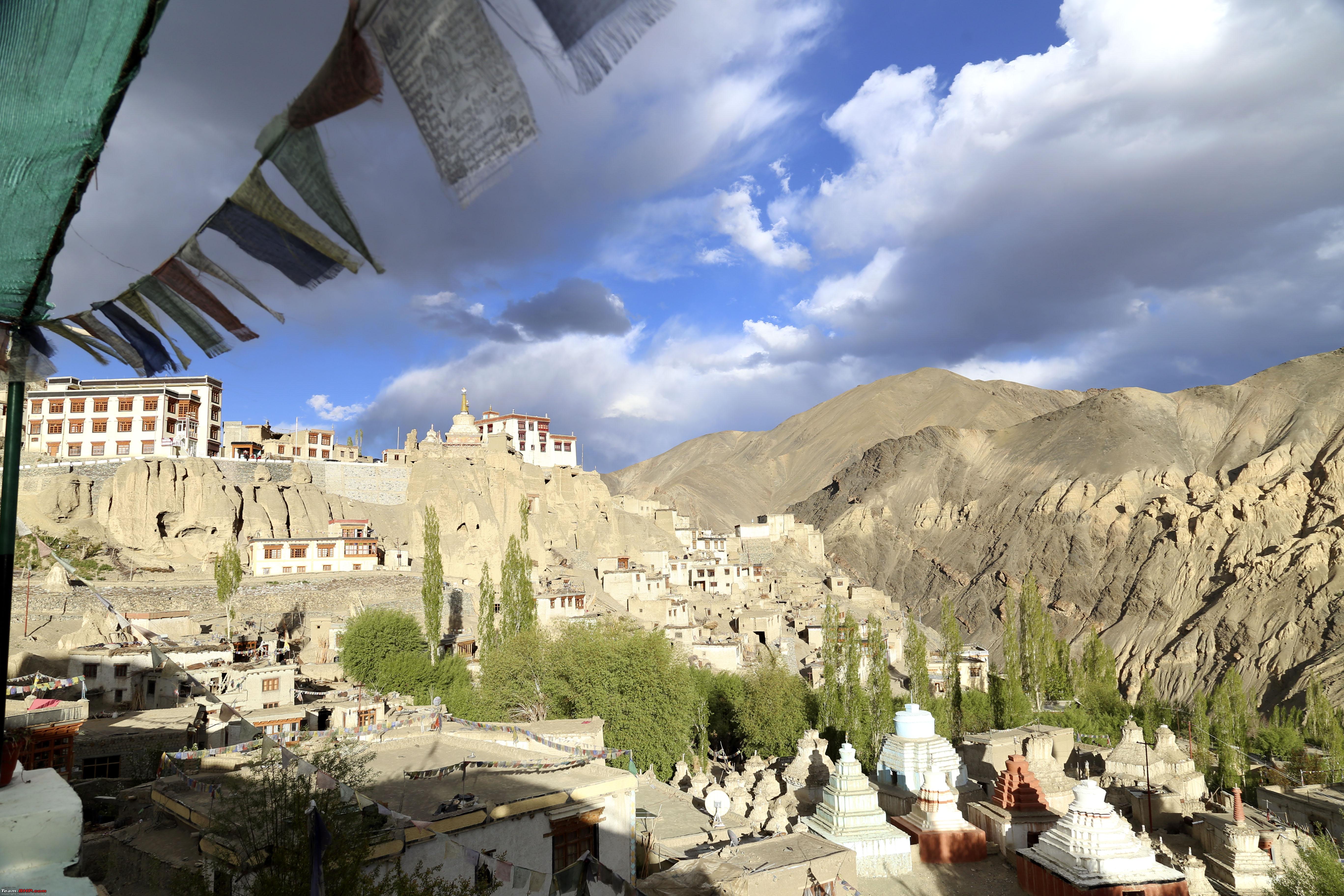 Soon we were at Magnetic hill, while the last rays of the day of over-deliverance just smiled us good-bye. Smiled looking at it and all I could say was "Thanks" 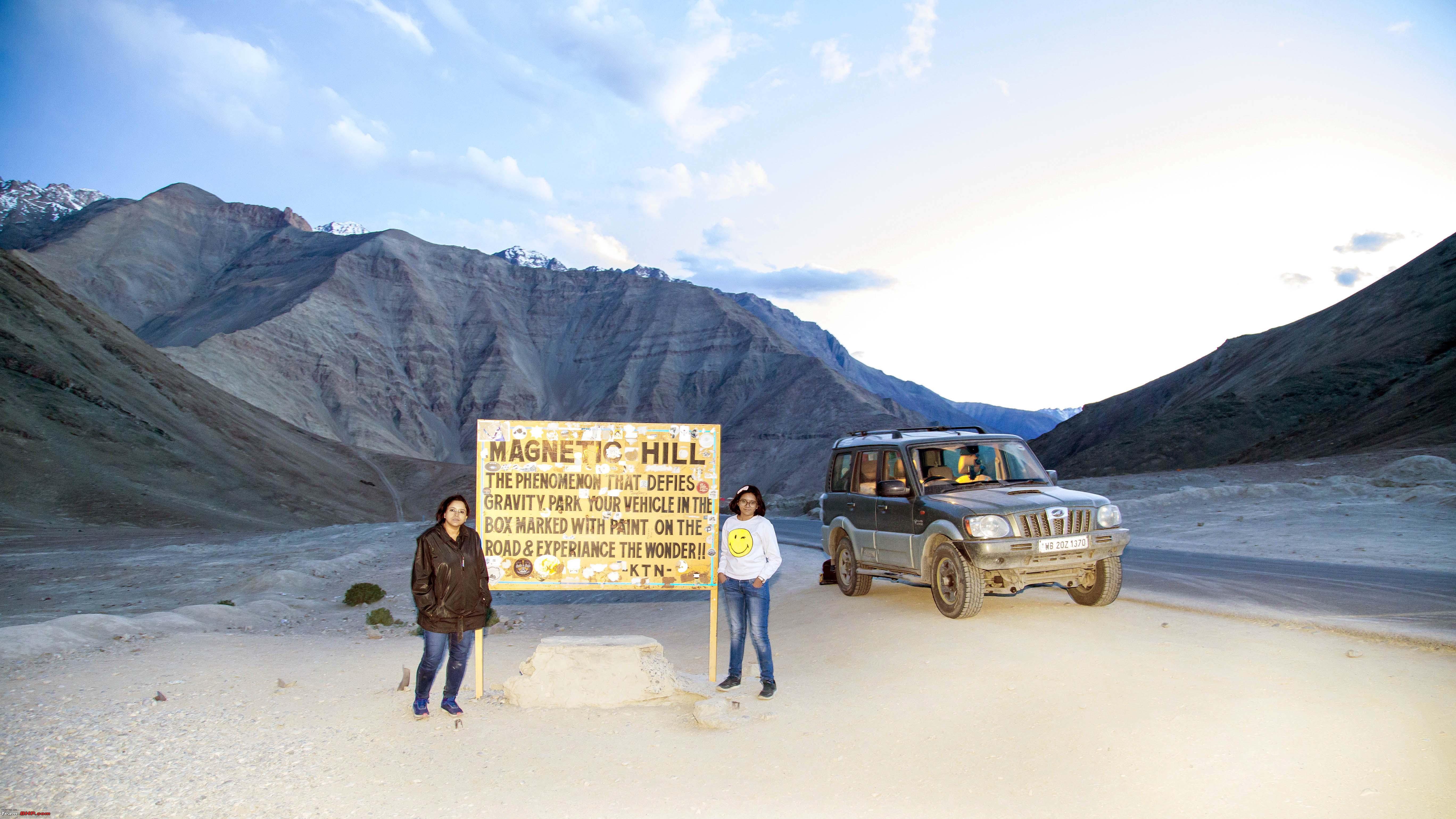 Leh here we come! The sixth day! Although we were scheduled to wake up early at Sonmarg, we actually had a leisurely wake up, all the way up at Leh instead!! What fate! So this will be a day to take easy, acclimatise, go around the Shanti Stupa, a few monasteries, a little walk to the Tibetian Kitchen. Generally taking it easy. Right? Wrong! Right at the start of the day, we decided to drive to the Shanti Stupa, less than 2 kms away. In an effort to give way to an oncoming Tempo Traveller, move to the extreme left of the road and soon after, an irritating but familiar roar followed, that of a tyre having given away. The rear left tyre! The culprit was this piece of steel road projecting from the road side, impossible to spot from the driver's seat. 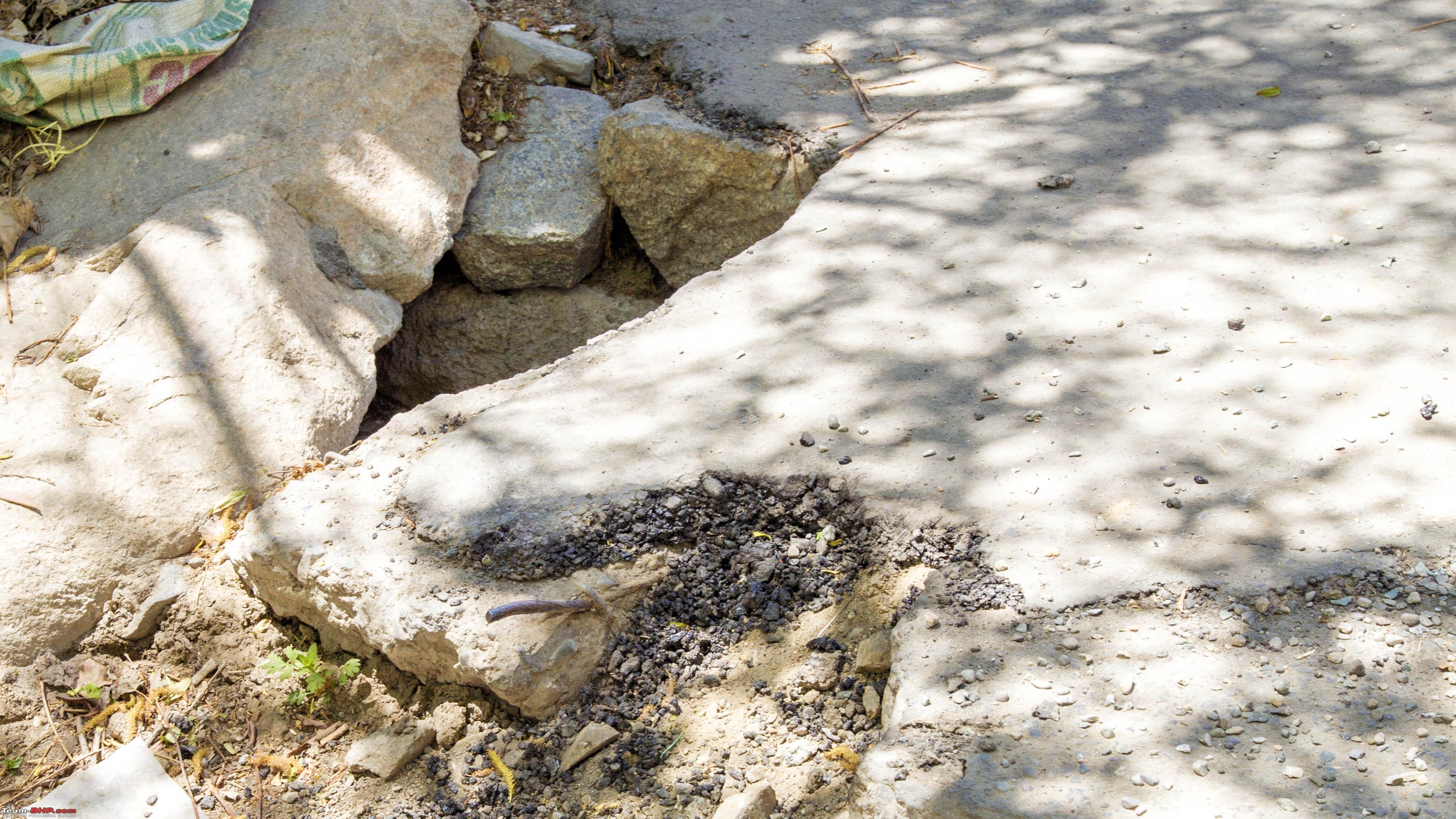 The act of acclimatisation rather became an exercise of changing a SUV tyre (Scorpio size) over 10k feet, that too after barely having arrived a few hours earlier. Not only that, the tyre that had been “done” was actually from a new set of Michelin LTX Force tyres procured 5 months back. The result  Went upto the Shanti Stupa after changing onto the spare   Leh shot from the Shanti Stupa 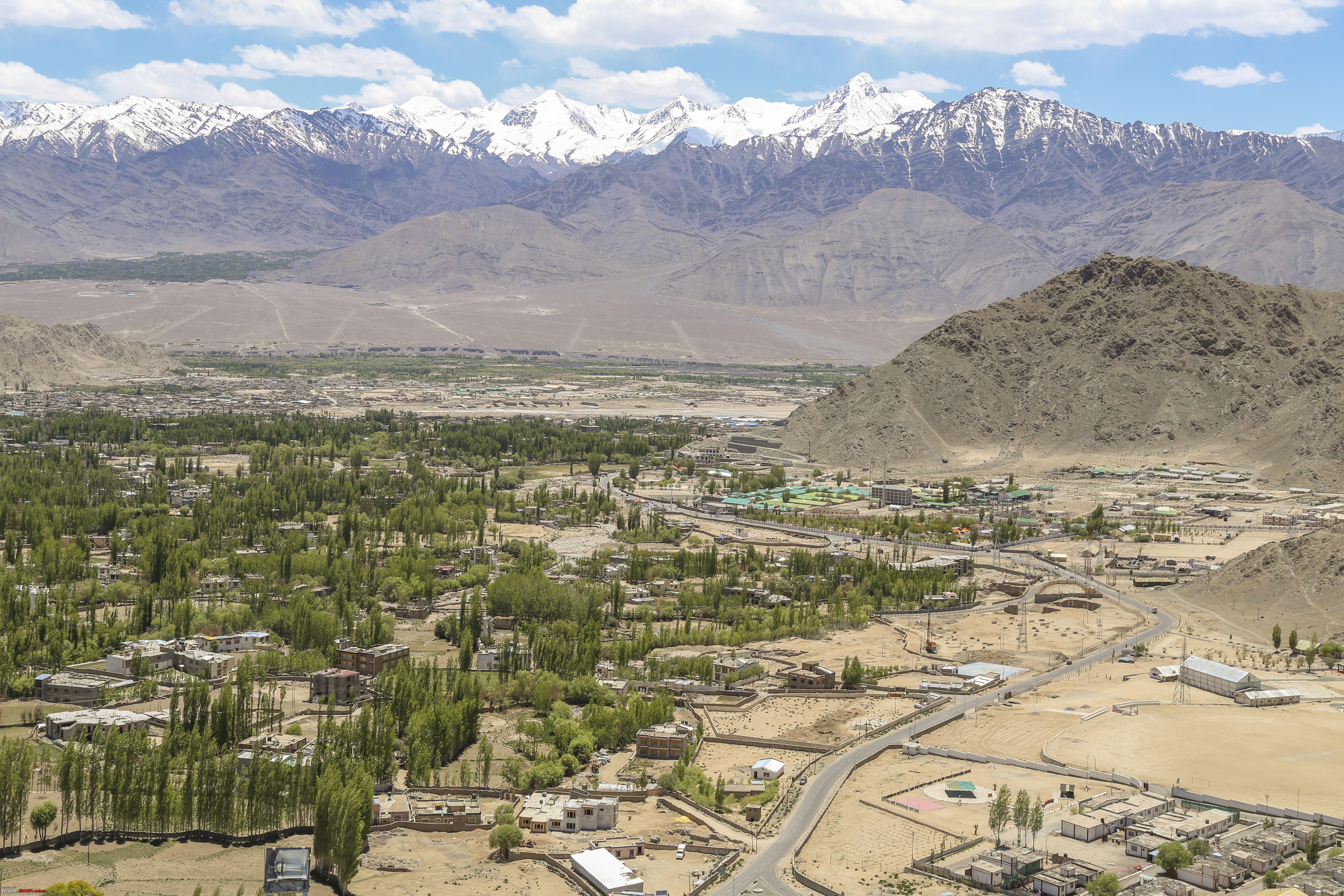 Shanti Stupa shot from Leh! 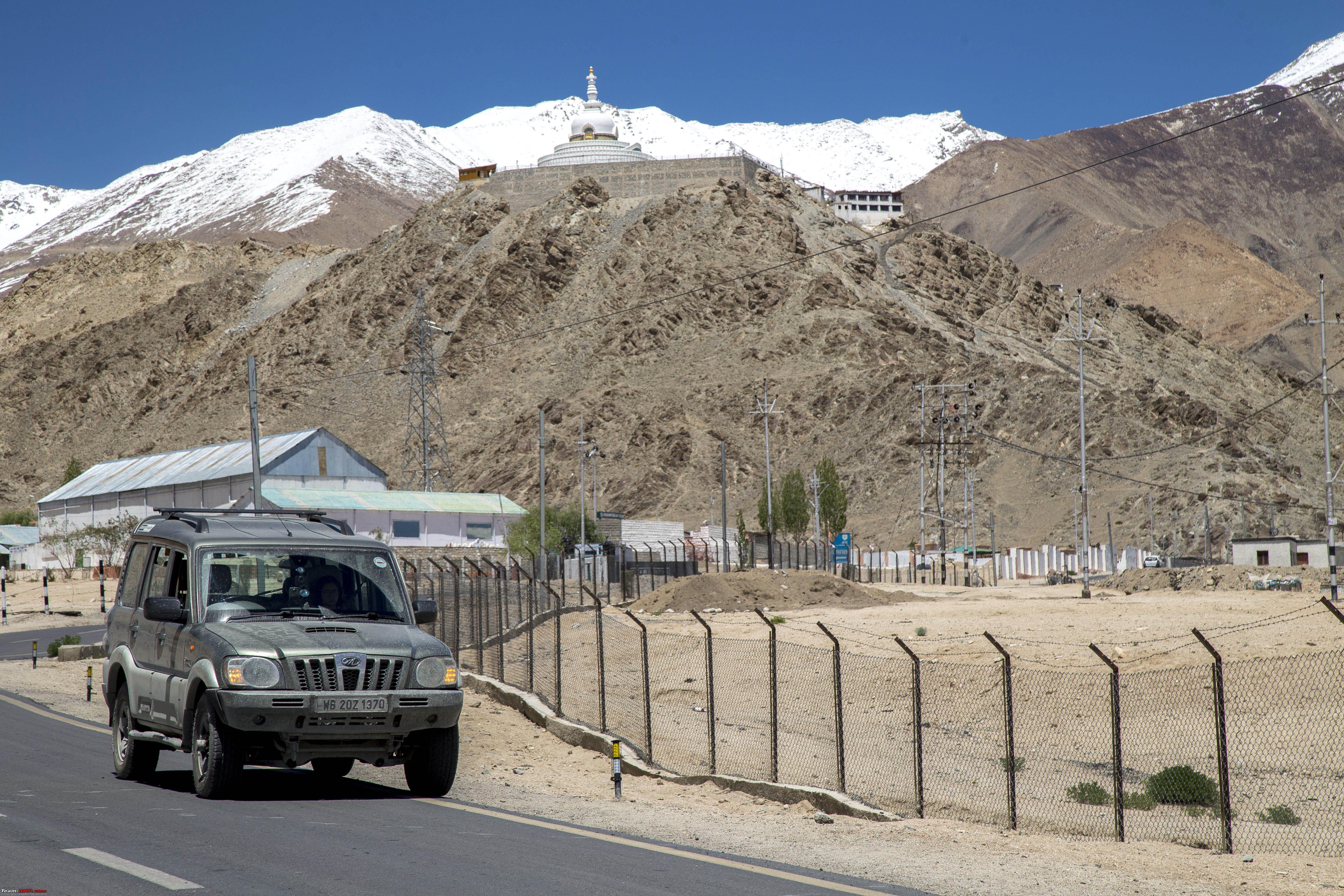 Next couple of hours went in searching for a matching tyre in all the tyre shops in Leh, in vain. So had to settle for this! 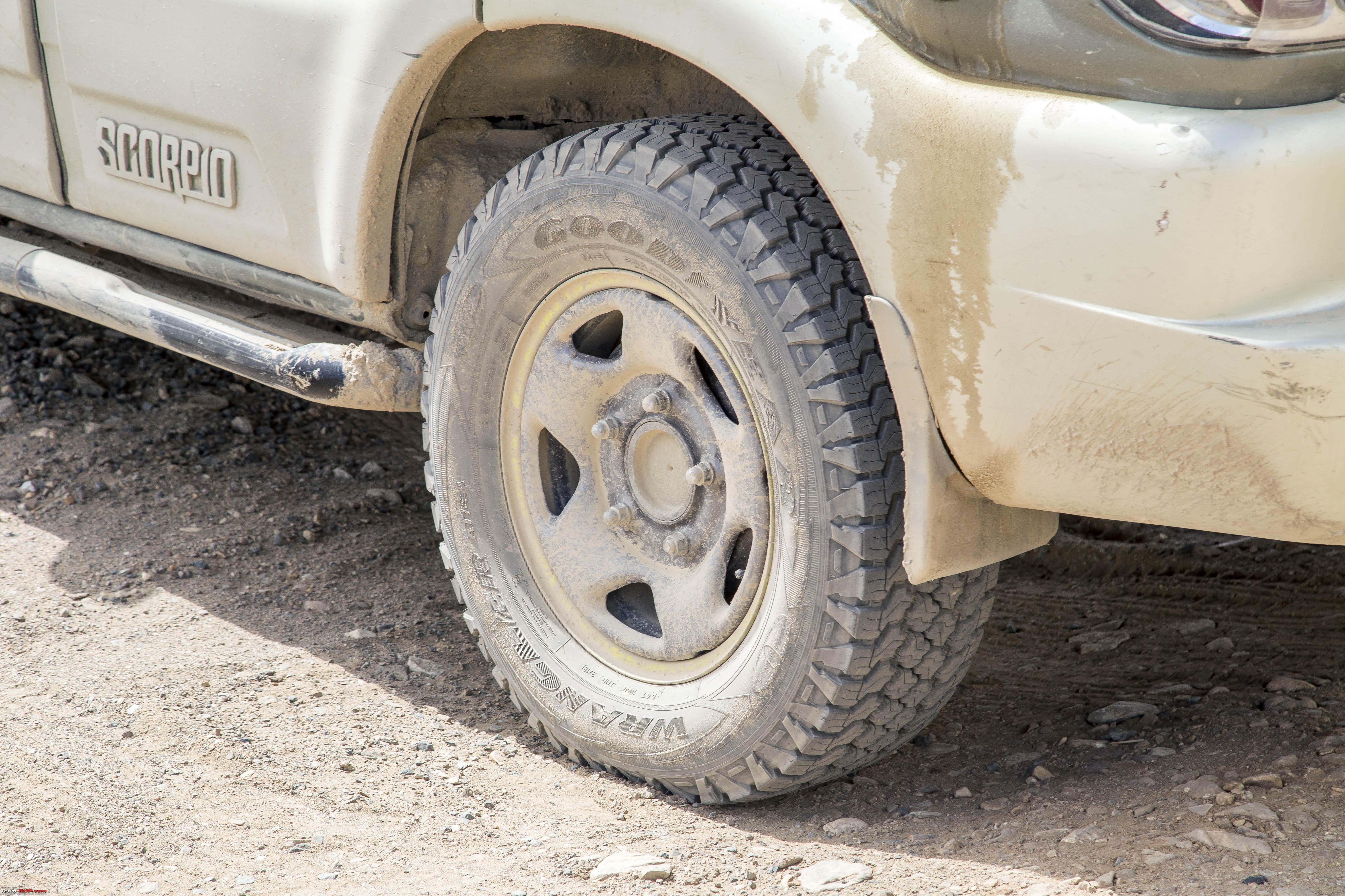 I actually like the way it looks!! Anyways, realised soon after that all of Leh is full of exposed construction rods everywhere, footpaths, roads, roadside walls. Still managed time enough to have a decent time at the Tibetian Kitchen 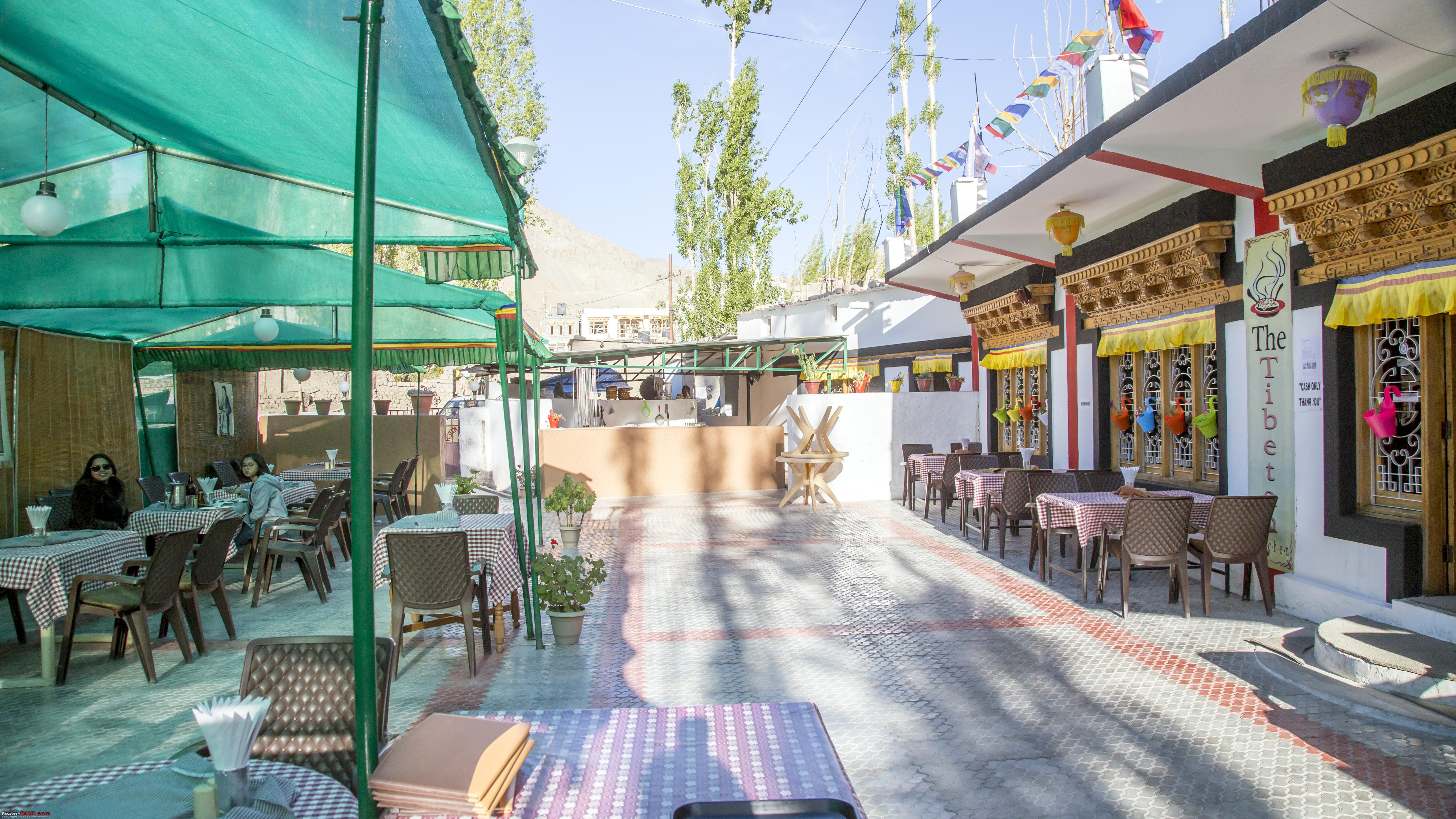 Some mouthwatering Sabagleb!  A little drive around Leh afterwards 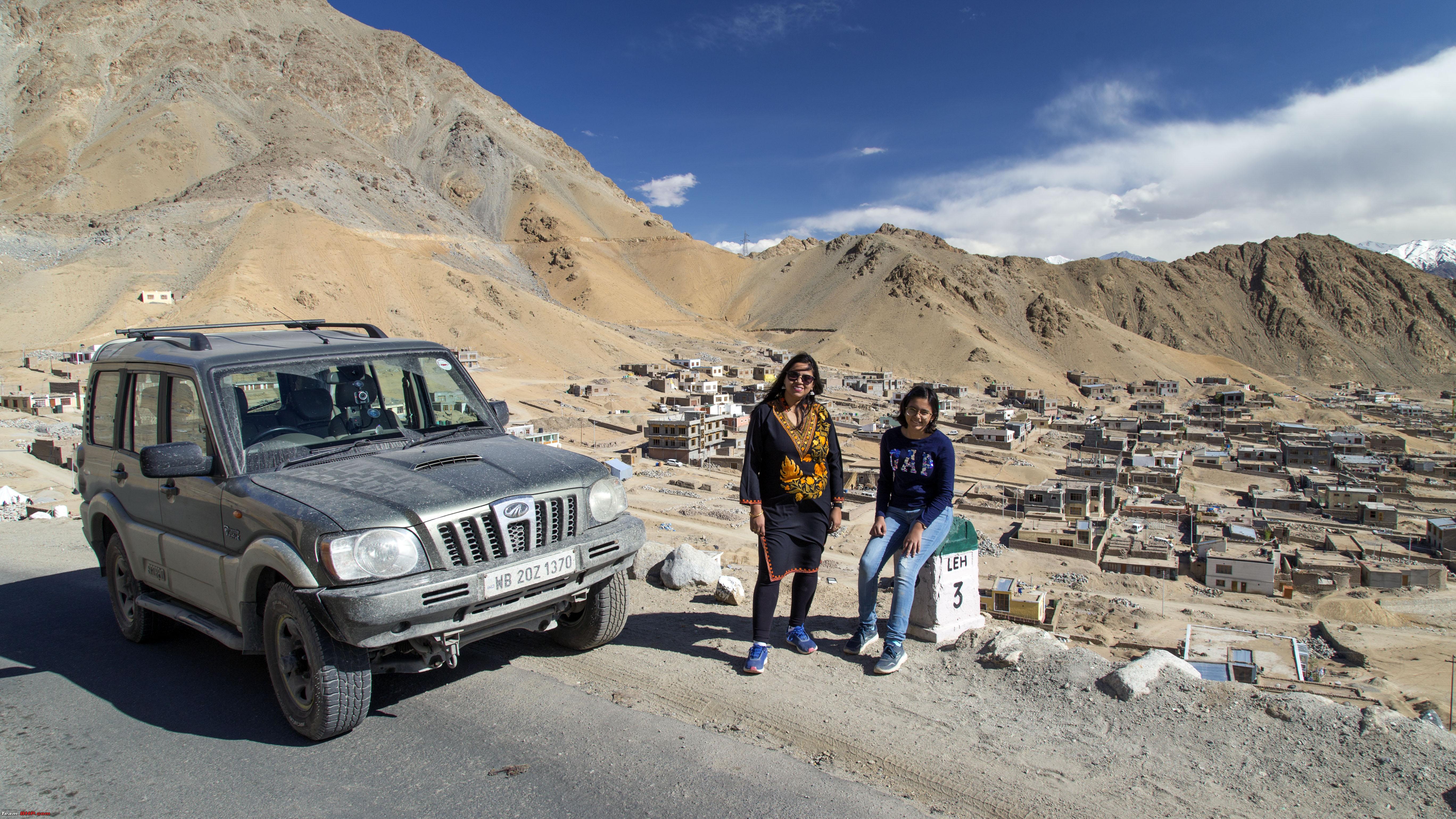  Time to retire back to the hotel for an early start the next day!! Last edited by 1100D : 12th July 2019 at 01:43. |
|
| (37)
Thanks
|
| The following 37 BHPians Thank 1100D for this useful post: | abhijeetp, alokn87, aniket17, ARAY, CrAzY dRiVeR, dailydriver, Dhar's, Dr.Vikas, DrANTO, Durango Dude, gmhossain, GTO, haisaikat, i20ian, jailbird_fynix, jaunthead, Leoshashi, maximus., mh09ad5578, mi2n, neil.jericho, Red Liner, Ronak_7, Rudra Sen, Samba, Samfromindia, Sayata, Sheel, siddarthab, ssambyal1980, streetfighter, Surprise, Thermodynamics, Turbanator, vaasu, Varun_HexaGuy, Wanderers |
|
11th July 2019, 22:08
| #3 |
| Senior - BHPian | Re: Ladakh Re-Juleh'd! With Siachen-Panamic-Agham-Chusul-MitpalTso-KaksangLa-TsoKar-KyunTso! The Seventh Day - Our idea for the day was to drive across KhardungLa and reach anywhere across to the Nubra Valley (Wasn't pre-decided) We had an early start as usual and before we knew it, we were moving up the slopes of this mighty "La" 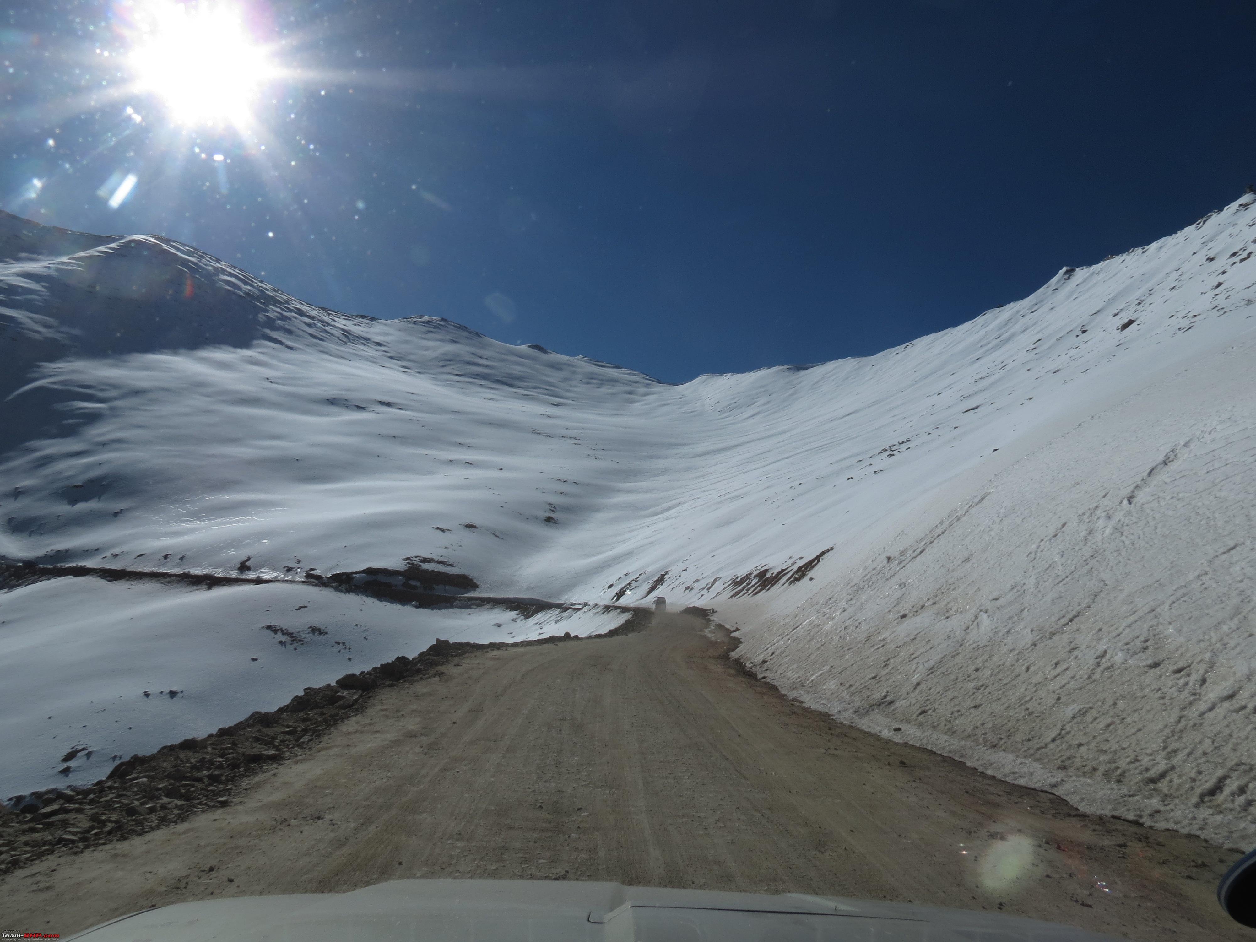  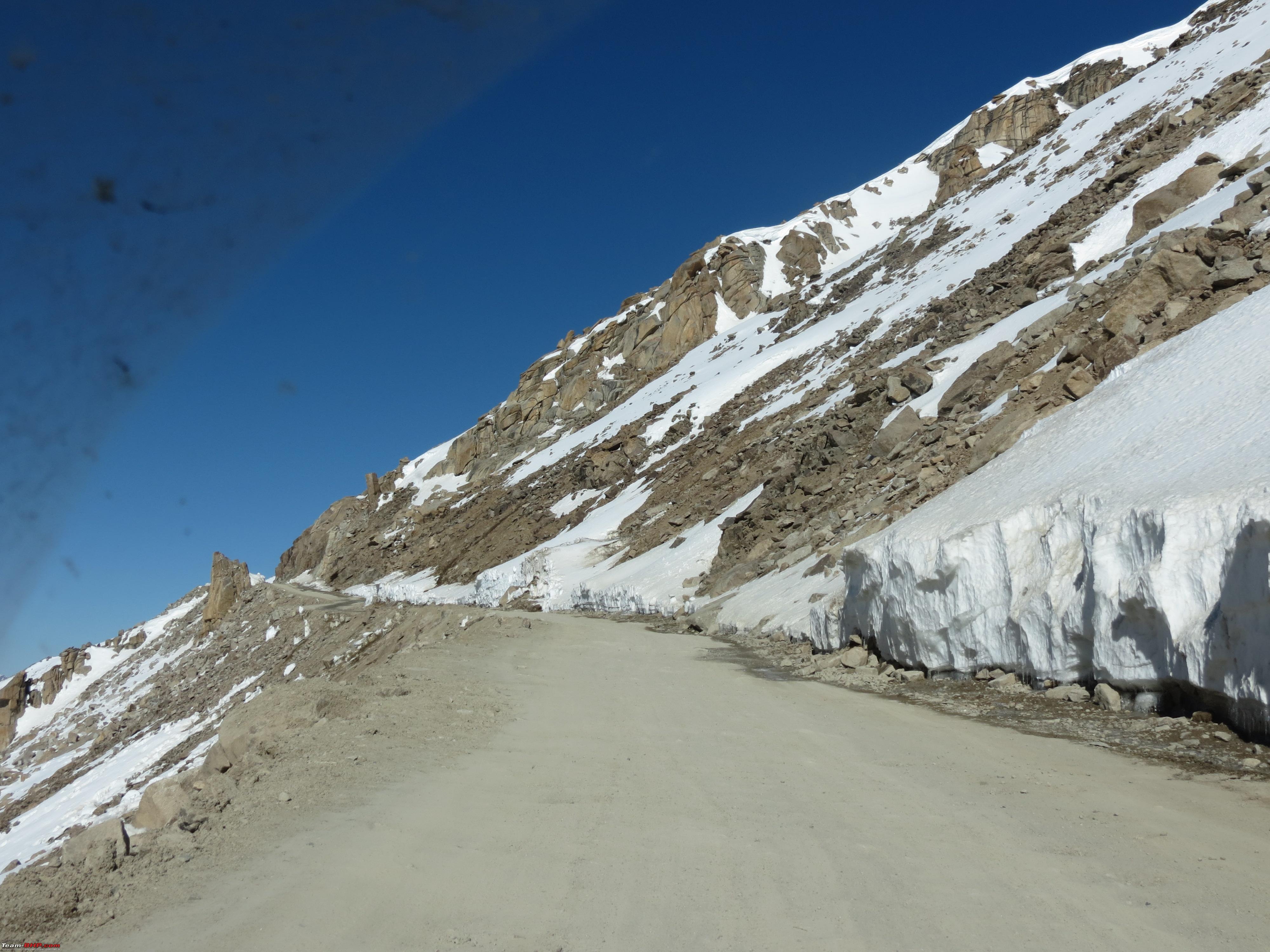 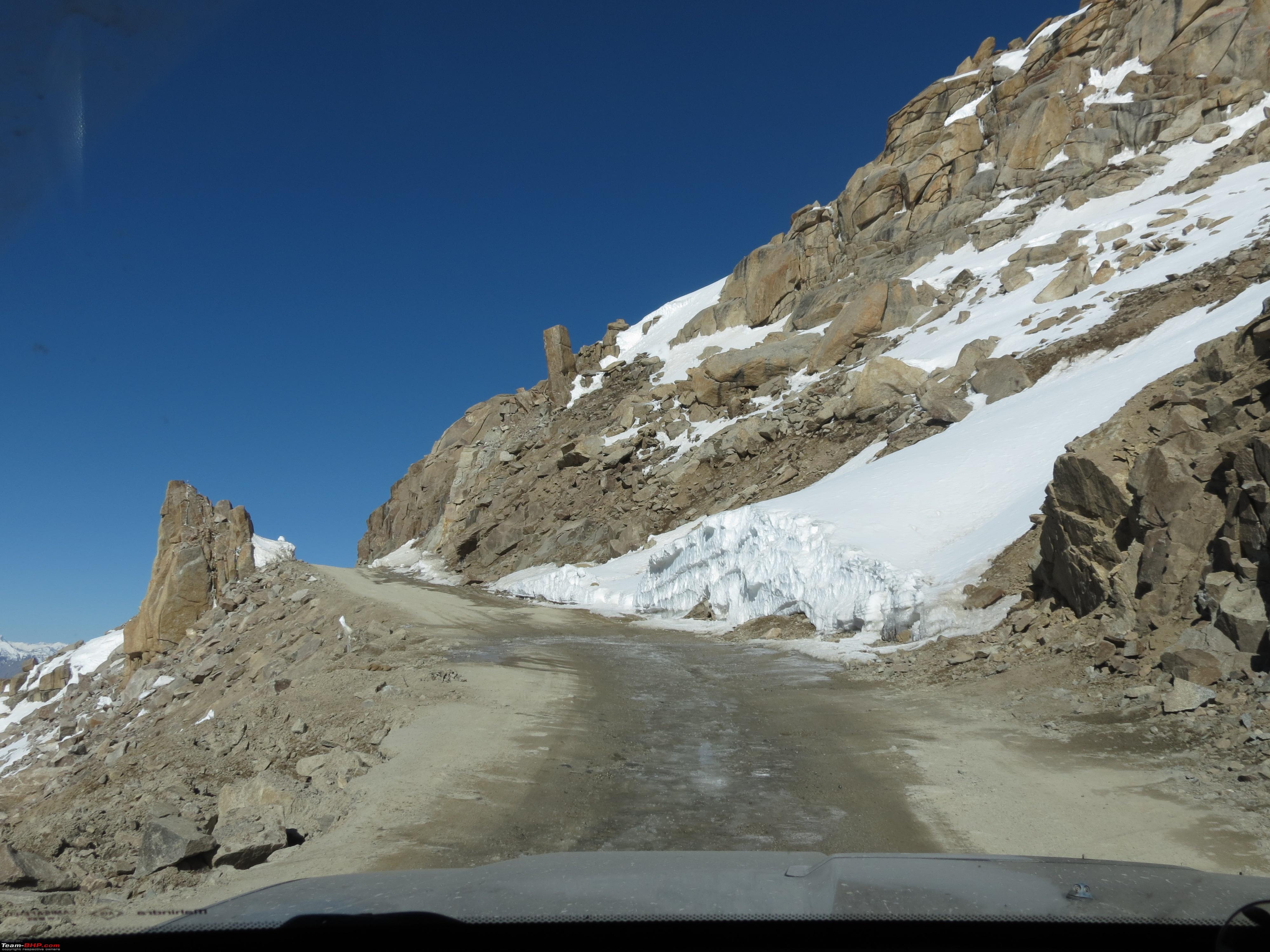 Some mandatory posing against the "Literature" on top of KhardungLa 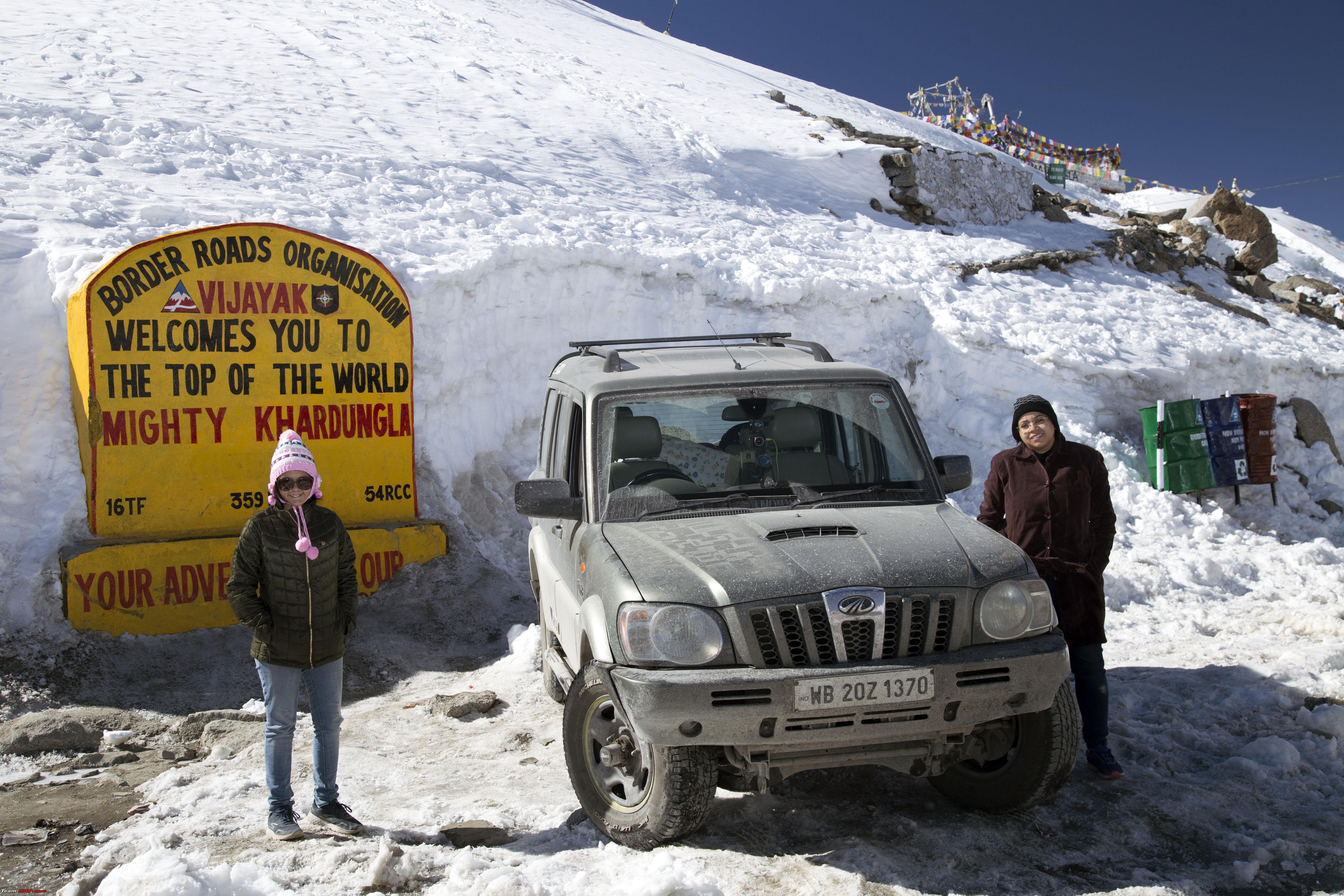  Some more customary stuff with the Ice Swords 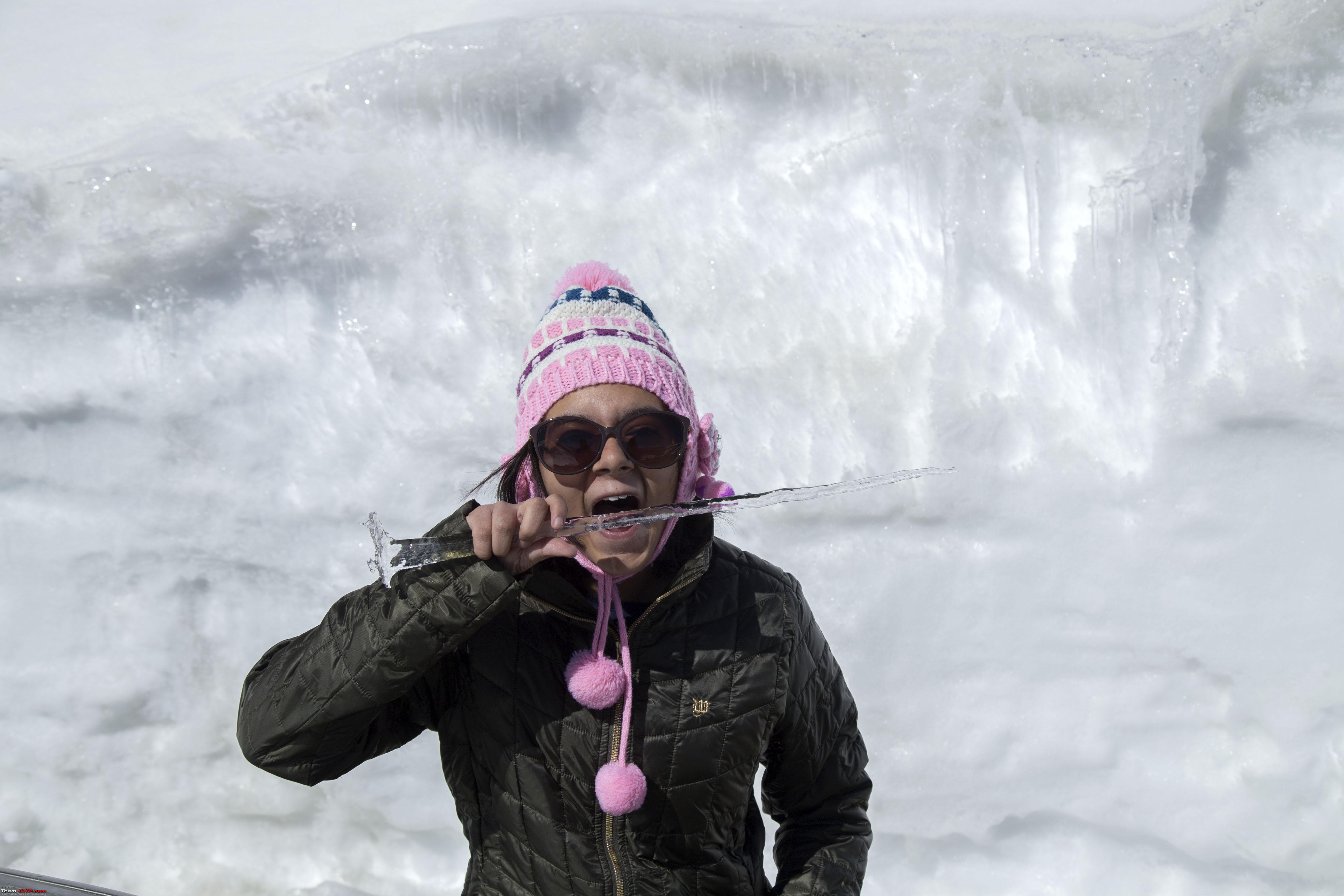 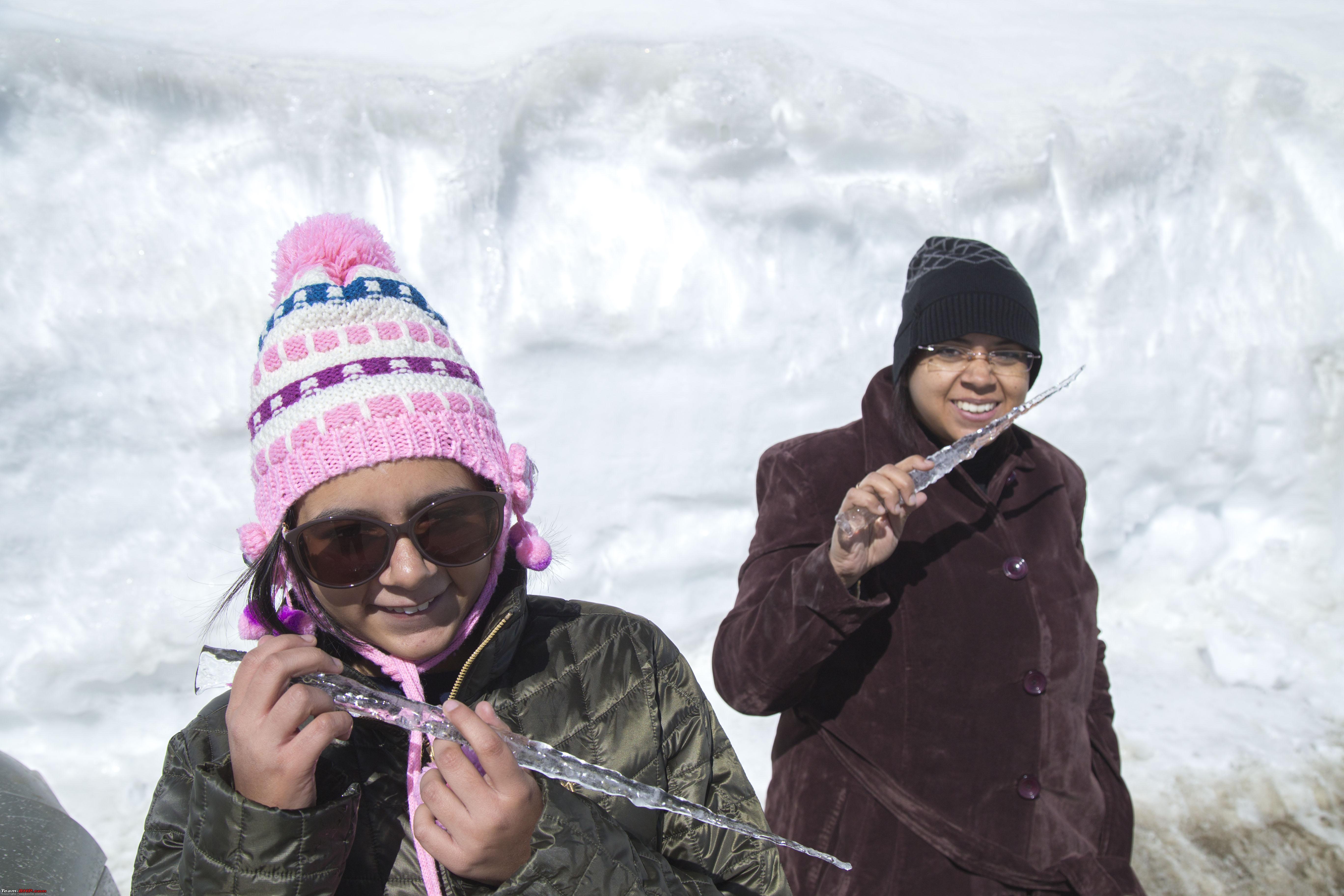  Icicles everywhere!! 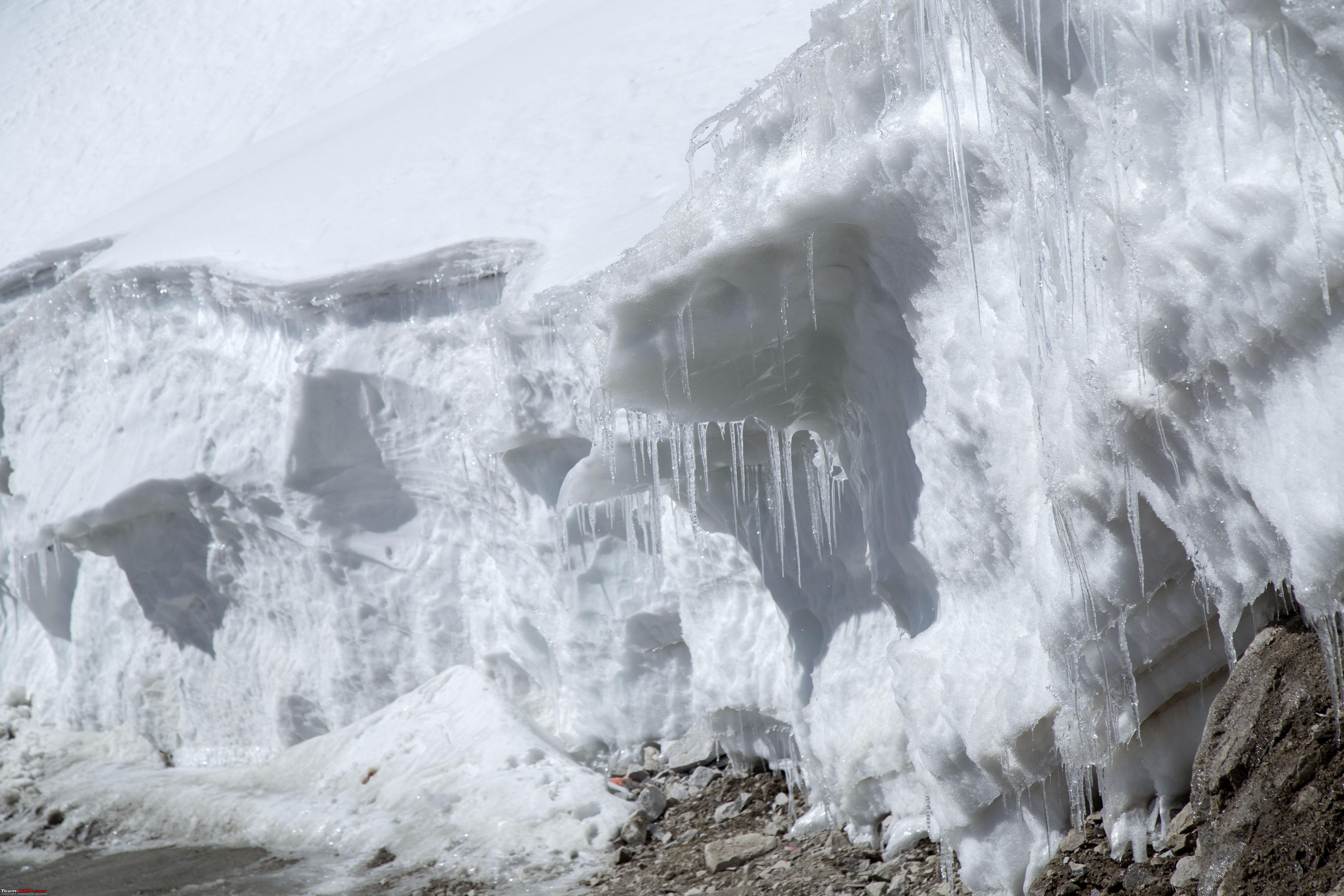 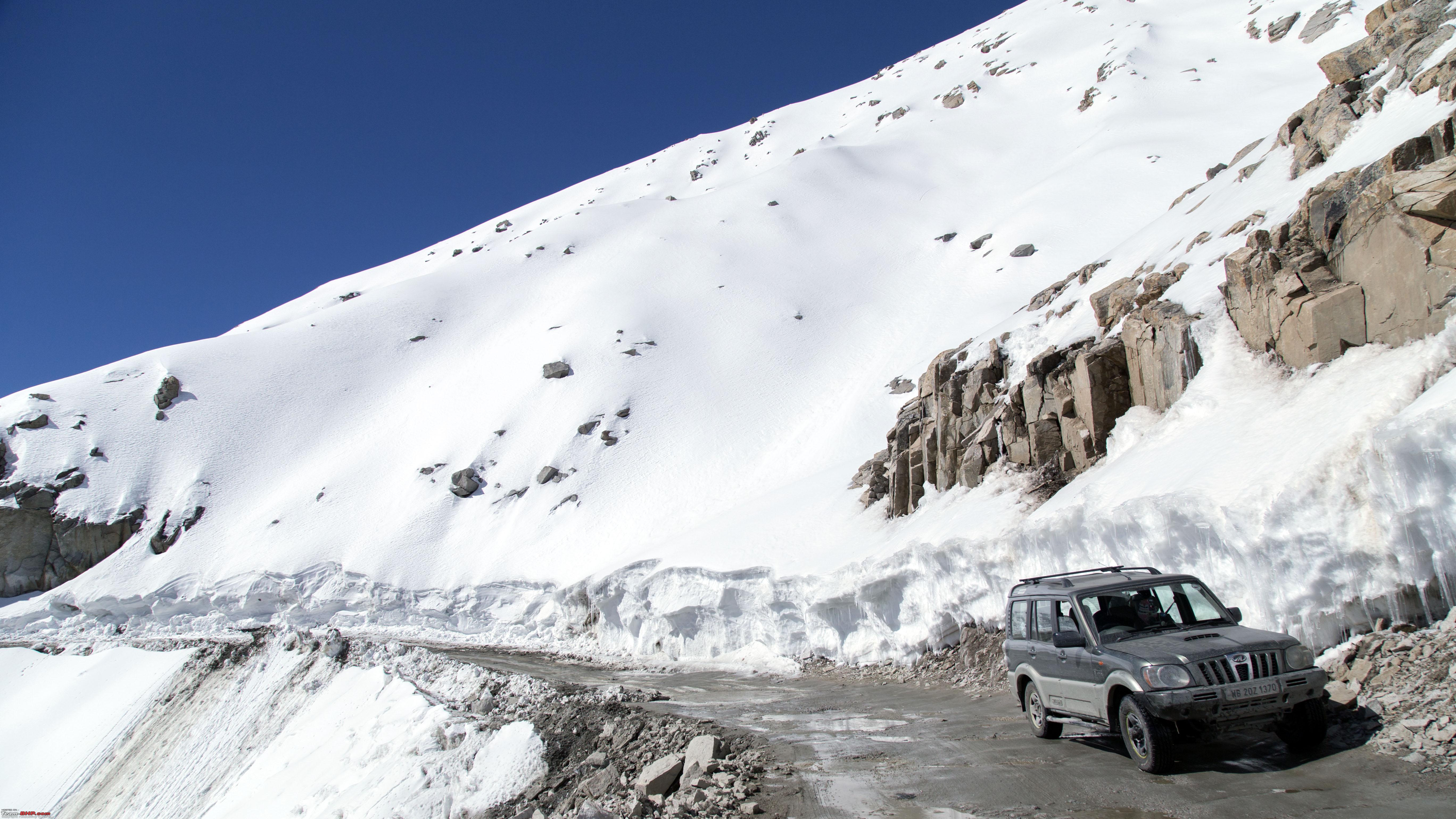 It was so chilly that one pillar started going down Marengo! (Marengo is what we named our 2010 Mahindra Scorpio 4wd and henceforth referred to by this name!) 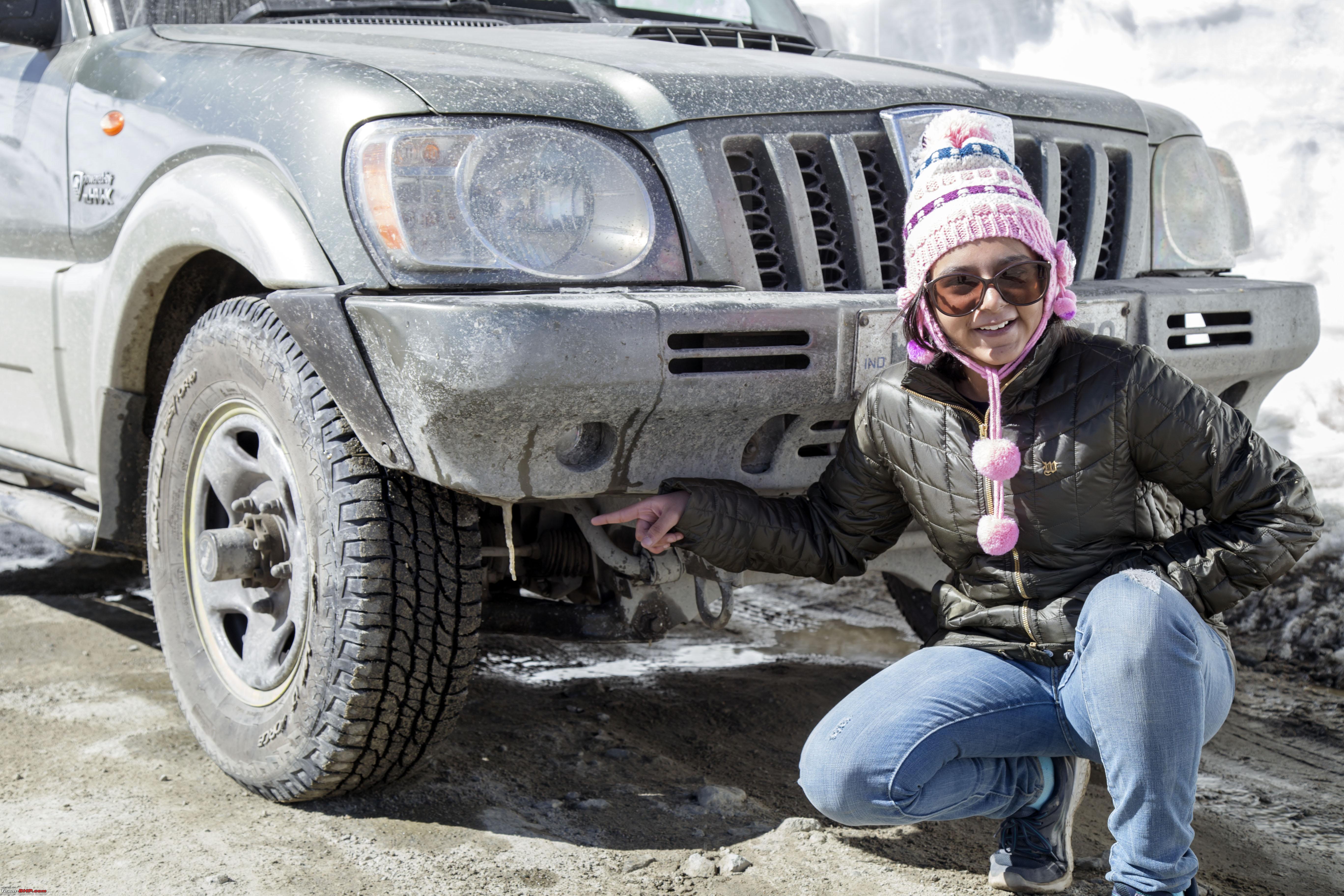 Finishing off her quota with the snow this year 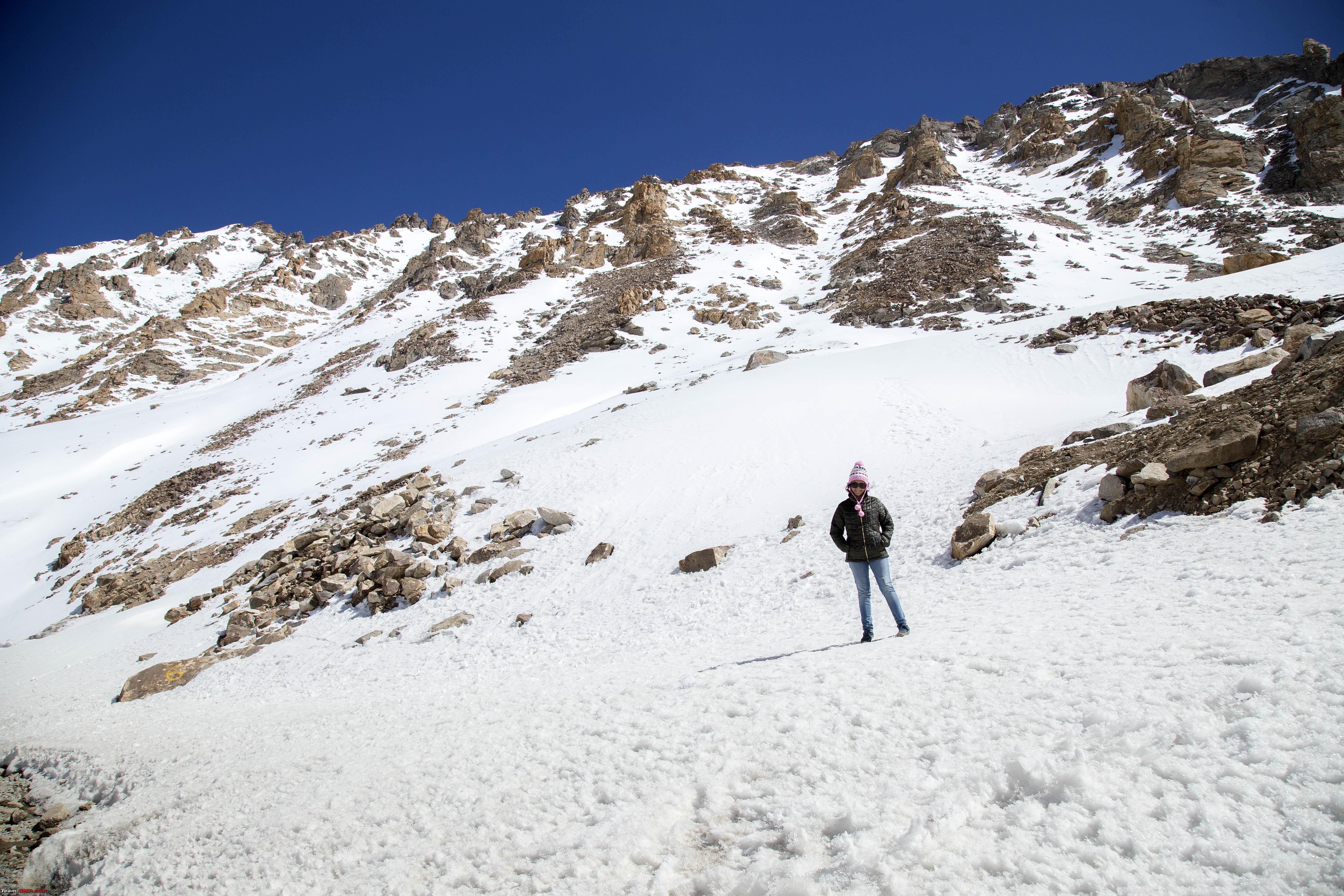 Some careful stepping  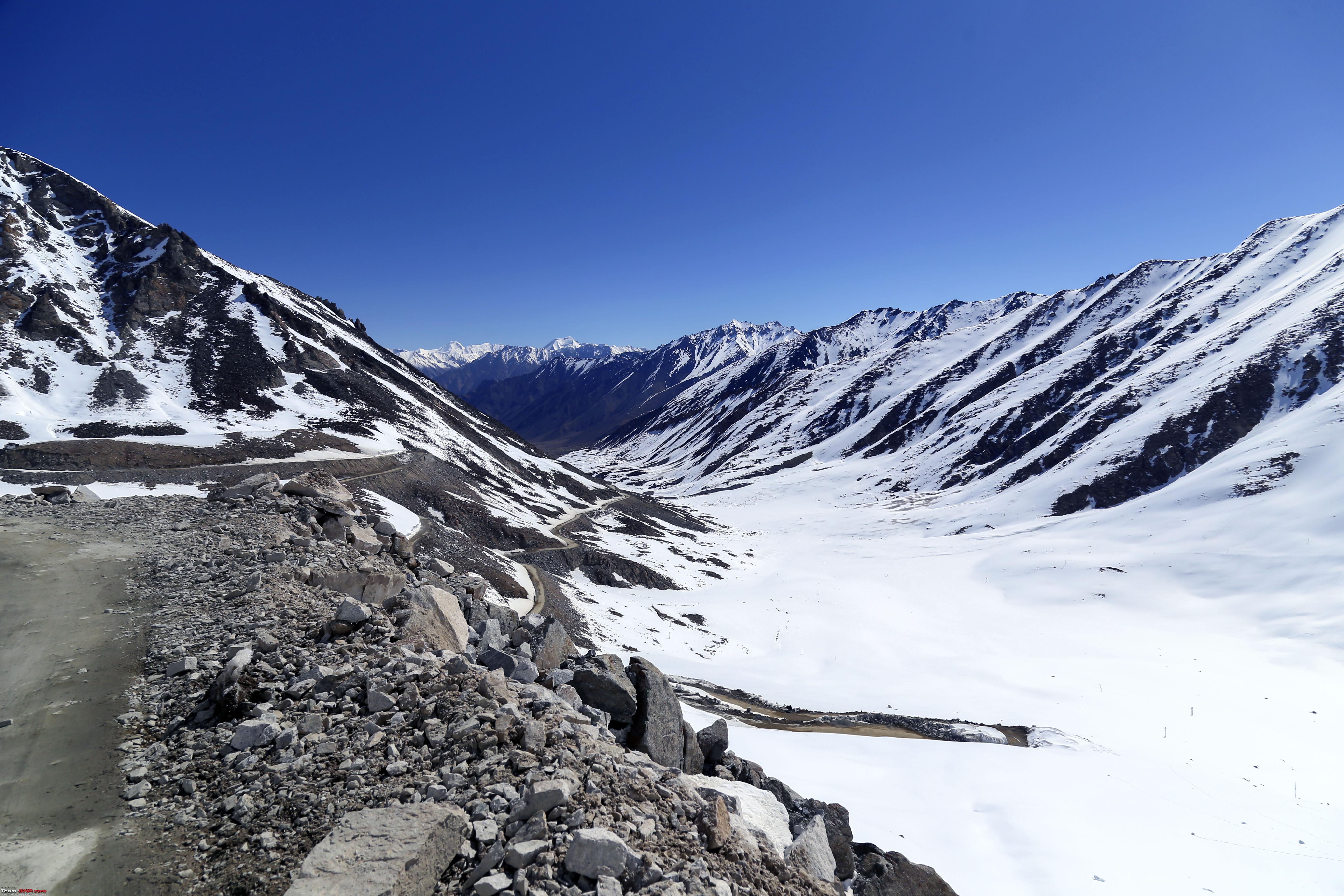 Soon across and the River Shyok at Khalsar 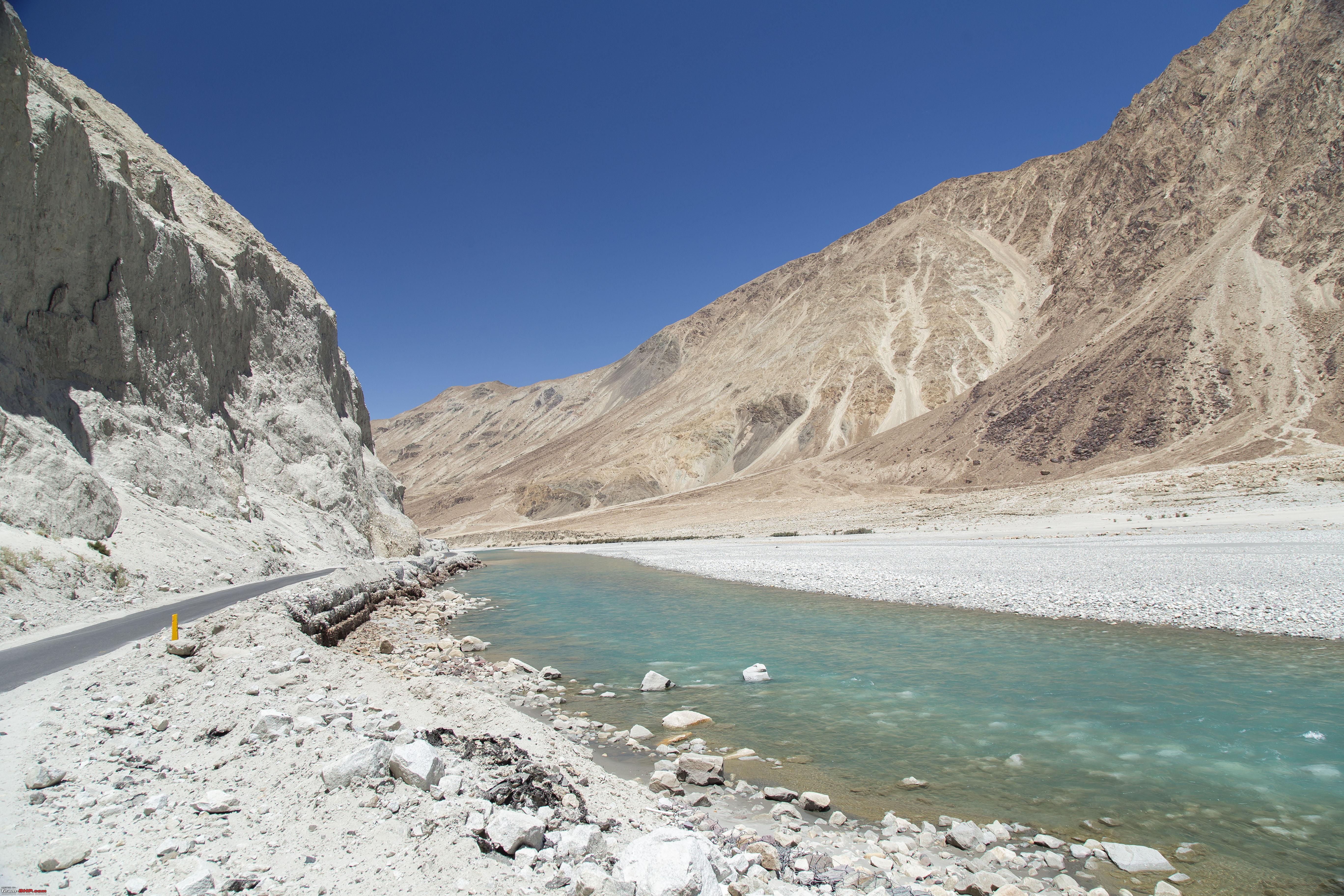 The 4km long straight stretch after Khalsar   For some reason, we were forced to put up for the day at Diskit itself. However, will take the opportunity to warn people planning to visit Ladakh to not take AMS lightly, even if one have had exposure to multiple high altitude trips. A snap from the hospital at Diskit (though the "prevention" mentioned is debatable, since some people can be allergic to sulphur drugs, in which case prior physician consultation is a must) 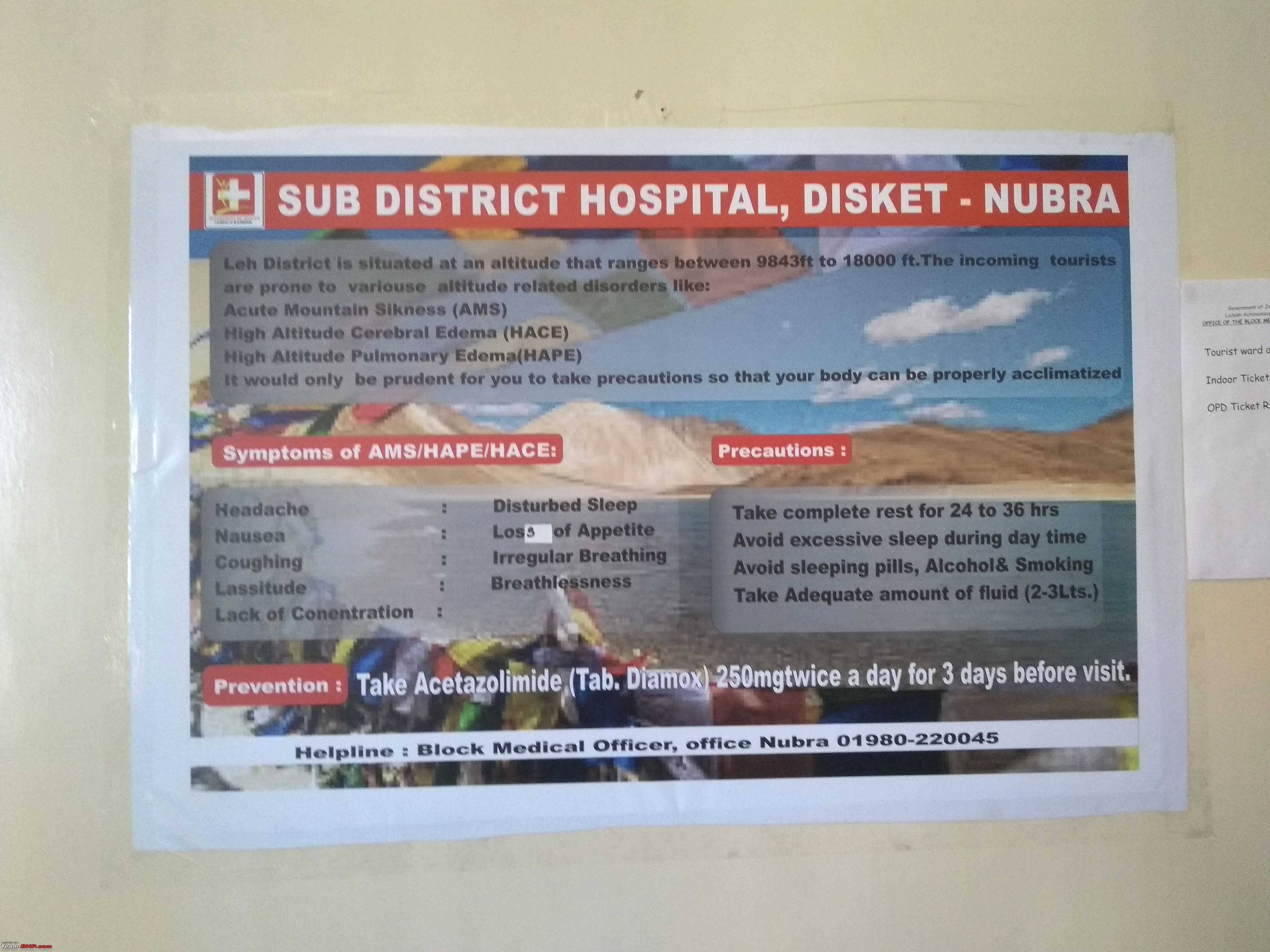 So the rest of the day was spent at Diskit. However, spent some time at the Monastery and filling up on it's wonderful bird's eye view of Nubra 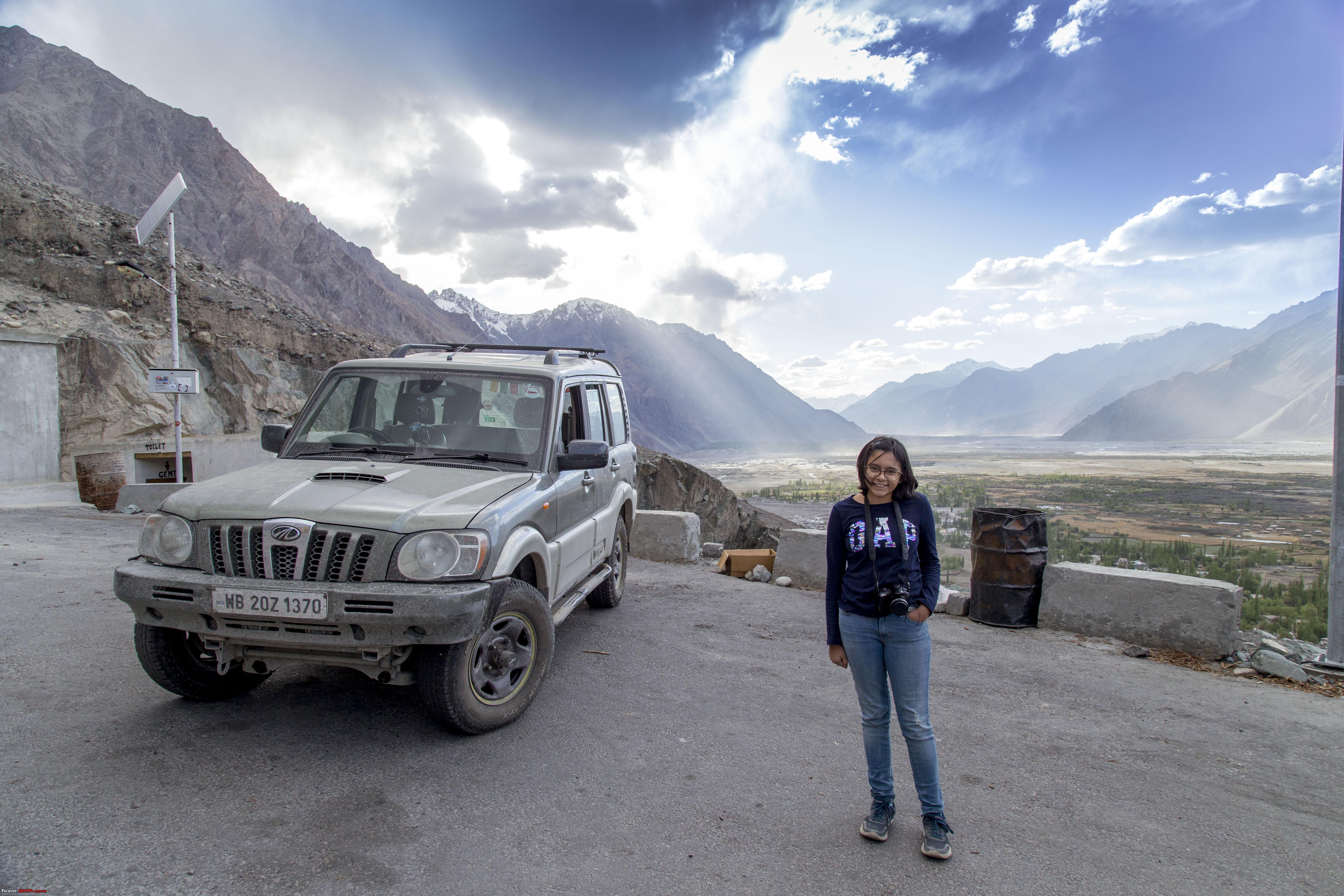 A Sandstorm on the valley 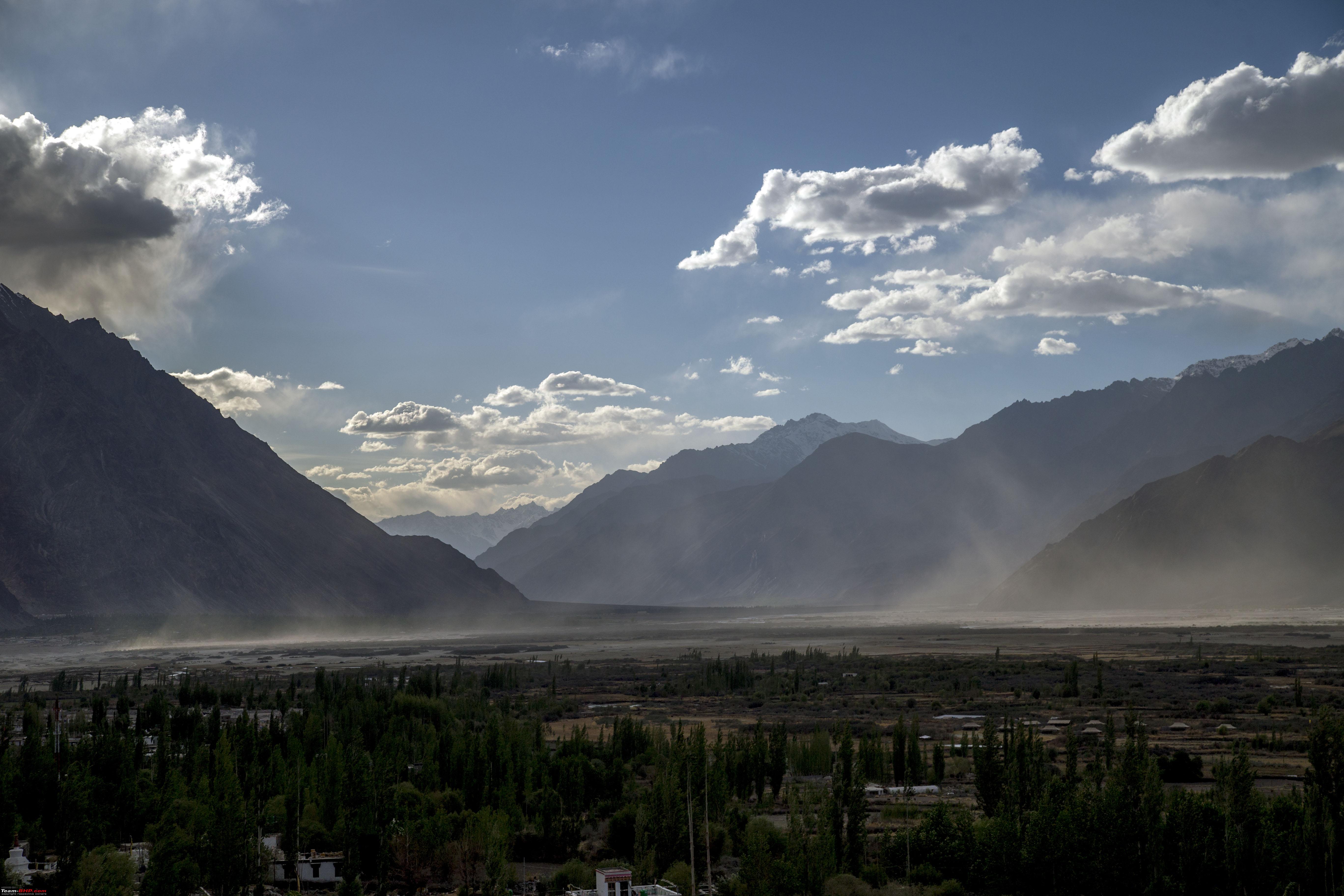 The Buddha guards on 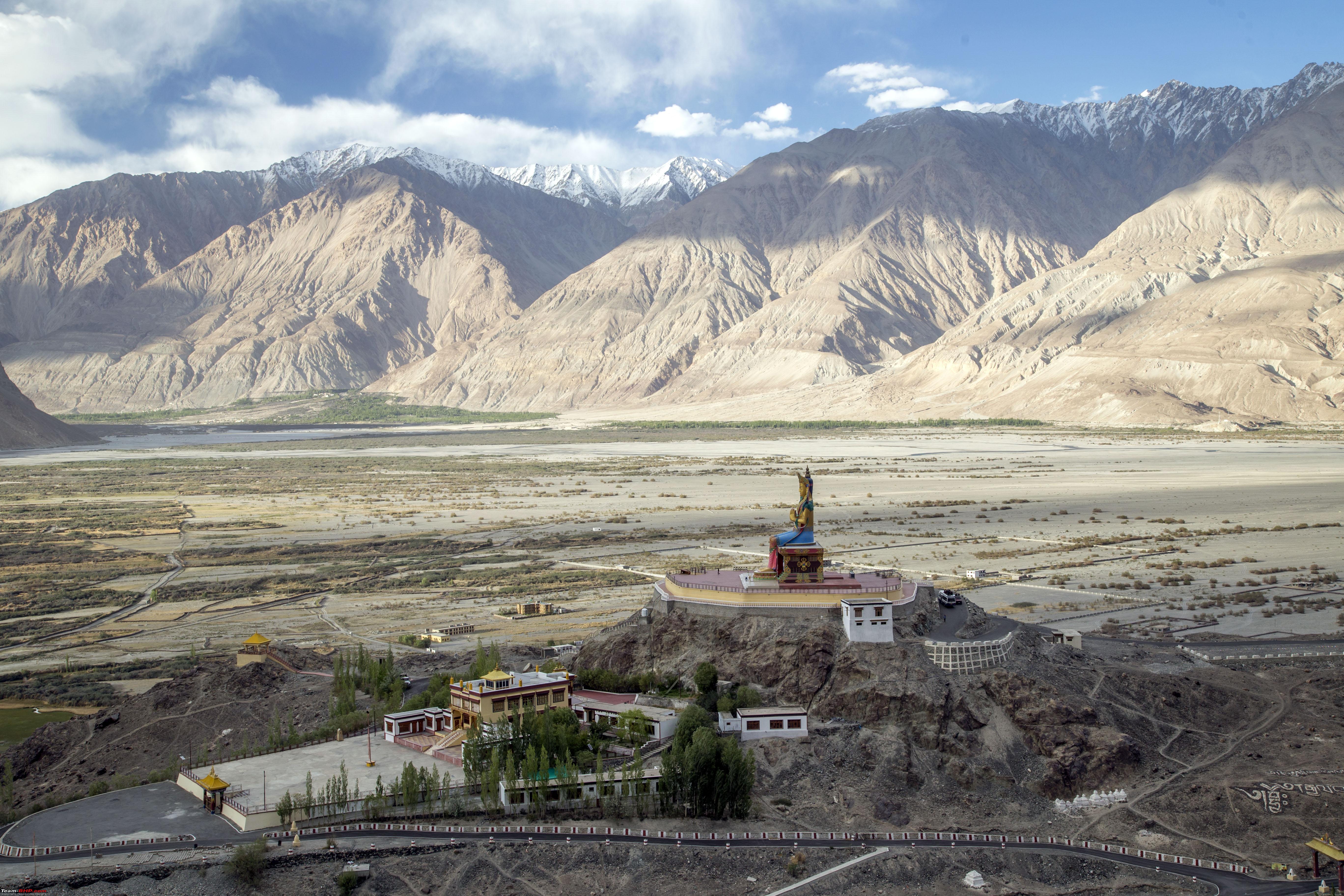 Topmost temples of the Diskit Monastery  Nubra valley shot from Diskit Monastery  The Nubra valley, contrast of greens amidst arid landscape  Some shots with the Maitreya Buddha at Diskit 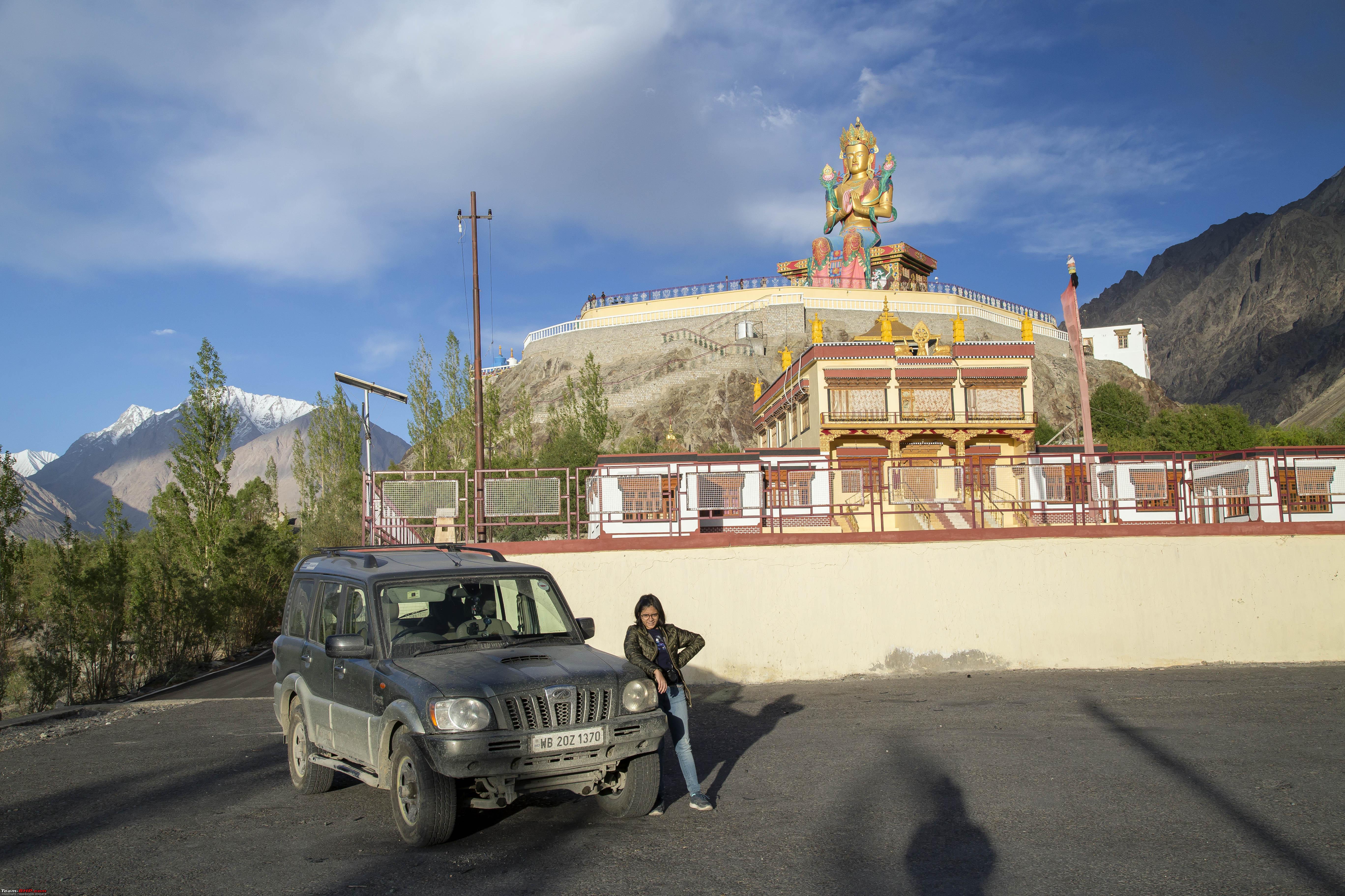 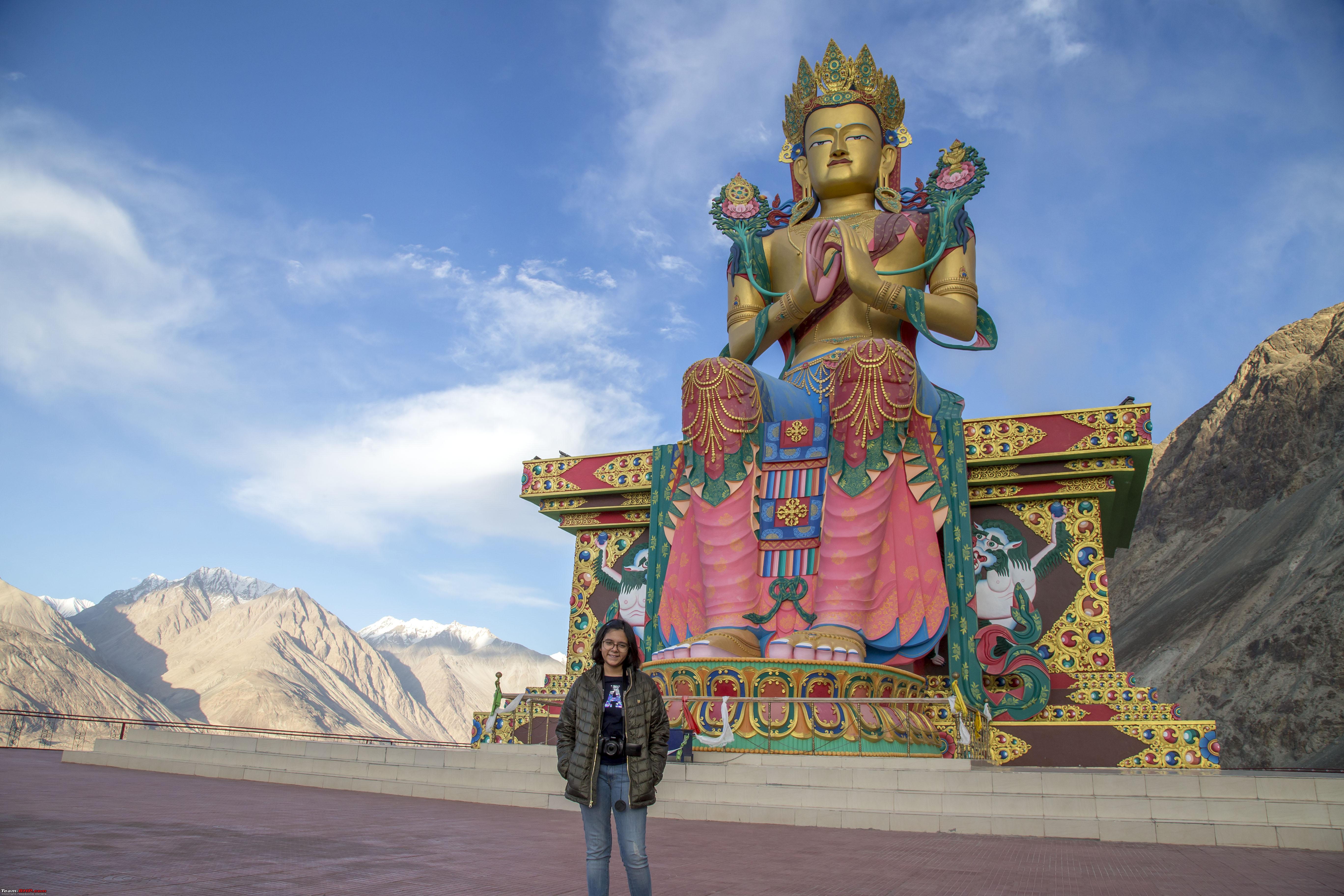 Last edited by 1100D : 11th July 2019 at 22:12. |
|
| (30)
Thanks
|
| The following 30 BHPians Thank 1100D for this useful post: | abhijeetp, aniket17, ARAY, CrAzY dRiVeR, dailydriver, desiaztec, DrANTO, Durango Dude, gauravanekar, gmhossain, GTO, haisaikat, jailbird_fynix, Leoshashi, maximus., mi2n, neil.jericho, Red Liner, Ronak_7, Rudra Sen, Samba, Samfromindia, Sayata, Sheel, ssambyal1980, streetfighter, suhaas307, Surprise, Thermodynamics, Varun_HexaGuy |
|
11th July 2019, 22:22
| #4 |
| Senior - BHPian | Re: Ladakh Re-Juleh'd! With Siachen-Panamic-Agham-Chusul-MitpalTso-KaksangLa-TsoKar-KyunTso! The Eighth day!! Due to the reason we were forced to halt at Diskit last night, our onward plans for the day was a little unsure. For this day, our original plan was to head towards the Siachen Base camp on the other side (compared to Hunder/Turtuk) of the Shyok River on Nubra valley. However, at the start of the day, that looked like a far-fetched dream. All we could dream of at that time, to salvage something out of it, was to drive to Panamic Hot springs, around 50kms away, but still on the other side of Shyok River. So, we had a late/leisurely start to the day. First objective will be to drive back to Khalsar and before reaching it to take a left turn at the T-junction instead of going right. However, even before this so-called T-junction, this kind of teased us from the other side of the river! 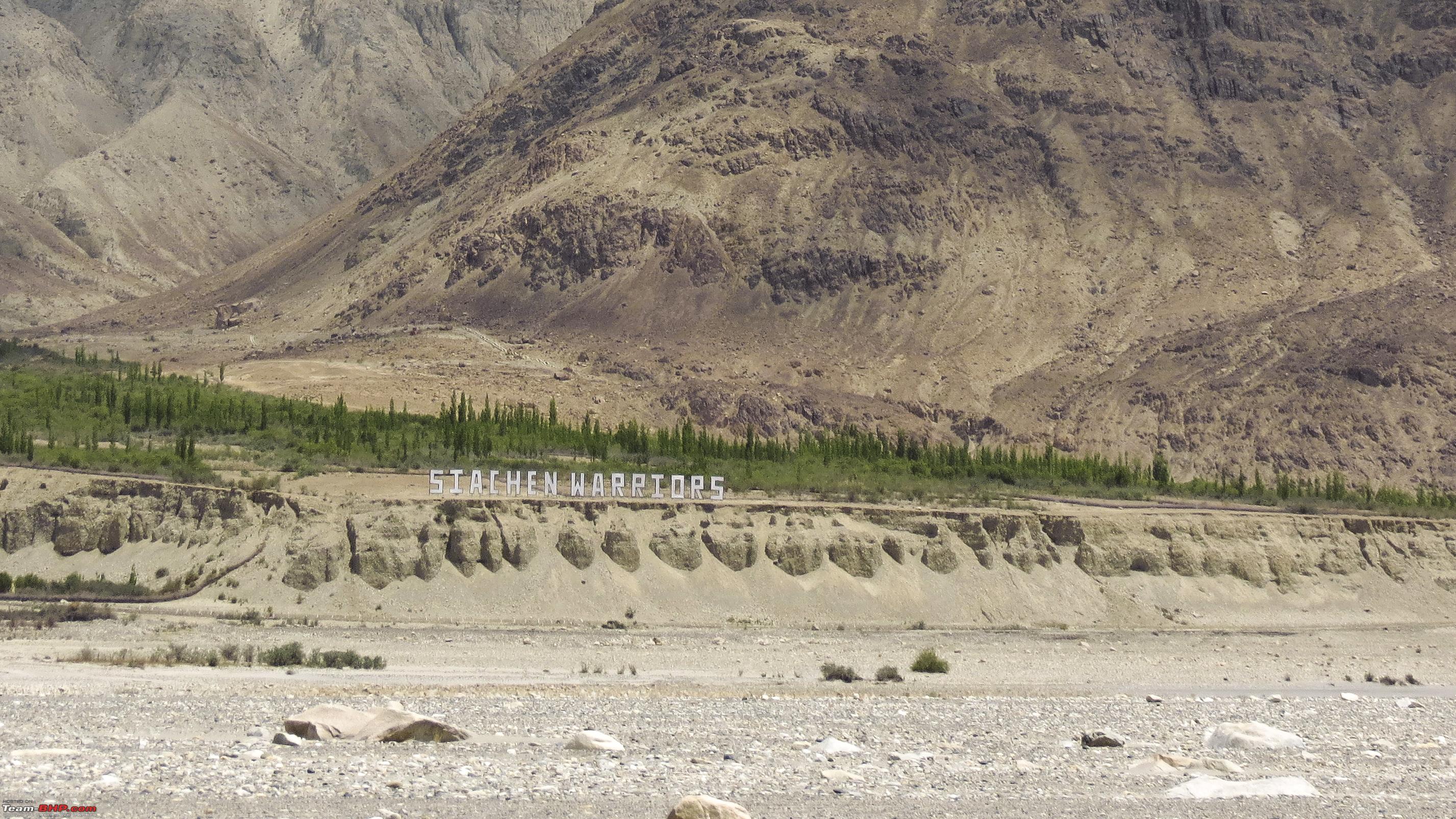 Soon we were at the T-junction, here we would take left towards Sumur  Right after that left turn, up a kilometre away was this bridge! 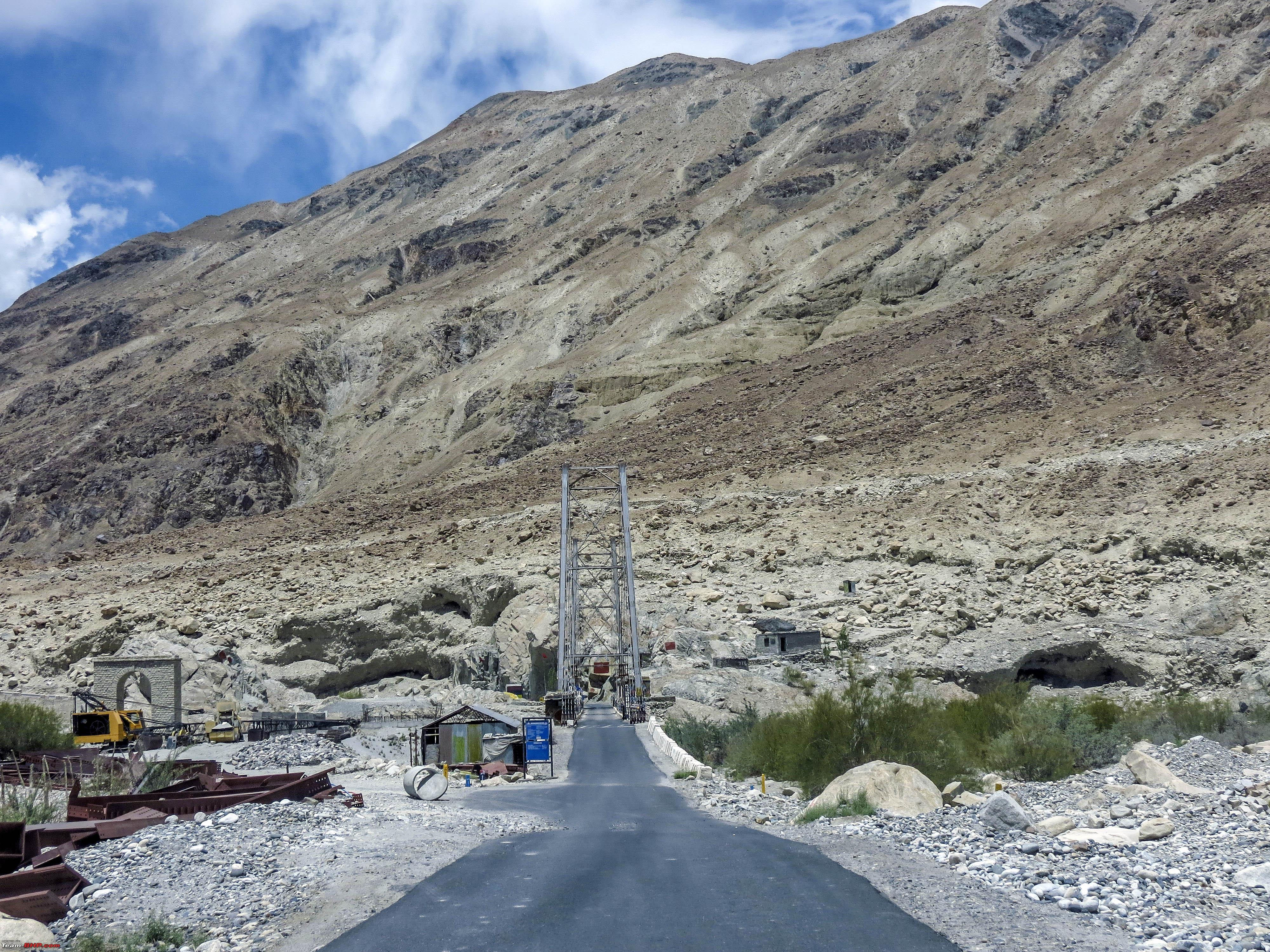 The bridge after crossing it 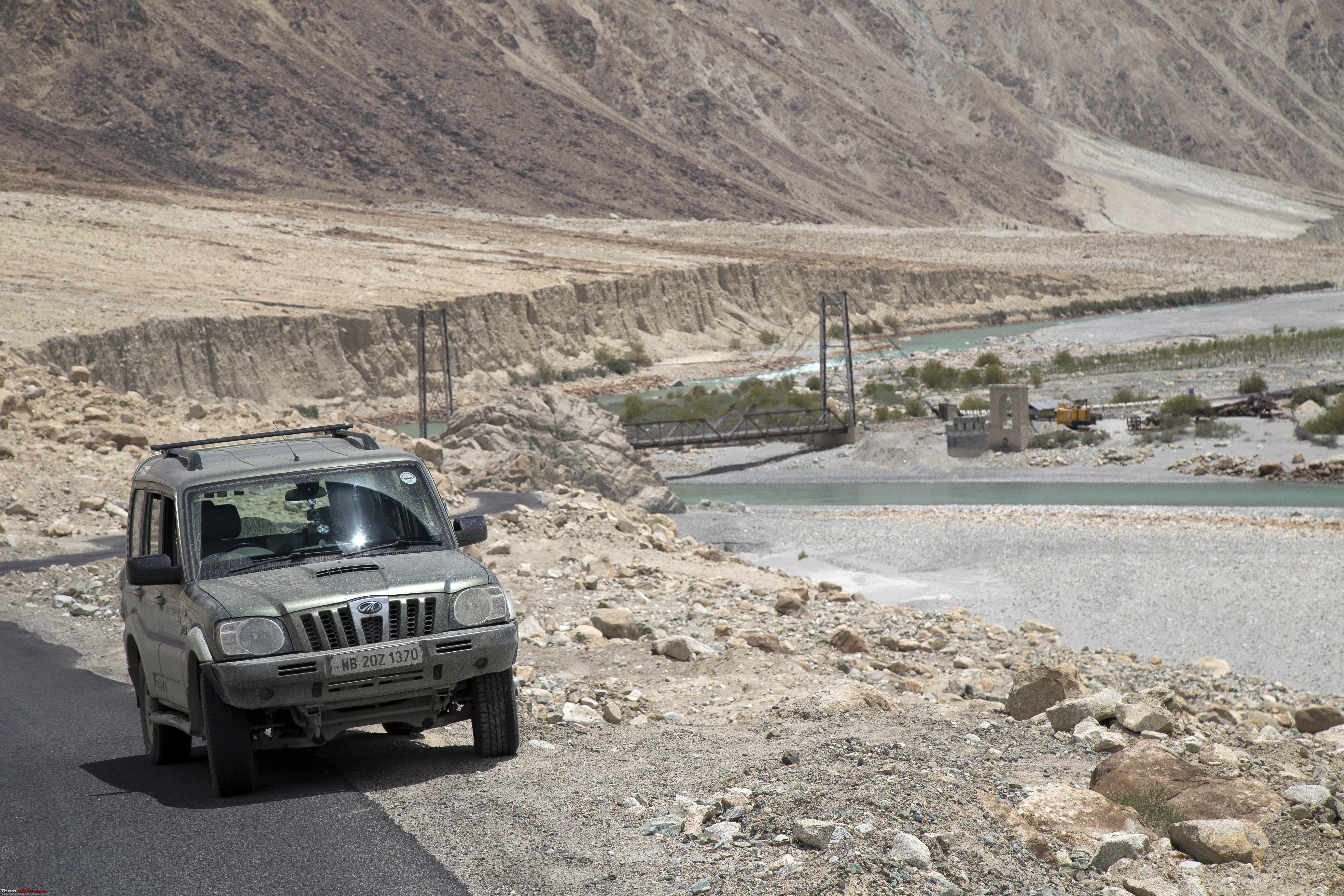 The road to Sumur! 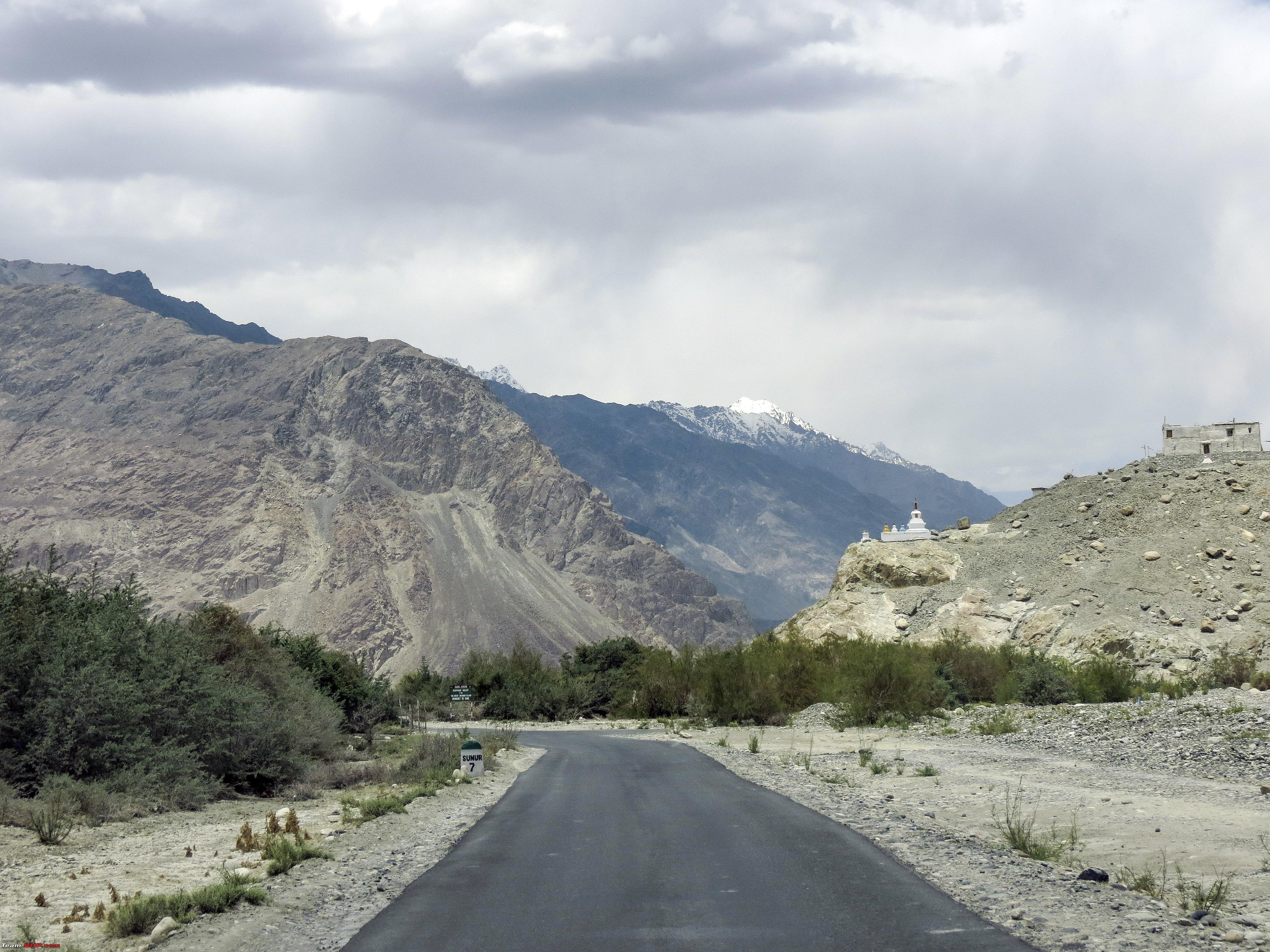 After Sumur, its the stretch to Panamic, note that this is opposite bank of Shyok River around Hunder, yet a completely different view  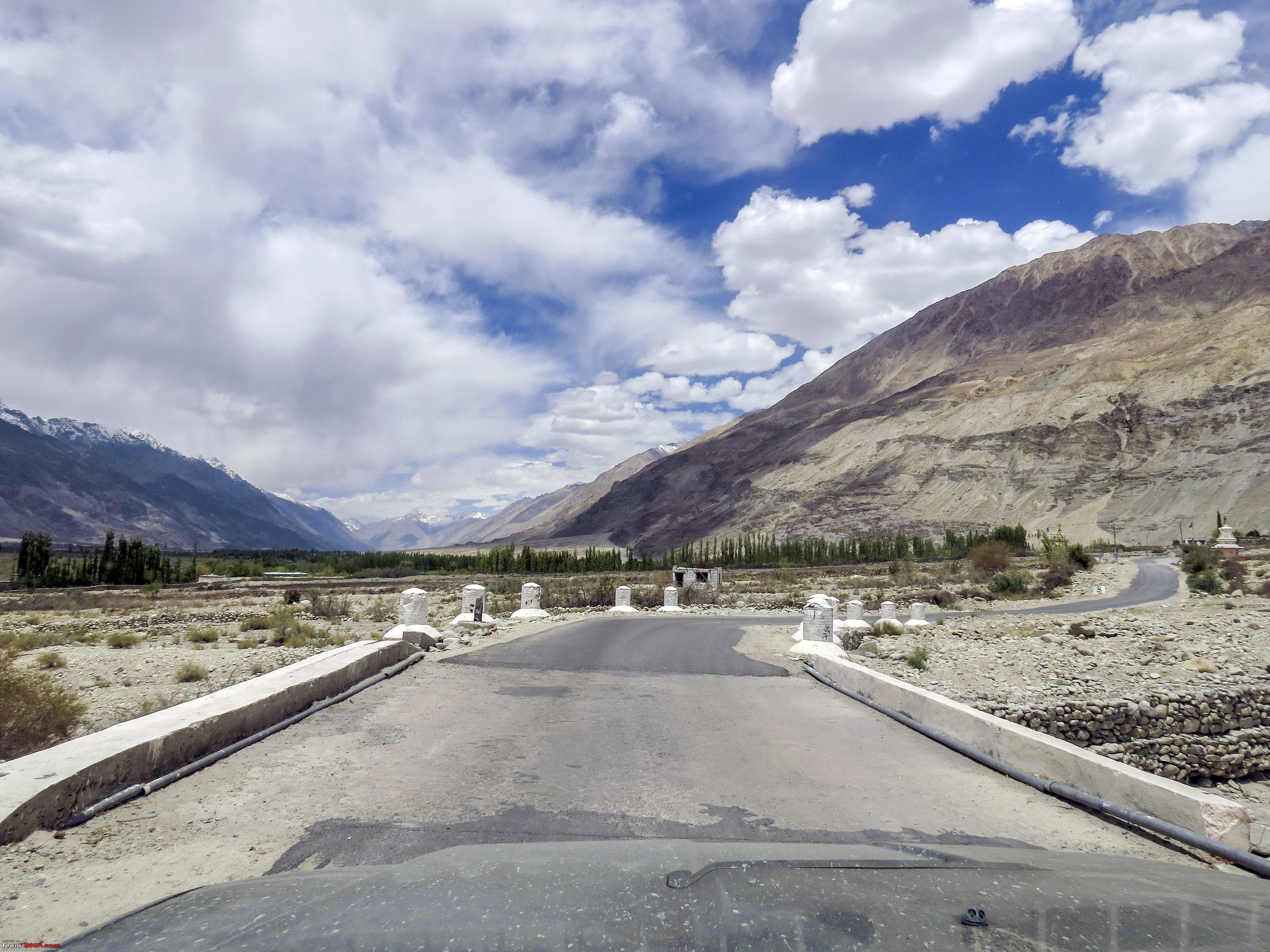 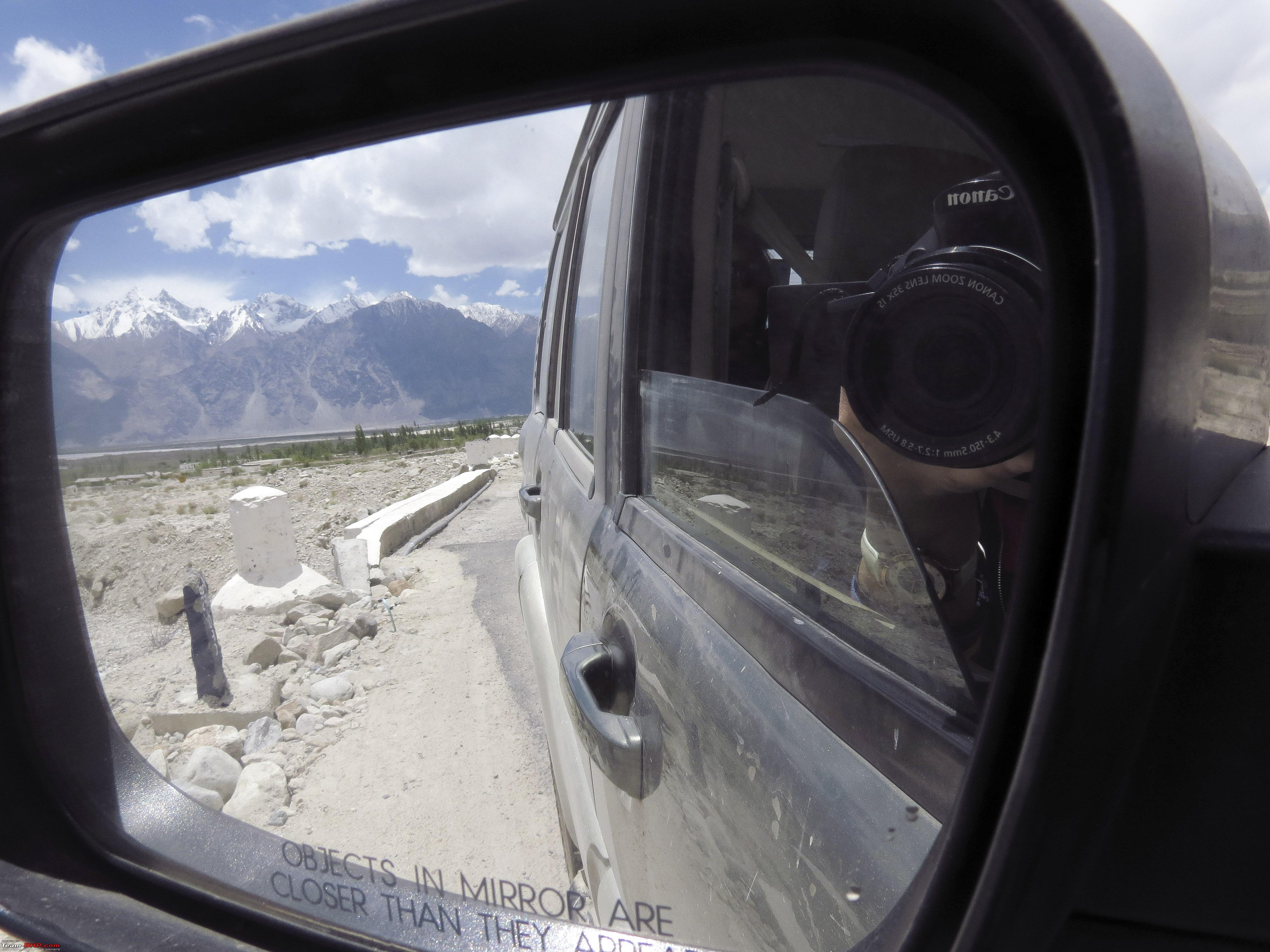 A small twister enroute 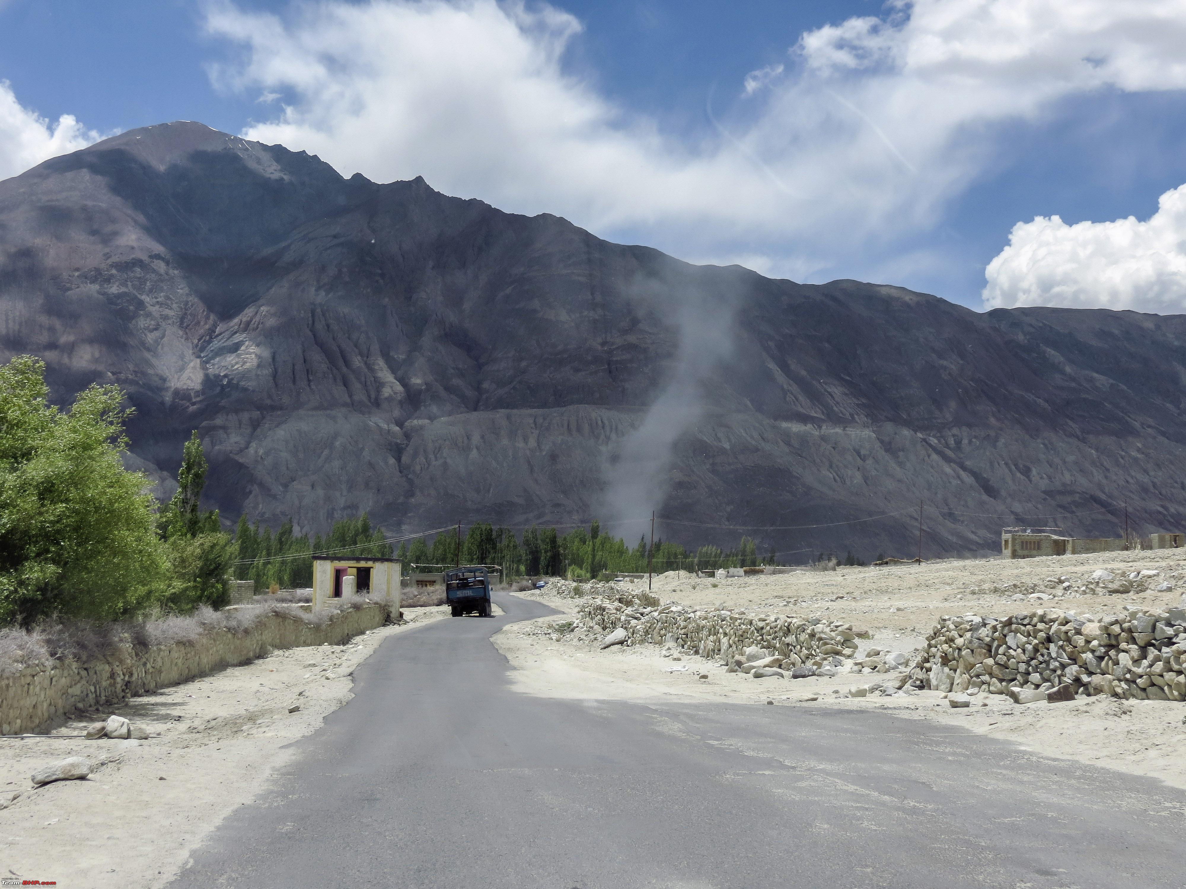 We soon reached Panamic, however, we had a decision to make whether to turn back from there after checking the hot spring out, or to try slowly moving ahead towards Siachen Base Camp as originally planned. We decided to try our luck and push for the later. So Panamic, we decided to explore on the way back. The road towards Sasoma  The Distances 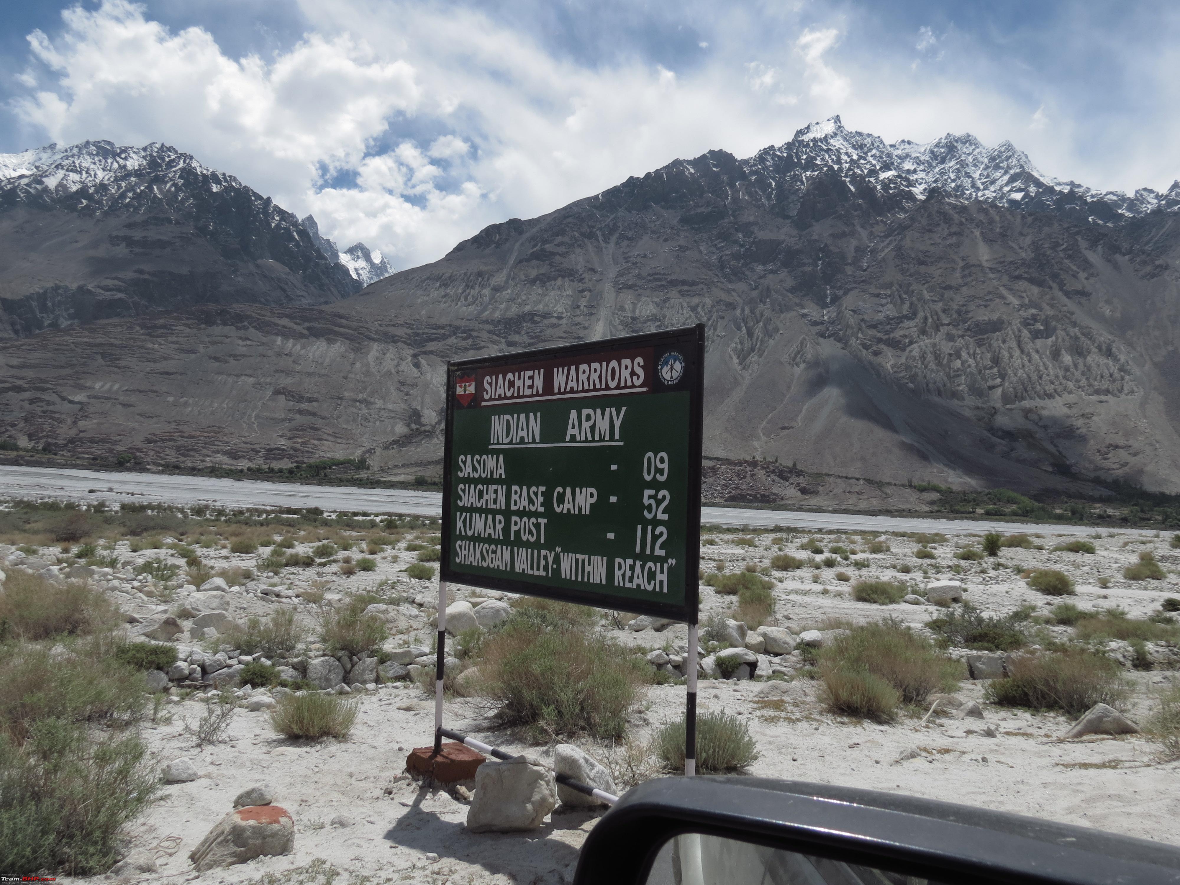 Sasoma Checkpost crossed, after completing few formalities, we were soon at Warsi 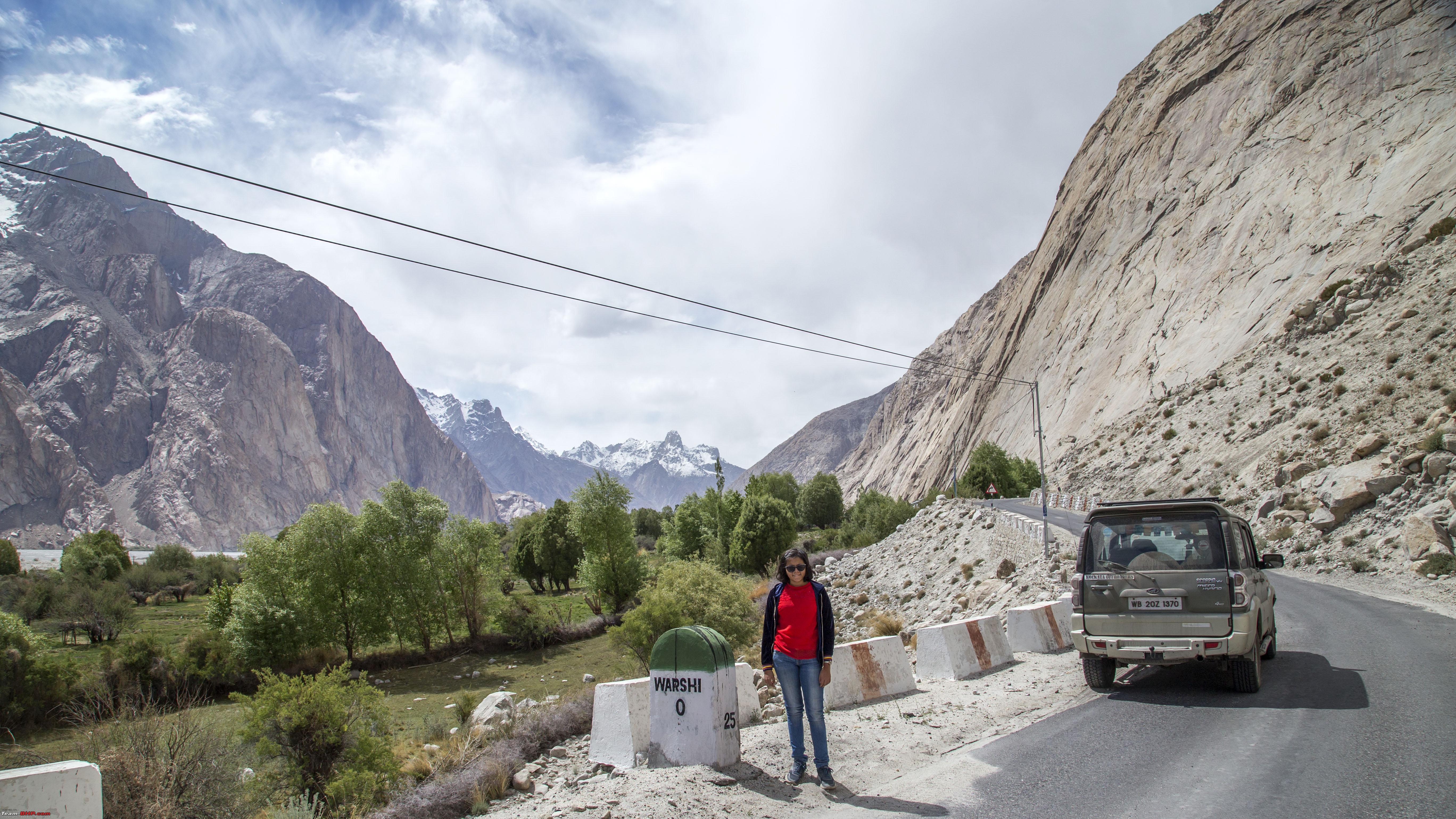 A dust storm ahead, nothing stopping us anymore 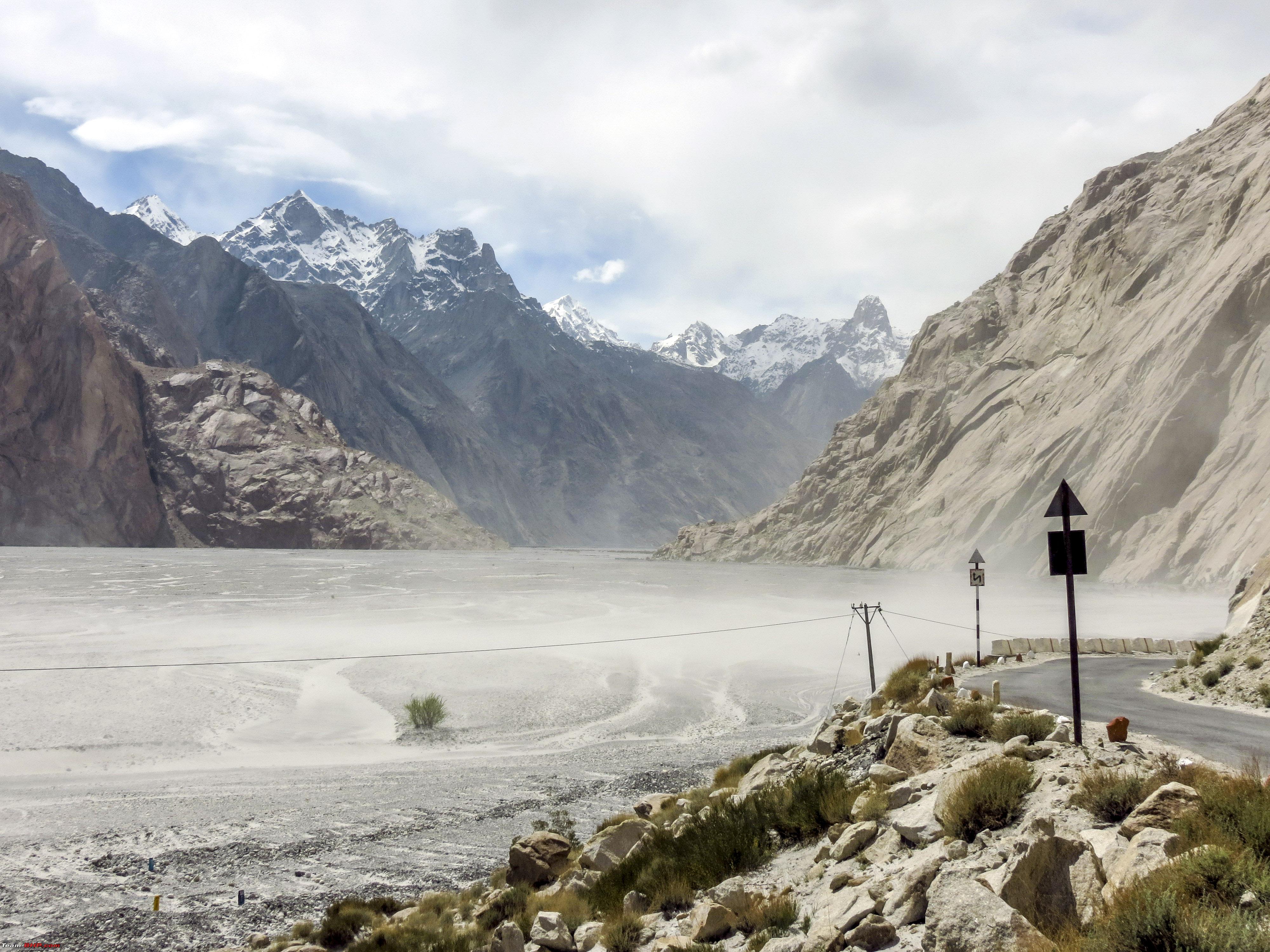 The Board says it all!! 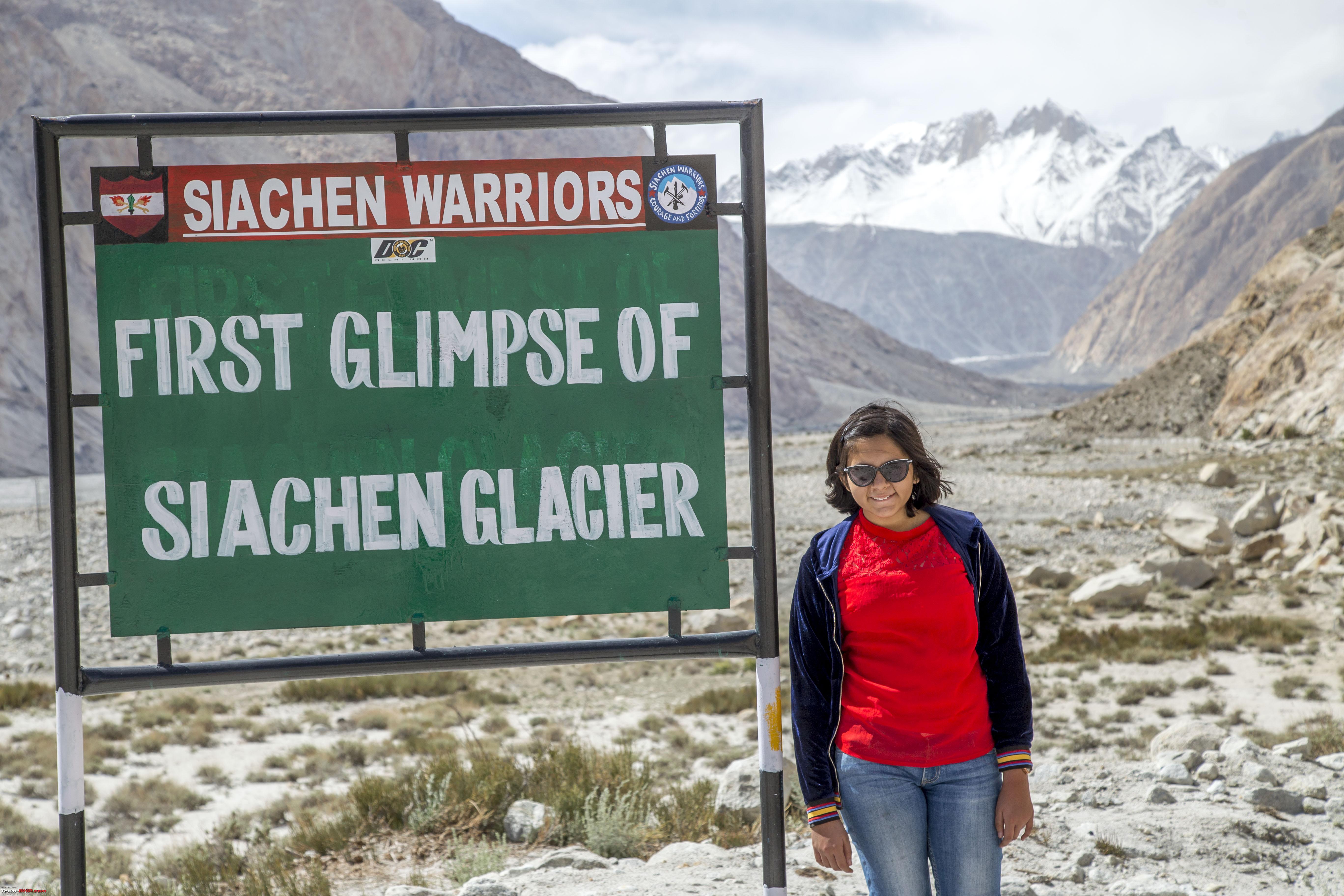 Few more kilometres down the road was the Goosebumps inducing battlefield. Google has adequate details of the place, so will just let the pictures roll. 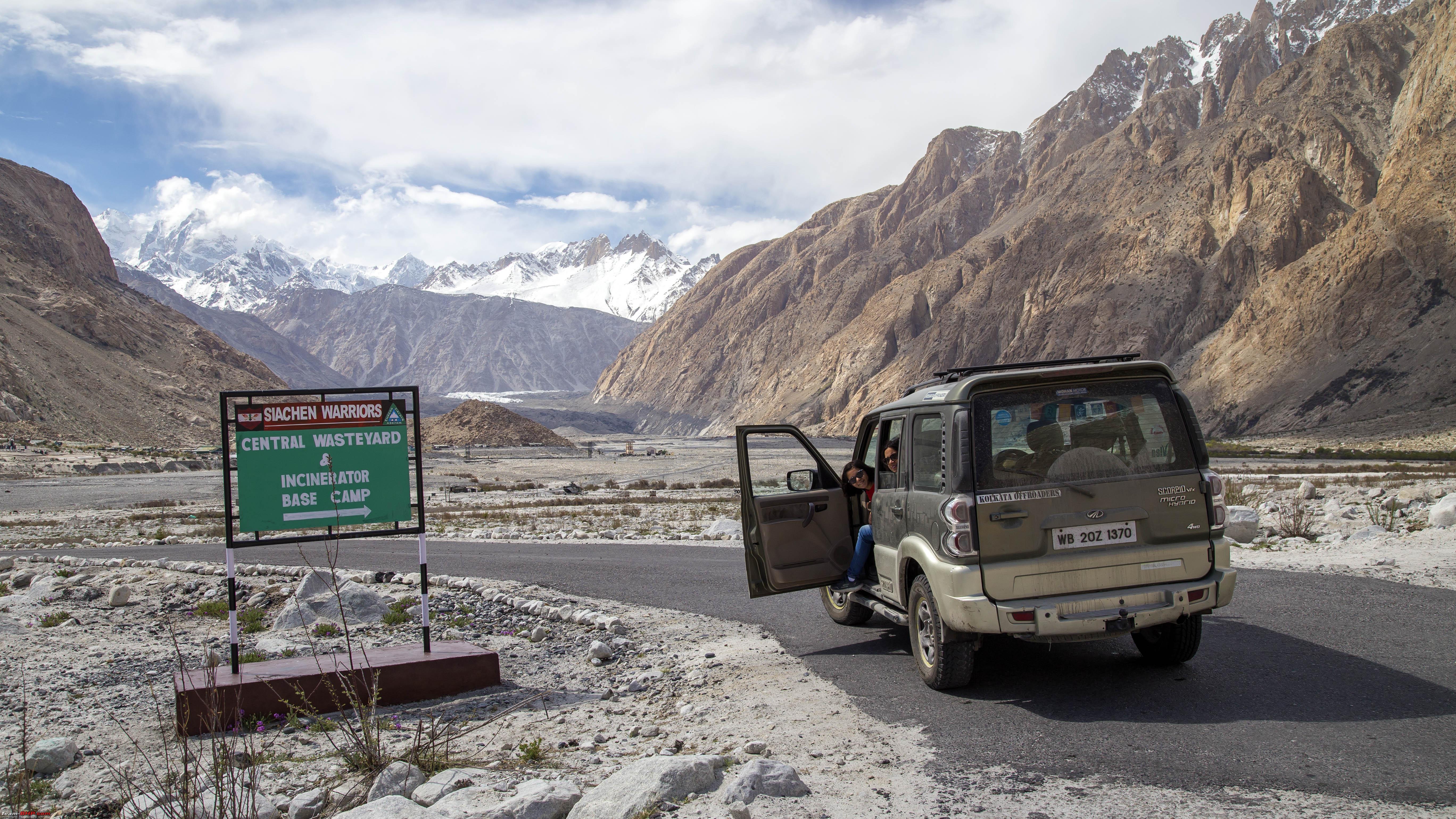 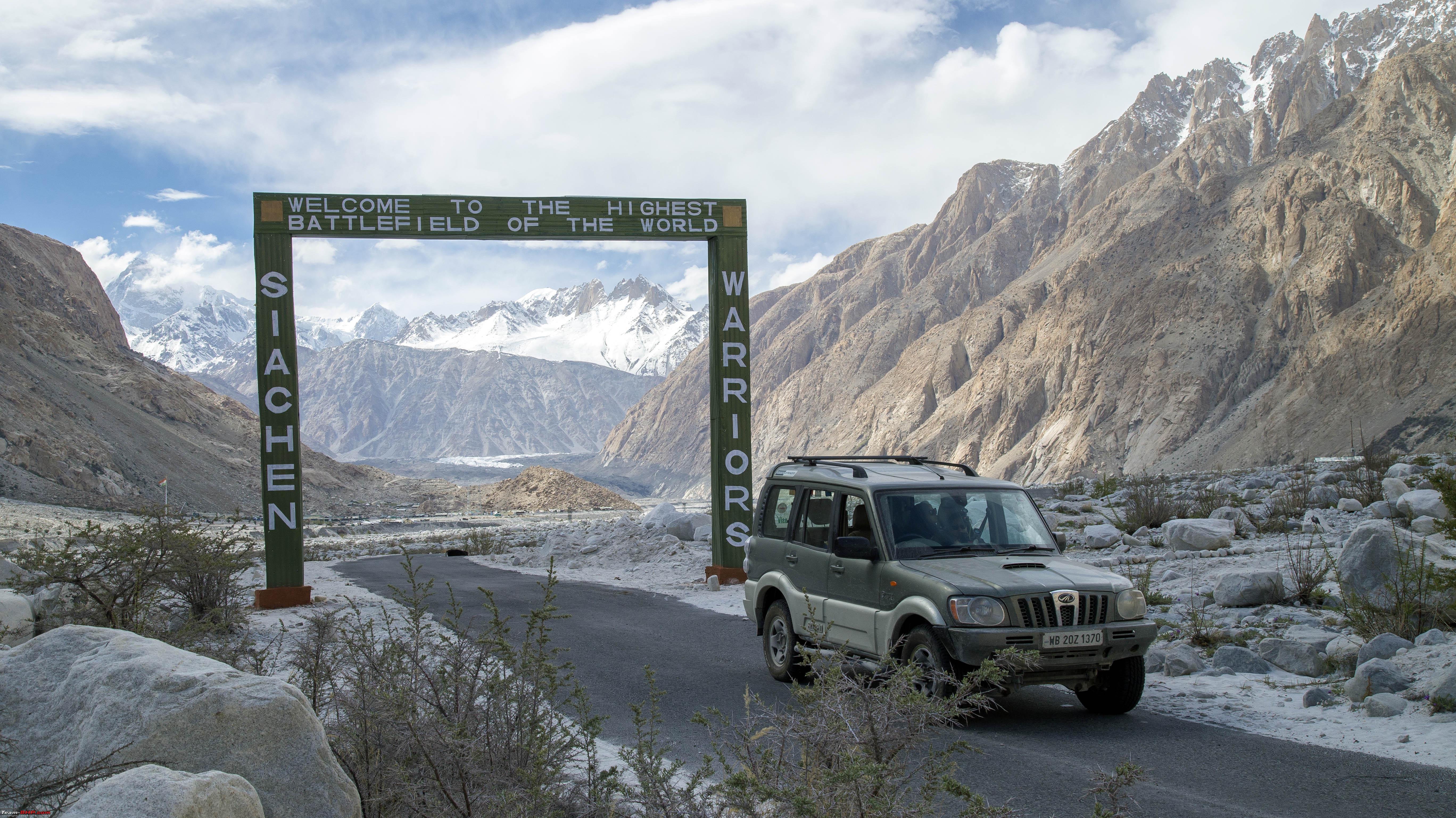 However, since we were pushing our luck against something, we decided not to waste any time there, simply head back. A picture with the board and Marengo on the way back 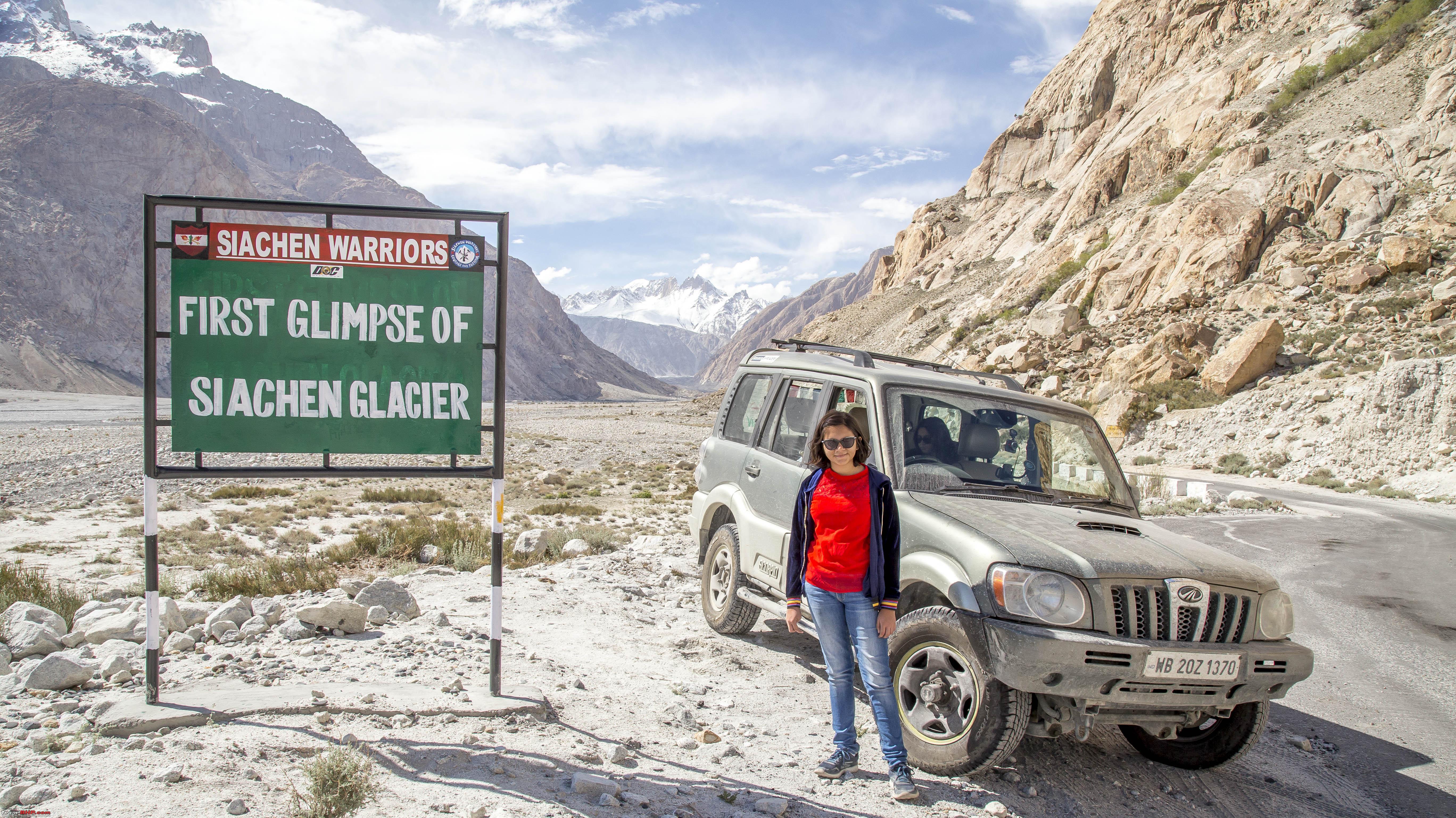 This is the Nubra River 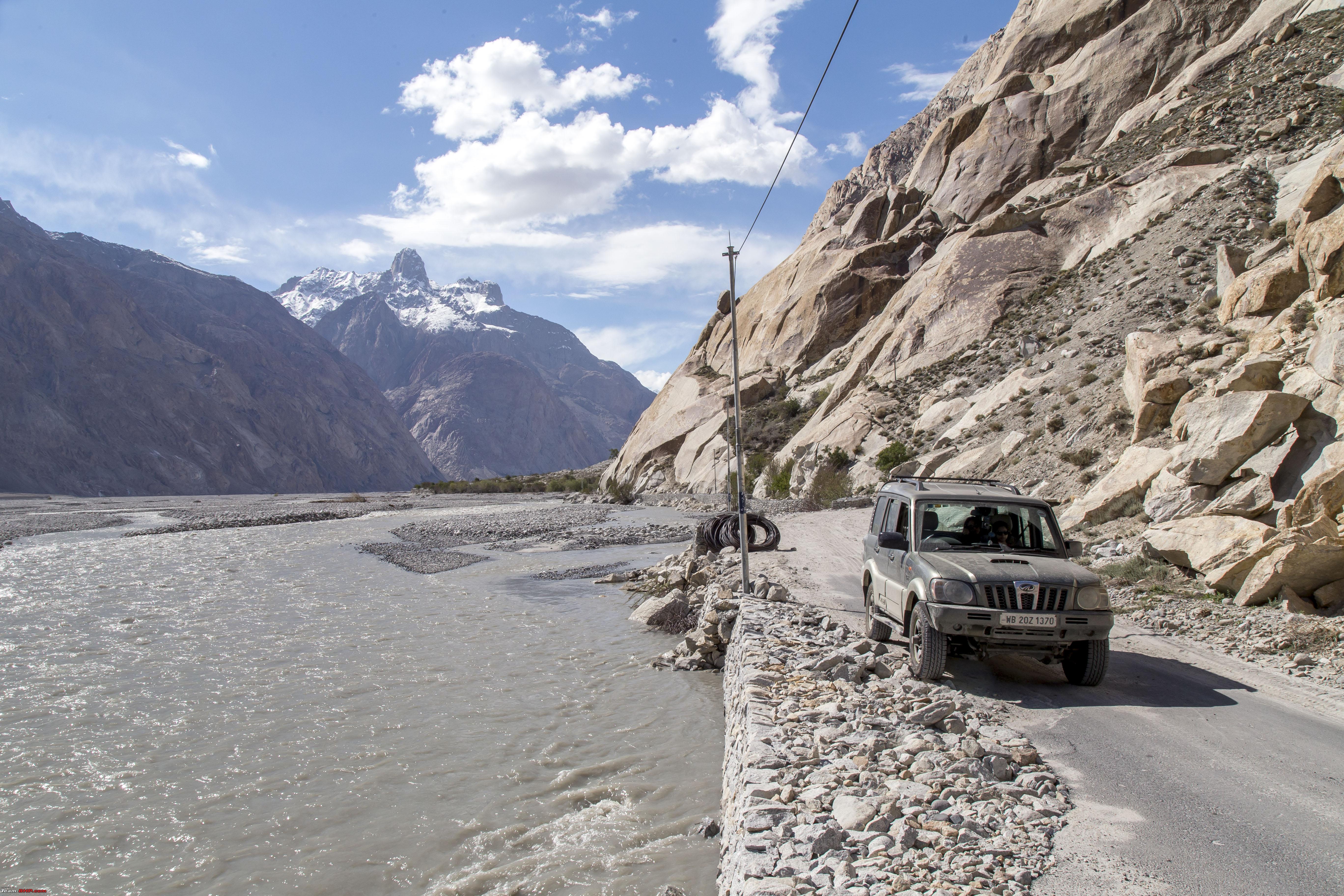 So, in essence, the true Nubra valley is from Sumur to Siachen, in contrast to the one regularly known (which should be Shyok valley!) Another board 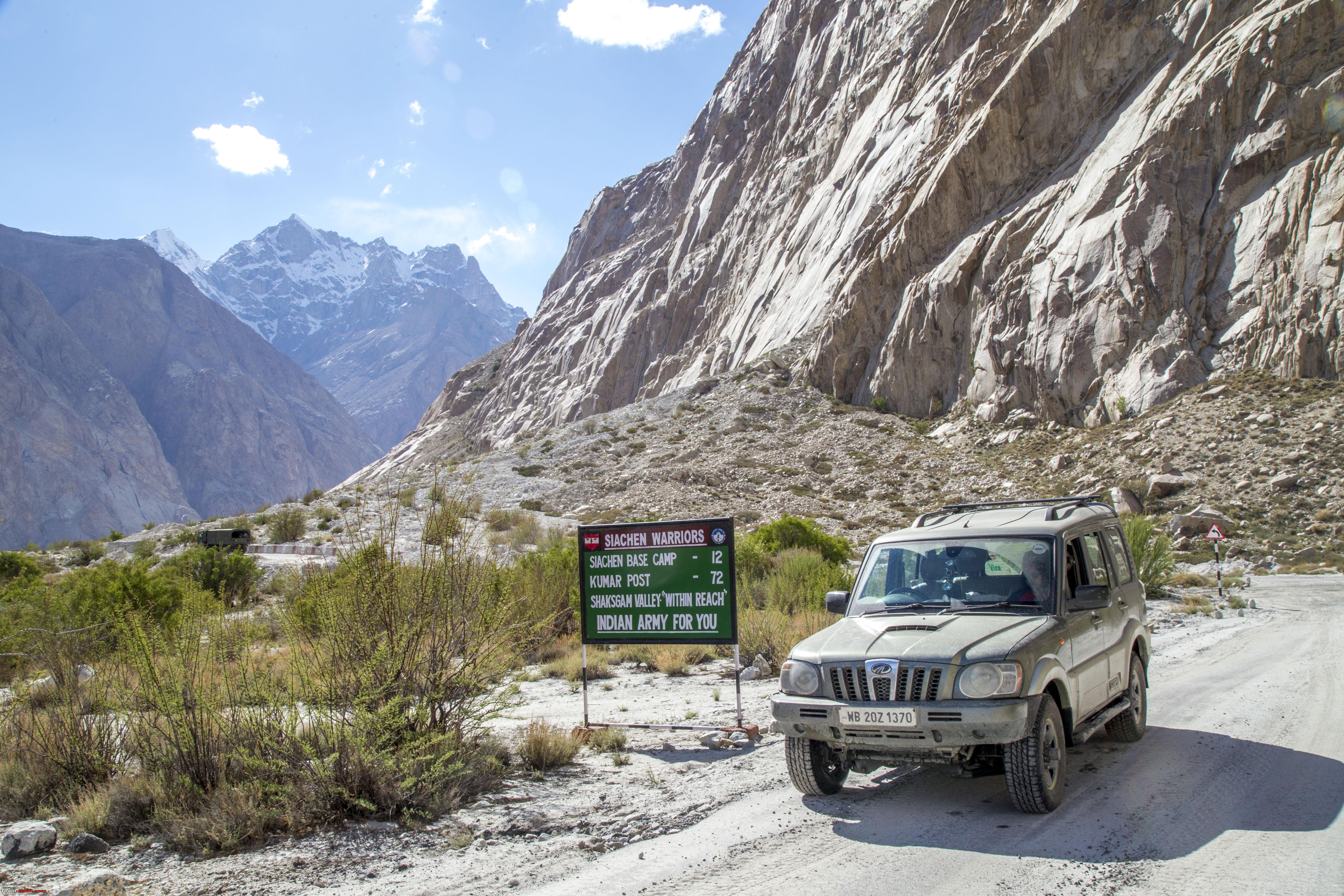 Passing Warsi again, note the vegetation  CNTD |
|
| (26)
Thanks
|
| The following 26 BHPians Thank 1100D for this useful post: | abhijeetp, ARAY, arungeorge, CrAzY dRiVeR, DrANTO, gmhossain, GTO, haisaikat, i20ian, jailbird_fynix, Leoshashi, maximus., mi2n, neil.jericho, Ronak_7, Rudra Sen, Samba, Samfromindia, Sayata, Sheel, ssambyal1980, streetfighter, suhaas307, Surprise, Thermodynamics, Varun_HexaGuy |
|
11th July 2019, 22:34
| #5 |
| Senior - BHPian | Re: Ladakh Re-Juleh'd! With Siachen-Panamic-Agham-Chusul-MitpalTso-KaksangLa-TsoKar-KyunTso! The Eighth Day CNTD If there was a dream scenic stretch, it would be this 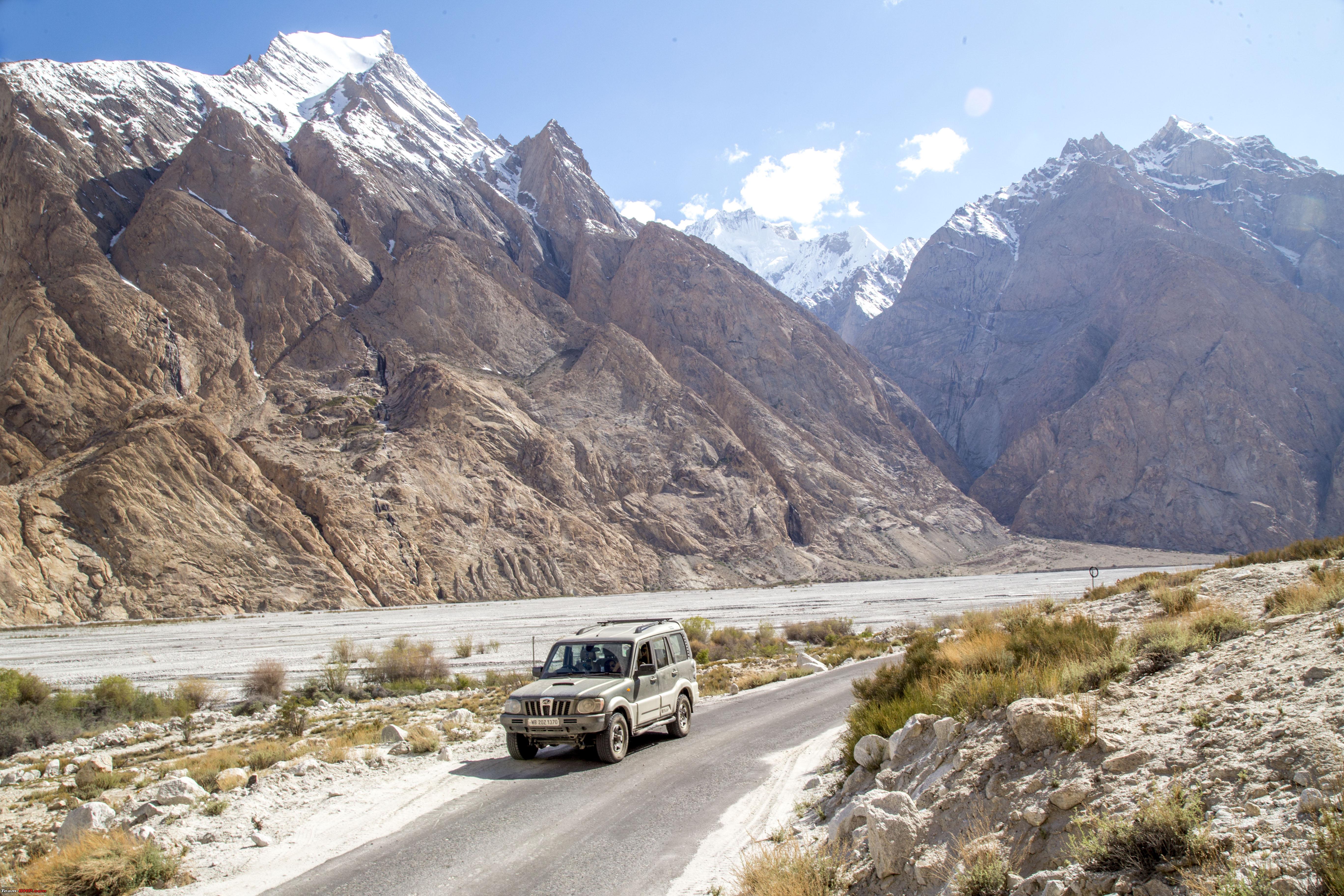  Or this, the true Nubra valley   A stop at the Sasoma CP  Courage and Fortitude, definitely 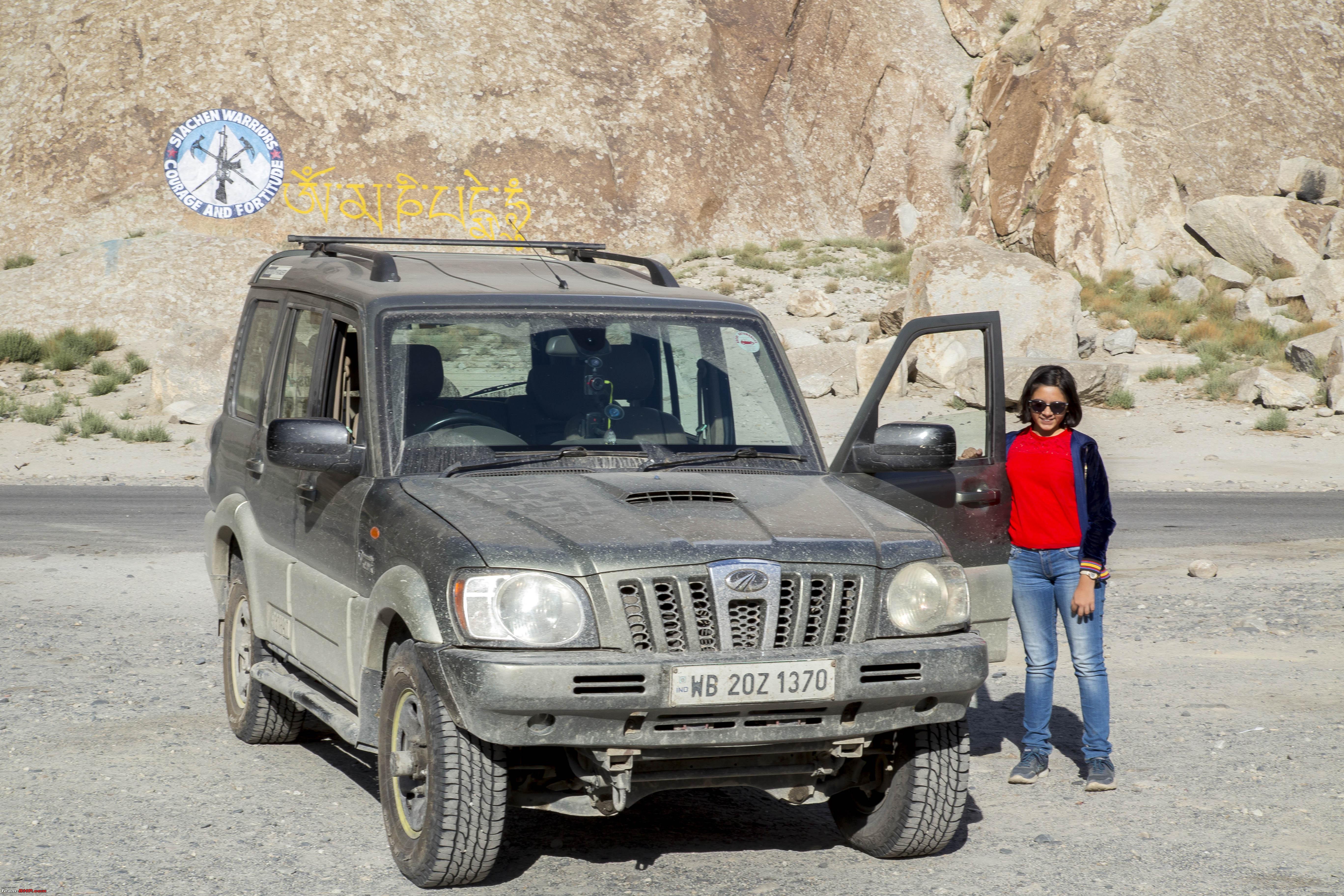 Some pics enroute to Panamic 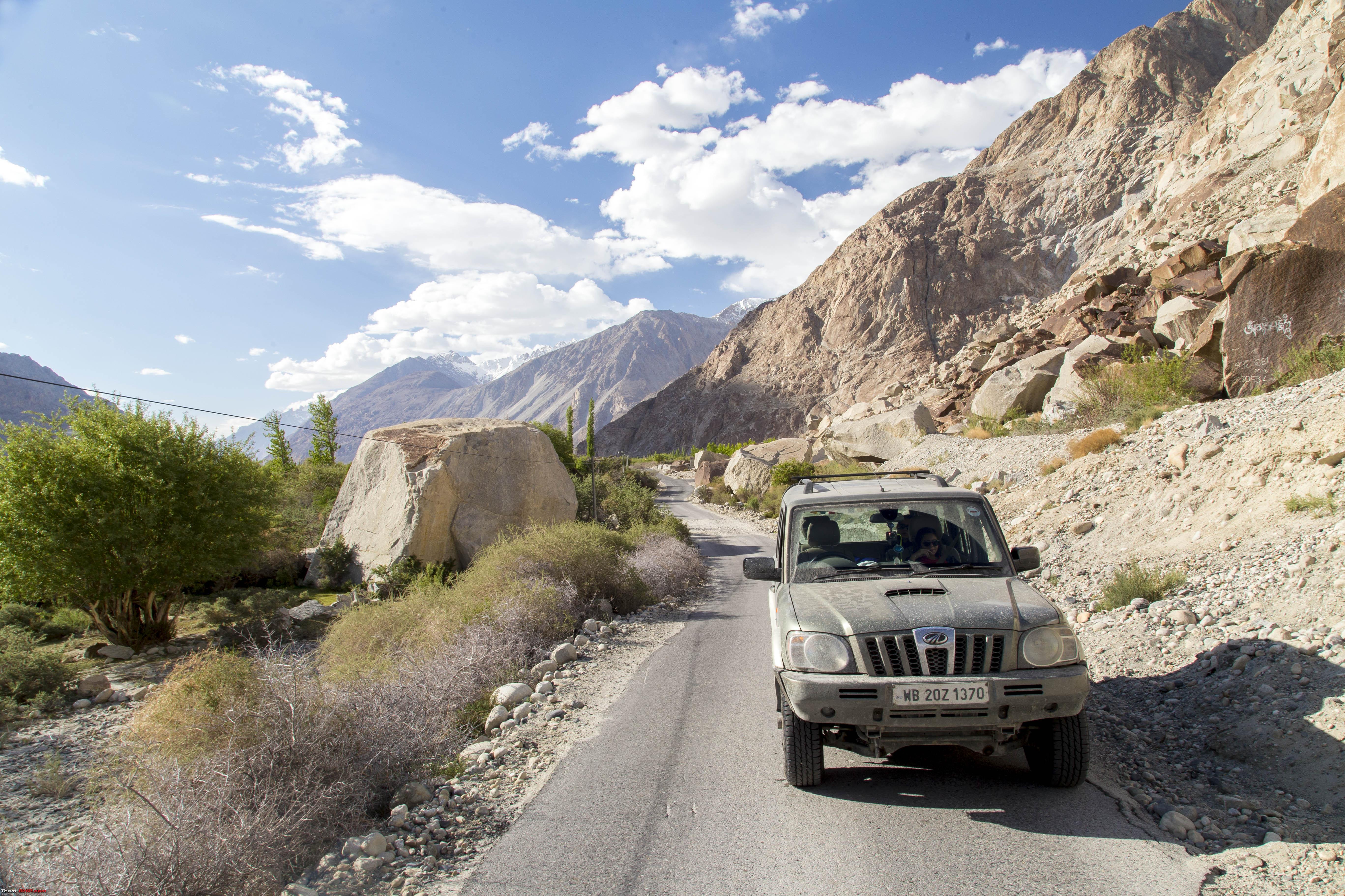 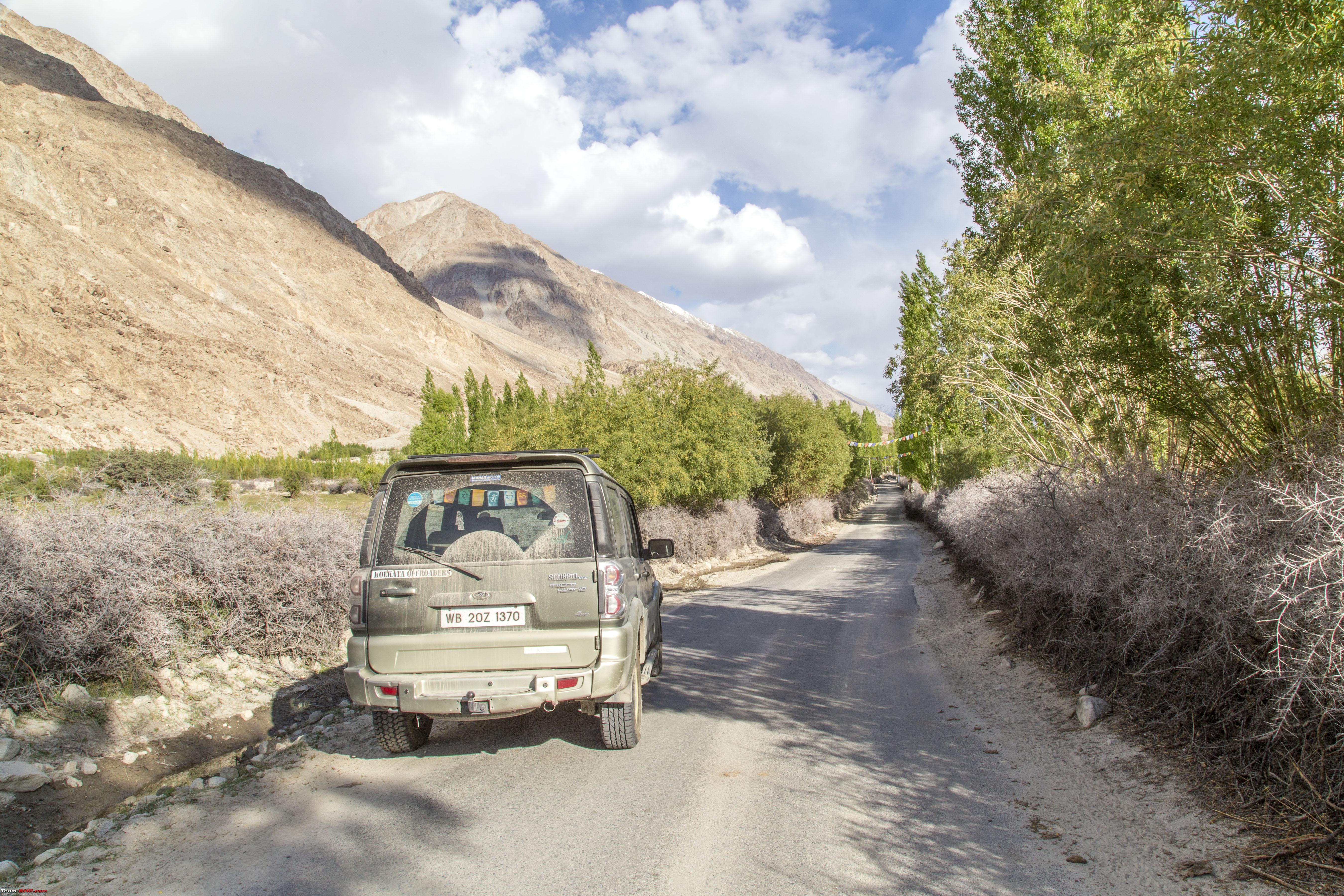 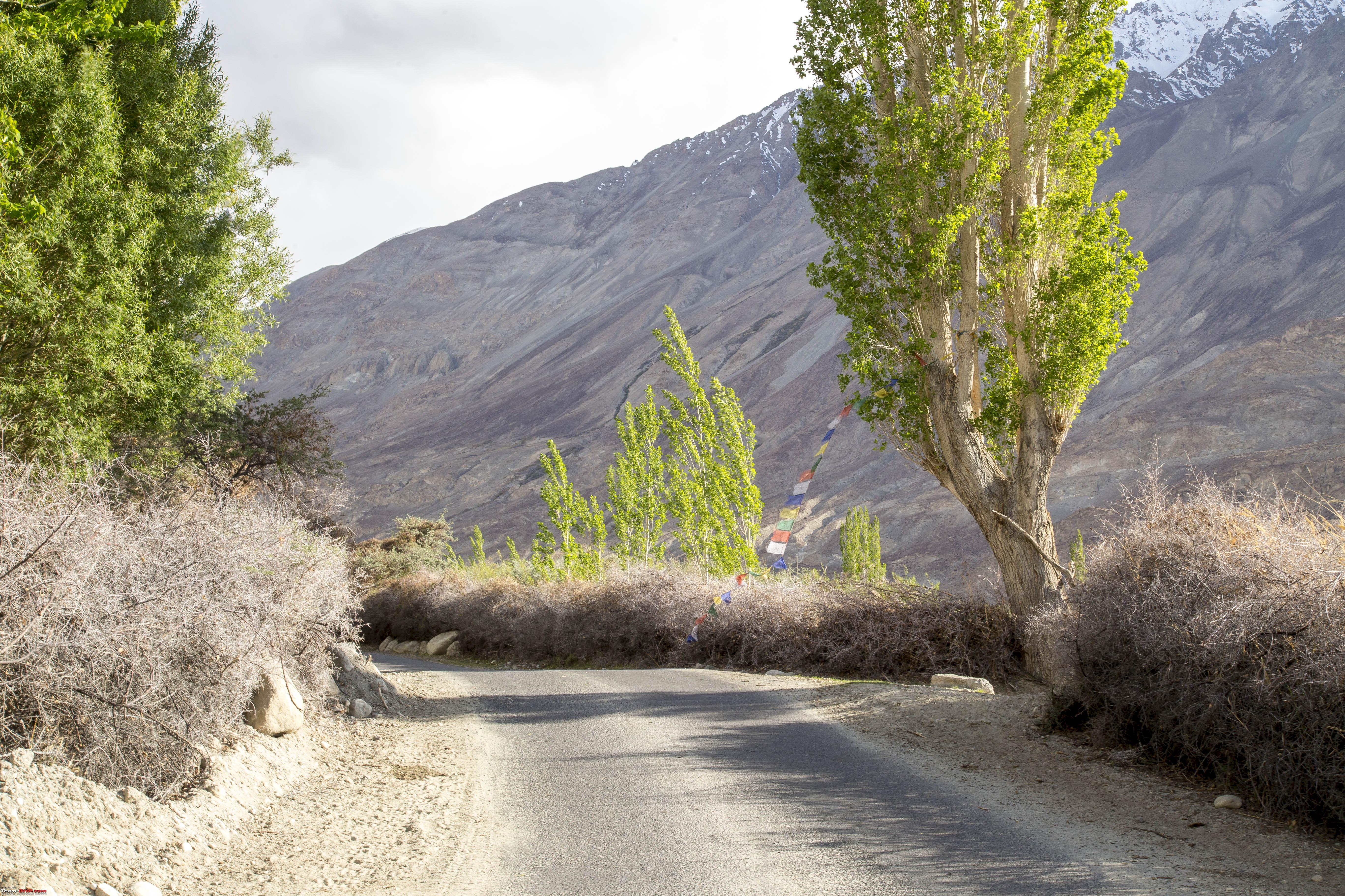  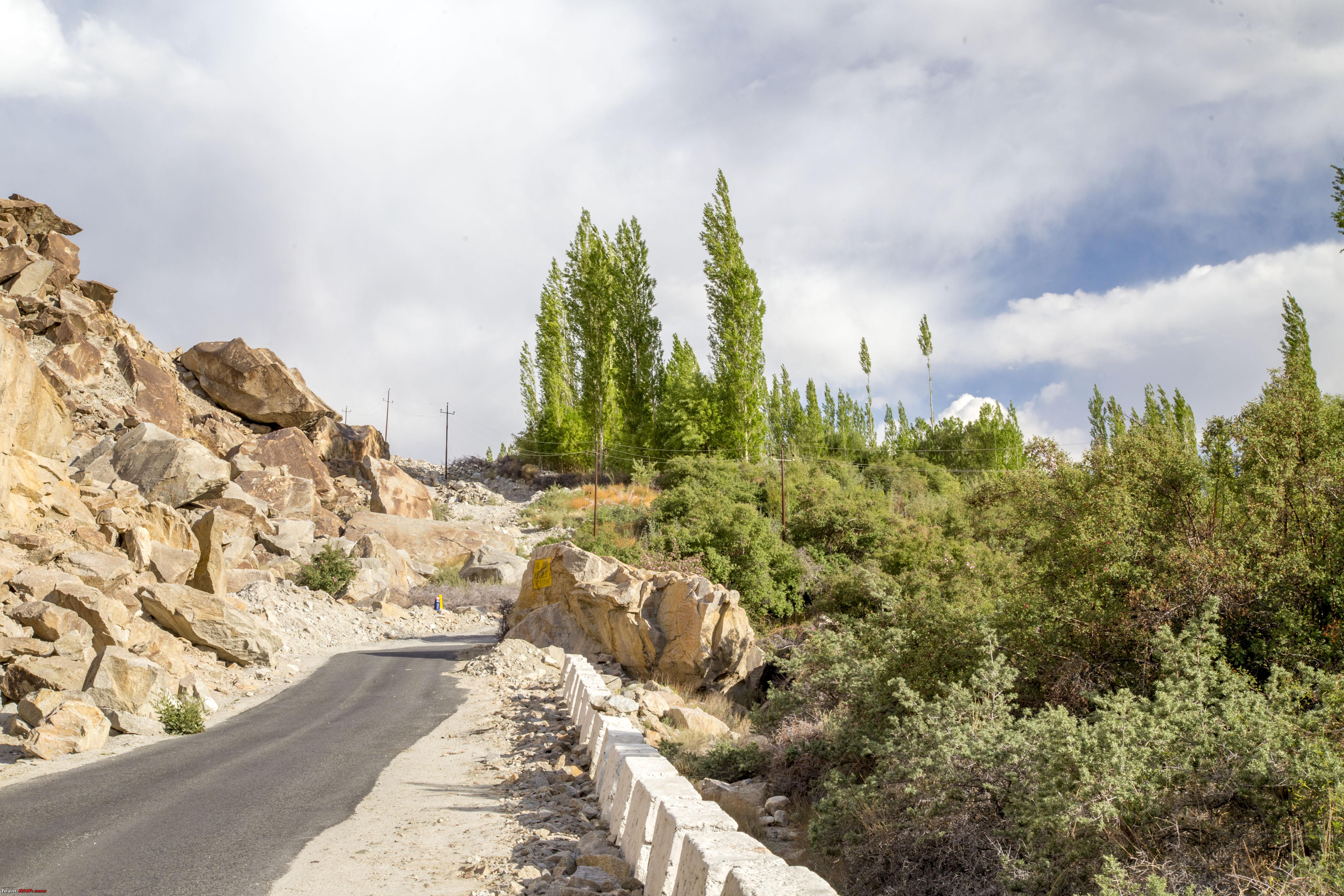 Soon we were at the Panamic Hot springs. This, the real Panamic Hot springs is situated a KM above, through dirt track and some climb. Usually in the Panamic village, there are resorts/swimming pool that get downstream water.  Me and my Daughter walked up even from the point above to the source Note the colour of the sedimentation! The water was unbelievably hot to touch  Some "Gyan"  Panamic Hot spring "Resort" located on the Sumur-Siachen road, easy to fall for it as the real thing!  Soon we were on our way back to Diskit via Sumur 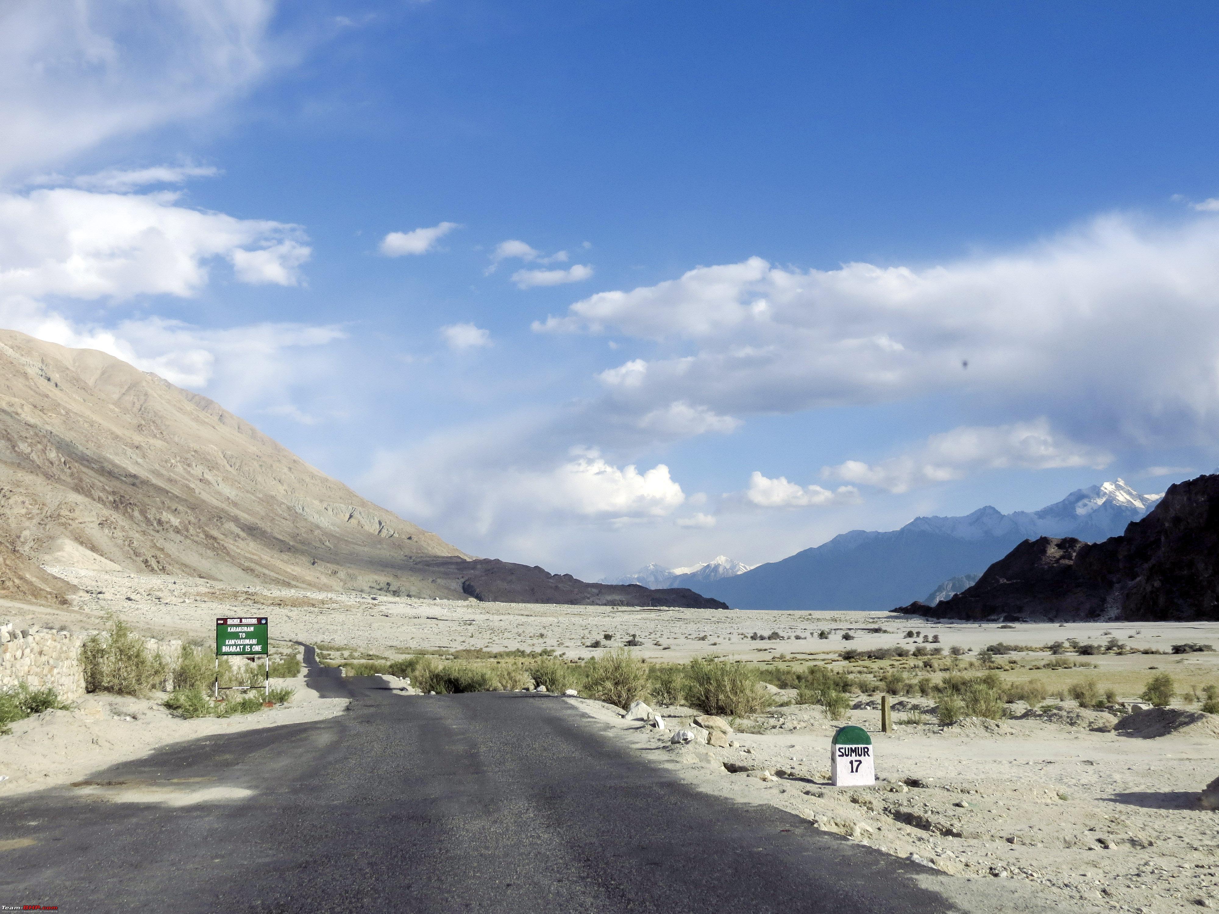  When we reached Diskit, there was still some left-over daylight and decided to take a stroll down to Hunder and these double hunched Camels  Some end of day "snappography" at the Dunes of Hunder  |
|
| (25)
Thanks
|
| The following 25 BHPians Thank 1100D for this useful post: | abhijeetp, ARAY, arungeorge, CrAzY dRiVeR, DrANTO, gmhossain, GTO, haisaikat, jailbird_fynix, jaunthead, mh09ad5578, mi2n, neil.jericho, Rudra Sen, Samba, Samfromindia, Sayata, Sheel, ssambyal1980, streetfighter, suhaas307, Surprise, Thermodynamics, tomraven99, Varun_HexaGuy |
|
11th July 2019, 22:56
| #6 |
| Senior - BHPian | Re: Ladakh Re-Juleh'd! With Siachen-Panamic-Agham-Chusul-MitpalTso-KaksangLa-TsoKar-KyunTso! The Ninth Day! Our plan for the day was to go across from Diskit to the Pangong lake in Changthang using the Agham-Shyok route. Not much in terms of distance, but then, some routes have to be taken, for the sake of it, besides, getting back to the lovely large blue lake was always on the plan. We started off by filling up at the Filling station at Diskit, under the watchful eye of the Maitreya Buddha!  However, have to say, that my experience with the Diesel from here, as well as the diesel's available in cans elsewhere has been unpleasant. More of that later. Soon we were again driving back towards Khalsar. After Khalsar, there is another T-junction, the road on right goes to KhardungLa and then Leh, and the straight road goes to Agham, Shyok and then onto Pangong. 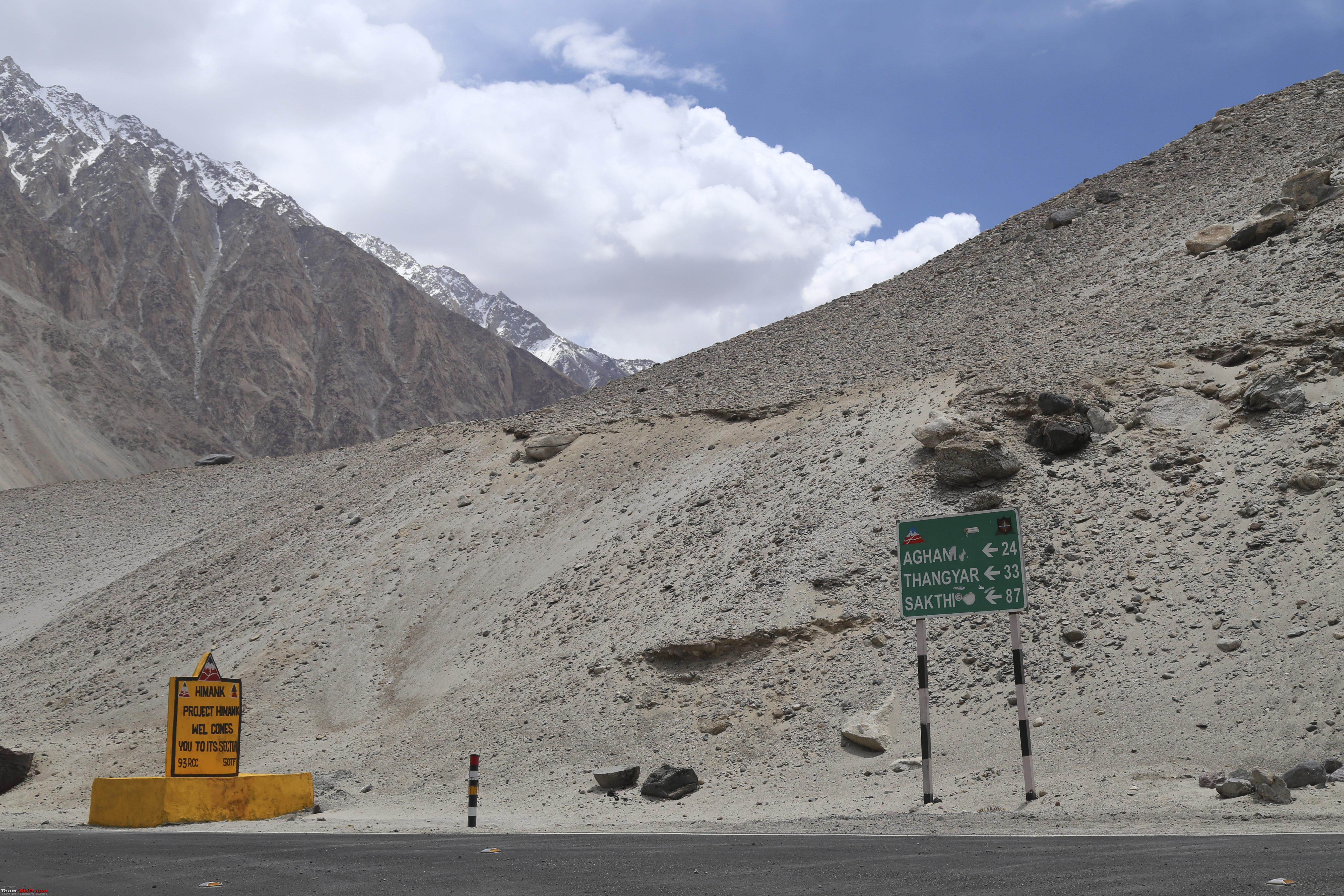 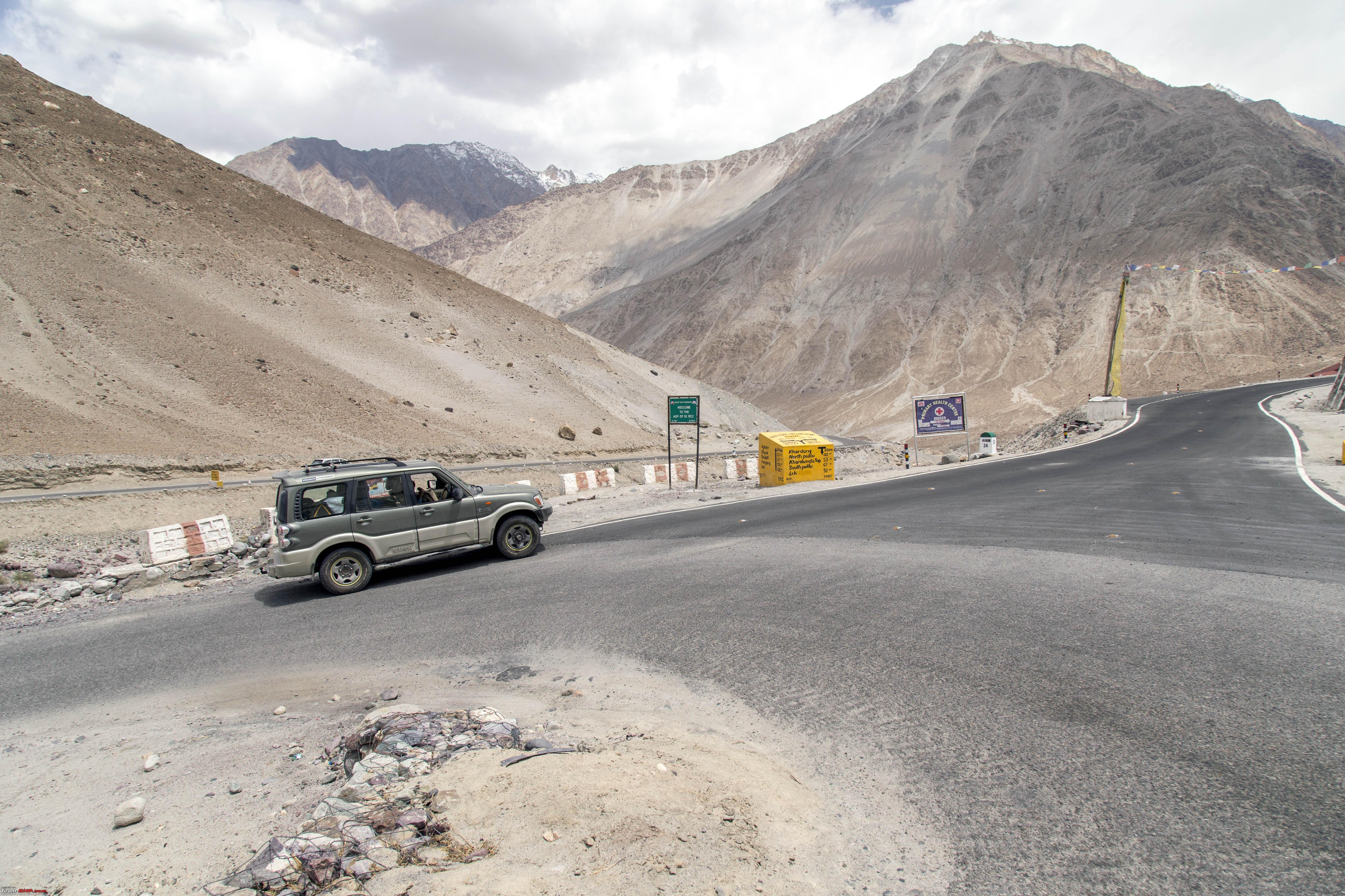 The surface is a mix of this 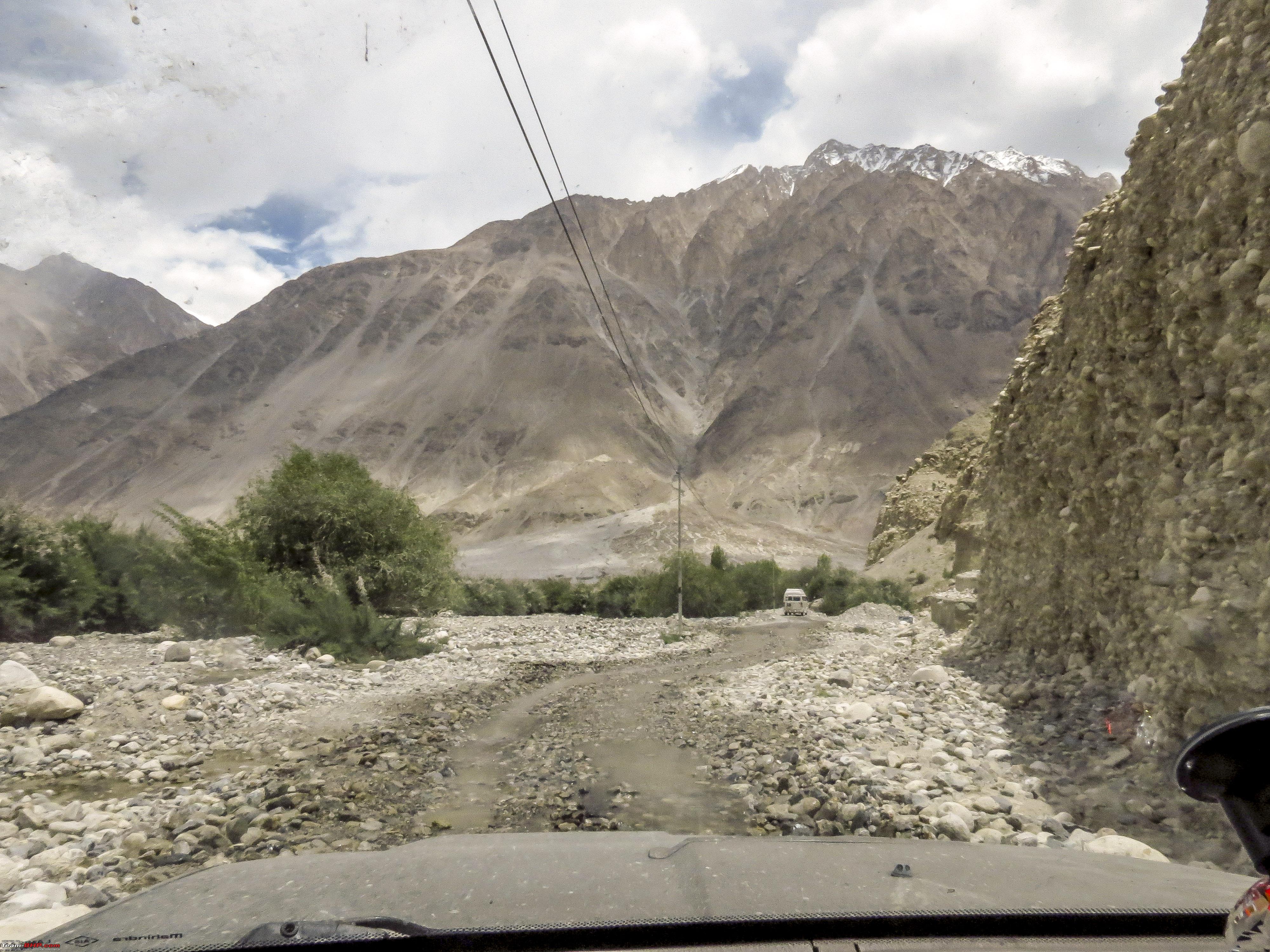 Some water 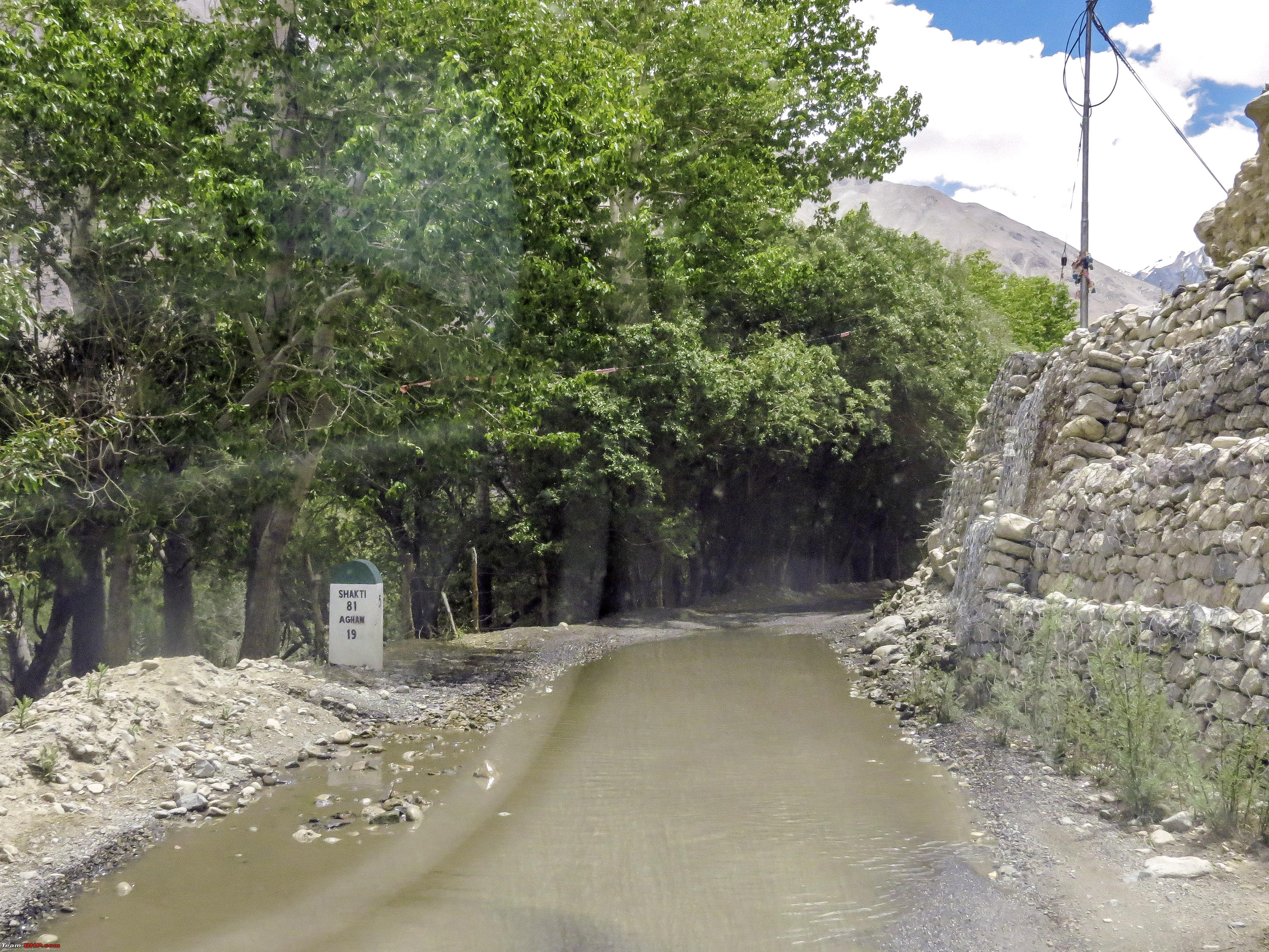 Some blacktop (around midway between Agham and Shyok) 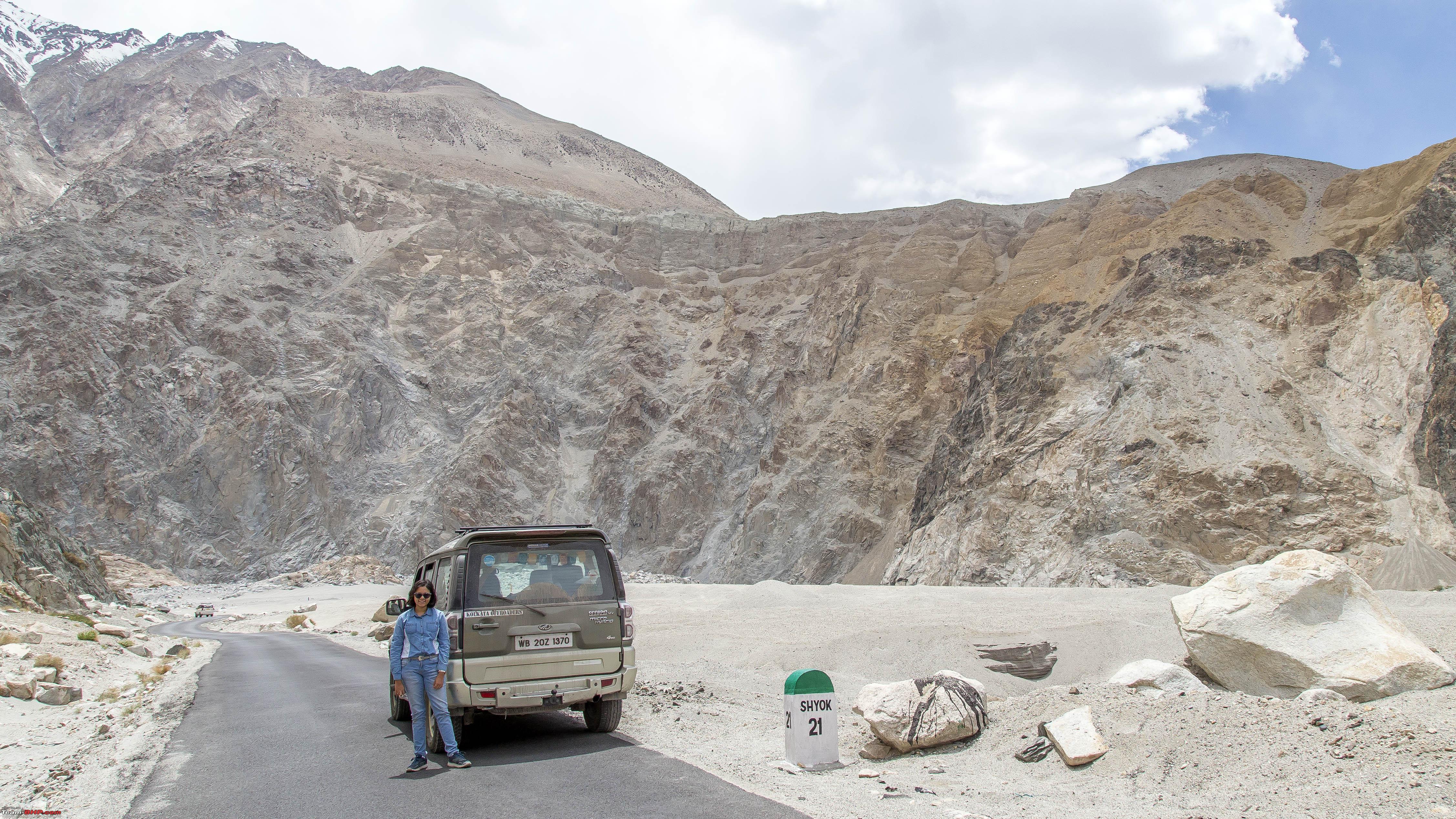 The other side of the same milestone  At some places it's an exercise of finding out which one is the track!  A lovely bailey at a picturesque location  Some more "track finding" 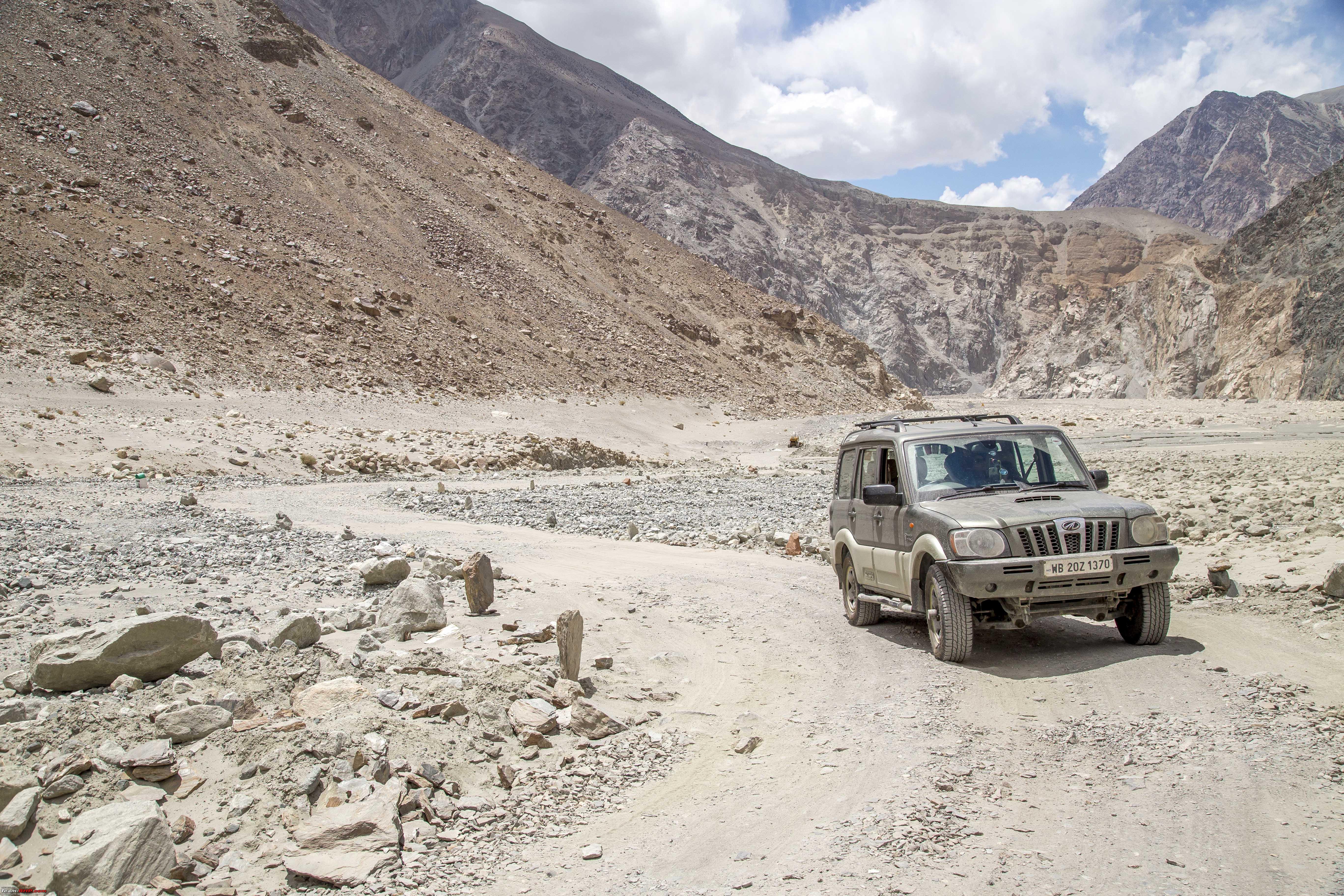 The Shyok river keeps company  Reason enough to stop and enjoy the "beach" for some time! 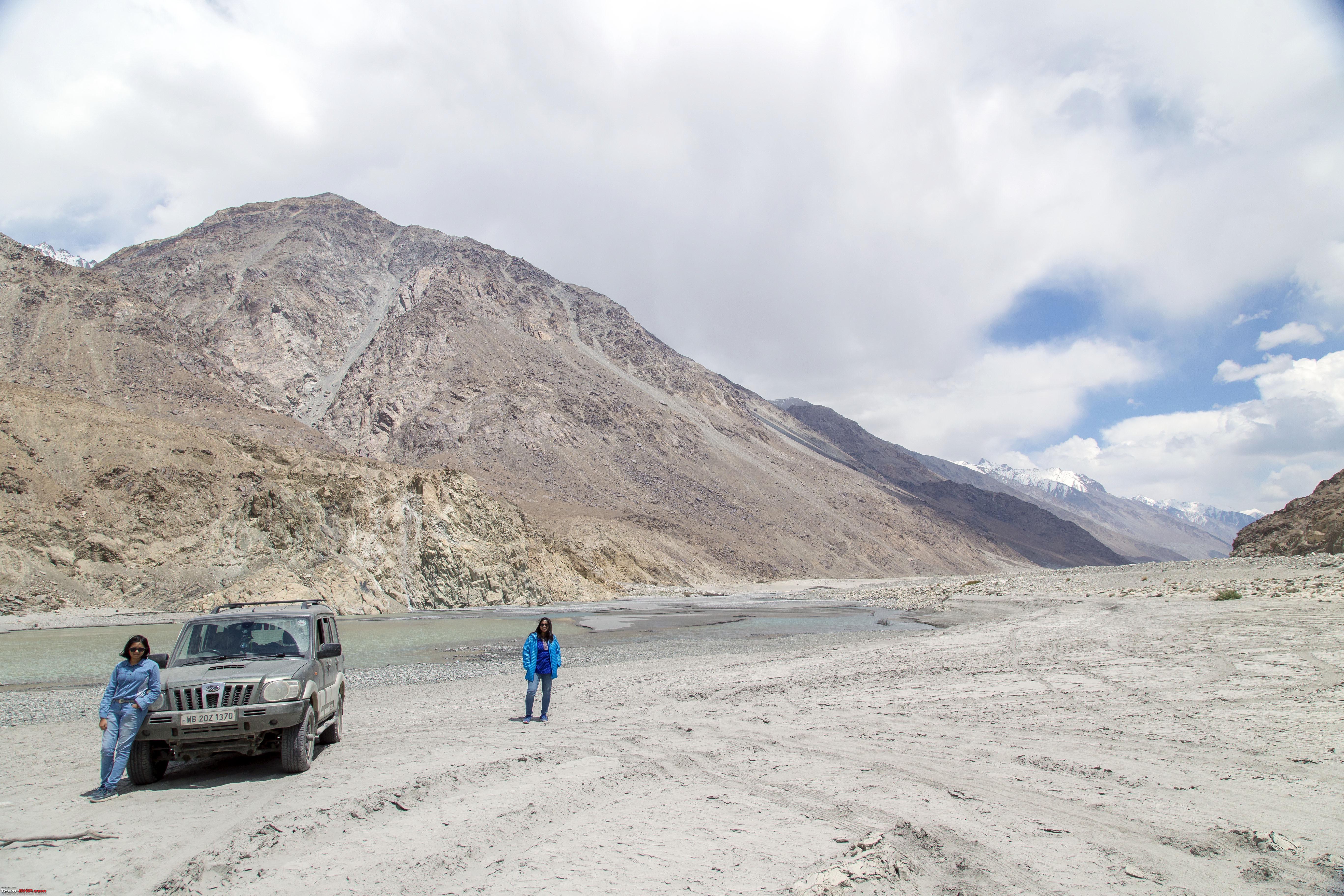  Track continues  A sole vehicle on the opposite side, reason enough to feel great! 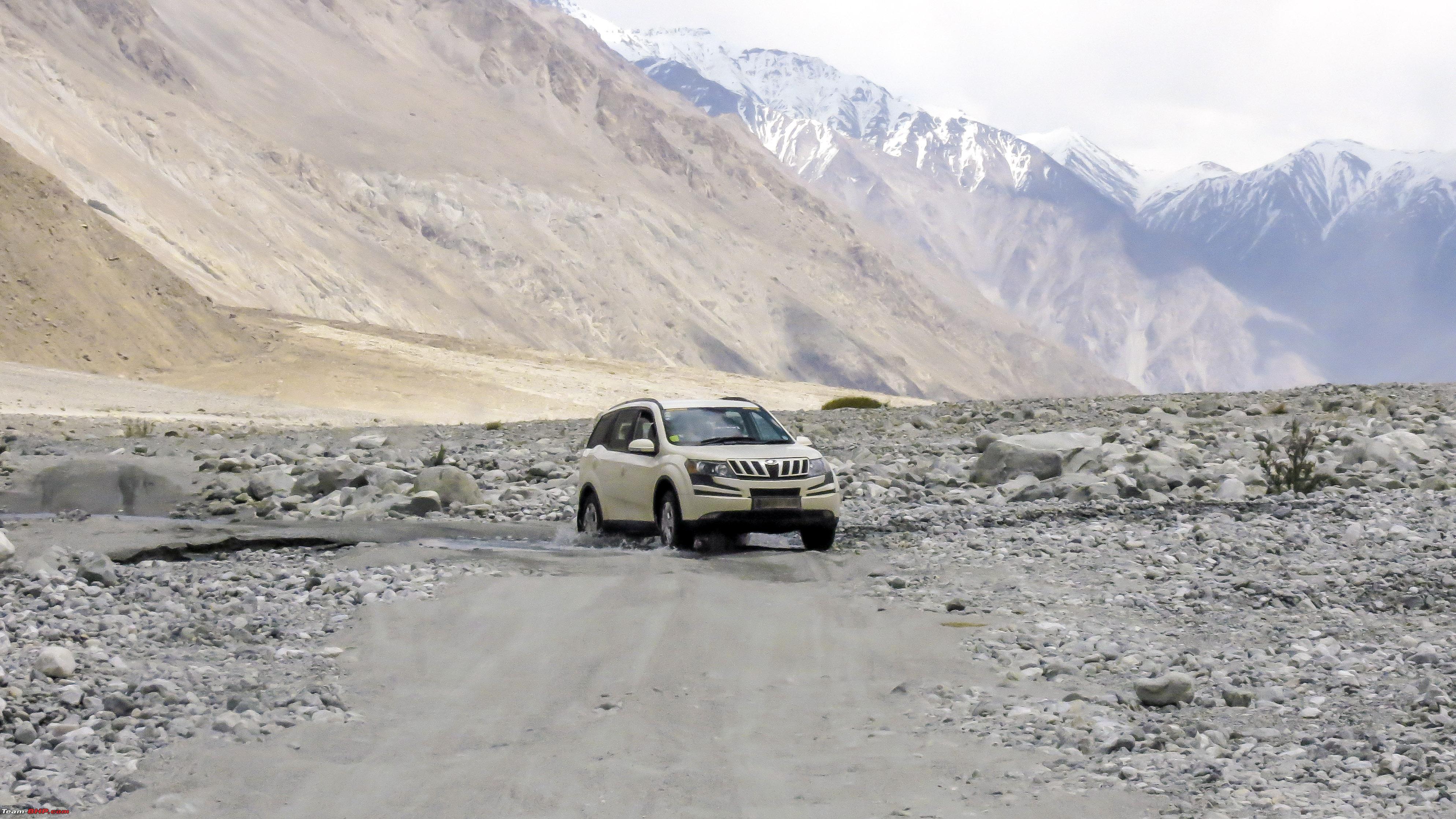 From this point onwards, its totally black top (how sad!) 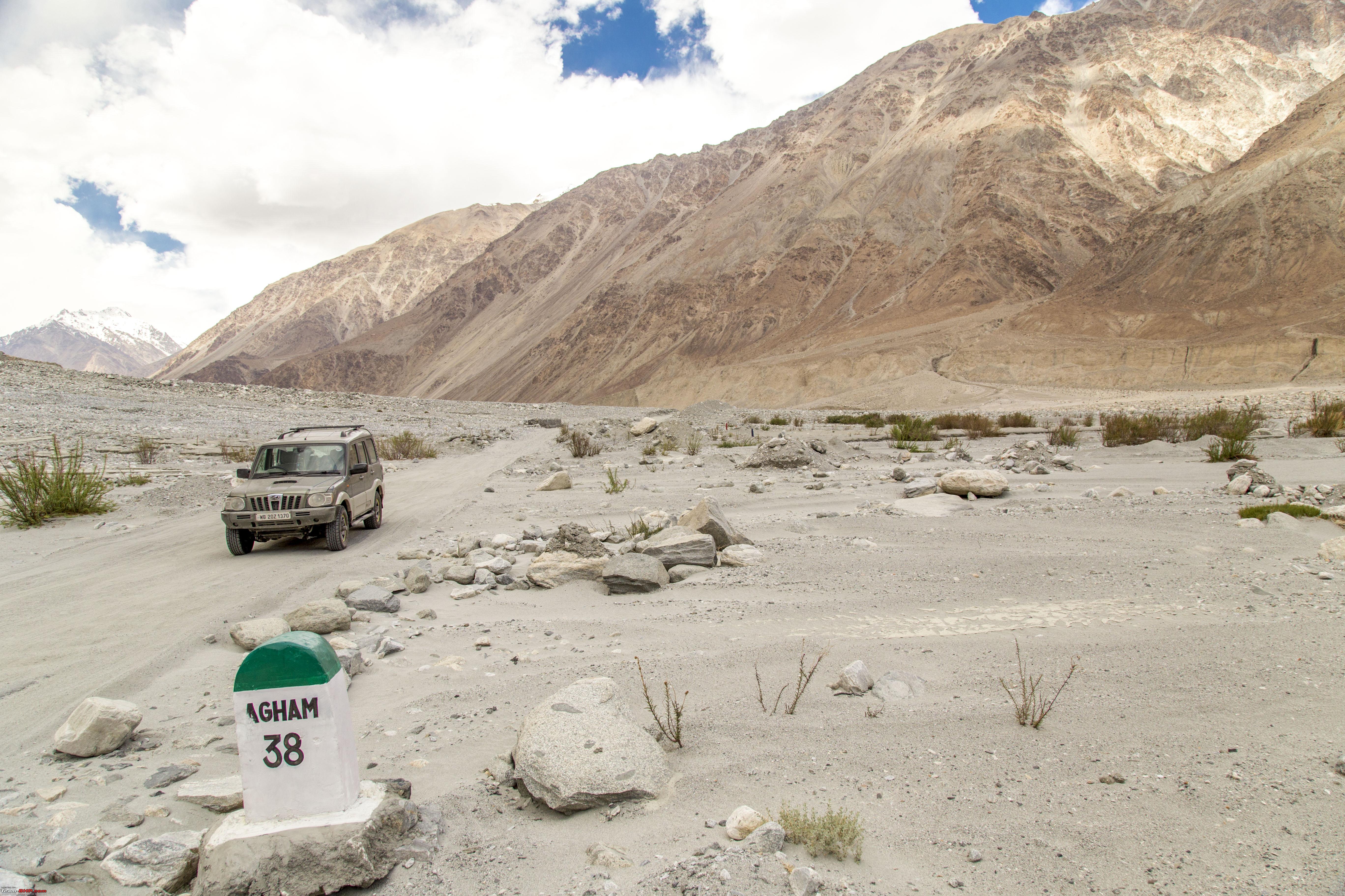 Soon we were driving up to Shyok 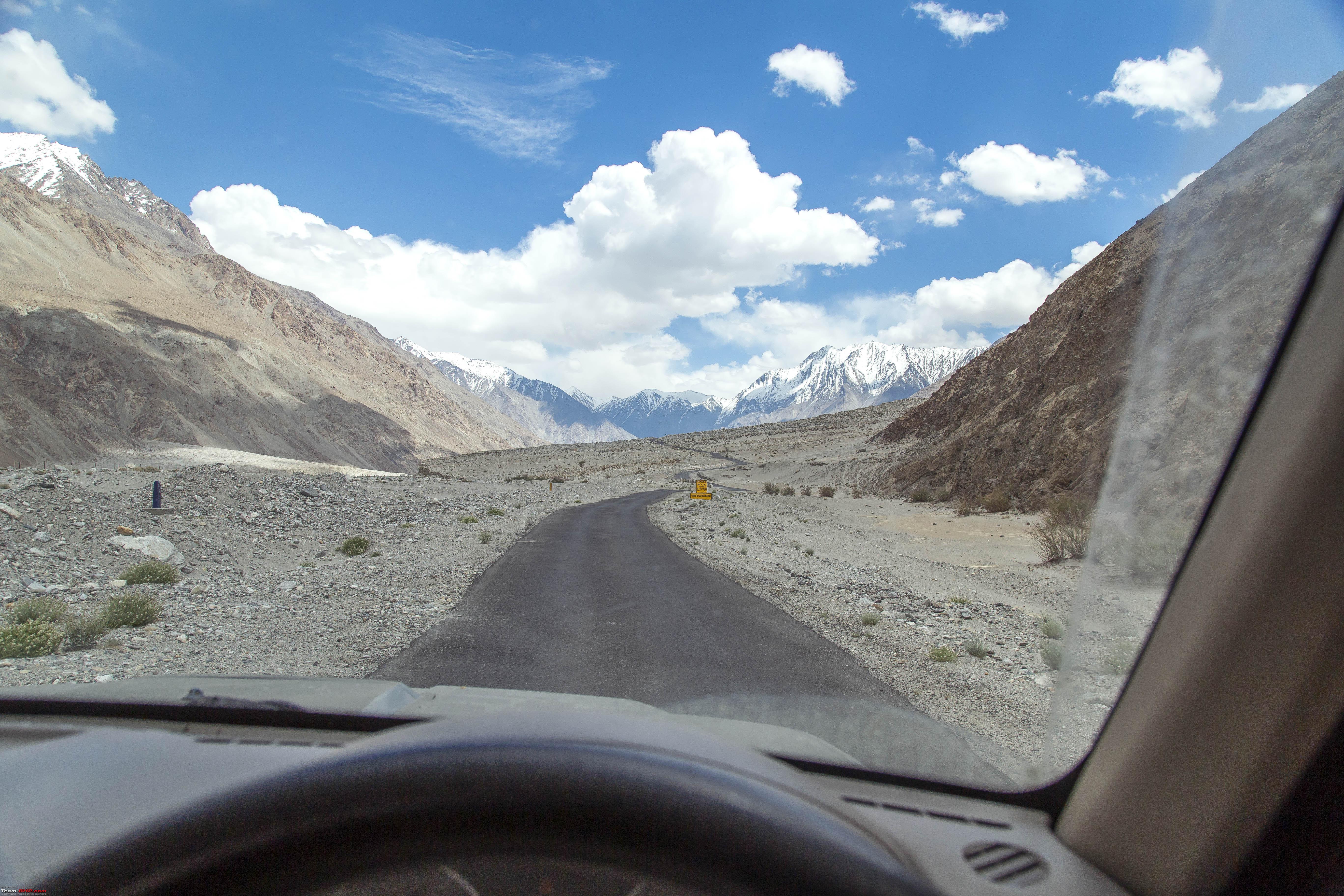 Shyok in the distance  At Shyok  Another fork at Shyok 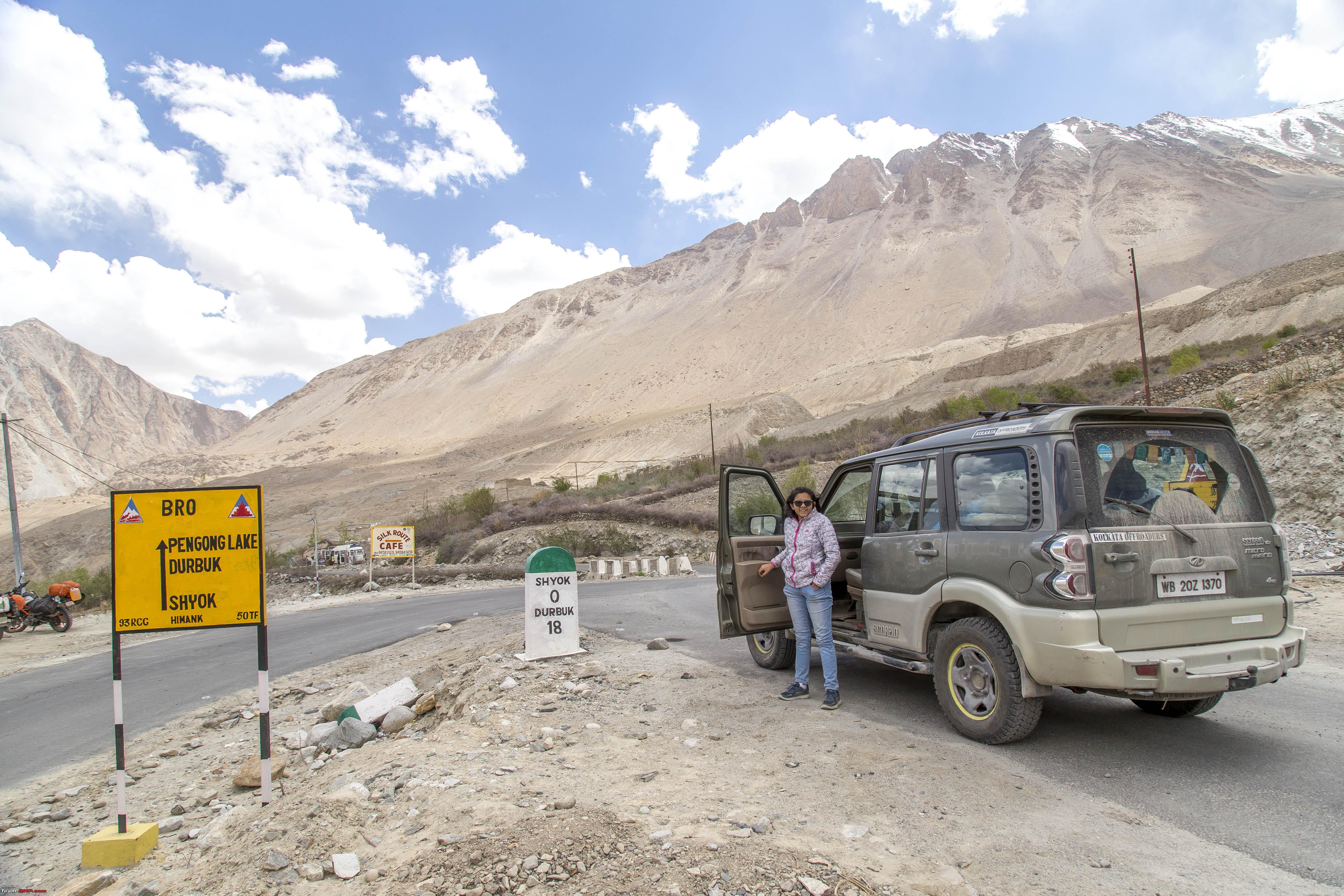 CNTD Last edited by 1100D : 11th July 2019 at 23:04. |
|
| (25)
Thanks
|
| The following 25 BHPians Thank 1100D for this useful post: | abhijeetp, alokn87, ARAY, CrAzY dRiVeR, desiaztec, Dr.Vikas, gmhossain, GTO, haisaikat, jailbird_fynix, mh09ad5578, mi2n, neil.jericho, Red Liner, Ronak_7, Rudra Sen, Samba, Samfromindia, Sayata, Sheel, ssambyal1980, streetfighter, Surprise, Thermodynamics, Varun_HexaGuy |
|
11th July 2019, 23:10
| #7 |
| Senior - BHPian | Re: Ladakh Re-Juleh'd! With Siachen-Panamic-Agham-Chusul-MitpalTso-KaksangLa-TsoKar-KyunTso! The Ninth Day! - cntd Scenery right after Shyok  Pushing on towards Durbuk 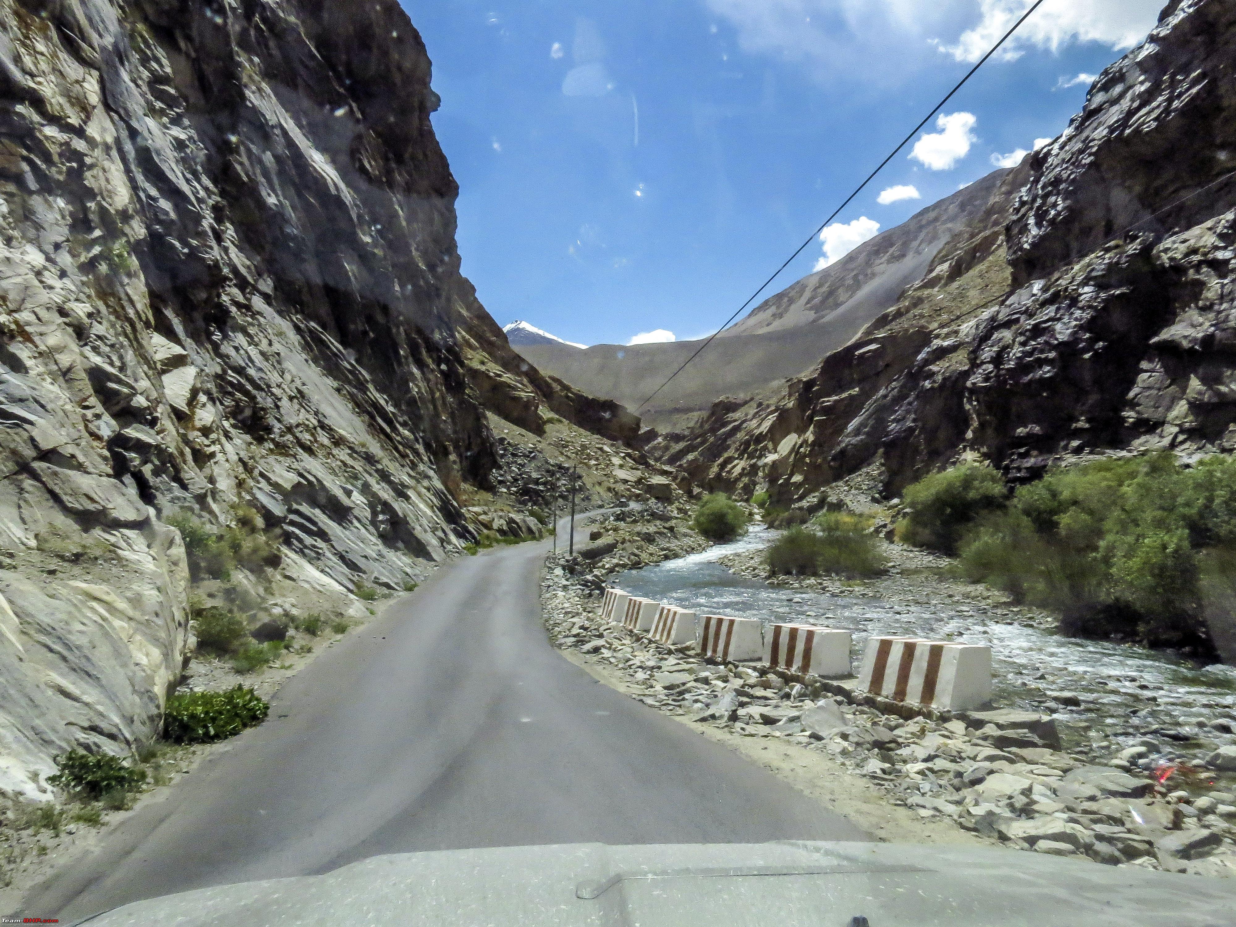 Some Shifting Sand on the road after Tangste  Some mandatory posing at this  Pangong, BACK we are!! 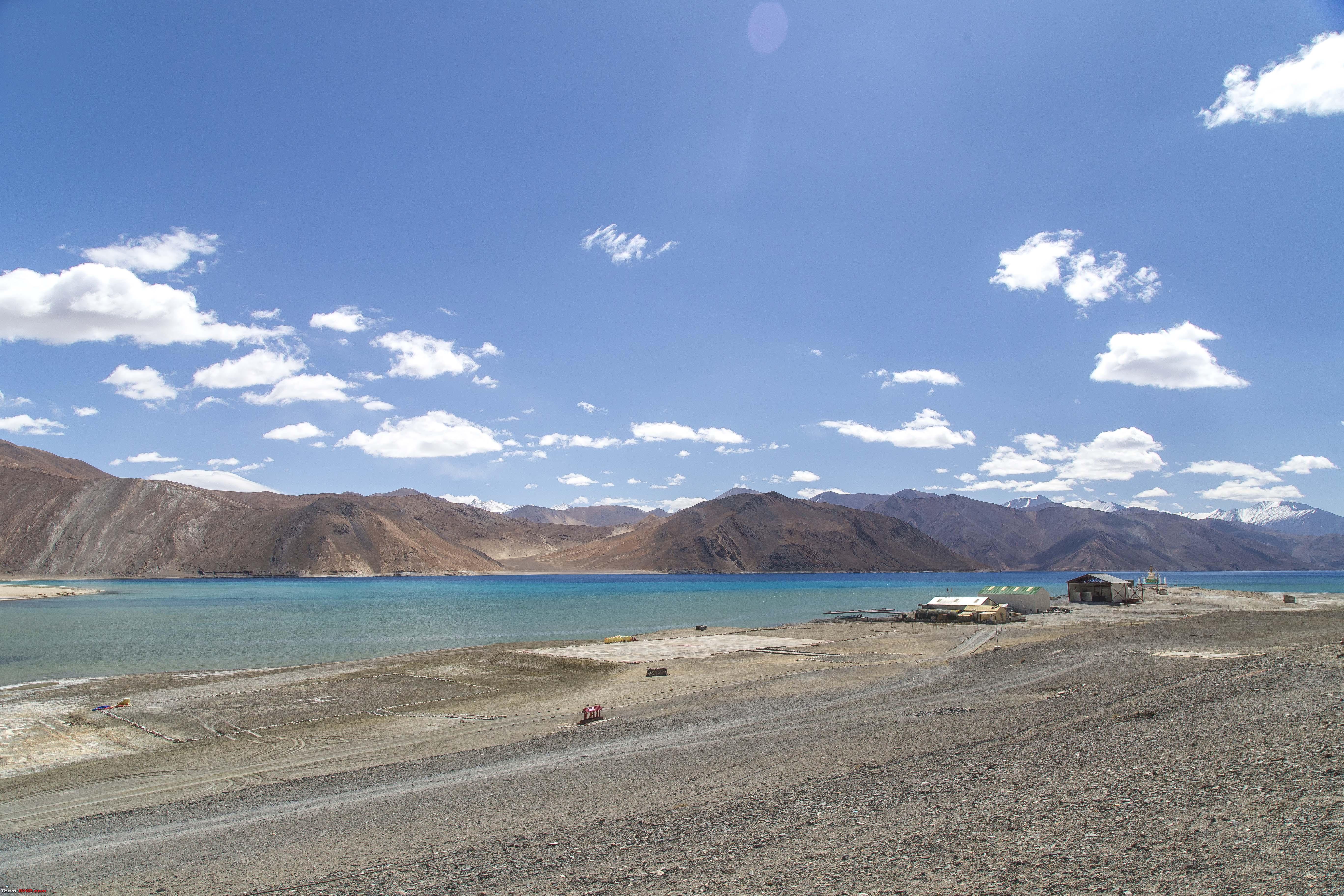 We decided to keep driving beyond the usual tourist gatherings towards Spangmik, just to find a secluded enough location without having too many people spoil our snaps But looks like, we had to drive beyond Spangmik also. Spangmik has now, after 5 years become a maze of cheap camps almost overlapping each other.    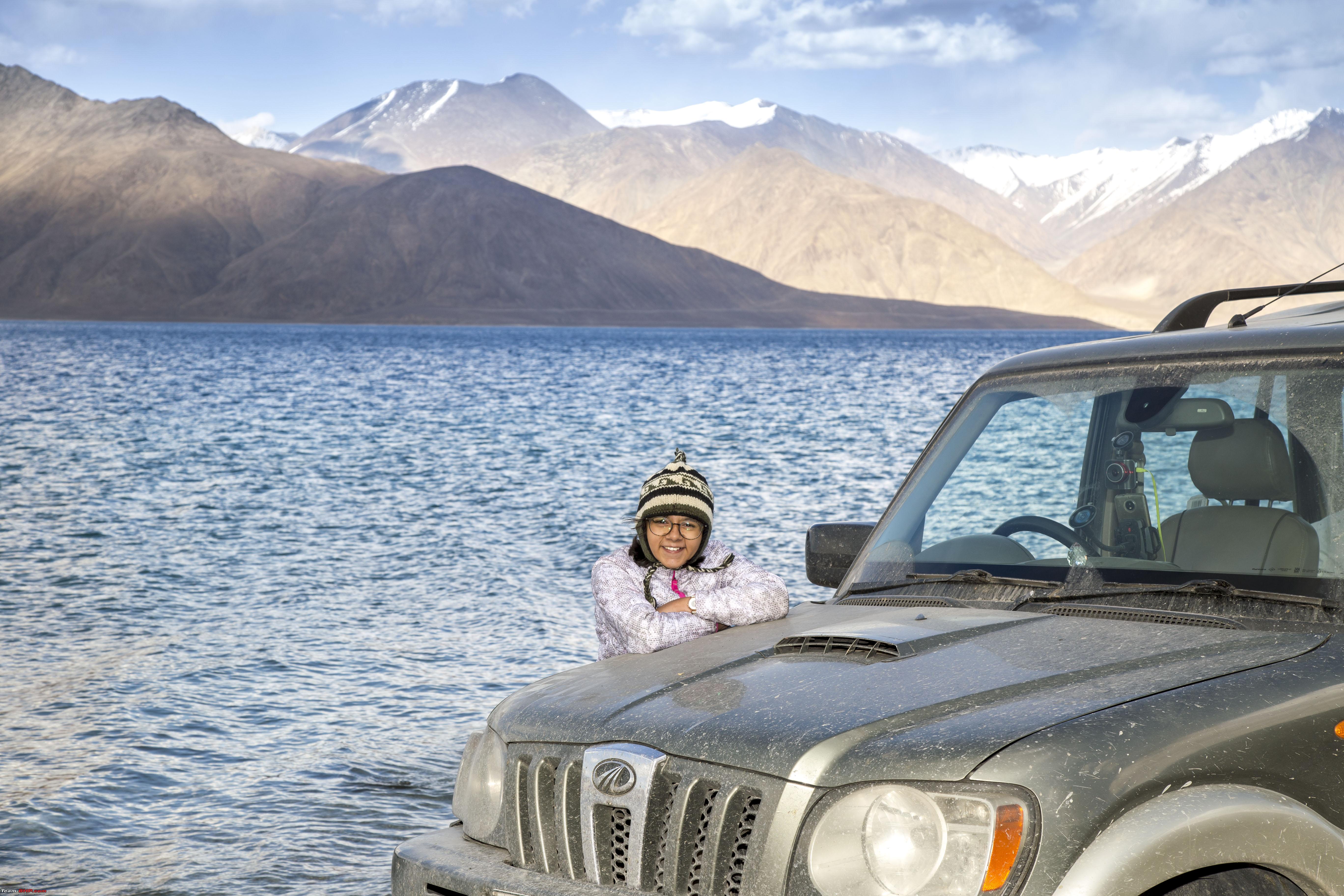  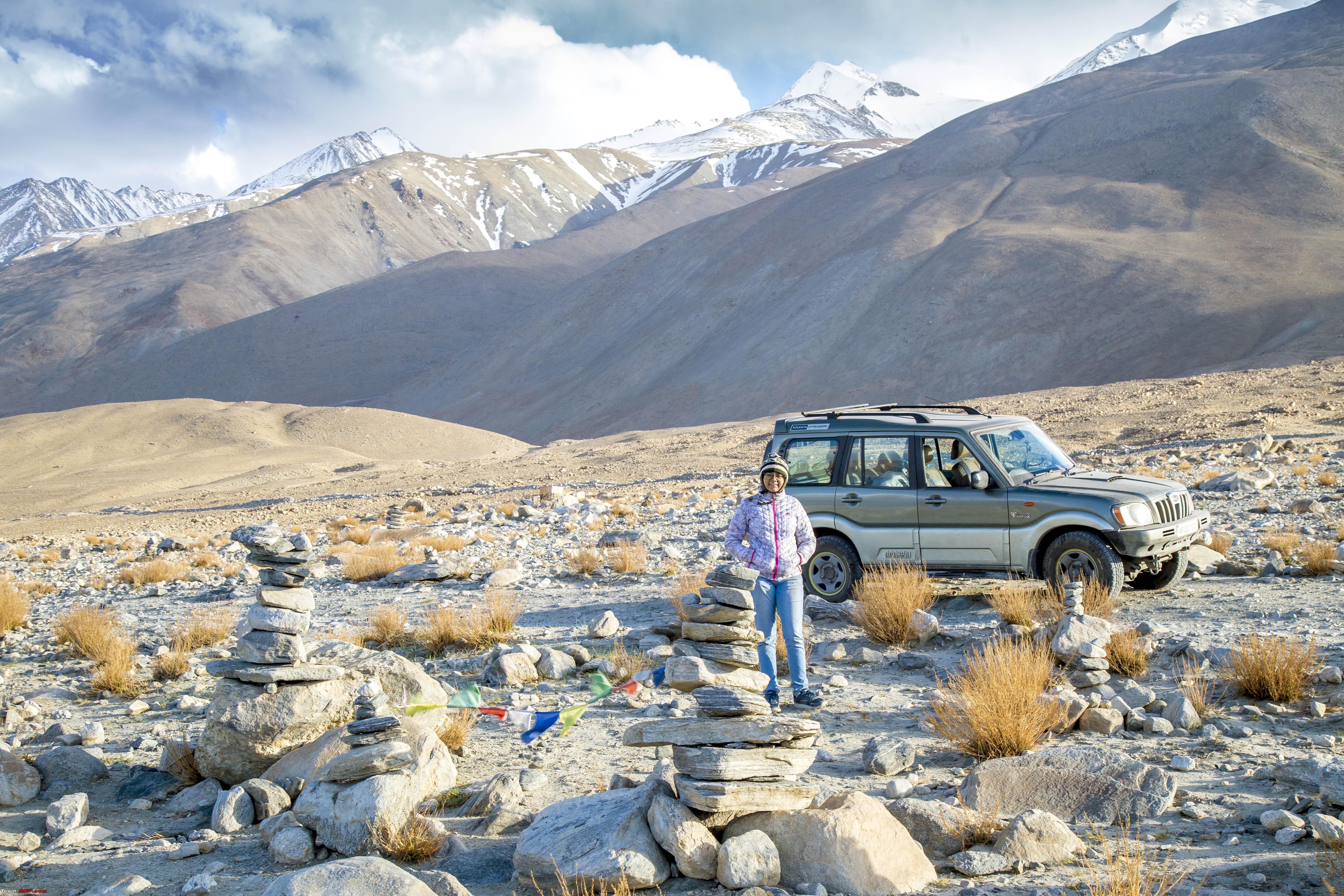  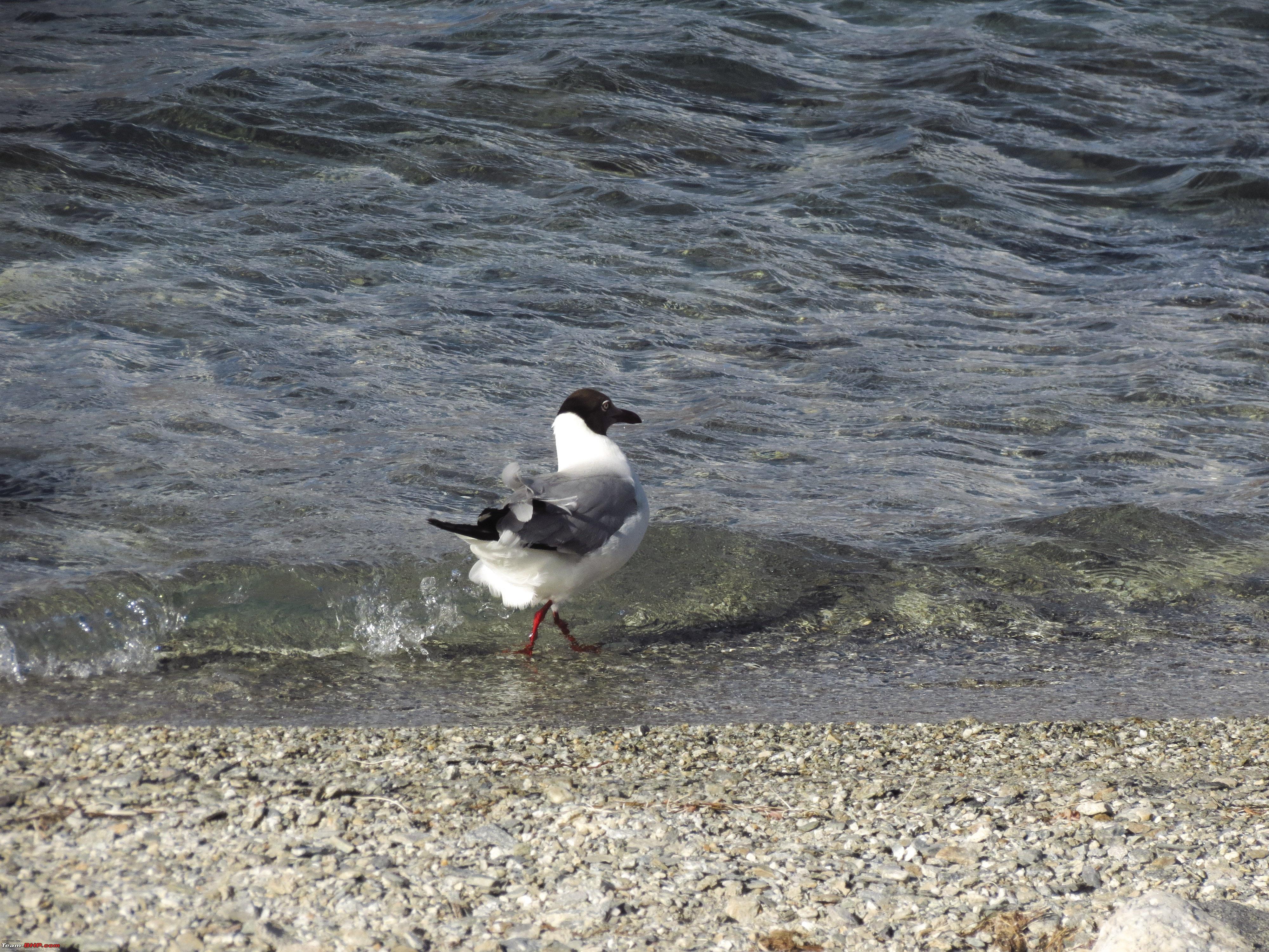 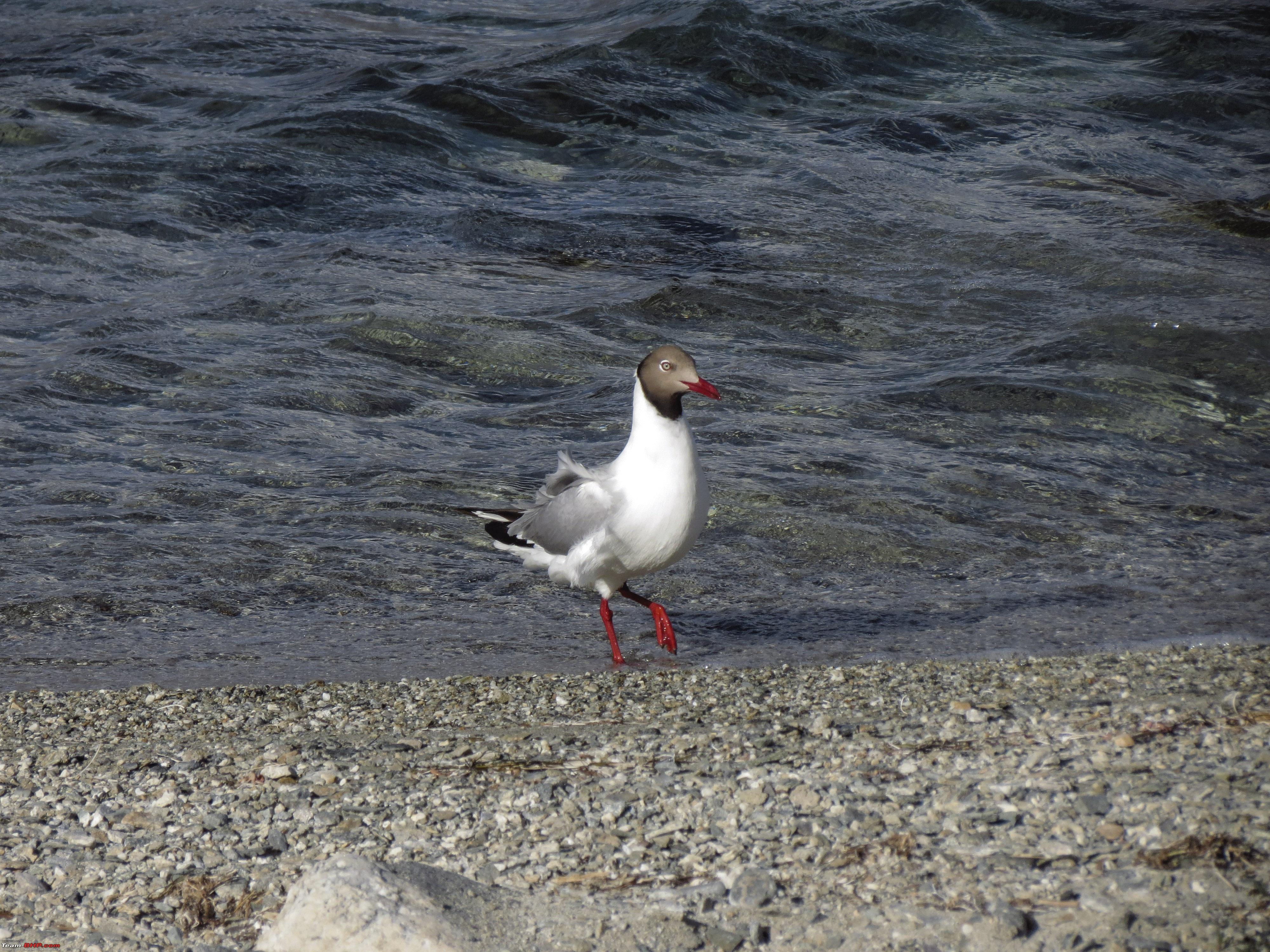 Soon it was time to head back, our decision was to stay over at Tangste (rather than near Pangong) in order to be a "little" immune from the perils of altitude.  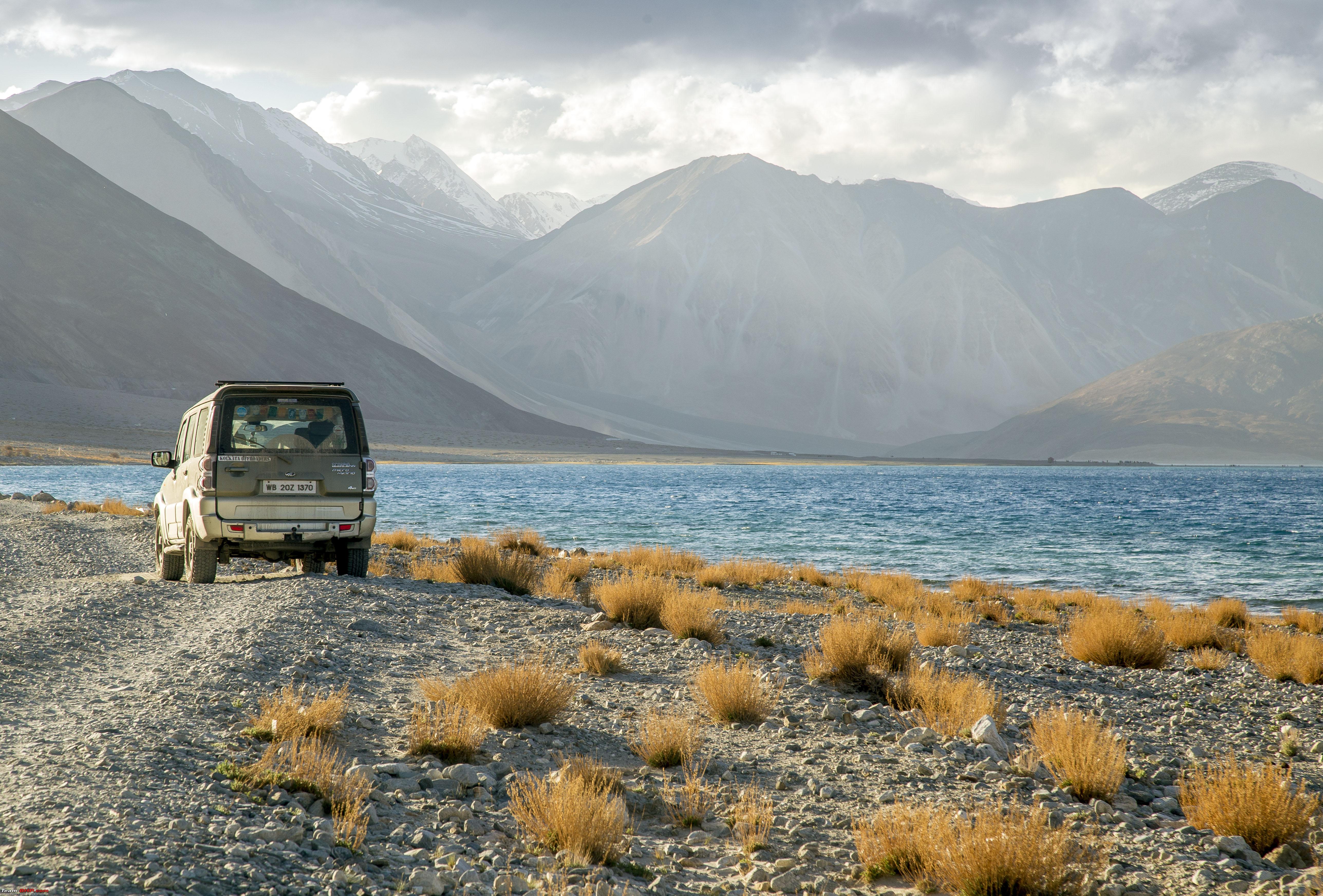 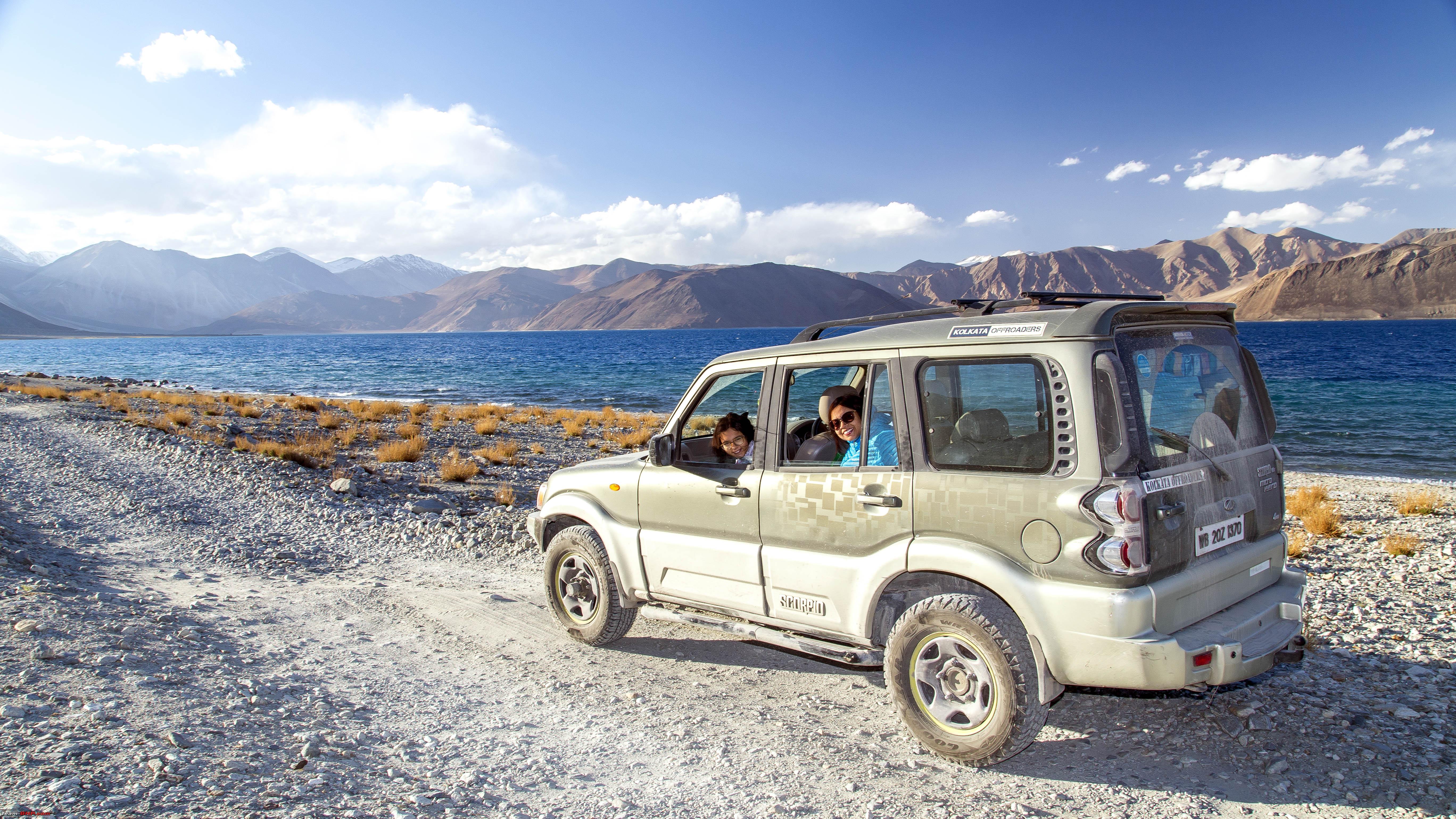 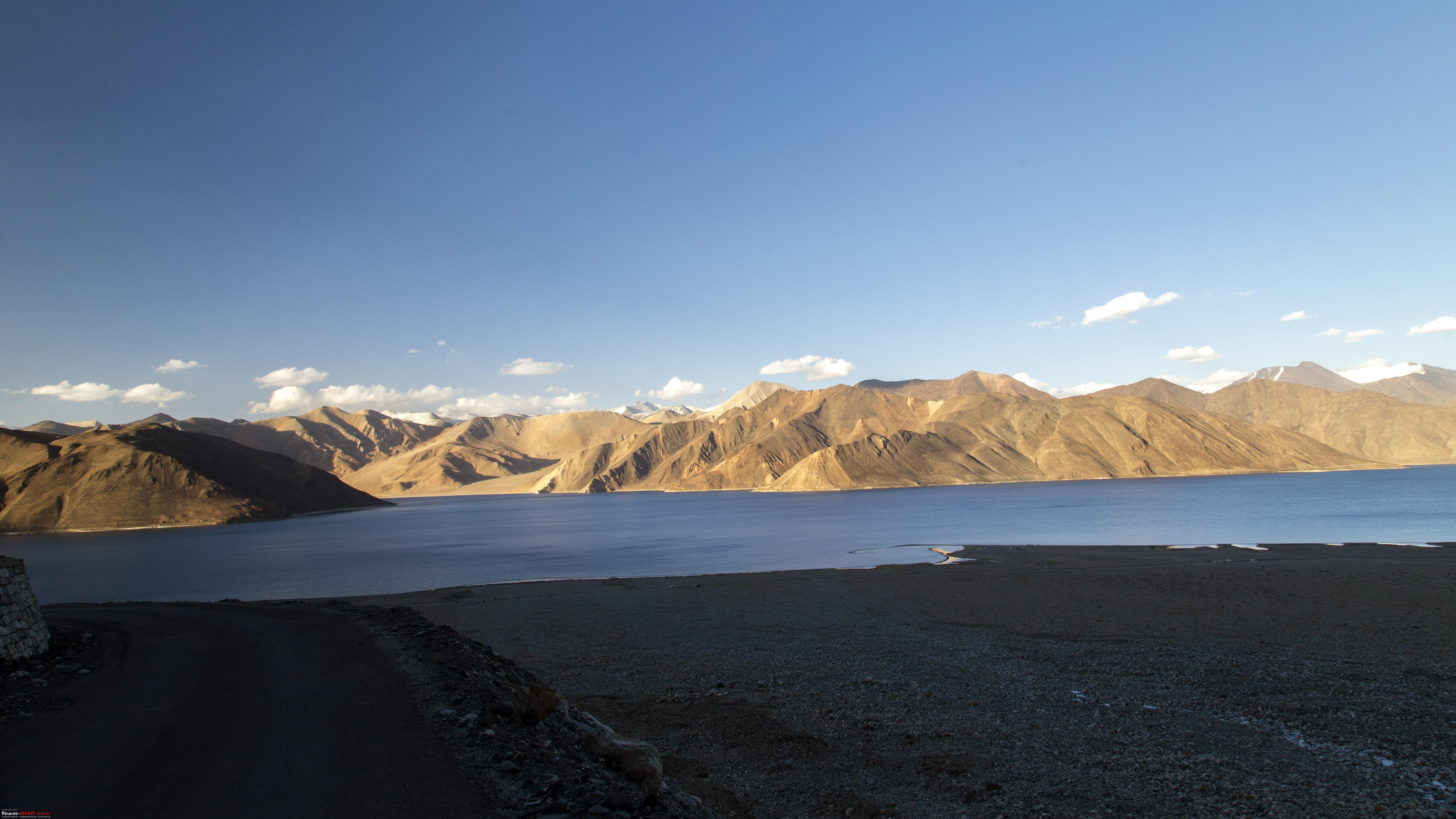 However, not before a customary glass of coffee at this 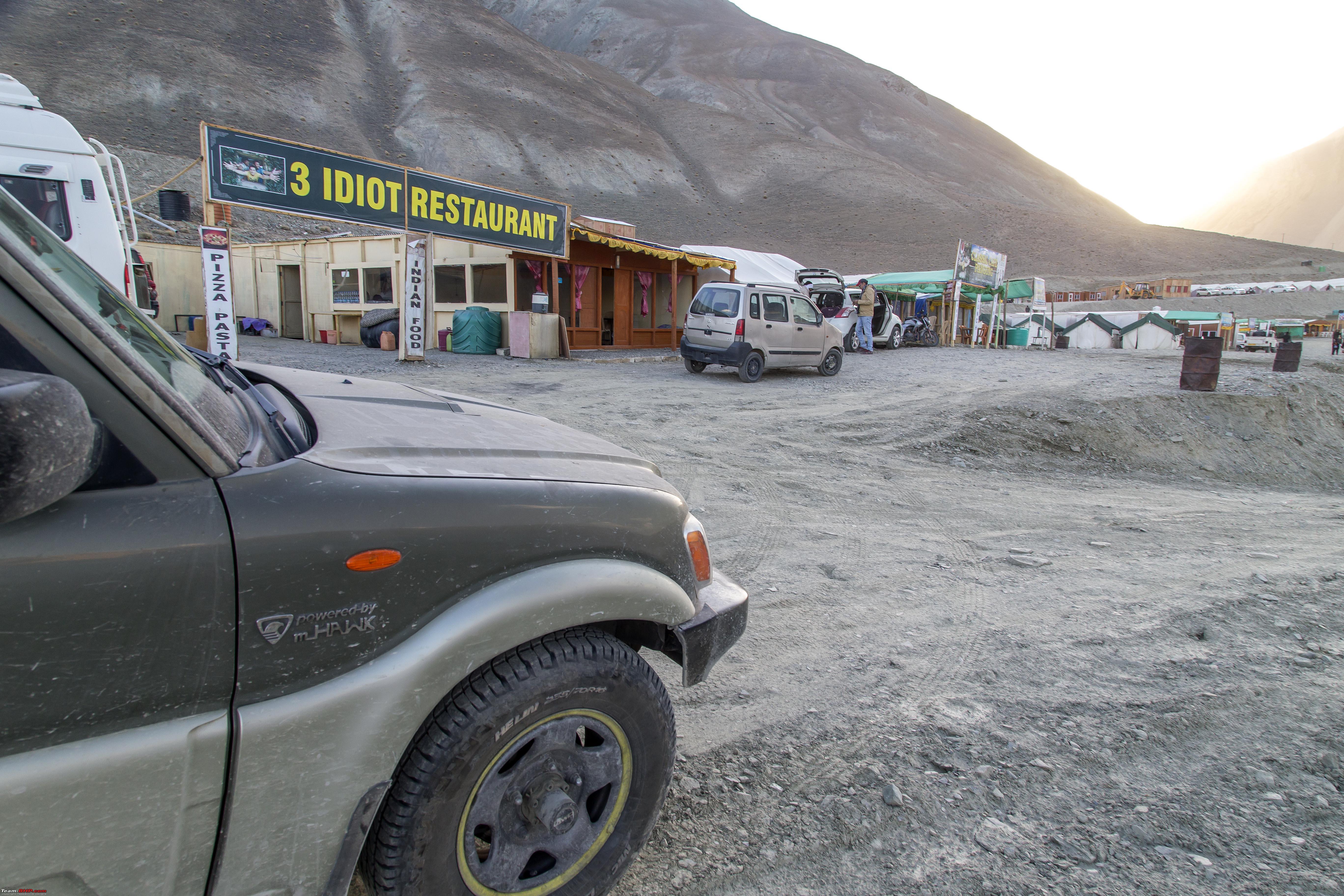 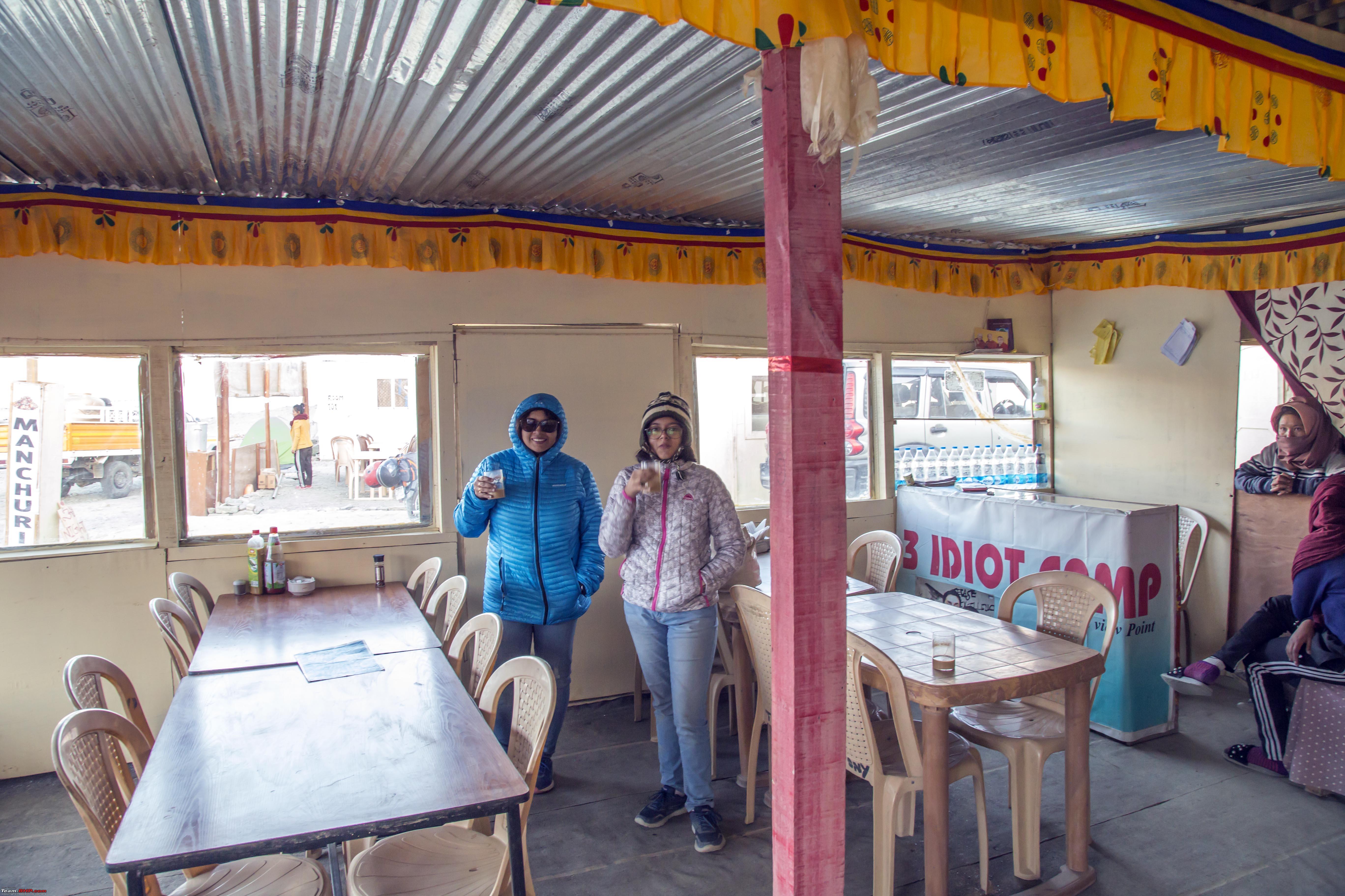 Last edited by 1100D : 11th July 2019 at 23:16. |
|
| (23)
Thanks
|
| The following 23 BHPians Thank 1100D for this useful post: | abhijeetp, ARAY, CrAzY dRiVeR, Dr.Vikas, gmhossain, GTO, haisaikat, i20ian, jailbird_fynix, maximus., mh09ad5578, mi2n, neil.jericho, Ronak_7, Rudra Sen, Samba, Samfromindia, Sayata, Sheel, ssambyal1980, streetfighter, Thermodynamics, Varun_HexaGuy |
|
11th July 2019, 23:31
| #8 |
| Senior - BHPian | Re: Ladakh Re-Juleh'd! With Siachen-Panamic-Agham-Chusul-MitpalTso-KaksangLa-TsoKar-KyunTso! The Longest Day! The Tenth! Well not exactly. But this day would have the probability of turning out to be one hell of a long haul, should situations demand. The plan for the day was to not only go from Changthang (near Pangong) to Chumathang (near Mahe) by the route via Man, Merak, Chusul but also use the KaksangLa route to Mahe, instead of TsagaLa route to Loma (that we had taken earlier). It was the later portion that was shroud with uncertainty. Firstly, at the permit office they weren't sure about putting this up, secondly, there was no information available about the latest status of this route. Even knowledge of the people I had asked, seemed lacking. So, there was a possibility that this 75km route might have been discontinuous at some point, in which case one would have to head back to Chusul and retrace TsagaLa route. Which could, in essence, mean, it could take forever. We started early, from Tangste (that also was a 50km setback) for a snap at an unnecessary point like this 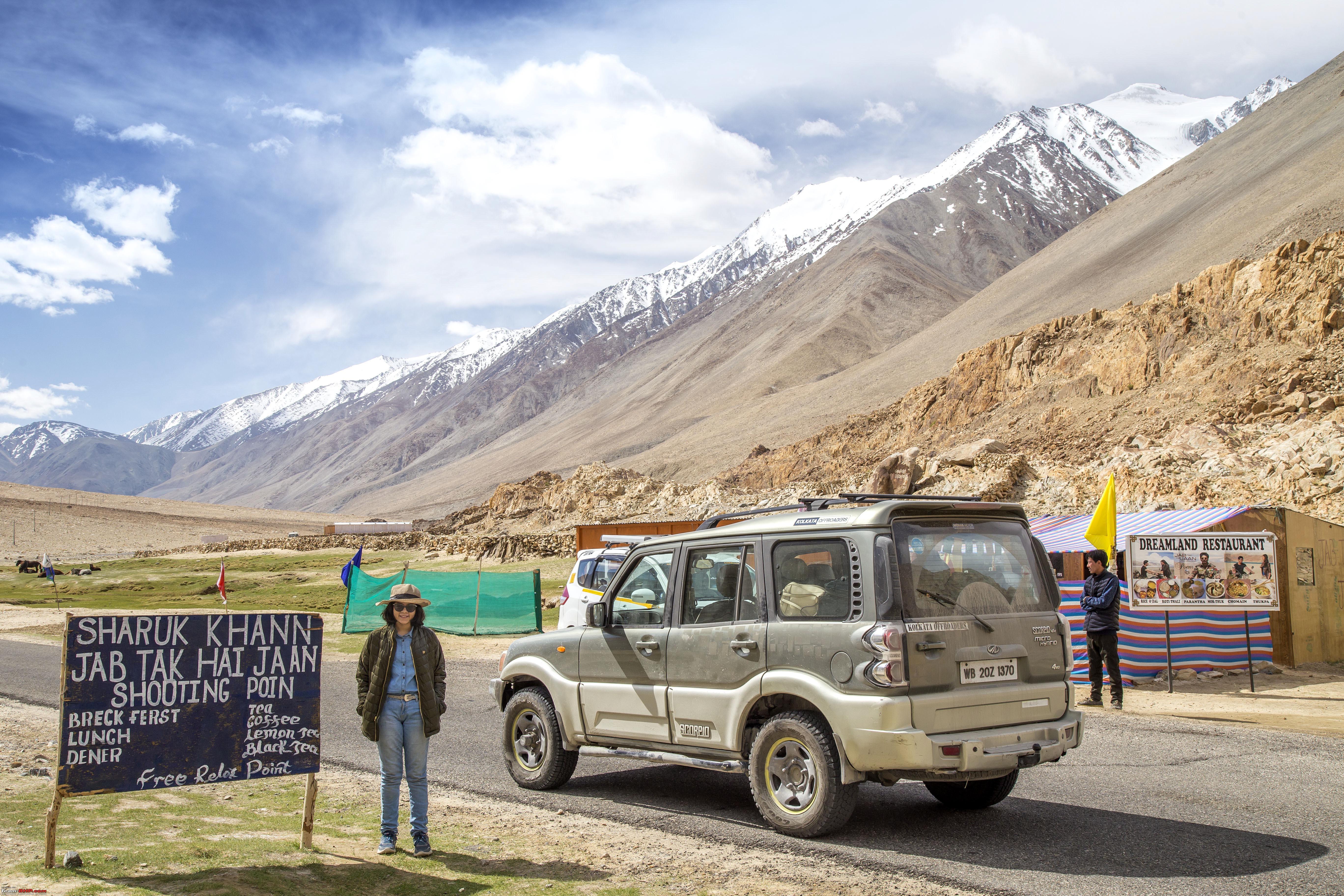 Soon we were at this lake (again!) 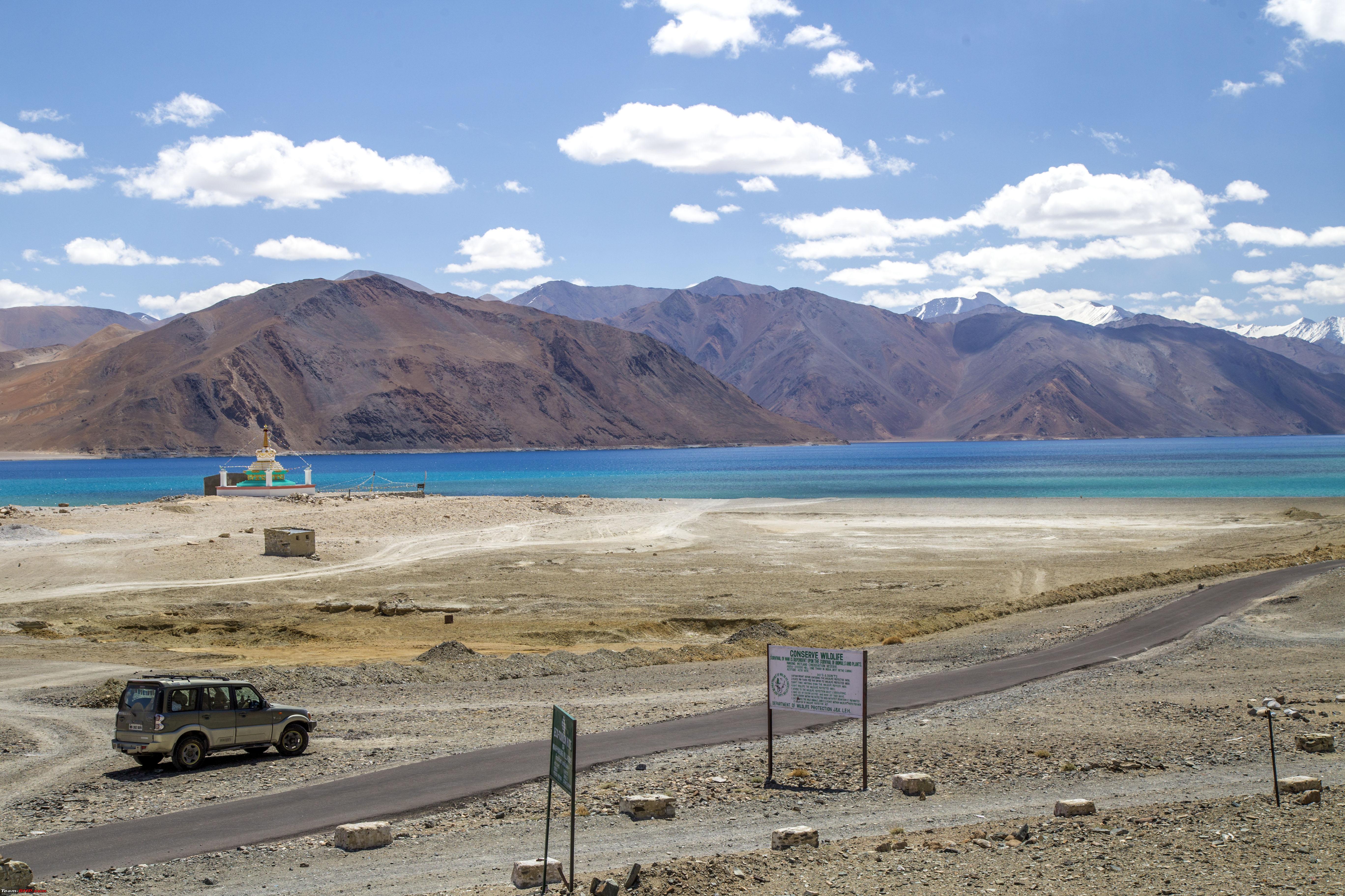 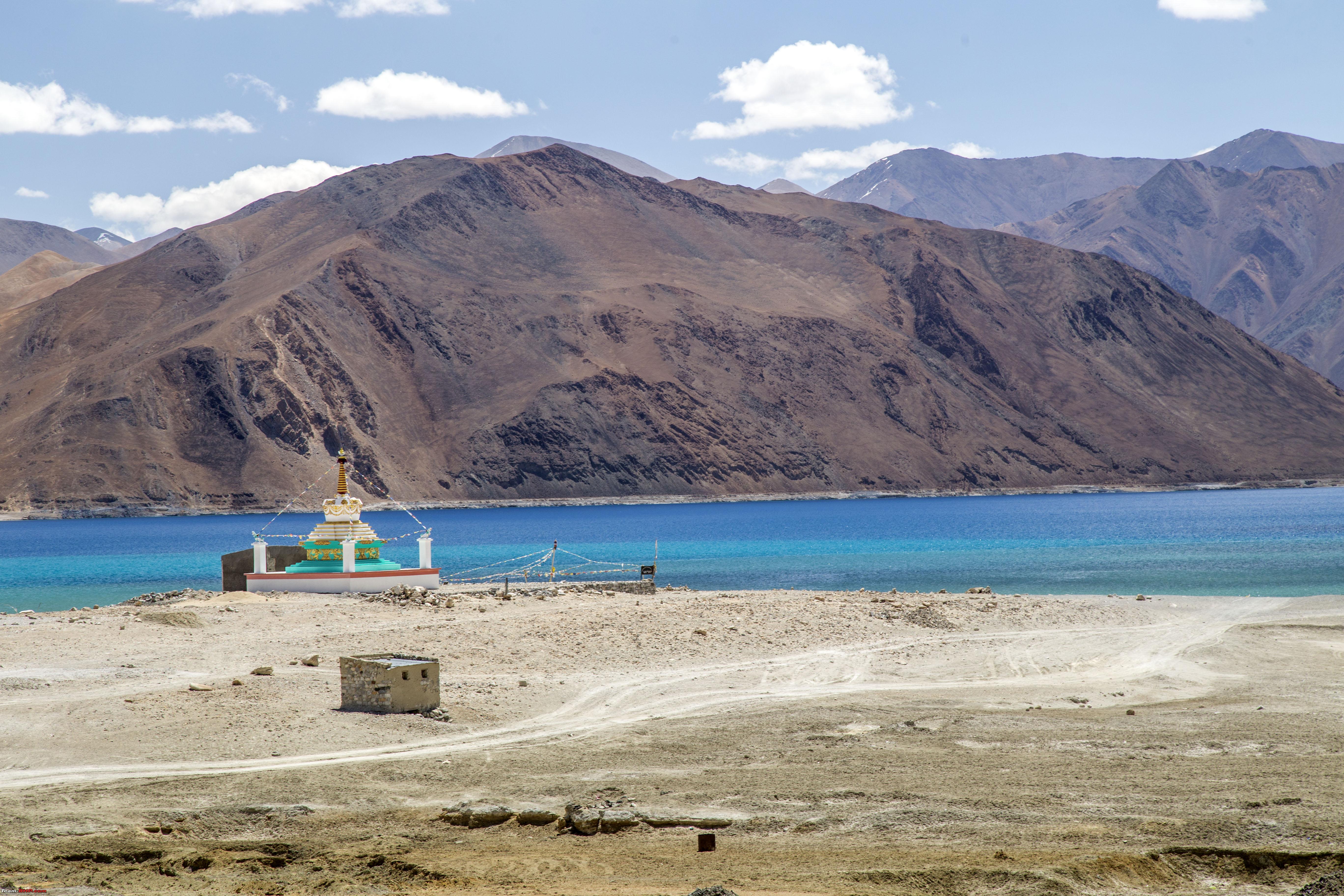 We would drive all the way upto Spangmik and start our 50km long drive along this beautiful lake  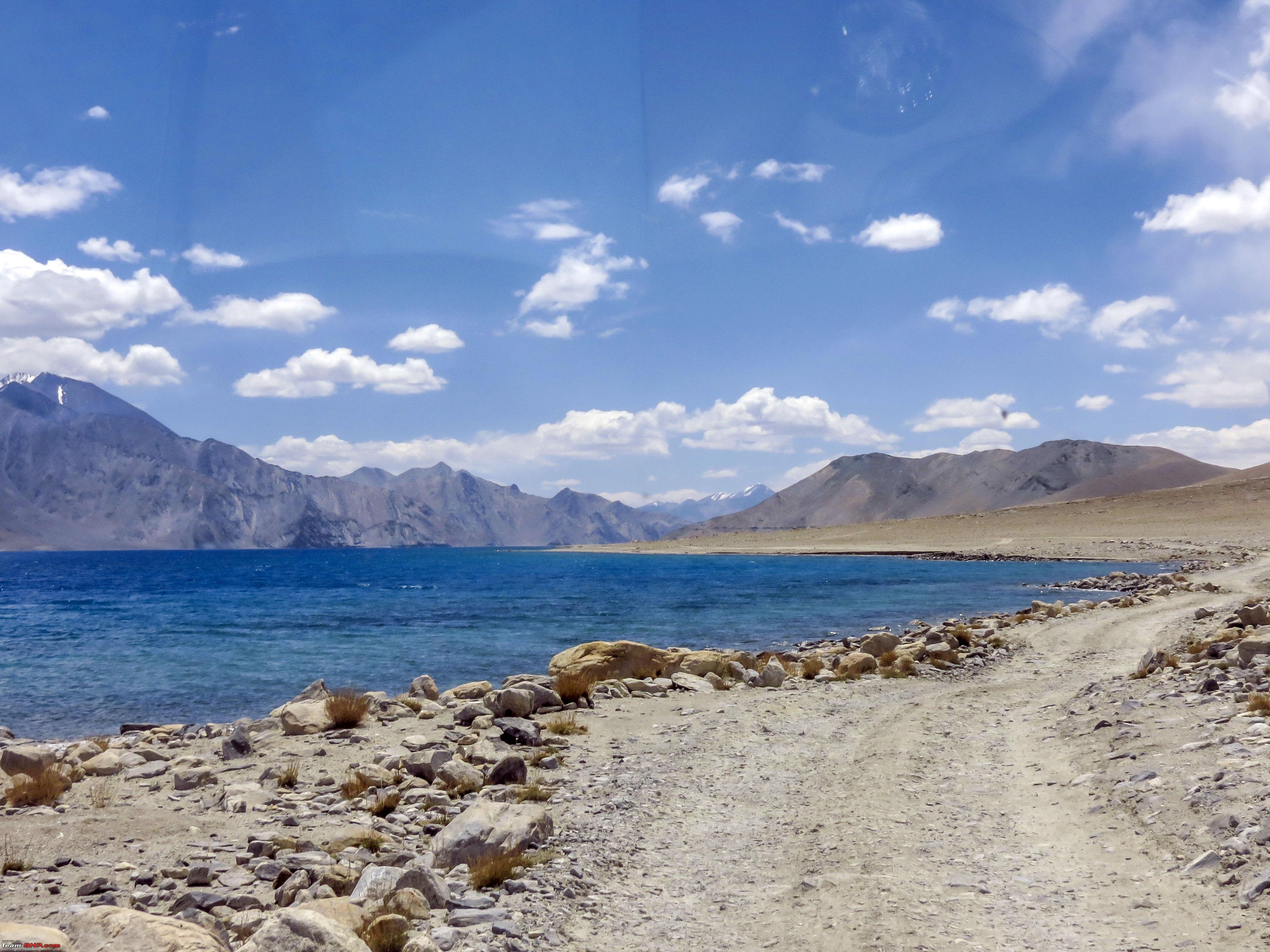 Prayer stones 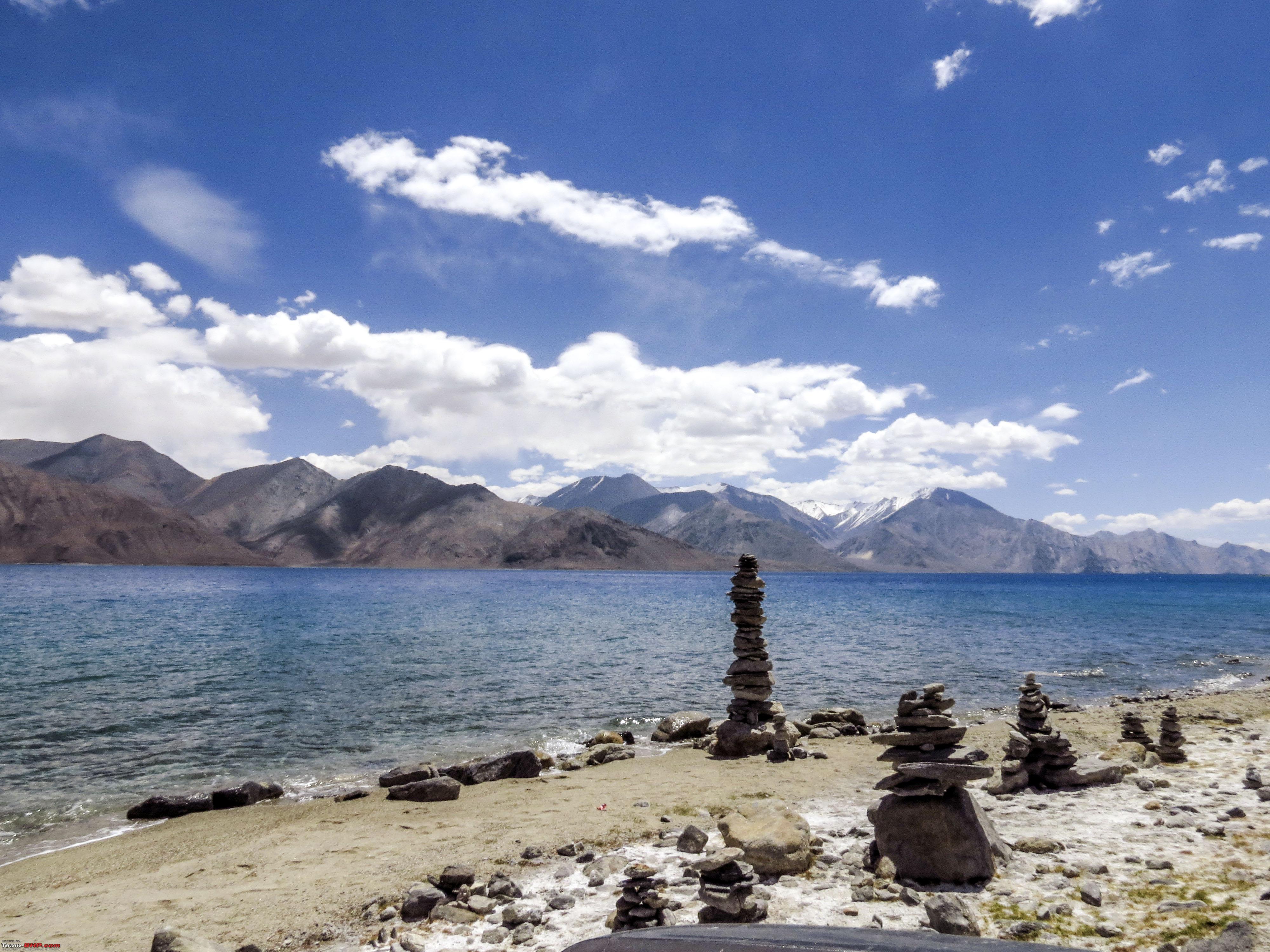 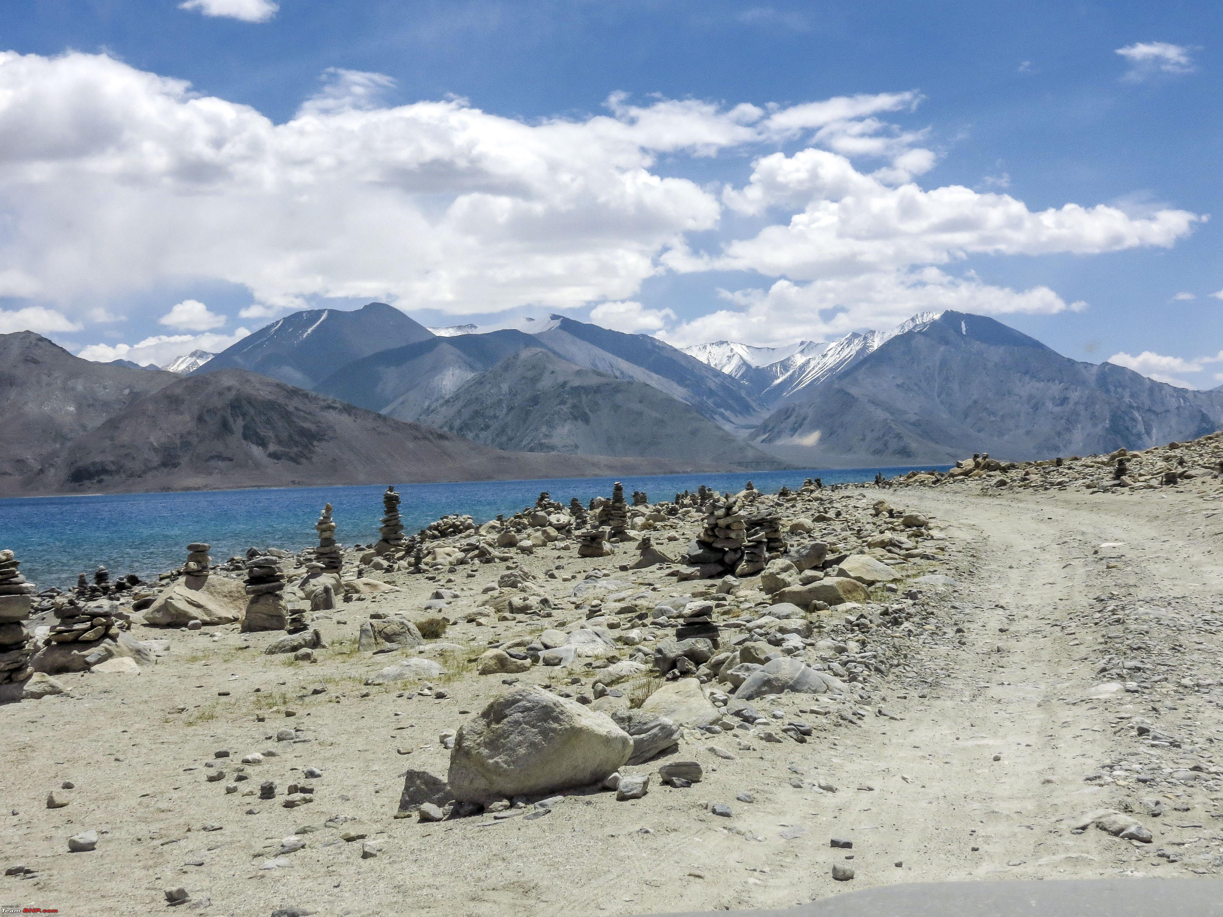 Concentrating on Breakfast 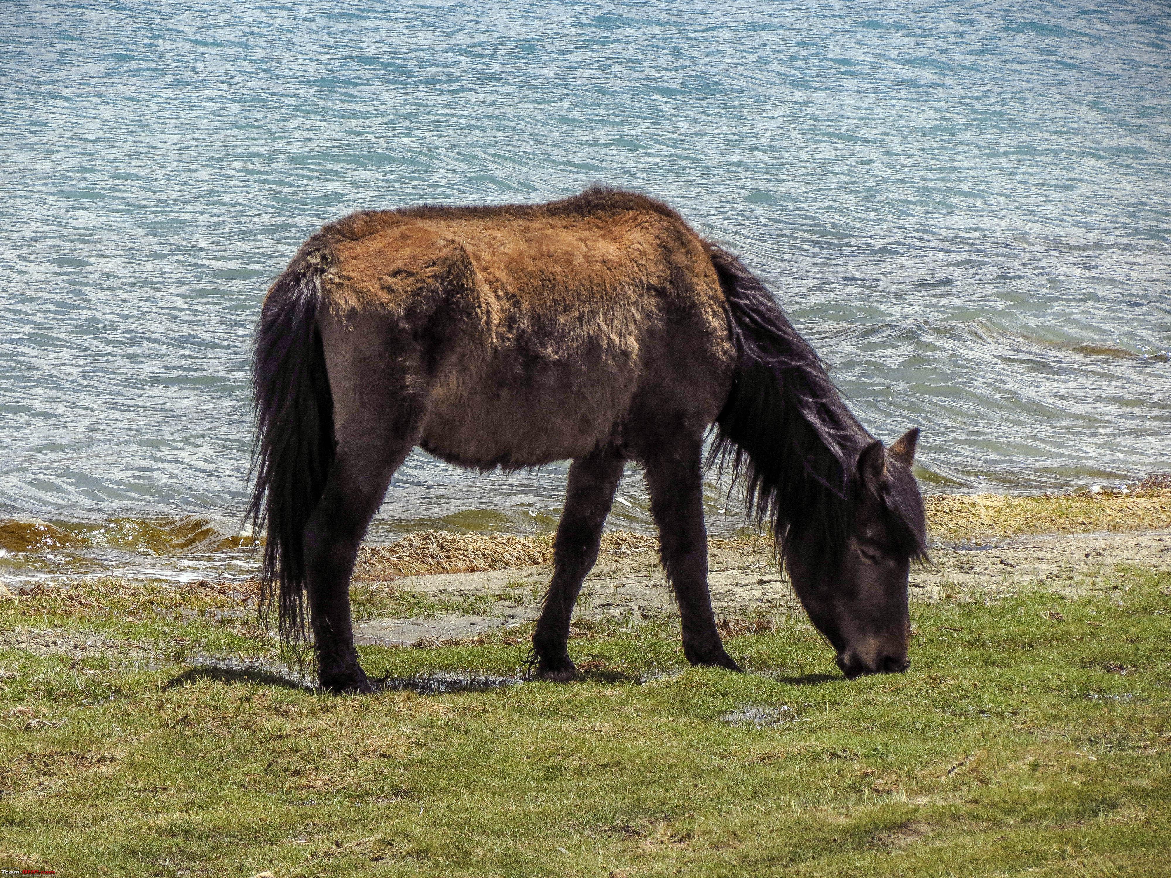 Another one 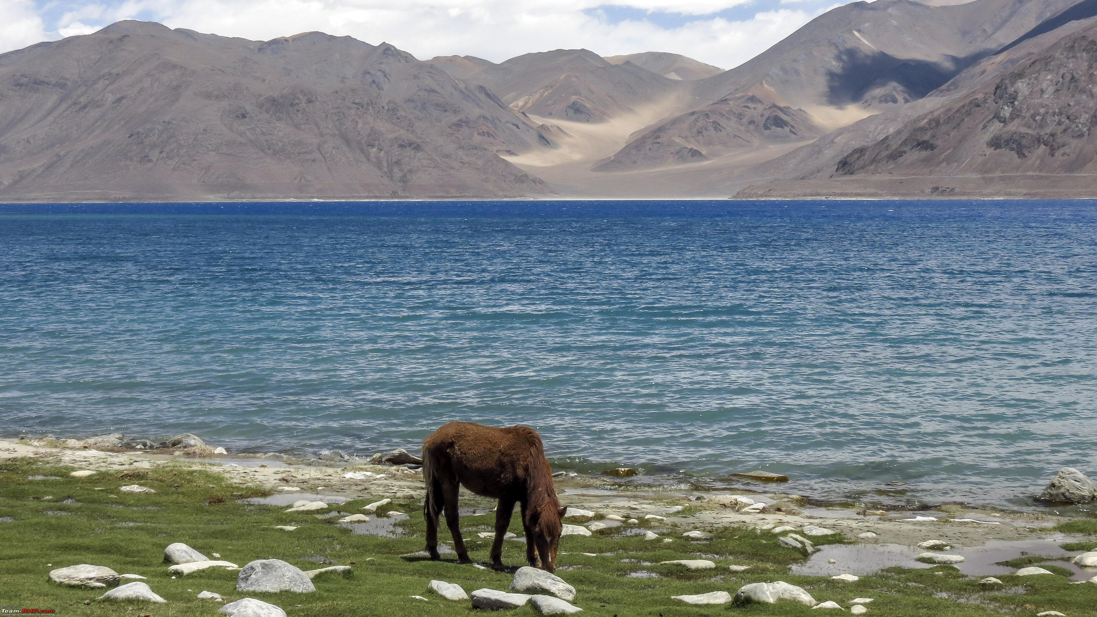 Passengers in the vehicle enjoying the ethereal surroundings and a brown horse  Passengers in the vehicle enjoying the ethereal surroundings and a white horse 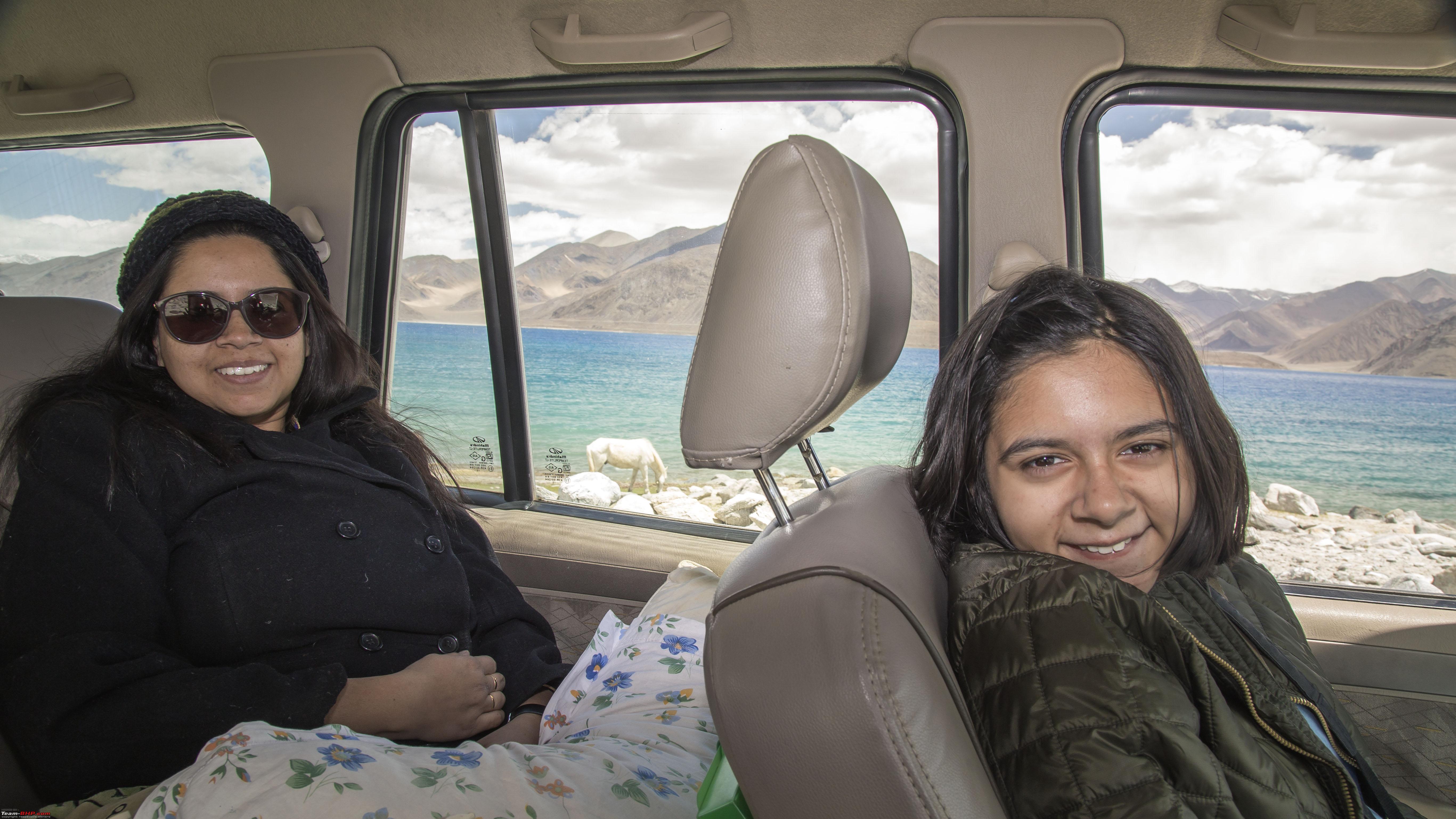 in reality, the brown and white horses were this much apart  some more driving around the lake 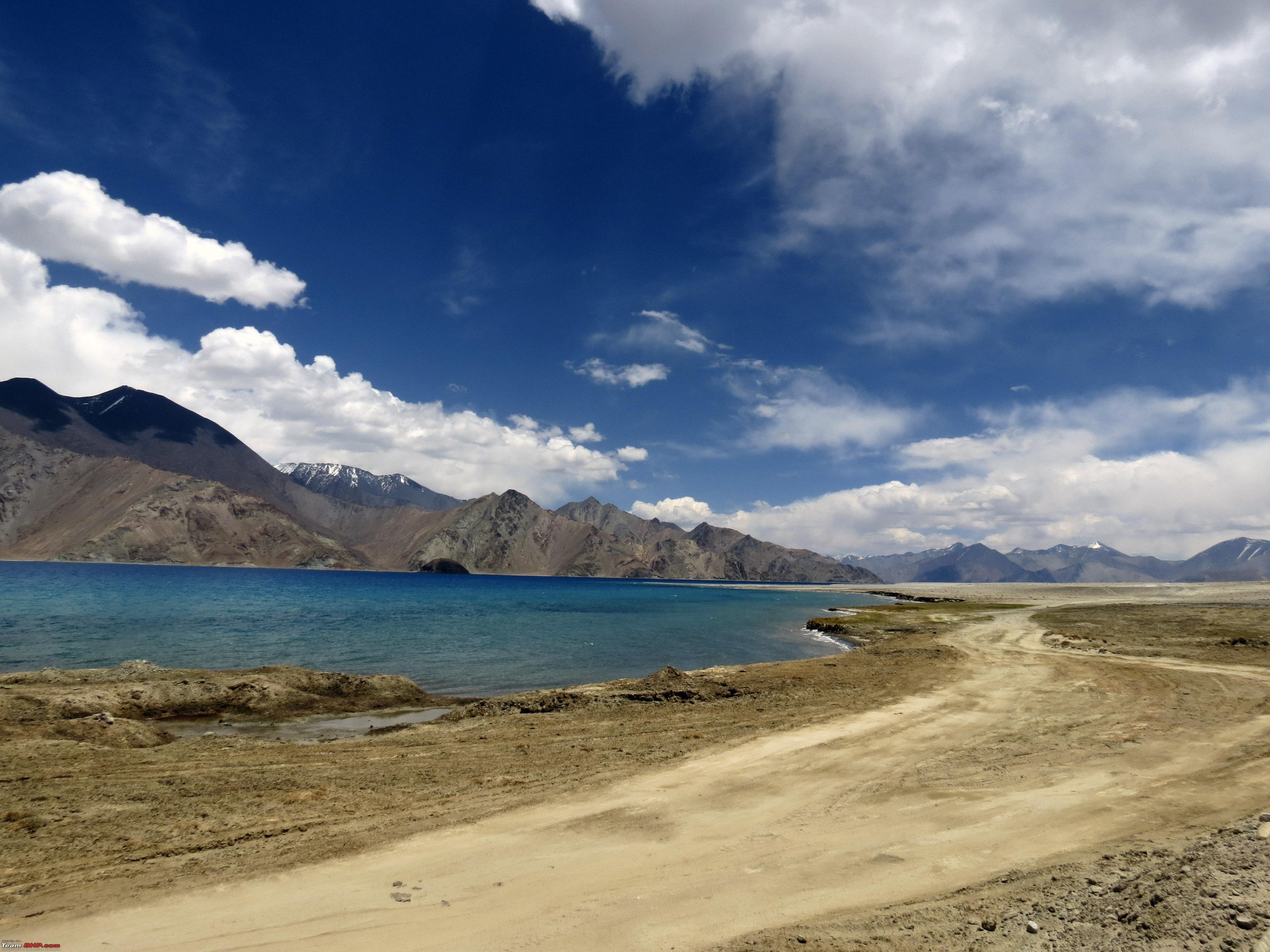 Some more birds 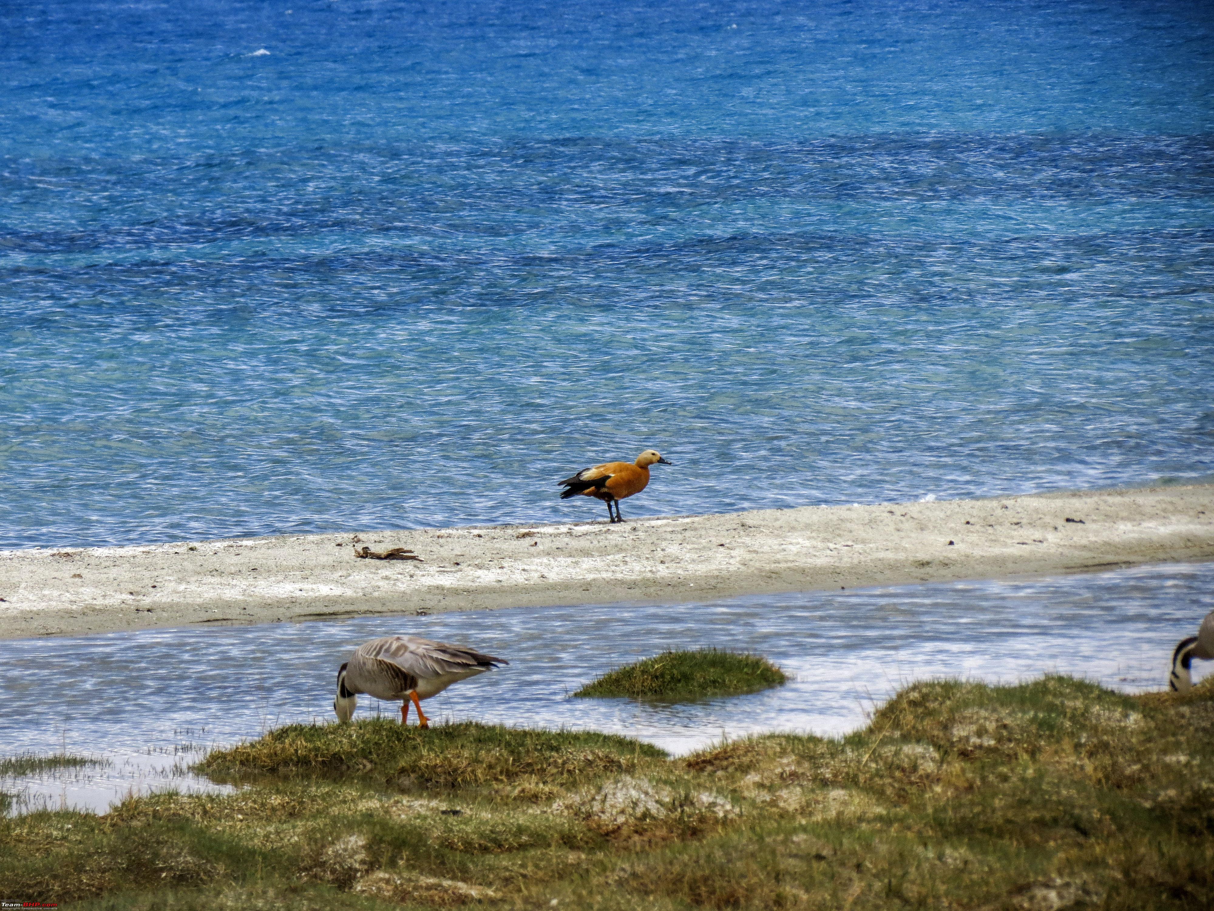 Soon we were at Man village 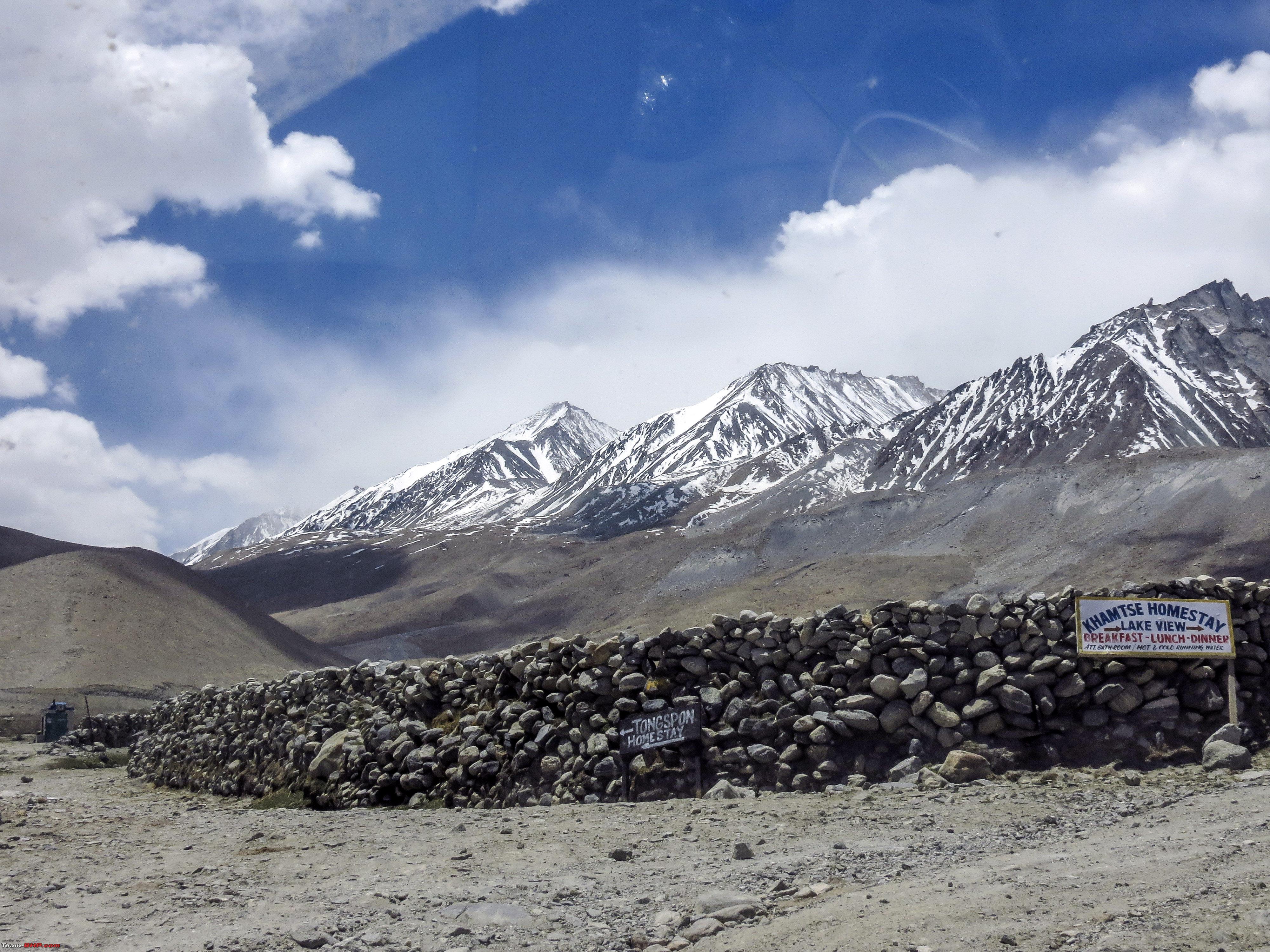 An interesting pickup  Some more lakeside drive 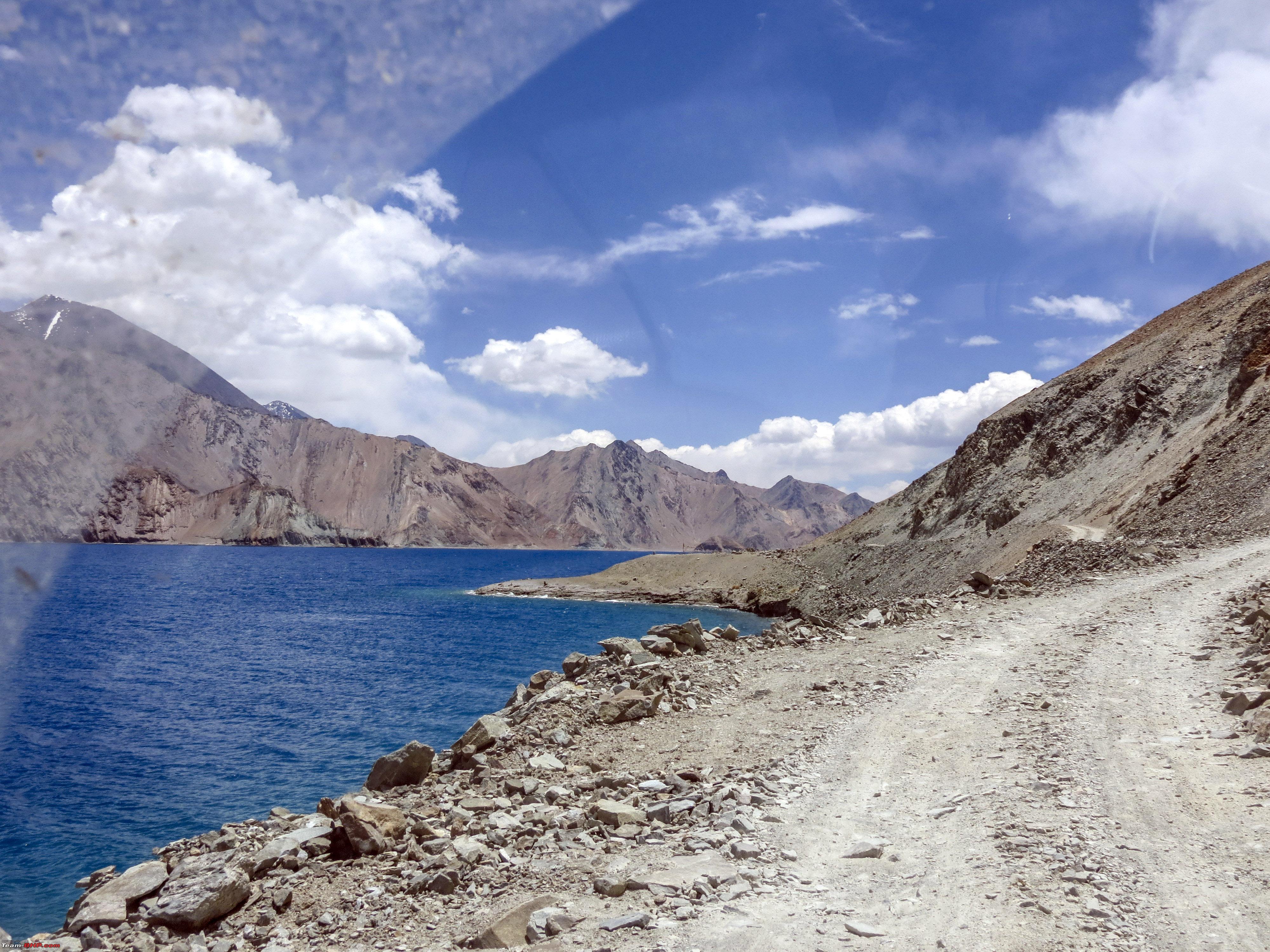 some dangerous stretches 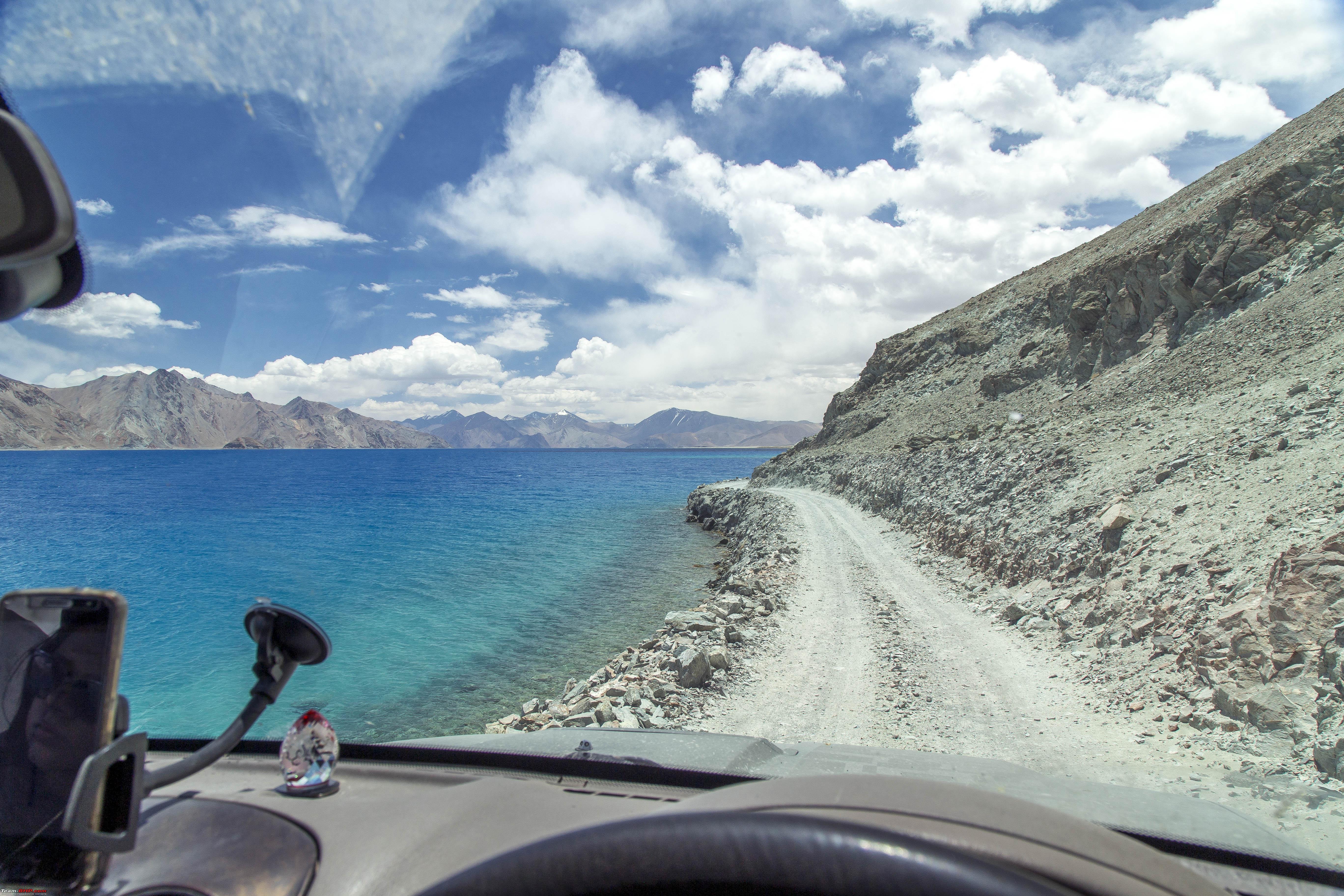 soon we were at Merak, the last point after which we leave the lake side and drive towards Chusul  A place without a name! There are still places in Ladakh that demands one to just drive based on intuition. No one to ask, but then one doesnt need to!! One just keeps going between two sets of hills on both sides. Only challenge in some places is to identify places where the soil would not support the weight of the vehicle.  Another twister in the distance  And another 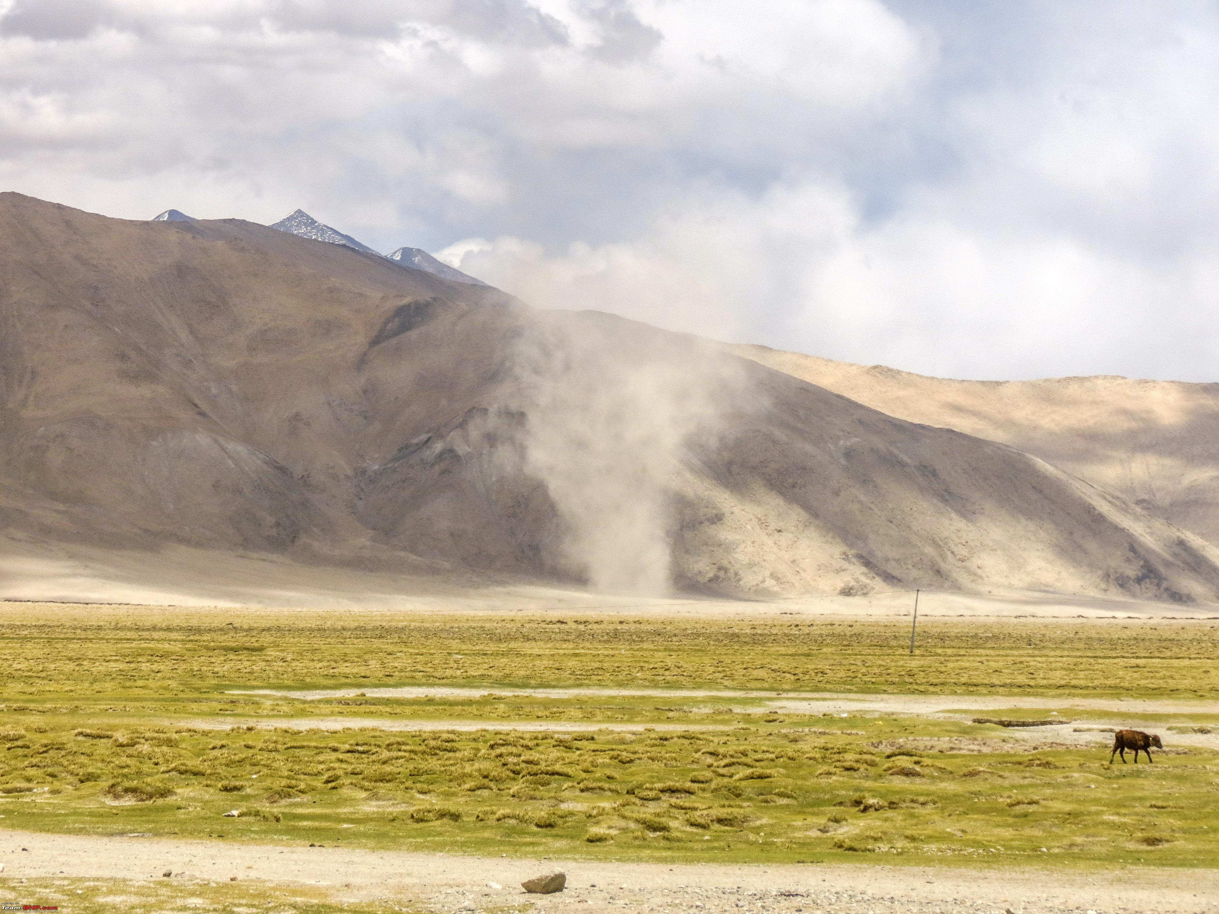 We reached Chusul, about 3 hours 20 minutes after starting from Spangmik. CNTD Last edited by 1100D : 11th July 2019 at 23:46. |
|
| (28)
Thanks
|
| The following 28 BHPians Thank 1100D for this useful post: | abhijeetp, alokn87, ARAY, CrAzY dRiVeR, dhanushmenon, Dr.Vikas, gmhossain, GTO, haisaikat, jailbird_fynix, jaunthead, maximus., mh09ad5578, mi2n, neil.jericho, Red Liner, Ronak_7, Rudra Sen, Samba, Samfromindia, Sayata, Sheel, ssambyal1980, streetfighter, Surprise, Thermodynamics, Varun_HexaGuy, wanderernomad |
|
11th July 2019, 23:40
| #9 |
| Senior - BHPian | Re: Ladakh Re-Juleh'd! With Siachen-Panamic-Agham-Chusul-MitpalTso-KaksangLa-TsoKar-KyunTso! The Tenth Day..cntd It was about quarter past two. However, right at the entry point of Chusul was lucky enough to find a person to ask about road to KaksangLa and coincidentally he pointed to just the narrow road going towards the right, a few yards down. However, he wasnt able to provide more detail as to whether the route is open. Instinctively knew he was right as we could spot the road go till far up. However, soon the track turned to this and would continue for, what seemed, forever. 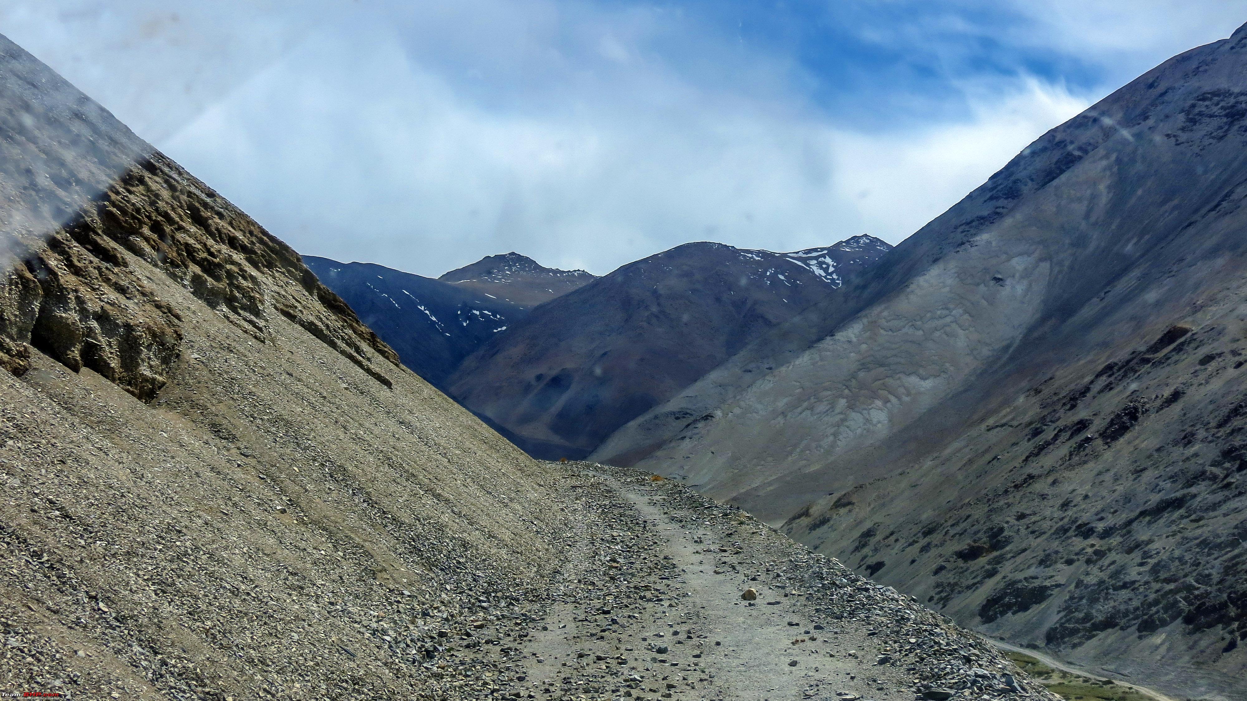 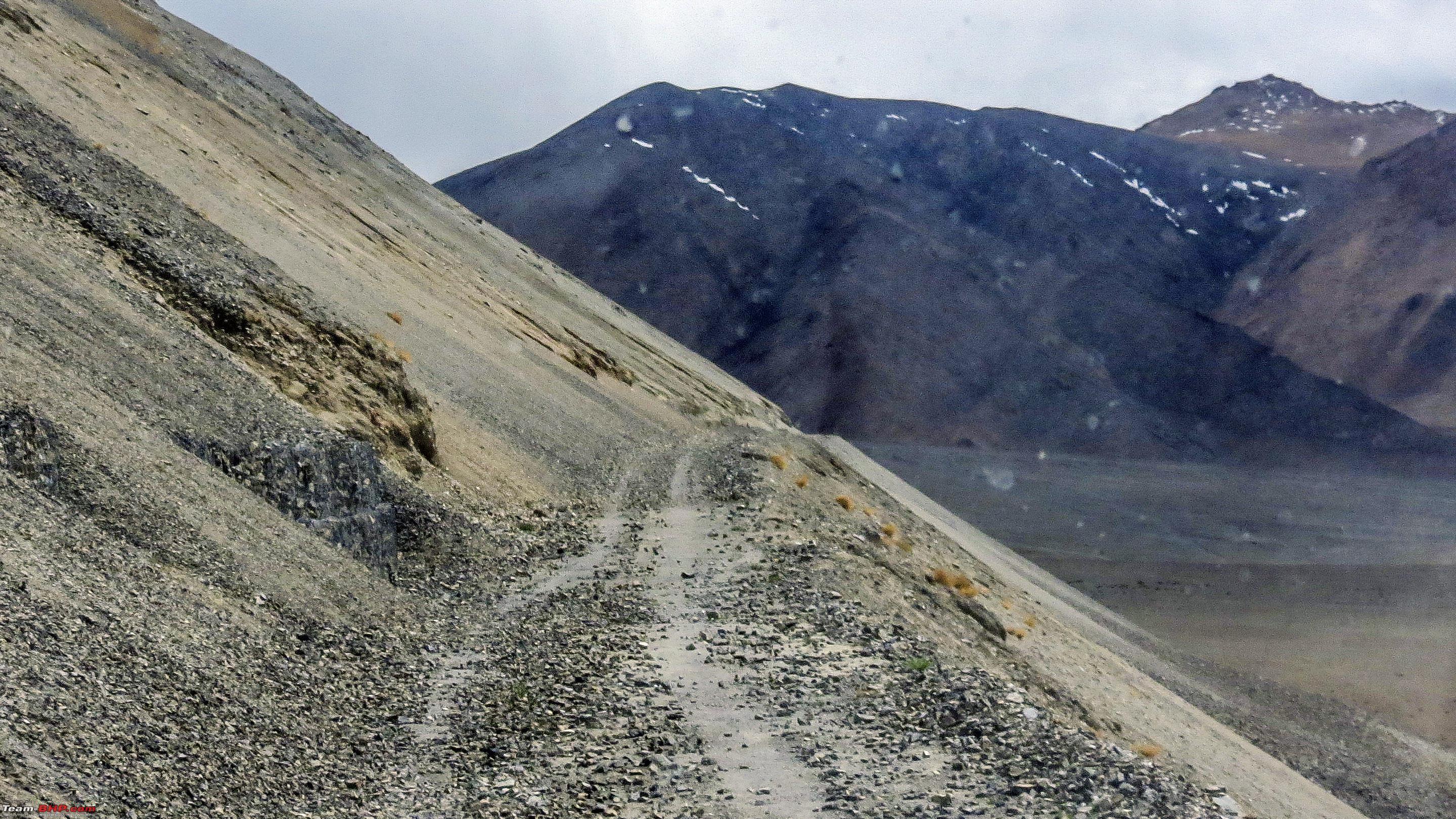 One would need to put the tyres on one side on the scree and continue driving. One slip and all of us would be history. 4WD engaged for safety. 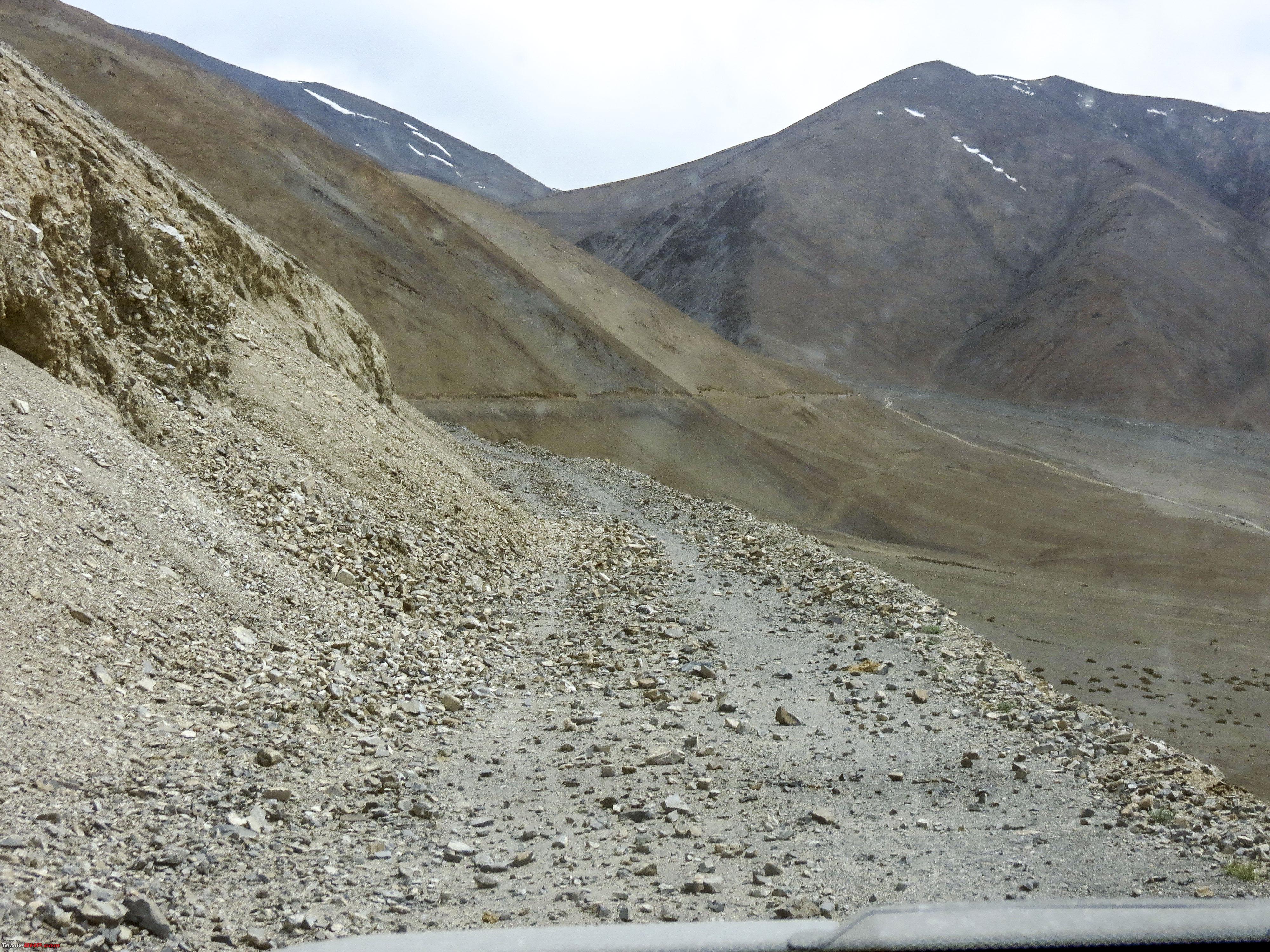 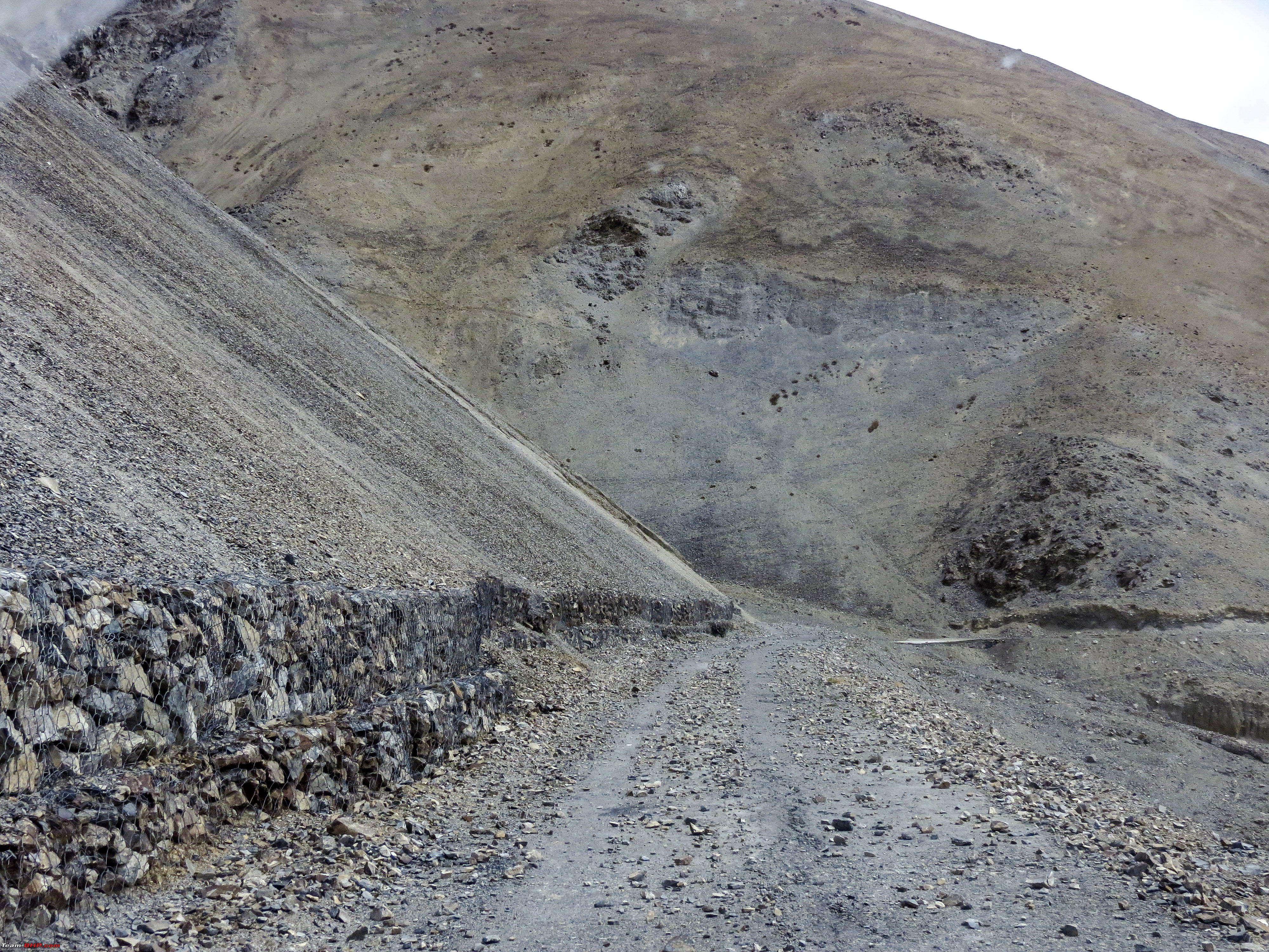 Honestly, at this point there were serious thoughts of turning back, however it got better after about 15 kms and we were again at a serious elevation  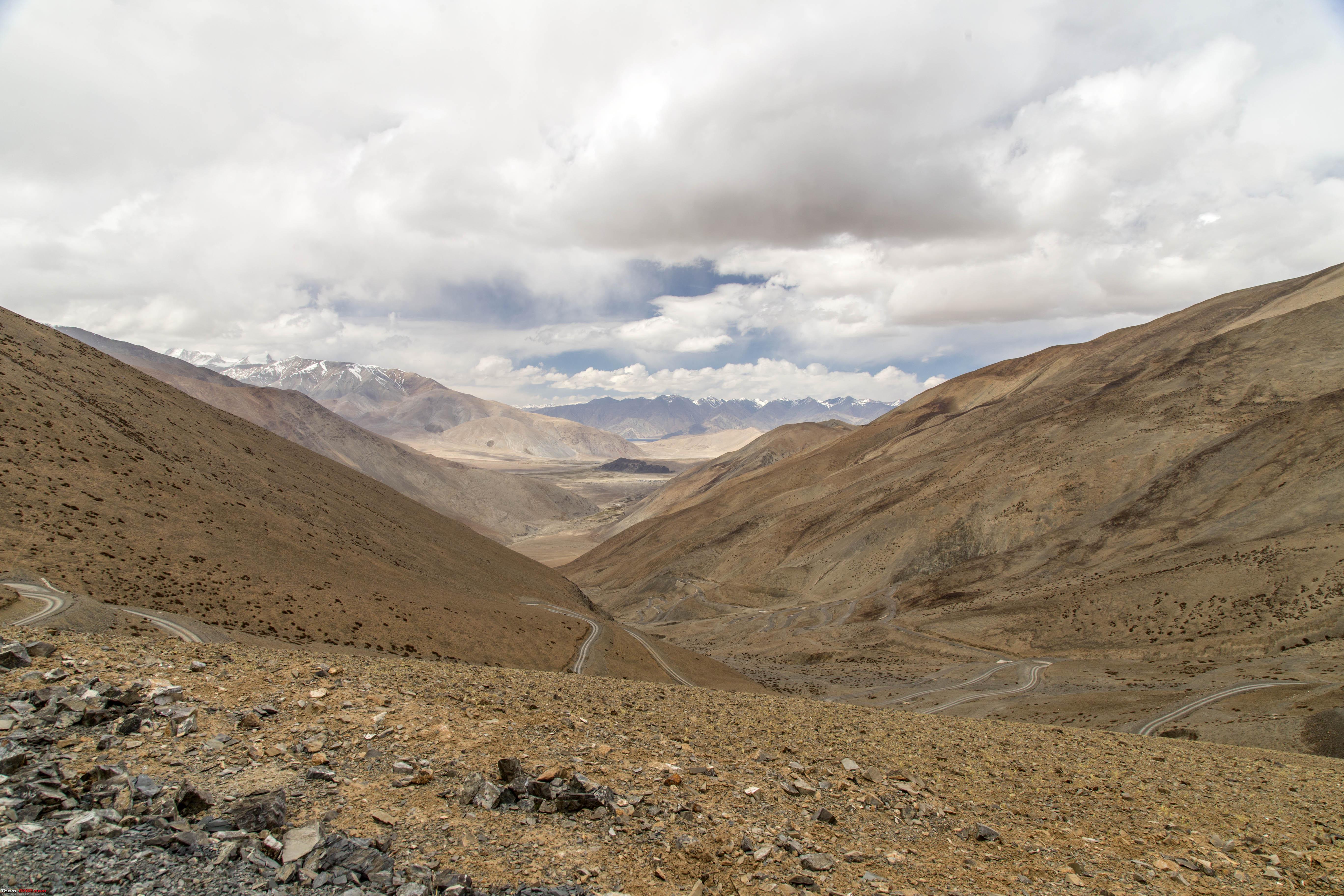 Note that in the above picture, one could still see the Pangong in the distance!  We continued our climb, the weather started getting darker  Suddenly there were flakes falling on the windscreen!! It was snow!!  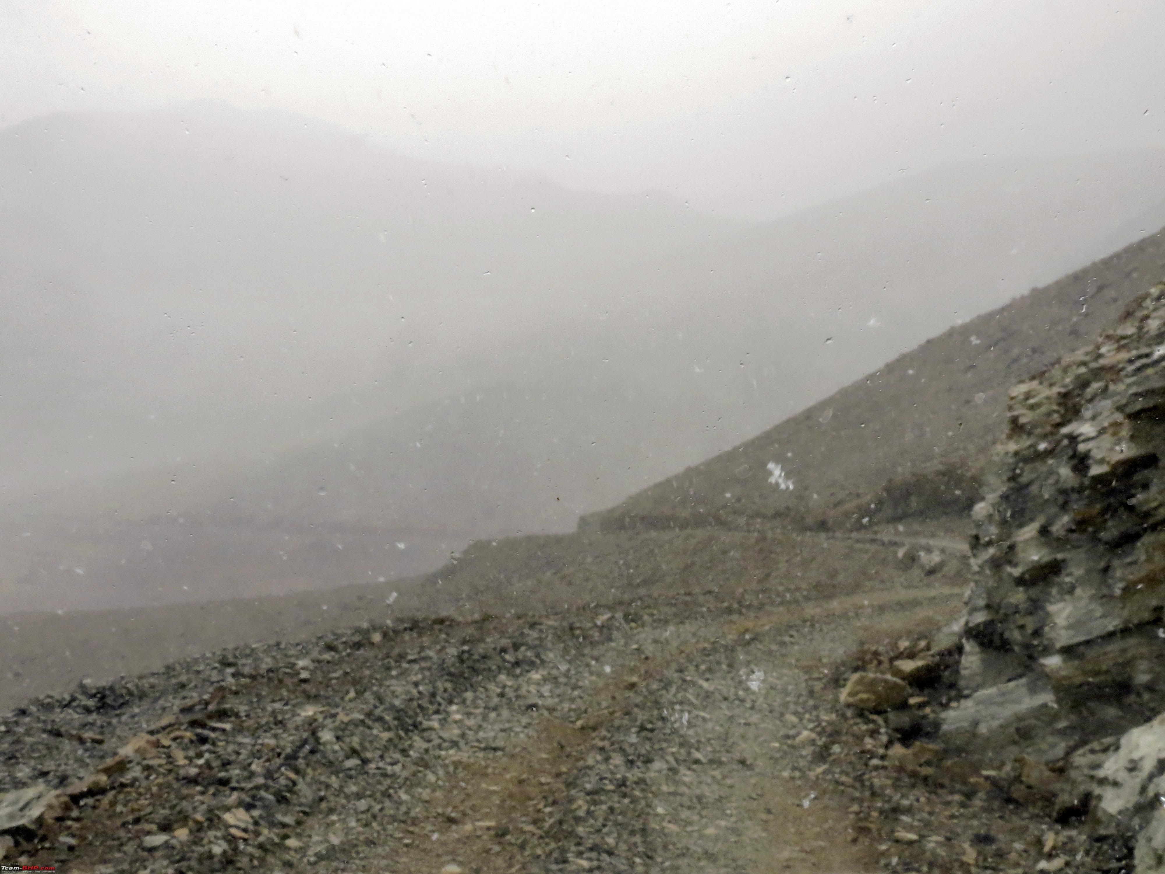 However, the situation that we were in, the thought of coming out and taking pictures in the snowfall was the last thing on the mind. Right from we left Chusul for about driving for above an hour, there were no sign of anything, neither something to suggest that, we were on the right route!! What if there is too much snow and the road ahead is closed. Only thing up my mind was that, if there had to be a block, it better be soon!! Some more snowflakes  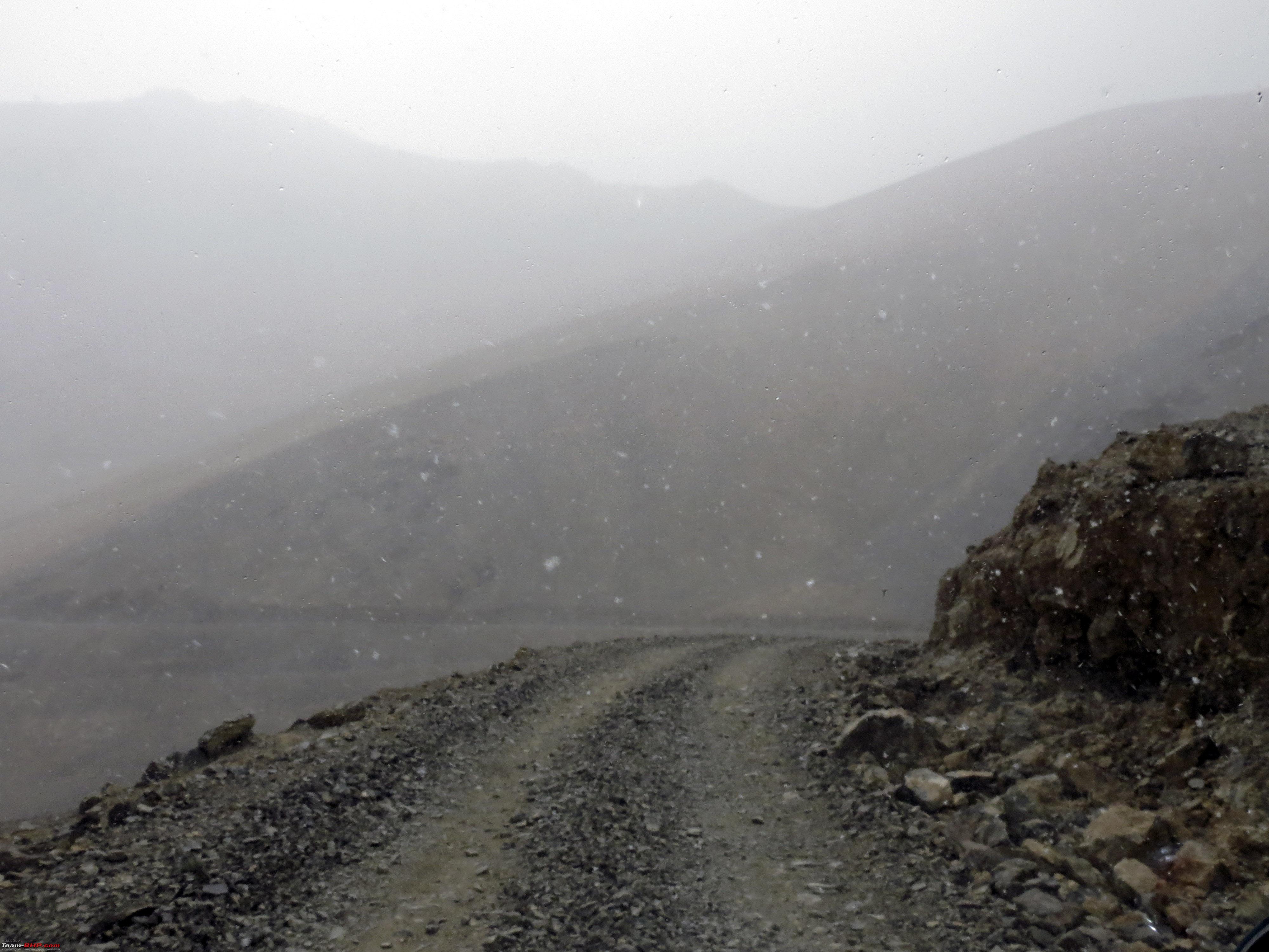 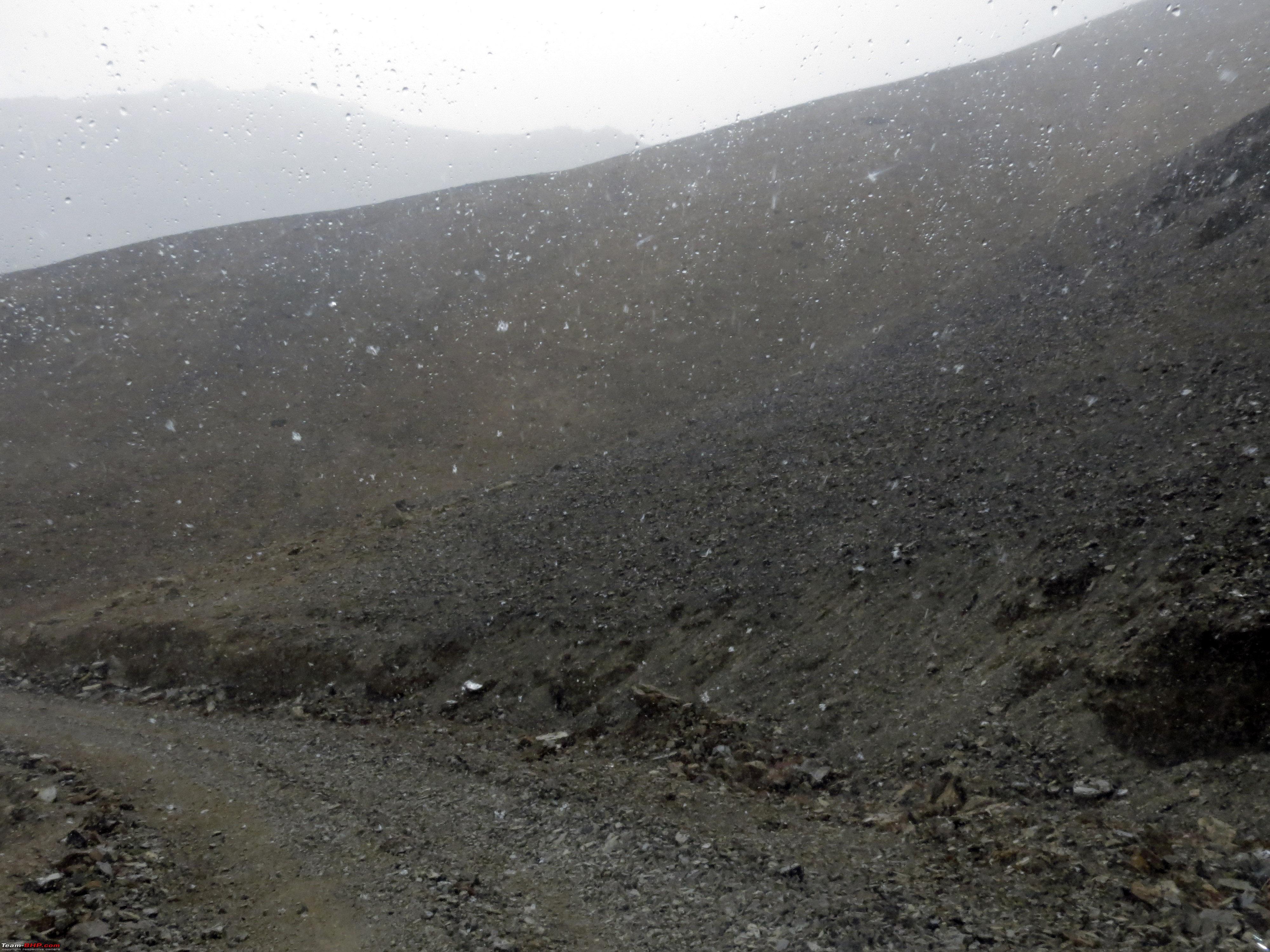 But suddenly we were out of the snowfall and on to what seemed like a "La". Ofcourse assumed it to be Statho La!  Right after the above "La" was "Wah"!  The first view of Mitpal Tso!  Some more views of this lovely waterbody   However, the trail continued to be lined with loosely packed stones. Too much power, you start displacing them and sink below! 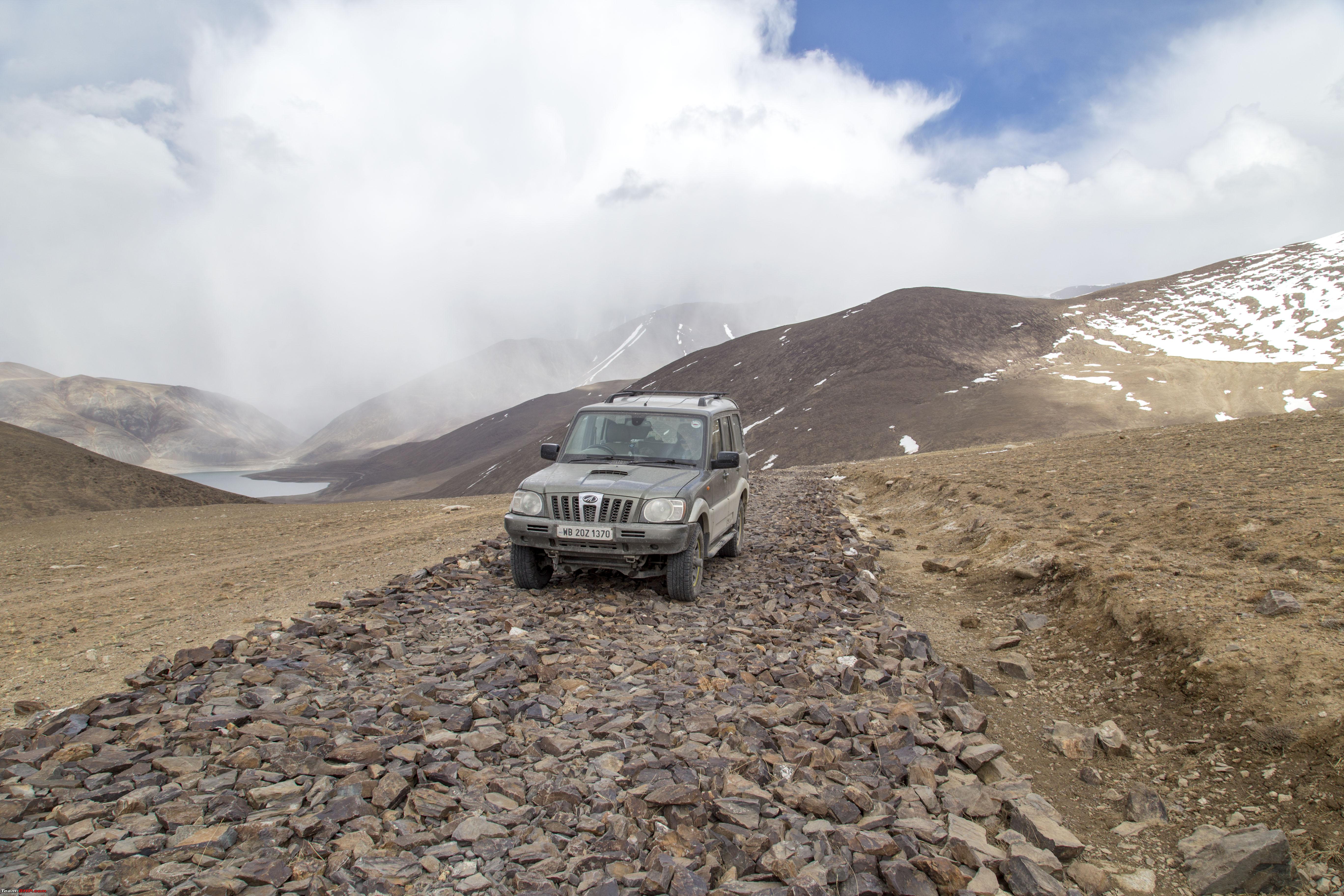  Soon, it was time for the next phase to begin! Slush!! Mixed with snow at places. (Sorry dont have too many pictures, was too involved with driving to even have the thought of taking pictures, all of these pics were taken by my daughter at places she herself wasn't too scared) 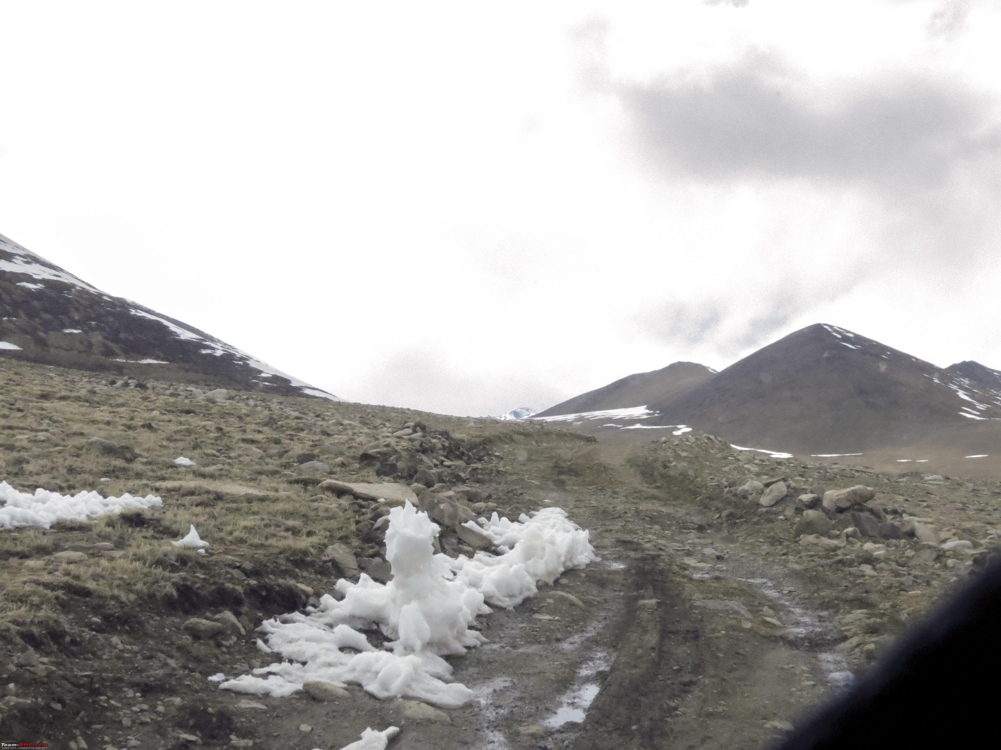   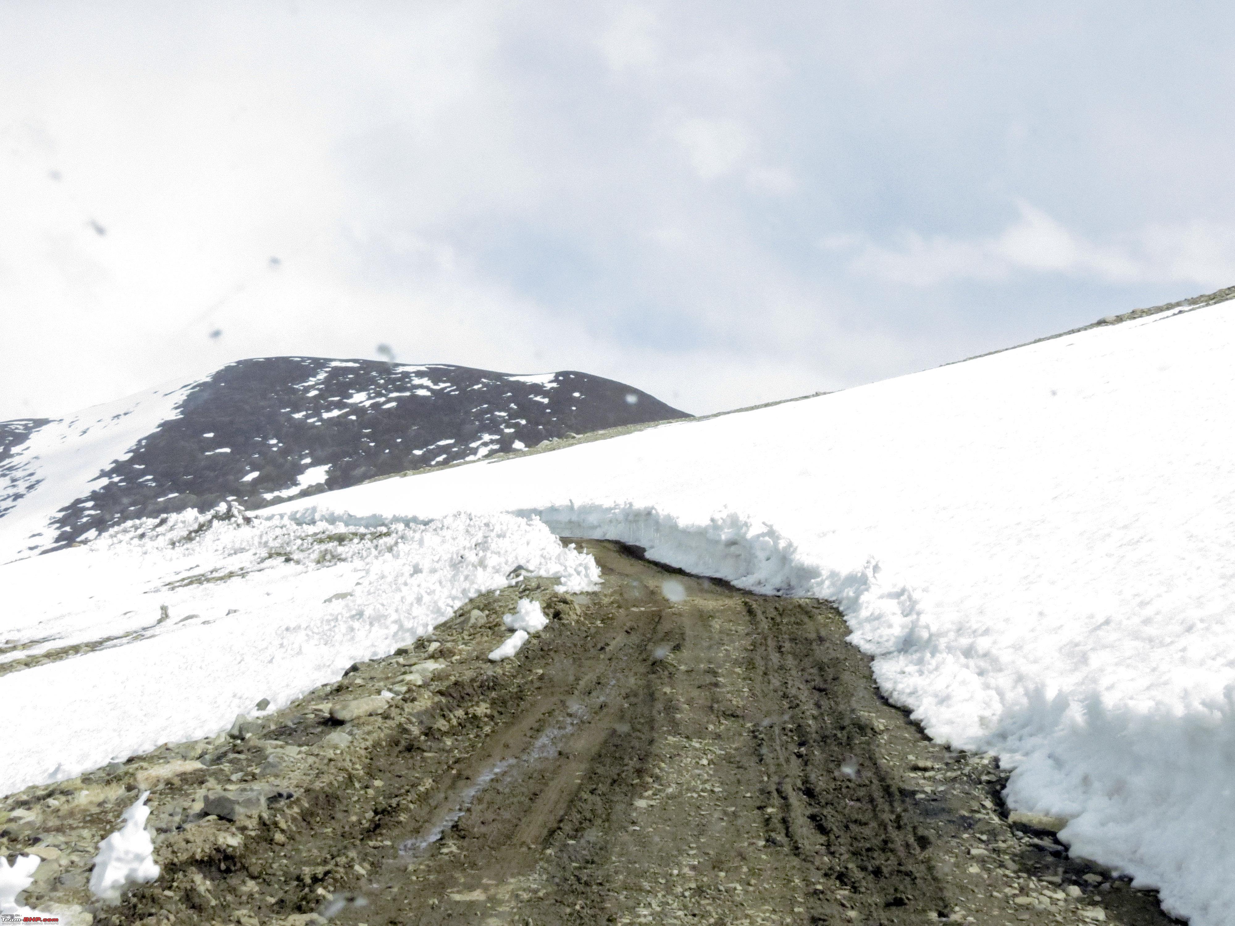  But guess what, soon we were at a mountain top, where we found this slab!! 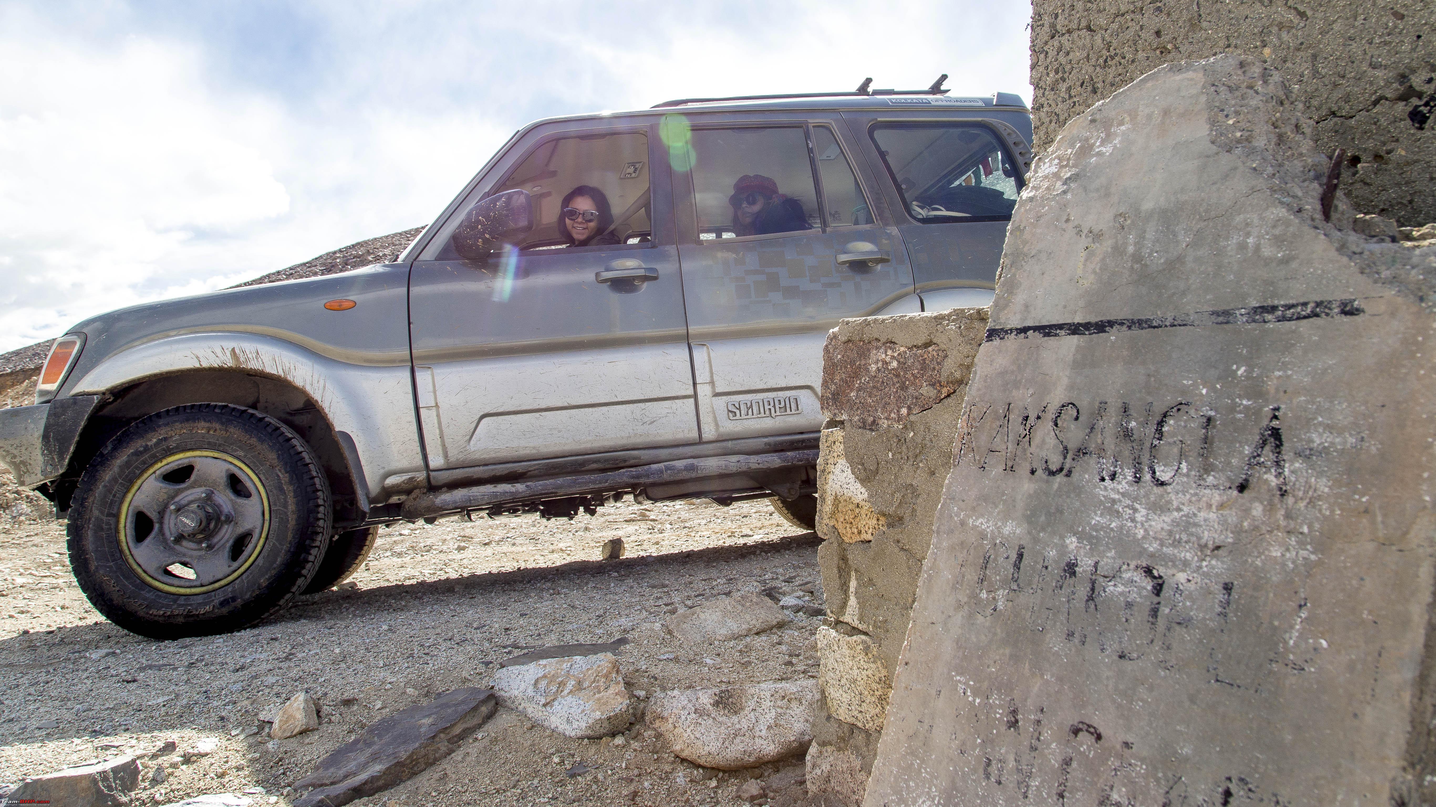 A very faint remnant of the writing, that too, dusted and cleared by me with my own hand before snapping. In all 75kms of this route, this is the only marker, that too improper. Atleast, we were sure now, we were on the right route! CNTD Last edited by 1100D : 11th July 2019 at 23:58. |
|
| (26)
Thanks
|
| The following 26 BHPians Thank 1100D for this useful post: | abhijeetp, alokn87, ARAY, CrAzY dRiVeR, desiaztec, dhanushmenon, Dr.Vikas, GTO, haisaikat, i20ian, jailbird_fynix, jaunthead, maximus., mh09ad5578, mi2n, neil.jericho, Red Liner, Ronak_7, Rudra Sen, Samba, Samfromindia, Sheel, ssambyal1980, streetfighter, Surprise, Thermodynamics |
|
12th July 2019, 00:06
| #10 |
| Senior - BHPian | Re: Ladakh Re-Juleh'd! With Siachen-Panamic-Agham-Chusul-MitpalTso-KaksangLa-TsoKar-KyunTso! The Tenth Day..cntd Some more pics on the KaksangLa top 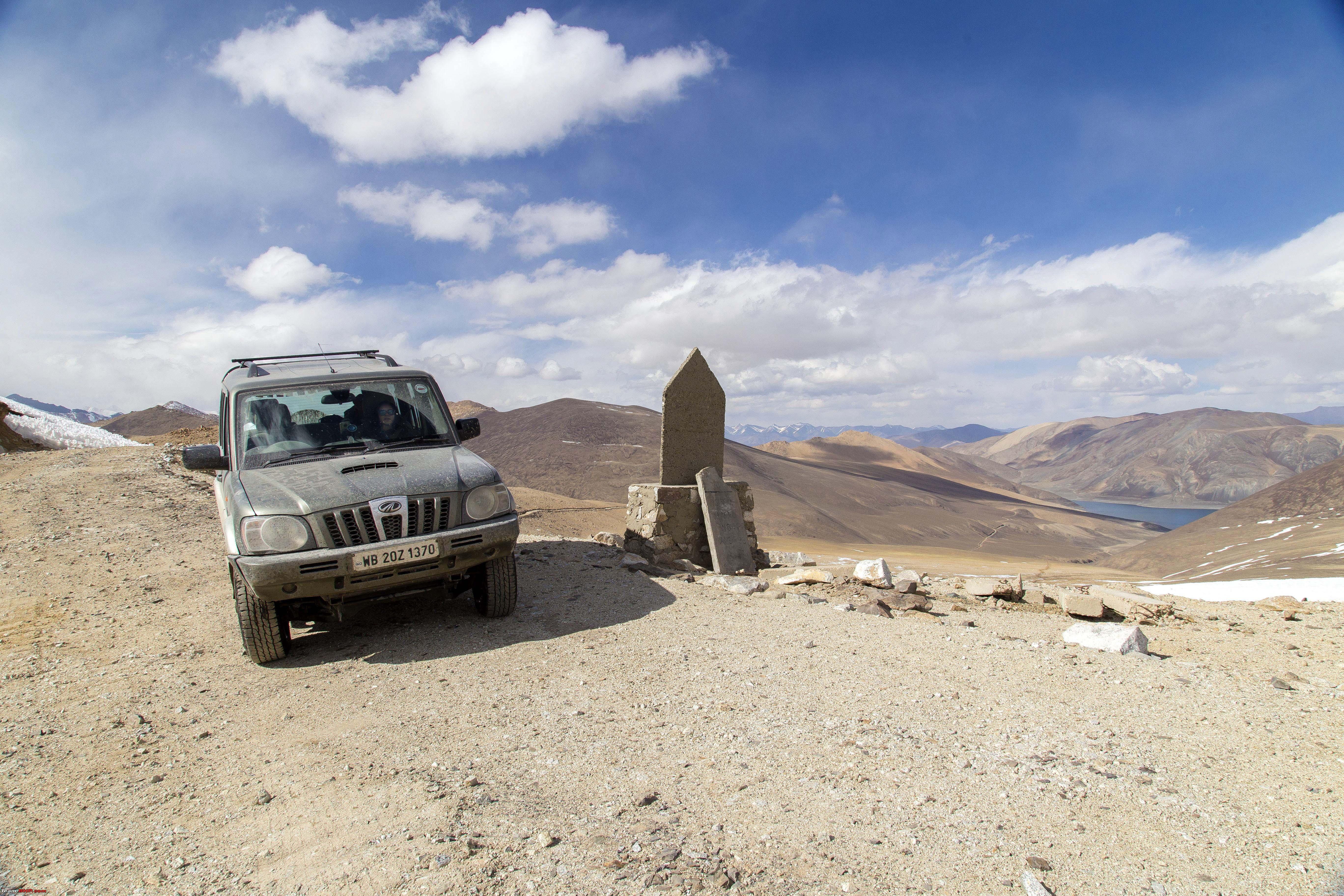  Soon it was time to alight 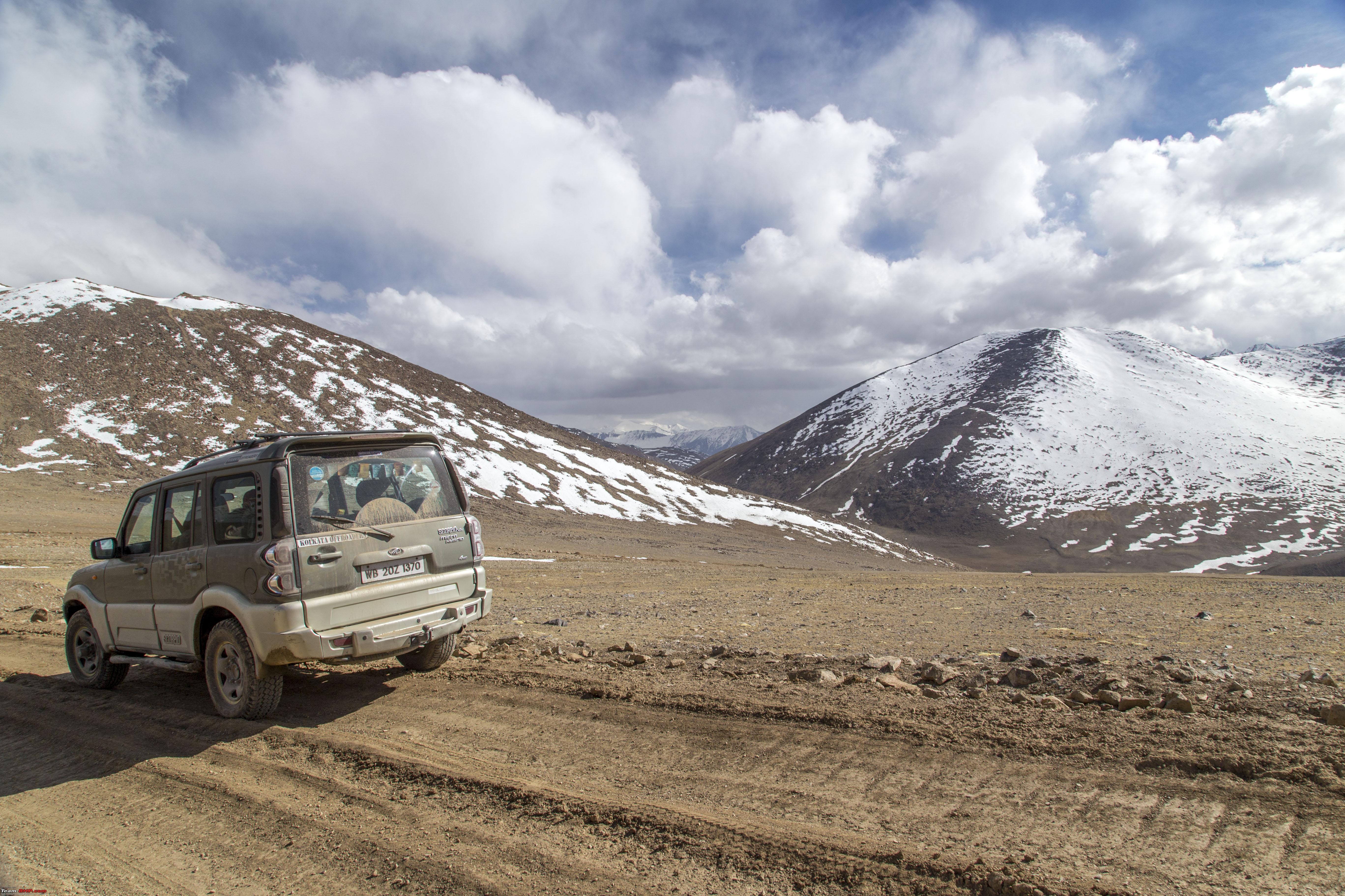 Spot the Marmot! 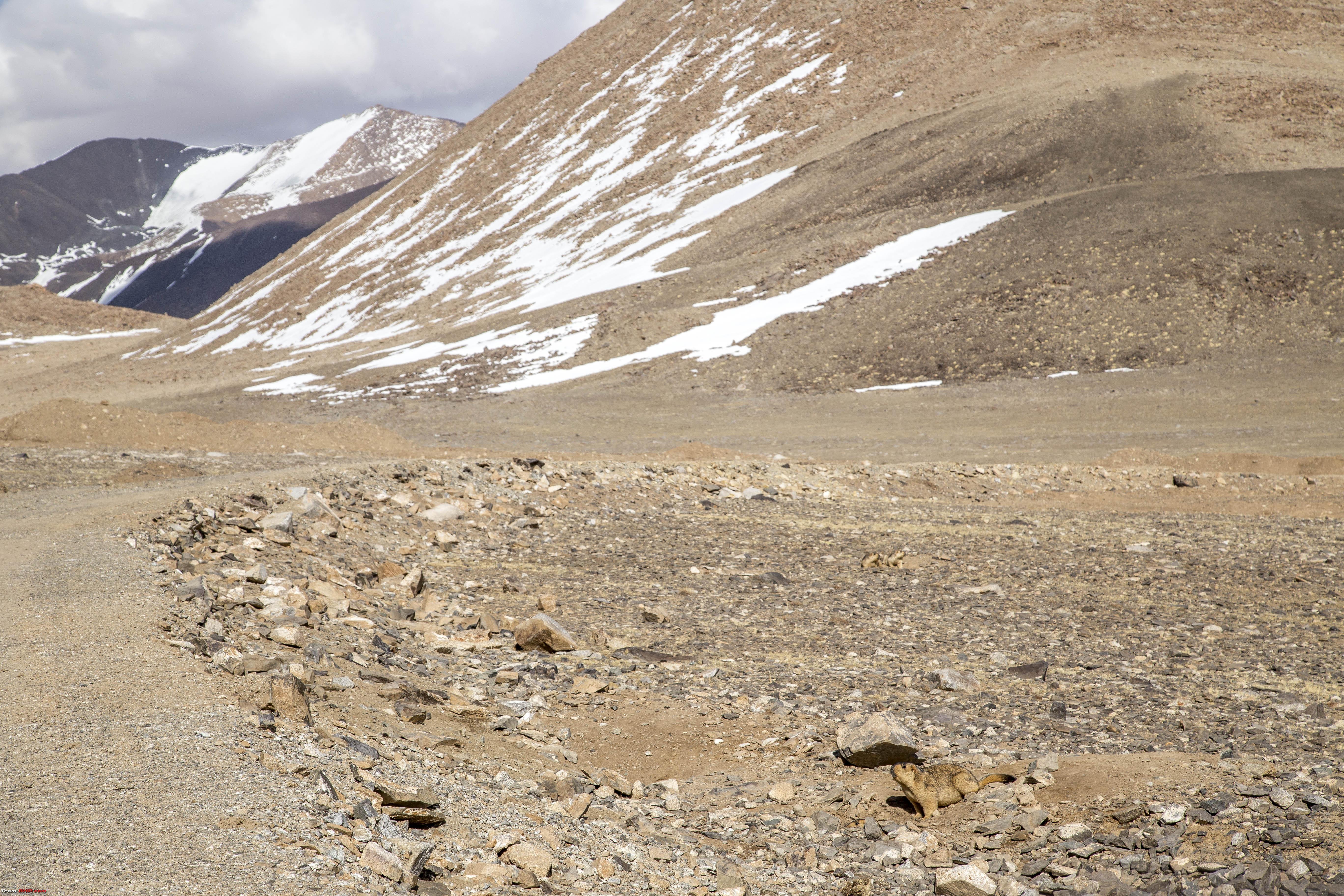 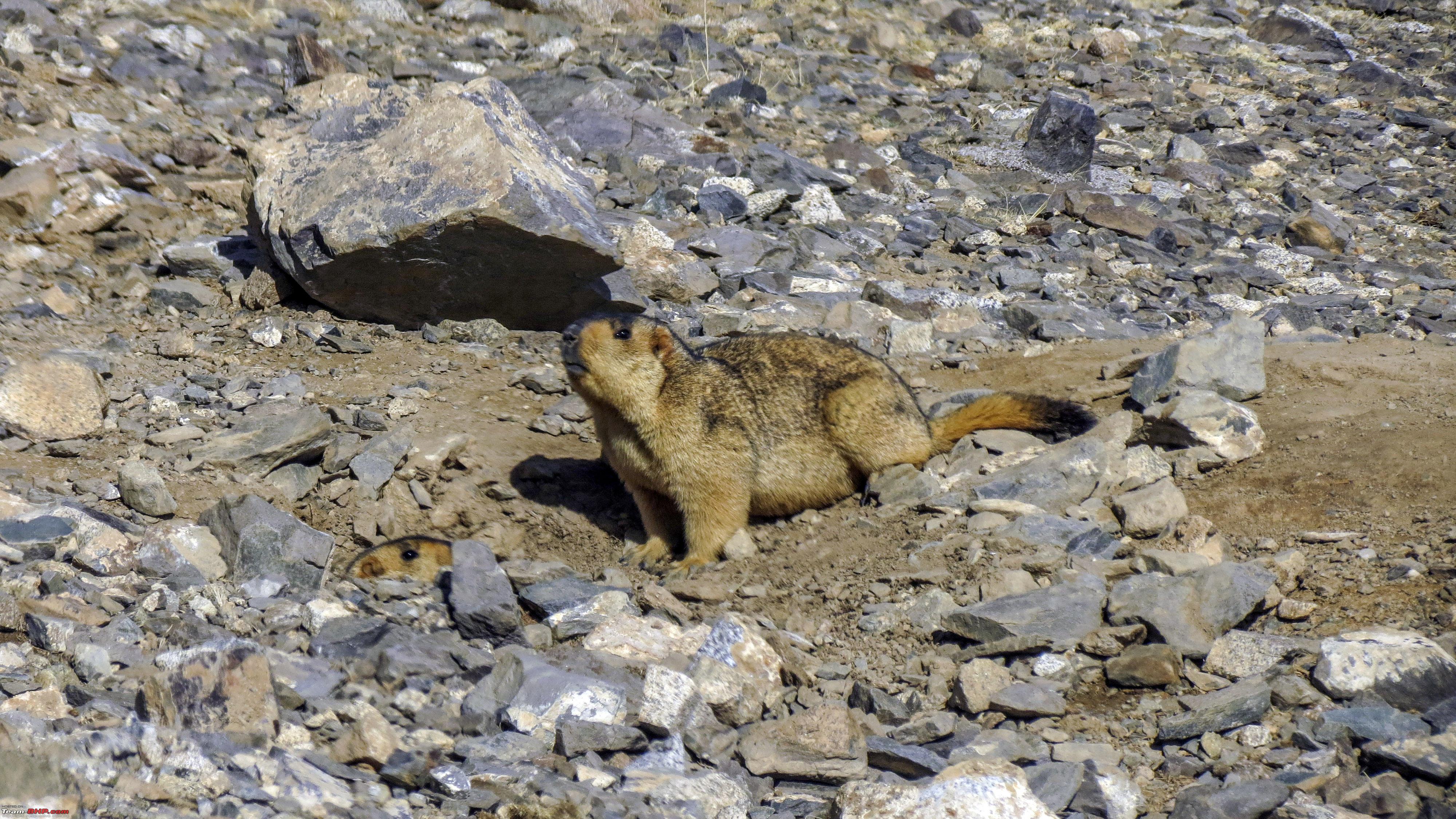 These things go into hiding when they hear the Diesel clatter, but what if the animal driving the diesel is smarter!! Switch off the engine and slowly roll down, even more silent than approaching animals on foot!!  We continued our descent. 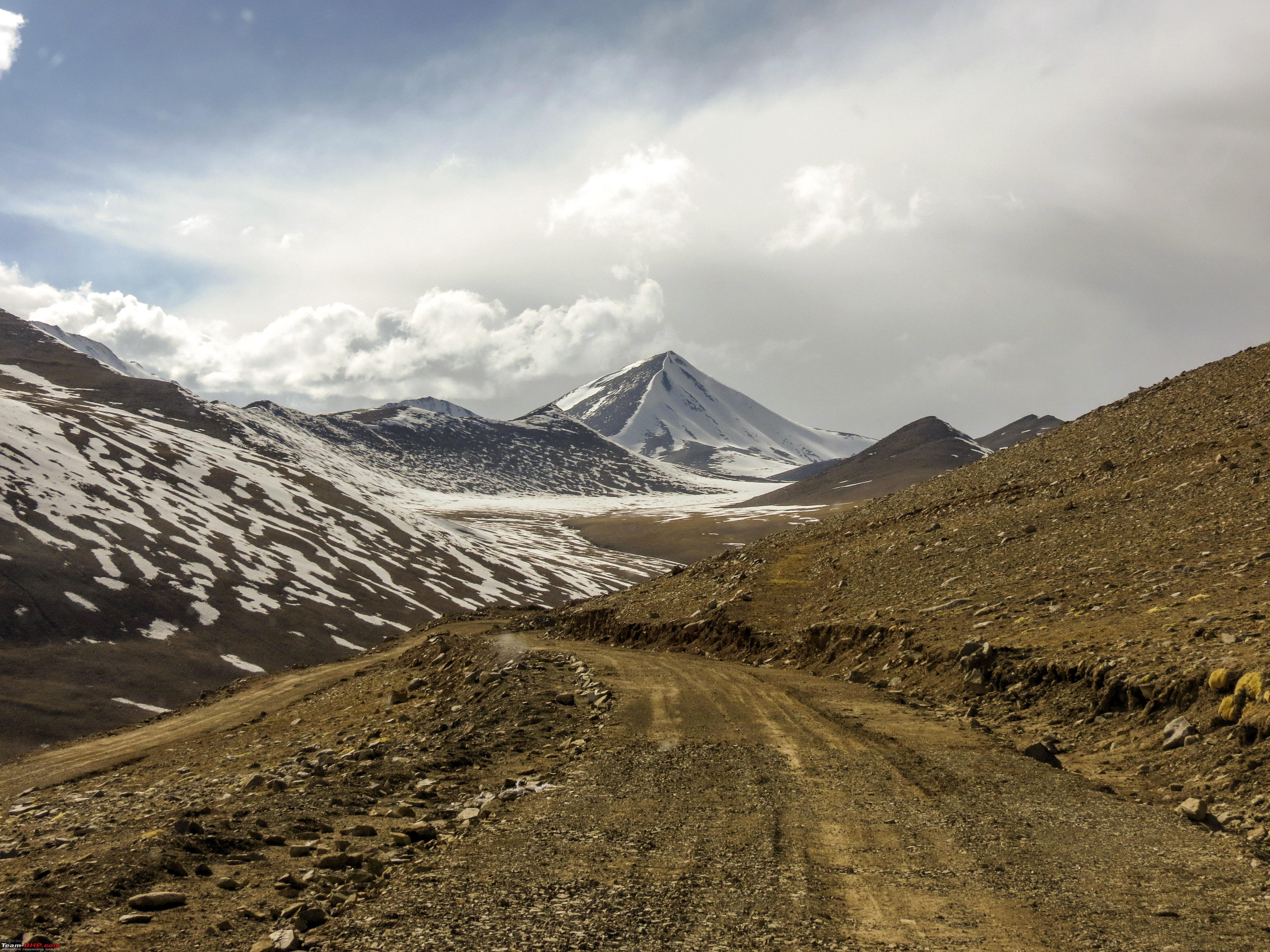 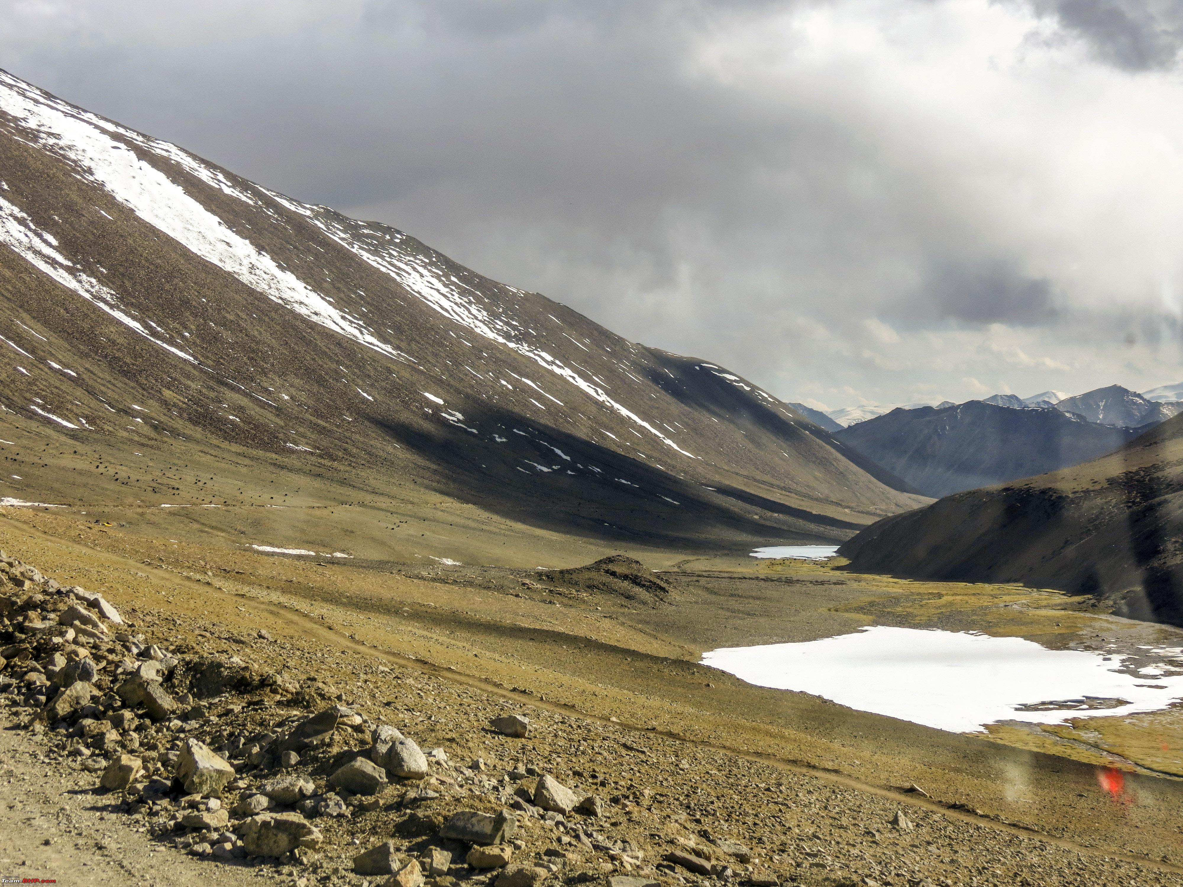 Same strategy with the mountain cattle (not sure if these qualifies to be called Yaks)  Photographers make a great deal out of taking animal photographs. Big lenses, this, that!! All you need is a slope, the animal doesn't know what's happening, click picture from the driver's seat, say "Thank You" to the animal and move on.  Soon we had good news, Blacktop ahead. Also, bad news, that it's blocked by the machinery that's making it!!  Ironic enough, we travelled 63kms through Scree, unpaved track, snowfall, rock layered surfacing, slush/snow mix, in about a little over 3 hours, to be held up for about one hour at this point by people making a blacktop to make people's life easier. Once we were allowed to go, infact we are grateful that they did, as the surface was still soft and they had to take measures to move out of the way, we were soon at another "La", the HorLa 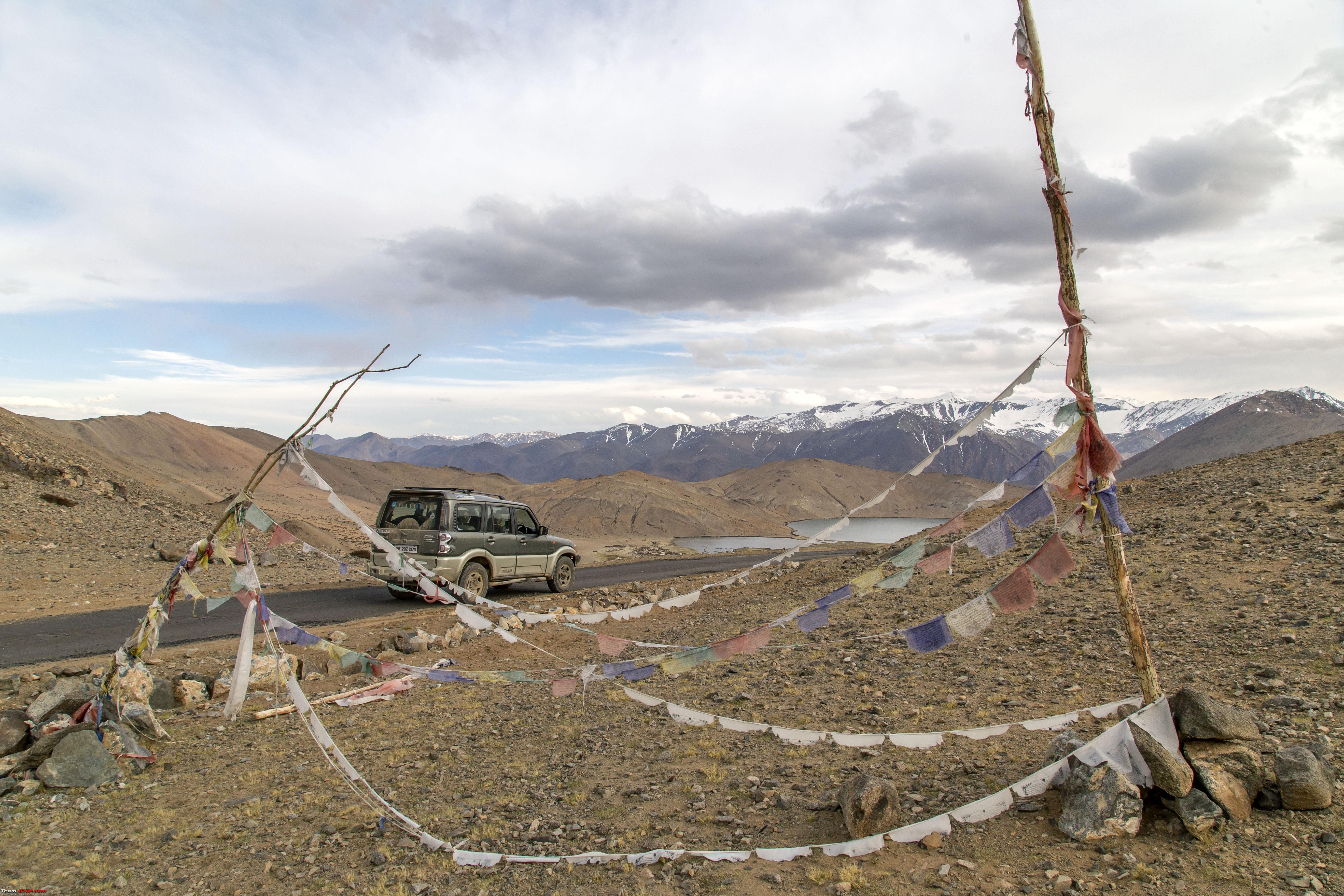 And like before, as one can see, soon after the La, was this! The Yaye Tso! 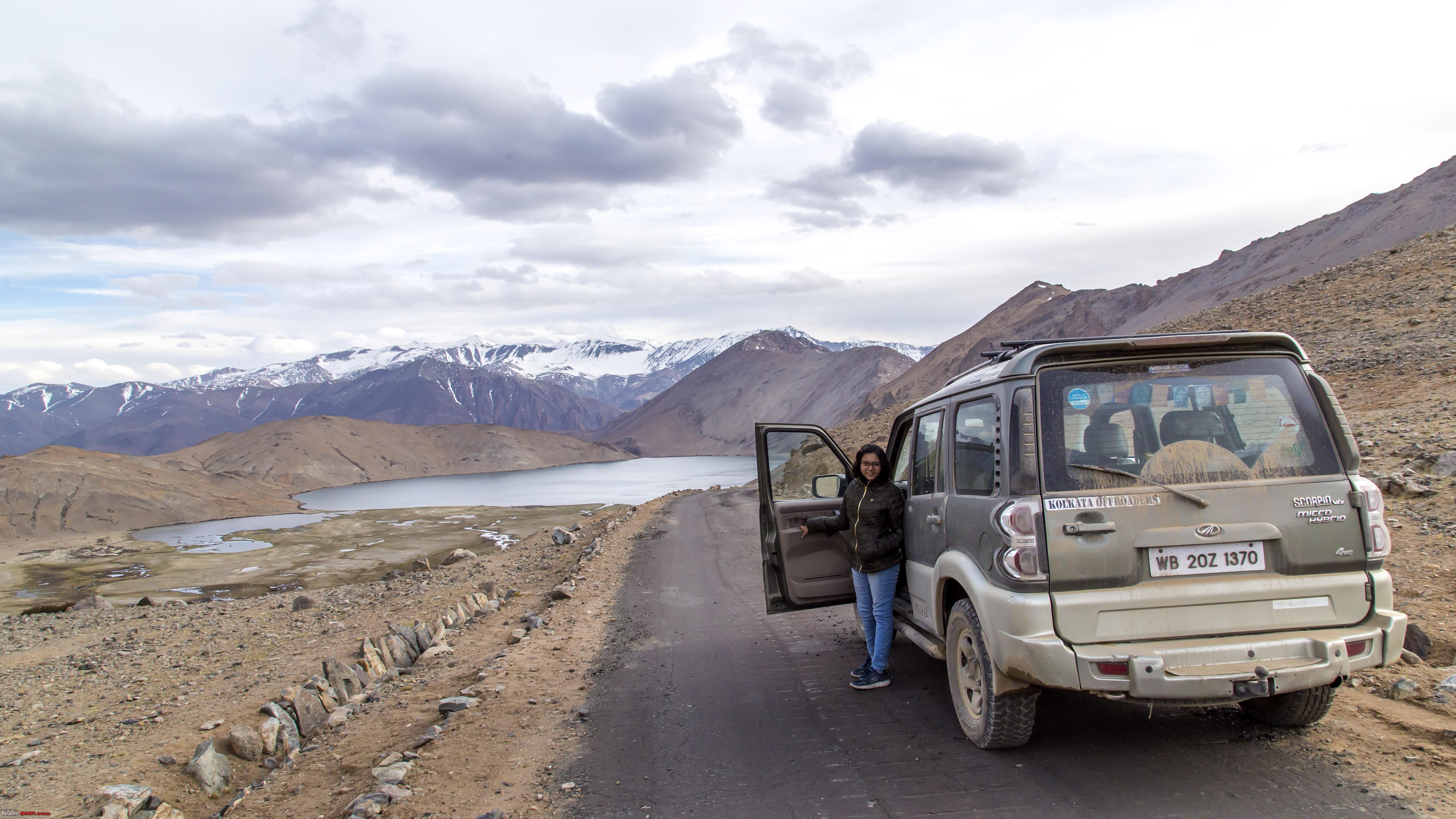 Loads of black smoke on its way to making people's lives easier!  The Beautiful Yaye Tso 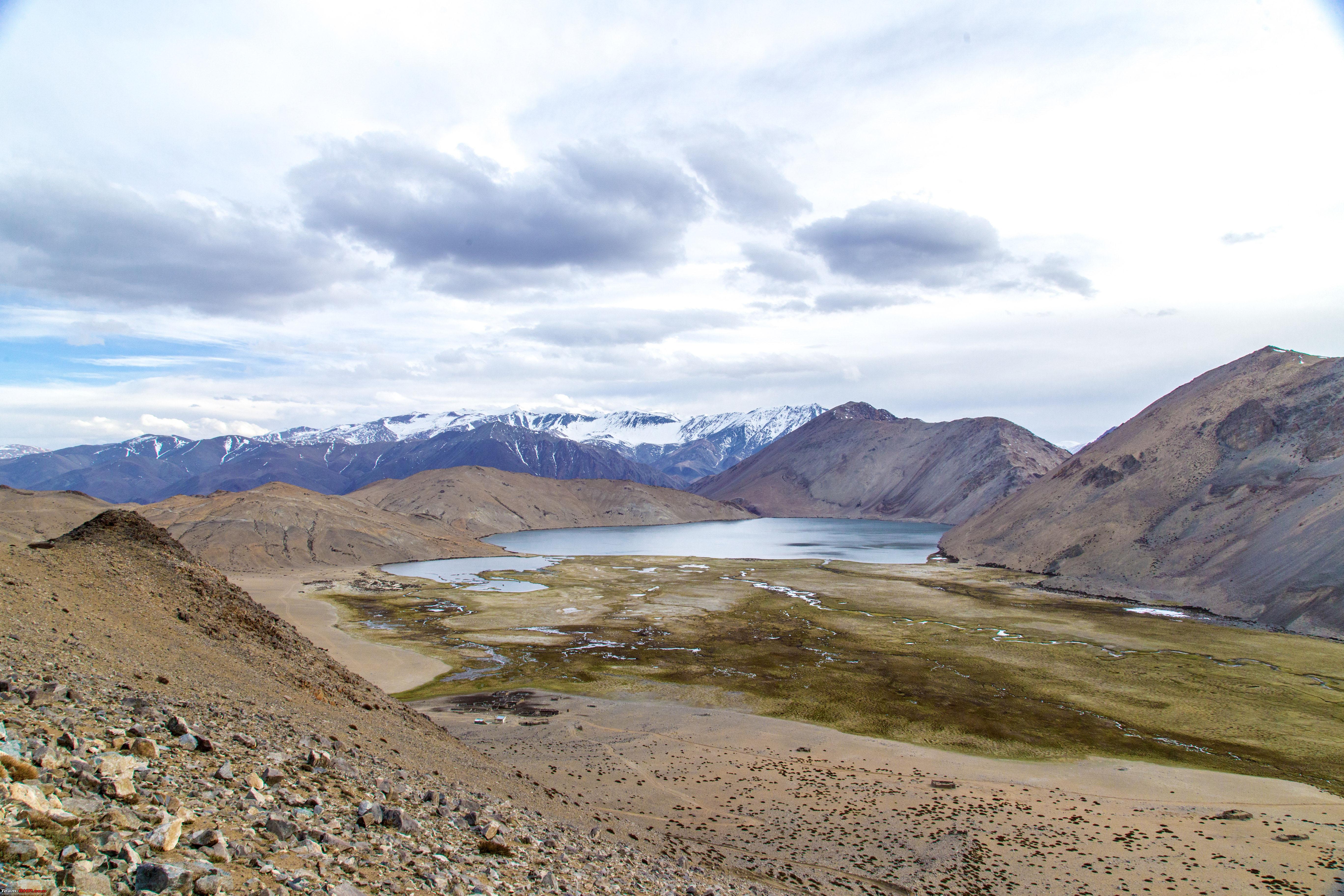 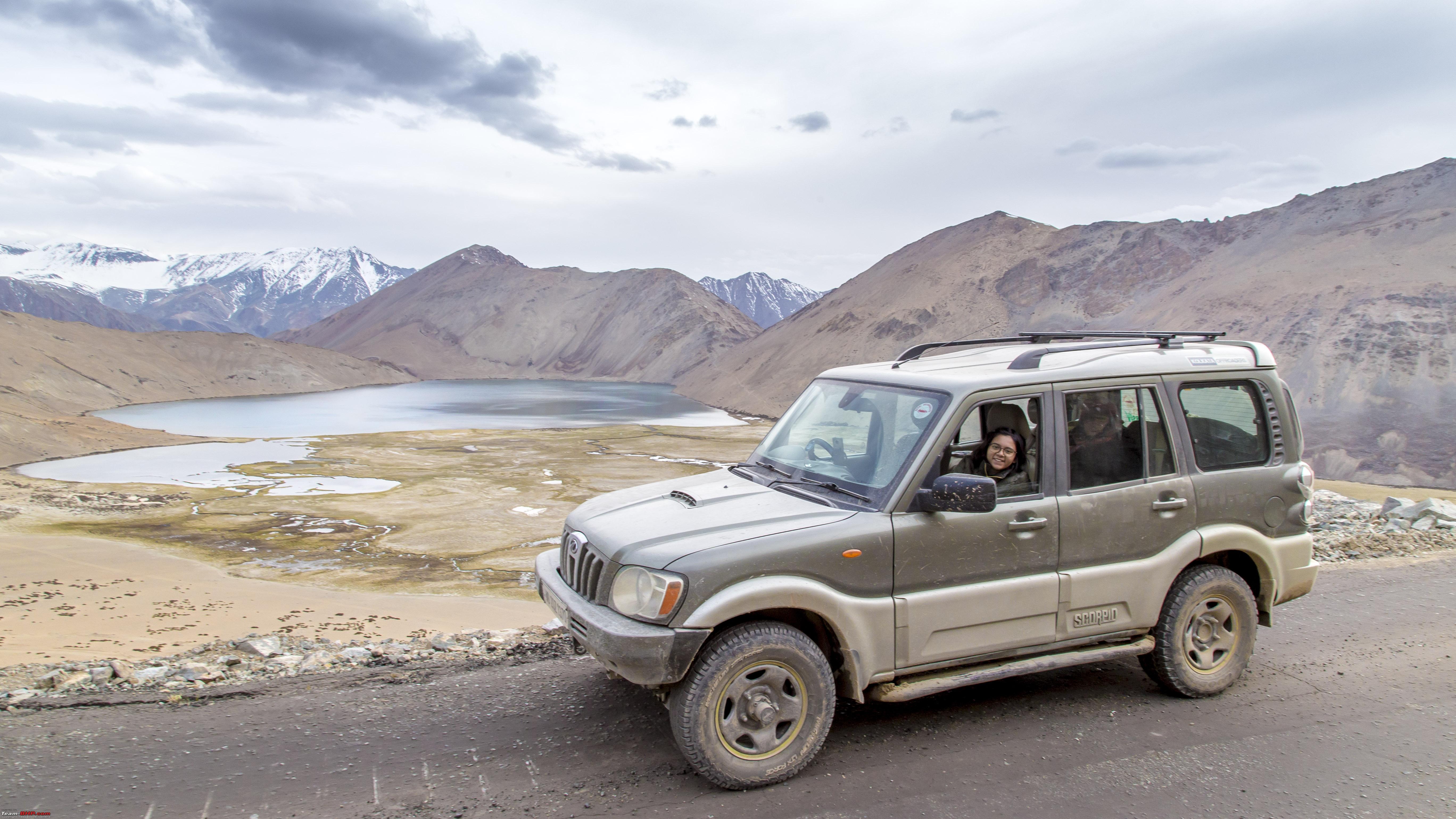 Soon we realised we were into the Chumathang region as the surrounding hills turned reddish and we had company of these 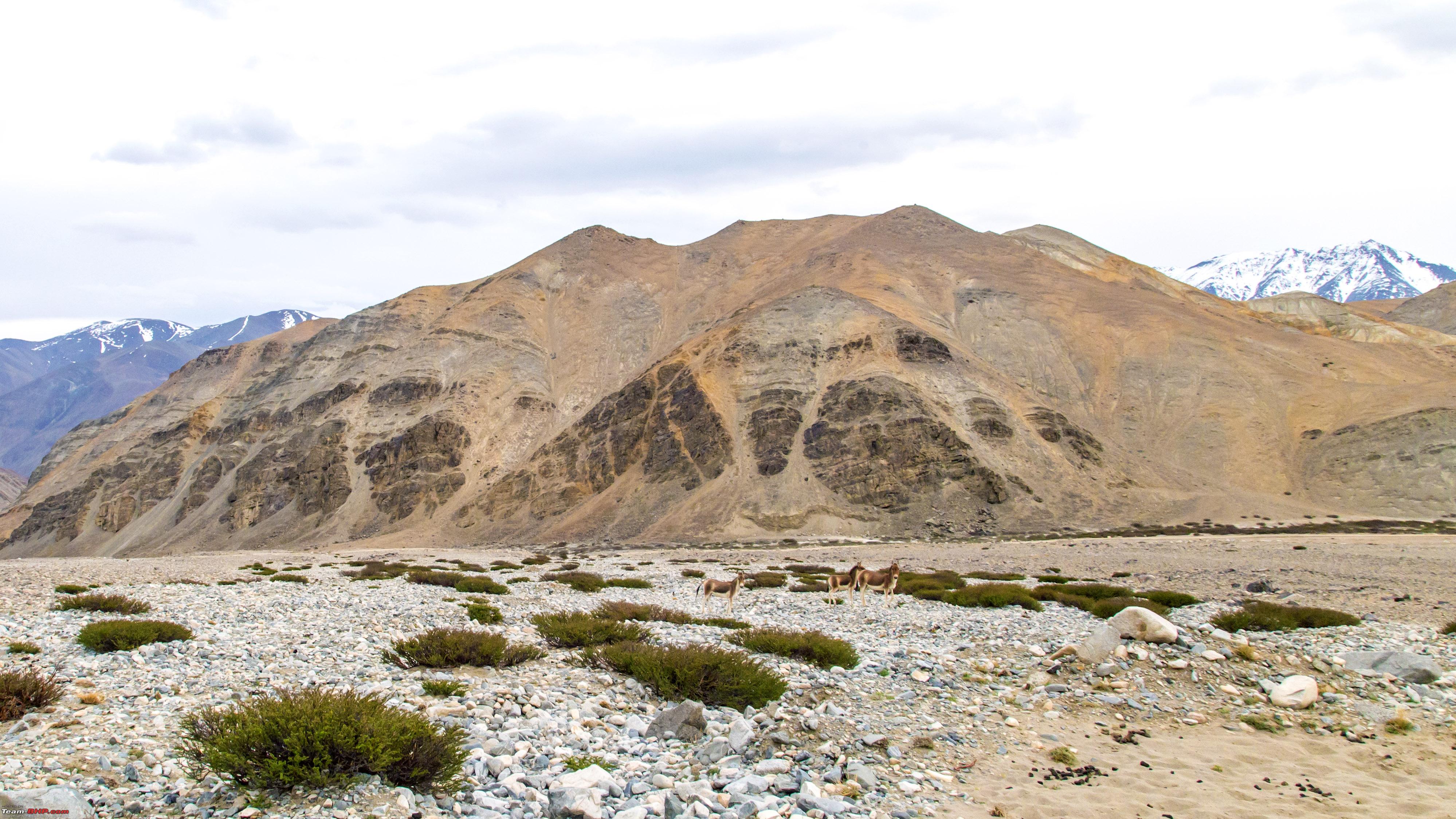 Used the same strategy on them 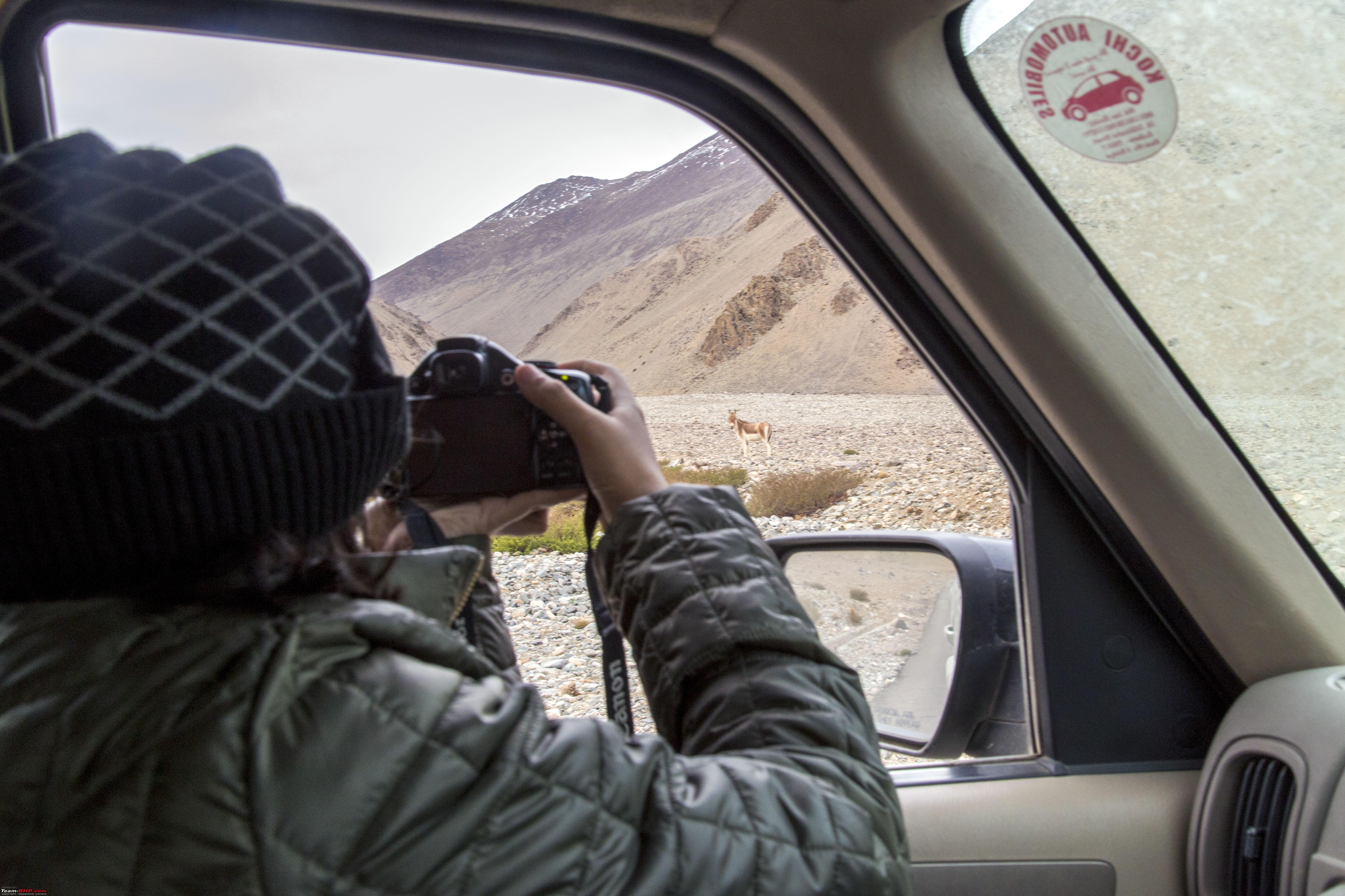 The resultant photo!  The moment the CRDI is cranked, they run away!  Anyways, before we knew it, we were at the junction of Mahe, where we joined the Nyoma-Chumathang road  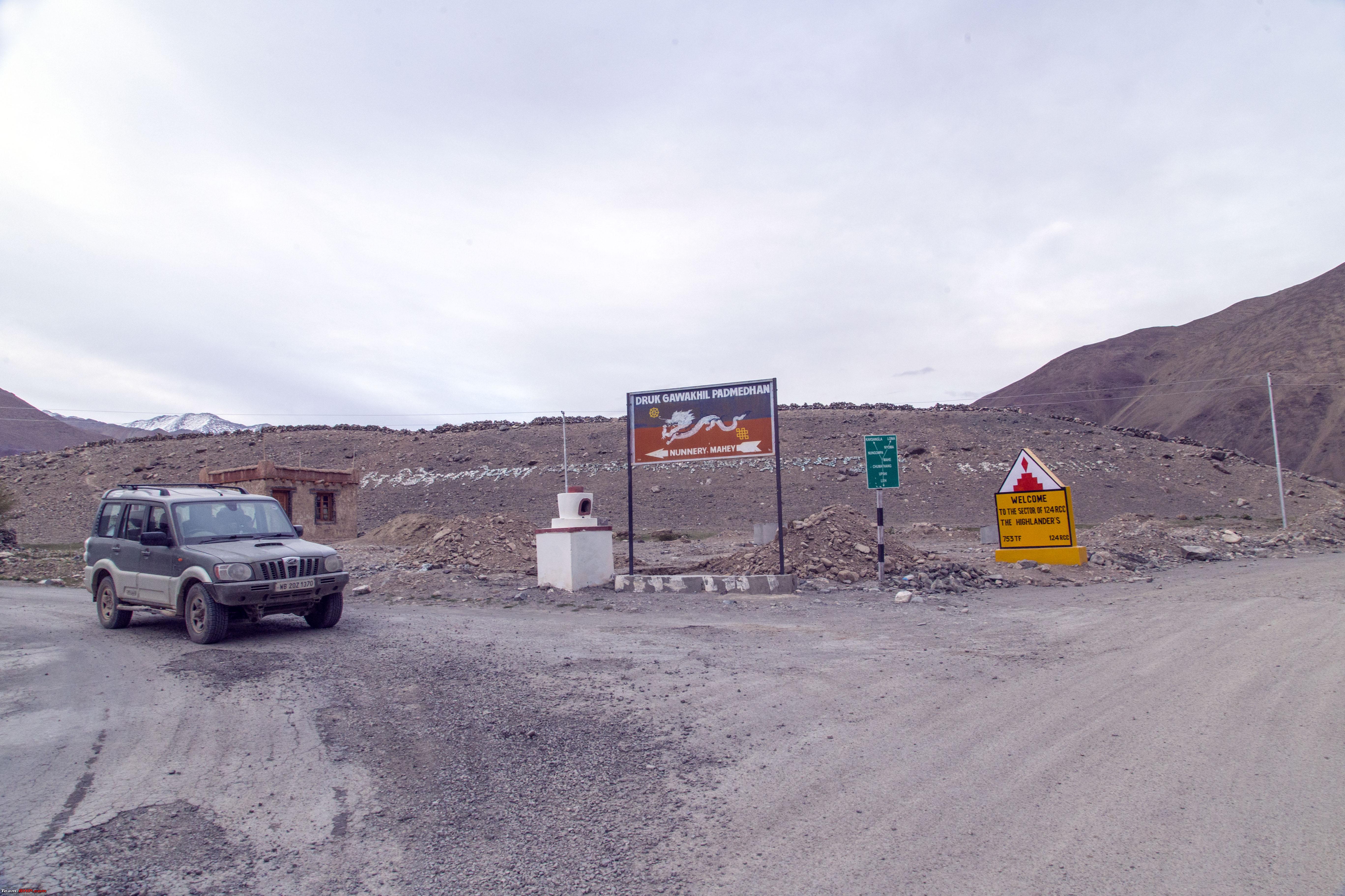 This board explains where we came from!  With the one-hour delay in between, it was 7pm by the time we reached this point. We knew there are homestays here and it was a matter of just asking people to find out. The Police checkpost at Mahe was near, also had a small tea stall. However, to our surprise, both the tea stall owner and policeman confirmed that there were no homestays near Mahe (Which we later found out to be incorrect). Either one has to go all the way back to Nyoma or ahead to Chumathang. Alternately the policeman suggested that we go to Sumdho on the way to Karzok (Tso Moriri - we already had the permit for it). Sumdho would be some 10 kms away. We did that, 10kms took a bit longer as the road surface wasn't consistent. Upon entering Sumdho, there was a board directing to a "Tso Moriri Resort" some 1km on the left side (on the way to Tso Moriri). That 1km seemed to come 2kms later. A small tea stall on the left side, proclaiming it to be the "Resort" in question! A lady quickly came out and intuitively asked us if we were looking for a place to stay. We laughed and remarked that we need something better than the one she came out from. She mentioned that they have another bungalow another half a km above, through a dirt track. Has attached washroom and all! We thought, bingo, what else we need?! Well, taking that dirt track to the "Bunglow", we realised it's a typical Ladakhi house, with some rooms. The rooms have just a bed, a small attached washroom consisting of a wc and a tap. The tap wasn't dry, but it was impossible to even touch the water, as it was chilled beyond bearable. She assured that she will get us warm water! But another problem was, it was cold, no electricity, no light. Nothing around the house for as far as one could see, to top it, there would be no one with us in this house at night! So, we decided to wish this place goodbye and drive back to the proper Sumdho town, which is 3.5kms back. It looked like a proper place at first. We asked for homestays and were soon confirmed that there are two. But one look inside and we realised that it's preferable to stay in a secluded house on the mountain top than in these. Besides at this point, bigger challenge than the 75km KaksangLa route was finding a place to put up for the night. Anyways, it was a drive back to the "Tso Moriri Resort", there was a new revelation! No food! We were carrying some Maggi, so asked the lady if it could be made at the tea stall itself. She also pitched in with some omelette's and soon we had a banquet going! Next would be to carry hot water jerry cans to the secluded house, illuminated by a small LED torch!! Good thing was, the bed was inviting, looked unused, the blankets fresh. A night in a Ladakhi house all by ourselves!! Boy, was the night scary!! Last edited by GTO : 13th July 2019 at 08:04. Reason: small edit |
|
| (26)
Thanks
|
| The following 26 BHPians Thank 1100D for this useful post: | abhijeetp, alokn87, ARAY, coolrats, CrAzY dRiVeR, Dr.Vikas, gmhossain, GTO, jailbird_fynix, jaunthead, maximus., mh09ad5578, mi2n, neil.jericho, Red Liner, Ronak_7, Rudra Sen, Samba, Samfromindia, Sheel, ssambyal1980, streetfighter, Surprise, Thermodynamics, Varun_HexaGuy, wolg |
|
12th July 2019, 00:44
| #11 |
| Senior - BHPian | Re: Ladakh Re-Juleh'd! With Siachen-Panamic-Agham-Chusul-MitpalTso-KaksangLa-TsoKar-KyunTso! Day Eleven! The night went faster than we anticipated and by 0630hrs, we had refuelled from the fuel can that we were carrying, packed our bags, wished goodbye, drove back past Sumdho to this point.  We were on the way to Tso Kar The plan for the day was to drive from Sumdho to Tso Kar and then back the same way all the way to Mahe. Then go to Nyoma, take the road to Nidar and then finally climb up to Thit Zharbo La to access the high grass lands of the twin lakes of Kyun Tso (also known as Chilling Tso and Ryul Tso). Then come back to Nyoma and drive back to Leh for the night. So, another long day on the cards So, coming back to our journey towards Tso Kar  The white sediment is not snow, would appreciate if someone provides details 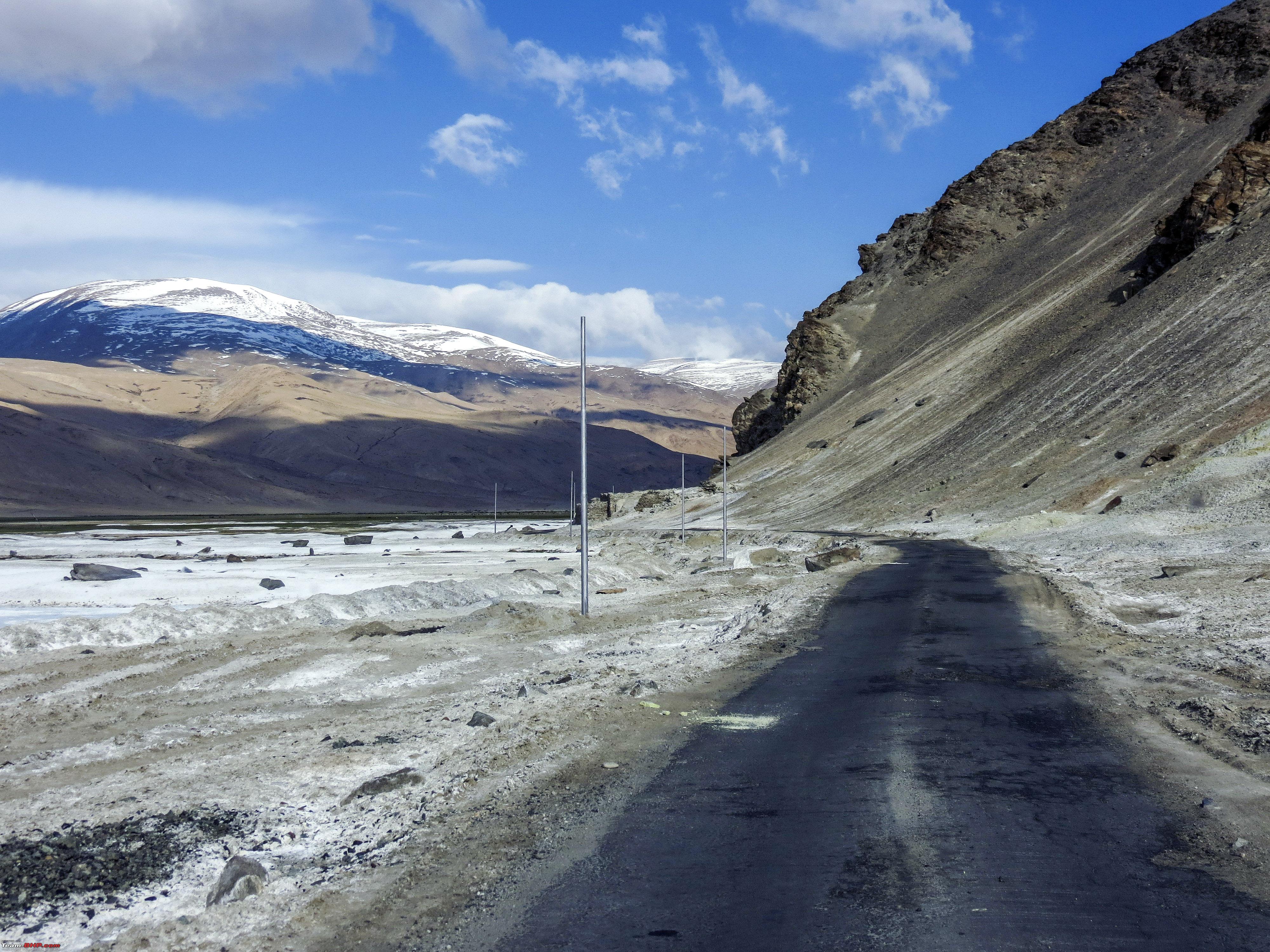 Some "Pashmina" on the way 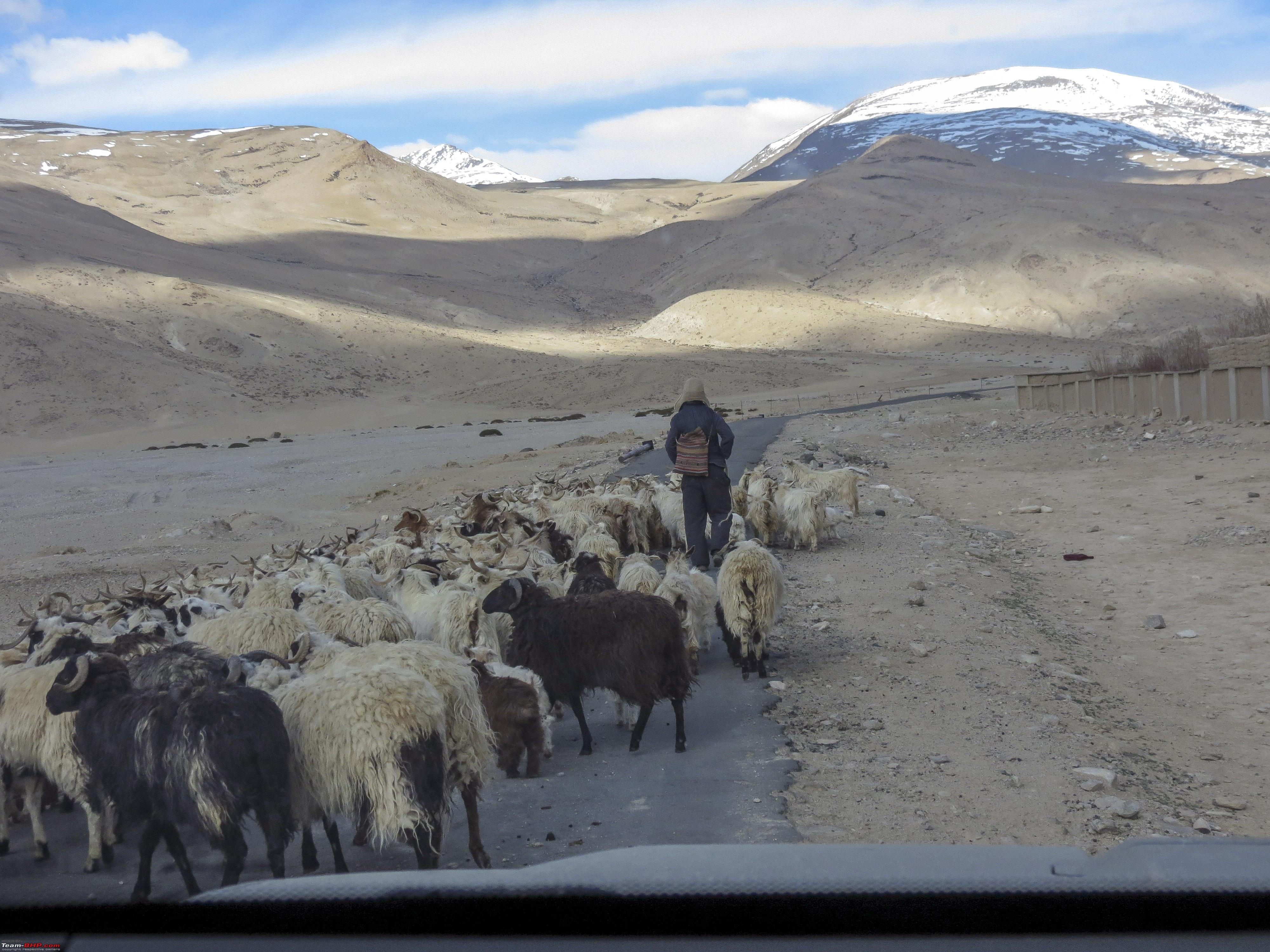 An hour or so later we were at Polokong La (picture to be taken on the way back) and soon we had the first view of the Tso Kar  One destination, multiple roads, shortcuts looked extremely doable 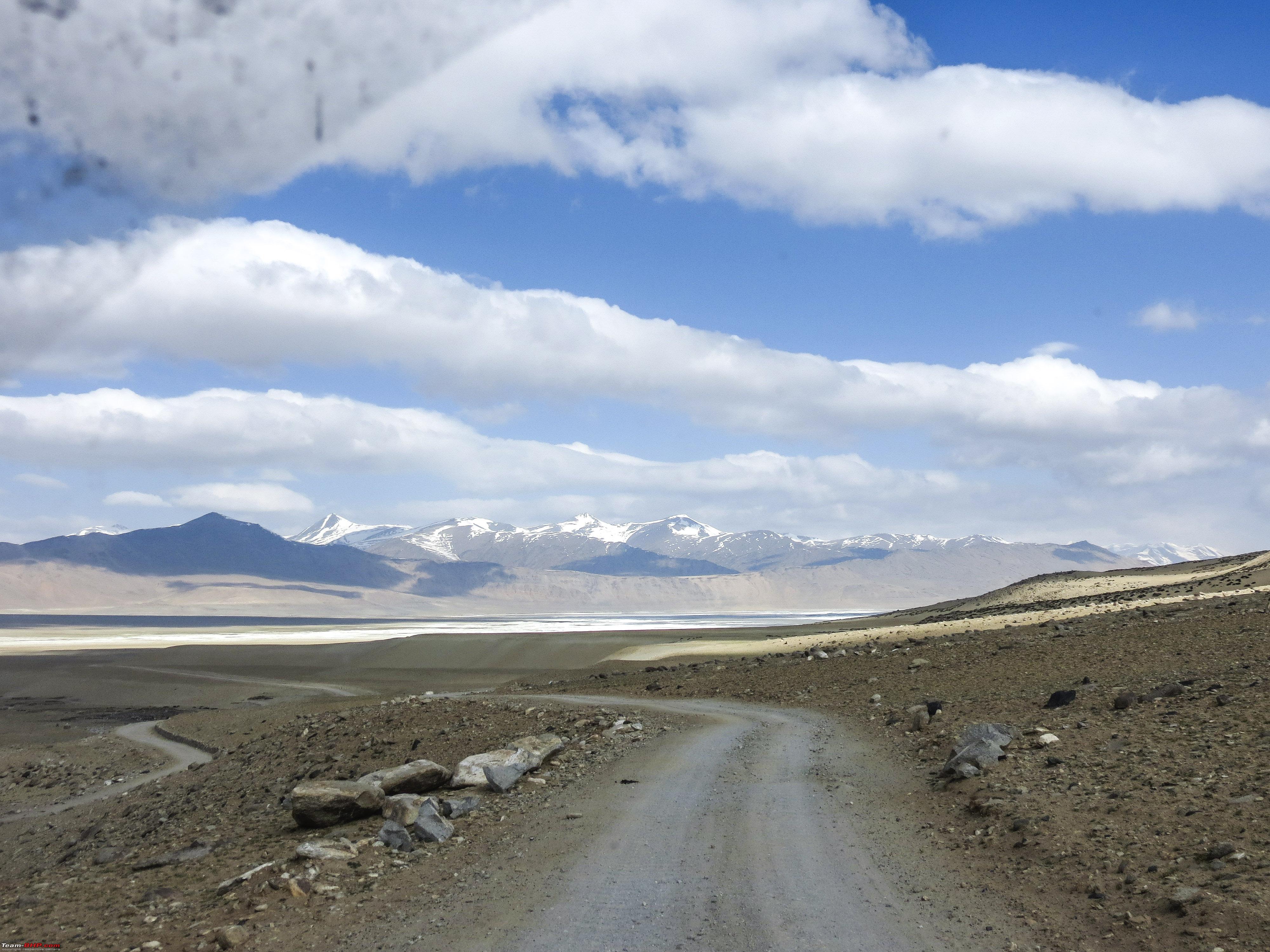 We crossed the town of Tso Kar and head towards the other side to the viewpoint, from where, a track looked going to the water surface  So here we are  The Tso Kar 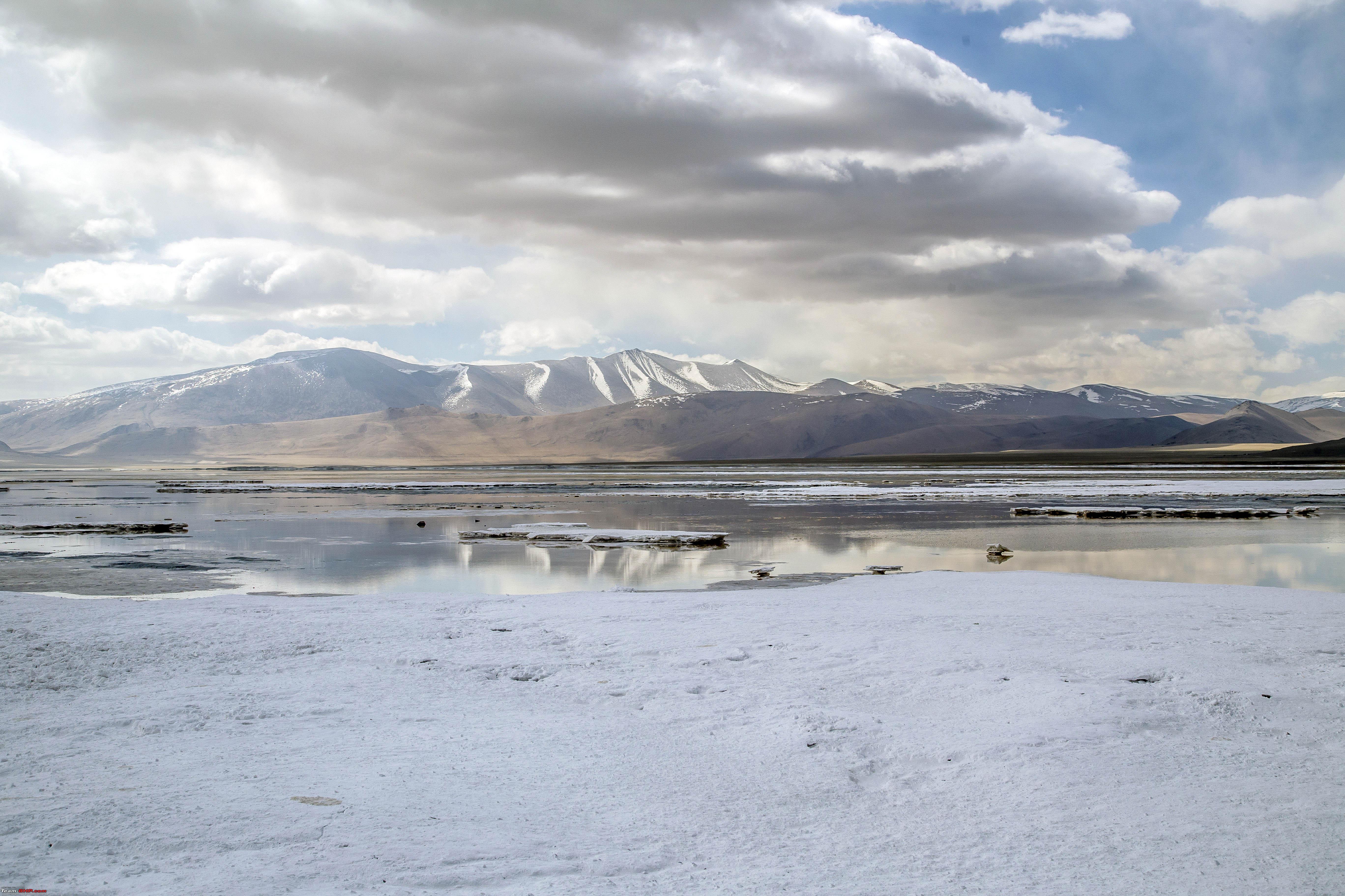 Like mentioned before the white sediment is not snow 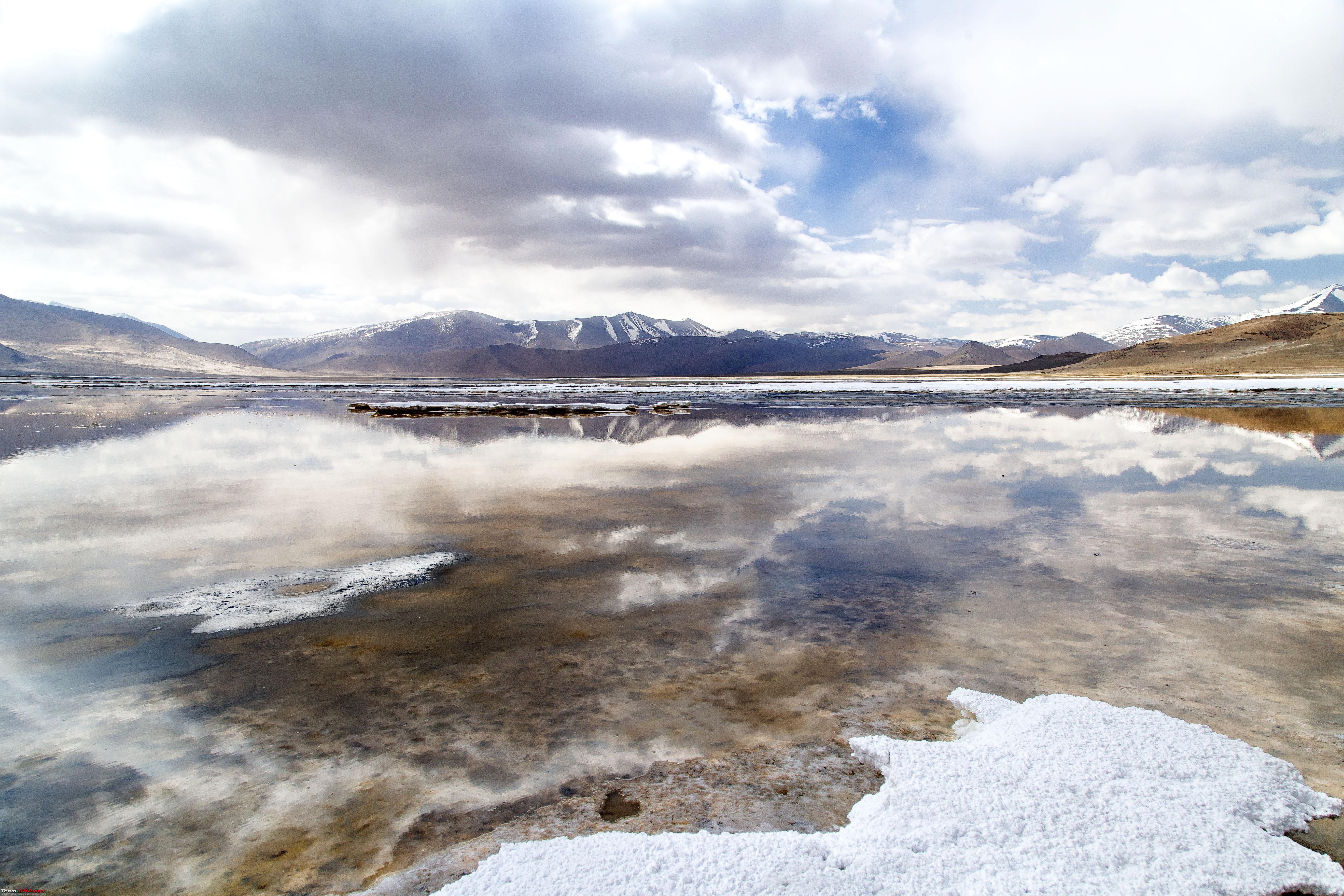   Soon we drove back to the Tso Kar town 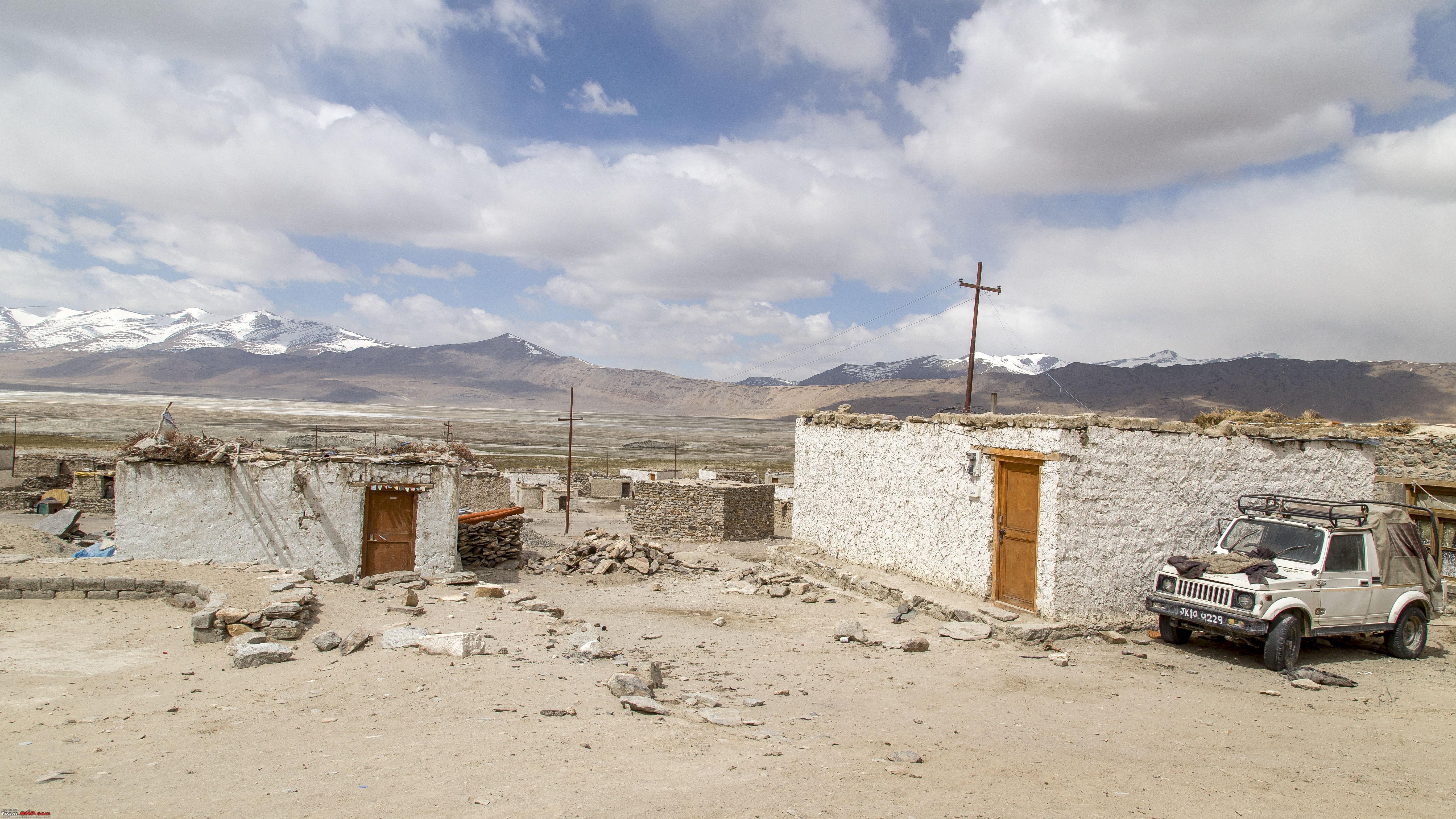 Some breakfast at this  Soon we were saying goodbye to the Tso Kar 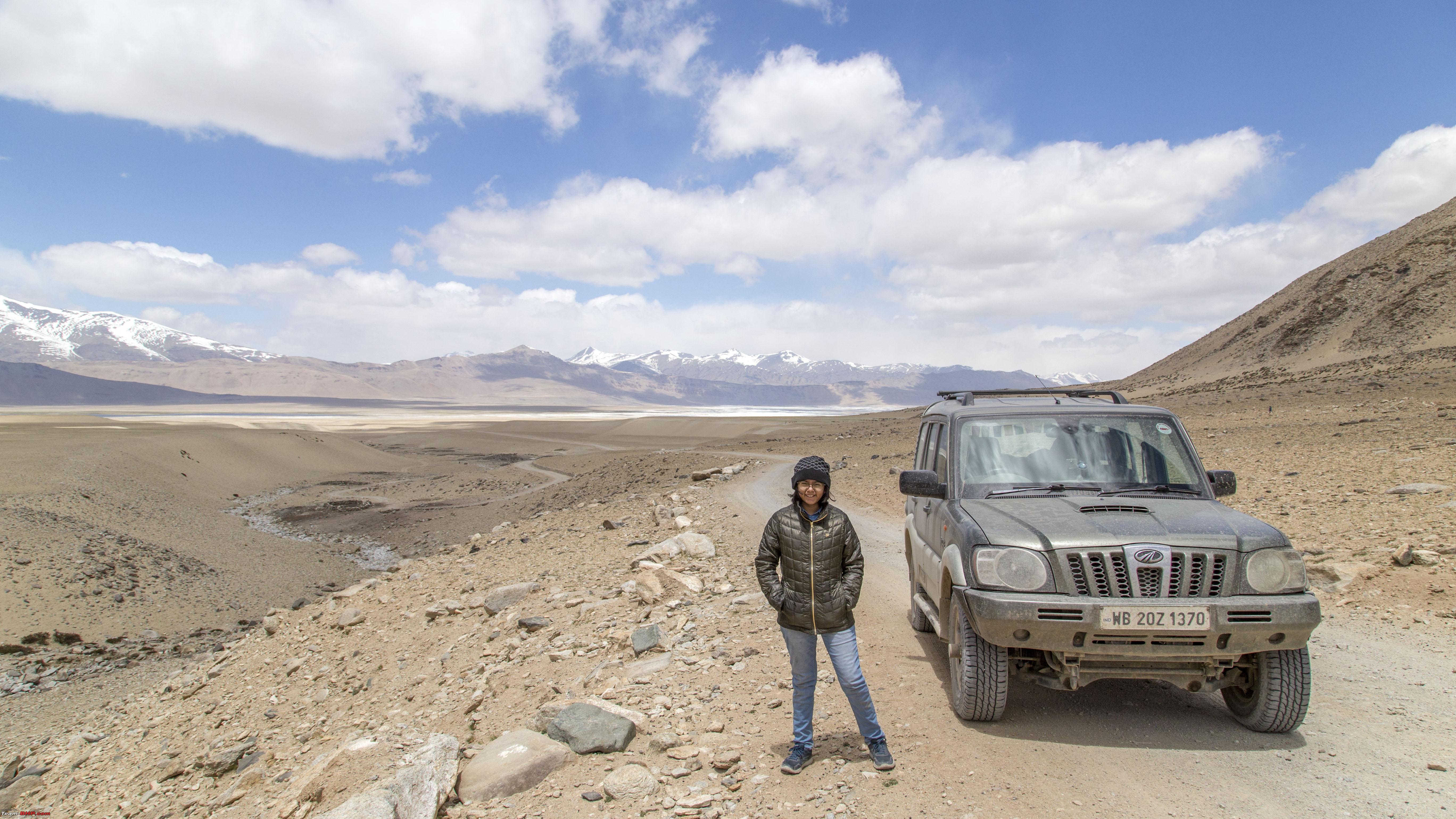 A snap at the Polokong La  Putting up that flag line must have been an effort, given the distance between the two hills  It was mainly an eventless drive back to Sumdho and then back to Mahe,  shot against the gate to the entrypoint of Korzok village, though that itself is quite a distance away 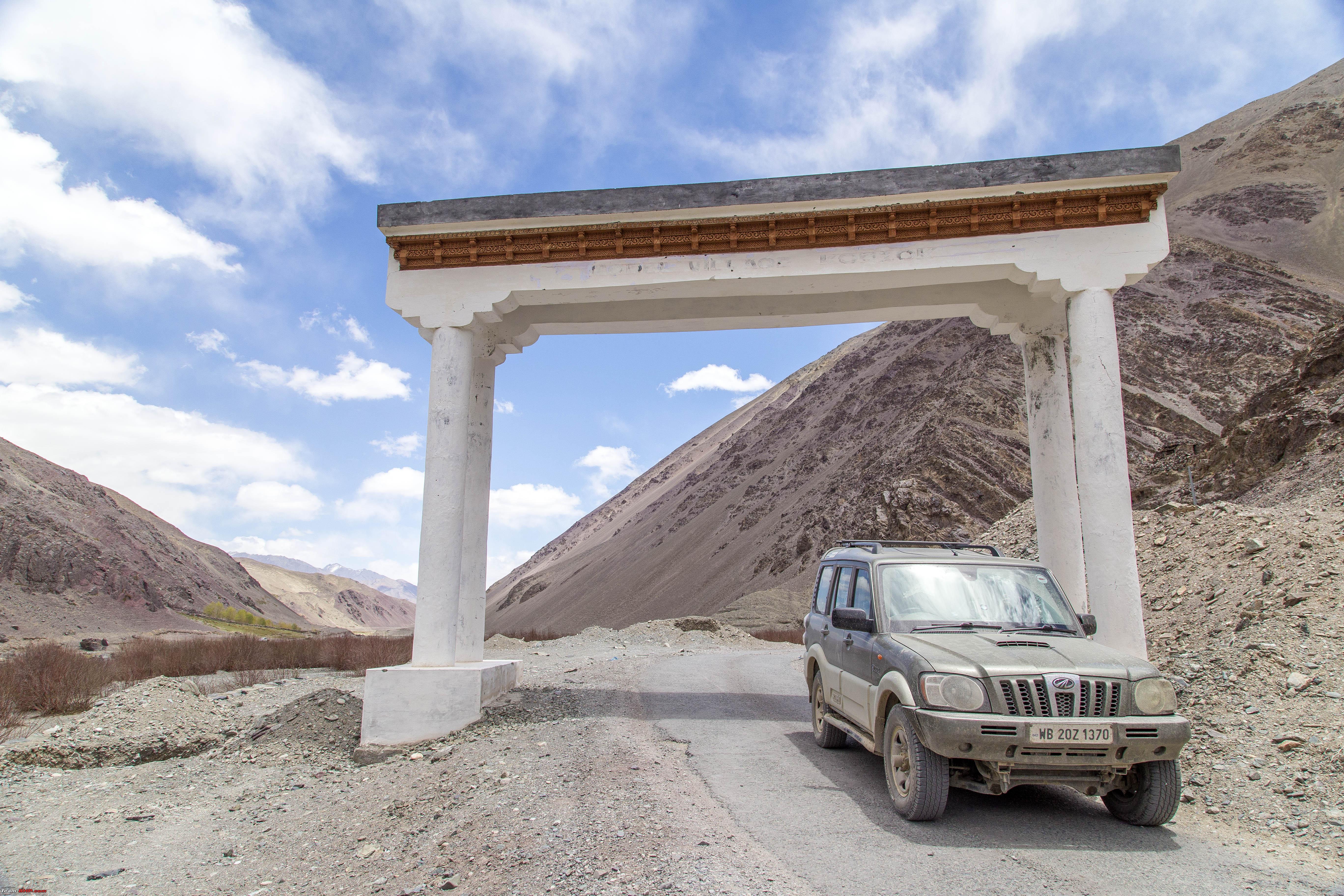 A shot against the Indus flowing through the Chumathang valley 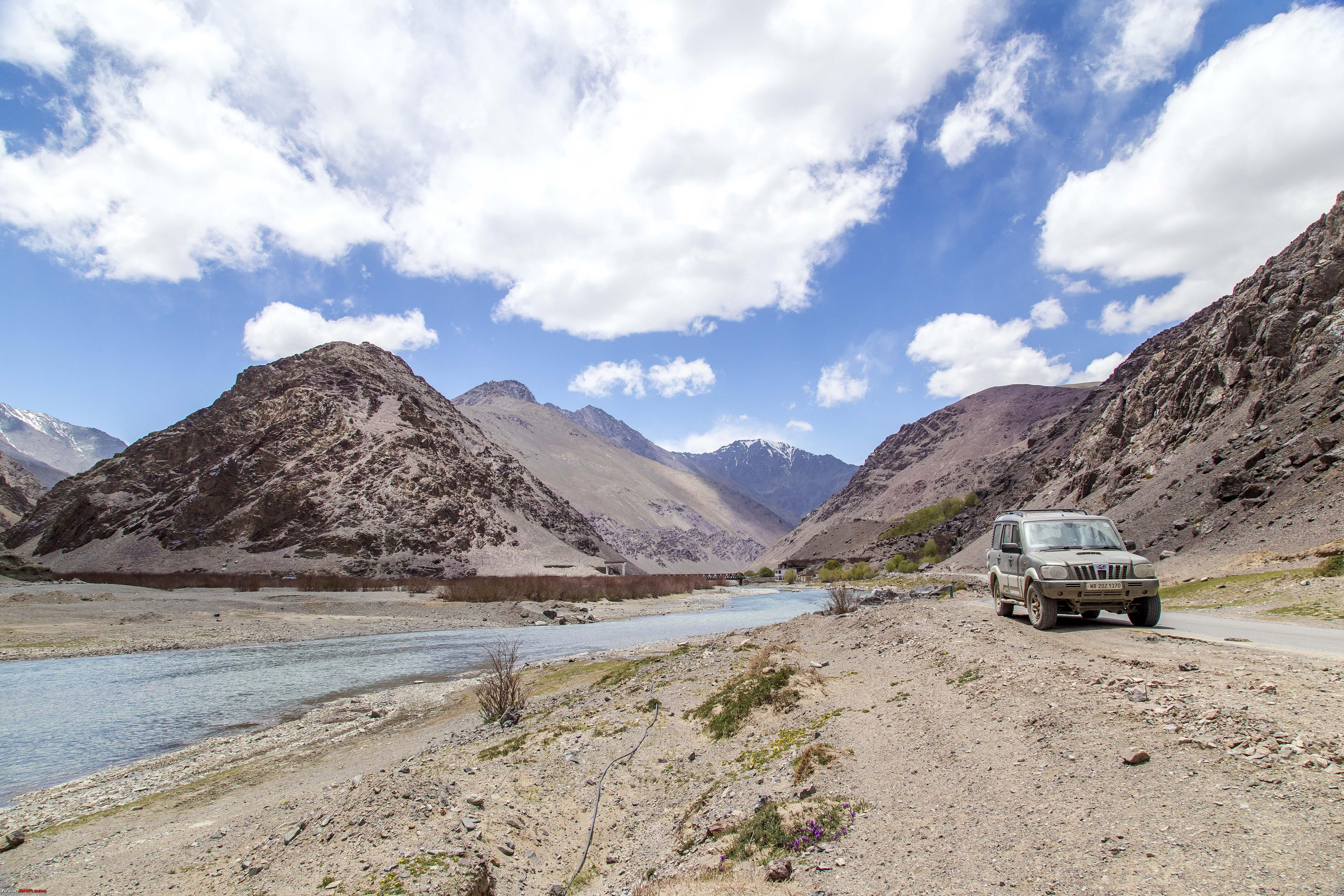 CNTD Last edited by 1100D : 12th July 2019 at 01:04. |
|
| (22)
Thanks
|
| The following 22 BHPians Thank 1100D for this useful post: | abhijeetp, alokn87, ARAY, CrAzY dRiVeR, Dr.Vikas, gmhossain, GTO, mh09ad5578, mi2n, neil.jericho, Red Liner, Ronak_7, Rudra Sen, Samba, Samfromindia, Sayata, Sheel, ssambyal1980, streetfighter, Surprise, Thermodynamics, Varun_HexaGuy |
| |
|
12th July 2019, 01:06
| #12 |
| Senior - BHPian | Re: Ladakh Re-Juleh'd! With Siachen-Panamic-Agham-Chusul-MitpalTso-KaksangLa-TsoKar-KyunTso! Day Eleven CNTD Our next target was Nidar,   we had to drive towards Nyoma and before it, there would be a bridge on the right to Nidar. Road to Nidar was blacktop and we were soon past it before we even realised it 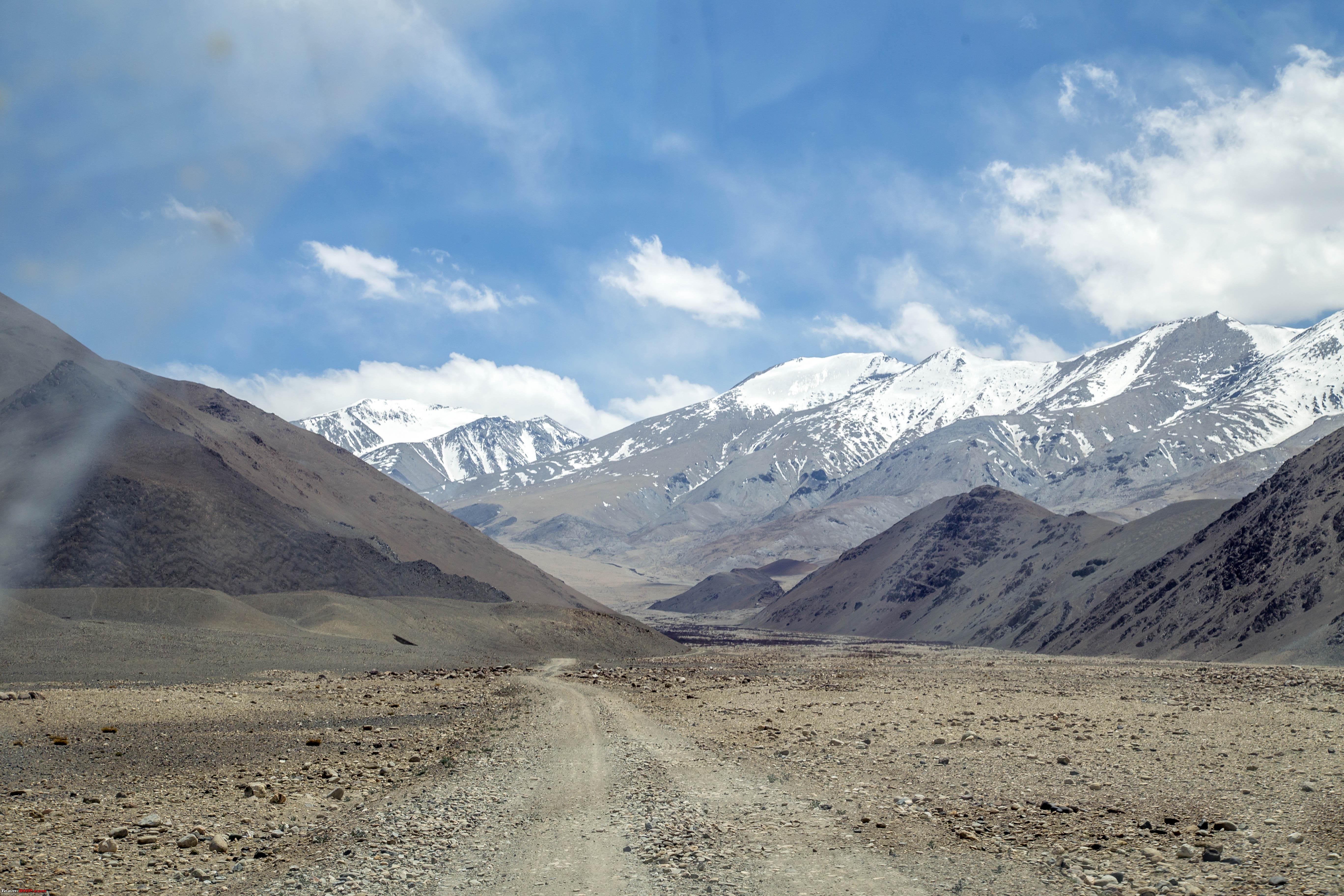 It was again dirt track  At some points one would still wonder what is the actual track to take    Soon there were some stretch of green flat lands 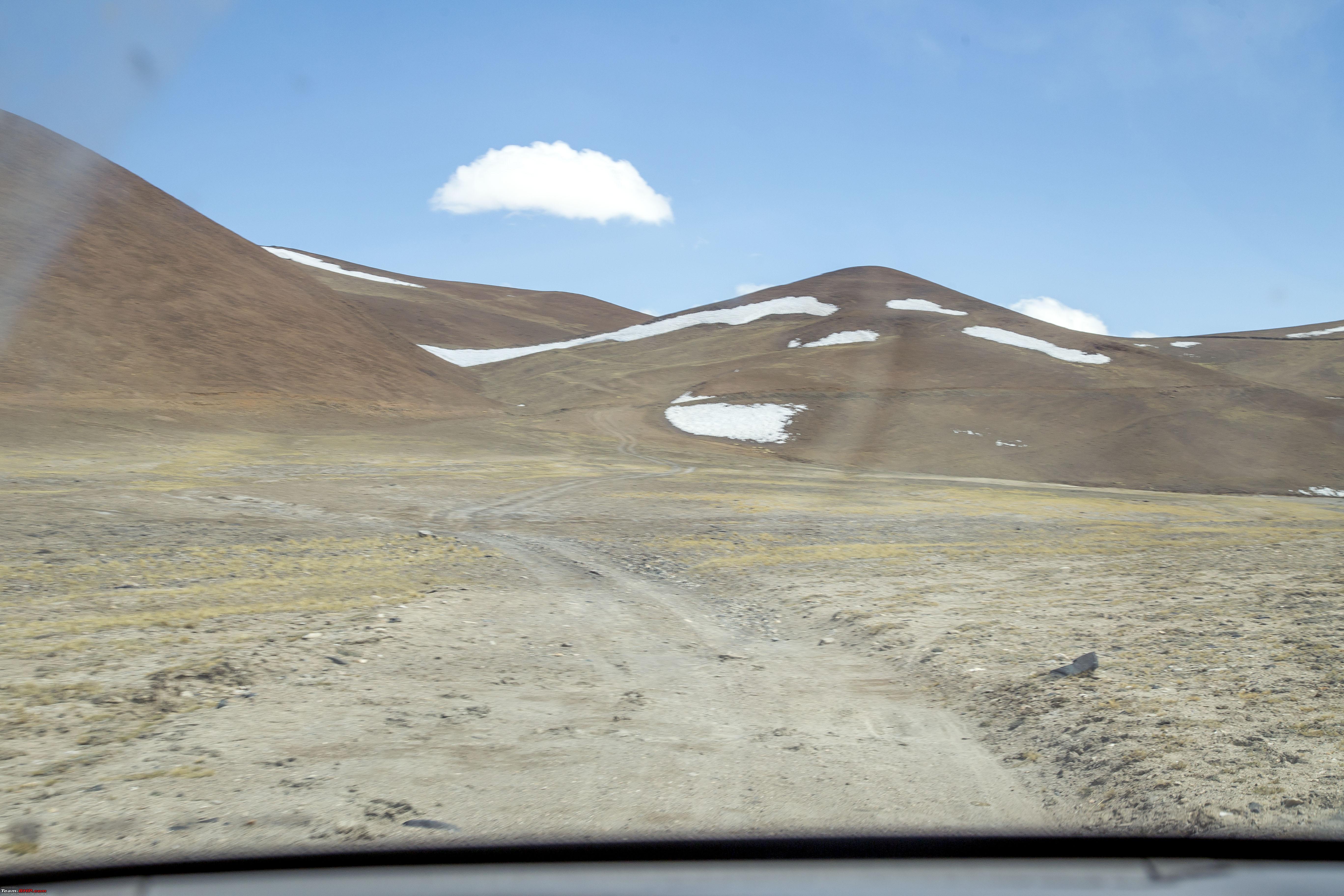 The climb here is anyone's guess, so many past tyre tracks have gone so many ways!!  Good thing is that they all ended up at the same place later!! Pity we had to break these cute spikes in order to move ahead. so took a picture before Marengo (our 2010 Scorpio 4wd) drove on them 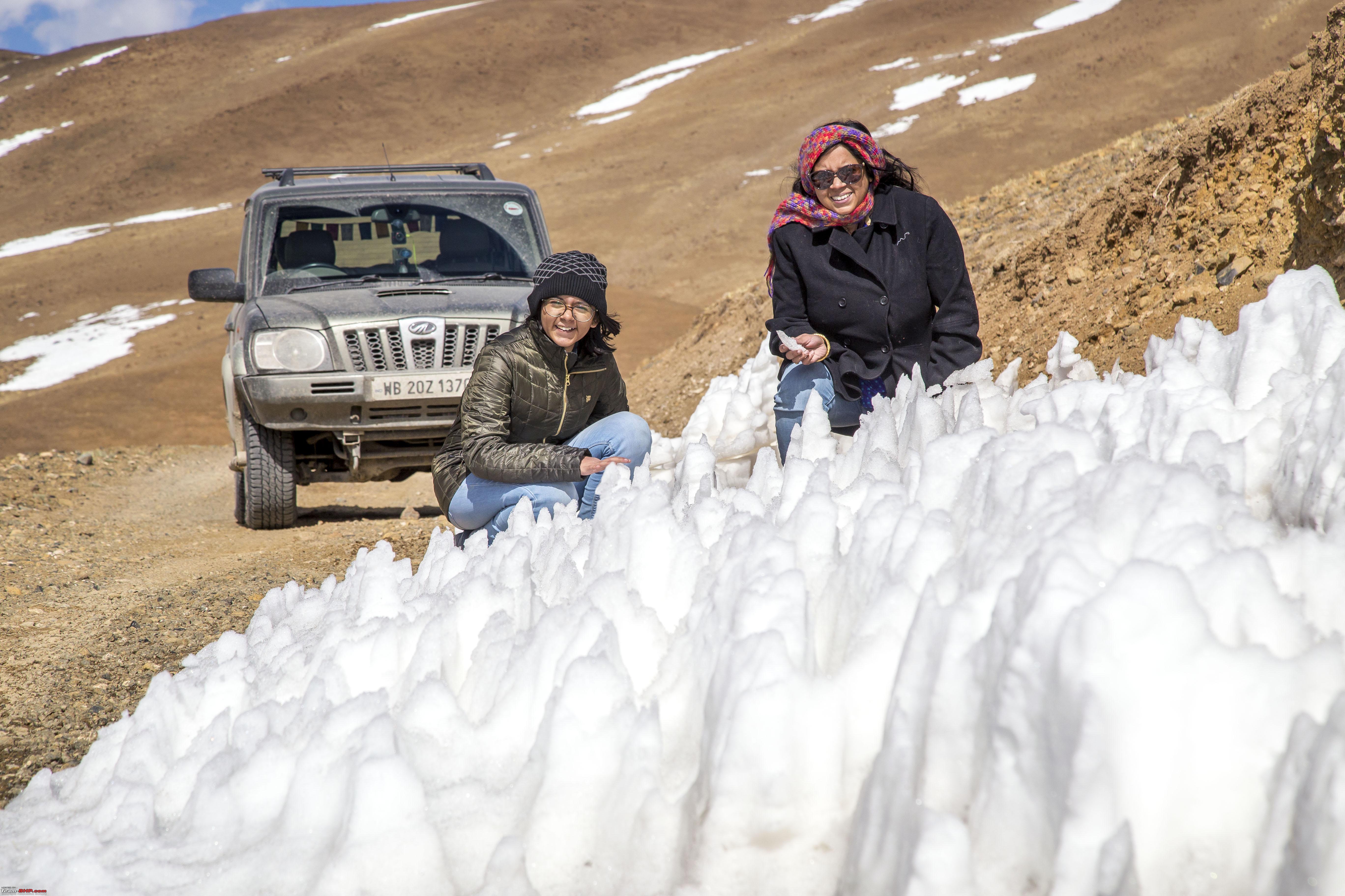 We were soon at Thit Zharbo La (picture taken on the way back) Descending a little from this "La" one would be on a vast stretch of green grassland and in the middle two little waterbodies of blue would appear. The eyes can see and make out easily, but difficult for the camera to make out. (Picture taken on the way back - posted later) We started with first heading towards the first waterbody. However, soon realised that the second waterbody has gone out of sight. The way the first waterbody is oriented, it would be difficult to manually navigate to the second one from the first. So, at this point we decided to trace back till the second waterbody becomes visible and then start driving to it. So here we are at the farthest lake of the two, referred here as the Kyun Tso I (or the Ryul Tso) 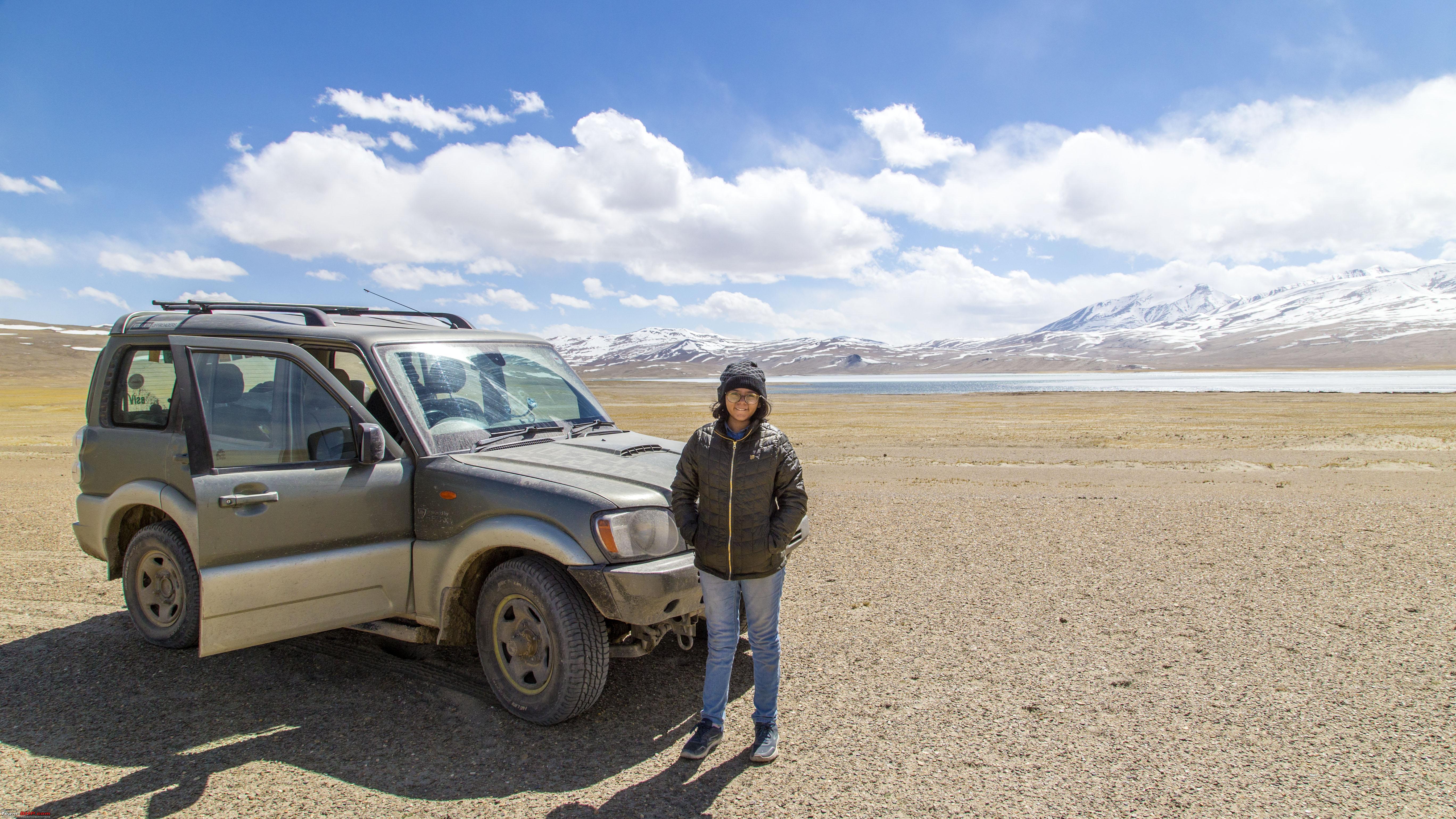 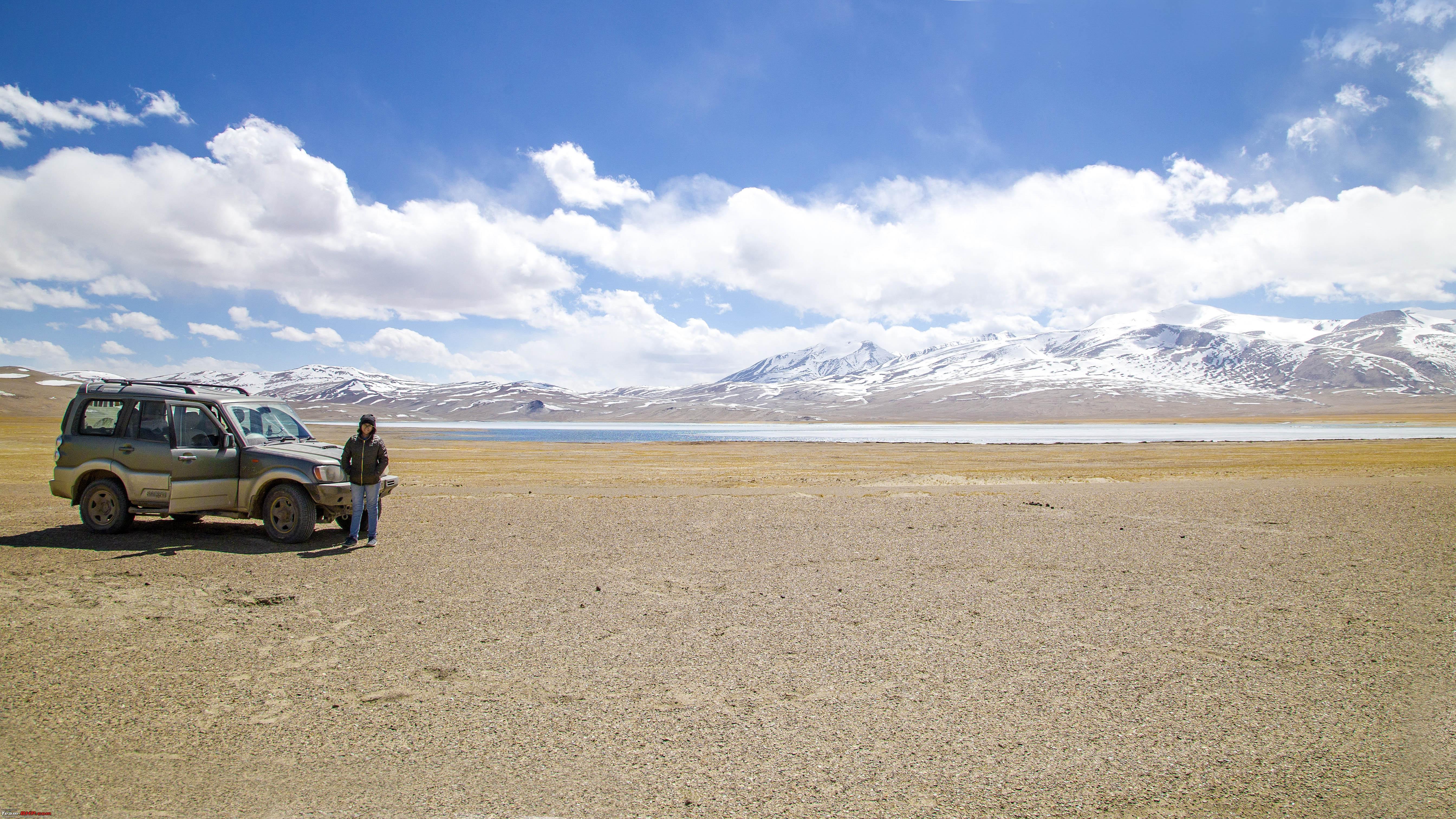  Driving back between the Lakes, a point which probably qualifies as "middle of nowhere"!!  7 kms between the two lakes, absolutely free to drive everywhere and this is probably half way Soon we were back to the first waterbody, referred here as the Kyun Tso II (Chilling Tso) 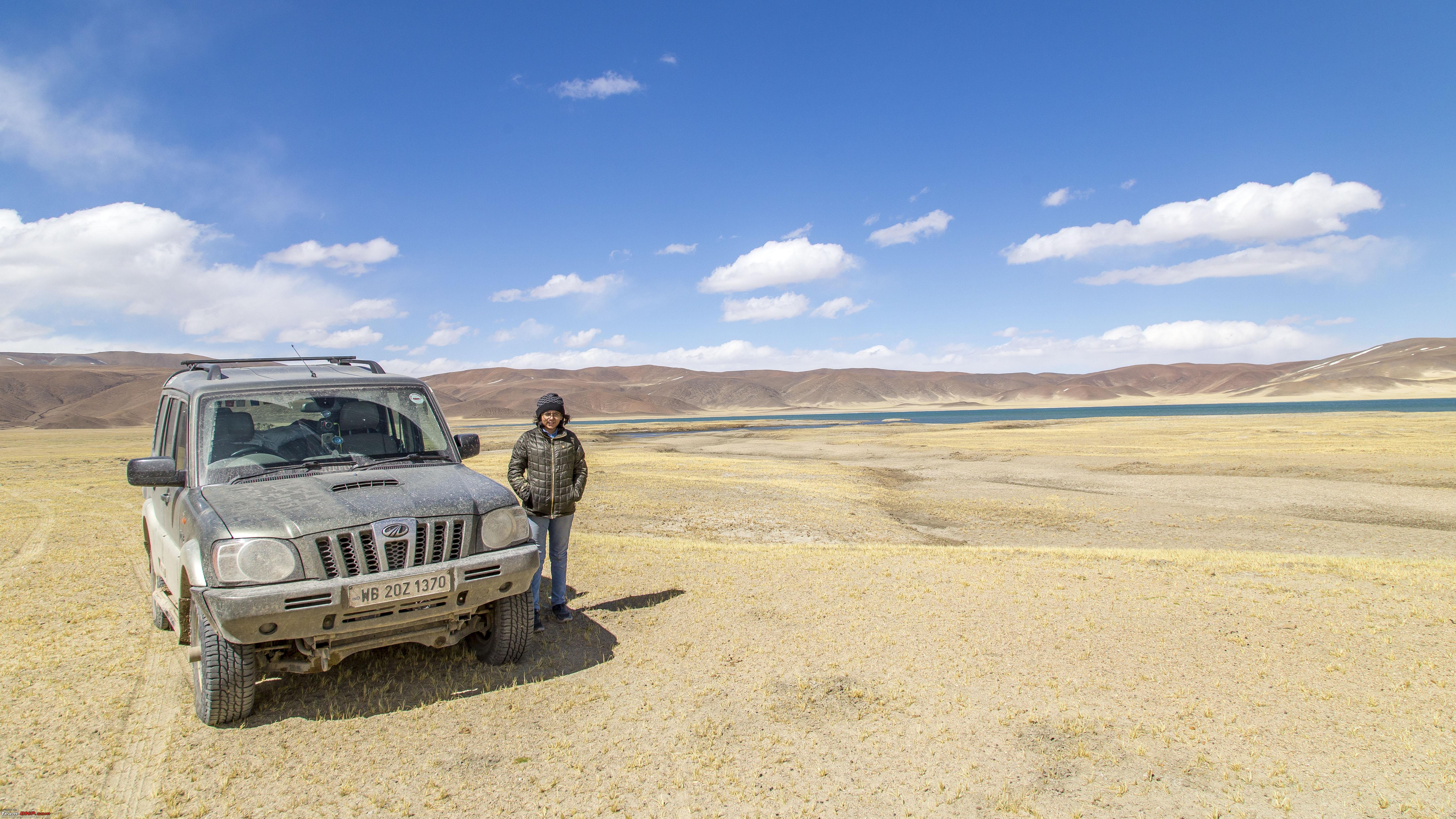  Then time to drive back to the point from which both the lakes can be seen (The lakes are marked as I and II only for reference)  However, when you put a vehicle, or a person in the photograph, it's almost impossible to tell there are two lakes in there (unless one zooms substantially). 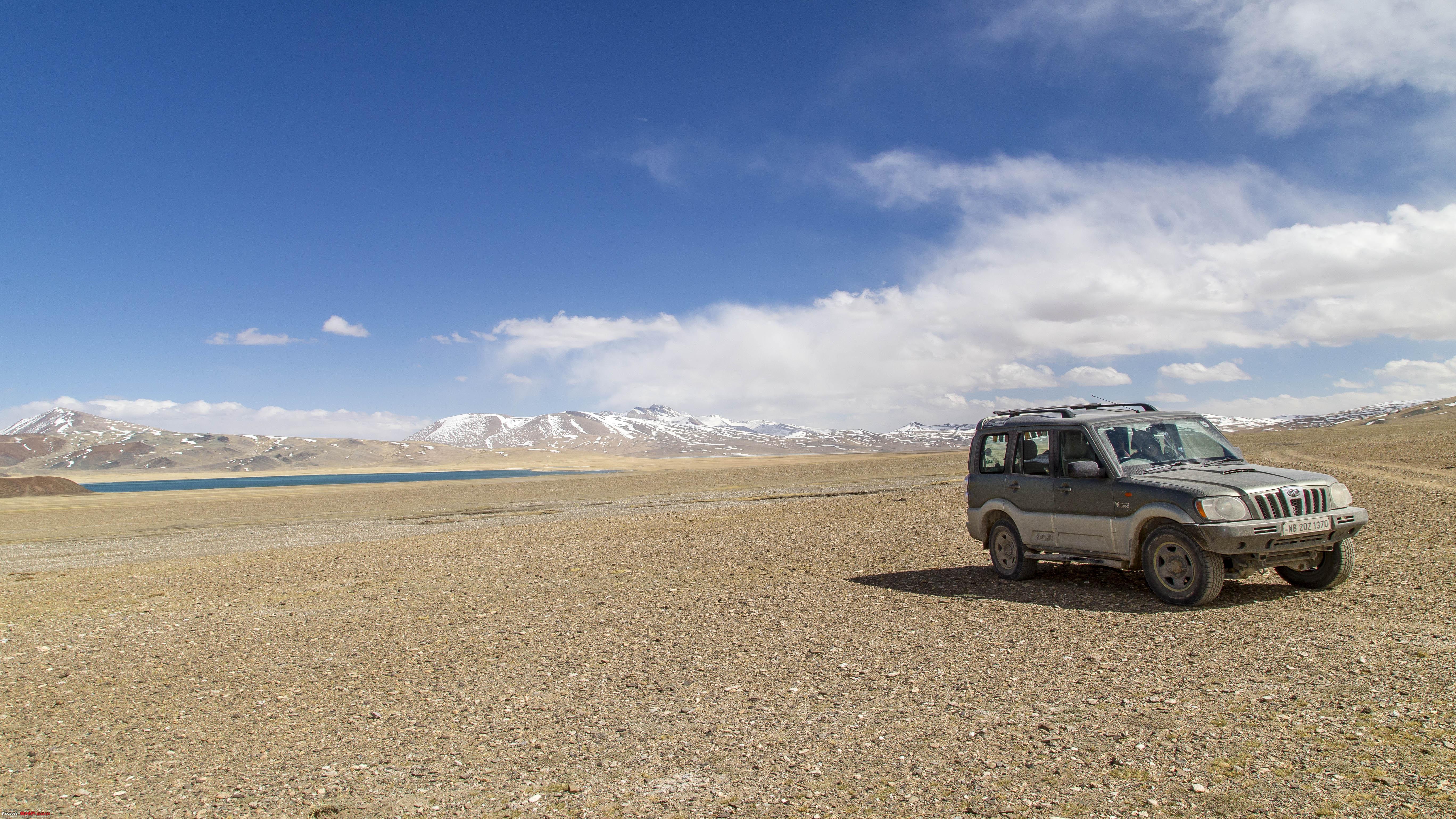 Another snap of the chilling Tso with a hump ahead of it 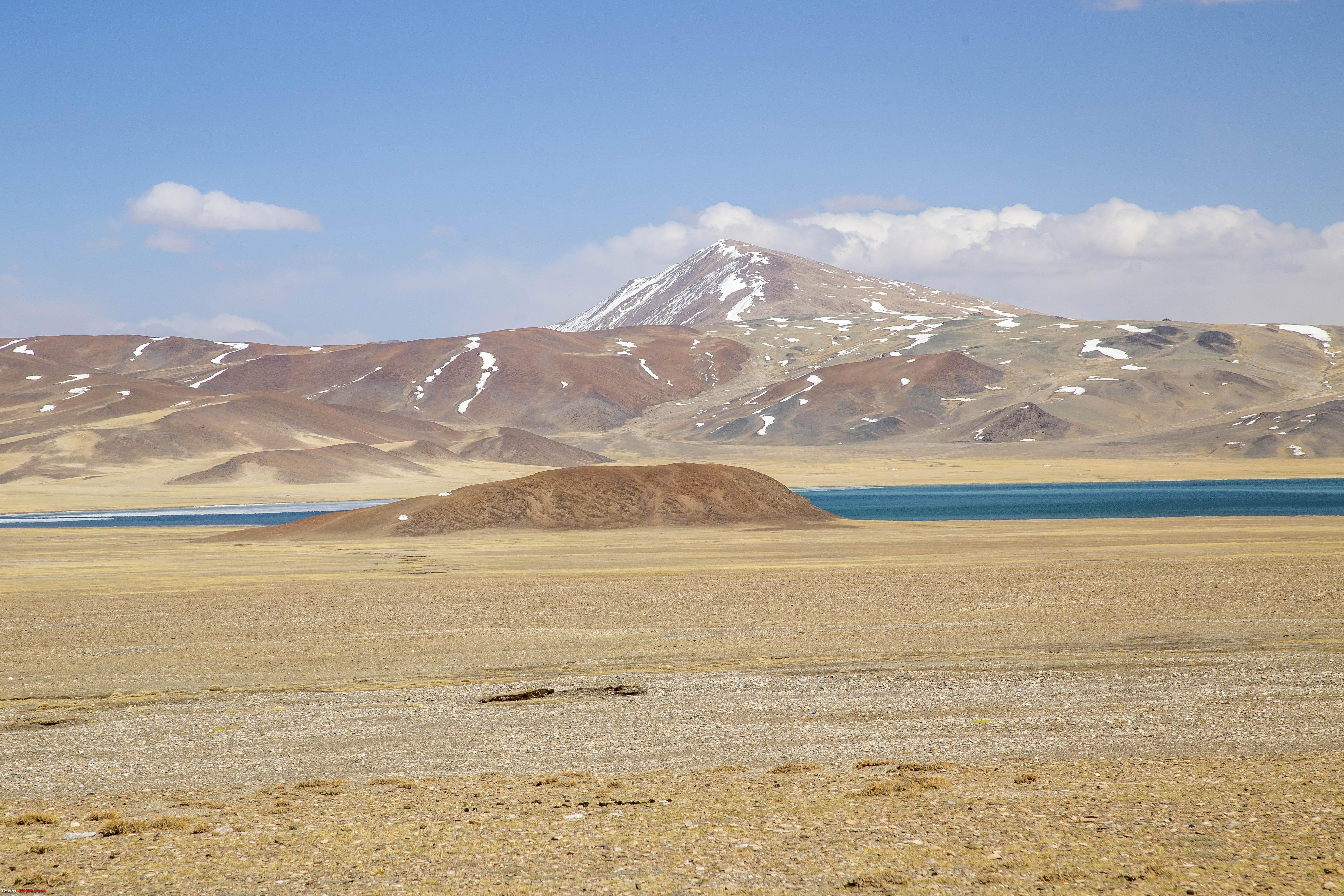 Soon we were heading back to Thit Zharbo La  The Thit Zharbo La  It was then time to trace the route back. At Chumathang!  Another 2.5 hours back to Leh Last edited by 1100D : 12th July 2019 at 01:13. |
|
| (20)
Thanks
|
| The following 20 BHPians Thank 1100D for this useful post: | alokn87, ARAY, CrAzY dRiVeR, gmhossain, GTO, jaunthead, lightning535, mh09ad5578, mi2n, neil.jericho, Red Liner, Ronak_7, Rudra Sen, Samba, Samfromindia, Sayata, Sheel, ssambyal1980, streetfighter, Thermodynamics |
|
12th July 2019, 01:20
| #13 |
| Senior - BHPian | Re: Ladakh Re-Juleh'd! With Siachen-Panamic-Agham-Chusul-MitpalTso-KaksangLa-TsoKar-KyunTso! The Twelfth Day The reason for coming back to Leh the previous evening and staying there for a day, were two-fold 1> We needed a day to cool off. Had been continually been exposed to high altitudes for 5 days at a stretch (barring one day at Nubra) 2> We still had hopes of the Leh-Manali highway opening up. Enquiring from the checkpost at Upshi, the past evening and also some local cabbies, it seemed they were close to opening the route up. So naturally, we started the day off late, but with, first going all the way to Upshi to find out and then plan the remaining day accordingly. Thiksey Monastery on the way to Upshi  Crossing Karu  However, at Upshi, we were now told that, there is no chance of the route opening in the next few days (infact it was almost a week later that it was opened initially before being closed again) So, we drove back, but took a detour to Hemis Gompa The Hemis Monastery in the distance 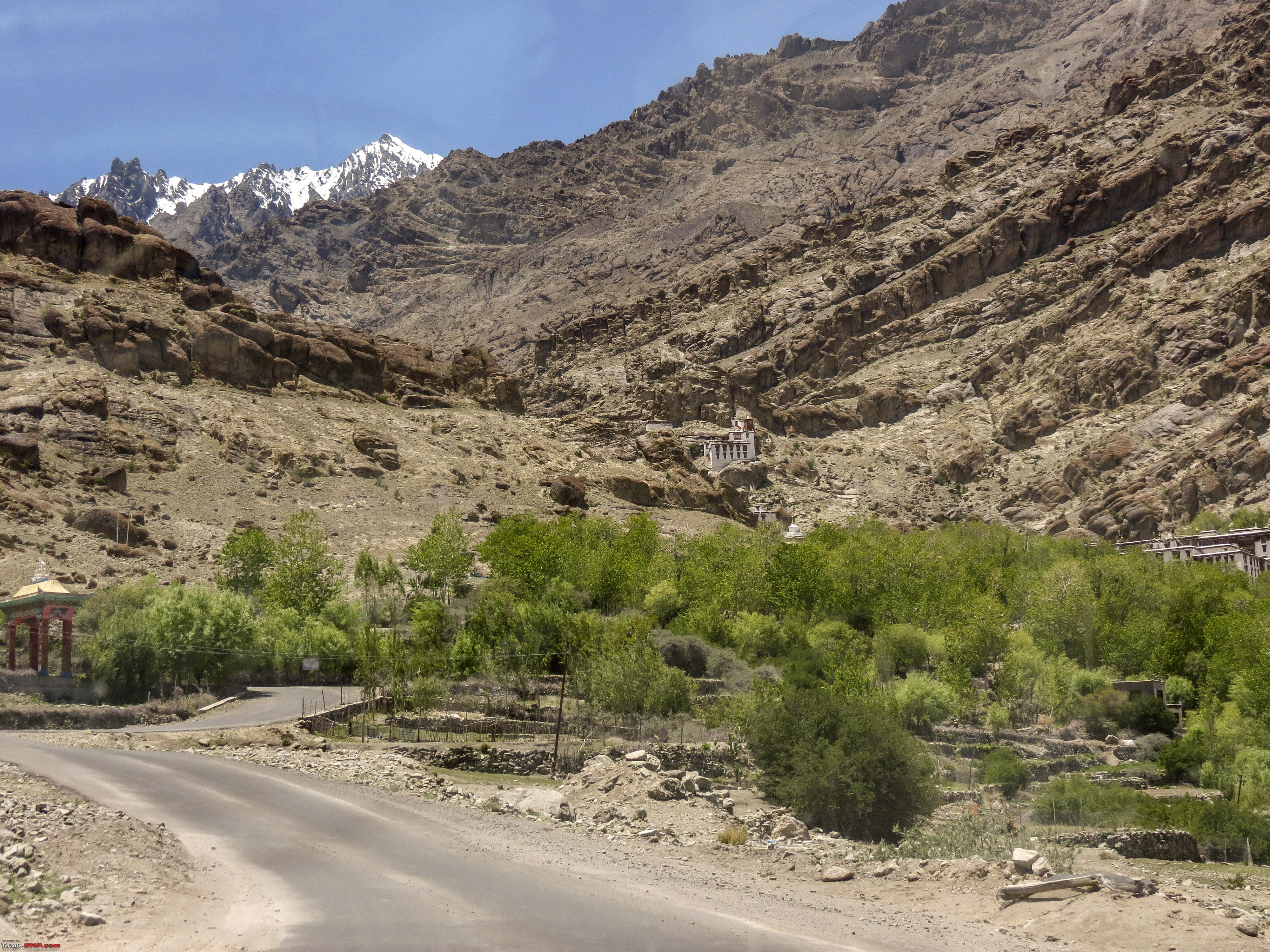 The entrance to the Monastery 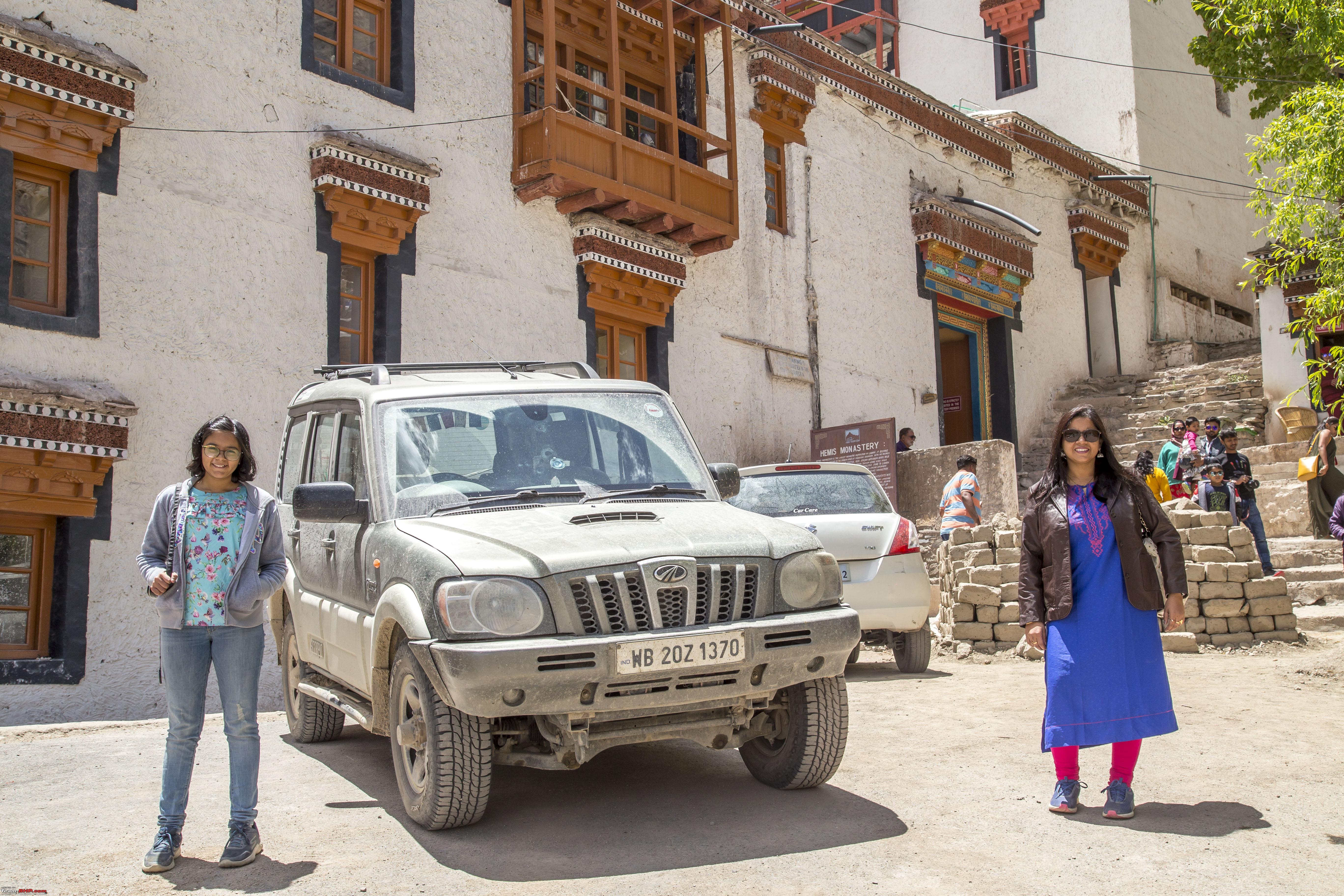 Some pictures in the courtyard 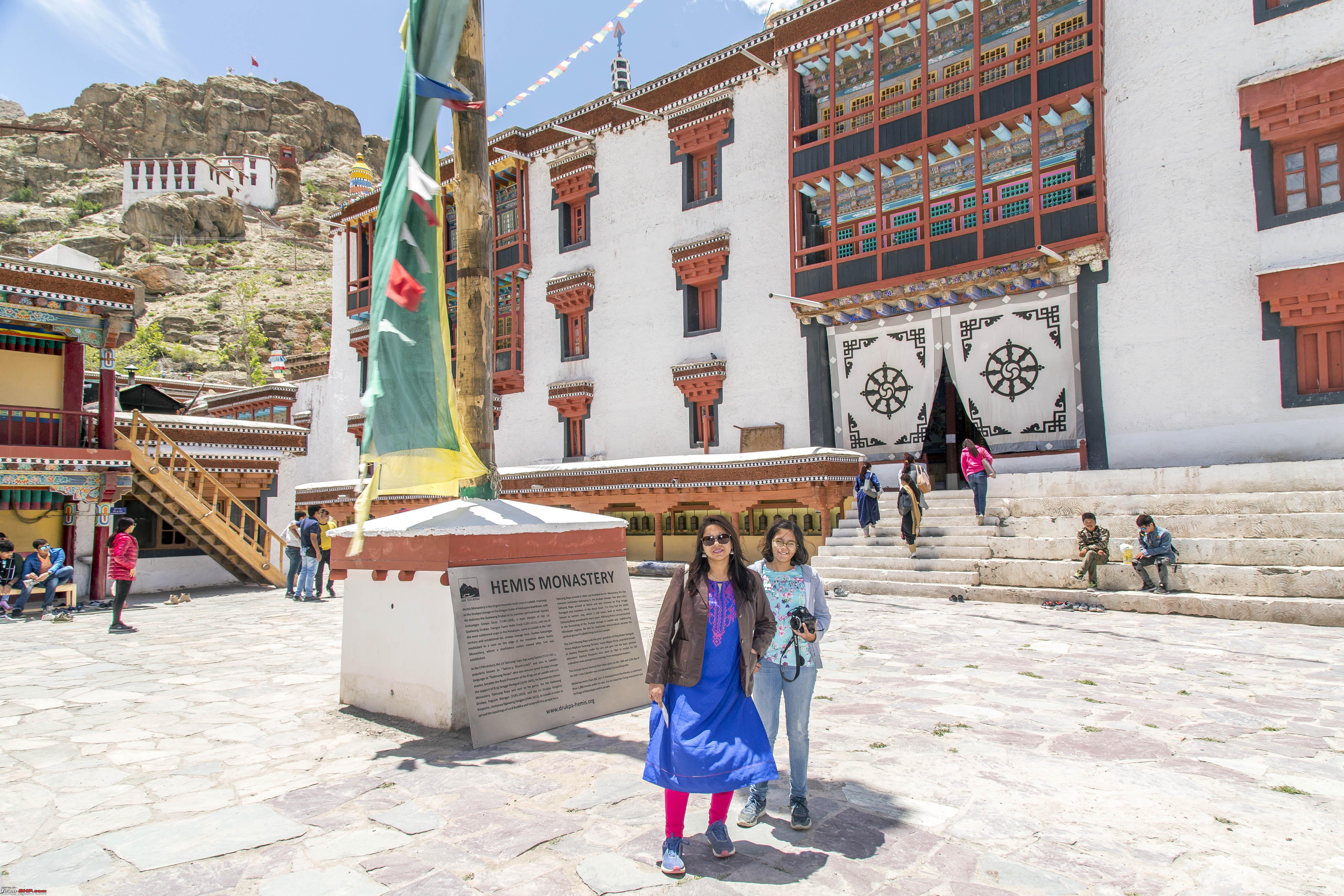 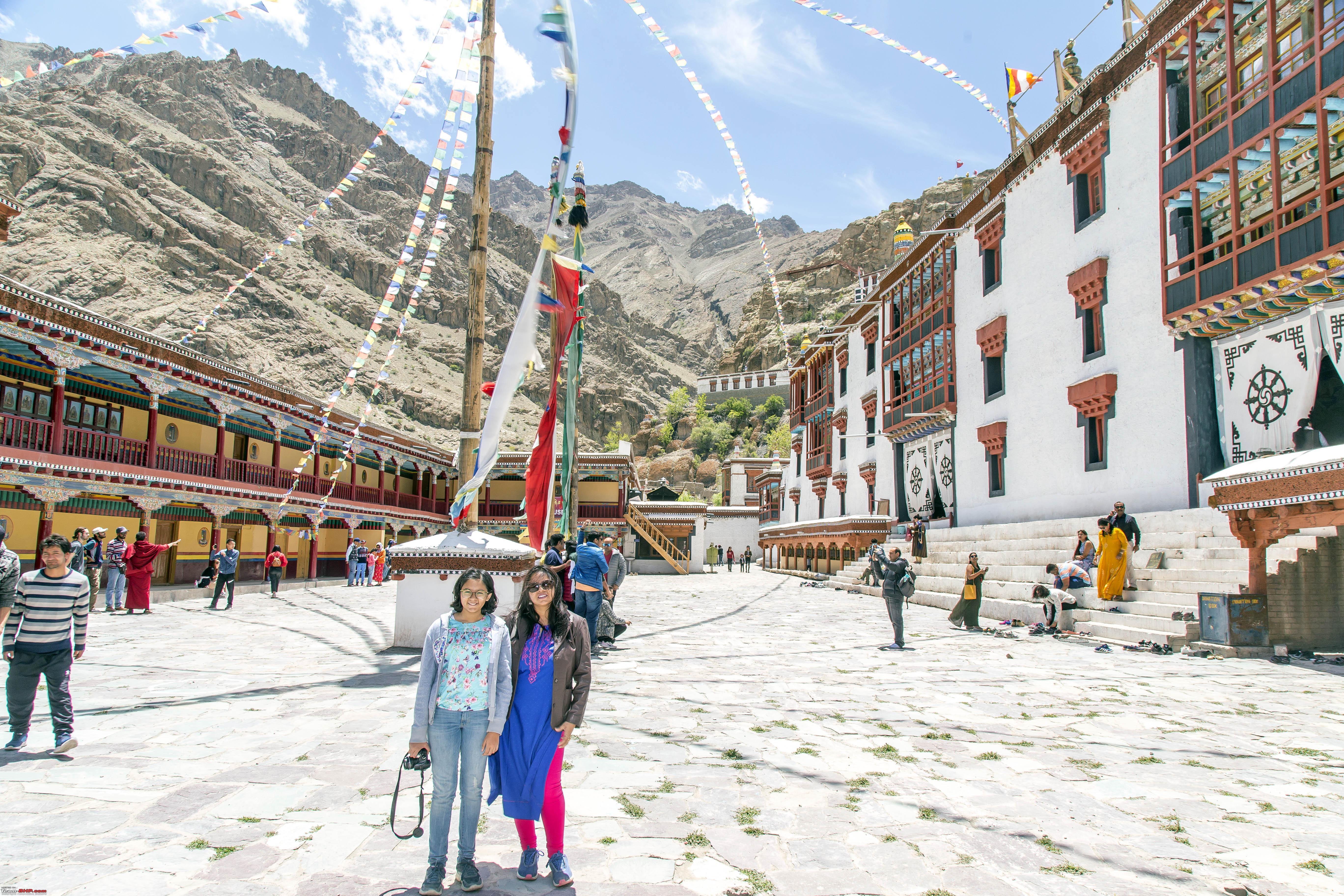  The Hemis Monastery has a museum with a wide range of artefacts 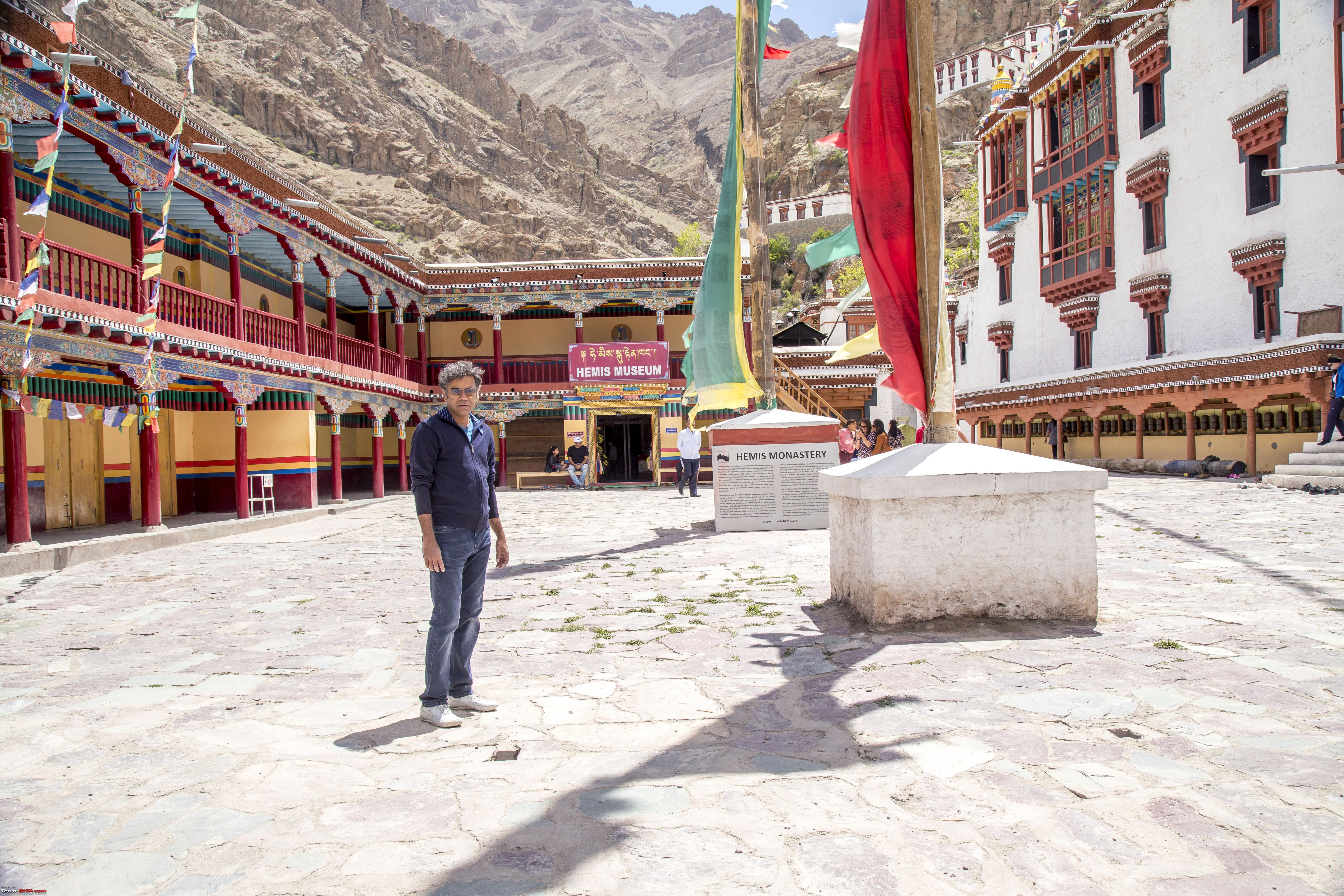  On the way back, the banners created in 2018 are still retained 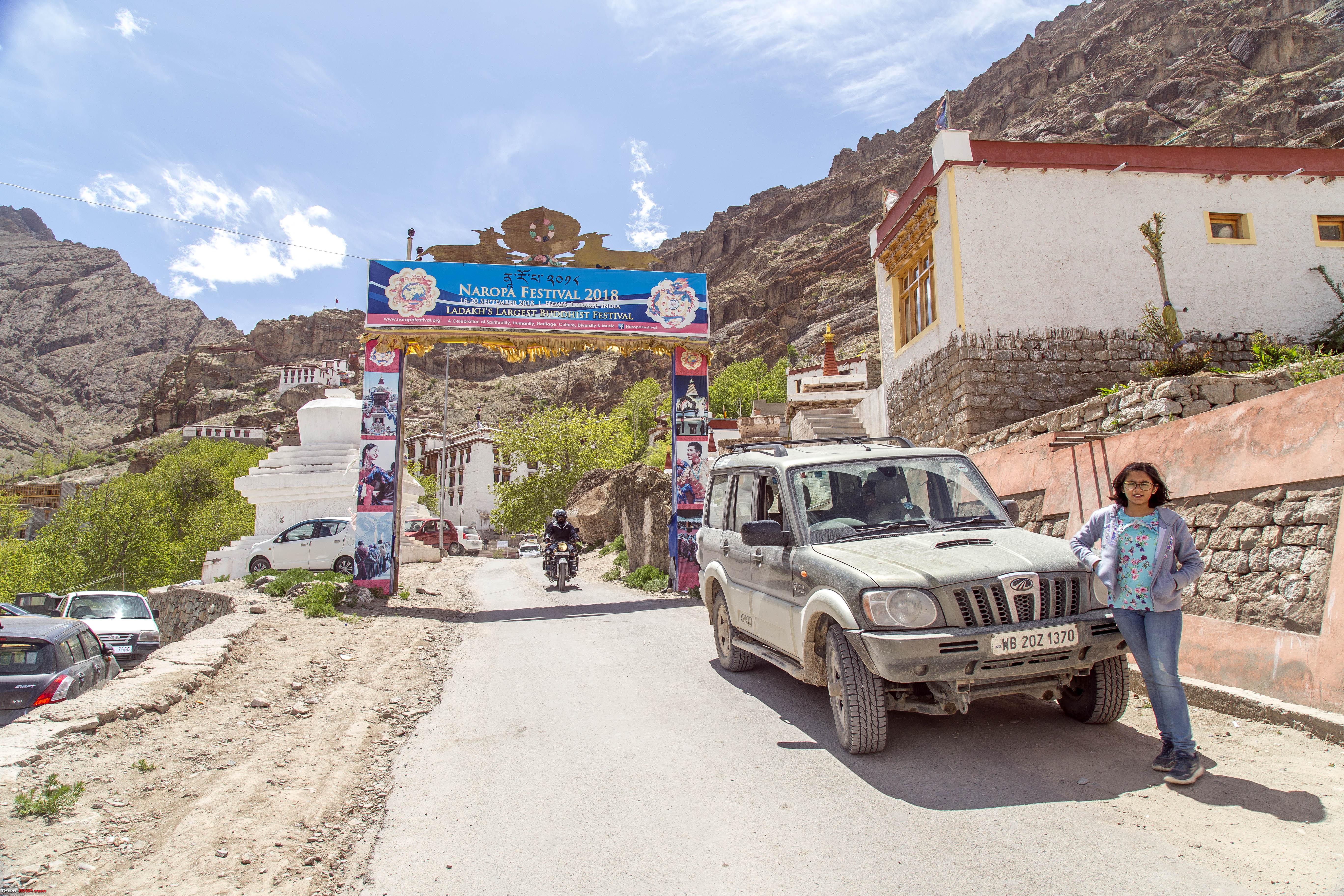  A new temple on the Hemis Road 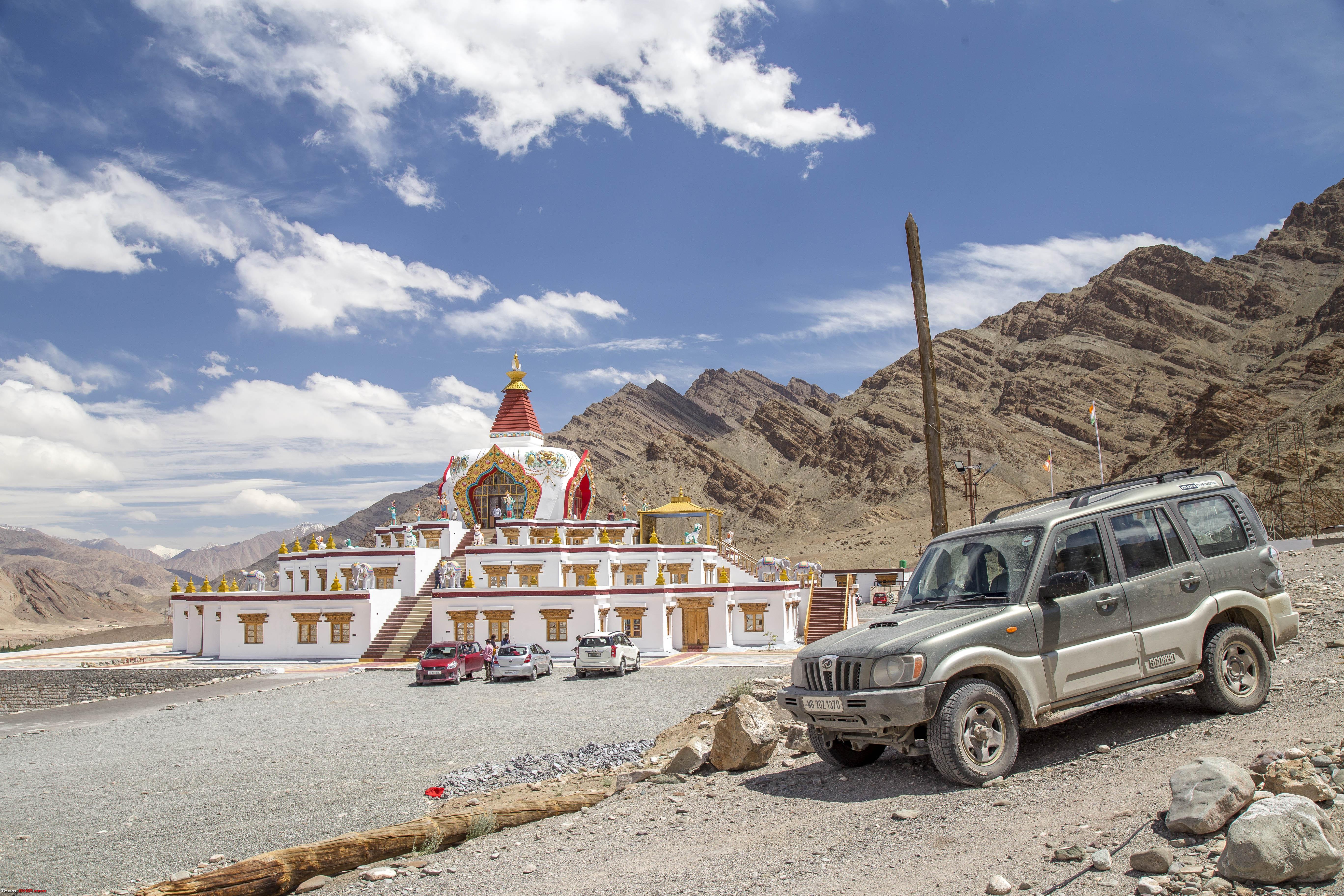 The Naropa 2018 banner, this one made of vegetation still remains on the bridge to cross the Indus 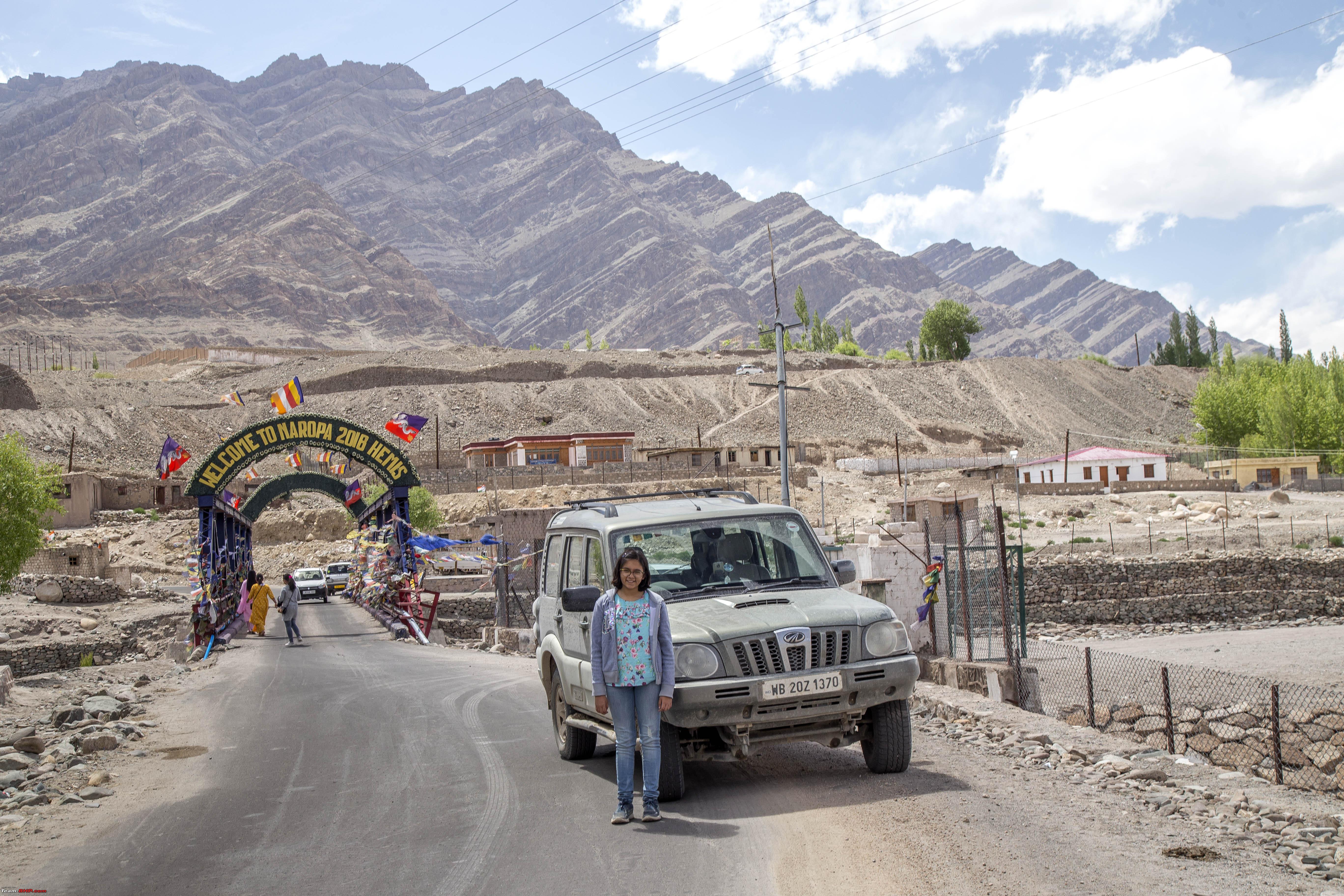 The Hemis Road 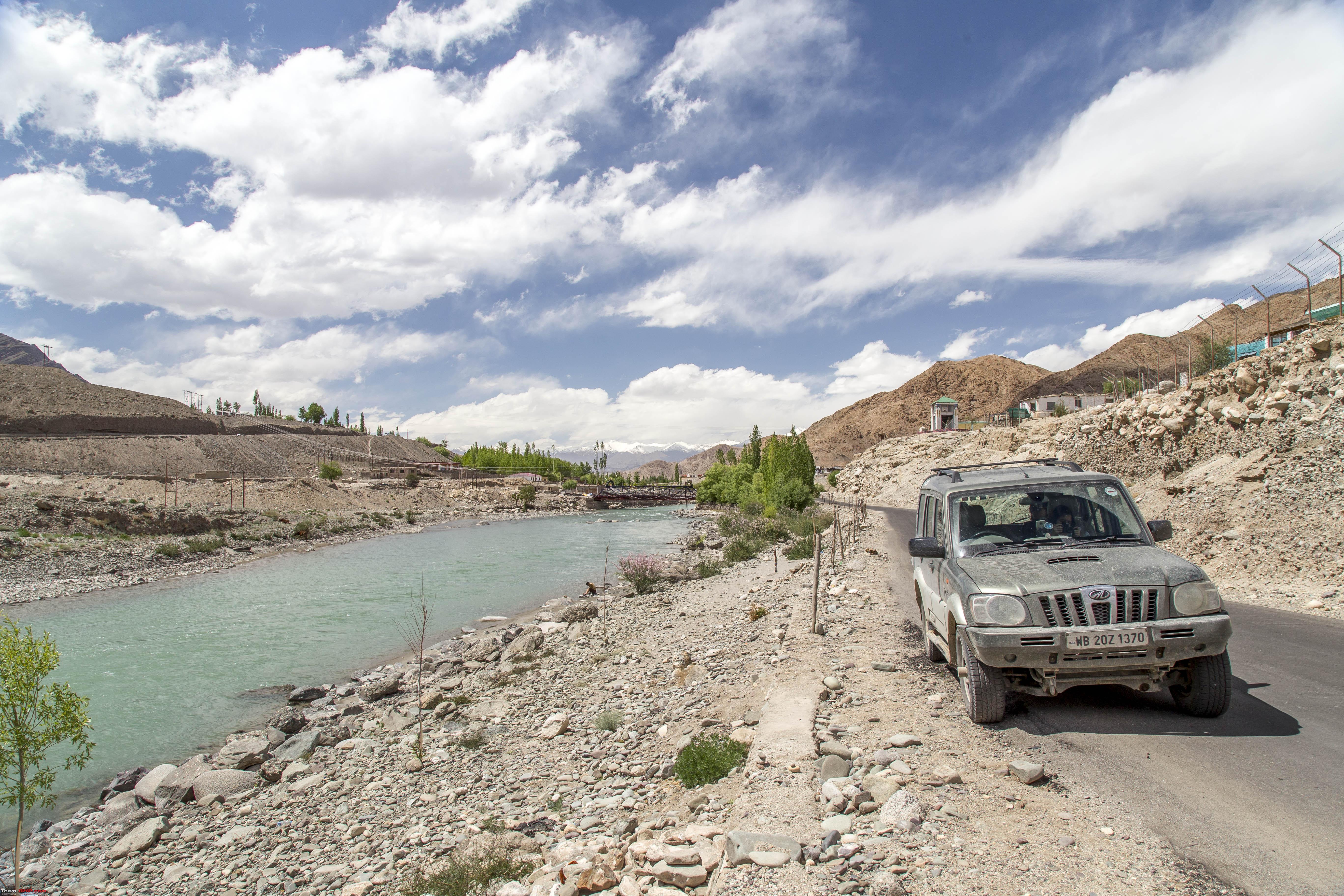 The Stakna Gompa in the distance 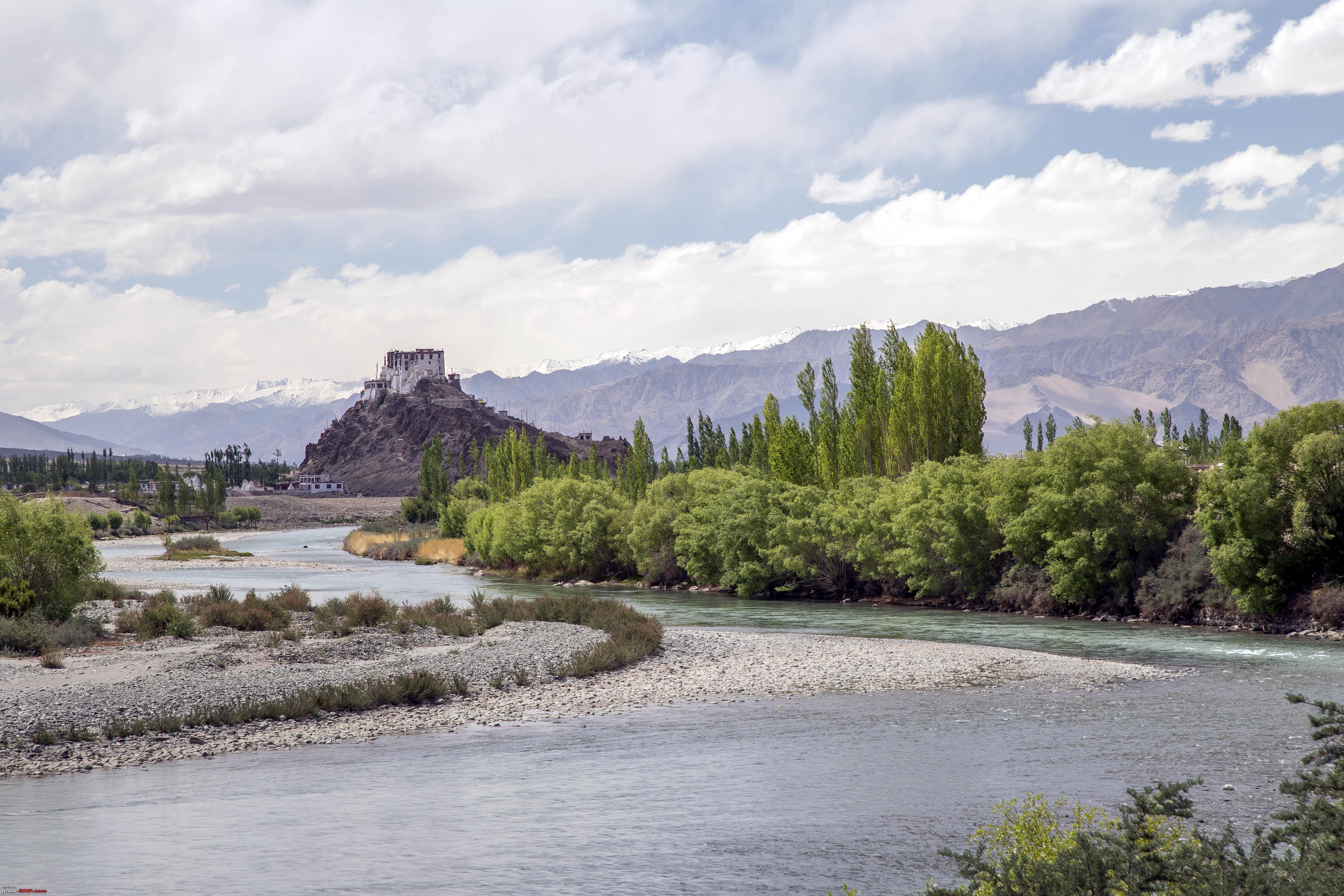 Marengo Posing with it  Soon we were driving up the slopes of Thiksey Monastery 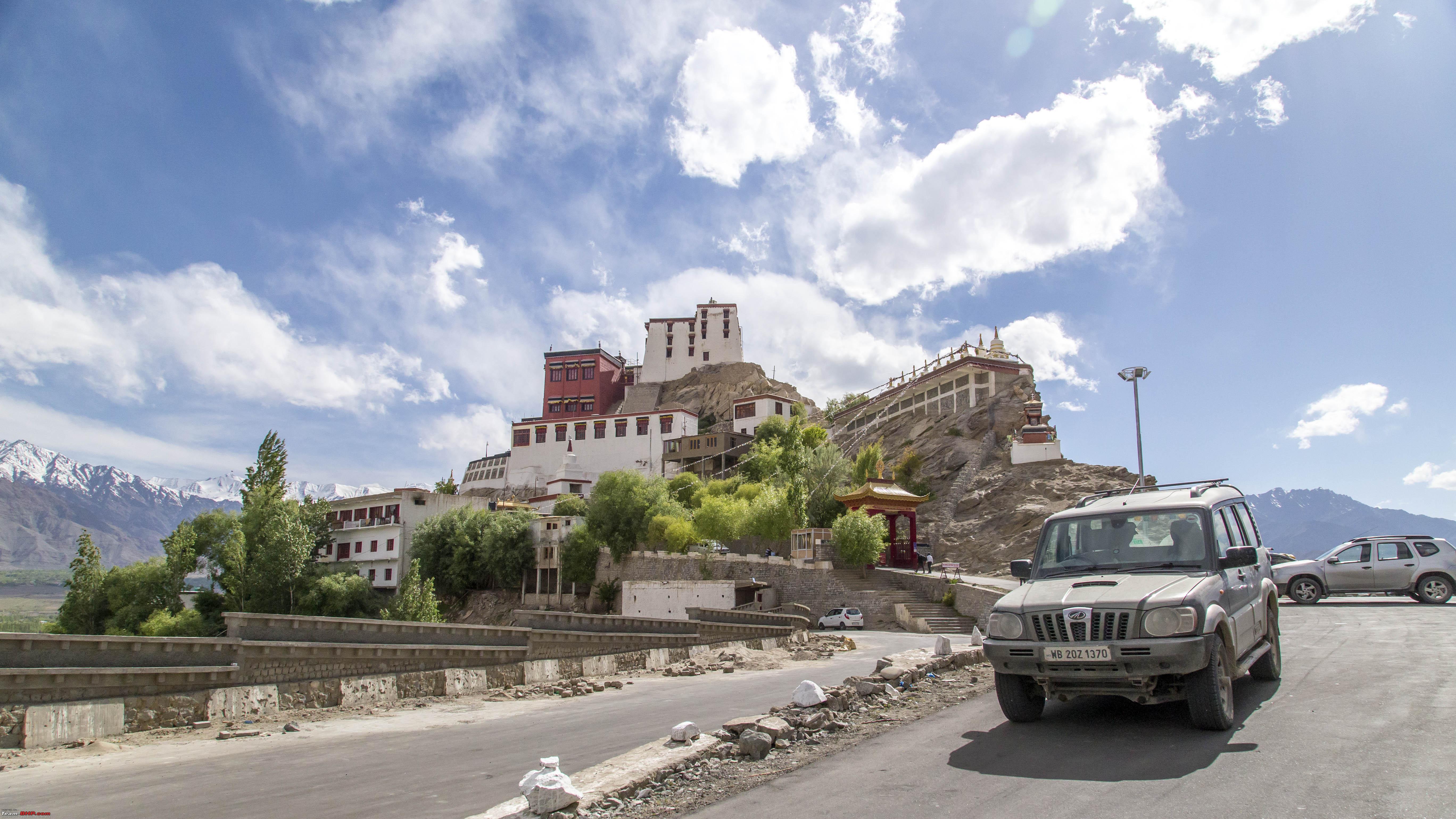 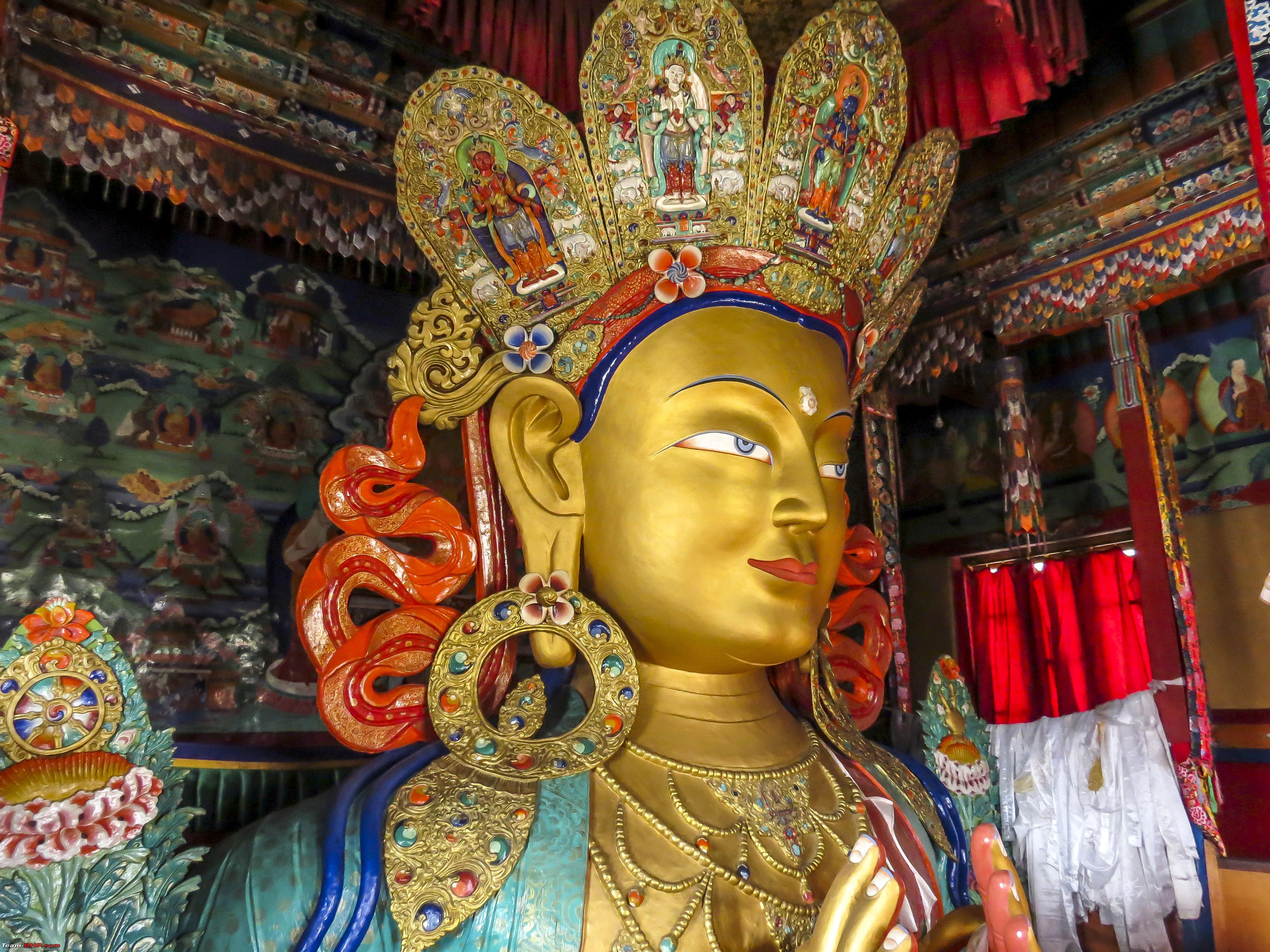 The Courtyard of the Thiksey Monastery   Some views from the top of Thiksey 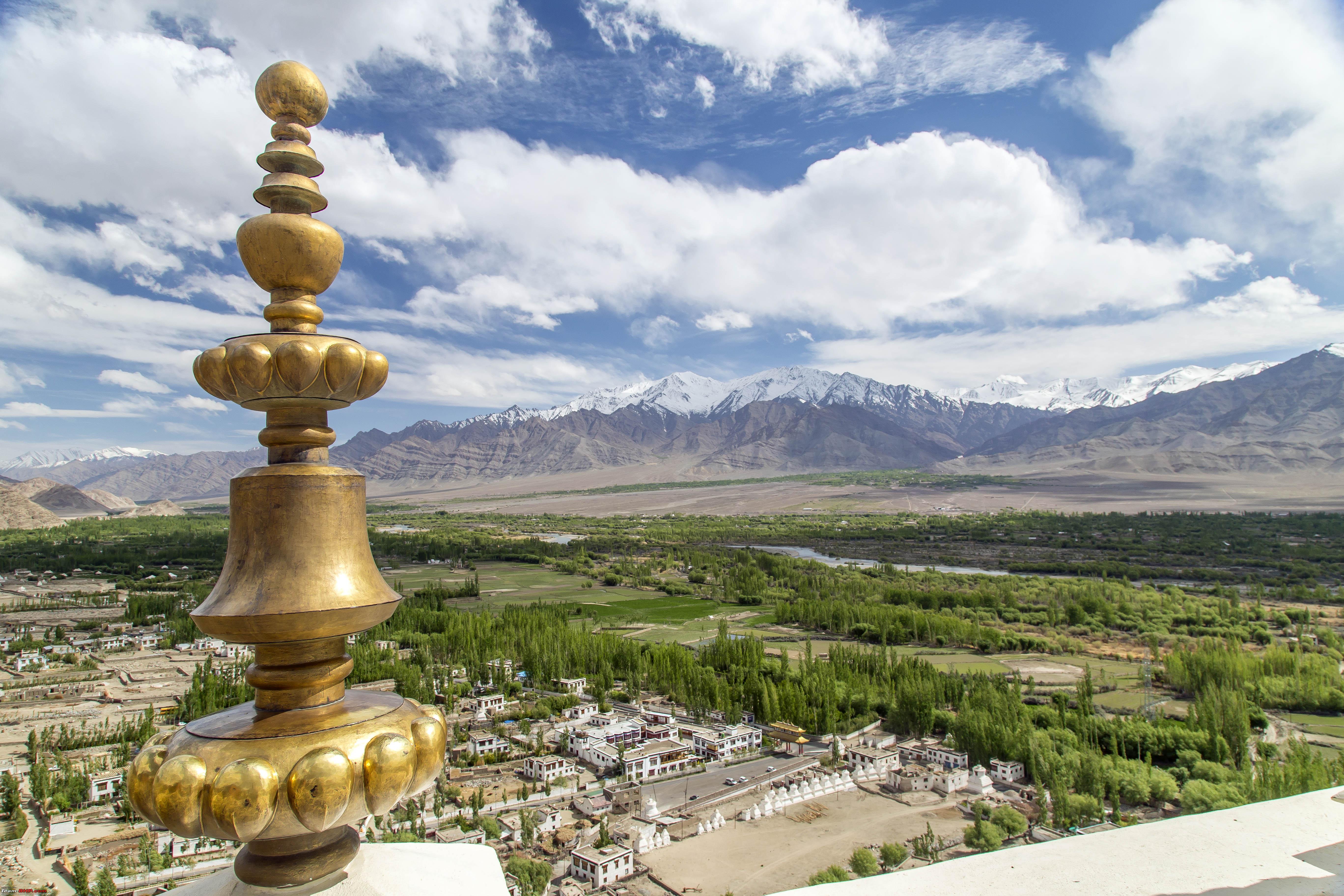 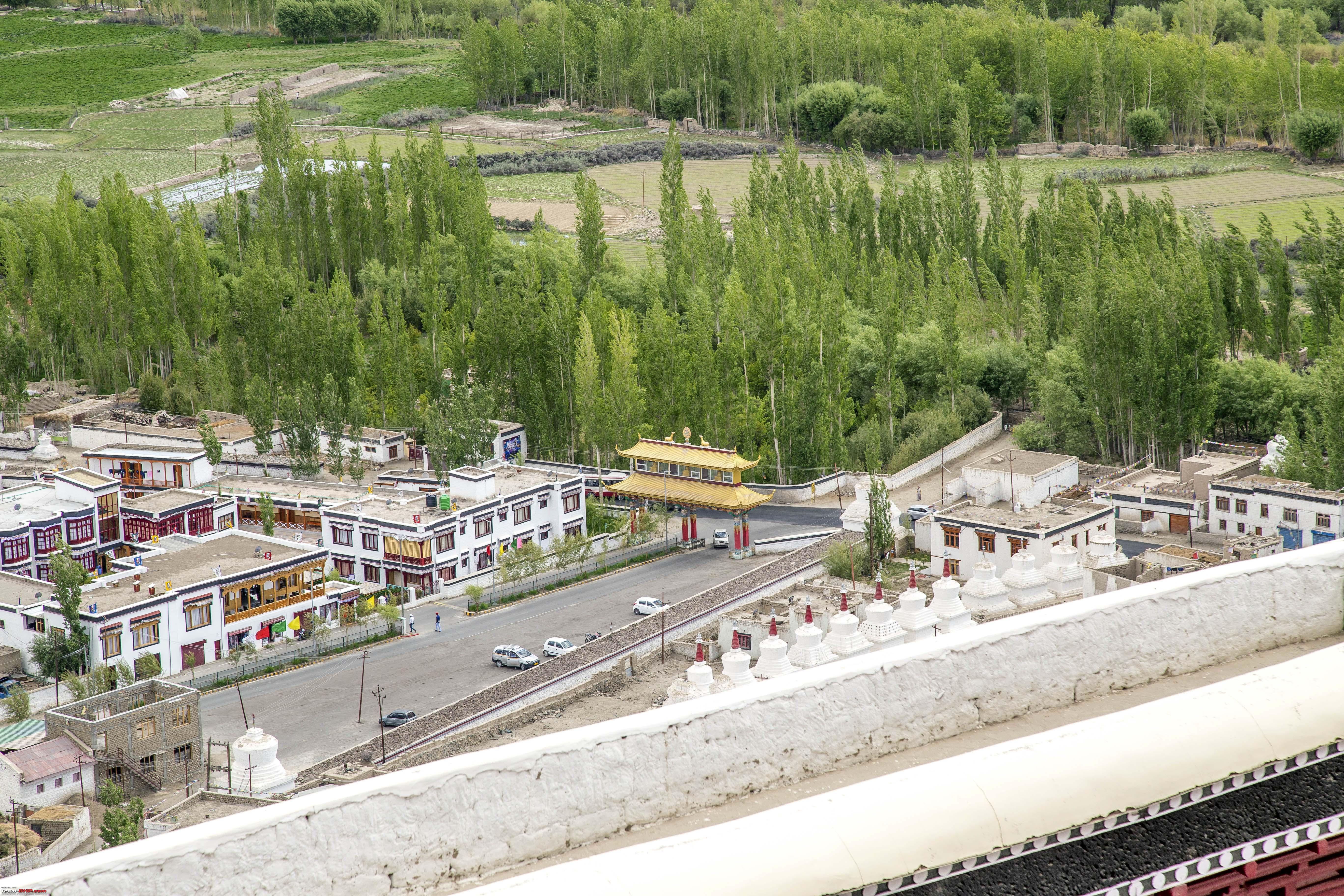  The restaurant at Thiksey, although it did not serve the kind of food we needed at that time! 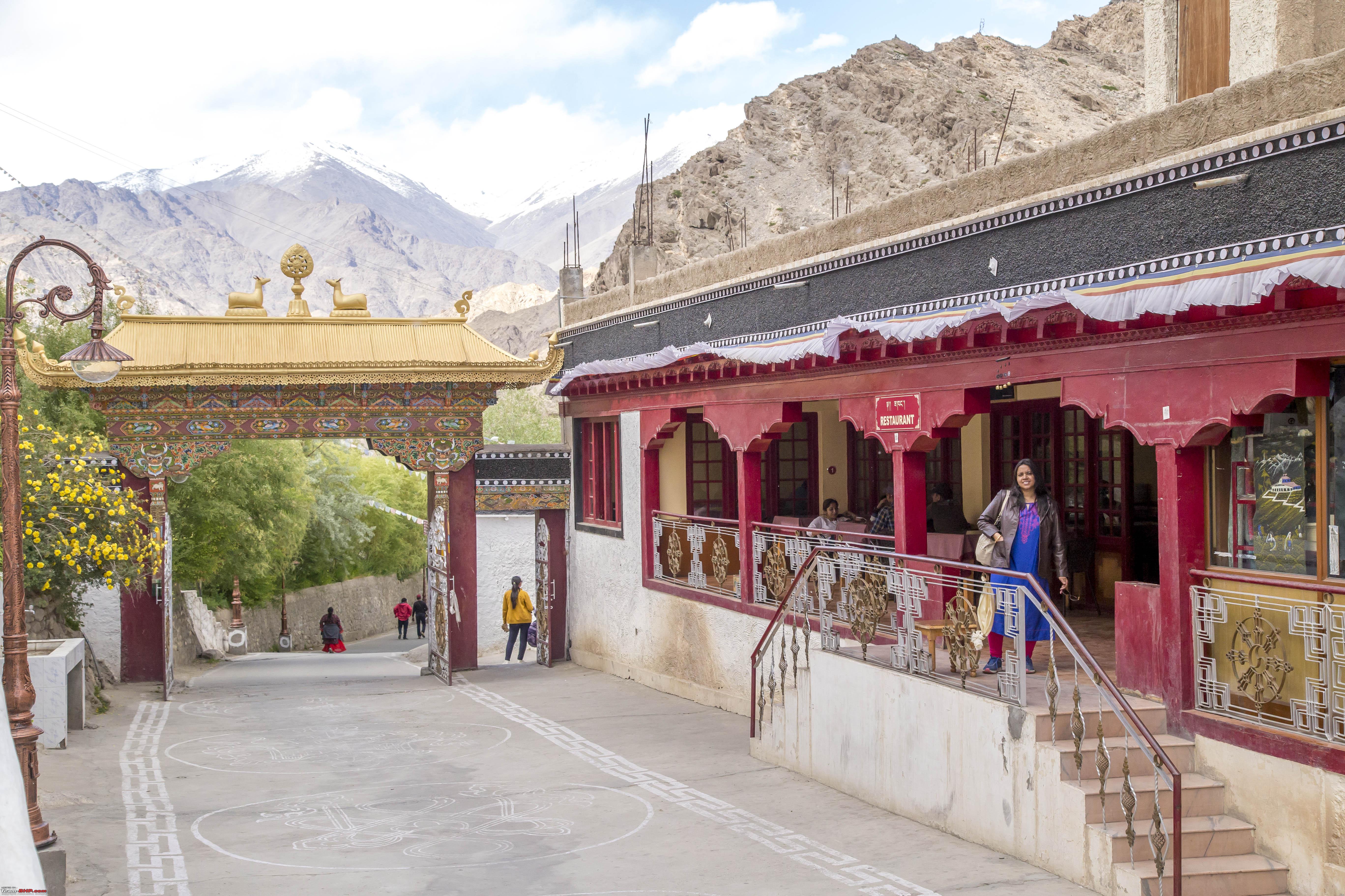 So, we head back to Leh, for another stint at Tibetian Kitchen and call it a day after that 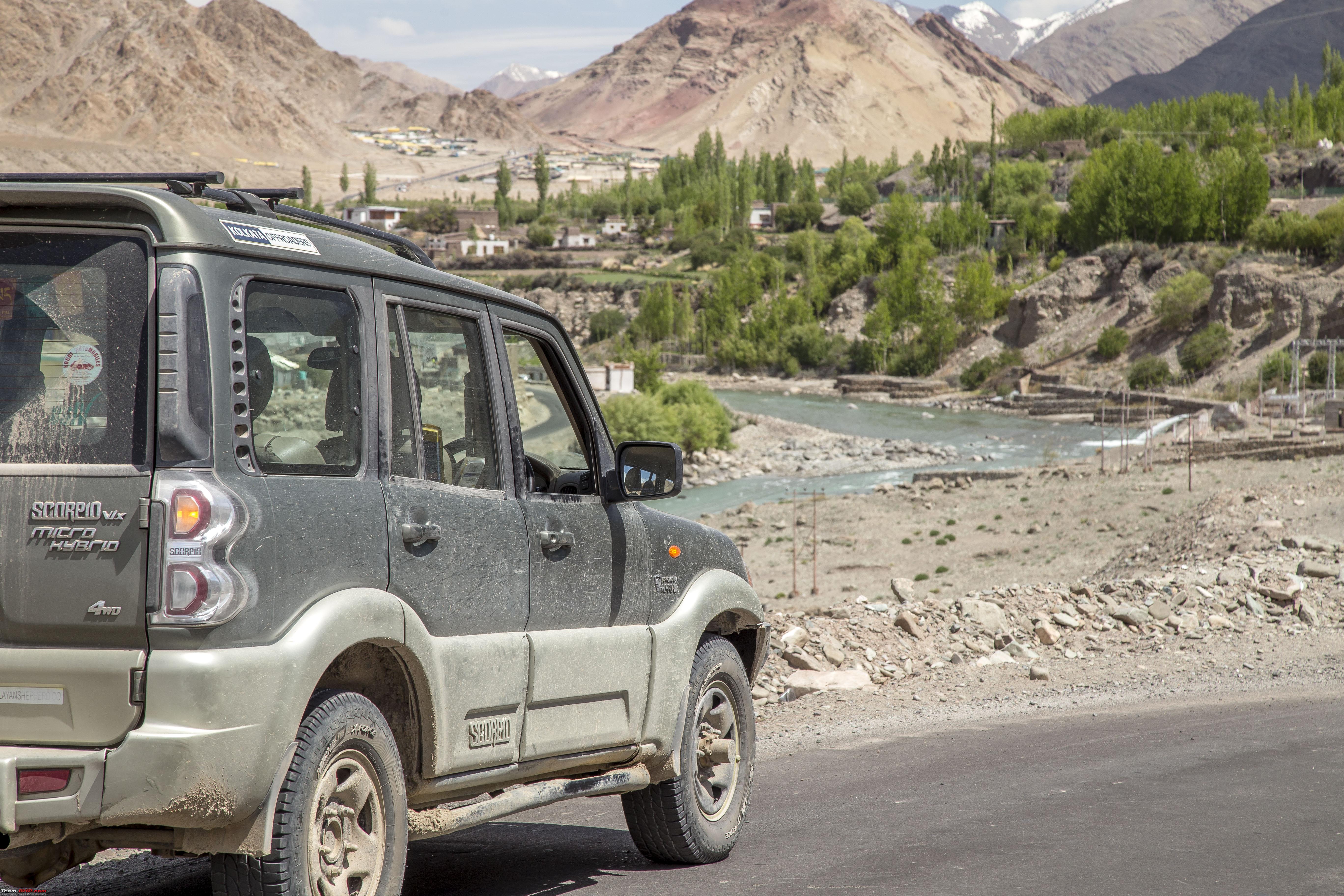 Last edited by 1100D : 12th July 2019 at 01:30. |
|
| (20)
Thanks
|
| The following 20 BHPians Thank 1100D for this useful post: | alokn87, ARAY, CrAzY dRiVeR, gmhossain, GTO, jaunthead, mh09ad5578, mi2n, neil.jericho, Red Liner, Ronak_7, Rudra Sen, Samba, Samfromindia, Sayata, Sheel, ssambyal1980, streetfighter, Surprise, Thermodynamics |
|
12th July 2019, 01:29
| #14 |
| Senior - BHPian | Re: Ladakh Re-Juleh'd! With Siachen-Panamic-Agham-Chusul-MitpalTso-KaksangLa-TsoKar-KyunTso! The Thirteenth Day Our plan was to drive all the way to Sonmarg/Srinagar depending on what the mighty Zoji-La allows us. However just like last time, even this time there was a heavy heart leaving these fabulous sights behind. 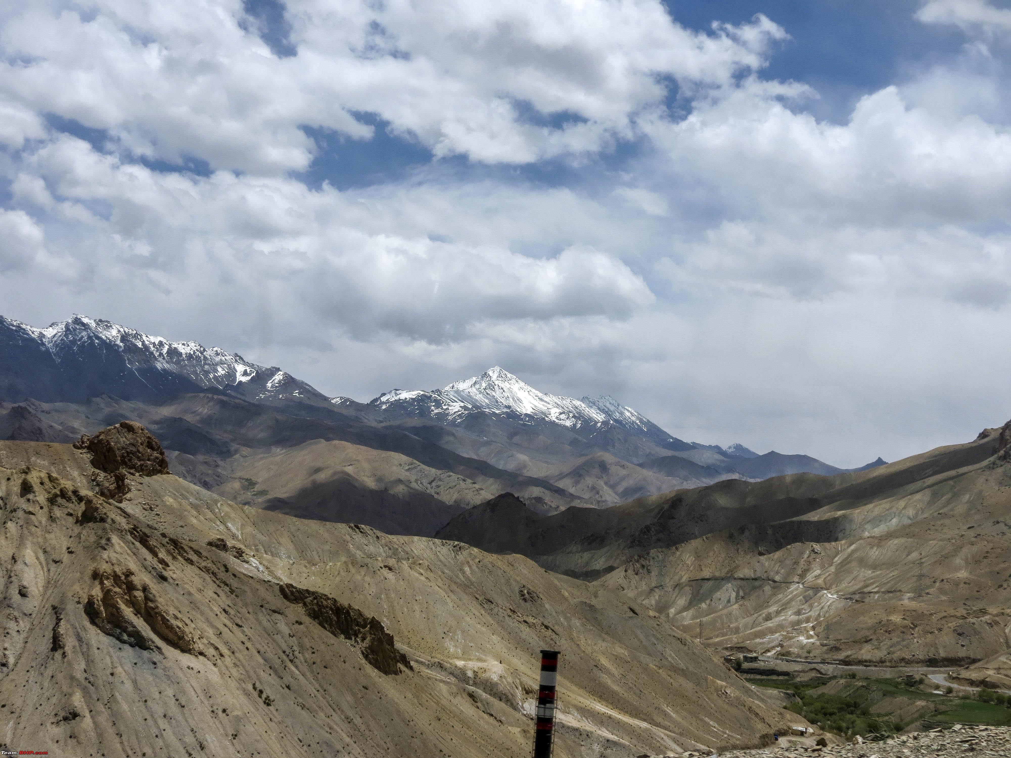 It was an easy and uneventful drive to Kargil which came up before we knew it. Then suddenly my daughter came up with an idea!! How about spending a night at the "The second coldest inhabited place in the world" during its peak summer? On the way up to Leh from Srinagar, she had posed against the board at Drass that proclaimed it to be the second coldest place in the world. Her idea stemmed from there. Initially the idea seemed crazy, because our return would get delayed by a day. We only had one buffer day into our plans and we had exhausted that. But soon enough, the idea started to grow on us. Because, where we are from, we do not get to make a trip to Ladakh as frequently as we like! She's also growing up faster than we like and ideas like these, who knows, if they would originate like this, later in her life. So, we decided to stop over at Drass for the night. However, we were still passing Kargil by and Drass was still some distance away Modern interpretation of a Doodhwala's bike we thought!  Turned out to be a camouflaged KTM (ofcourse they were from the KTM factory team)  However, pretty fast riders they were, they must have also been surprised, at being kept up with them all the way till Drass by a Scorpio (of all things!)  At Drass, while going up, we did see the "Hotel D'Meadows Ladakh", happened to have heating and all in place. However, if we stayed there, there would be no experiencing the coldness of the place. So, we had decided to give the cottages right beside the Kargil War Memorial, "The Tololing Inn", a try. Besides, it was only a night and it was quite warm anyway. Pictures of the cottages (taken the next day morning)  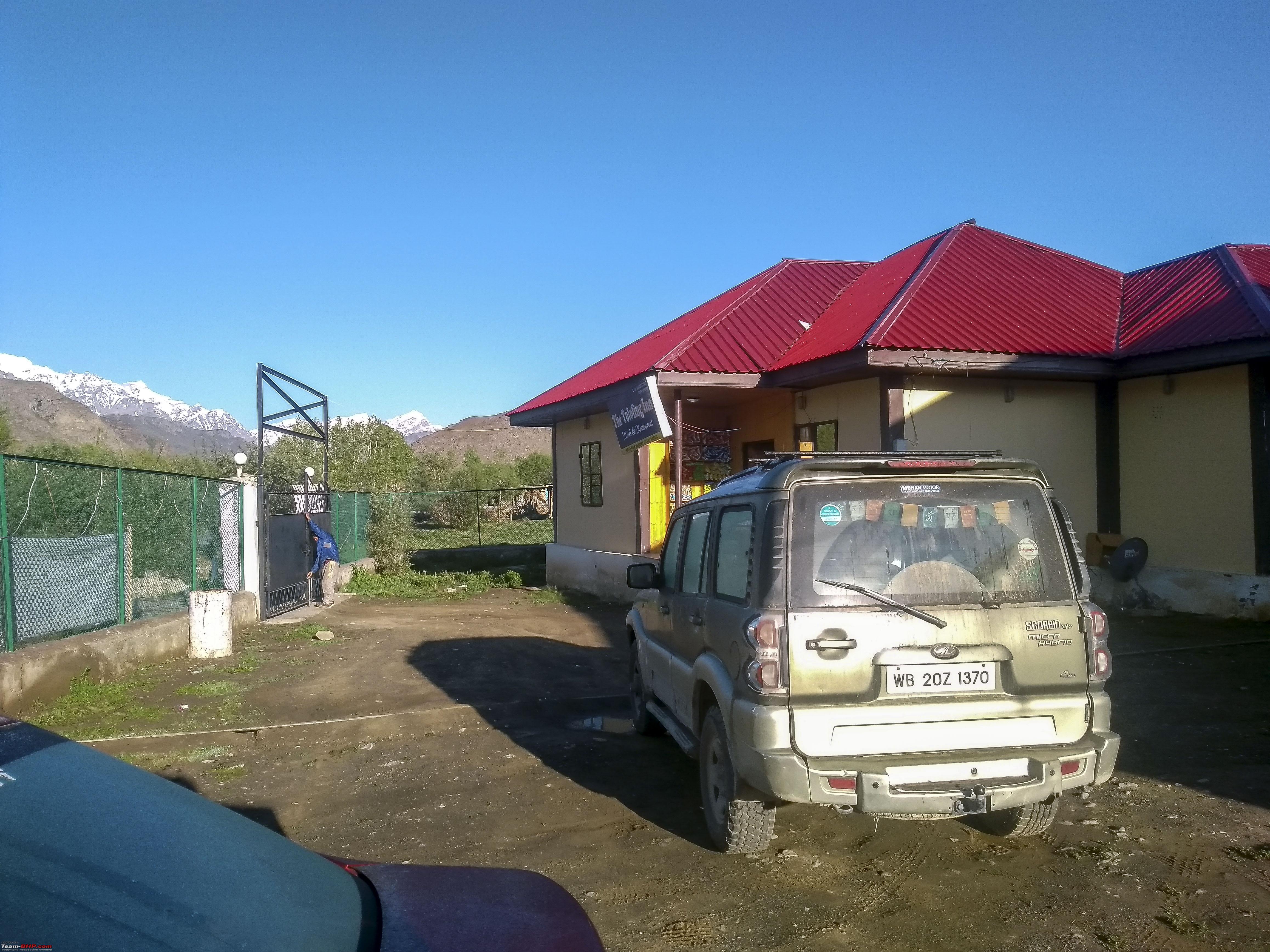 Spoke to the caretaker for the nearby places to see, as we had substantial daylight still left. He suggested a viewpoint, about 22kms away, on the way to Sanku where one can get snow and also amazing views of the Suru Valley. Also, there would be another Mashkoh valley on the other side of Drass, if time permitted. We started by heading out towards Drass first, and then took a small road on left. However, the locals at that point weren't sure as to why we were heading up this hill, warning us that the road is closed ahead. Anyways, undeterred, we still continued up. After around 12 kms of climbing, we were saying hi to the snow beside the road. Some snow walls. A km or so later, there was snow on the road. However, looked pretty doable. 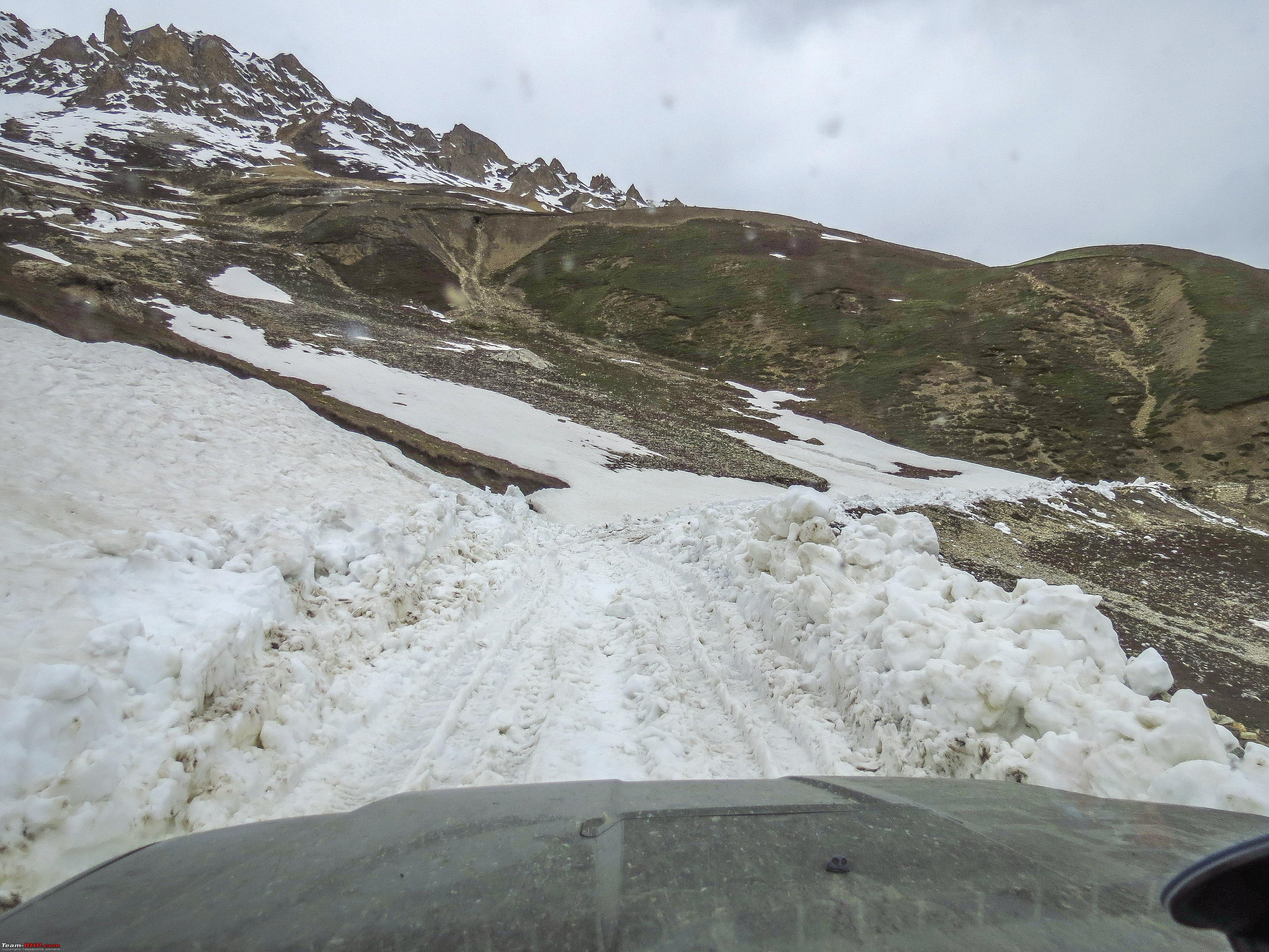 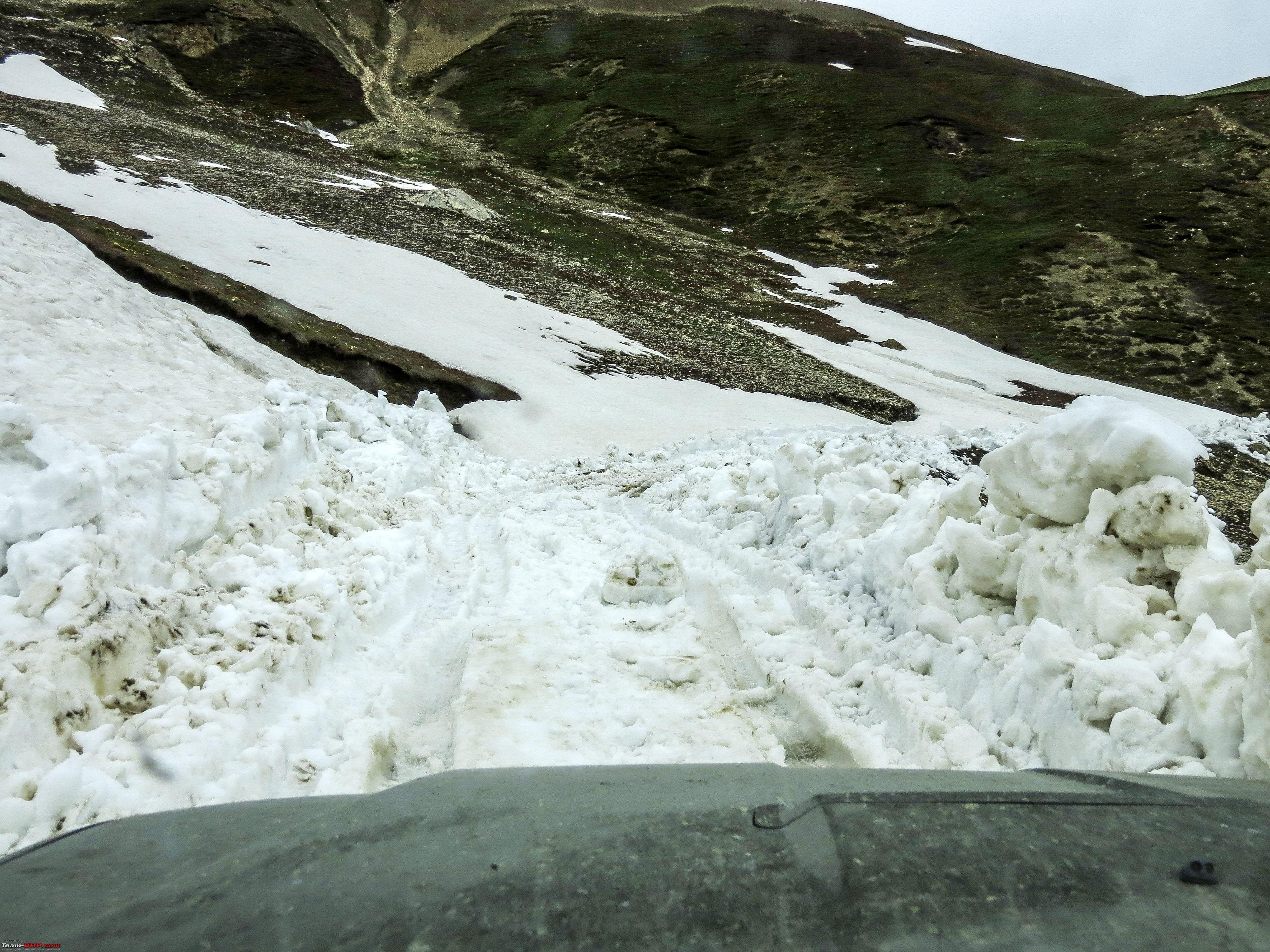 But around 2 kms more 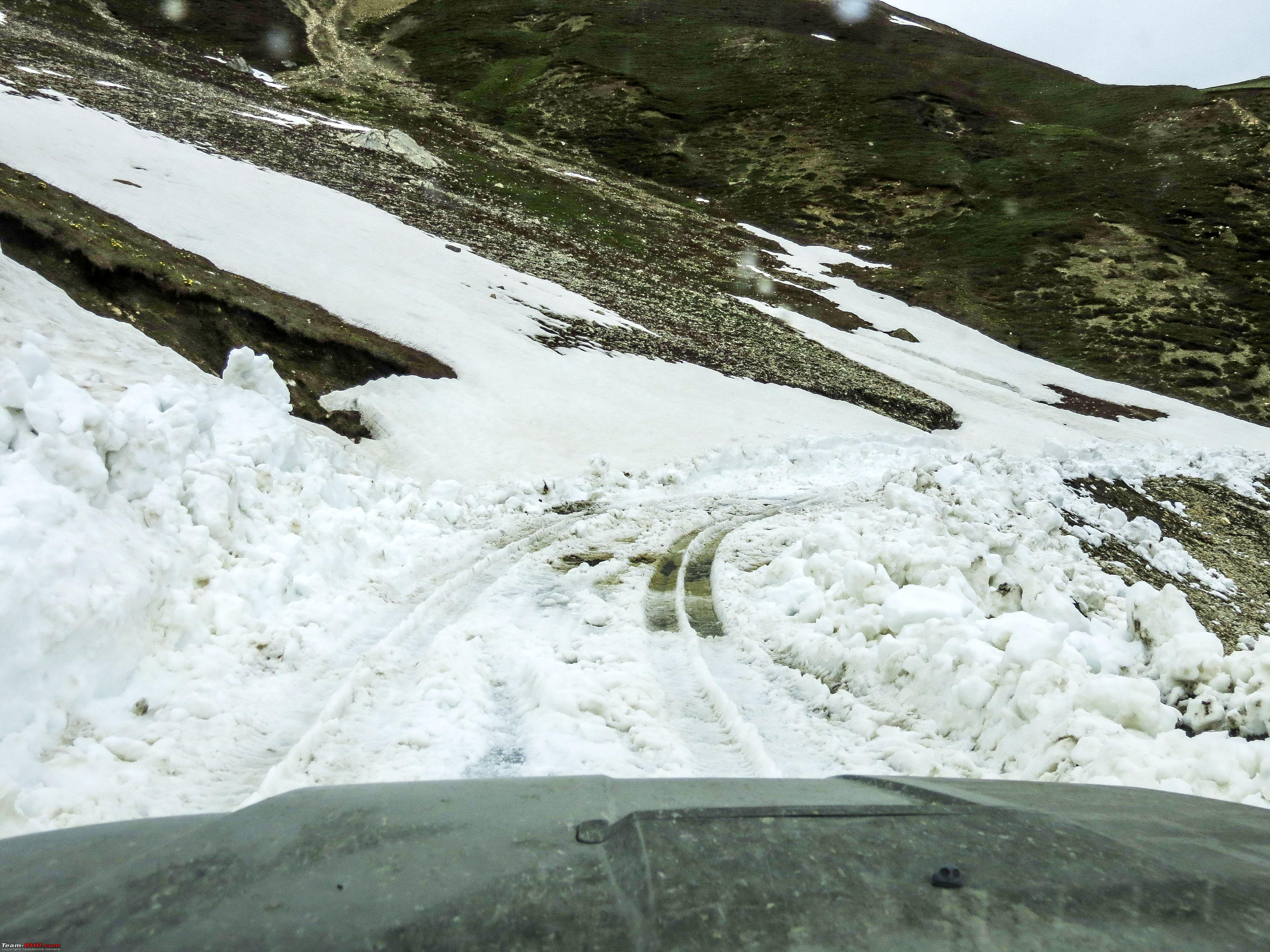  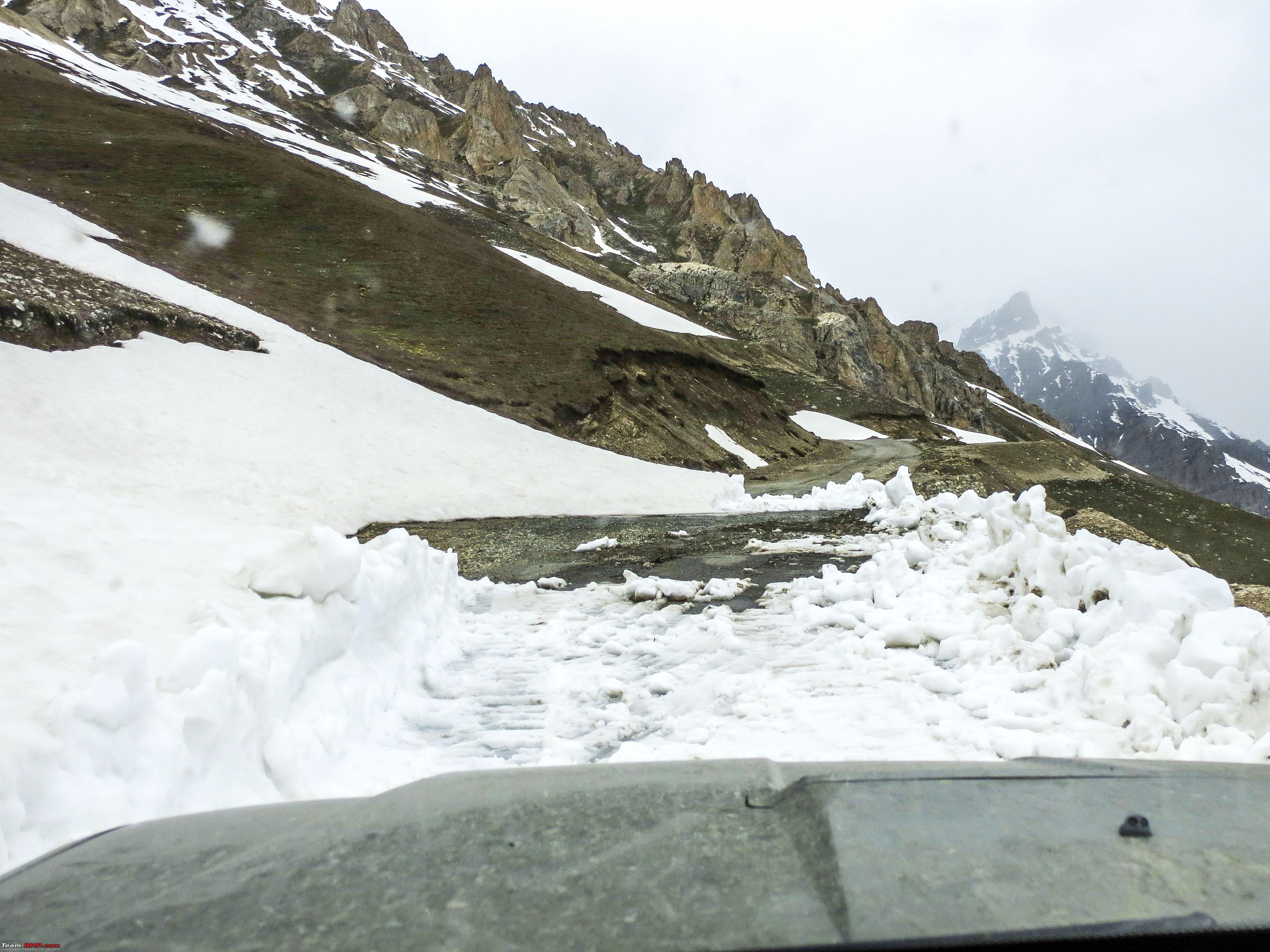 And soon there was a dead stop!!  We assumed the viewpoint to be half a km ahead, but there wasn't even a way to make it on foot. Some snow that got dragged on the underbody  On the way back, time to take pictures from the outside  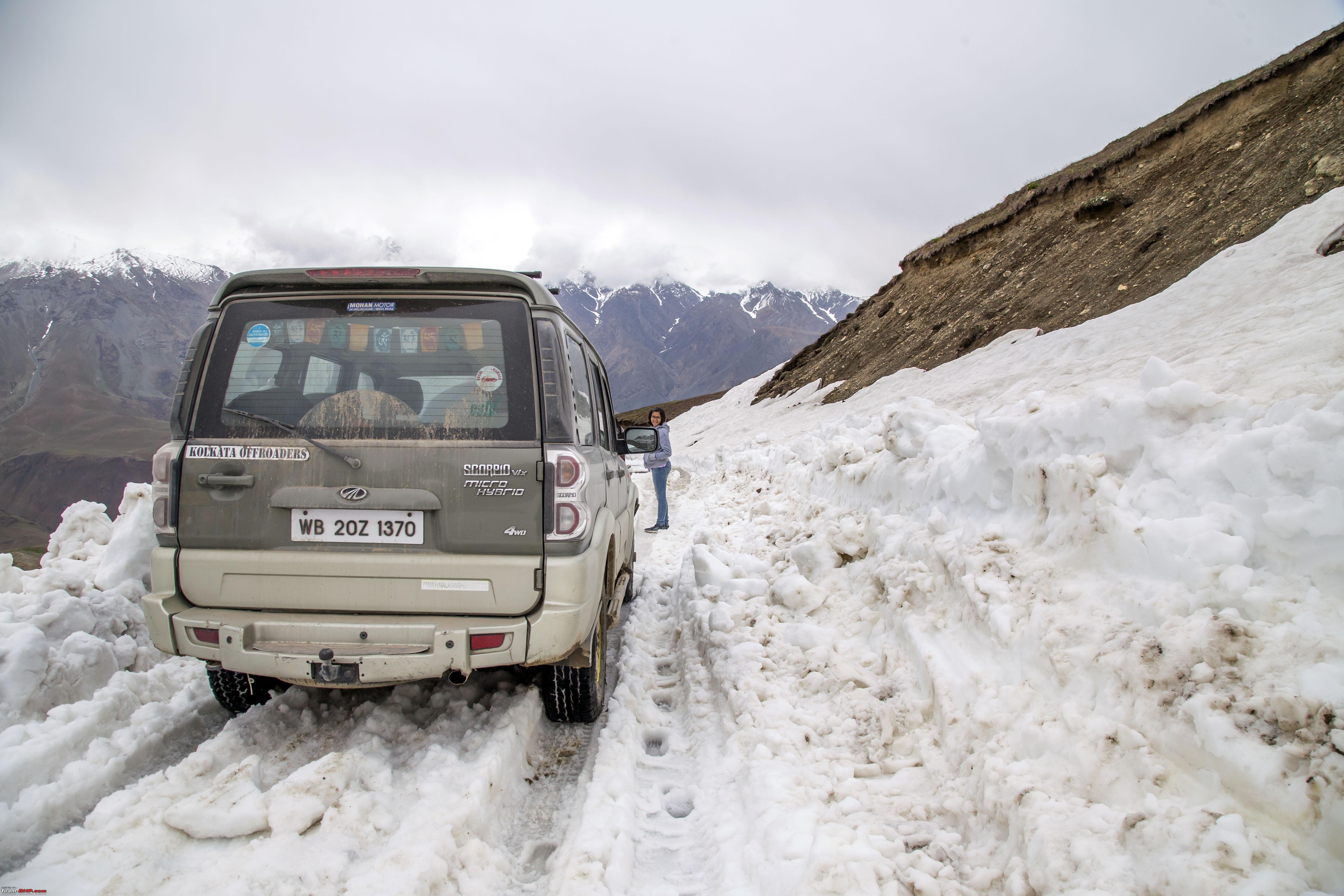 Seriously, from the driver's seat it did not look this much  A very tight turn on this snow wall! Wonder how we made it easily on the way up.  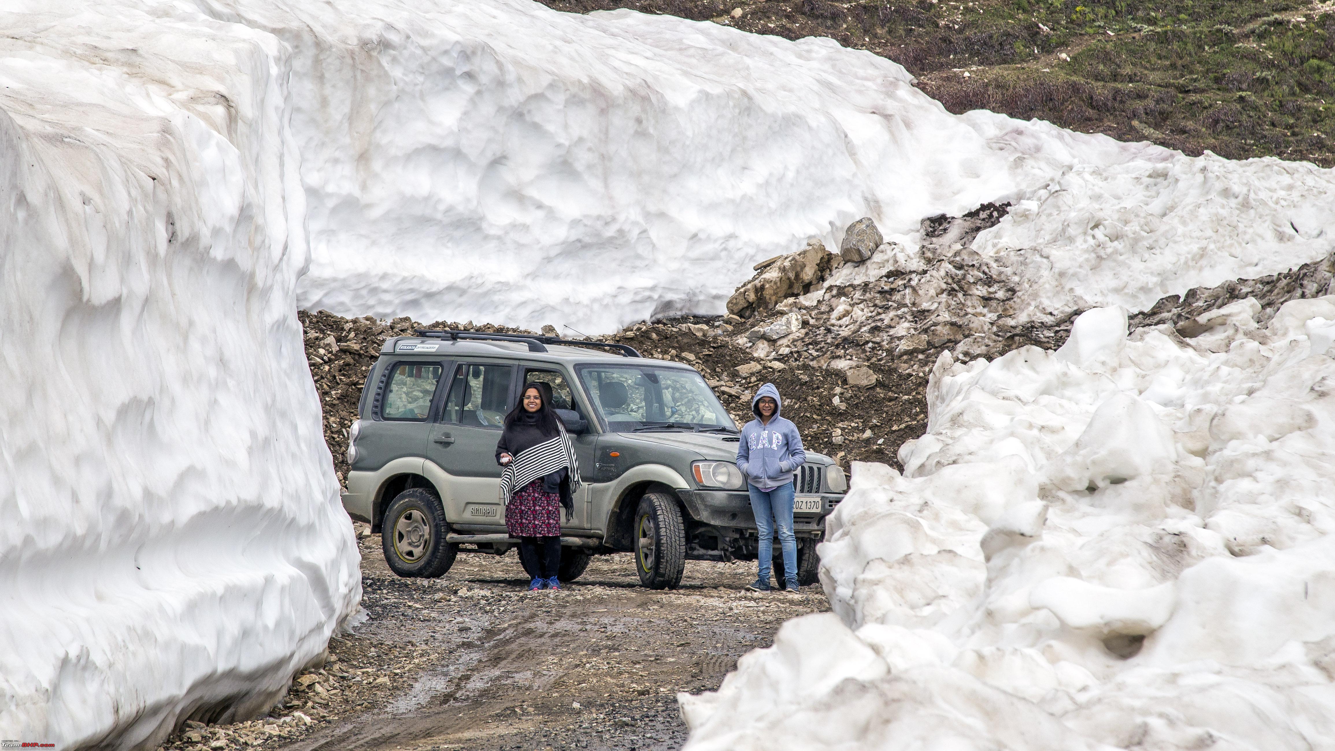 Soon we were back to Drass and crossed the town, to take a road marked by a board to Mushkoh Valley The scenery on the road was spectacular. (Pictures taken on the way back) The Village of Mushkoh seemed to have been retained by time, loads of local kids on the unpaved road. We crossed Mushkoh, however we were told by an authority, that the region behind this is out of bound for civilians without special permit. So, we turned back.  The Village of Mushkoh in the background 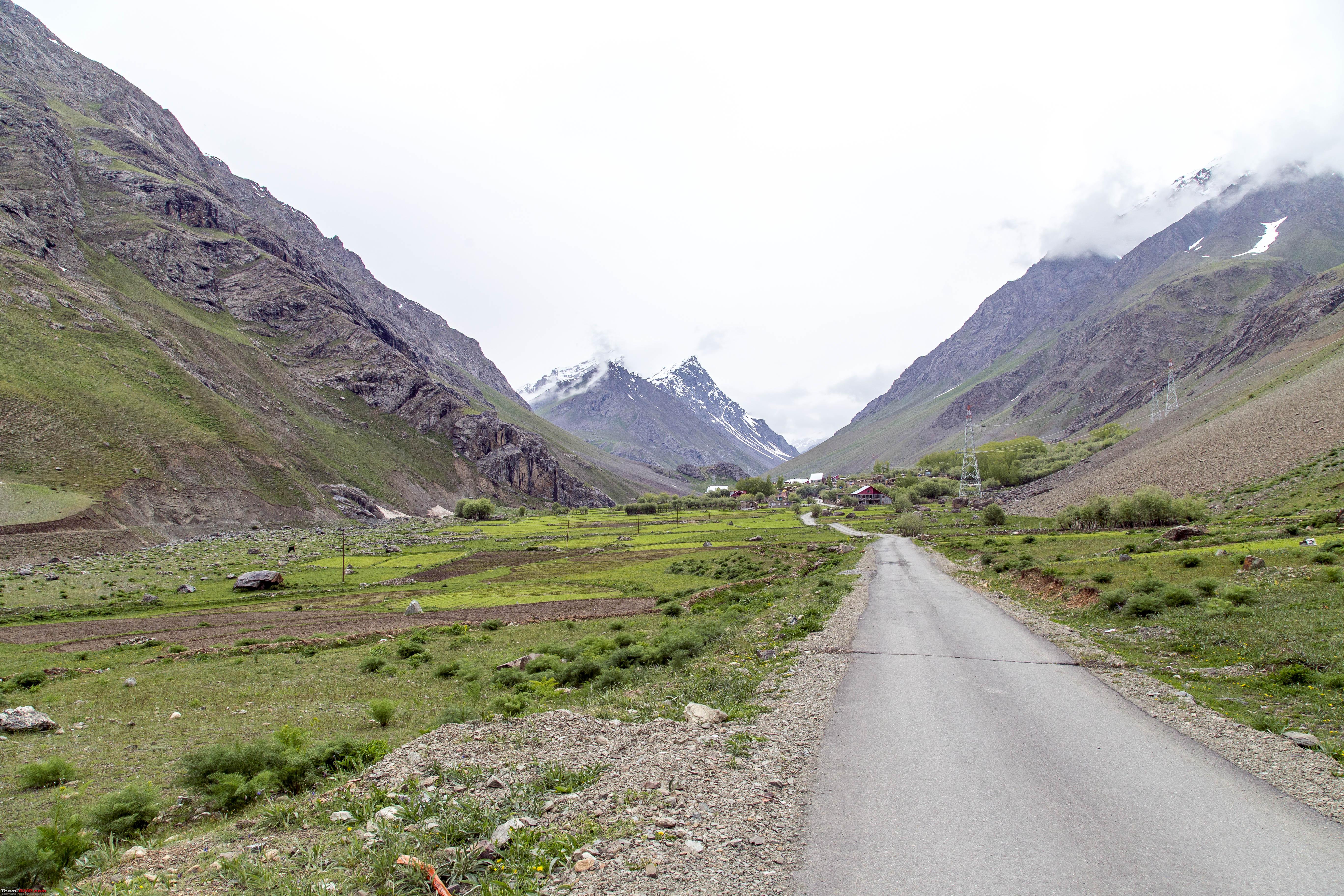 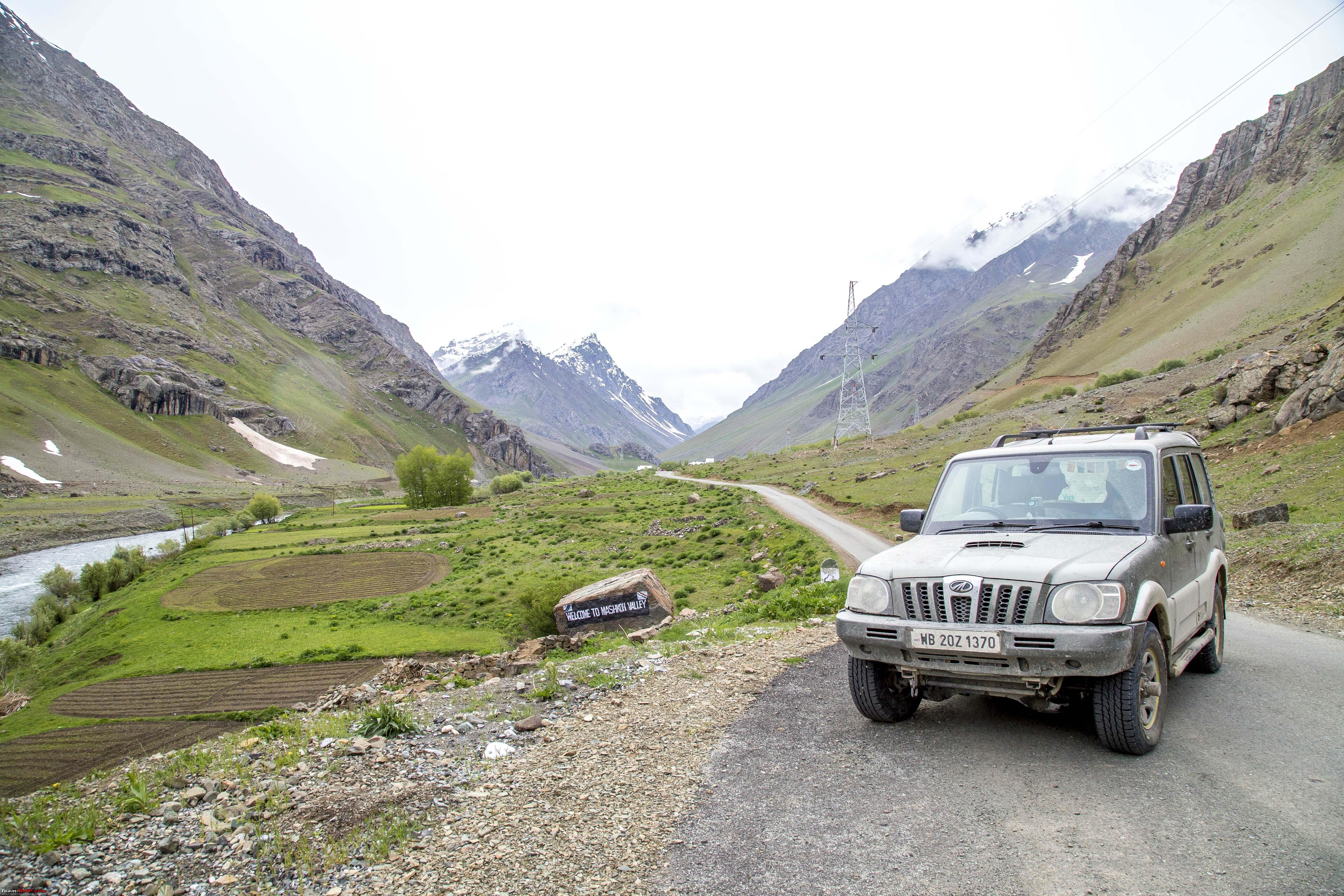 What else do you need on this picture! 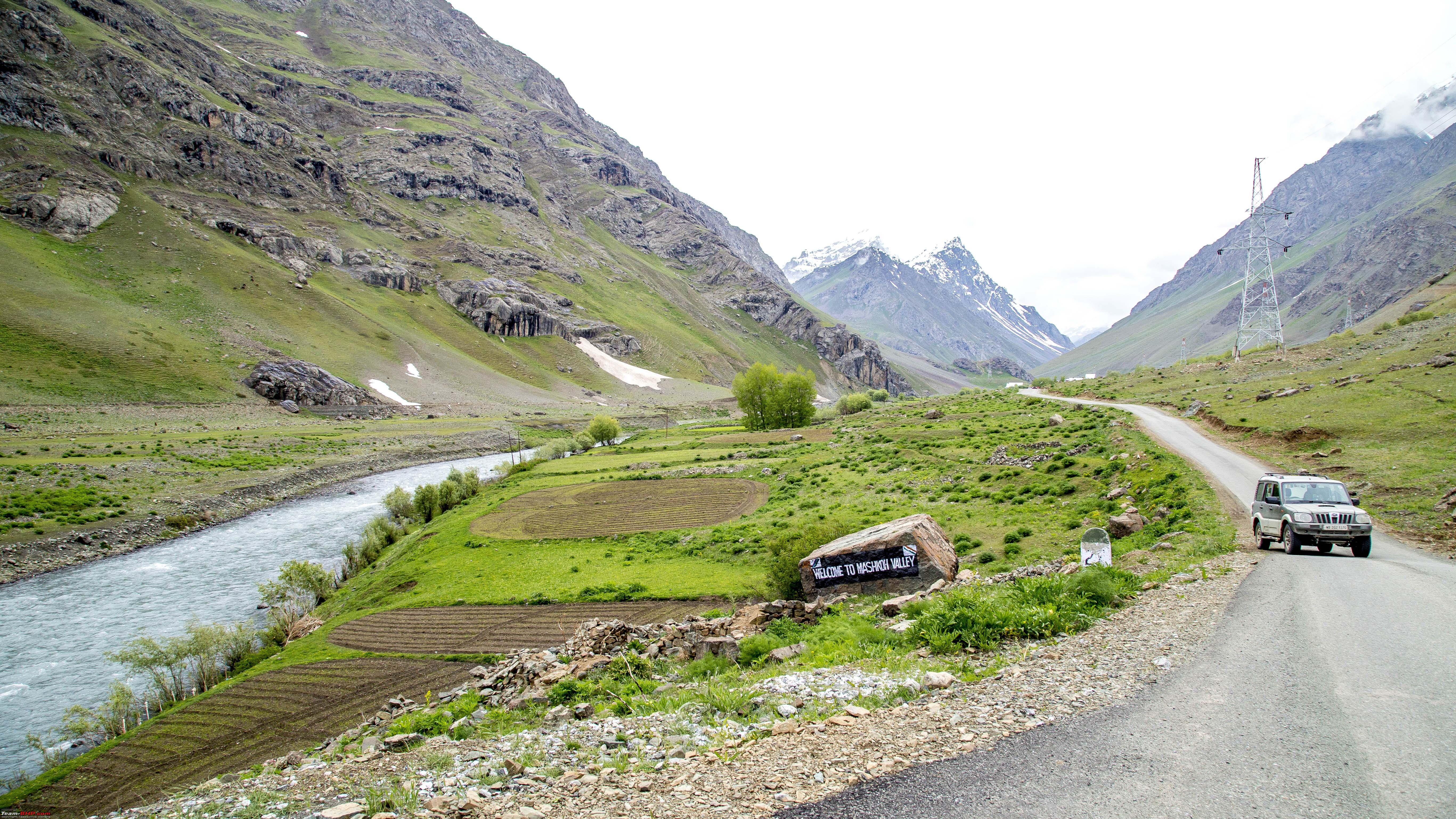 Anyways, we came back to the Tololing Inn, but surprisingly, it was quite chilly by then. Had some very tasty dinner made by the caretaker and retired for the night. While going to sleep, not only did the thought of the coldness bite us, but also, we were going to sleep just beside the place where one of the fiercest modern battles were fought and so many lives were lost at the very spot. Gave it a more eerie feeling. So much, that we began thinking if staying over at "D'Meadows" would have been a better option. However, when the night was over, that thought did not even hit us once! Last edited by 1100D : 12th July 2019 at 01:38. |
|
| (21)
Thanks
|
| The following 21 BHPians Thank 1100D for this useful post: | ARAY, CrAzY dRiVeR, gauravanekar, gmhossain, GTO, jaunthead, mh09ad5578, mi2n, neil.jericho, Red Liner, Ronak_7, Rudra Sen, Samba, Samfromindia, Sayata, Sheel, ssambyal1980, streetfighter, Surprise, Thermodynamics, Varun_HexaGuy |
|
12th July 2019, 01:44
| #15 |
| Senior - BHPian | Re: Ladakh Re-Juleh'd! With Siachen-Panamic-Agham-Chusul-MitpalTso-KaksangLa-TsoKar-KyunTso! The Fourteenth Day Last night, we had delayed our exit from Ladakh by one day. However, this was it, today there would be no excuse for not leaving it behind today! Final checkout formality at Pandrass before starting the climb to Zoji-La 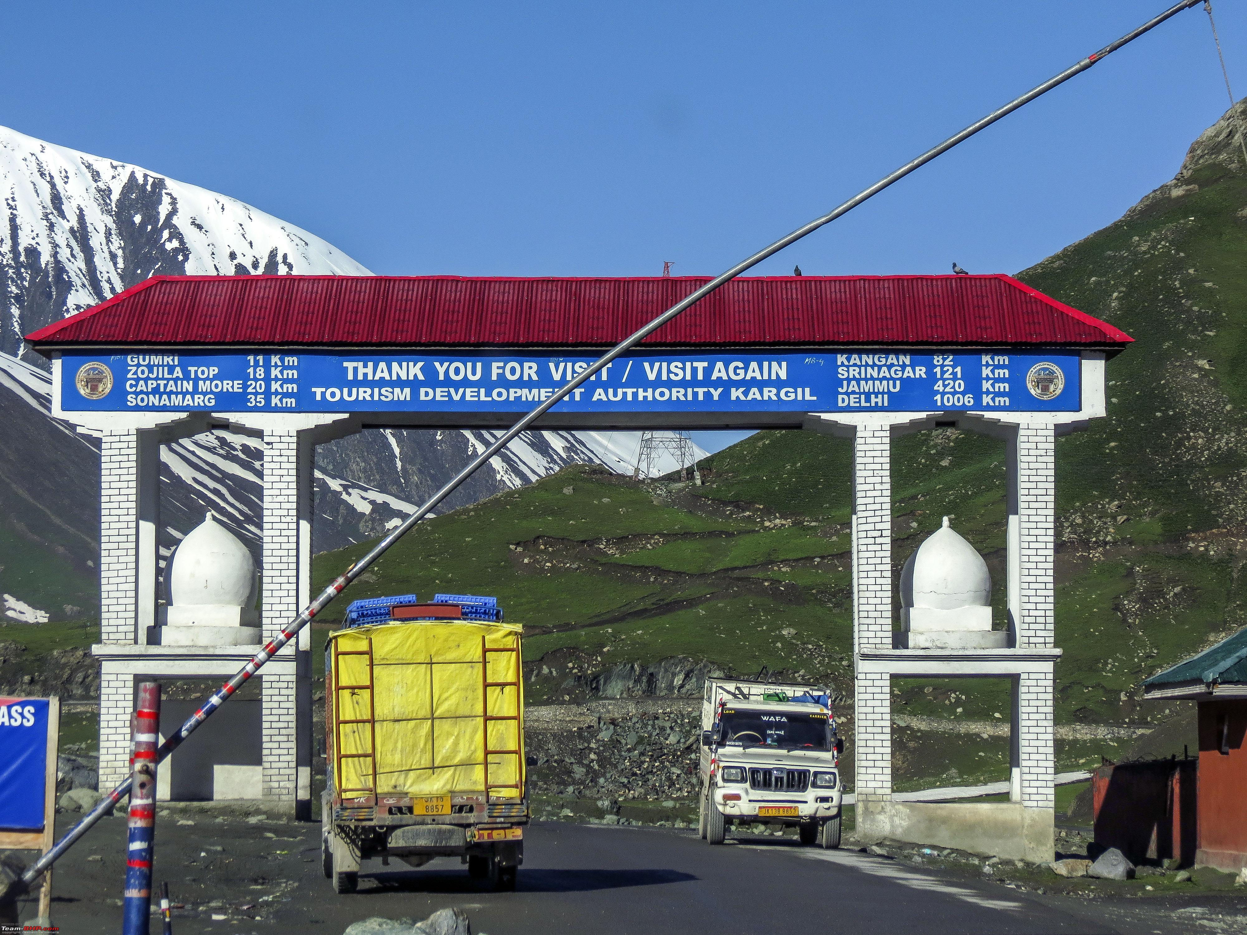 The last few minutes at Ladakh, the last few sights  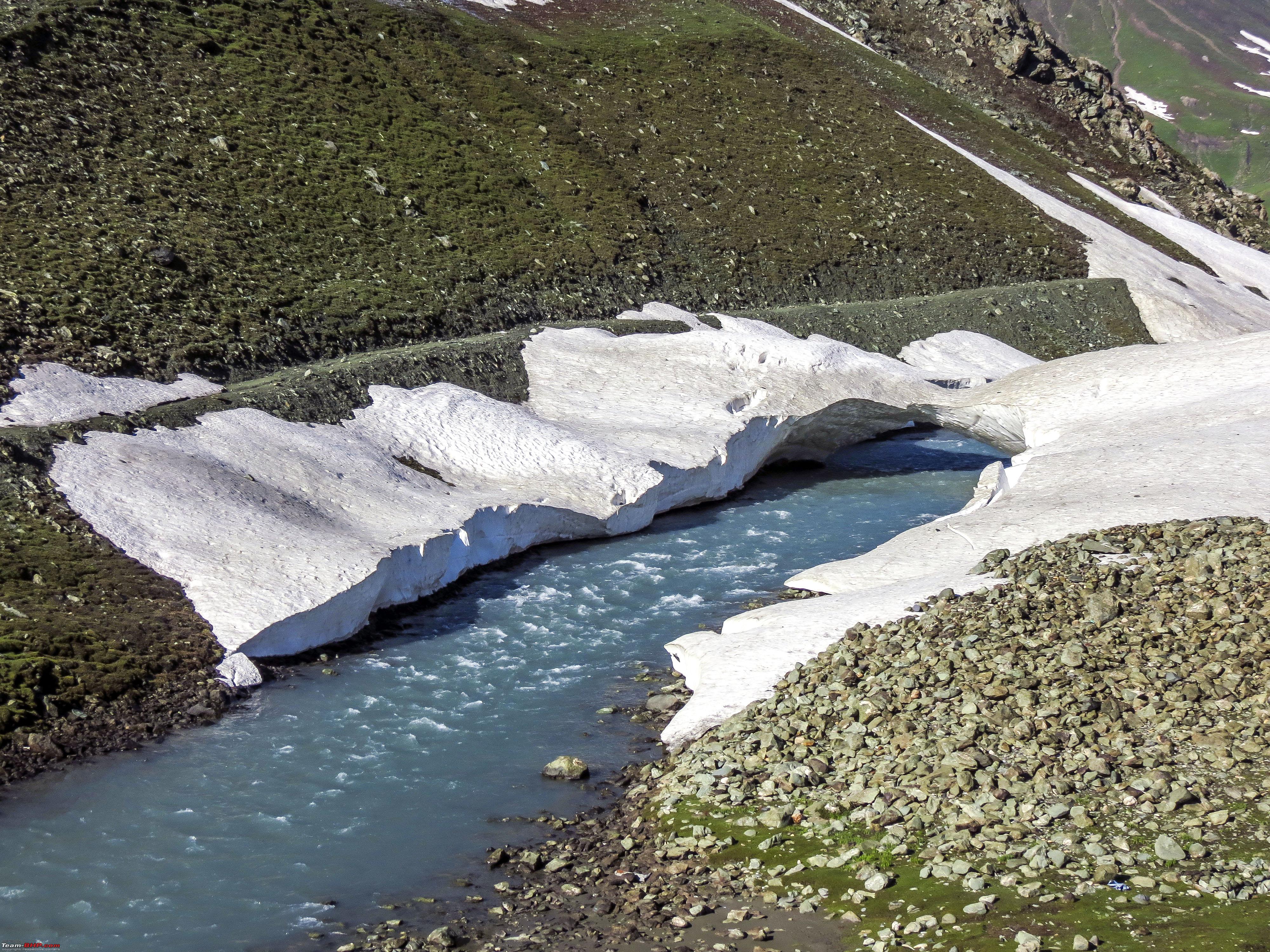 wonderful ones at that  Hatches do make across the passes quite well, unlike this one! 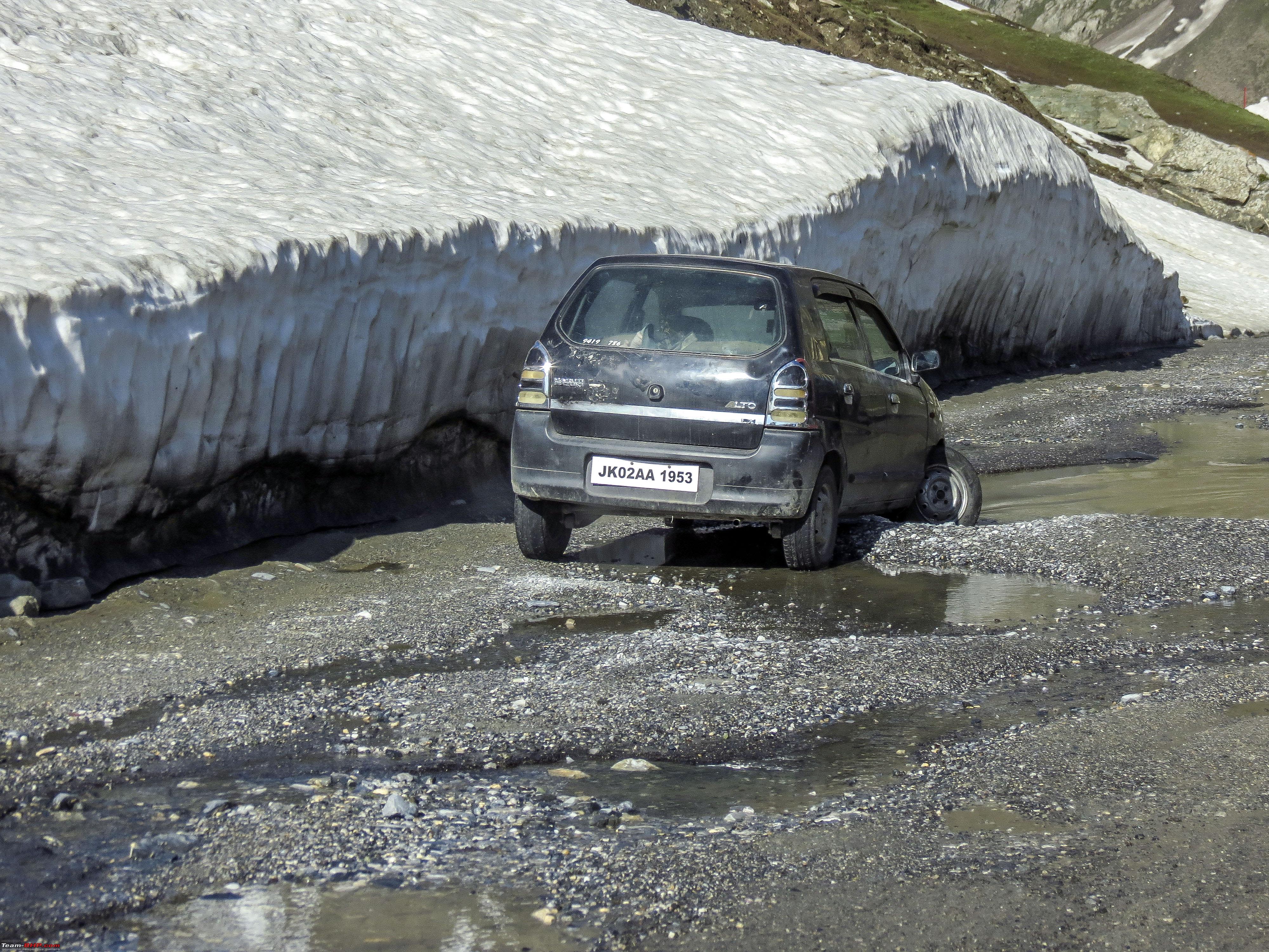 This is the official Goodbye to Ladakh  The last of the snow walls, the ice melt 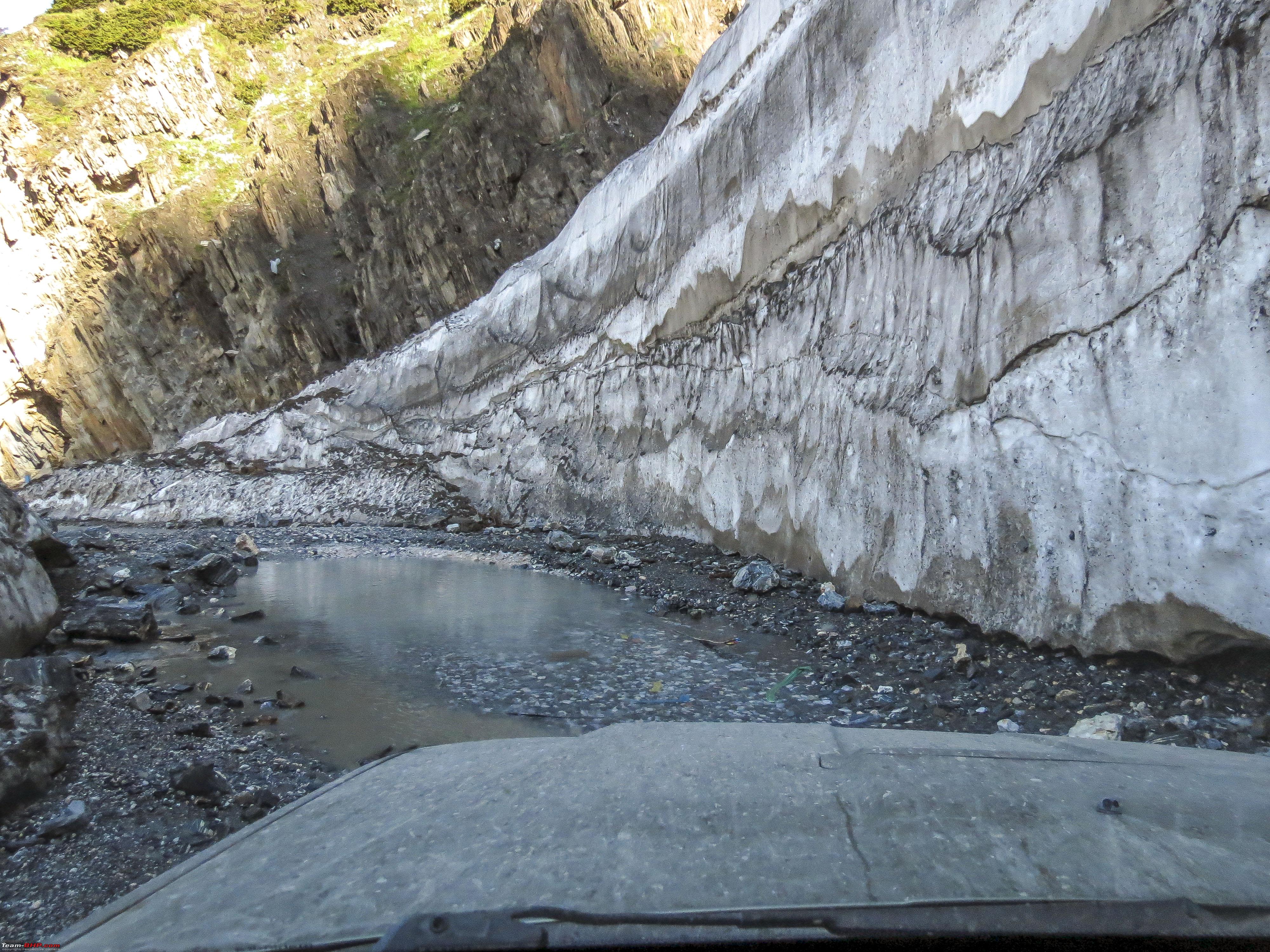 Hatches do make across the difficult terrain, but they also slow others behind them down  First view of the valley of Sonmarg 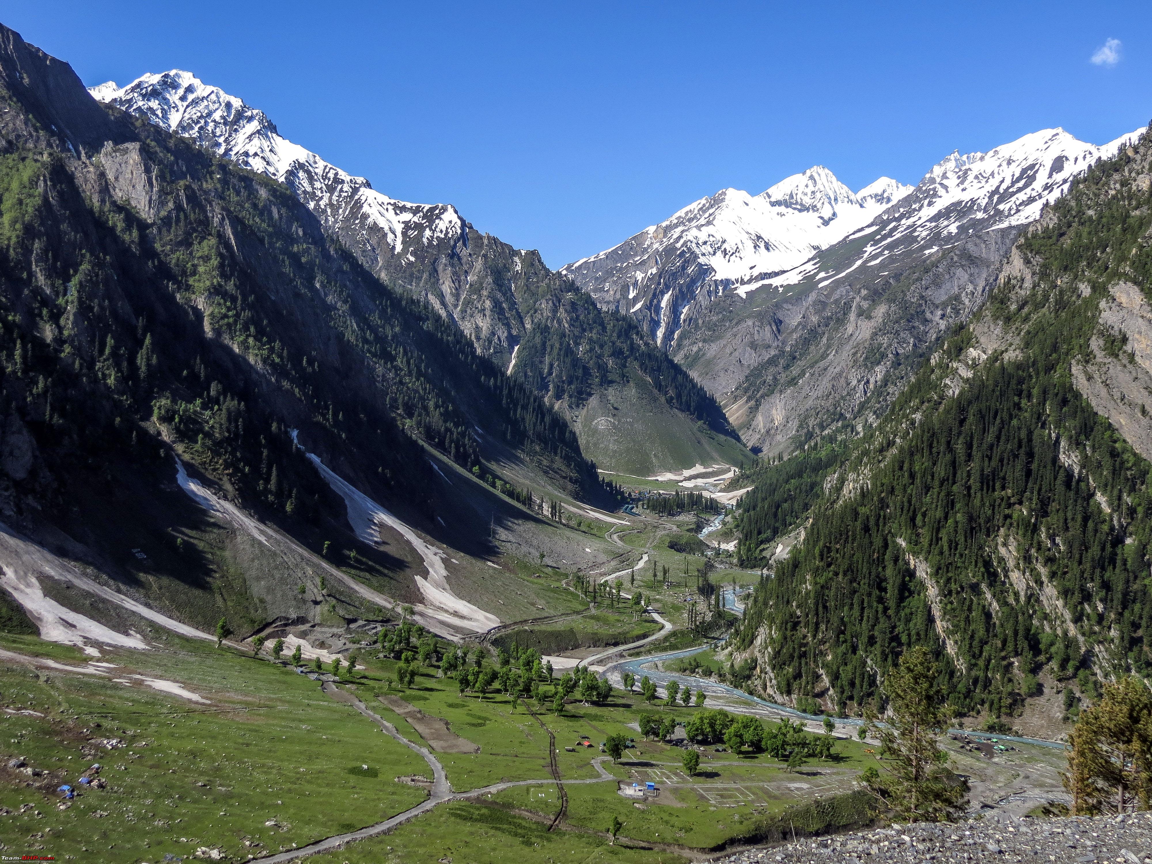 Different modes of transportation  Entering Sonmarg (sad!) 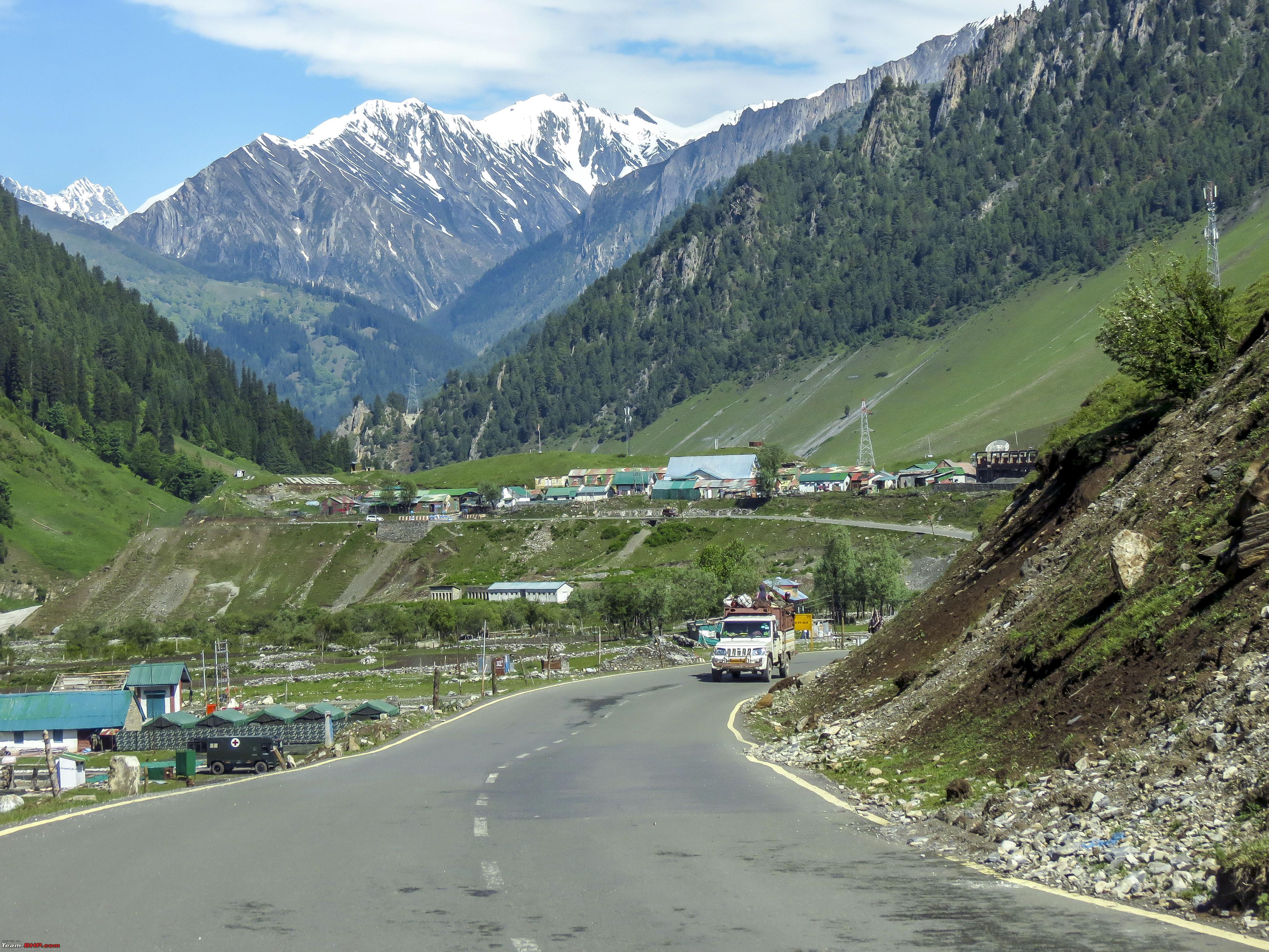 Beyond Sonmarg, pushing towards Srinagar, but the scenic beauty still remains 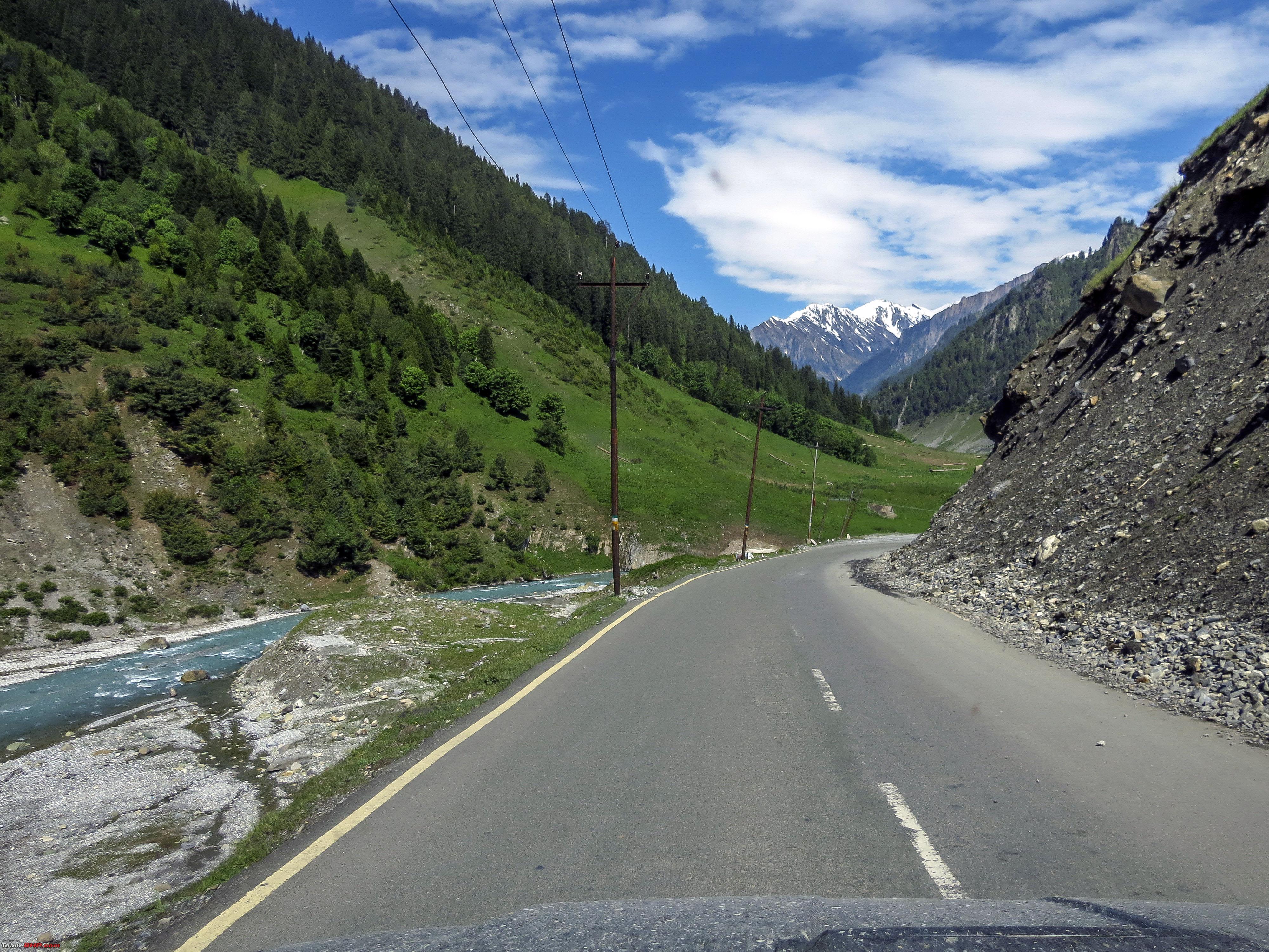 The flowing Indus beside the Leh-Srinagar highway  Pashmina goats all around lead by a German-shepherd  Entering Gund. If one is driving towards Leh, this is the last point on the Leh-Srinagar highway that has a Petrol Pump all the way before Kargil.  The valley of Kashmir and its typical Busses, though they are fast being replaced by factory-built Busses.  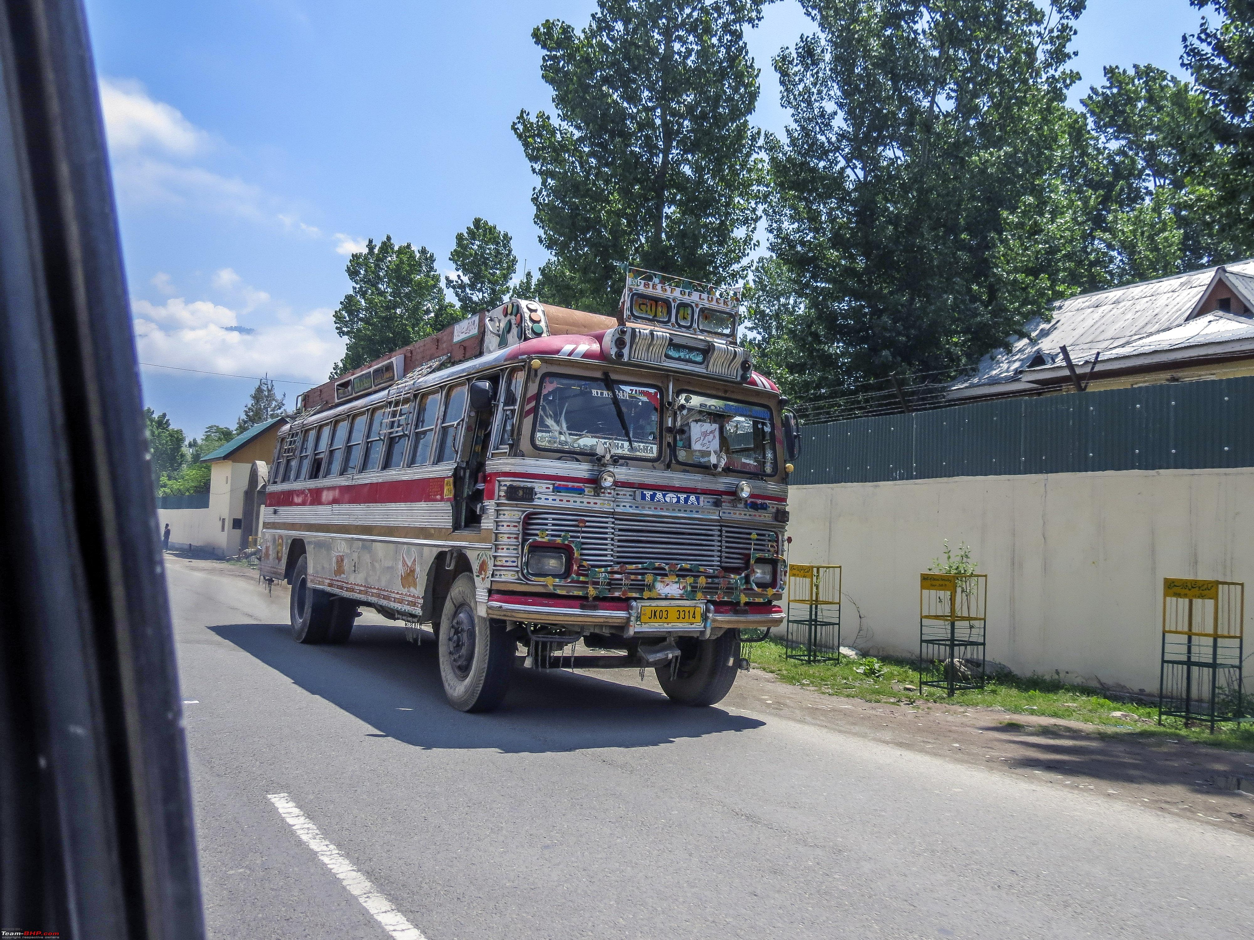  We did have the option of carrying on till Jammu and making up for a day lost, however driving through Srinagar, we still decided to give it our afternoon and evening. We needed something to eat. What better, than to take a Shikara ride on the Dal lake for it!!  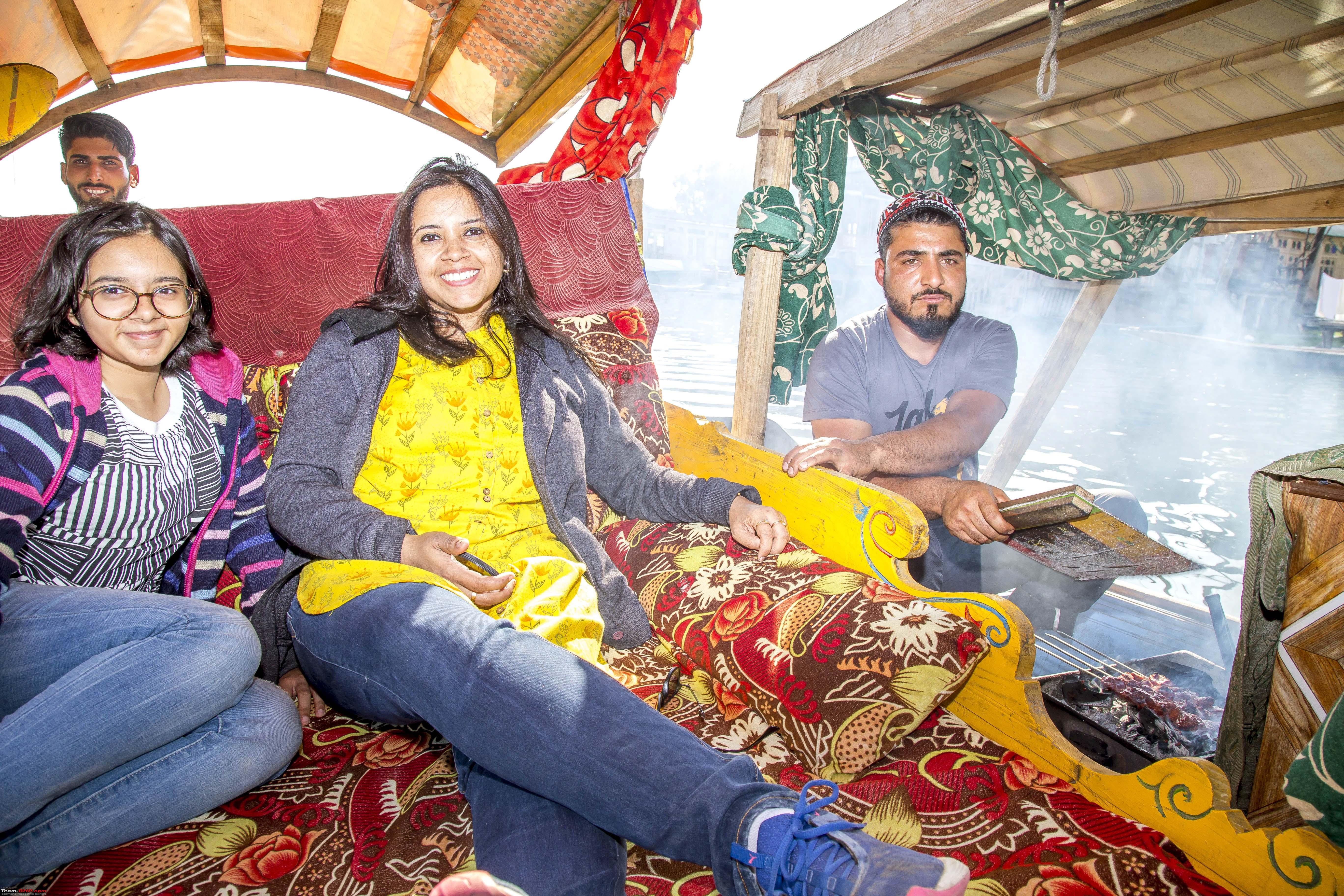 Lake weeding 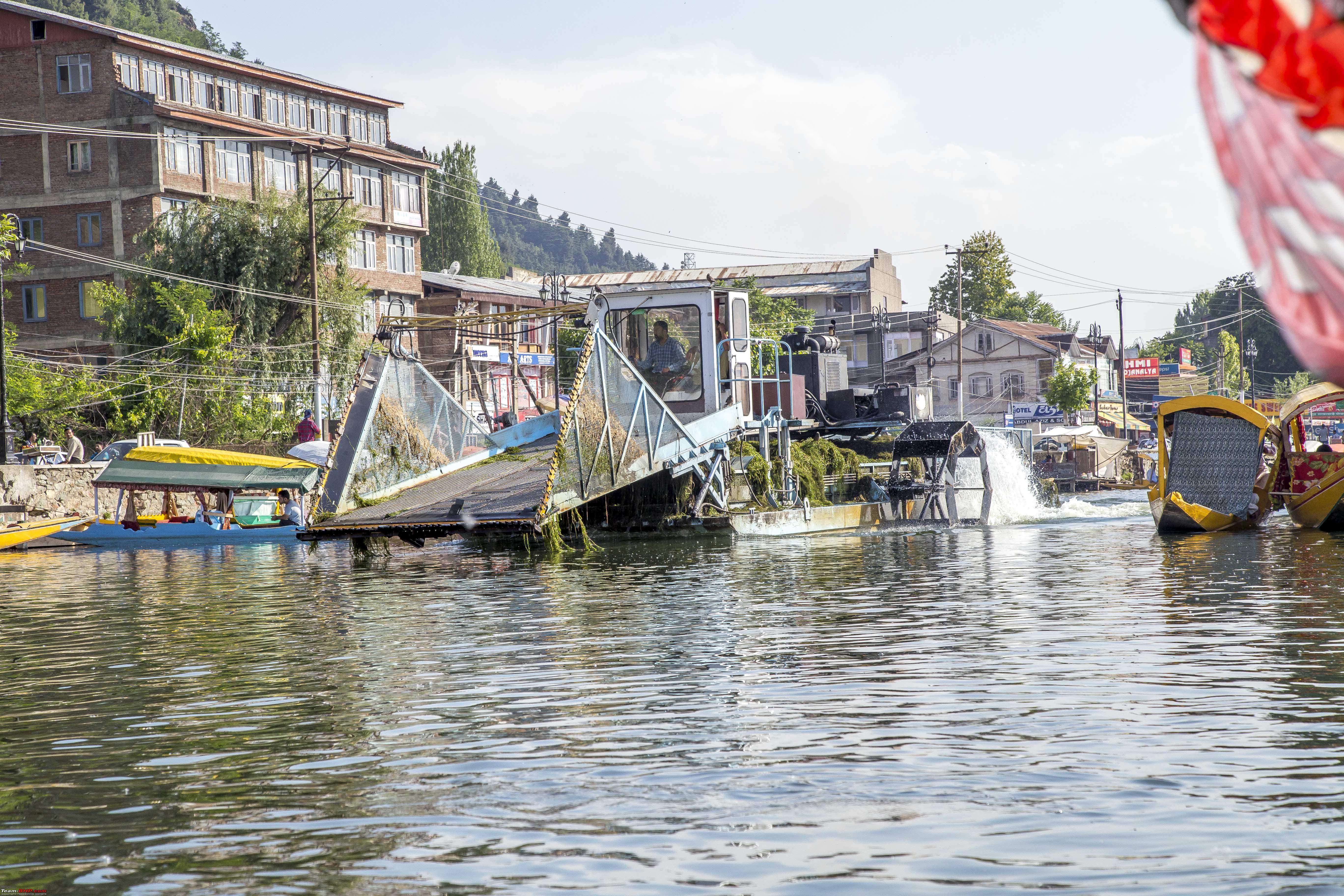 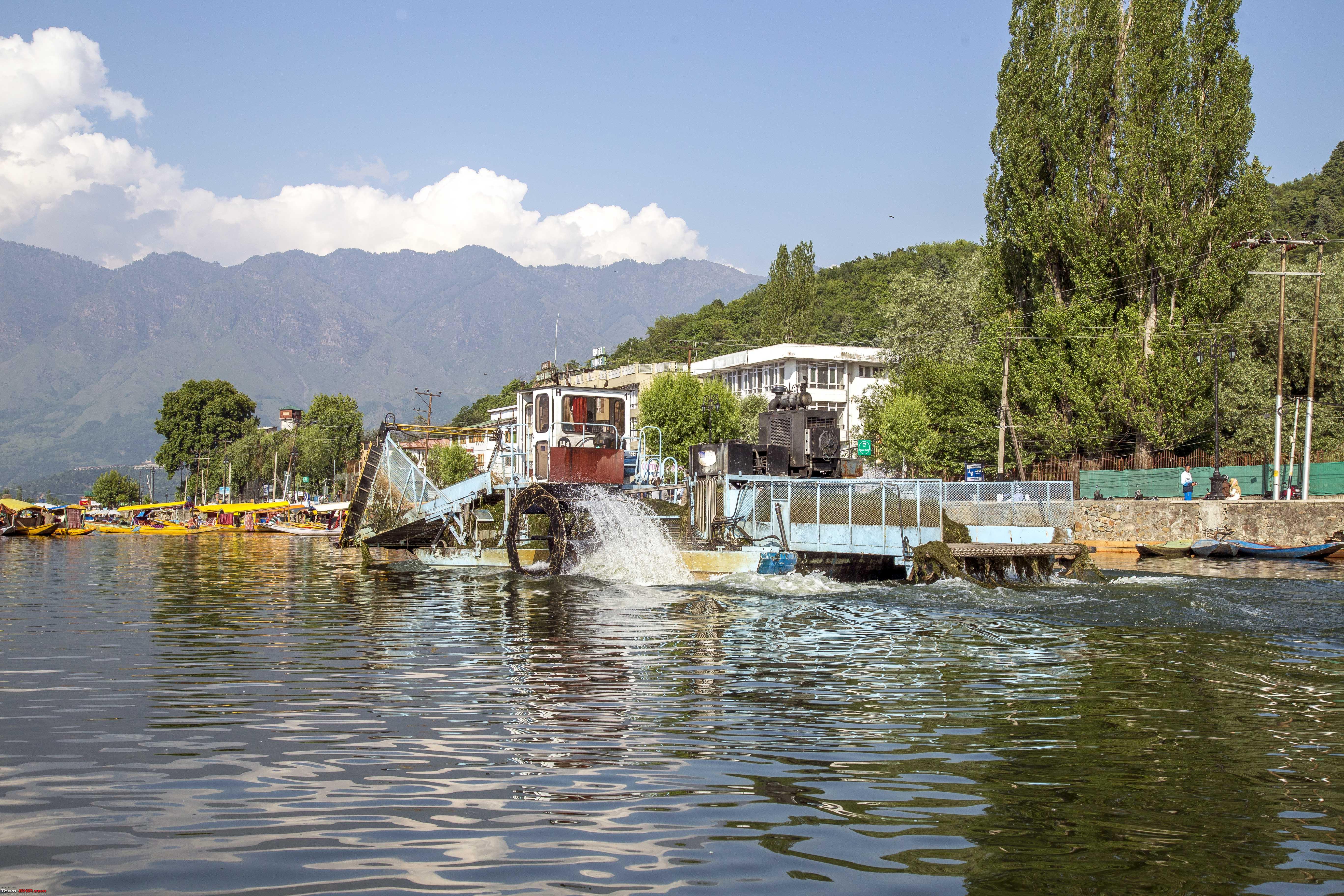 "Happy Aeroplane" floats! 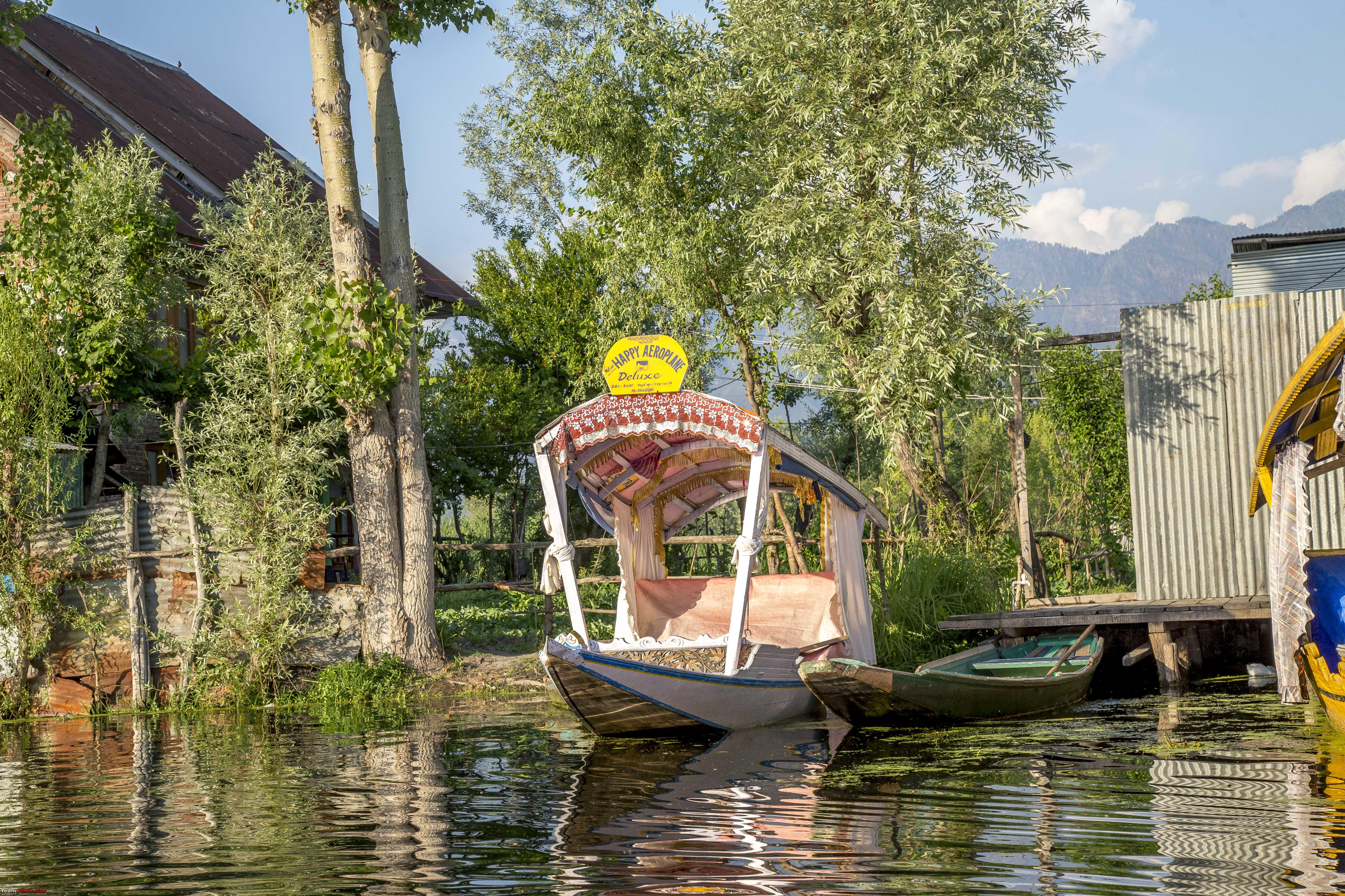 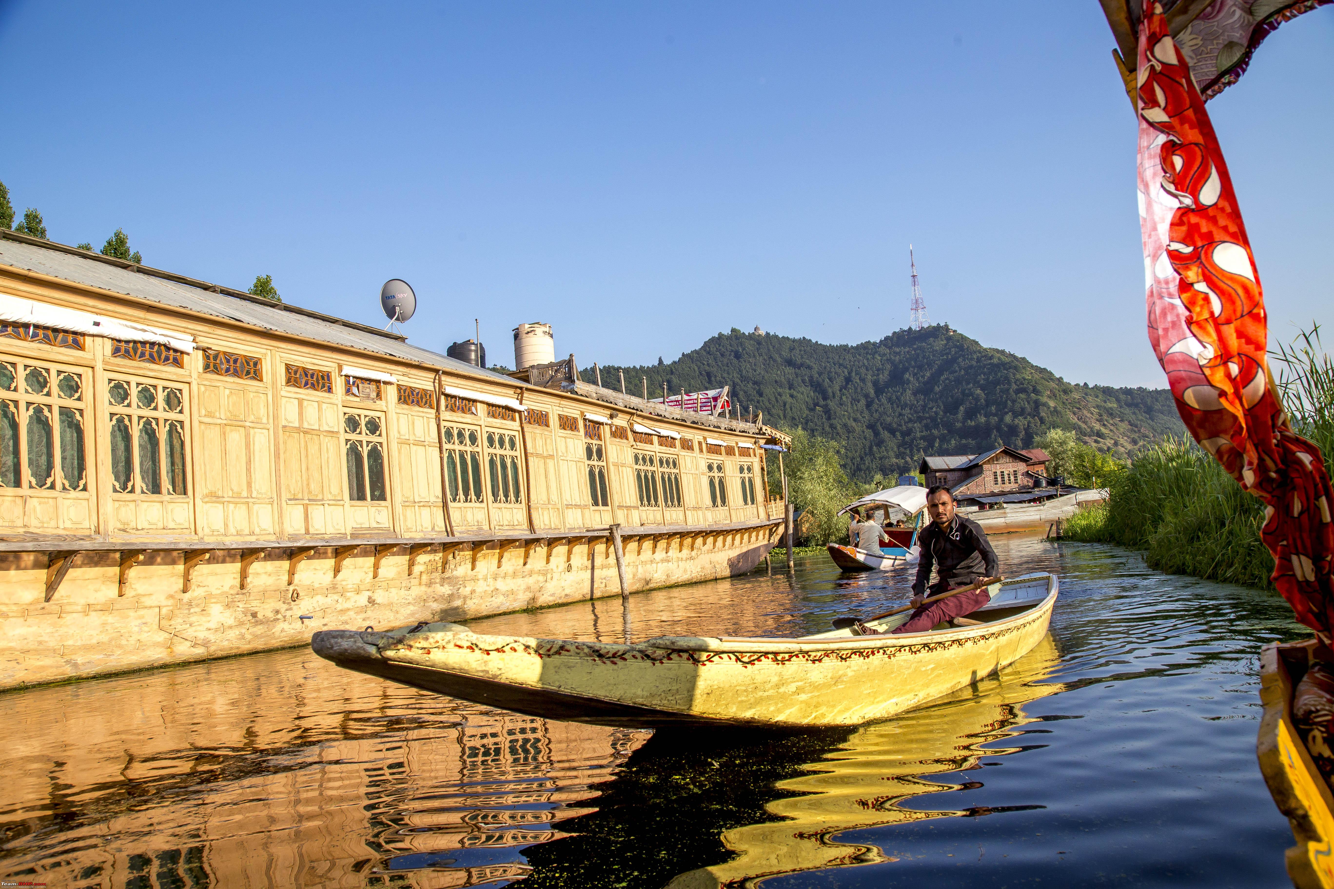 Some tea  Some more "Barbeque"! 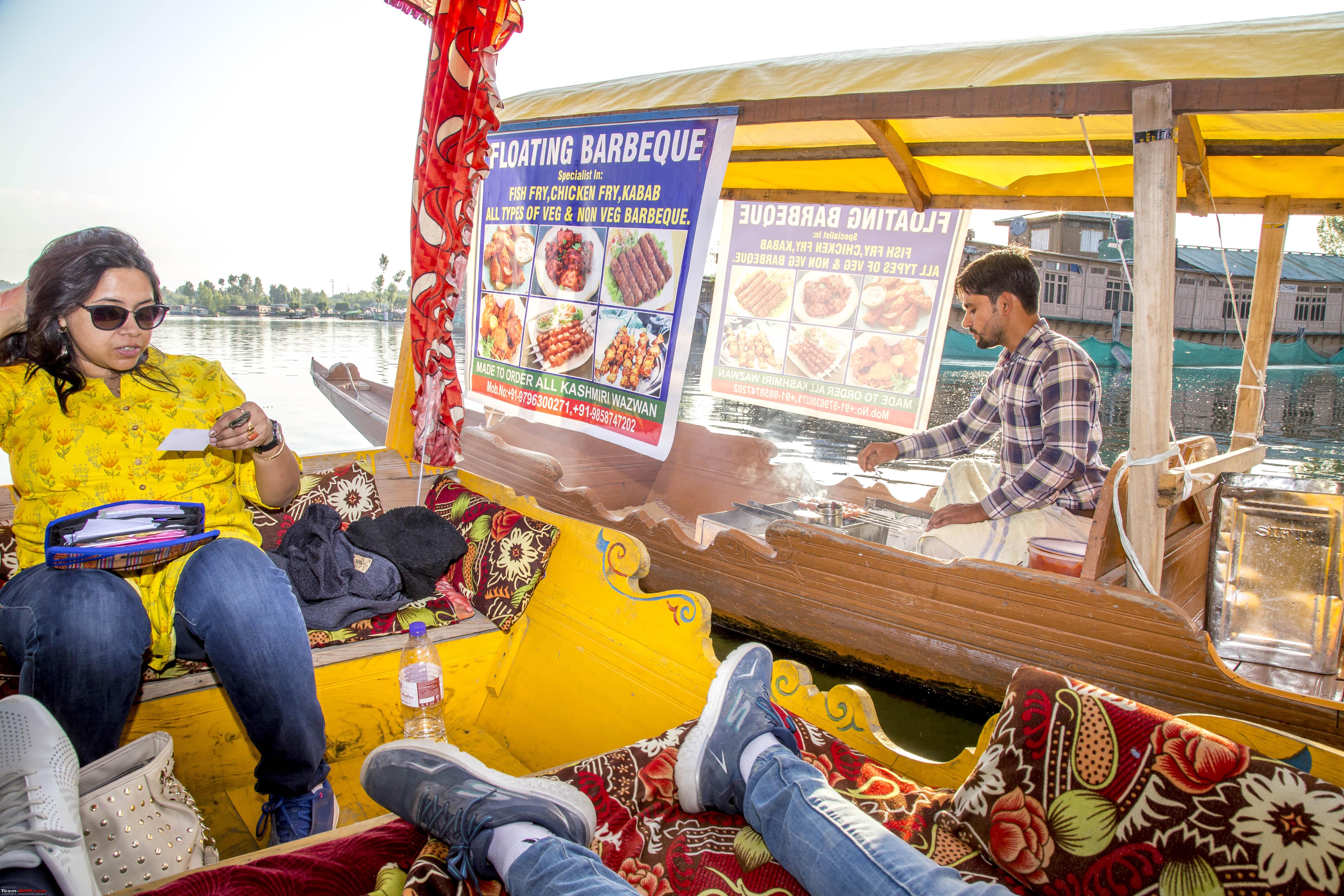 It was Wazwan again for the night. The day Fifteen It was a day to finally put one's foot down and drive as much as possible. We were now a day behind in our schedule and any more delays, would not be too well taken by the people back in our place of origin. Target to reach was Chandigarh. Not that we hadn't done it before. We took the Mughal Road again. It all went smooth, but for about the traffic/conditions of Jammu. Beyond Jammu it was a breeze to reach the state border, but a long hold up there too. By the time we reached Chandigarh, it was past 9, no big deal in the plains. Last edited by 1100D : 12th July 2019 at 02:28. |
|
| (25)
Thanks
|
| The following 25 BHPians Thank 1100D for this useful post: | AlphaKilo, ARAY, coolrats, CrAzY dRiVeR, gmhossain, GTO, jailbird_fynix, lightning535, mh09ad5578, mi2n, neil.jericho, rakirank, Red Liner, Ronak_7, rst89, Samba, Samfromindia, Sayata, ssambyal1980, streetfighter, Surprise, Thermodynamics, tomraven99, Varun_HexaGuy, wanderernomad |
|