Team-BHP
(
https://www.team-bhp.com/forum/)
-
Travelogues
(
https://www.team-bhp.com/forum/travelogues/)
Dear Laluks
Even though my name in this forum has a vagabond in it, it seems you are the real one indeed. Salute to you for your ability to
1. manage the Vitamin T (time)
2. managing the much needed vitamin M (money)
3. actually planning and excecuting these trips with your family
4. most importantly very regularly sharing the experience with all of us along with beautiful photographs and narration.
great going man, may your tribe increase.
clap:
Quote:
Originally Posted by Samurai
(Post 1548961)
The road from Chikmagalur to Malandur, is that the same road that goes to Mullaingiri, Babubudangiri hills and Datta Peeta via Kaimara?
|
No, that is not the route. While on IG road in Chikmagalur take the left at the first signal after the bus stand. This is the Chikmagalur-Mallandur road. You can approach Muthodi via this road.
If you continue straight from the same signal, you will pass Ratnagiri road and join Tarikere road which is the road you have to take to Mullianagiri-Kemmangundi. Kaimara is around 10 kms from Chikmagalur on Tarikere road and you need to take a left turn here.
There is another road from Muthodi to Bababudangiri which joins the regular Chikmagalur-Mullianagiri-Bababudangiri-Kemmangundi road just after the Kavikalgandi checkpost. This road passes via Kopprikhan Estate and is very narrow & bad. I guess you have been on this road earlier.
Great travelogue, laluks.
Nice combination of narration and quality photos :)
Can't wait for more.
Quote:
Originally Posted by Samurai
(Post 1548961)
The road from Chikmagalur to Malandur, is that the same road that goes to Mullaingiri, Babubudangiri hills and Datta Peeta via Kaimara?
|
That is not the road I took.
Quote:
Originally Posted by addyhemmige
(Post 1549300)
No, that is not the route. While on IG road in Chikmagalur take the left at the first signal after the bus stand. This is the Chikmagalur-Mallandur road. You can approach Muthodi via this road..
|
Yes this one. A left turn on IG road before reaching the straight road to Mullianagiri and the likes.
Road I took was Chikmagalur - Karemane -Jolada - jakkanahalli - Mallandur - Muthodi.
Quote:
Originally Posted by Roameo
(Post 1548986)
Excellent coverage of Shravanabelgola , Beautiful picture and the photos of the Information boards is really useful.
I have been there when I was about 6 years of age. Now I have another weekend destination on my list. :)
|
The details on the information boards, if it was available to me before, I would have studied the sculptures and would have appreciated it more. What I could not, I thought will give you guys :) so that it would benefit immensely.
Thanks Roameo, and good to note you liked the same.
Quote:
Originally Posted by StarVegabond
(Post 1549193)
Dear Laluks
Even though my name in this forum has a vagabond in it, it seems you are the real one indeed. Salute to you for your ability to
1. manage the Vitamin T (time)
2. managing the much needed vitamin M (money)
3. actually planning and excecuting these trips with your family
4. most importantly very regularly sharing the experience with all of us along with beautiful photographs and narration.
great going man, may your tribe increase.
clap:
|
Thank you
star.
Point 4 is the one which takes most of the time. :D
Quote:
Originally Posted by anekho
(Post 1549352)
Great travelogue, laluks.
Nice combination of narration and quality photos :)
Can't wait for more.
|
Thank you anekho.
Guys, I have a doubt. After exiting the NICE road at Magadi road exit, I took right turn and continued for around 25Km and at that intersection which looked like a bus stand I took a right to a byepass road which put me exactly at the Nelamangala turn on NH4. I was expecting to join NH48 further inside. Should I have gone straight form that intersection? The locals said road ahead was quite bad and put me onto this byepass which was horrible too.
Could you please let me know how from Magadi road exit of NICE I reach NH48, and where.
Quote:
Originally Posted by laluks
(Post 1550211)
Guys, I have a doubt. After exiting the NICE road at Magadi road exit, I took right turn and continued for around 25Km and at that intersection which looked like a bus stand I took a right to a byepass road which put me exactly at the Nelamangala turn on NH4. I was expecting to join NH48 further inside. Should I have gone straight form that intersection? The locals said road ahead was quite bad and put me onto this byepass which was horrible too.
Could you please let me know how from Magadi road exit of NICE I reach NH48, and where.
|
I can understand the confusion here, as there are many a diversions after magadi town. The easier solution for this is, just ask directions for kunigal. From what i remember after magadi town we need to take a right turn, and there is a bus depot on the left side of the road (as a landmark). This road should take you to NH48, from where kunigal is just around 7 KMs.
Hope this helps!
Wow lovely! lalu one more interesting logue from you. keep it coming!
guess i need to buy a diesel car soon;)
Quote:
Originally Posted by JMaruru
(Post 1550219)
I can understand the confusion here, as there are many a diversions after magadi town. The easier solution for this is, just ask directions for kunigal. From what i remember after magadi town we need to take a right turn, and there is a bus depot on the left side of the road (as a landmark). This road should take you to NH48, from where kunigal is just around 7 KMs.
Hope this helps!
|
Thanks JMaruru. Will do a drive to sort this out some weekend :D
Quote:
Originally Posted by lohithrao
(Post 1550225)
Wow lovely! lalu one more interesting logue from you. keep it coming!
guess i need to buy a diesel car soon;)
|
Lohith, both my cars are petrol :Frustrati
Day 1, 17th October 2009 Continued.
Shravenbelagola - Gorur Dam
By 10:30AM we have reached NH48 and was on the way to Belur. After about 35Km, we saw a board saying
Gorur 22Km to the left.
Gorur? 22Kms?
Why?
How long to go and come?
Could be 1.5hours up and down drive, 30minutes at the Dam.
It's already 11:15AM. We can be back by 13:30PM, and continue to Belur. Still we can make it?
Think so.
There's a dam?
Yes.
Will it be full?
Don't know. Must be. It was raining here often.
Should we go?
Ok. Come one. Let's go and find out.
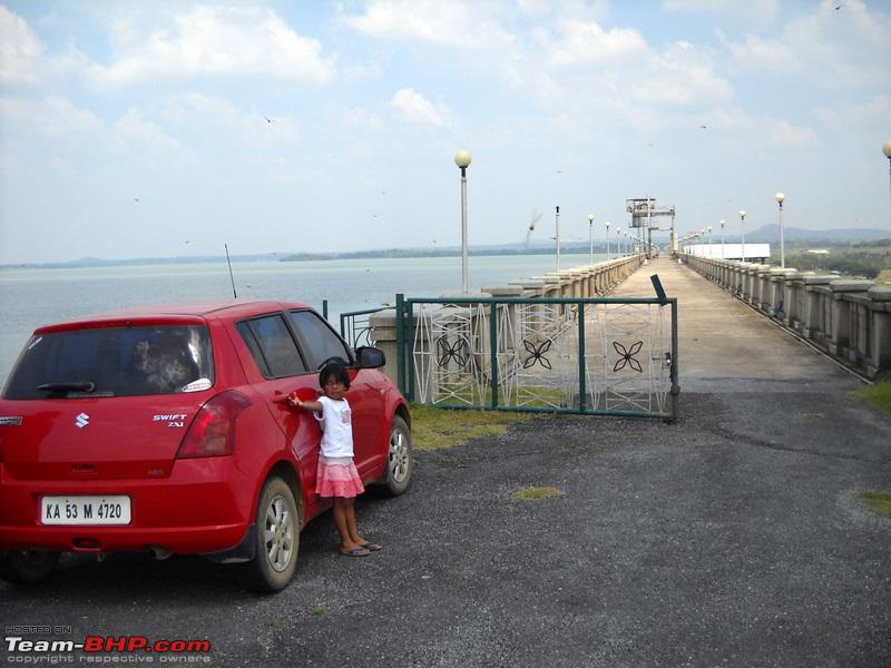
On that note at 11:15Am we turned left to Gorur from NH48. We reached Gorur Dam gate by 11:45AM. We saw some school buses parked at the gate. I also parked the car at the gate and went inside.
On seeing my kids a guy approached me.
Are you going to the Dam?
Yes.
It is quite a walk!
I know. The security does not allow me to take the car inside.
Do you really want to walk that much?
Well I don't know. What else can I do?
Do you want to go to the top of the Dam?
I'd love to.
Well then, come on. I'll take you. Let's go take your car.
Car?
Yes, lets take your car?
Well...
Oh! I am a police man. See my id. I should have told you before.
Oh! Sorry. Thanks, I thought....
That's all right. Come let's go.
Ok.
Let us take the next gate.
Ok.
The man seems to be serious. We reached the next gate, all salutes, the gates open, and we are inside the dam area driving. We reached a place, where I was about to park.
Do you want to drive on the top of the Dam?
Well, I'd love to.
Ok then let's go.
Really?
Yes, lets drive.
Speechless I just drove in the directions shown. All barricades lifted, we are up on the Dam. We went all the way to the other side and came back. Well that was an experience.
We have never driven on any Dam like that before. We then stopped by to take some pictures.
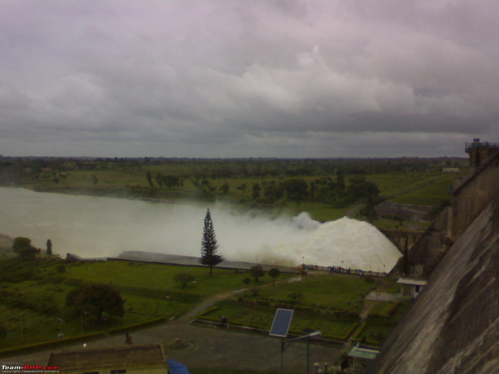
The dam is filled up to its brim. One more feet and the water would overflow.
I guess a little is left open so that the dam does not get full

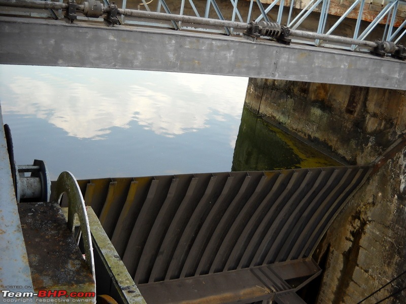
That's the bridge for the road. We were supposed to park the car there on that road and walk to the dam.


My family walking on the top of the Dam

Our Red Riding Hood on the top of the Dam, loving it


We reached the gate back by 12:30PM. Gate to gate it was 10Km. We dropped the gentleman at the gate.
Where are you guys off to?
Well don't know. Belur now and Chikmagalur in the night.
Chikmagalur?
Why?
You want to see scenery?
yes.
Then why dont you go to bisle and kukke? That nearer.
Bisle? From here? (I was like - hey that where I want to go sometime in this trip!!)
Kukke should be 80Km from here. Roads are bad. Go to Kodlipet, Mallipatna and turn left to Bisle.
OK. How bad?
Its too bad, but slowly you can go.
OK. thats fine. How much time?
By 15:30PM you'll be in the temple.
That's very fine.
Scenery is good.
That's great.
Where are you planning to stay?
I'd like to be back near Sakleshpur or Hassan.
Ok. You'll be there in Saklespur by 17:30PM. Hassan would be better to stay.
That seems very fine. But how to reach Sakleshpur. Is Shiradi ghats open.
Yes. But it is patchy. Cars go these days.
Well that should be fine. If not?
If its not open some where on the Ghats you'll see a deviation to Sakleshpur. Take that!
That's great!!
Ok then. Have a safe journey.
Thanks, it was a nice gesture. Kids enjoyeed the dam drive very much.
I am happy to hear that. Bye
Bye. Thanks.
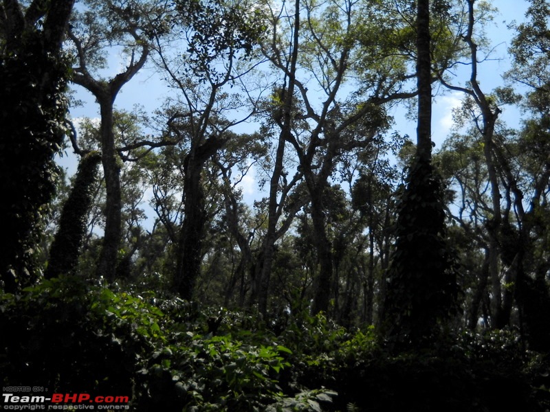
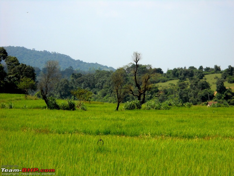
On that we said bye to the gentleman at 12:30PM and drove to Kukke Subrahmanya temple via Bisle ghats. This was one drive through a lot of greenery, streams, tiny waterfalls and no roads!!
continued...
Wonderful pics laluks. Waiting to see the green ones.
Quote:
Originally Posted by laluks
(Post 1550211)
Guys, I have a doubt. After exiting the NICE road at Magadi road exit, I took right turn and continued for around 25Km and at that intersection which looked like a bus stand I took a right to a byepass road which put me exactly at the Nelamangala turn on NH4. I was expecting to join NH48 further inside. Should I have gone straight form that intersection? The locals said road ahead was quite bad and put me onto this byepass which was horrible too.
Could you please let me know how from Magadi road exit of NICE I reach NH48, and where.
|
I think you have taken the Tavarekere-Sondekoppa-Nelamangala road.
After you enter Magadi road from NICE, keep going on till you pass Tavarekere (the place where you took a right turn), keep going straight and follow the good road. You will pass Tippagondanahalli Dam and then, just before Magadi you will get a junction. Keep going straight as left takes you to Savanadurga & Ramanagar.
After the junction you will see the remains of a fort towards your right. Keep going straight and you will enter Magadi town and after the town you will find a metal arch (magadi municipality) covering the road and a fork. Take the right side. You will find the first board indicating direction to Kunigal. A few kms later, you will find another fork. Take the left side this time and continue for about 12 kms to reach NH 48 near Johnson Tiles/Indo Spanish Foods factories'.
One tip: Keep going straight until you pass Magadi town. No need to take any diversions until you pass Magadi.
Quote:
Originally Posted by laluks
(Post 1550378)
The dam is filled up to its brim. One more feet and the water would overflow. Attachment 216331
|
I have a picture taken from the same angle:). Taken very long back. Will see if I can find it. I also have some pics of Gorur dam when water was released. I will post them if I can find it.
Quote:
Kukke should be 80Km from here. Roads are bad. Go to Kodlipet, Mallipatna and turn left to Bisle.
OK. How bad?
|
I think you mean to say Mallipatna-Kodlipet-Yeslur-Shukravarsante and then to Bisle.
If I am right, you went past Gorur, reached Arkalgud and took a right to Mallipatna. From Mallipatna, you took the straight road at the junction to Kodlipet, right??:)
I used to travel on this road frequently. I have a couple of cousins in Mallipatna
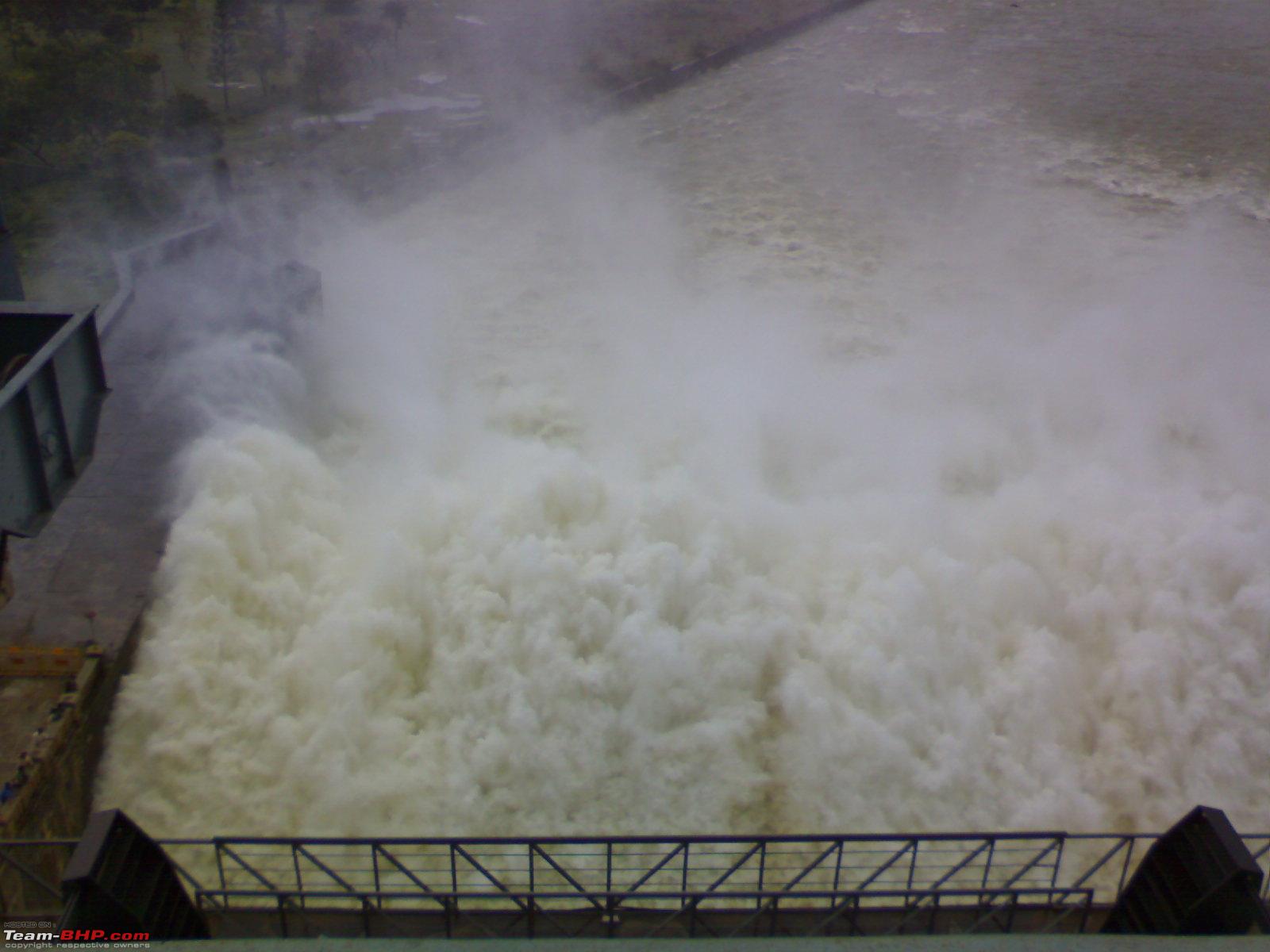
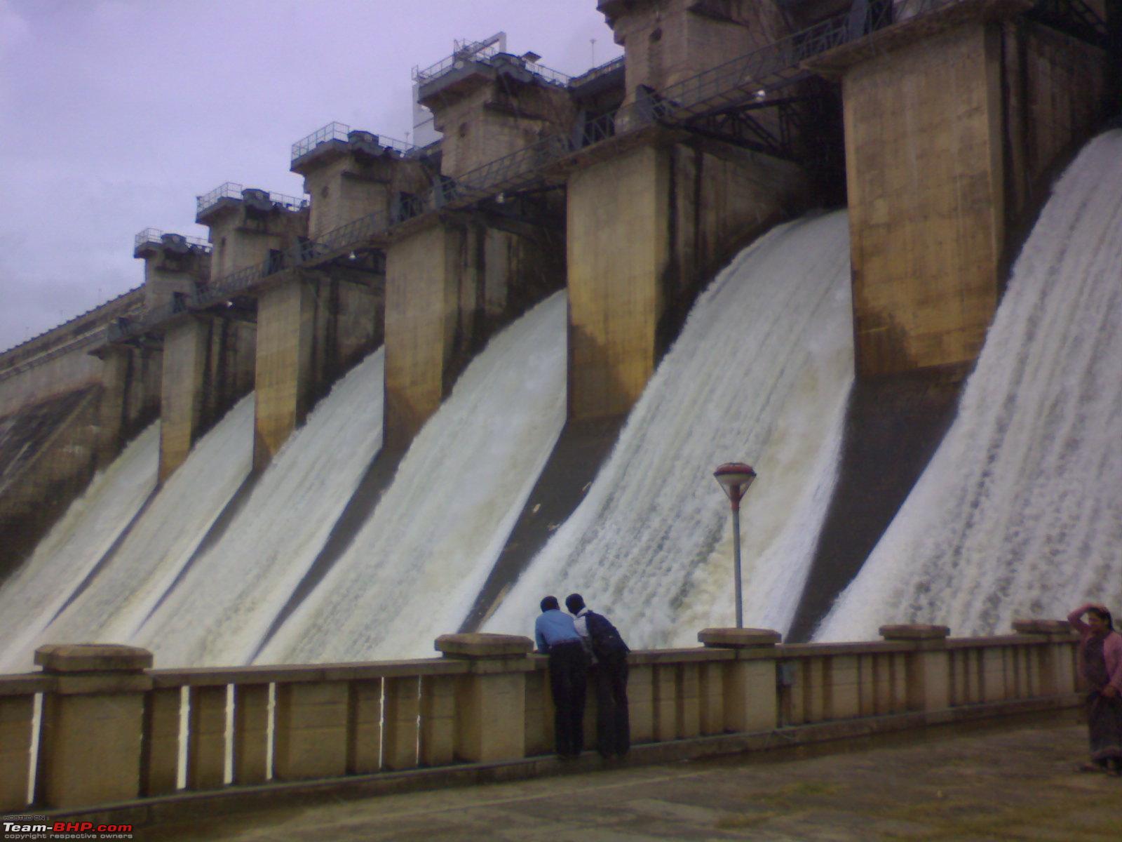
Found the pictures. Apologies for the quality of the pics. They were taken on a mobile some 4-5 years ago
Compare this with the one laluks has taken

A full dam

Pic taken from above the dam. Notice people standing at the parapet wall to the bottom left of the pic.


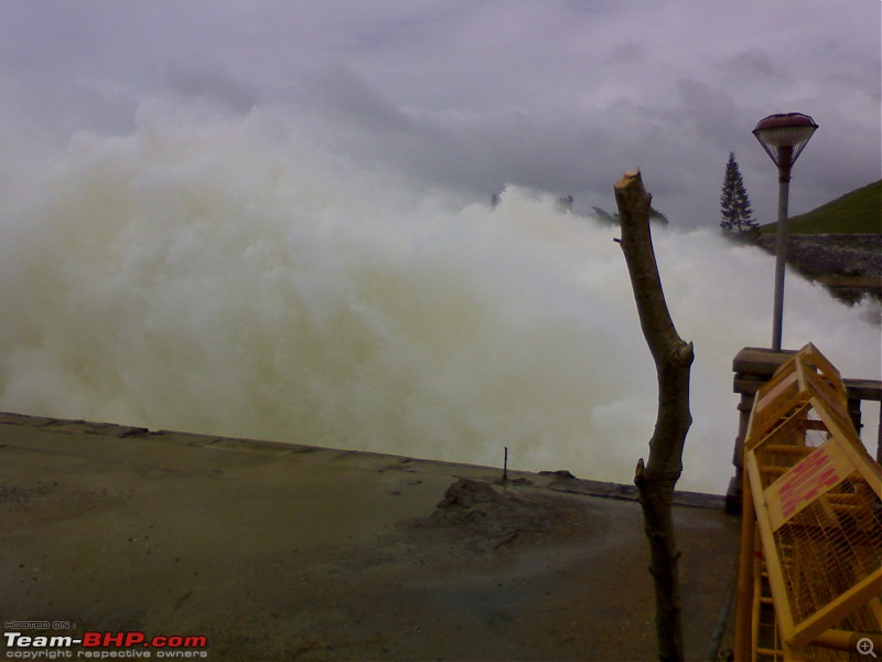
Picture taken from the bridge

@laluks, sorry for poking my nose in your thread. Couldn't resist adding my bit:D
Quote:
Originally Posted by KishoreC
(Post 1550428)
Wonderful pics laluks. Waiting to see the green ones.
|
Thanks Kishore. Next ones will be green :)
Quote:
Originally Posted by addyhemmige
(Post 1550553)
I think you have taken the Tavarekere-Sondekoppa-Nelamangala road.
After you enter Magadi road from NICE, keep going on till you pass Tavarekere (the place where you took a right turn), keep going straight and follow the good road. You will pass Tippagondanahalli Dam and then, just before Magadi you will get a junction. Keep going straight as left takes you to Savanadurga & Ramanagar.
After the junction you will see the remains of a fort towards your right. Keep going straight and you will enter Magadi town and after the town you will find a metal arch (magadi municipality) covering the road and a fork. Take the right side. You will find the first board indicating direction to Kunigal. A few kms later, you will find another fork. Take the left side this time and continue for about 12 kms to reach NH 48 near Johnson Tiles/Indo Spanish Foods factories'.
One tip: Keep going straight until you pass Magadi town. No need to take any diversions until you pass Magadi.
|
Will drive a weekend on these roads to sort it out. :D
Quote:
I think you mean to say Mallipatna-Kodlipet-Yeslur-Shukravarsante and then to Bisle.
If I am right, you went past Gorur, reached Arkalgud and took a right to Mallipatna. From Mallipatna, you took the straight road at the junction to Kodlipet, right??:)
I used to travel on this road frequently. I have a couple of cousins in Mallipatna
|
I passed guddugalale and Shenivarsante after Mallipatna. So many Y forks every where. Is it the same?
Quote:
I have a picture taken from the same angle:). Taken very long back. Will see if I can find it. I also have some pics of Gorur dam when water was released. I will post them if I can find it.
Found the pictures. Apologies for the quality of the pics. They were taken on a mobile some 4-5 years ago
|
Cool. Would have been great to see the flow like that
Quote:
@laluks, sorry for poking my nose in your thread. Couldn't resist adding my bit:D
|
Not at all. With sharing the fun multiplies
Those pictures of the full dam are great. One can feel the power of the crashing water.
Day 1, 17th October 2009 Continued.
Gorur Dam - Bisle
By 12:30PM we started from Gorur Dam towards Kukke Subramanya through Bisle ghats.
The route was some thing like this.
Time--Kms---Place / Turn
12:30
000.0 Gorur Dam.
12:45
007.0 Arkalgud. Right Turn.
13:10
019.0 Left Turn.
13:11
019.4 Y Fork, Take Right.
13:25
028.0 Turn Left.
13:26
028.7 Turn Right.
13:30
030.0 Big Junction. SaniVarsanthe. Take Right.
13:31
030.1 Y Fork, Take Left.
13:45
035.5 Junction. Go Straight.
14:00
041.0 Y Fork, Take Left.
14:10
044.2 Y Fork, Take Right.
14:20
048.0 Junction. Take second exit to the Right. You'll now get on to Bisle ghats. (See the last picture for the direction board here)
Some views from these roads.


Continued...
| All times are GMT +5.5. The time now is 23:06. | |