Area Impacted - Neeladri Road, Electronics City Phase I
=============================================
(Please note: The main idea behind this thread is to make fellow citizens aware of the road conditions in the vicinity and if possible alternative route options to beat the traffic and the wear 'n' tear of your car)
Hi Friends,
All of us would agree that this year has blessed us with much awaited full fury monsoon throughout the country. All the dams are full, water tables have risen considerably and there is lush greenery all around. No wonder we have so many travelogues/escapades from cities to the nearest green spots. And must I say, the pictures have just been gorgeous!
More often than not, a good rainy stint also brings along an aftermath. One of it, is the commonly found moon surface aka 'crater' road. A lot of cities are 'famous' for it - Mumbai, Bangalore etc. Till the local administration comes to the rescue, we, the 'Aam Aadmi' have little choice but to rattle our bones and suspension with it

And god help you if the road in your vicinity cracks up just before or when the monsoon begins - in all probability the authorities will not pick up the repair work till the rains die down. The commuters of the patch that I will be illustrating below are one of those unfortunate ones...
Area impacted - Neeladri Road, which is an important connect between Banerghetta Road and Electronics City owing to bare minimum traffic and zero traffic signals. For your reference the origin in the map below is Meenakshi Mall, Banerghetta road and the destination is Infosys Campus, E.City. The route selected is via Begur-Koppa Road.

Zooming-in on to the map above, I have highlighted the bad patch on Neeladri road below.

For obvious reasons, this route is packed with office goers during morning and evening, considering its zero traffic signal zone with bare minimum traffic. Given the conditions of the road, there is a complete mess during peak business hours here. During the end of this write up I will mark an alternative way on the maps which users can take/are taking up to avoid this chock-a-block.
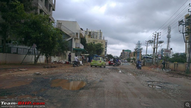
But before that lets look at the condition of the road in 'dry' condition on a Sunday afternoon.
Approaching the patch just after we cross Ajmera Infinity and Ganga Vertica on the left. The mud layer that you see on the left hand side was recently added to counter the unevenness of the road, but little did they know that shortly after it would rain and the mud would add on to the list of several other factors that have made the surface very unstable to drive. More on that later.

Mind you, this is a lazy Sunday afternoon and a dry day. You can imagine the situation when it comes to peak traffic hours or peak traffic hour with 0.5 to 1 feet water on a rainy day collected between the left boundary wall to right boundary of the apartment societies on either side. This water logged unstable stretch is easily around 400-500 meters, enough to pile up traffic on either sides for a kilometer!
The society that you see on the right (yellow) is Ittina Mahaveera.

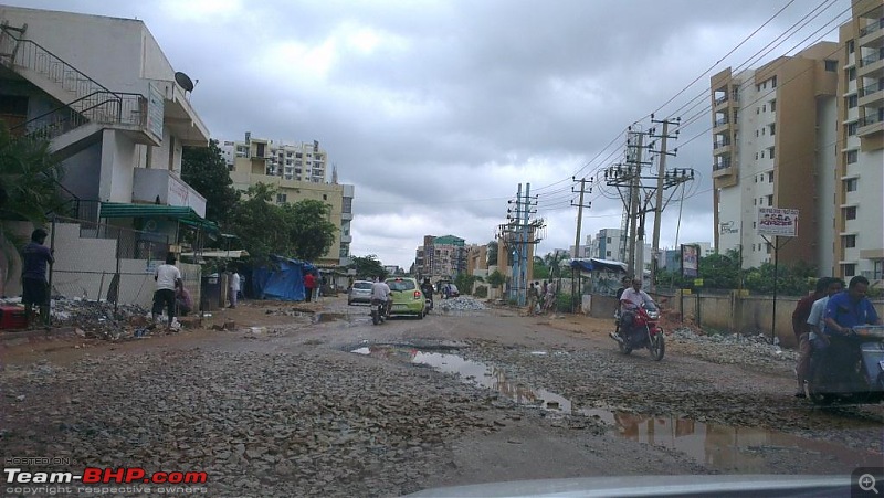
There are the two severely impacted patches on this road (several minor ones), the one shown above and below is the better one of the two.
The images don't look that scary, but trust me when water logged, even in the comfort and security of one's own car, people think twice before they attempt any pothole on this stretch. Many a times you see people doing a last minute steer left or right in order to avoid a water logged pothole which initially they thought they could tackle head on.
Seeing two wheelers falls down is a common sight on this road, especially women on their Activas. As you can see, to level the unevenness of the surface they have added stones. Every second day it's raining so more often than not, you see all the bulldozers are parked.
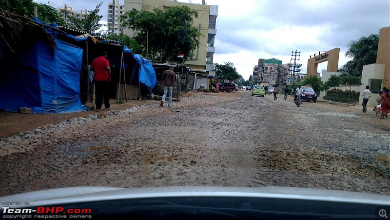
Approaching the second patch.
The patch below is the real one-at-a-time bottle neck. Even the puddles that are created here are reasonably sized potholes. It did not rain this weekend and still the water persisted till Sunday evening in these craters. Gives an idea of how deep they are.

The society on the right is Genisis Ecosphere. It's really surprising to find that this road which hosts some really nice townships is in, this bad a shape.

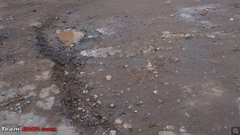
All the stones which are yet to be layered by the bulldozers. I am really concerned for the people on two wheelers falling on this surface.

A close up

The pic below demonstrates the unevenness in this stretch that I had mentioned earlier.
The pothole below is another minor one-at-a-time bottle neck close to Wipro gate but there is enough stable ground on either side to pass this patch.

I will try capturing the madness during a 'rainy peak business hour chaos' but taking pictures at that time has been quite difficult till now, being a part of that bottleneck myself. But will try posting a few pics nevertheless...
Now for the alternative route that one can take to avoid this madness:

1. After crossing St Xaviers on your left, we hit a small crossing on which usually the traffic takes right and then the left to hit the Neeladri road. Instead of taking that right, take the road straight ahead.
Zooming in:

Continuing from above:
(Note: in this route the road is narrow but wide enough for incoming traffic to pass abreast.)
2. Just keep following the road, it curves ahead, and then finally hits a 'right only' just where Ganesh Medicals is.
3. Take that right and keep going until you hit a T end.
4. Take the right from that T junction (left is a very narrow road, and most of the traffic will be taking a right here).
5. Just after taking that right, take the immediate/first left.
6. Keep coming straight till you hit a (iron) gate and hit another T end which is the Velankani Drive.
7. If you wish to take the Elevate toll, you can take a right from the Velankani drive T junction and keep following the road. The road will curve towards your left and finally meet BHEL gate followed by Siemens, then Infosys Gate 1 and finally the toll plaza.
8. If you wish to take Hosur road, take the left from Velankani Drive T junction, take the immediate/first right and then the first/immediate left. This is the same road on which HP campus gates fall. Straight ahead you will meet up Hosur Main road.
Hope this helps!
Would be good if others can also contribute in the same thread by adding more rain impacted areas/routes.
Cheers!
PS: All the pics have been taken by my phone (HTC One X) camera.


 19th August 2013, 13:56

 (16)
Thanks
(16)
Thanks


