

 3rd March 2012, 16:16
| #1846 |
| Senior - BHPian Join Date: Sep 2008 Location: Bangalore
Posts: 6,552
Thanked: 16,425 Times
| |

|  (2)
Thanks (2)
Thanks
|


| |
|
3rd March 2012, 16:24
| #1847 |
| Senior - BHPian Join Date: Sep 2008 Location: Bangalore
Posts: 6,552
Thanked: 16,425 Times
| |
|
| (2)
Thanks
|


|
3rd March 2012, 16:31
| #1848 |
| Senior - BHPian Join Date: Sep 2008 Location: Bangalore
Posts: 6,552
Thanked: 16,425 Times
| |
|
| (3)
Thanks
|


|
3rd March 2012, 16:41
| #1849 |
| Senior - BHPian Join Date: Sep 2008 Location: Bangalore
Posts: 6,552
Thanked: 16,425 Times
| |
|
| (3)
Thanks
|


 . It smells real nice, infact it is a medicinal shrub. I took a lot of it to be planted in Bangalore. It helped me and HVK breathe easy till the rest of the trip. Amazing shrub.
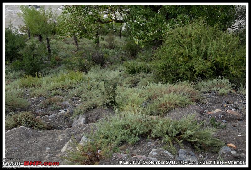

|
3rd March 2012, 16:48
| #1850 |
| Senior - BHPian Join Date: Sep 2008 Location: Bangalore
Posts: 6,552
Thanked: 16,425 Times
| |
|
| (2)
Thanks
|


|
3rd March 2012, 16:55
| #1851 |
| Senior - BHPian Join Date: Sep 2008 Location: Bangalore
Posts: 6,552
Thanked: 16,425 Times
| |
|
| (3)
Thanks
|


|
3rd March 2012, 17:00
| #1852 |
| Senior - BHPian Join Date: Sep 2008 Location: Bangalore
Posts: 6,552
Thanked: 16,425 Times
| |
|
| (5)
Thanks
|


|
4th March 2012, 12:12
| #1853 |
| Senior - BHPian Join Date: Jun 2008 Location: MH-02-India-Bombay-Bandra
Posts: 1,562
Thanked: 446 Times
| |
|
| (1)
Thanks
|
|
5th March 2012, 14:33
| #1854 |
| Newbie Join Date: Sep 2011 Location: Mumbai
Posts: 4
Thanked: 9 Times
| |
|
| (3)
Thanks
|
|
6th March 2012, 17:00
| #1855 |
| Senior - BHPian Join Date: Nov 2006 Location: Mumbai
Posts: 7,369
Thanked: 3,455 Times
| |
|
| (4)
Thanks
|
|
7th March 2012, 15:19
| #1856 |
| Senior - BHPian Join Date: Nov 2006 Location: Mumbai
Posts: 7,369
Thanked: 3,455 Times
| |
|
| (6)
Thanks
|


| |
|
8th March 2012, 10:05
| #1857 |
| Senior - BHPian Join Date: Nov 2006 Location: Mumbai
Posts: 7,369
Thanked: 3,455 Times
| |
|
| (4)
Thanks
|
|
8th March 2012, 17:14
| #1858 |
| BHPian | |
|
| (1)
Thanks
|
|
8th March 2012, 18:11
| #1859 |
| Senior - BHPian Join Date: Nov 2006 Location: Mumbai
Posts: 7,369
Thanked: 3,455 Times
| |
|
| (2)
Thanks
|


|
8th March 2012, 18:27
| #1860 |
| BHPian | |
|
|
 |
Most Viewed