| |||||||

| Search Forums |
| Advanced Search |
| Go to Page... |
 |
| Search this Thread |  30,671 views |
 20th October 2013, 20:25
| #1 |
| Distinguished - BHPian  | Wanderlust Traveller - Call of the Hills: Munnar, Thekkady & Idukki  It is more than a month since our Hampi trip and travel bug is biting again. When? : Oct 2, a Wednesday. We decide to take leave for two days (Oct 3 & 4) so that along with weekend we get a break of 5 days. With Whom? : Now this usually is the toughest one. You would have planned to visit a place with your friends, now you have leave and they don't, it is a dilemma if to go without them or to wait till all get leave. Prior experience says waiting for all to get leave is a never ending proposition. So it was just myself and wife, problem solved. Where? : We were having two locations in mind. First was to a trip to Pondichery. However we felt 5 days will be too long for a Pondichery plan, guess 3 days will be sufficient. The other plan was to visit Thekkady & Munnar. This was planned last year along with an Idukki trip for friends marriage. However for some reason we had to drop the trip last year. Since Munnar & Thekkady will need more than 3 days we decided to go ahead with this. Stay: There are multiple staying options for varied budget in both Thekkady and Munnar. For Thekkady we wanted a place near to boating, hence we booked at KTDC Periyar house. Booking was done online through their portal . For Munnar we booked a homestay based on tripadvisor reviews. Rheinberg Day1: Oct 2 - Route: Bangalore - Hosur - Krishnagiri - Karur - Dindigul- Theni - Thekkady - 511 Kms : Route We start off from our home near Marathahalli at 3.30 AM, for a change Attibele toll booth was empty. We usually have to wait for 10-15 mins even if we start at 04.00 AM at this toll booth. Even road towards Hosur is empty. We take Hosur - Krishnagiri - Salem - Karur route. With a ten minute break at Thoppur, we are able to reach Karur by 07:30 AM. At Karur we check Arunachalam hotel as suggested by TBHPians, however we find the hotel closed and on checking found that it opens only for Lunch. Empty roads thanks to an early morning start  We tank up at HP COCO bunk next to second down ramp of Karur over pass and continue our search for a hotel to have breakfast. Strangely that bunk is not present in Google maps, however the bunk is located here We stop at couple of places for breakfast but decided not to have food from there since all of them were shabby. Finally found this place on opposite side of road. This is located next to a BP bunk, there is a break in median about half KM before and after this place, hence taking U turn to get over to other side is not an issue. It is a clean place and we decide to have breakfast over here. This place also is not mentioned in Google Maps, however the location is near to this. Reached the hotel around 08.00 AM and started after breakfast at 08:30 AM.  We reach Dindigul around 09.15 AM and take NH 45 towards Batalagundu. You need to take the service road on left and go below overpass on NH 7 and take right. Road condition is good overall though there is ongoing road work in between. Road passes through lush green fields, a proof of good monsoon this year. 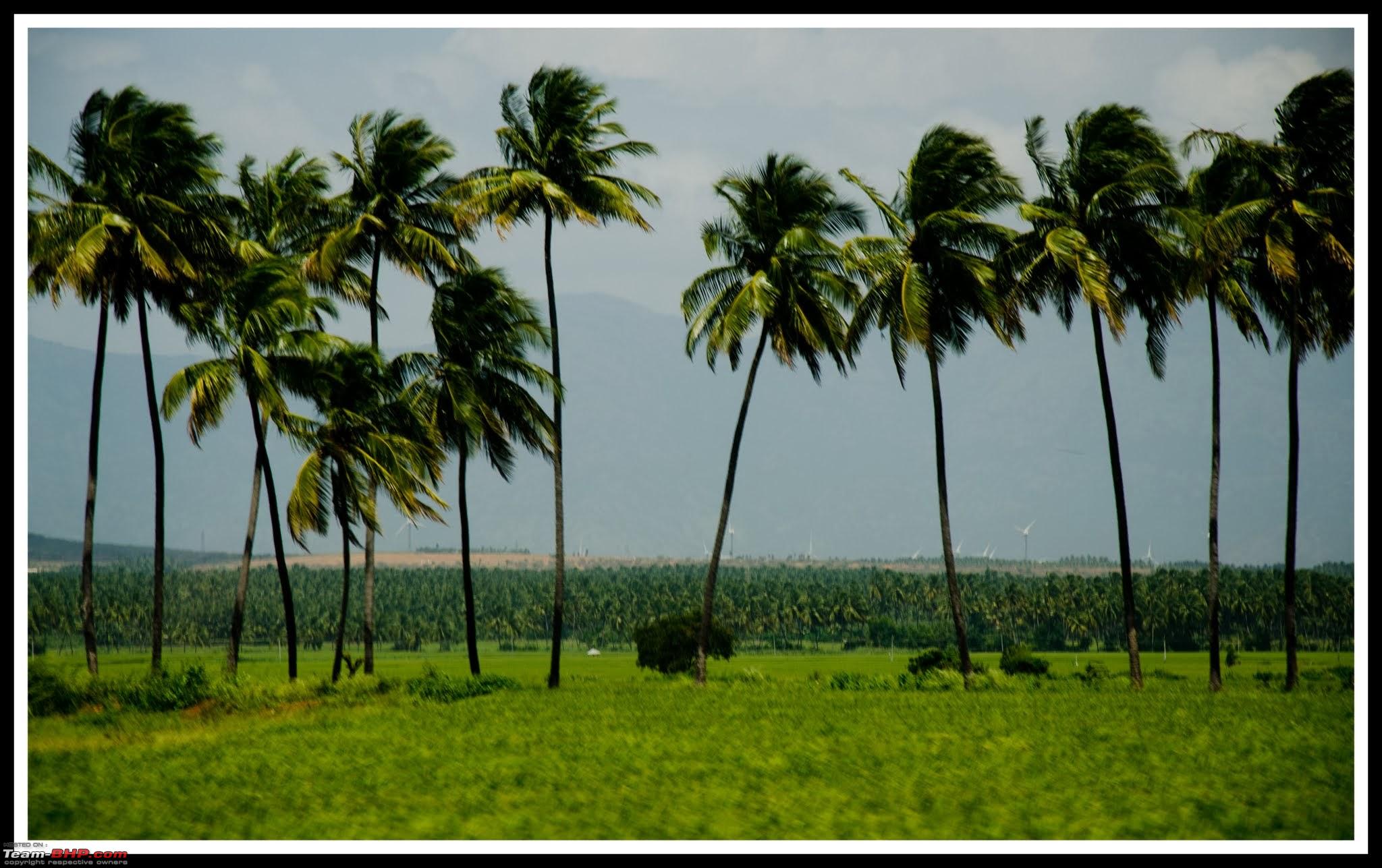    We reach 500 Km mark for the day, one pointer for driving on roads in TN is to keep the speeds low no matter how inviting the roads are. TN roads comparatively has more two wheeler's, keeping a safe distance from them is advisable.  We come across another TBHPian  Once we cross Cumbum and Periyar power station Ghat section starts  We cross over to Kerala soon after and take left towards Thekkady from Kumily. Thekkady KTDC hotel is located inside Periyar tiger reserve, hence you need to pay entry fees of Rs 25 per head and Rs 50 per car. Entry to reserve is restricted between 06:00 PM to 06:00 AM. There are three hotels located inside the reserve area, all owned by KTDC. KTDC Periyar house (where we stayed) & KTDC Aranya Nivas both of which are located next to each other. There is sufficient parking space in both the hotels. The third hotel is KTDC Lake Palace, which is located next to the reservoir in which boating is conducted, this is an upmarket property and you need to take boat to reach there. KTDC Periyar house   Hotel is suitable for those looking for clean basic accommodation near to boating area. Another advantage on taking any KTDC hotels is that you can book boating tickets through your hotel reception since boating is conducted by KTDC. It will be done at no extra charge, you will have to give a form with your name, address contact details and preferred boating time. This saves you from waiting at boating ticket counter since tickets gets sold out during weekends and holidays soon. Room   We have lunch and take rest for a while, we had booked for the last boat ride of the day which is at 03.30 PM. It is advisable to take either the first or last boat rides since animals come for having water around that time, hence chances of sighting are more. We collect our tickets from reception at 02.40 PM, since boating area is nearby to hotel, we decide to walk to the boat jetty. Thekkady boating parking area -  Boating booking counter -  There are trekking packages conducted by forest department, information of the same -  Boating counter is a newly constructed building with a gift shop and place for tourists to wait till boating starts. Camera tickets has to be purchased separately (Rs 25). Previously when I had visited Thekkady (~2003) there was only a single room ticket counter. There were no seat numbers assigned those days and passengers were left to roam around the deck of the boat as per their wish. Bigger boats are double decker ones and since higher deck gives a panoramic view of the forest, this was the popular seat. However after the 2009 Boat disaster things have changed for better. Nowadays seat numbers are mentioned on tickets and you are required to wear life jackets compulsorily. The ill-fated boat can still be seen near the boat jetty. There were four boats which was starting at same time, though your boat name and seat number is mentioned on your ticket (meaning no advantage in pushing ahead of the queue), people were pushing and shouting at each other. View of boat jetty from booking counter -  Thanks to KTDC we have got upper deck seats. Boats starting off one after another - 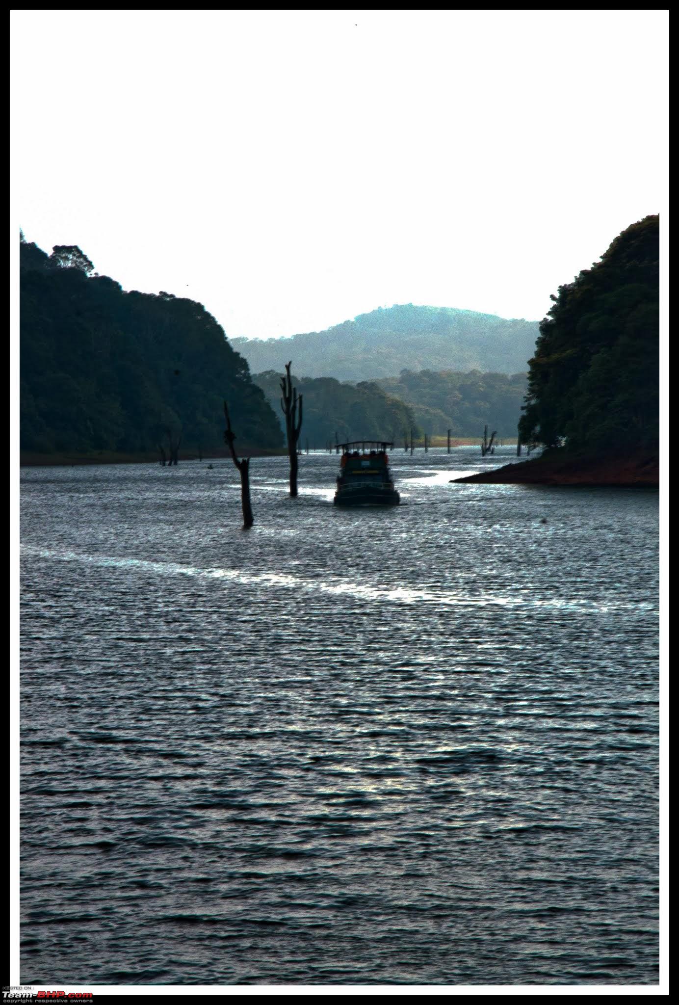 We can see KTDC Lake palace hotel on another shore, there was couple of people on its lawns watching wildlife grazing on grass land below.  Soon we come across a herd of elephants which had come to drink water. Also we were able to spot herds of Spotted and Sambar deer. Elephants are not happy to see the boats approaching, may be since there is a calf in the herd. They take off and hide inside the forest. The boat goes towards Mullaperiyar Dam and turns around and backtracks the path. We spot the same herd of elephants and deer on way back too. We are back on land by 05:15 PM.    There is nothing much to do in Thekkady apart from boating, we walk back to the hotel enjoying the view of forest and have an early dinner. Food is average at hotel. Felt they tried changing Kerala food for a national taste and ended up loosing the plot. Route taken for first day.  Route 1 stats : Start time : 3.30 AM Krishnagiri toll : 04.48 AM Thopur toll: 05:40 AM Omalur toll : 06:10 AM Rasampalayam, Namakkal : 07:10 AM Hotel Arunachalam, Karur : 07:30 AM Valluvar Family restaurant: 08:00 AM - 08:30 AM Velanchet toll (Tiyur): 08:45 AM Dindigul turn off towards Theni : 09:15 AM Theni: 10:30 AM Periyar house, Thekkady : 12:20 PM Total KM's : 511 Last edited by mpksuhas : 24th October 2013 at 23:21. |

|  (12)
Thanks (12)
Thanks
 |
| The following 12 BHPians Thank mpksuhas for this useful post: | aeroamit, andyonwheels, dailydriver, GTO, gurha, JoseVijay, nilanjanray, Ponbaarathi, predatorwheelz, samm, sdp1975, vb-saan |
| |
|
21st October 2013, 23:06
| #2 |
| Distinguished - BHPian | Day2 - Thekkady - Idukki dam - Munnar We have breakfast from hotel, check out and start around 10.20 AM. We had planned of visiting Idukki dam on way to Munnar. Idukki Dam Arch dam in Idukki is said to be third tallest arch dam in the world. Every year for one month each following Onam and Christmas, dam is opened for tourists. Luckily for us our trip coincided with this tourist season, however camera and other electronic equipment are prohibited inside the dam area. We reach Idukki Dam after a drive of 2 hours (57 KMs). Though it is noon time visibility is bad around dam area due to mist.  We park near Idukki dam, get the ticket and walk around dam area. It takes us around 1.5 hours to walk and see both Arch dam and Cheruthony dam.  Since arch dam does not have a spill way it is possible to stand near bottom of the dam. We drive down near to bottom of dam. If anyone is visiting dam while tourists are not allowed, it will be best to go to this location and see the dam from nearby. By taking this road you can drive till the gate of the dam. Since photography is banned inside dam area, there are no pics of this architectural marvel. There is a newly constructed park nearby from where you can get good view of the dam. We stop there for a while and get some pics.  It is past 03.00 PM and late for lunch, we will have to go towards Idukki town for taking lunch. However as per our plan we should be half way to Munnar by now. Since we wanted to be at Munnar before 04.30 PM we decide to skip lunch. We usually carry small stock of food items in car, which we dig in to while we start off to Munnar. Idukki - Munnar is around 55 KMs via Chitrapuram route, the other widely suggested route (via Kattapana) is around 107 KMs. My parents had taken Chitrapuram route before rains and had said the roads were good. We decide to try this route to save time. This road passes through scenic locations, however road conditions have deteriorated very badly after rains and we take around 2.5 hours to cover this 50 odd KM's. Beautiful scenery on way  A small power station next to road  Small streams en route -  We join NH 49 near 2nd Mile (its a place name) junction which is around 9 Kms before Munnar near Pallivasal. The NH is in worse condition than SH, which means the final 9 KM's take half hour. View suddenly changes once you cross Pallivasal, we have reached Munnar -  Munnar Our initial plan was to visit Kathakalli centre near Pallivasal while driving down to Munnar, this was the reason we wanted to start from Idukki early. They have shows daily at 05.00 PM, since we are late we decide to come back for the same next day. Munnar CSI Church However we decide to visit CSI church which is en-route. This Church which was constructed in 1910 is located next to main road as you are reaching Munnar town. However unless you are on lookout for the place there is a good chance of missing it. You need to look for Sujatha Inn which is on left side while driving down to Munnar from Cochin side, just before the hotel compound there is a small lane which take you to the Church, located on a plot above the hill slope next to Sujatha Inn. You can find the location of church on Google Map here Every tourist place has some locations which are ignored by tourists, in Munnar those are CSI church and Muniyara ( which we visit on our last day). Apart from the caretaker the church is empty.   Windows of church is made of etched glass, sadly time has taken its toll and most of the glass windows are broken, though some of the windows are repaired I guess workmanship is not matching the original ones. Photography is allowed inside the church, however we decide against switching on the flash since it is a place of worship.  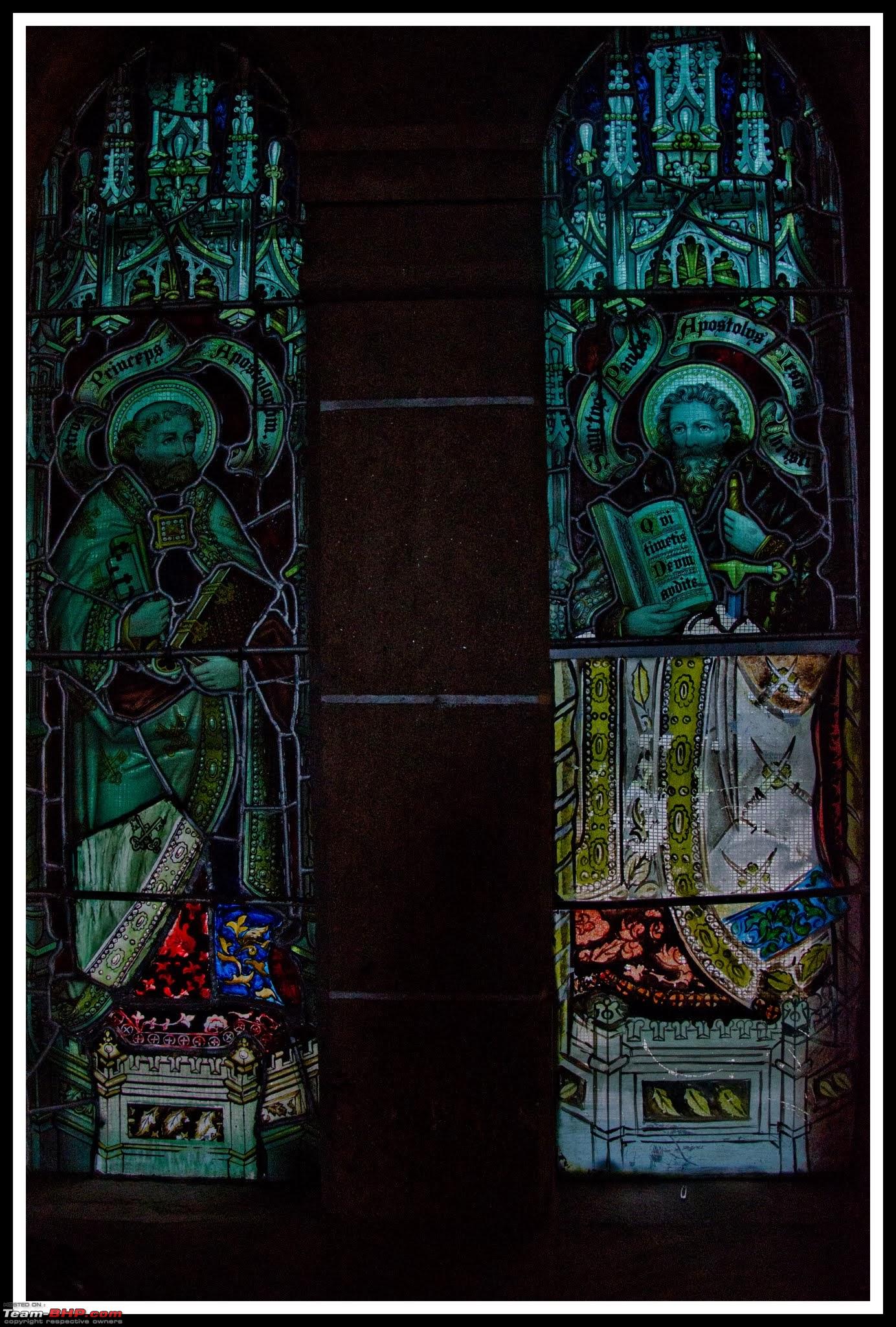 There is a cemetery further ahead of the hill where the wife of British officer who build this church is buried. Legend has it that she died of Malaria which was prevalent in that area then. The British officer after this started growing a plant all over Munnar which has a brightly colored flower, smell of which acts like a mosquito repellent. I am not sure how much this story is true, however during our stay we found Munnar to be comparatively free of mosquitoes. We are not sure if to thank the British officer or our home-stay owner for that. We decide against climbing the hill towards the cemetery since its getting dark and the path is overgrown. Once we finish seeing the church we head to our home-stay. We are able to locate it without much issues. Since home-stay does not have parking, we are required to park at nearby Mount Caramel church compound. Parking is safe and there is a security guard also present. There are two walkways to the homestay. First one is next to Mount Caramel church parking, this is an unpaved path narrow foot path. However this is the shortest (~ 100mts). The other path is the road next to Saravana Bhavan restaurant, this is a famous landmark in Munnar which serves good vegetarian food. You need to take the concrete path next to the restaurant and walk for around 300 meters. This path is very steep and by time you reach home-stay you are out of breath. This route can be taken in car also. However there is parking space for only one car in home-stay which is used by the owner. Outside view of the home-stay, the concrete road on left is what mentioned by me-  Home-stay has three differently themed rooms, our room was bamboo themed which was supposed to be the most expensive. However we found the other room colors more appealing. Apart from this cosmetic issue we found the rooms good in all other aspects. Bedroom  Toilet  The biggest advantage of this home-stay is that it is very near to town center, hence food and shopping options are plenty. We rest for a while and then head off to Saravana Bhavan for dinner. Route taken for the day Day Stats: Start time 10.20 AM Idukki Dam 12.20 PM Start from Idukki dam 1.50 PM Start from Idukki dam view point 3.05 PM Munnar CSI church 5.50 PM Total KM's - 118 Last edited by mpksuhas : 24th October 2013 at 23:32. |
|
| (8)
Thanks
|
| The following 8 BHPians Thank mpksuhas for this useful post: | aeroamit, ankan.m.blr, GTO, gurha, josejoseph, JoseVijay, samm, vb-saan |
|
22nd October 2013, 10:54
| #3 |
| Distinguished - BHPian | Day 3: Eravikulam National park - Tea museum- Punarjani village Kathakalli show Though the home-stay does not have a kitchen, they will deliver food you order from Saravana Bhavan. We have an early breakfast and start off to Eravikulam National Park. Eravikulam National Park (Rajamala) Eravikulam national park (Rajamala) was around 8 KM's from our home-stay next to Munnar - Chinnar - Udumelpetai road. This park established in 1978 has the highest peak in India outside the Himalayan range - Anamudi (2695 Mts). This is the habitat of Nilgiri Thar, a mountain goat which is a highly endangered species. As per current estimates only around 2000 of these animals remain. We were advised by many to reach there early. And also to plan the trip to National park on a weekday, else we were warned about ending up in an endless queue for bus. I have heard about people waiting 3 hours in queue, since this not a way we want to spend our vacation we reach early at ticket counter. Luckily there is no much crowd. Private vehicles are banned inside the national park, so we park the car near reception area and queue up for tickets. There is sufficient car parking available. Ticket counter is in the building on right, once you get the tickets mini -buses as seen takes you to national park.  Ticket rates  Bus takes a winding road through park surrounded by tea plantation. The ride takes around 20 minutes at end of which we are dropped off near an information center which has details about the national park and a photo gallery. Gallery at bus drop off point  Information about national park  A picture in the gallery caught my eye, this may be bit graphic for the forum but the text above; a quote of our first prime mister Jawaharlal Nehru I feel is worth sharing.  We need to walk up the winding road for around 1 KM which passes through Thar's grazing area. How far you want to walk is purely based on your interest since Thar's are seen roaming even at the bus drop off point. However the top of the road gives a good view of hills around.   View of bus drop off area from top, the building on right bottom is the drop off area with gallery  The park area has lots of Kurunji plants which blooms only once in 12 years  We then come across many herds of Thar 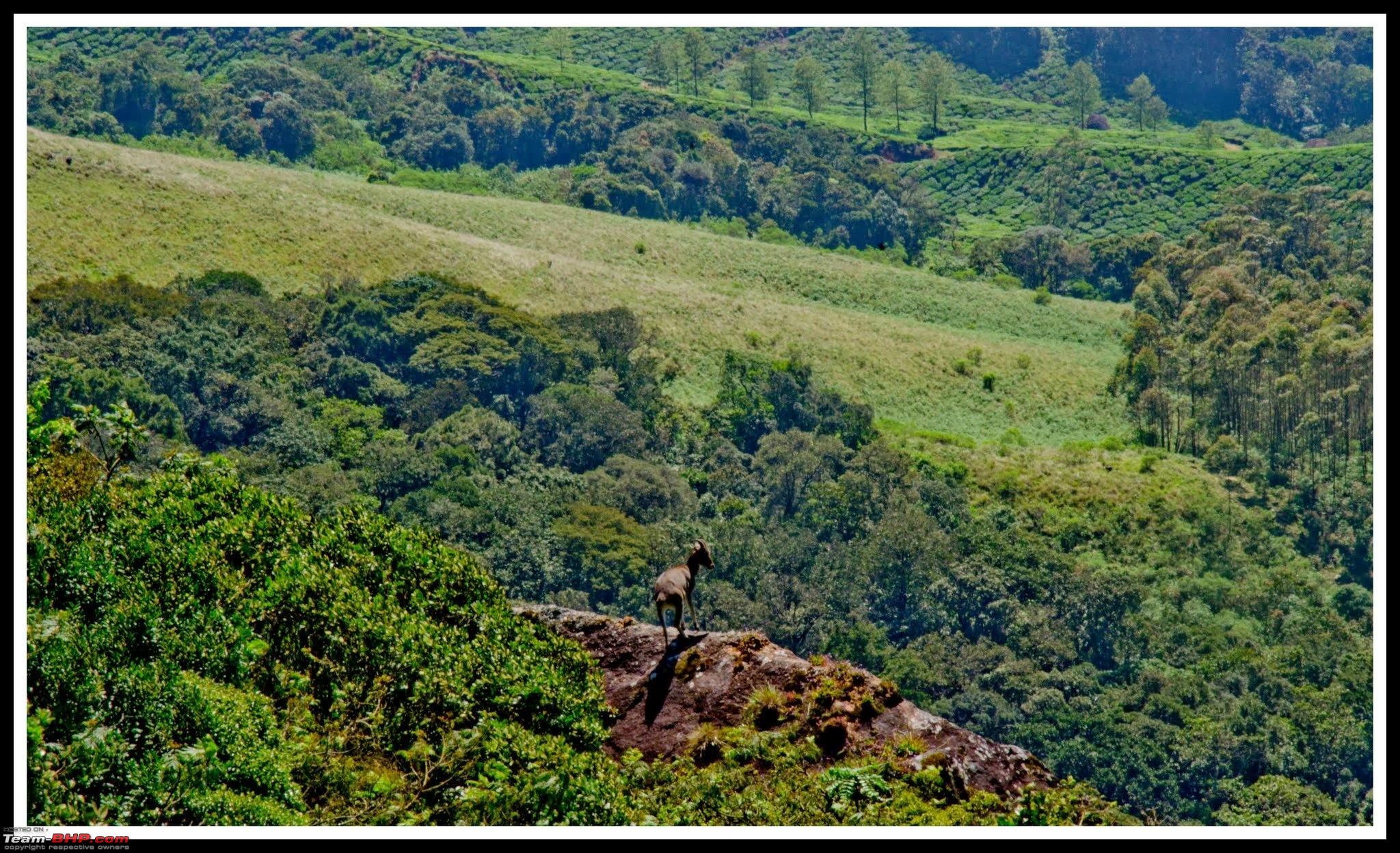     We return to bus drop off area, since crowd is only building up we get the return bus without any delay. Tea Museum We reach back at parking counter and start off to tea museum. Tea museum is on way from Munnar to Eravikulam national park. Museum has a video show about the history of plantation in Munna. Also it is possible to see working of tea factory. Once you enter the museum we are guided to a place where freshly plucked leaves is dried, a gentleman from museum comes to explain the tea powder making process. However we felt the emphasis here was more about different types of tea and how to make a cup of tea rather than how a factory works. Anyways we roam around the factory, we meet a factory worker Mr Murugan who explains different steps in tea processing to us. Tea museum  Ticket counter  Plucked tea leaves left to dry in hot steam  Tea factory  Mr Murugan who explained us the process  Tea leaf in different stages of processing before tea powder is made  There is a counter inside the museum which sells different products made by Kannan Devan plantations. We know of another outlet of theirs near Munnar town so decide against shopping in museum and instead head to sales outlet in the town. Anyone going to Munnar and planning of buying tea products it is best to visit this place rather than the numerous shops which are present all across the town. Factory outlet is located here, they sell chocolates, jams and different types of oil along with varied tea products. Kannan Devan outlet  Kathakalli Perfomance Once shopping is done we have lunch and take rest at home-stay for a while. We have planned to go visit Kathakalli perfomance in the evening. There are two centers in Munnar which conducts the performance, the first one is near to Munnar town and the another one around 9 Kms from town center towards Adimali route on NH 49. However on checking with our home-stay owner he suggested to visit the center on Adimali route. The place name is Punarjani. They have Kathakalli shows daily at 05.00 PM and Kalaripayattu (Martial arts) at 06.00 PM. Punarjani center is located next to NH 49 (Yes the road in pic is an NH)  Ticket rates for each show is Rs 200 and camera charges are a steep 100. We reach the place around 04.15 PM since it is possible to see the elaborate make up for Kathakalli performance. There are two separate stages for each performance, this stage is for martial arts.  Elaborate makeup    Since we are early most seats are empty. By show time most of the seats were full.   Last edited by mpksuhas : 27th October 2013 at 15:01. |
|
| (7)
Thanks
|
| The following 7 BHPians Thank mpksuhas for this useful post: | aeroamit, GTO, gurha, josejoseph, JoseVijay, Ponbaarathi, vb-saan |
|
22nd October 2013, 23:13
| #4 |
| Distinguished - BHPian | Day 3: Ctd Unlike in traditional Kathakalli makeup where thick cloth is used, artists are using plastic bags in makeup.   Once make up is completed an artist comes and explains the different expressions used in Kathakalli. Artists does not speak during any Kathakalli performance, they convey a story with help of actions. A commentator explains each actions and the story which is to be presented on the day.     The performance gets over by around 06.00 PM, we don't stay for martial arts performance and return to home-stay. Day 3 Stats: Munnar - Eravikulam - 8KM Eravikulam - Tea Museum - 9KM Munnar - Punarjani - 8.7KM End of day 3 Day 4 Mattupatti Dam - Kundla Dam - Top station Since it is a weekend we start off early. We had planned to return from Top Station, have lunch at Munnar and then roam around the town on foot in evening. We plan on having only short stops at Mattupatti dam and Kundala dam since we were not keen on boating. We wanted to spend most time at top station enjoying the view. The road from Munnar to Top station does not have any deviations and both Mattupatti and Kundala dam are on the way. Mattupatti Dam While driving from Munnar the road passes over the dam, we cross the dam and enjoy the scenery for a while.  Since its early morning work is just starting up  Echo Point We proceed towards Echo point which is around 5 Kms from Mattupatti dam enroute Kundala dam. The road towards Kundala dam passes along side the reservoir created by Mattupatti dam. Echo point is a location en-route standing where you can hear your echo from across the reservoir. During my last visit to Munnar I had been to this place and remember it as an empty stretch of land next to reservoir, this time I was in for a shock since the whole place is filled with makeshift shops ruining the beauty of the place. I guess leave alone your echo, you can not hear your own voice in that crowd. Instead of stopping there we drive down for few hundred meters and come across this place. 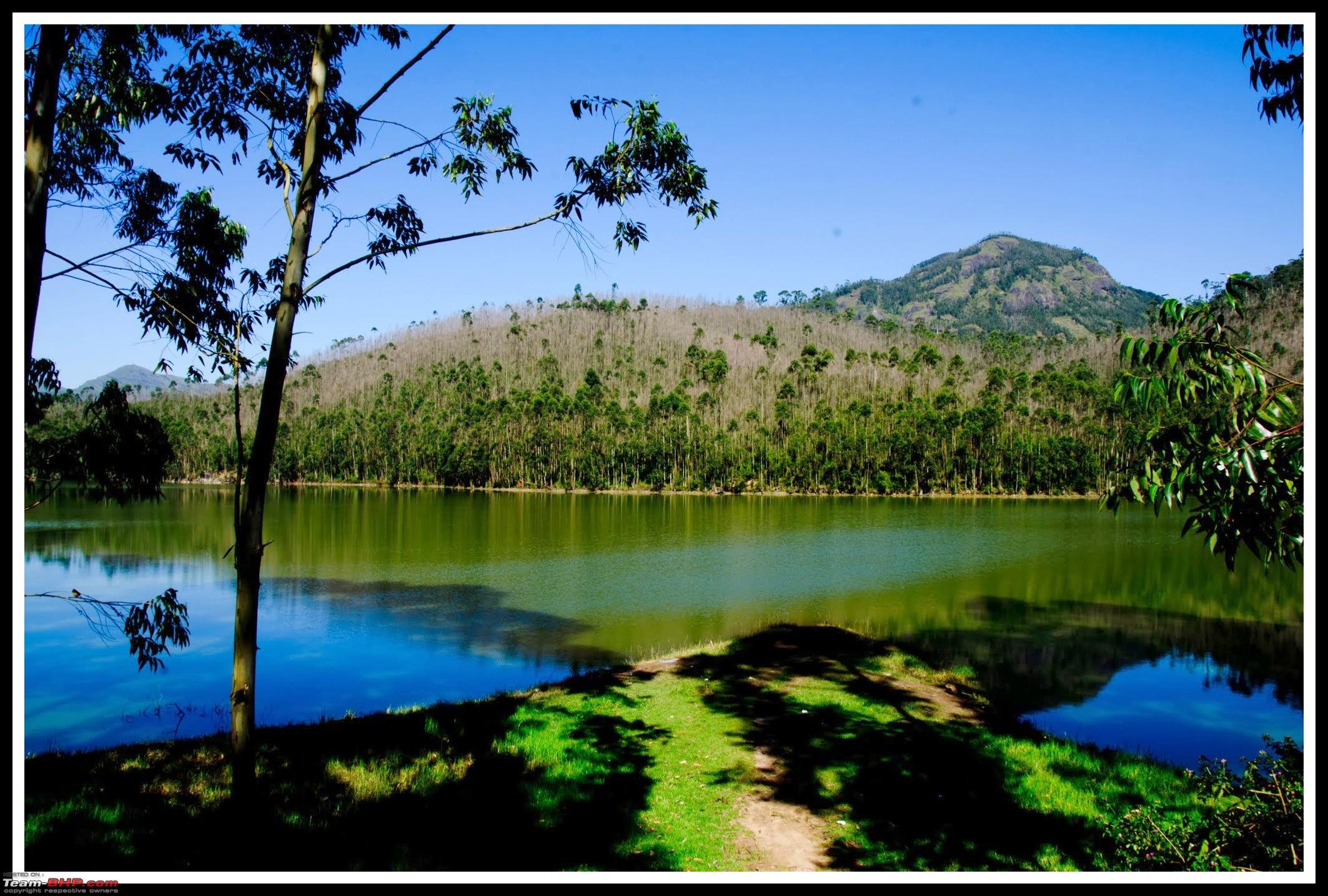  The trees visible across the reservoir are planted by Kannan Devan plantations for meeting their timber requirement. They cut the trees once in a while and re-plant the same, during that time as per locals you will not be able to hear any echo. Further ahead the road we come across pastures of Kerala Livestock development board, this institute is commonly referred to as Indo-Swiss project.  It was earlier possible for tourists to visit the institute, however nowadays visitor entry is banned. We look across the pastures to see if it is possible to catch a glimpse of the Swiss- Cows, as per those who has seen the cows " they look like baby elephants". And we are able to spot something, but it is not cow. It is an adult elephant   Elephants graze in this route on way to have water from Mattupatti dam, however thanks to tourism water in dam is getting polluted. Due to which elephants have started drinking water from Indo-Swiss project complex. This was a lone bull elephant, there is an elephant herd also which roams in that area, though we were not able to spot them. Kundala dam We drive further towards Kundala dam. Dam comes on the left side of the road, you need to take a detour of around 200 meters and drive over the dam to reach the boating area. For those interested in boating, you can rent pedal boats and shikara's here. I guess this is a better location compared to Mattupatti dam for boating.   No other tourists had arrived apart from us, hence we were able to enjoy the beauty of the place in peace.  There are many shops nearby, which sells showpieces made of wood. Do note that the deviation from Top station road towards Kundala dam is broken, if you are not careful you may end up scratching under-body of the car (I did). Top station We drive towards Top Station. This road is mapped as Top Station road in Google Maps. Further ahead of Top station this road goes to Vattavada Village. As OTR enthusiasts will be knowing there is a Jeep road from here to Kodaikannal across KL - TN boarder through forest, there was an OTR event conducted here in 2009. I had read it on internet that Kodaikanal is only ~35 KM's through this road. There was a travelogue (not on TBHP) by a cyclist, who had done this route on cycle over 2 days. Currently this road is closed on both KL & TN side, however KL tourism department conducts trekking through this forest. Prior to the road being closed down, there are few TBHPian's who had taken this path to Kodaikanal (Including HVK on his bike). I had checked the condition of the route from locals in Top Station and as per them even Jeeps can not travel through this route now due to bad road condition. Munnar to Top station route used have India's first mono rail, which was used in transporting tea products from Top station towards Munnar. This was infact a cart on mono rail, pulled by cattle. Later on it was converted to narrow gauge railway powered by steam locomotive. However floods of 1924 swept away the railway and it was never re-built. You need to take right at this junction, left takes you to KL-TN border and Vattavada village.  Though Munnar is in Kerala, top station comes under Tamil Nadu.  There are no specific parking area, however getting parking space is not an issue since this road ends at Top Station entry.  You need to walk through this mud road to reach the hill, just ahead of this gate on the left side you can see the remains of Munnar - Top station railway. Should say there is nothing much apart from concrete floor and couple of feet high brick which is left now.  There are lots of shops on way which sell snacks and cool drinks, very much required if you visit on a sunny day!  Ticket counter to Top Station view point.  View point is located on a private property, proceeds of the tickets goes to them. Once you pass the ticket counter there is a flight of steps to take. Ticket counter is actually on higher ground, view point strangely is quite way down. During my previous Munnar trip, place mentioned as view point was at the place where ticket counter exists now and well, there was no ticket counter then.   View point visible far below   View around  We start back from the Top station. Around a kilometer from the top station we find this view point. I felt the view was almost equal to Top Station.   The high point of the trip for me was the drive from Munnar to Top station. Superb winding road, minimal traffic and beautiful views around.   Last edited by mpksuhas : 27th October 2013 at 15:22. |
|
| (4)
Thanks
|
| The following 4 BHPians Thank mpksuhas for this useful post: | aeroamit, GTO, JoseVijay, vb-saan |
|
23rd October 2013, 22:19
| #5 |
| Distinguished - BHPian | Day 4 ctd & Day 5 - Lakkom Falls, Marayoor & drive back Day 4 ctd. Top station - Munnar road view     We reach back home-stay around 1.30 PM and have lunch. Since we don't have any specific plans for the evening, we roam around town on foot. Day 4 Stat: Munnar - Mattupatti - 11 KM Mattupatti - EchoPoint - 6 KM Echo Point - Kundala dam - 7 KM Kundala dam - Top station - 11.4 KM Day 5 Lakkom waterfall- Marayoor Muniyara- Udumalpetta - Avinashi- Salem - Bangalore Its last day of our trip, we wanted to reach Bangalore before it is dark since I was not keen on taking NH 7 - Krishnagiri - Bangalore route after dark due to ongoing road work and weekend traffic. We check out and start at 8.40 AM from our home-stay. I have petrol take till BP COCO near Avinashi, well on second thought I may not. With an unfamiliar ghat road ahead I decide to fill up for Rs 1000 from Munnar. It is around 08.50 AM now and we start off towards Lakkam falls. We drive past Eravikulam national park entry point and reach Lakkom at 09:35 AM Lakkom Falls Lakkom falls is right next to the Munnar - Udumelpetai highway Road as seen from falls    Falls as seen from road     There is a tourist information center and restrooms next to the falls. Dolmens of Marayoor (Muniyara) Our next destination was Muniyara. Muniyara or dolmens are located near Marayoor town just before Chinnar wildlife sanctuary. While coming from Munnar, just as you cross Marayoor town you reach a junction with an IOC bunk on the left side. You should take the road going to right from here (Kanthaloor road) and proceed around 2.5 KM's. Junction from which we take right towards Kanthaloor road  We drive around 2.5 KM's on this road and find this sign board on left.  Dolmens are located on a hill around 200 meters from Marayoor Kanthaloor road. Drive down that road and you are greeted by this board.  We reach at end of the road and walk towards top of the hill. It is a dirt track of around 200 meters. The exact location of Dolmens is not present in Google Maps, however I guess it is around here Locals know the place as Muniyara, in case you are not sure of the place they will guide you. It is possible to drive the vehicle till the top of the hill, however the path is bit rough with stones lying around. I decide against the same (Did not want to spoil my new Michelin's  ) . My parents who visited the place in a Scorpio had driven to the top of the hill. ) . My parents who visited the place in a Scorpio had driven to the top of the hill.Once you reach the top, there are Dolmens all around.  Some of the bigger Dolmens are fenced  View from the hill is breathtaking.  Death surrounds you, but the scenery is to die for.   Though the view is great we are unable to enjoy it for long due to hot sun. We start off towards Chinnar Wildlife sanctuary. Kerala Forest department conducts trekking through the forest. There are different trek packages differentiated based on distance of trek.  We reach Kerala border, they note down the vehicle details and let us through. Chinnar forest department office is next to this.  It seems Good bye is straight ahead  Do note that the surface of road all through the forest is good. However the road is narrow at most of the places, meaning if any vehicle comes in opposite direction you should be careful. To add to this saw that the Forest department jeeps were driven rashly.  Forest continues on TN side also till the plains. There is a check post at start of plain also. We take the Udumelpetta - Palladam route towards Avinashi. Road is in great condition with windmills on both sides  There is flyover construction going on just before Udumelpetta and Avinashi. Deviation at Avinashi requires bit off roading.  Soon we reach Avinashi bye-pass. Work on bye-pass is not completely done with traffic plying on both direction on both carriageway.  We come across what looks like a head on collision  However lessons are not learnt  We stop over over at Saravana Bhavan after Vaikundam toll booth for lunch. Food was good and service fast, an alternative hotel on this route is Annapoorna Hotel near Perundurai. Once lunch was over we crossed Salem in no time since traffic was thin We stop over at BP COCO at Thoppur where we see this TBHP stickered Swift.  Last edited by mpksuhas : 27th October 2013 at 16:17. |
|
| (5)
Thanks
|
| The following 5 BHPians Thank mpksuhas for this useful post: | aeroamit, ankan.m.blr, GTO, JoseVijay, vb-saan |
|
24th October 2013, 22:24
| #6 |
| Distinguished - BHPian | Day 5 Ctd - Return to Bangalore As we near Krishnagiri it becomes cloudy  And soon it starts to rain  Though it is a weekend thankfully traffic between Krishnagiri - Bangalore route is only building up. We cross Electronics city BETL toll at 06.50 PM Route taken  Day 5 Stats: Munnar Start -08.40 AM - 0 KM Lakkom water fall -09.35 AM to 09.55 AM - 24 KM Muniyara, Marayoor - 10.45 AM - 11.00 AM - 21 KM Chinnar check post - 11.40 AM - 19 KM Udumelpetta - 12.15 PM - 27 KM Palladam - 01.10 PM - 50KM Avinashi Bye pass - 01.45 PM - 24 KM Saravana Bhavan Vaikundam - 03.00 PM - 03.30 PM - 92 KM Thoppur Toll - 04.40 PM - 75 KM Krishnagiri Toll - 05.40 PM - 64 KM Attibele Toll - 06.35 PM - 55 KM Electronic city toll (BETL) - 06.50 PM - 13 KM Marthahalli - 07.30 PM - 20 KM Total KM's - 484 KM Total KM's covered during trip over 5 days - 1223 KM Epilogue
Last edited by mpksuhas : 27th October 2013 at 21:11. |
|
| (15)
Thanks
|
| The following 15 BHPians Thank mpksuhas for this useful post: | aeroamit, ampere, andyonwheels, ankan.m.blr, Ddrive, GTO, gurha, InControl, JoseVijay, mallumowgli, motomaverick, samm, sayakc, vb-saan, VLOCT |
|
28th October 2013, 18:32
| #7 |
| Team-BHP Support  | Re: Wanderlust Traveller - Call of the Hills: Munnar, Thekkady & Idukki Thread moved from the Assembly Line to Travelogues. Thanks for sharing! |
|
| ()
Thanks
|
|
28th October 2013, 23:03
| #8 |
| Team-BHP Support | Re: Wanderlust Traveller - Call of the Hills: Munnar, Thekkady & Idukki That was quick and fast. Do they allow to take snaps of Idukki dam on the other side where contains the water? |
|
| (1)
Thanks
|
| The following BHPian Thanks ampere for this useful post: | mpksuhas |
|
29th October 2013, 19:42
| #9 |
| BHPian Join Date: Jul 2010 Location: Bangalore
Posts: 173
Thanked: 729 Times
| Re: Wanderlust Traveller - Call of the Hills: Munnar, Thekkady & Idukki Nice informative TL. Btw, can you please let me know the rationale behind masking the number plates. Thanks. |
|
| (1)
Thanks
|
| The following BHPian Thanks RSUDARSANAN for this useful post: | mpksuhas |
|
30th October 2013, 08:31
| #10 |
| BHPian Join Date: May 2013 Location: KL-45/KA-51
Posts: 132
Thanked: 150 Times
| Re: Wanderlust Traveller - Call of the Hills: Munnar, Thekkady & Idukki Thanks a ton Suhas, Even though I am a Keralite haven't visited Thekkady So far :( ... Munnar had been there once. Thanks for the crisp and informative travelogue buddy. Would use this ( Your TL) as a ready reckoner when I venture out to the hills ,Thanks to you. |
|
| (1)
Thanks
|
| The following BHPian Thanks TheHkrish for this useful post: | mpksuhas |
|
30th October 2013, 15:11
| #11 |
| BHPian Join Date: Jun 2013 Location: Chennai
Posts: 254
Thanked: 534 Times
| Re: Wanderlust Traveller - Call of the Hills: Munnar, Thekkady & Idukki A superb travelogue this is. So many important details and inputs. You have covered the region elaborately without any rush or haste, and thats the way doing it. The photographs deserve applaudes. I liked snap #suh_9329, the boat approching the elephant. Cool. |
|
| (1)
Thanks
|
| The following BHPian Thanks Ddrive for this useful post: | mpksuhas |
| |
|
30th October 2013, 15:51
| #12 |
| BHPian Join Date: Apr 2011 Location: Madras/Bangalor
Posts: 131
Thanked: 93 Times
| Re: Wanderlust Traveller - Call of the Hills: Munnar, Thekkady & Idukki "There was a travelogue (not on TBHP) by a cyclist, who had done this route on cycle over 2 days." Ahem, if you are referring to this link, (http://shyamk.blogspot.com/2010/01/k...n-bicycle.html), then yes, that cyclist is yours truly. Shyam |
|
| (4)
Thanks
|
| The following 4 BHPians Thank shyamk for this useful post: | bschandramohan, mpksuhas, Ponbaarathi, searacer932 |
|
1st November 2013, 11:53
| #13 |
| BHPian Join Date: Jun 2011 Location: Bangalore
Posts: 234
Thanked: 155 Times
| Re: Wanderlust Traveller - Call of the Hills: Munnar, Thekkady & Idukki Great travelogue and fantastic pictures! I had been to Munnar a few times, but have been missing out on Idukki. The Idukki dam have been in my list for a while. This has given me quite some information for planning. Do they allow us on the dam, and the power station area? Last edited by samm : 1st November 2013 at 11:55. |
|
| (1)
Thanks
|
| The following BHPian Thanks samm for this useful post: | mpksuhas |
|
5th November 2013, 11:48
| #14 | ||||||
| Distinguished - BHPian | Re: Wanderlust Traveller - Call of the Hills: Munnar, Thekkady & Idukki Quote:
Quote:
It is not possible to take pictures from either Arch dam or Cheruthoni dam since camera / mobiles are not allowed inside. However you can get picture of reservoir of Cheruthoni dam from the boating area / park here . Cheruthoni dam will also be visible from there. It is not possible to get close up picture of arch dam from the road to top of dam since the road passes through a tunnel before the dam, you have to surrender your camera and mobile before that. The best option for getting picture of arch dam is to take the road below the dam, which ends in a police check post few hundred meters before the dam. This road is open on all days (unlike entry to dam which is restricted to two months during the year). Road is here , opposite to the ground in map. I guess entry to power station is fully stopped as of now, the last any person I know went to the power station was some 15 + years back. However power station is not near to dam but at Moolamattam which is around 40 Km's away. Quote:
Some members are not comfortable in sharing their detail over the forum and mask their rides number. Since I was sharing the picture of another member thought it was good to mask the number. Quote:
Quote:
Quote:
| ||||||
|
| (1)
Thanks
|

| The following BHPian Thanks mpksuhas for this useful post: | samm |
|
4th March 2014, 17:31
| #15 | ||||
| Distinguished - BHPian Join Date: Apr 2011 Location: KL-2/KL-7/GA-06
Posts: 1,109
Thanked: 4,346 Times
| Re: Wanderlust Traveller - Call of the Hills: Munnar, Thekkady & Idukki Quote:
However, I lost track and steam to check up the developments as promised due to my busy schedule which immediately followed. This afternoon, I was glancing through my thread and soon took the path to your thread. And boy!! what have I missed!!! I feel so miserable that I missed this thread for so long. Amazing pics dude. Especially of Topstation, Nilgiri Tahr and the Dolmens. I wasn't able to visit Rajamalai on my visits to Munnar nor was I able to travel till Marayoor. Looks like I need to make amends. And very soon at that Fantastic snaps once again Quote:
You did mention this on my thread too. Quote:
Same pinch Quote:
| ||||
|
| ()
Thanks
|
|