Team-BHP
(
https://www.team-bhp.com/forum/)
-
Travelogues
(
https://www.team-bhp.com/forum/travelogues/)
Bagsa district

Udalguri district which share border with both Bhutan and Arunachal

Nalbari tourist lodge NH 31 details card

Quote:
Originally Posted by hvkumar
(Post 2039644)
I have never been to Tura Caves. Planning to do so during my next trip. Tell me, is it possible to go further south from Tura, like the Google Maps shows or are those non-existent roads. I remember my friend from Shillong mentioning that when he visits Tura, he returns via NH37 and Guwahati.
And what is this Williamsnagar loop?
|
Sorry for the delay, but I normally log on at night.
From Tura one can go upto Dalu and Baghmara. I don't know the condition of the roads now.
Quickest route is GHY - NH37 - Krishnai Bypass - Paikan (did not know this tinali had a name till a few years ago!) - Tura.
The loop is NH51 - NH62. One can go from one to the other either at the Bangladesh border (Dalu - Baghmara) or cut across from Tura to Williamnagar. Williamnagar is just off NH62. Or maybe do a figure of 8. I have never been there, but the Tura W'Nagar 'road' had a reputation of being a carbreaker. I have no idea of the condition of NH62, and noone seems to know, which is what makes it interesting!
There is another road in that area (the original prepartition road which skirts the Meghalaya hills) which also I want to explore.
Quote:
Originally Posted by tortoiseNhare
(Post 2040168)
The route I had taken back in 1983 was a village road linking Baghmara (on NH152) with Bansbari Bazar via Ananda Bazar. I remember a small tea estate there too, just before the Manas entry point. If you go further north from Baghmara to Lakhibazar along NH152 there is a road to the left which presumably meets the one I was talking about. I am yet to explore that road. In fact those were extremist infested areas in the recent past. Now many of those extremists have surrendered and are themselves promoting tourism in the region.
|
Most of these names are foreign to me. Have to check them out. What about the river crossings?
Quote:
Originally Posted by San Phrangmung
(Post 2040653)
|
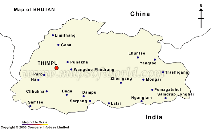
I have a better Bhutan map, but too large to post. It is a Bhutan Gov map, and should be available on the net somewhere.
Regards
Sutripta
Thanks, San, for the lovely district maps of Assam that you have uploaded.
I have a couple of detailed Bhutan maps that I will also scan an upload once I located them.
The Tura-Baghmara-Williamnagar "carbreaker" loop sounds exciting, definitely going to be in my itinerary when I travel to your region next! Any further info on this circuit is welcome. I think the intersection on Nh37 is Parkhan, not Paikan - that is what I noted in my log book when I went that way last year. The distance from Parkhan to Tura is 100 kms. My friend from Shillong reported that the road is in good condition.
Quote:
Originally Posted by hvkumar
(Post 2040952)
Thanks, San, for the lovely district maps of Assam that you have uploaded.
I have a couple of detailed Bhutan maps that I will also scan an upload once I located them.
The Tura-Baghmara-Williamnagar "carbreaker" loop sounds exciting, definitely going to be in my itinerary when I travel to your region next! Any further info on this circuit is welcome. I think the intersection on Nh37 is Parkhan, not Paikan - that is what I noted in my log book when I went that way last year. The distance from Parkhan to Tura is 100 kms. My friend from Shillong reported that the road is in good condition.
|
All these maps of Assam: better to treat these as sketch maps. If you are running parallel to the Brahmaputra, esp N. bank, it is very important to know which rivers are bridged, which are fjordable, and which will bring you to a dead stop. Also would be nice if these maps also showed the militant camps!
The reputed carbreaker is the short Tura - W'Nagar road. Don't know about the longer route (NH62).
Paikan/ Parkhan: will stop and ask next time!
Hope to see you soon.
Regards
Sutripta
Quote:
Originally Posted by Sutripta
(Post 2040938)
Most of these names are foreign to me. Have to check them out. What about the river crossings?
|
The names are of little known villages. I haven't checked whether they are tagged in Google Maps etc or not. As far as I can remember, we only had one major river crossing (of river Pahumara at Kathalmuri), over a wooden bridge. All the bridges in the interior roads of that region were later burnt to ashes by militants. I don't have the latest news whether those (and the roads) have been rebuilt or not.
Very nice pictures. I have been through Gangtok/Darjeeling but not beyond.
Need to plan some time. Thanks for sharing.
San, really nice pics and very good info. Thanks for sharing.
In the boards its mentioned as Paikan.

Thanks, San, for the correction! I will alter my log book also accordingly. Looks like I made a mistake when jotting down the details, I was whizzing past Paikan and alone!
I can understand, on return journeys its like we ain't got no time. I drive slow while going but on way back in a sporty mode.
Ther's a group of great bikers who have done the bad bad roads of Meghalaya, i will try to find there thread and give the link here.
Some adventerous guys like Mr Vijay Sonam (Working for planning dept govt of AP) of Arunachal has even done the trans Arunachal jungle trek on their Enfields. He's also been to WW II plane wreakage place & other remote treks and may be contacted through his Orkut or Facebook link.
Quote:
Originally Posted by San Phrangmung
(Post 2041808)
Check the Garo Hills trip by Dragon Danny from Shillong on Xbhp.
|
lol: I had forgotten all about this thread.
The prepartition road I was talking about is the Agia - Baghmara Road.
A thing to keep in mind is that Meghalaya gets drenched in the monsoons.
Regards
Sutripta
| All times are GMT +5.5. The time now is 03:37. | |