HVK Scorpio Aug 12, Bombay-Behror, 1402 kms
Aug 13, Behror-Rampur, 692 kms
Aug 14, Rampur-Chitkul, 144 kms
Aug 15, Chitkul-Pooh, 207 kms
Aug 16, Pooh-Kaza, 178 kms
Aug 17-19, Kaza, 291 kms
Aug 20, Kaza-Jispa, 236 kms Aug 21, Jispa-Leh, 374 kms
10 days into the Ladakh trip, and we have still not left Himachal - that is what you must be thinking!
Everyone asks me, how many days does it take to reach Ladakh? What do I tell them - 2 days from Bombay to Delhi, 3 days from there via Manali or Srinagar to Leh? But now they can't figure it out when I say that I have not reached Ladakh even after 10 days of hard driving!!!
They also know that Ladakh is a very cold place - but we had to run our AC most of the time during day - can you figure that out?
Hotel Ibex at
Jispa was probably one of the most expensive hotels we stayed in during the entire trip - I first stayed there during my 2004 trip and they continue to be inflexible in handing out any discounts. We had wanted to stay in the more friendly Padma Guest House nearby but the thought of spending a night in darkness (no power there, but Hotel Ibex was shining bright!) brought us to Hotel Ibex.
The line-up at Baralacha la
Everyone was eager to get out of their rooms and be on their way - here was the big day, we were finally going to reach Leh tonight! Such was the sense of anticipation and excitement as we departed from Jispa at
555 am. During our pre-departure briefing session, we discussed the
4 high passes of 5000 metres & thereabouts that we would have to cross today, and no one forgot to pop in their Diamox tablets and check their bottles of water. This is also the most scenic part of the drive to Leh as we transited from the green valley of Lahaul to the high altitude, wilderness and barrenness of
Ladakh.
Within 10 minutes, we were signing the register at the
Darcha Check Post, from where the steep ascent starts. There was now a bridge across the
Bhaga River - on the last occasion, we had to wade through the water - and we were amazed to see some fabulous tarred roads. The drive for the next 100 minutes was fast and smooth, but we were stopped in our tracks by the beautiful
Suraj Tal just before the
Baralacha la. It was cold, we were breathing out fog and despite a punk in the white HR 26 Scorpio driving like a nut, our spirits soared as we enjoyed
16,500 feet, the highest we had come so far in the trip.
Suraj Tal
As we descended from Baralacha la, the roads continued to be great and there was decent truck traffic. The
luxury tent camps started appearing one after the other some 8 kms before Sarchu proper, all of them were empty despite it being peak season. At
4,400 metres height, they are the only place where you can stay in comfortably after Jispa till Leh. It is a popular overnight stay destination for those coming from Manali to Leh, being the half-way point, but I can assure you that even the sturdiest stands a good chance of getting hit by AMS symptoms at these rarefied heights. The ravines around
Sarchu were something which had all the lensmen running, and I saw Lalu take out that "bazooka" lens of his, as he zoomed in and got some shots of horses and villagers far across the ravines and the Tsarap chu river.
Sarchu
Sarchu! A big-time destination on the map in the Manali/Kaza-Leh road. All of 10 tea tents and a check post, not to forget the few army & BRO barracks! This is a temporary camp which closes down in mid-October, only to reopen in summer, so inhospitable the place is during winter. But this was summer day time and we reached out to our sun-block creams for protection against the UV radiation.
Sarchu has a puncture shop. It has one liquour shop. One can buy "black" diesel here, but "black" petrol is a rarity. The handful of tea shops here also double up as dorms charging anywhere from Rs 50-150 a bed, no attached toilets of course! Sorry, no toilets, please!! Many who are going to Ladakh for the first time think Sarchu is some big-time "Sonmarg" or "Ooty" and enthusiastically pencil in an extra day of stay in Sarchu - I gently tell them that Sarchu is the kind of place where you shiver inside your tents, suffer headaches and pray that time moved faster so that you can get the hell out of the place.
A refreshing cuppa tea and 30 minutes later, we were off again at
950 am, but not before signing in one more regiter at the check post in Sarchu. Sarchu is also the end of Himachal and the beginning of the
J&K border. After crossing the Twing Twing Bridge, we were all looking out eagerly to check out if there was really any intoxicating fluids flowing under the Brandy & Whisky Nullahs.
It was disappointing to see the murky muddy water flowing in the
Tsarap chu where we have seen such beautiful blue waters on previous visits. But our spirits soared as we started the climb up the Gata Loops.
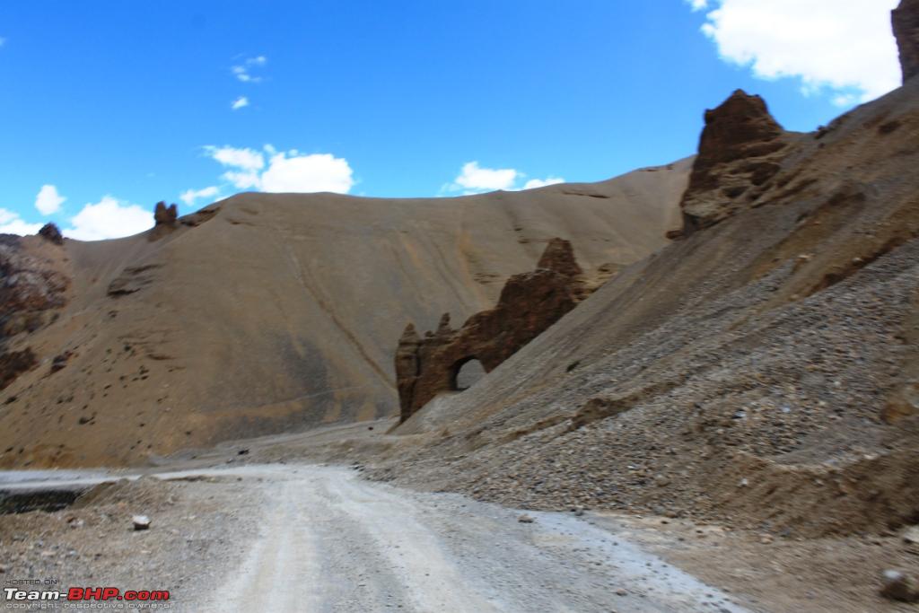
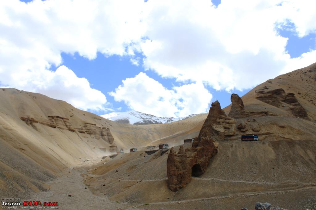
Driving up the
Gata Loops - from 4200 mtrs to 4600 mtrs in 10 kms on 21 levels of steep road - is fun, especially now that it is a fantastic road and not the mud track that it was a few years ago. One has to be careful of the empty trucks that hurtle down - and sometimes off the cliff too - at high speed. What was terrible was those "take-offs" as the road suddenly fell into a trough with the risk of the car also landing down into the roads below! I think you can get photos of max 8 levels of road from a few points. 4WD vehicles have greater fun on the Gata Loops as several "short"-cuts have been scraped out of the hill-sides and you can virtually drive the car down in a straight line almost at steep gradients - definitely not for those with a poor head for heights, like going down one of the roller coasters in an amusement park.
At
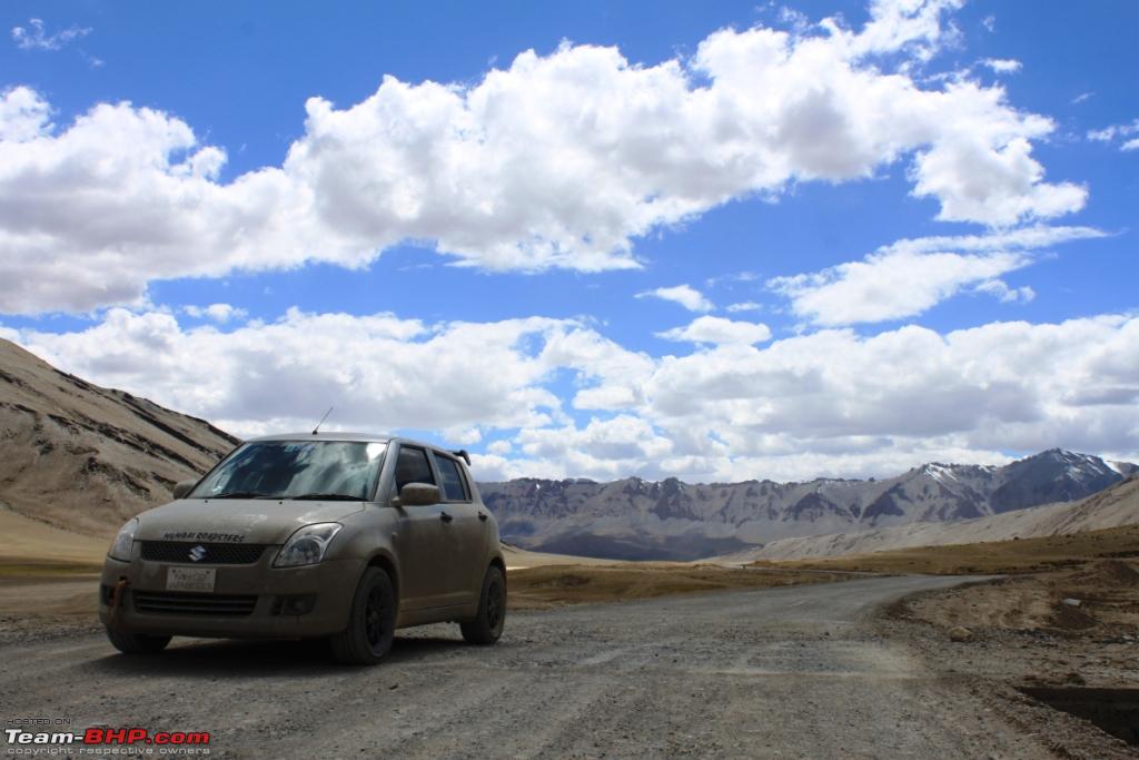
16250 feet, Nakila is the second high pass of the day. Thereafter the road plunges down to the bottom of the Valley 600 feet below and crosses a river and climbs up again all the way back 1000 feet to the next high pass. Everyone was in high spirits - DB was heard remarking that the Govt should build a long high bridge across the Valley to avoid this roll down-climb up road, and KSM-vTEC was cheeky enough to think that his Swift could cross the river through loose gravel and then climb up on a dirt road that was a "short-cut" too! Luckily, I was saved from a heart attack when I saw KSM-vTEC suddenly remember that he was not driving a Maruti GYpsy any more, it was only a Swift!
Taking to truckers en route we were reminded that Rohtang Pass - near Manali - which was far lower but has been the most troublesome of passes this year - they faced delays of 4-5 days waiting to cross it thanks to the slush, land slides and traffic jams, and they were quite happy to be in the high places here. For them, this 4-month trip sorties to and fro Leh - to ship supplies to the army and the rest of the population - was a bonanza and they tried to maximise as many trips as possible despite the harsh terrain inflicting lots of damage to their trucks.
Lachulung la - almost
16,700 feet - higher than the other two. By now, were surrounded on all sides by mountains although we are at considerable height ourselves. MOuntain sides change colour and texture as we move forward into what is popularly referred to as "
McKenna's" country. The road cracks up as we snuggle in through steep rock faces and for some time even the sun disappears as the shadows deepen. The
Kanglajal crossing is a pale shadow of its fiery self, many have shuddered at the thought of steering your car through the raging current on a hot day in the late hours of the day.
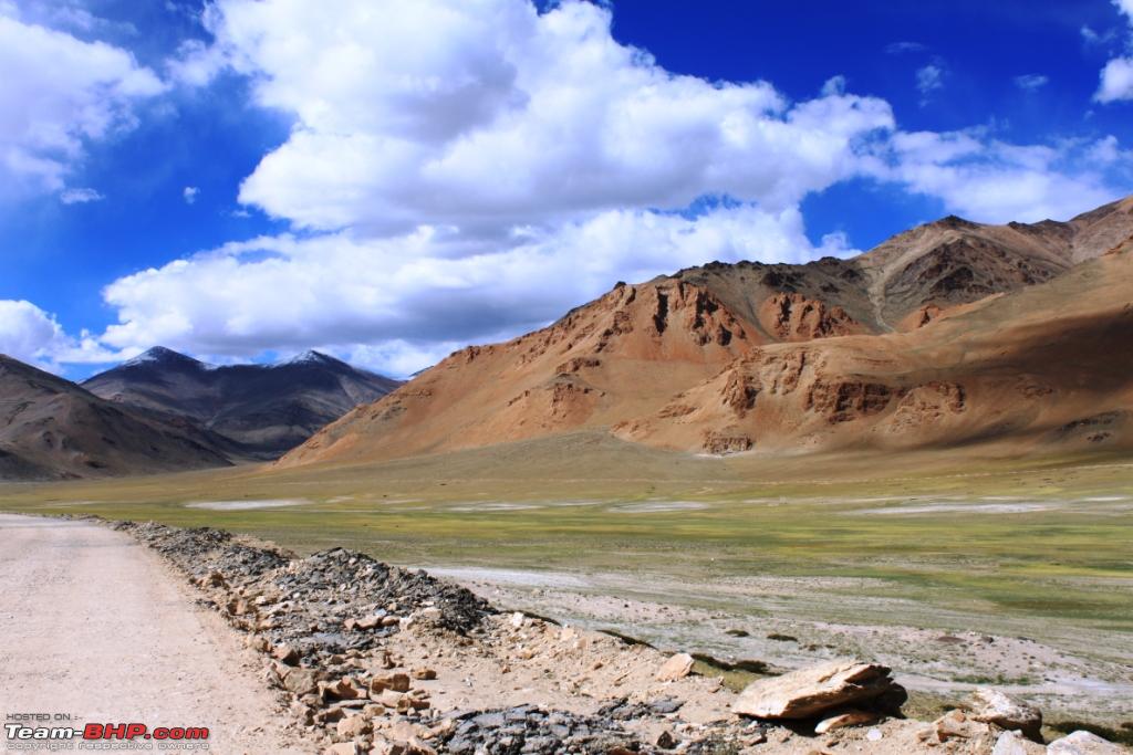
You see the continental collision effect clearly here - as we did when we went to Tashi Ganga in Spiti Valley (which is on the other side of the high mountains, as the crow flies) - with mountains of different colours and hues, with different rock strata halfway up, and so on, indicating some major mix-up appears to have happened here as land masses have collided with each other.
Pang - the next "large town" after Sarchu is a slightly larger army camp, has a puncture shop too, and maybe "black" diesel. The customary few tea shops - with their dorm accommodation - and the check post too. Yet another inhospitable place, like Sarchu night temperatures by September can dip to (-) 10-15 C and winters below (-) 30+ C. It was 1 pm, everyone was hungry, but we resolutely decided to go on since we had to cross the Tanglang Pass fast.
After a steep climb, we are on
More Plains, the high-altitude plateau
4800 mtrs high and nearly
40 kms long. But what is happening - where were all the trails made by 4WD SUVs through the loose desert sands which raised dust from the wheels of cars and hung in the air? Some of the most glamorous photos of Ladakh were those of vehicles enveloped in dust. BUt now they have started building some pucca roads (were we dismayed???!!!) through the More Plains and I am sure they will be done by next year although many stretches are looking good.
This region is under snow 7 months a year and I will be surprised if anything resembling a road will be left next summer when the snow melts! What fun we had as we hurtled at speeds of 100 kmph+ in the finished and half-finished roads! With full AC on to cool us from the midday heat and keep the dust out. Suddenly, the road ends as some culvert is being built and you are banished into the sands where we chase a few tyre tracks hoping that the ground will hold firm.........will it, that is what I will tell you later....
All photos here are from the albums of TS and KSM-vTec 

 22nd October 2011, 14:23

 (2)
Thanks
(2)
Thanks


 Super thinking and action. When I saw this, I thought, this has to surely nose-dive the alto atleast with its internal under the bonnet soaked, even if one was to tow it across. Glad to see it really made it through unharmed. And hats off to your guys courageous work to go through it.